
 Country
Asia
Iraq
Iraq is a country in Asia with two great rivers. Some of the first cities in the world were built there, long, long ago.
Iraq is a country in the Middle East. Its two great rivers, the Tigris and the Euphrates, water a wide plain that was once called Mesopotamia, where some of the world's earliest cities grew. About 46.1 million people were counted there in 2024, and its capital is Baghdad.
Iraq occupies most of ancient Mesopotamia, the alluvial plain of the Tigris and Euphrates where Sumer, Akkad, Babylon and Assyria arose. A federal republic since its 2005 constitution, it counted 46.1 million people in its 2024 census, the first in nearly 40 years; about three-fifths are Shi'i and two-fifths Sunni Muslims, and about one-fourth are Kurds.
Photo: Diyar Muhammed, CC BY-SA 4.0, via Wikimedia Commons
Discover Iraq
Iraq is a country in Asia.
Two big rivers flow through it. Their names are the Tigris and the Euphrates. Iraq has flat farmland, deserts and snowy mountains. The capital city is called Baghdad.
Iraq is a country in the Middle East, in southwest Asia. Long ago, the land between its two great rivers, the Tigris and the Euphrates, was called Mesopotamia, which means "land between the rivers." Some of the world's earliest cities were built there.
Iraq has a wide, flat river plain in the middle and south, dry deserts in the west and south, and high mountains in the northeast. It touches the sea only at a short strip of coast on the Persian Gulf. About 46.1 million people were counted in Iraq in 2024, and the capital is Baghdad, on the Tigris.
Iraq lies at the eastern edge of the Arab world, at about the latitude of the southern United States, and covers some 437,000 square kilometers. Britannica divides it into four regions: the alluvial plains of the center and southeast, covering more than 132,000 km² or almost a third of the country; Al-Jazirah, an upland between the Tigris and Euphrates in the north; deserts in the west and south, some 168,000 km² or almost two-fifths; and the highlands of the northeast, about a fifth.
The modern state was created after World War I from the Ottoman provinces of Baghdad, Basra and Mosul, and its name comes from a medieval Arabic term for the region. Iraq's 2024 census, its first in nearly 40 years, counted 46.1 million people, according to final results announced in February 2025. With only 58 km of coast on the Persian Gulf, Iraq has the least access to the sea of any Middle Eastern state, followed by Jordan.
Cities and famous places
Baghdad is the capital city.
It is on a big river. At Babylon there are old city walls and gates. In Samarra a tall tower winds round and round, like a spiral.
Baghdad, the capital and largest city, stands on both banks of the Tigris. It was founded in 762, and for the next 500 years it was the most important center of culture in the Arab and Islamic world. The Iraq Museum there holds a large collection of ancient objects.
About 85 kilometers south of Baghdad lie the ruins of Babylon, with its old walls, gates and palaces. North of Baghdad, the ruined city of Samarra has a famous spiral minaret, a tower from the 800s. In the far south stand the mud-brick ruins of Ur, one of the early cities of Sumer. Mosul, in the north, is Iraq's second-largest city.
Baghdad lies on the Tigris about 530 km from the head of the Persian Gulf, in the heart of ancient Mesopotamia. Founded in 762 as the capital of the Abbasid caliphs, it was for 500 years the most significant cultural center of Arab and Islamic civilization; its importance waned after the Mongol conquest of 1258, and it regained prominence as the capital of Iraq in 1920. The Iraq Museum, founded in 1923, holds a major collection of antiquities.
Babylon, 85 km south of Baghdad, was the capital of the Neo-Babylonian Empire from 626 to 539 BCE; UNESCO inscribed its walls, gates, palaces and surrounding farmland in 2019. Samarra, 130 km north of Baghdad on both banks of the Tigris, was an Abbasid capital for a century; its 9th-century Great Mosque and spiral minaret stand on a site of which 80 percent remains unexcavated (inscribed 2007). Ur, Uruk and Eridu, Sumerian cities of the 4th and 3rd millennia BCE, were inscribed with the southern marshes in 2016. Mosul, beside the ruins of Nineveh, is Iraq's second-largest city.

Rivers, deserts and mountains
Two big rivers bring water to Iraq.
Farmers use the water to grow food. Summers are very hot and dry. In the north, snow falls on the mountains.
The Tigris and the Euphrates both begin in the mountains of Turkey, far to the north. They flow across Iraq and join near the town of Al-Qurnah to form one river, the Shatt al-Arab, which runs into the Persian Gulf. In the south there are wide marshes, wetlands full of reeds and water.
Summers on the plains are very hot: in Baghdad, July and August average about 35 °C, and no rain falls from June to September. In the northeast, mountains on the border with Iran rise above 3,600 meters. They can get more than 1,000 millimeters of rain and snow in a year, but little rain falls there in summer.
Both rivers rise in the Armenian highlands of Turkey; the Tigris flows 1,417 km and the Euphrates 1,212 km through Iraq before joining near Al-Qurnah to form the Shatt al-Arab, which runs another 109 km to the gulf. The Tigris receives the Great Zab, Little Zab and Diyala from the Zagros, may carry more than two-fifths of its annual flow from March to May, and has flooded often; the Euphrates, with roughly 50 percent more flow, receives no large tributaries in Iraq. Dams and canals control floods and feed irrigation, and salinity, partly from over-irrigation, affects about two-thirds of the land.
The lowlands have two seasons: a dry summer from May to October, when Baghdad's July and August days average about 35 °C and 51 °C has been recorded, and a mild winter; the lowlands receive about 100-180 mm a year, nearly all between November and April. The northeast is cooler. Britannica names Ghundah Zhur, 3,607 m, on the Iranian border as the highest point, while Wikidata lists Cheekha Dar at 3,611 m; these mountains may receive more than 1,000 mm, much as snow. A dry northwesterly summer wind, the shamal, blows across the country, and dust storms occur in most months.

Animals of Iraq
Many birds live in Iraq.
Flocks of water birds spend the winter in the marshes. Otters live in the marshes too. Foxes and wolves live in Iraq as well.
Birds are the easiest wild animals to spot in Iraq. In winter, the marshes of the south fill with more than 197 kinds of migrating water birds. UNESCO calls two of the marsh birds, the Basra reed warbler and the Iraq babbler, endemic, which means they are special to this region.
On land there are wolves, foxes, jackals, hyenas, wild pigs and wildcats, as well as badgers, otters and porcupines. A desert antelope, the Arabian sand gazelle, survives in a few remote places. The rivers and lakes are full of fish such as carp and catfish. Date palms, dozens of kinds of them, grow all over the south.
Britannica notes that the lion, oryx, ostrich and wild ass have become extinct in Iraq, while wolves, foxes, jackals, hyenas, wild pigs, wildcats, martens, badgers, otters and porcupines remain, and the Arabian sand gazelle survives in remote desert. Carp, Barbus species, catfish and loach stock the rivers. In the 1990s two large canal schemes drained about nine-tenths of the southern marshes, once the largest wetland system in the Middle East; parts were reflooded in the early 2000s.
UNESCO describes the Ahwar of Southern Iraq, inscribed in 2016, as one of the world's largest inland deltas in an extremely hot, arid setting: a wintering ground for more than 197 species of migrating water birds, a staging point for ducks and a major stopover for shorebirds, and a route for fish and shrimp that migrate in from the gulf. Endemic birds include the Basra reed warbler and the Iraq babbler, and the marshes shelter a subspecies of the smooth-coated otter and the endangered Euphrates softshell turtle. The Huwaizah Marshes, never drastically drained, became the main refuge from which many birds spread back.
People, languages and ways of life
About 46 million people live in Iraq.
Many people speak Arabic. Many people in the north speak Kurdish. Farmers grow wheat, rice and dates. Lots of people love football.
About 46.1 million people were counted in Iraq in 2024. Roughly two-thirds are Arabs and about one-fourth are Kurds, who live mostly in the mountains of the north. Smaller groups include Turkmen, Assyrians and Armenians. Arabic is the official language, and Kurdish is official in the Kurdistan Region in the north.
Farmers grow wheat, barley, rice, vegetables and dates, and raising animals for milk, meat and wool is common, especially among the Kurds of the northeast. Poetry thrives in Iraq, and traditional crafts include leather, copper and carpet work. Football is the national passion: Iraq's team won the Asian Cup in 2007.
Britannica estimates that roughly two-thirds of Iraqis are Arabs and about one-fourth Kurds, with smaller communities of Turks, Turkmen, Assyrians, Lur and Armenians. More than three-fourths speak Arabic, the official language, and roughly one-fifth speak Kurdish, an Indo-European language that is official in the Kurdish autonomous region; Turkmen and Syriac are also spoken. Iraq is predominantly Muslim, with the two major branches more equally represented than anywhere else: about three-fifths Shi'i and two-fifths Sunni. Shi'i pilgrims visit shrines at Karbala and Najaf. In federal Iraq about 70.2 percent of people live in urban areas, and in the Kurdish region 84.6 percent, according to the 2024 census.
About one-eighth of the land is arable: winter wheat and barley are rain-fed in the north and northeast, while the river valleys need irrigation all year. Chief crops include barley, wheat, rice, vegetables and fruit, and Iraq was once the world's largest date producer. Twentieth-century Iraqi poets such as Nazik al-Malaika and Badr Shakir al-Sayyab are known across the Arab world, and Iraq's football team won the Asian Cup in 2007.

A long history
People built some of the first cities here.
They made houses and tall towers out of mud bricks. Long ago, Babylon was a great city. Later, Baghdad became a great city too.
More than 5,000 years ago, people in southern Mesopotamia built some of the world's first cities, such as Ur, Uruk and Eridu, beside freshwater marshes. These cities saw the beginning of writing, and their people built huge mud-brick towers called ziggurats. Later came the empires of Akkad, Babylon and Assyria.
In the 600s CE, Iraq became part of the Islamic world, and in 762 Baghdad was founded as a new capital. After World War I, the modern country of Iraq was formed, with Baghdad as its capital, and in 1932 it became independent. Today it is a federal republic with an elected parliament.
Between 5000 and 3000 BCE the sea reached some 200 km inland of today's coast, and on the margins of its marshes Uruk, Ur and Eridu grew into the urban centers where, UNESCO notes, writing, mud-brick temples and ziggurats, and complex urban societies originated. Sumer, Akkad, Babylon and Assyria followed; Babylon was the seat of Hammurabi and, from 626 to 539 BCE, capital of the Neo-Babylonian Empire. Persian, Greek and Roman dynasties later ruled the region, and after the 7th century it became central to the Islamic world, with Baghdad the Abbasid capital from 762.
Modern Iraq was formed after World War I, became independent in 1932, and remained a monarchy until 1958; the Ba'ath Party ruled from 1968 to 2003. Under Saddam Hussein, Iraq fought the Iran-Iraq War (1980-88) and the Persian Gulf War (1990-91), which Britannica says left the country isolated and drained; his government was toppled in 2003 in the Iraq War. A permanent constitution approved in 2005 made Iraq a federal parliamentary state with an autonomous Kurdistan region. The militant group ISIL seized Mosul in 2014 and was pushed out of most of the country by the end of 2017.

Iraq on the map
Find Iraq on the globe.
It is in Asia, near the top of the Persian Gulf. Turkey is to the north. Iran is to the east.
Iraq is in the Middle East, in southwest Asia. Turkey lies to the north and Iran to the east. Syria and Jordan are to the west, and Saudi Arabia and Kuwait are to the south.
Iraq reaches the sea only at the very top of the Persian Gulf, where it has 58 kilometers of coast. The Tigris and the Euphrates flow across the country toward the gulf. Baghdad, the capital, stands on the Tigris, and so does Mosul, in the north.
Iraq is bordered by Turkey to the north, Iran to the east, Syria and Jordan to the west, and Saudi Arabia and Kuwait to the south. Its 58 km of coastline at the head of the Persian Gulf give it only a tiny sliver of territorial sea. Since 1913 the deep Wadi al-Batin has been recognized as the boundary between western Kuwait and Iraq, and the southern desert reaches 951 m at Mount Unayzah, where the borders of Jordan, Iraq and Saudi Arabia meet.
The alluvial plains run some 600 km from Balad on the Tigris and Al-Ramadi on the Euphrates to the gulf, mostly below 100 m. Silt carried by the rivers has built such a large deposit at their mouth that the gulf coast now lies much farther south than in Babylonian times. In the northeast, the high ridges of Iraqi Kurdistan, associated with the Taurus and Zagros mountains, run northwest to southeast.
- Coastline on the Persian Gulf
- 58 km
- Tigris and Euphrates in Iraq
- 1,417 km and 1,212 km
- Highest mountains
- more than 3,600 m, on the border with Iran
- People (2024 census)
- 46.1 million
Amazing facts
-
The old name for this land means land between the rivers.
The old name Mesopotamia means "land between the rivers," for the Tigris and the Euphrates.
Britannica glosses Mesopotamia as "Land Between the Rivers"; its alluvial plains gave rise to the civilizations of Sumer, Akkad, Babylon and Assyria.
-
Iraq has only a tiny bit of seaside.
Iraq's coast on the Persian Gulf is only 58 kilometers long.
With 58 km of coastline, Iraq has less access to the sea than any other Middle Eastern state; Jordan comes next.
-
Writing began in the old cities of southern Iraq.
UNESCO says the old cities of Uruk, Ur and Eridu saw the beginning of writing.
UNESCO's listing of the Ahwar names Uruk, Ur and Eridu as cities that saw the origin of writing, monumental mud-brick temples and ziggurats, and complex technologies and societies.
-
Most of old Samarra is still under the ground.
About 80 percent of the ancient city of Samarra has not been dug up yet.
Samarra Archaeological City stretches 41.5 km along the Tigris, and UNESCO says 80 percent of the site remains to be excavated.
-
The sea used to come much farther into Iraq.
Mud and sand carried by the rivers have pushed Iraq's coast much farther south than it was in the time of Babylon.
The Tigris-Euphrates system has built such a large alluvial deposit at its mouth that the Persian Gulf coast now lies much farther south than in Babylonian times.
Words to know
- Mesopotamia
- the ancient name for the land between the Tigris and Euphrates rivers
- ziggurat
- a huge mud-brick tower built in ancient Mesopotamian cities
- marsh
- low, wet land covered with water and reeds
- minaret
- a tall tower that is part of a mosque
- alluvial plain
- flat land built up from mud and sand left by rivers
- archaeology
- the study of the past by digging up and studying old things people left behind
Discovery challenge
-
What is the capital city of Iraq?
Which city is the capital of Iraq?
Which city, founded in 762 as the capital of the Abbasid caliphs, is Iraq's capital today?
- Baghdad
- Basra
- Mosul
Show the answer
Baghdad
Baghdad is the capital. It is on the Tigris River.
Baghdad is the capital and largest city, on both banks of the Tigris.
Baghdad was founded in 762 as the Abbasid capital and became the capital of modern Iraq in 1920.
-
Which two rivers flow through Iraq?
Which two great rivers cross Iraq?
Which two rivers join near Al-Qurnah to form the Shatt al-Arab?
- The Tigris and the Euphrates
- The Nile and the Congo
- The Amazon and the Orinoco
Show the answer
The Tigris and the Euphrates
The Tigris and the Euphrates flow through Iraq.
The Tigris and the Euphrates start in Turkey and cross Iraq to the Persian Gulf.
The Tigris and Euphrates join near Al-Qurnah; the Shatt al-Arab then runs 109 km to the gulf.
-
Long ago Iraq was called Mesopotamia. It means land between the what?
The old name Mesopotamia means "land between the" what?
Mesopotamia, the ancient name for much of Iraq, means "land between the" what?
- Rivers
- Mountains
- Forests
Show the answer
Rivers
Mesopotamia means land between the rivers.
Mesopotamia means "land between the rivers," the Tigris and the Euphrates.
Mesopotamia means "Land Between the Rivers"; its alluvial plains supported Sumer, Akkad, Babylon and Assyria.
-
What shape is the famous tall tower in Samarra?
What shape is the famous minaret of Samarra?
What form does the 9th-century minaret of Samarra's Great Mosque take?
- A spiral
- A pyramid
- A round dome
Show the answer
A spiral
The tower goes round and round, like a spiral.
Samarra's minaret is a spiral tower, built in the 800s.
UNESCO highlights the 9th-century Great Mosque and its spiral minaret among Samarra's monuments.
-
Which animals fill the marshes of southern Iraq in winter?
Which animals come to the marshes of southern Iraq in great numbers each winter?
More than 197 species of which group winter in the Ahwar of Southern Iraq?
- Migrating water birds
- Penguins
- Kangaroos
Show the answer
Migrating water birds
Lots of water birds spend the winter in the marshes.
More than 197 kinds of migrating water birds spend the winter in the marshes.
UNESCO counts more than 197 migrating water-bird species wintering there, on flyways between western Eurasia and Africa.
Places to discover in Iraq
-
 Watch
City
Baghdad
Baghdad, the capital of Iraq, stands on the Tigris River in the land once called Mesopotamia. It was founded in 762 as a round city, and for about 500 years it was one of the greatest cities in the world and a great center of learning, where scholars studied math, medicine and the stars. Today it is Iraq's largest city.
-
 Watch
Landmark
Babylon
Babylon was one of the most famous cities of the ancient world, beside the Euphrates River in what is now Iraq. Kings like Hammurabi and Nebuchadnezzar II ruled from here. Today its ruins are a UNESCO World Heritage Site, and about 85 percent of it has never been dug up.
-
 Watch
Landmark
Nineveh
Nineveh was the biggest city of the Assyrian Empire, on the east bank of the Tigris River in what is now Mosul, Iraq. About 2,700 years ago, King Sennacherib filled it with streets, canals and a palace of at least 80 rooms, and King Ashurbanipal collected a library of clay tablets. In 612 BCE the city was conquered and burned, and it never recovered.
-
Watch
Landmark
Samarra
Samarra, on the Tigris River in Iraq, was the capital of the Abbasid caliphs, rulers of a huge Islamic empire, from 836 to 892. In that short time they built enormous mosques, palaces, canals and even racecourses. Because the city was left so early, its plan survives, and its Great Mosque still has a famous spiral minaret.
-
 Watch
Landmark
Ur
Ur was a great city of Sumer, in the south of what is now Iraq, founded more than 5,000 years ago. Twice it was the capital of an empire. Archaeologists found royal tombs full of gold treasures, streets of brick houses and a huge stepped temple tower called a ziggurat. When the Euphrates River moved away, the fields dried up and the city was abandoned.
Explore next
-
Watch
City
Baghdad
Baghdad, the capital of Iraq, stands on the Tigris River in the land once called Mesopotamia. It was founded in 762 as a round city, and for about 500 years it was one of the greatest cities in the world and a great center of learning, where scholars studied math, medicine and the stars. Today it is Iraq's largest city.
-
Watch
Landmark
Babylon
Babylon was one of the most famous cities of the ancient world, beside the Euphrates River in what is now Iraq. Kings like Hammurabi and Nebuchadnezzar II ruled from here. Today its ruins are a UNESCO World Heritage Site, and about 85 percent of it has never been dug up.
-
Watch
Landmark
Samarra
Samarra, on the Tigris River in Iraq, was the capital of the Abbasid caliphs, rulers of a huge Islamic empire, from 836 to 892. In that short time they built enormous mosques, palaces, canals and even racecourses. Because the city was left so early, its plan survives, and its Great Mosque still has a famous spiral minaret.
-
Watch
Landmark
Ur
Ur was a great city of Sumer, in the south of what is now Iraq, founded more than 5,000 years ago. Twice it was the capital of an empire. Archaeologists found royal tombs full of gold treasures, streets of brick houses and a huge stepped temple tower called a ziggurat. When the Euphrates River moved away, the fields dried up and the city was abandoned.
-
 Watch
 Country
Kuwait
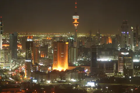
Kuwait is a small desert country at the top of the Persian Gulf, between Iraq and Saudi Arabia. It grew from a trading town on Kuwait Bay into a modern country after oil was found. About 4.9 million people live there, most of them in and around Kuwait City.
-
Watch
Landmark
Nineveh
Nineveh was the biggest city of the Assyrian Empire, on the east bank of the Tigris River in what is now Mosul, Iraq. About 2,700 years ago, King Sennacherib filled it with streets, canals and a palace of at least 80 rooms, and King Ashurbanipal collected a library of clay tablets. In 612 BCE the city was conquered and burned, and it never recovered.
-
 Watch
 Country
Afghanistan
Afghanistan is a landlocked country in south-central Asia. The high Hindu Kush mountains run across its middle, sandy deserts lie in the southwest, and the capital, Kabul, sits in a valley about 1,800 meters above sea level.
-
 Watch
 Country
Azerbaijan
Azerbaijan is a country on the southern side of the Caucasus Mountains, along the western shore of the Caspian Sea. It has high mountains, wide lowlands and forests, its capital is Baku, and about 10.3 million people lived there in mid-2026.
For parents & teachers
What children will learn
- Locate Iraq and trace the Tigris and Euphrates from Turkey to the Persian Gulf.
- Explain why river plains such as Mesopotamia were good places for early cities.
- Describe the many peoples, languages and ways of life in Iraq without treating them as one single culture.
- Outline Iraq's long history from Sumerian cities to independence in 1932.
Recommended ages: 3 to 17 · About 15 minutes
Talk about it
- Why might the first cities have grown up beside rivers and marshes?
- How do you think people built big towers using only mud bricks?
- What could help birds that need wetlands, like the marshes of southern Iraq?
Try at home or in class
- Press shapes into a flat piece of modeling clay with a craft stick, like early writing on clay.
- Stack sugar cubes or small blocks into a stepped tower and see how wide the base must be.
Key vocabulary: Mesopotamia, ziggurat, marsh, minaret, alluvial plain, archaeology
Where these facts come from
- Wikidata , Wikimedia Foundation (CC0 1.0)
- Natural Earth vector data , Natural Earth (NACIS) (Public domain)
- UNESCO World Heritage List , UNESCO World Heritage Centre (Linked as a reference; site facts come from Wikidata)
- 46.1 million people counted in Iraq's first census in nearly 40 years (Associated Press) , NBC News
- Iraq , Encyclopaedia Britannica
- Iraq: The northeast (drainage and soils) , Encyclopaedia Britannica
- Iraq: Climate (plant and animal life, ethnic groups) , Encyclopaedia Britannica
- Iraq: Arabs (Kurds, languages, religion) , Encyclopaedia Britannica
- Iraq: Agriculture, forestry, and fishing , Encyclopaedia Britannica
- Iraq: Government and society , Encyclopaedia Britannica
- Iraq: The arts (cultural institutions, sports) , Encyclopaedia Britannica
- Iraq: U.S. withdrawal and the rise of the Islamic State in Iraq and the Levant (ISIL) , Encyclopaedia Britannica
- Baghdad , Encyclopaedia Britannica
- Mosul , Encyclopaedia Britannica
- Final 2024 Census Results: Iraq's Population at 46.1 Million , PUKmedia
- Babylon , UNESCO World Heritage Centre
- Samarra Archaeological City , UNESCO World Heritage Centre
- The Ahwar of Southern Iraq: Refuge of Biodiversity and the Relict Landscape of the Mesopotamian Cities , UNESCO World Heritage Centre
- PlayOwl region table, version 1 , PlayOwl (PlayOwl original data)
- flag-icons 7.5.0 , Panayiotis Lipiridis and contributors (MIT)
- Wikimedia Commons , Wikimedia Foundation (Per file (public domain, CC0, CC BY or CC BY-SA); see each media record)
Checked, not yet human-reviewed. Last updated October 24, 2026. Spotted a mistake? Tell us.
Picture credits
- Photo: Diyar Muhammed, CC BY-SA 4.0, via Wikimedia Commons · source · license
- Photo: Jim Gordon, CC BY 2.0, via Wikimedia Commons · source · license
- Photo: aows.laith, CC BY 3.0, via Wikimedia Commons · source · license
- Photo: Emir doski, CC BY-SA 4.0, via Wikimedia Commons · source · license
- Photo: Hardnfast, CC BY 3.0, via Wikimedia Commons · source · license
- Photo: M.Lubinski from Iraq,USA., CC BY-SA 2.0, via Wikimedia Commons · source · license
- Photo: Mohamm3dfadil, CC BY-SA 4.0, via Wikimedia Commons · source · license
- Photo: Osama Shukir Muhammed Amin FRCP(Glasg), CC BY-SA 4.0, via Wikimedia Commons · source · license