
Journey Australia and Oceania
The first voyagers of the Pacific
Long ago, people sailed big canoes across the Pacific Ocean. They found their way using the stars, the waves and the birds. They found and settled islands far, far apart.
Over thousands of years, the ancestors of today's Pacific Islanders sailed double-hulled canoes across the Pacific and settled islands from Samoa and Tonga to Hawaiʻi, Rapa Nui and Aotearoa New Zealand. They had no compasses or maps: navigators read the stars, the ocean swells, the clouds and the birds.
Polynesia, a triangle bounded by Hawaiʻi, Rapa Nui and Aotearoa, was settled by deliberate voyages in large sailing canoes, beginning in the west (Tonga and Samoa) some 2,000 to 3,000 years ago and reaching New Zealand about 1250 to 1300 CE. Navigators used star paths, swells and signs of land. Since 1976, voyages of the canoe Hōkūleʻa have revived these skills.
Photo: Olivier Dugornay (IFREMER, Pôle Images, Centre Bretagne - ZI de la Pointe du Diable - CS 10070 - 29280 Plouzané, France), CC BY 4.0, via Wikimedia Commons
An ocean of islands
The Pacific is the biggest ocean on Earth.
It has many small islands, very far apart. Long ago, brave sailors in canoes found these islands. Their families made new homes there.
Look at a map of the Pacific and you will see tiny islands scattered across a huge ocean. Draw lines between Hawaiʻi in the north, Aotearoa New Zealand in the southwest and Rapa Nui (Easter Island) in the east, and you get a giant triangle. This is Polynesia, which comes from Greek words meaning "many islands."
The first people to live on these islands got there by sailing canoes. Over many centuries, they made deliberate voyages of exploration, carrying their families, plants and animals, and settled islands right across the triangle. They did it without compasses, clocks or charts.
Britannica describes Polynesia as a huge triangle of the east-central Pacific, with its apex at Hawaiʻi and its base angles at Aotearoa New Zealand and Rapa Nui. The ancestors of the Polynesians entered the region some 2,000 to 3,000 years ago, first settling the western islands of Wallis and Futuna, Samoa and Tonga; because these islands lacked much that people needed, settlers brought most of their useful plants and all of their domestic animals with them.
The Polynesian Voyaging Society, founded in Hawaiʻi in 1973, framed the scientific question this way: how did Polynesians discover and settle small islands spread across about ten million square miles of ocean, navigating without instruments across distances of up to 2,500 miles? Te Ara, the Encyclopedia of New Zealand, notes that New Zealand's first settlers came on deliberate voyages, using prevailing winds and ocean currents and observing the stars.
Stops along the way
- Samoa
- Tonga
- French Polynesia (Tahiti)
- Honolulu, Hawaiʻi
- Hanga Roa, Rapa Nui (Easter Island)
-
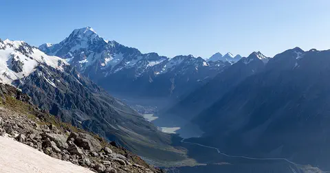 Aotearoa New Zealand
Canoes built for the ocean
The voyagers sailed in double canoes.
Two long canoes were joined side by side. They had sails to catch the wind and long paddles to steer.
Te Ara explains that the earliest island crossings were probably made on rafts and dugout canoes between islands that could be seen from one another. For long voyages, Pacific peoples developed much better boats: outrigger canoes, with a float on one side for balance, and double-hulled canoes, made of two hulls joined by a deck.
Double-hulled canoes used for long distances were often about 20 meters long and could travel 150 to 250 kilometers in a day. V-shaped sails caught the wind, and steering paddles over 6 meters long both steered the canoe and stopped it from being pushed sideways.
According to Te Ara, rafts were slow and dugouts prone to capsizing, so long crossings needed outrigger and double-hulled designs. Micronesian outriggers were sailed with the outrigger to windward, with an asymmetric hull whose flat outer side resisted sideways drift; European explorers including James Cook estimated some canoes at up to 22 knots.
Long-distance double-hulled canoes were generally about 20 m long and could cover 150 to 250 km a day. Names varied: the tongiaki in Tonga, the va'a-tele in Samoa, the pahi in Tahiti and the wa'a kaulua in Hawaiʻi. Steering paddles over 6 m long worked much like a modern yacht's keel. The modern canoe Hōkūleʻa, launched in 1975, was designed to perform like an ancient Hawaiian wa'a kaulua.
Reading the stars and the sea
The navigators had no maps.
At night, they steered toward a star rising on the sky's edge. They felt the waves rocking the canoe. They watched for birds flying home to land.
The greatest skill of the old navigators was reading the night sky. They memorized where bright stars rose and set on the horizon, and steered toward a star low in the sky; when it rose too high, they picked the next one. Seven to 12 stars could guide a canoe through one night.
On cloudy days they used ocean swells, long waves pushed up by steady winds. By keeping the canoe at the same angle to the swells, they stayed on course. Some stars pass right overhead at certain islands: Arcturus is the overhead, or zenith, star for Hawaiʻi.
Te Ara describes how navigators used star compasses to gauge the rising and setting points of the brightest stars and planets, then memorized them; they steered toward a star near the horizon and switched as each rose too high or set, needing seven to 12 stars a night, and checked the sun's position at dawn and dusk. Routes were preserved in memory or song, and by back-sighting, lining up landmarks behind the departing canoe with known star paths.
Under overcast skies, steady swells raised by the north- and south-easterly trade winds kept the canoe's heading. Zenith stars helped find land: sailing directly beneath an island's zenith star (Arcturus for Hawaiʻi, Sirius for Ra'iatea and for Vanua Levu in Fiji) put a canoe within about 80 km of the island. Navigators may also have used the height of meridian stars such as the Southern Cross, measured in finger and hand widths above the horizon, which changes as a canoe sails north or south.
Signs of land
How do you find an island you cannot see?
Birds fly out to sea in the morning and back home at night. Clouds pile up over islands. Waves bounce back from the land.
An island can be found long before it is seen. Seabirds fly out to sea at sunrise to fish and return to land at sunset: frigate birds go up to 100 kilometers from land, and terns up to 50 kilometers. Clouds build up over high islands such as Tahiti and Hawaiʻi and can be seen from more than 150 kilometers away.
Waves change near land too. When swells hit an island they bounce back and curl around it, making patterns a skilled navigator can feel in the canoe. Changes in the color of the water, floating leaves and driftwood were more clues.
Te Ara lists many signs of land. Birds that fish at sea return to nest at sunset: frigate birds range up to 100 km from land, gannets and petrels 70 km, terns 50 km. Convection clouds over high islands such as Tahiti and Hawaiʻi can be seen more than 150 km away, small eyebrow-shaped clouds over atolls up to 50 km, and a bright cloud base can mean light reflected from a lagoon.
Land-swell patterns form when swells rebound from an island or divide and curl around it; rebounding waves can be detected about 50 km from small islands and up to 300 km from land as large as New Zealand. Te Ara adds that the migration paths of birds such as the West Polynesian pigeon between Tonga and Samoa may have helped navigators, and that sea color, currents, fish and floating debris also signalled land.
Settling the islands
The voyagers brought plants and animals in their canoes.
They planted sweet potatoes and yams in their new homes. Samoa and Tonga were settled first. Aotearoa New Zealand was one of the last.
Settlement happened in stages over a very long time. Britannica says people first settled the western islands, including Samoa and Tonga, some 2,000 to 3,000 years ago. Later voyagers reached Hawaiʻi and Rapa Nui. Scientists still debate the exact dates. A 2011 study of more than 1,400 radiocarbon dates found that people reached the Society Islands, including Tahiti, around 1025 to 1120 CE, and then spread quickly to the far corners, Hawaiʻi, Rapa Nui and Aotearoa, around 1190 to 1290 CE. Some older sources give much earlier dates.
Aotearoa New Zealand was one of the last places settled. Te Ara says current understanding is that the first arrivals came from East Polynesia between 1250 and 1300 CE. They brought kūmara (sweet potatoes), yams, dogs and rats.
Britannica's article on Polynesian culture dates the first settlement of the western islands, Wallis and Futuna, Samoa and Tonga, to some 2,000 to 3,000 years ago. East Polynesia was settled later, and its dates are debated. A 2011 meta-analysis of 1,434 radiocarbon dates by Wilmshurst and colleagues, using only reliable short-lived samples, placed the first settlement of the Society Islands at about 1025 to 1120 CE and a rapid spread to the remaining islands, including Hawaiʻi and Rapa Nui, at about 1190 to 1290 CE. Older sources give much earlier dates: Britannica's history of Hawaiʻi says the first inhabitants may have arrived as early as 300 CE, and UNESCO's brief description of Rapa Nui gives c. 300 CE, though its fuller statement says a small group from Eastern Polynesia arrived toward the end of the first millennium.
For New Zealand, Te Ara notes that the date of first settlement is debated but that current understanding places the first arrivals from East Polynesia between 1250 and 1300 CE. They brought kūmara and yams, which grew well in the warmer North Island, and the Polynesian dog and rat; the islands' pigs and chickens did not arrive, for reasons not fully understood.

Hōkūleʻa: sailing again
In the 1970s, people in Hawaiʻi built a big double canoe called Hōkūleʻa.
In 1976, it sailed all the way to Tahiti and back with no maps or instruments. It showed how the first voyagers found their way.
After Europeans colonized the Pacific, traditional navigation was almost lost. In 1973, people in Hawaiʻi founded the Polynesian Voyaging Society to find out how the ancestors had sailed. They built Hōkūleʻa, a double-hulled canoe about 20 meters long, named for the star Arcturus.
In 1976 Hōkūleʻa sailed from Hawaiʻi to Tahiti and back, guided by Mau Piailug, a master navigator from Satawal in Micronesia, using no modern instruments. He later taught Nainoa Thompson of Hawaiʻi, who taught many young navigators. Hōkūleʻa has since sailed more than 140,000 nautical miles.
Te Ara records that traditional navigation declined after European colonization, as ships replaced canoes and some colonial governments restricted movement between territories. The Polynesian Voyaging Society, founded in 1973 to test theories of Polynesian seafaring, launched Hōkūleʻa on March 8, 1975: a 20 m fiberglass and plywood double-hulled canoe designed by Herb Kawainui Kāne and named for Arcturus, Hawaiʻi's zenith star.
In 1976, guided by Mau Piailug of Satawal in the Caroline Islands, it made a return voyage to Tahiti, repeated in 1980; Te Ara says these voyages proved navigation without modern instruments was possible. Piailug taught Nainoa Thompson, who led a voyage of rediscovery from 1985, and in 1999 and 2000 Hōkūleʻa sailed to Rapa Nui and back, when Pi'ikea Miller became the first woman navigator of the modern period. PVS counts more than 140,000 nautical miles sailed and 25 voyaging canoes across the Pacific since 1975.
Amazing facts
-
Navigators could use 7 to 12 stars in one night.
Seven to 12 stars were enough to guide a canoe through one night.
Te Ara notes that seven to 12 stars, plus the moon and bright planets, sufficed for one night's navigation.
-
Clouds can show where an island is.
Clouds over high islands such as Tahiti and Hawaiʻi can be seen from more than 150 kilometers away.
Convection clouds over high islands can be seen over 150 km away, and small eyebrow-shaped clouds over atolls up to 50 km away.
-
The canoe Hōkūleʻa is named after a star.
Hōkūleʻa means 'Star of Gladness' and is the Hawaiian name for the star Arcturus.
Hōkūleʻa ('Star of Gladness') is the Hawaiian name for Arcturus, a zenith star of Hawaiʻi; the canoe was launched on March 8, 1975.
-
Some canoes were faster than the explorers' ships.
European explorers saw Pacific canoes sailing much faster than their own ships, some at up to 22 knots.
Cook, Wilkes and others estimated some outrigger canoes at up to 22 knots; Bougainville in Samoa and Cook in Tonga wrote that outrigger canoes sailed around their ships 'with the same ease as if we had been at anchor'.
Words to know
- navigator
- the person who finds the way on a voyage
- wayfinding
- finding your way across the ocean using stars, waves, winds and birds instead of instruments
- double-hulled canoe
- a sailing canoe made of two hulls joined together by a deck
- swell
- a long, steady ocean wave pushed up by wind far away
- horizon
- the line where the sky seems to meet the sea
- zenith star
- a star that passes straight overhead at a particular island
Discovery challenge
-
What did navigators look at in the night sky?
What did Polynesian navigators steer by at night?
What did navigators memorize the rising and setting points of, using a star compass?
- Stars
- Airplanes
- Street lights
Show the answer
Stars
Stars! They steered toward a star low in the sky.
They steered toward stars rising or setting on the horizon, changing to a new star as each one climbed.
The brightest stars and planets; seven to 12 stars could guide a canoe through one night.
-
What kind of boat did the voyagers sail?
What kind of boat did Polynesian voyagers use for long ocean crossings?
Which vessel type, typically about 20 m long and covering 150 to 250 km a day, carried long-distance voyages?
- Steamships
- Double-hulled canoes
- Rowboats
Show the answer
Double-hulled canoes
Big double canoes with sails!
Double-hulled canoes, two hulls joined by a deck, with sails and long steering paddles.
Double-hulled sailing canoes, such as the Tongan tongiaki and the Hawaiian wa'a kaulua.
-
Which island was settled later: Samoa or New Zealand?
Which place was one of the last in Polynesia to be settled, about 1250 to 1300 CE?
According to Te Ara's current understanding, which land was first settled between 1250 and 1300 CE?
- Samoa
- Aotearoa New Zealand
- Tonga
Show the answer
Aotearoa New Zealand
New Zealand! Samoa was settled long before.
Aotearoa New Zealand, about 1250 to 1300 CE; Samoa and Tonga were settled some 2,000 to 3,000 years ago.
Aotearoa, by arrivals from East Polynesia; the date is still debated.
-
How can birds help you find land?
How could seabirds show a navigator where land was?
Why were birds such as frigate birds and terns useful signs of land?
- They fly home to land at sunset
- They sing louder near land
- They only fly over deep water
Show the answer
They fly home to land at sunset
Birds fly home to their nests on land in the evening.
Seabirds fly out to fish at sunrise and return to land at sunset, so their path points to land.
They return to nest at sunset and range only so far: frigate birds up to 100 km from land, terns up to 50 km.
Explore next
-
Watch
Natural wonder
Easter Island
Easter Island, called Rapa Nui by its first people, is a small volcanic island in the Pacific Ocean, about 3,540 kilometers west of Chile. Polynesian settlers who arrived long ago carved more than 600 giant stone statues, called moai, from the rock of a volcano and set many of them on stone platforms. Today the island's national park is a World Heritage Site cared for by the Rapa Nui people.
-
Watch
 Country
New Zealand
New Zealand, also called Aotearoa, is an island country in the South Pacific. Its two main islands have snowy mountains, glaciers, volcanoes and deep fiords, and about 5.36 million people lived there in 2026.
For parents & teachers
What children will learn
- Locate the Polynesian triangle and the stops from Samoa to Aotearoa New Zealand.
- Describe double-hulled voyaging canoes and how they were sailed.
- Explain how navigators used stars, swells, clouds and birds to find their way and to find land.
- Understand that settlement dates are debated, and describe the modern revival of voyaging.
Recommended ages: 6 to 14 · About 15 minutes
Talk about it
- What would you need to remember to sail to an island you had never seen?
- Why do you think people set out on such long voyages?
- Why might scientists disagree about when an island was first settled?
Try at home or in class
- On a clear night, with an adult, pick a bright star near the horizon and notice where it rises or sets compared with a tree or building; check again an hour later to see how it has moved.
- Float a small toy boat in a bathtub and make steady waves at one end; keep the boat at the same angle to the waves to 'hold a course'.
Key vocabulary: navigator, wayfinding, double-hulled canoe, swell, horizon, zenith star
Where these facts come from
- Canoe navigation: Waka – canoes (page 1) , Te Ara – the Encyclopedia of New Zealand (Rāwiri Taonui)
- Canoe navigation: Ocean voyaging (page 2) , Te Ara – the Encyclopedia of New Zealand (Rāwiri Taonui)
- Canoe navigation: Locating land (page 3) , Te Ara – the Encyclopedia of New Zealand (Rāwiri Taonui)
- Canoe navigation: Decline and renaissance of canoe voyaging (page 4) , Te Ara – the Encyclopedia of New Zealand (Rāwiri Taonui)
- History: Māori arrival and settlement , Te Ara – the Encyclopedia of New Zealand (John Wilson)
- High-precision radiocarbon dating shows recent and rapid initial human colonization of East Polynesia (Wilmshurst, Hunt, Lipo and Anderson, PNAS 108(5):1815-1820, 2011) , Proceedings of the National Academy of Sciences
- Polynesian culture , Encyclopaedia Britannica
- Hawaii: History , Encyclopaedia Britannica
- Hōkūleʻa , Polynesian Voyaging Society
- Voyages , Polynesian Voyaging Society
- Rapa Nui National Park , UNESCO World Heritage Centre
- Wikidata , Wikimedia Foundation (CC0 1.0)
Checked, not yet human-reviewed. Last updated October 27, 2026. Spotted a mistake? Tell us.
Picture credits
- Photo: Olivier Dugornay (IFREMER, Pôle Images, Centre Bretagne - ZI de la Pointe du Diable - CS 10070 - 29280 Plouzané, France), CC BY 4.0, via Wikimedia Commons · source · license
- Photo: kallerna, CC BY-SA 4.0, via Wikimedia Commons · source · license
- Photo: Stephen Glauser, CC BY-SA 2.0, via Wikimedia Commons · source · license
- Photo: Farragutful, CC BY-SA 4.0, via Wikimedia Commons · source · license