Geography
Ocean currents
The water in the ocean is always moving, like giant rivers in the sea. Wind pushes it, and it carries warm and cold water around the world.
Ocean currents are flows of seawater from one place to another. Winds push the surface water, and because Earth spins, the currents curve into giant loops called gyres. Deep down, cold, salty water sinks and creeps slowly around the planet. Together, currents carry heat from the warm tropics toward the cold poles.
Ocean currents are driven by tides, by wind and by thermohaline circulation (density differences from temperature and salinity). Wind-driven surface flow, deflected by the Coriolis effect, organizes into five major subtropical gyres bounded by strong western boundary currents such as the Gulf Stream; deep, dense water links the basins in a global conveyor that redistributes heat.
Rivers in the sea
The ocean never stands still.
Its water moves in big streams called currents. Currents are like rivers in the sea. They can carry things a very long way.
The ocean is never still. Currents are movements of water from one place to another, and some are so big and steady that they have names, like the Gulf Stream. NOAA, the U.S. ocean agency, explains that currents are driven by three main things: the rise and fall of the tides, the wind, and differences in how warm and how salty the water is.
Currents don't just move water. They carry heat, tiny living things, people's boats and goods, and sadly pollution and litter as well.
NOAA defines ocean currents as the movement of water from one location to another, usually measured in meters per second or knots (1 knot is 1.85 km/h). It identifies three main drivers. Tides create tidal currents, strongest near shore and in bays and estuaries, regular enough to predict and in places faster than eight knots. Winds drive currents at or near the surface, locally along coasts and across whole basins in the open ocean. Thermohaline circulation, driven by density differences from temperature and salinity, moves water at deep and shallow levels, much more slowly.
Currents carry more than water: NOAA notes they move people and goods as well as pollution and debris, which is why it collects data on tides and currents for navigation and search and rescue.
Pushed by the wind
Wind blows over the sea. It pushes the top of the water.
The moving water starts a current. Big winds that always blow the same way make big currents.
When wind blows across the sea, it drags the surface water along with it. NOAA explains that winds drive currents in the top 100 meters or so of the ocean. Steady winds that blow in the same direction for much of the year, such as the trade winds near the equator, push water across whole oceans.
The trade winds got their name because sailing ships used them to travel between Europe and the Americas. Farther from the equator, winds called the westerlies blow the other way.
Wind drives currents in roughly the upper 100 meters of the ocean. NOAA traces the global wind pattern to atmospheric circulation: warm air rises at the equator, flows poleward, is deflected, and descends near 30 degrees latitude, returning toward the equator as the trade winds, which meet in the calm Intertropical Convergence Zone (the doldrums) between about 5 degrees north and 5 degrees south. Air that continues poleward forms the westerlies.
The transfer of motion downward is not simple. In the Ekman spiral, first theorized by Vagn Walfrid Ekman in 1902, each layer of water is dragged by the one above, moving more slowly and deflected further, until motion ceases at about 100 meters (330 feet).
Earth's spin bends the flow
Earth is spinning. That makes moving air and water curve.
In the north, they curve to the right. In the south, they curve to the left.
If Earth did not spin, air would simply flow back and forth between the poles and the equator. But Earth does spin, so moving air and water are bent off course. NOAA explains that they curve to the right in the Northern Hemisphere and to the left in the Southern Hemisphere. This is called the Coriolis effect.
It is named after Gaspard Gustave de Coriolis, a French mathematician who studied energy in spinning machines such as waterwheels. The Coriolis effect is one reason currents travel in curves instead of straight lines.
NOAA's explanation of the Coriolis effect starts from a thought experiment: on a non-rotating Earth, the atmosphere would circulate in a simple back-and-forth pattern between high pressure at the poles and low pressure at the equator. Because Earth rotates, moving air is deflected to the right in the Northern Hemisphere and to the left in the Southern Hemisphere, producing curved paths.
The effect is named after Gaspard Gustave de Coriolis (1792–1843), who studied the transfer of energy in rotating systems like waterwheels. It shapes both the prevailing winds that drive surface currents and the water those winds set moving, which is deflected in the same sense, as the Ekman spiral shows.
Giant loops: gyres
In the big oceans, currents go round and round in giant loops.
These loops are called gyres. There are five big ones.
Put the winds and the Coriolis effect together, and the big surface currents join up into huge circling systems called gyres. NOAA lists five major gyres: the North Pacific, South Pacific, North Atlantic, South Atlantic and Indian Ocean gyres.
Each gyre has a strong, narrow current on its western side and a weaker, broader current on its eastern side. Sometimes people use the word gyre to mean the patches where plastic litter collects, but NOAA notes that the word really means the big, rotating currents themselves.
NOAA identifies five major subtropical gyres: North and South Pacific, North and South Atlantic, and Indian Ocean. Each is flanked by a strong, narrow western boundary current and a weak, broad eastern boundary current. The larger, sustained currents within them, such as the Gulf Stream, have proper names.
NOAA cautions that 'gyre' is increasingly used for the concentrations of plastic and other debris found in parts of the ocean, but the term traditionally refers to the large rotating current systems. NASA's 'Perpetual Ocean' visualization, built from the MIT/JPL ECCO2 ocean model, shows the surface currents and swirling eddies of June 2005 to December 2007.
The Gulf Stream
The Gulf Stream is a warm current in the Atlantic Ocean.
It carries warm water from near Florida all the way across the ocean toward Europe.
The Gulf Stream is a strong, warm current in the North Atlantic. NOAA explains that it flows north along the coast of Florida, turns east off North Carolina and heads northeast across the Atlantic. Its average speed is about 6.4 kilometers per hour, and it carries more water than all the world's rivers put together.
It carries warmth too. NOAA says the Gulf Stream brings milder winter weather to Bergen, in Norway, than to New York, even though New York is much farther south.
The Gulf Stream is the western boundary current of the North Atlantic gyre, paired with the eastern boundary Canary Current. NOAA describes it flowing north along Florida, turning east off North Carolina and crossing the Atlantic to the northeast, the main conveyor of heat from south to north in the Atlantic. Its maximum speed, near the surface, is typically about 9 km/h; its average is about 6.4 km/h (4 mph), slowing to about 1.6 km/h as it widens northward. It transports more water than all the world's rivers combined.
NOAA credits it with milder winters in Bergen, Norway, than in New York, much farther south, and with warmer winters and cooler summers on Florida's east coast than in other southeastern states.
The deep, slow conveyor
Deep down, there are slow currents too.
Near the poles, very cold, salty water sinks to the bottom. Then it creeps slowly all around the world.
Not all currents are near the surface. Near the poles, seawater gets very cold, and when sea ice forms, the salt is left behind in the water. Cold, salty water is heavy, or dense, so it sinks toward the bottom.
NOAA explains that in the far North Atlantic, cooled water sinks and flows slowly south along the deep ocean floor, past the equator all the way to Antarctica, and eventually rises back to the surface. Together with the surface currents, it makes a giant loop around the planet called the global ocean conveyor belt.
Below the wind-driven layer, NOAA explains, currents are driven by density, controlled by temperature (thermo) and salinity (haline): thermohaline circulation. In polar regions, sea ice forms and leaves salt behind, so the surrounding water becomes saltier and denser and sinks; surface water flows in to replace it and in turn sinks, setting the deep currents moving.
NOAA describes the global ocean conveyor belt as starting in the Norwegian Sea, where warm Gulf Stream water loses heat to the cold atmosphere, cools, becomes denser and sinks. The cold bottom water flows south past the equator to Antarctica and eventually returns to the surface through mixing and wind-driven upwelling, completing a loop that encircles the globe.
Amazing facts
-
The Gulf Stream carries more water than all the rivers in the world.
The Gulf Stream moves more water than all of the world's rivers combined.
NOAA notes the Gulf Stream transports more water than all the world's rivers combined.
-
A warm current helps a city in Norway have milder winters.
Thanks to the warm Gulf Stream, Bergen in Norway has milder winters than New York, which is much farther south.
NOAA cites Bergen, Norway, having milder winter weather than New York, far to the south, as an effect of the Gulf Stream.
-
The trade winds are named after ships that carried goods.
The trade winds got their name because sailing ships used them to travel between Europe and the Americas.
NOAA says the trade winds were so named because ships historically used them on voyages between Europe and the Americas.
-
Wind can only push the water near the top of the sea.
The push of the wind fades with depth and stops at about 100 meters down.
In the Ekman spiral, wind-driven motion weakens and turns with each deeper layer until it ceases at about 100 m (330 ft).
Words to know
- current
- a steady flow of water in one direction, like a river in the sea
- gyre
- a huge loop of ocean currents that circles around an ocean basin
- Coriolis effect
- the way Earth's spin makes moving air and water curve
- trade winds
- steady winds that blow toward the equator from the northeast and southeast
- density
- how heavy something is for its size; cold, salty water is denser than warm water
- thermohaline circulation
- deep ocean currents driven by differences in water temperature and saltiness
- Gulf Stream
- a strong, warm current that flows up the east coast of North America and across the Atlantic
Discovery challenge
-
What pushes the water at the top of the sea to make currents?
What mainly drives currents at the ocean's surface?
What drives currents in roughly the upper 100 meters of the open ocean?
- The wind
- Fish swimming
- Rain falling
Show the answer
The wind
The wind pushes the top of the water along.
Winds drag surface water along and drive currents near the surface.
Wind drives surface currents, its influence fading through the Ekman spiral to about 100 m.
-
In the north, which way does Earth's spin make moving water curve?
In the Northern Hemisphere, which way does the Coriolis effect deflect moving water?
In the Northern Hemisphere, in which direction does the Coriolis effect deflect currents?
- To the left
- To the right
- Straight up
Show the answer
To the right
To the right! In the south, it curves to the left.
To the right in the Northern Hemisphere, and to the left in the Southern Hemisphere.
Rightward in the Northern Hemisphere and leftward in the Southern, because of Earth's rotation.
-
What are the giant loops of currents called?
What are the five huge circling systems of ocean currents called?
What term describes large systems of rotating ocean currents, five of which are major?
- Tides
- Waves
- Gyres
Show the answer
Gyres
Gyres! They go round and round.
Gyres: the North and South Pacific, North and South Atlantic and Indian Ocean gyres.
Gyres; NOAA lists five major subtropical gyres.
-
Near the poles, why does the water sink?
Why does seawater sink near the poles?
What causes polar surface water to sink and drive thermohaline circulation?
- It gets cold and salty, so it is heavier
- It gets warm and light
- Fish push it down
Show the answer
It gets cold and salty, so it is heavier
Cold, salty water is heavy, so it sinks.
As sea ice forms, salt is left behind; colder, saltier water is denser and sinks.
Cooling and brine rejection during sea ice formation increase density, so the water sinks.
Experiments to try
Explore next
- Watch Geography Tides Tides are the slow rise and fall of the sea along coasts. The Moon's gravity, helped a little by the Sun, pulls Earth's oceans into two bulges. As Earth turns through them, most coasts get two high tides and two low tides every 24 hours and 50 minutes.
- Watch Geography The five oceans There is really only one global ocean, covering about 71 percent of Earth and holding about 97 percent of its water. People divide it into five named oceans: the Pacific, Atlantic, Indian, Southern and Arctic. They are all connected, so water and ocean animals can travel from one to the next.
- Watch What If? Lab What if there were no ocean currents? Ocean currents are like rivers in the sea. They carry warm water away from the equator and cold water away from the poles, and some lift food-rich water up from the deep. Imagine them stopping: follow the Gulf Stream, warm and cold coasts, and the rich fishing waters fed by upwelling.
-
 Watch
 Country
Ireland
Ireland is a country on an island in the Atlantic Ocean, west of Great Britain. It covers most of the island, while Northern Ireland, in the northeast, is part of the United Kingdom. Rain keeps its fields green, its capital is Dublin, and more than 5.5 million people live there.
- Watch Geography Climate zones Geographers sort the world's climates into a few big groups called climate zones: tropical, dry, temperate, continental and polar, plus cold highland climates on mountains. A zone depends mostly on temperature and rain, which decide what plants can grow. How much sunlight a place gets, how near it is to the ocean, how high it is and the winds all help decide its zone.
-
 Watch
Natural wonder
Atacama Desert
The Atacama is a cool desert in northern Chile, squeezed between the Pacific coast and the Andes mountains, about 1,000 to 1,100 kilometers long. It is one of the driest places on Earth: the city of Arica, on its coast, averages less than 1 millimeter of rain a year. Its dry, clear air makes it a top place for giant telescopes.
-
 Watch
Natural wonder
Namib
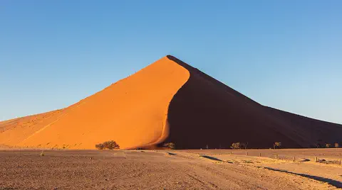
The Namib is a cool desert that runs for about 1,900 kilometers along Africa's Atlantic coast, from Angola through Namibia into South Africa. It gets almost no rain, but cold ocean water makes thick fog that drifts inland. UNESCO says its Namib Sand Sea is the only coastal desert in the world with huge dune fields influenced by fog.
- Watch Geography The ocean floor The bottom of the ocean is not flat. Starting from the shore, there is a shallow continental shelf, a steep slope, wide abyssal plains, a huge chain of underwater mountains called the mid-ocean ridge, and deep trenches. The deepest place, Challenger Deep in the Mariana Trench, is about 10,935 meters down.
For parents & teachers
What children will learn
- Explain that ocean water moves in currents driven by tides, wind and density.
- Describe how the Coriolis effect curves currents.
- Name the five major gyres and describe the Gulf Stream.
- Explain how cold, salty water sinks to drive deep currents.
Recommended ages: 7 to 14 · About 15 minutes
Talk about it
- How might a current help or slow down a ship or a migrating sea turtle?
- Why might litter thrown into the sea in one country wash up on a beach far away?
- What do you think would happen to winters in Bergen if the Gulf Stream were weaker?
Try at home or in class
- Put a few drops of food coloring into a tray of water and blow gently across the surface through a straw: see how 'wind' starts a surface current.
- Freeze water with blue food coloring into an ice cube, then put it in a clear glass of room-temperature water and watch the cold, blue meltwater sink, as NOAA describes cold, dense water sinking.
- Watch NASA's 'Perpetual Ocean' visualization and find the Gulf Stream and some swirling eddies.
Key vocabulary: current, gyre, Coriolis effect, trade winds, density, thermohaline circulation, Gulf Stream
Where these facts come from
- What is a current? , NOAA National Ocean Service
- Currents tutorial: The Coriolis effect , NOAA National Ocean Service
- Currents tutorial: Global wind patterns , NOAA National Ocean Service
- Currents tutorial: Major ocean gyres , NOAA National Ocean Service
- Currents tutorial: The Ekman spiral , NOAA National Ocean Service
- Currents tutorial: Thermohaline circulation , NOAA National Ocean Service
- What is a gyre? , NOAA National Ocean Service
- How fast is the Gulf Stream? , NOAA National Ocean Service
- What is the global ocean conveyor belt? , NOAA National Ocean Service
- Perpetual Ocean , NASA Scientific Visualization Studio
Checked, not yet human-reviewed. Last updated October 24, 2026. Spotted a mistake? Tell us.