
 Country
Africa
Mauritania
Mauritania is a big desert country in Africa next to the ocean. It has tall sand dunes, old desert towns and a giant rock eye.
Mauritania is a large country in northwest Africa where the Sahara meets the Atlantic Ocean. Dunes cover about half the land, ancient trading towns stand by desert oases, and many kinds of migrating birds spend the winter on its coast. About 5.3 million people live there.
Mauritania bridges the Arab-Amazigh Maghrib and sub-Saharan West Africa. Mostly Saharan, with the Sahel in the south and the Senegal River on its border, it holds iron-ore mines, the Banc d'Arguin bird coast and the old caravan towns of Chinguetti and Ouadane. It had about 5.3 million people in 2025 (World Bank).
Photo: Clemens Schmillen, CC BY-SA 4.0, via Wikimedia Commons
Discover Mauritania
Mauritania is a country in Africa.
Most of it is the Sahara, a huge sandy desert. Its west side is next to the Atlantic Ocean. The capital city is Nouakchott.
Mauritania is a large country on the Atlantic coast of northwest Africa. Much of it is part of the Sahara, and sand dunes cover about half of the land. In the far south, near the Senegal River, there is more rain and grassland.
Mauritania is like a bridge between the Arab and Amazigh (Berber) lands of North Africa and the lands of West Africa. It became independent from France on November 28, 1960. Its capital, Nouakchott, was a small village before then. About 5.3 million people lived there in 2025.
Mauritania forms a geographic and cultural bridge between the North African Maghrib and the westernmost part of sub-Saharan Africa, a transitional zone between Arab-Amazigh populations and the peoples of the Sudanic belt. Much of it lies in the Sahara; until the droughts of the 1970s a large share of the population was nomadic. Its mineral wealth includes large reserves of iron ore, copper and gypsum, all exploited, and some oil.
A French colony for the first half of the 20th century, it became independent on November 28, 1960. Under the constitution Islam is the state religion, with freedom of conscience guaranteed, and Arabic is the official language. The World Bank put the population at 5,315,065 in 2025; about half live in and around towns, and Nouakchott, once a small village, held about one-fourth of the people by the early 21st century.

Desert towns and a giant eye
Nouakchott is the biggest city.
Old desert towns have stone houses and narrow streets. In the desert is a huge circle of rock rings. From space, it looks like an eye!
Nouakchott, the capital, is home to about one in four people in Mauritania. In the desert stand four old towns, Chinguetti, Ouadane, Tichitt and Oualata, founded in the 1000s and 1100s to serve camel caravans crossing the Sahara. Their stone houses with courtyards crowd along narrow streets. They became a World Heritage Site in 1996.
Near Ouadane is the Richat Structure, a set of rock rings about 50 kilometers across. From above it looks like a giant eye. Scientists once thought a meteorite made it, but it is really a dome of rock pushed up long ago and worn down by wind and water.
Nouakchott, a small village before independence, held about one-fourth of the population by the early 21st century. Nouadhibou is the center of the fishing industry and an iron-ore export port, and the mining towns of Zouérate and Fdérik serve the iron deposits; towns along the Senegal River such as Kaédi and Rosso have also grown.
UNESCO inscribed the Ancient Ksour of Ouadane, Chinguetti, Tichitt and Oualata in 1996: founded in the 11th and 12th centuries to serve trans-Saharan caravans, they became trading and religious centers, and their urban fabric of patio houses in narrow lanes around a mosque with a square minaret evolved between the 12th and 16th centuries. Britannica notes Oualata's elaborately painted house walls. The Richat Structure near Ouadane, about 50 km across, was once thought to be an impact crater but lacks a central peak and impact melt; it is an uplifted dome formed by molten rock in the Cretaceous and eroded into rings of hard igneous and softer sedimentary rock. Acheulean hand axes there show early humans lived in the area.
Dunes, plateaus and the Sahel
Most of Mauritania is very dry.
Long lines of sand dunes stretch far away. Hot winds blow from the desert. In the far south, a little rain falls in summer.
Mauritania is mostly flat. Dunes cover about half the country, in long ridges that can be 90 meters high, and plains of pebbles called regs stretch for miles. The highest point is Mount Ijill, a huge block of iron-rich rock 915 meters tall.
Rain comes only in summer, and less falls the farther north you go: about 635 millimeters a year in the far south at Sélibabi, but only 25 to 50 at Nouadhibou on the northern coast. Summer afternoons reach the high 30s °C, and the hot, dry harmattan wind blows from the desert.
The coastal plains lie below 45 m and the interior plateaus at 180–230 m, broken by cuestas, scarps up to 275 m and inselbergs; the highest, Mount Ijill (915 m), is an enormous block of hematite. Dunes cover about half the country in long ridges (alab) up to 90 m high, and regs of packed pebbles form vast plains. Normal drainage exists only in the southwest, where tributaries of the Senegal River flood briefly in summer; elsewhere rare floods in wadis end in permanent pools called gueltas.
The northeast trade winds and the harmattan make the climate arid. Summer rain from southwesterly winds decreases northward: about 635 mm at Sélibabi (June–October), 355 mm at Kiffa, 180 mm at Tidjikdja and Atar, and 25–50 mm at Nouadhibou. Interior highs in the 40s °C are not uncommon. Vegetation shifts from Sudanic savanna with baobabs in the far south through the Sahel, with acacias and euphorbias, to desert where plants grow only in wadis and oases.
Birds of the coast, life in the desert
Many birds rest on Mauritania's coast in winter.
Dolphins and sea turtles swim in the sea. Warthogs and hyenas live in the dry grasslands. Long ago, camels carried families across the desert.
On the Atlantic coast, Banc d'Arguin National Park mixes sand dunes, swamps, small islands and shallow sea. It is one of the most important places in the world for nesting birds and for wading birds that fly south from Europe and Asia for the winter. Sea turtles and dolphins live in its waters, and local fishers use the dolphins to help bring shoals of fish closer.
In the southern grasslands, gazelles, ostriches, warthogs and hyenas still roam, but hunting has made many large animals rare.
UNESCO describes the Banc d'Arguin (inscribed 1989) as one of the world's most important zones for nesting birds and Palearctic migratory waders: sand dunes, coastal swamps, small islands and shallow waters where the austere desert meets a rich marine zone. Several species of sea turtle and dolphin occur, and the dolphins are used by fishers to drive shoals of fish.
On land, Britannica notes that little remains of the large animals that lived in the savanna into the colonial period; the steppe is still frequented by gazelles, ostriches, warthogs and hyenas, but hunting has greatly reduced animal populations, prompting conservation measures. Camels remain central to life in the desert: nomads rode camels and used pack camels, and in the south pack oxen and donkeys.

People, languages and nomad life
About 5.3 million people live in Mauritania.
Many people speak Arabic. Long ago, many families moved with their camels and lived in tents. Today, most live in towns.
More than two-thirds of the people are Moors, who speak an Arabic dialect called Hassaniyya. The Tukulor, Fulani, Soninke and Wolof live mostly in the south, near the Senegal River. Arabic is the official language, and Fula, Soninke and Wolof are national languages.
Until the 1980s, many families were nomads who moved with their animals to find water and grass. Women made tents from bands of woven sheep's wool and water bags from goatskins. Long droughts in the 1970s led many people to move to towns, and today the nomadic way of life has almost disappeared.
The Moors make up more than two-thirds of the population and speak Hassaniyya Arabic; Britannica describes about three-fifths of them as Haratin, of Sudanic African origin, and about two-fifths as Bidan, of Arab and Amazigh descent. Roughly one-third belong to the Tukulor of the Senegal valley, the Fulani of the south, the Soninke of the far south and the Wolof near Rosso. Arabic is official; Fula, Soninke and Wolof are national languages, and Arabic has been the main language of schooling since the late 1980s. Almost all Mauritanians are Sunni Muslims. Slavery, abolished in colonial times, was made a criminal offense by a 2007 law.
Nomadism dominated until the 1980s: livestock supplied milk and meat, encampments in the southwest reached 300 tents, and herds moved with the seasonal rains. Drought in the 1970s drove rapid urbanization, and dams in wadis and expanded palm groves changed rural life. Along the Senegal River, irrigation since the 1980s has sharpened competition for farmland in the region called the Chemama.
Caravans, coasts and independence
People have lived in Mauritania for a very long time.
Long ago, camel caravans carried salt and gold across the desert. Later, France ruled. In 1960, Mauritania became its own country.
Very old stone tools found in the north show that people lived here long ago. In the 1000s, the Almoravids, a reform movement that spread Islam, began in this region. Camel caravans crossed the Sahara through Mauritania, carrying salt and cloth south and bringing gold north, and towns like Chinguetti were important stops on the way.
Portuguese sailors reached the coast in 1442. Later, France took control, and Mauritania became independent on November 28, 1960.
Acheulean and Neolithic remains in the north point to deep prehistory. Sub-Saharan peoples and Sanhaja Amazigh settled the region, which was the cradle of the 11th-century Almoravid movement. Trade routes linking Moroccan empires with the south carried Saharan salt and Mediterranean cloth, brocades and paper in exchange for gold, passing caravan towns such as Chinguetti and Oualata; Hassani Arab tribes entered along these routes, forming the Moorish culture. Portuguese mariners rounded Cape Blanco in 1442 and built a fort at Arguin, followed by Spanish, Dutch, French and English traders seeking gum arabic and other goods.
France governed Mauritania as a colony for the first half of the 20th century; it became independent on November 28, 1960, under Moktar Ould Daddah. The army took power in 1978, 1984, 2005 and 2008. A 1991 constitution introduced multiparty politics, and in 2007 Sidi Ould Cheikh Abdallahi became the first democratically elected president. In 1989 a crisis with Senegal led both countries to expel tens of thousands of each other's citizens; diplomatic ties returned in 1992.
Mauritania on the map
Find Mauritania on the globe.
It is in northwest Africa, by the Atlantic Ocean. It is big and sandy. The Senegal River runs along its southern edge.
Mauritania's Atlantic coast runs about 700 kilometers north from the Senegal River delta to the Cape Blanco peninsula. Western Sahara is to the northwest, Algeria to the northeast, Mali to the east and southeast, and Senegal to the southwest.
The Senegal River forms the border with Senegal. Inland, the Adrar and Tagant plateaus form the country's rocky heartland, while vast, empty desert plains stretch to the north and east.
Mauritania is bounded by Western Sahara to the northwest, Algeria to the northeast, Mali to the east and southeast and Senegal to the southwest, with an Atlantic coastline of about 700 km from the Senegal delta to the Cape Nouadhibou (Cape Blanco) peninsula. The Senegal River forms the frontier with Senegal.
The Adrar and Tagant plateaus, the 'country of stone', hold the old oasis towns at the foot of their cliffs; desert peneplains called the Empty Quarter extend north and east, and the Hodh basin in the southeast is a major livestock region tied economically to Mali.
- Atlantic coastline
- about 700 km
- Neighbors
- Western Sahara, Algeria, Mali and Senegal
- Highest point
- Mount Ijill, 915 m
- People (2025)
- 5,315,065
Amazing facts
-
A giant circle of rock in Mauritania looks like an eye.
The Richat Structure is about 50 kilometers across, and from above its rings look like a giant eye.
The Richat Structure, named from a Berber term for 'feather', was once thought to be an impact crater but is an eroded dome at least 100 million years old.
-
Mauritania's highest mountain is made of iron-rich rock.
Mount Ijill, Mauritania's highest point at 915 meters, is an enormous block of iron-rich rock.
The highest inselberg, Mount Ijill (915 m), is an enormous block of hematite, and its iron ore exploitation reshaped settlement in the north.
-
Fishers in Mauritania get help from dolphins.
At Banc d'Arguin, fishers have used dolphins to help bring shoals of fish closer.
UNESCO notes that several species of sea turtle and dolphin occur at Banc d'Arguin, and that the dolphins are used by fishermen to attract shoals of fish.
-
Some tents were made from woven wool.
Nomad women dyed sheep's wool and braided it into long brown bands that they sewed together to make tents.
In nomadic camps women braided dyed sheep's wool into bands sewn into tents and tanned goatskins into waterskins called guerbas; southwestern camps reached 300 tents.
Words to know
- dune
- a hill or ridge of sand piled up by the wind
- oasis
- a place in a desert where water lets plants grow
- nomad
- a person who moves from place to place with animals to find water and grass
- caravan
- a group of traders traveling together, often with camels
- Sahel
- the dry grassland belt along the southern edge of the Sahara
- dome
- a rounded bulge of rock pushed up from below
- World Heritage Site
- a place UNESCO lists as important to all people, to be protected
Discovery challenge
-
What is the capital city of Mauritania?
Which city, a small village before 1960, is Mauritania's capital?
Which capital grew from a small village to hold about a quarter of Mauritania's people?
- Nouadhibou
- Chinguetti
- Nouakchott
Show the answer
Nouakchott
Nouakchott is the capital of Mauritania.
Nouakchott was a small village before independence and is now the capital.
Nouakchott held about one-fourth of the population by the early 21st century.
-
Which big desert covers much of Mauritania?
Much of Mauritania is part of which desert?
Mauritania's dunes and regs belong to which desert?
- The Gobi
- The Sahara
- The Atacama
Show the answer
The Sahara
The Sahara covers much of Mauritania.
Much of Mauritania lies in the Sahara, and dunes cover about half the country.
Mauritania encompasses part of the Sahara; dunes cover about half its area.
-
What does the Richat Structure look like from above?
From high above, what do the rings of the Richat Structure look like?
The concentric rings of the Richat Structure, seen from above, are said to resemble what?
- An eye
- A star
- A square
Show the answer
An eye
It looks like a giant eye.
Its rings, about 50 kilometers across, look like a giant eye.
Its rings of hard and soft rock, eroded over millions of years, resemble an eye from above.
-
What lives in huge numbers at Banc d'Arguin?
Banc d'Arguin is one of the world's most important places for which animals?
UNESCO ranks Banc d'Arguin among the world's most important zones for which group?
- Birds
- Tigers
- Penguins
Show the answer
Birds
Lots of birds rest at Banc d'Arguin.
Birds nest there, and many wading birds spend the winter.
It is a key zone for nesting birds and Palearctic migratory waders.
-
When did Mauritania become its own country?
In which year did Mauritania become independent from France?
On November 28 of which year did Mauritania become independent?
- 1442
- 1960
- 1991
Show the answer
1960
Mauritania became its own country in 1960.
Mauritania became independent on November 28, 1960.
Independence came on November 28, 1960; 1442 is the Portuguese arrival and 1991 the multiparty constitution.
Places to discover in Mauritania
Animals of Mauritania
-
Watch
3D
Animal
Dromedary camel
The dromedary, or Arabian camel, is the one-humped camel of the deserts of North Africa, the Middle East and India. Its hump stores fat, not water, and its body is full of tricks for saving water. People tamed dromedaries thousands of years ago, and today none live truly wild, except a large feral population in Australia.
-
 Watch
Animal
Common warthog
Common warthogs are tough wild pigs of the African savanna. They kneel down to eat short grass, sleep in old aardvark burrows and run with their tails held straight up like little flags. The bumps on their faces are thick pads of skin.
-
 Watch
Animal
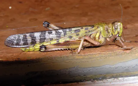
Desert locust
The desert locust is a large grasshopper of the deserts of Africa, the Middle East and Southwest Asia. Most of the time it lives alone. But after good rains, when locusts become crowded, they change their color and behavior and can gather into enormous swarms that fly long distances and eat farmers' crops.
Explore next
-
 Watch
Natural wonder
Sahara
The Sahara fills almost all of northern Africa. Britannica calls it the largest hot desert in the world: about 4,800 kilometers from east to west and about 8.6 million square kilometers in all. Only about a quarter of it is sand dunes; the rest is gravel plains, rocky plateaus and mountains.
-
Watch
3D
Animal
Dromedary camel
The dromedary, or Arabian camel, is the one-humped camel of the deserts of North Africa, the Middle East and India. Its hump stores fat, not water, and its body is full of tricks for saving water. People tamed dromedaries thousands of years ago, and today none live truly wild, except a large feral population in Australia.
-
Watch
Animal
Common warthog
Common warthogs are tough wild pigs of the African savanna. They kneel down to eat short grass, sleep in old aardvark burrows and run with their tails held straight up like little flags. The bumps on their faces are thick pads of skin.
-
 Watch
 Country
Senegal
Senegal is a country at the far western tip of Africa, on the Atlantic Ocean. Its capital, Dakar, sits on the westernmost point of the continent. About 19 million people live there, and the Senegal River, wetlands full of birds and quiet mangrove deltas make it a place of water as well as dry grassland.
-
 Watch
 Country
Mali
Mali is one of the largest countries in Africa. Its north is part of the Sahara, its middle is the dry Sahel, and its south has savanna. The Niger River flows through it, and long ago great empires grew rich here from trade in gold. About 25.2 million people lived there in 2025.
-
Watch
Animal
Desert locust
The desert locust is a large grasshopper of the deserts of Africa, the Middle East and Southwest Asia. Most of the time it lives alone. But after good rains, when locusts become crowded, they change their color and behavior and can gather into enormous swarms that fly long distances and eat farmers' crops.
-
 Watch
 Country
Democratic Republic of the Congo
The Democratic Republic of the Congo, or DR Congo, is the second-largest country in Africa. The mighty Congo River curves through its rainforests, volcanoes rise in the east, and its capital, Kinshasa, is a center of music, fashion and popular culture.
-
 Watch
 Country
Ethiopia
Ethiopia is a country on the Horn of Africa with no coast. Much of it is high, rugged land cut by the Great Rift Valley, it is one of the world's oldest countries, and more than 110 million people live there.
For parents & teachers
What children will learn
- Locate Mauritania, its neighbors, the Atlantic coast and the Senegal River.
- Explain how rainfall changes from south to north and how that shapes plants and ways of life.
- Describe the peoples, languages and ways of life of Mauritania without treating them as one culture.
- Outline Mauritania's history from Saharan caravan towns to independence in 1960.
Recommended ages: 3 to 17 · About 15 minutes
Talk about it
- How might life change for a family that stops moving with its herds and settles in a city?
- Why do you think towns grew up at oases along caravan routes?
- Why might birds fly thousands of kilometers to spend the winter on a desert coast?
Try at home or in class
- Model the Richat Structure: stack layers of different colored play dough into a dome, slice off the top, and look at the rings.
- Blow gently across a tray of dry sand with a straw and watch ridges form, like Mauritania's dunes.
Key vocabulary: dune, oasis, nomad, caravan, Sahel, dome, World Heritage Site
Where these facts come from
- Wikidata , Wikimedia Foundation (CC0 1.0)
- Natural Earth vector data , Natural Earth (NACIS) (Public domain)
- UNESCO World Heritage List , UNESCO World Heritage Centre (Linked as a reference; site facts come from Wikidata)
- Mauritania (introduction, land, relief, drainage, soils, climate) , Encyclopaedia Britannica
- Mauritania: Plant and animal life (ethnic groups, languages) , Encyclopaedia Britannica
- Mauritania: Religion (settlement patterns, traditional regions, nomadism) , Encyclopaedia Britannica
- Mauritania: History , Encyclopaedia Britannica
- Richat Structure , Encyclopaedia Britannica
- Banc d'Arguin National Park , UNESCO World Heritage Centre
- Ancient Ksour of Ouadane, Chinguetti, Tichitt and Oualata , UNESCO World Heritage Centre
- Population, total: Mauritania , World Bank
- PlayOwl region table, version 1 , PlayOwl (PlayOwl original data)
- flag-icons 7.5.0 , Panayiotis Lipiridis and contributors (MIT)
- Wikimedia Commons , Wikimedia Foundation (Per file (public domain, CC0, CC BY or CC BY-SA); see each media record)
Checked, not yet human-reviewed. Last updated October 27, 2026. Spotted a mistake? Tell us.
Picture credits
- Photo: Clemens Schmillen, CC BY-SA 4.0, via Wikimedia Commons · source · license
- Photo: Laminesall96, CC BY-SA 4.0, via Wikimedia Commons · source · license
- Photo: Garrondo, CC BY-SA 3.0, via Wikimedia Commons · source · license
- Photo: Charles J. Sharp, CC BY-SA 4.0, via Wikimedia Commons · source · license