
 Country
Europe
Slovakia
Slovakia is a country in the middle of Europe. It has high, rocky mountains, deep caves and old castles. It does not touch the sea.
Slovakia is a landlocked country in central Europe. The Carpathian Mountains cover much of it, with the High Tatras in the north, and about 5.4 million people lived there at the end of 2025. Its capital, Bratislava, sits on the Danube River.
Slovakia is a landlocked central European republic of about 49,000 km², dominated by the Western Carpathians and drained mostly south to the Danube. Ruled from Hungary from the 11th century and part of Czechoslovakia from 1918, it became independent on January 1, 1993; its Statistics Office counted 5,409,407 people at the end of 2025.
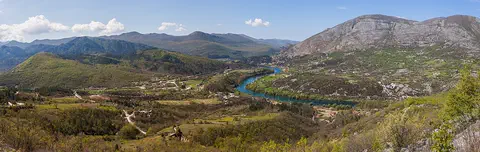
Photo: Rob Hurson from Kentstown, Ireland, CC BY-SA 2.0, via Wikimedia Commons
Discover Slovakia
Slovakia is a country in the middle of Europe.
It has no coast on the sea. Big mountains cover much of the land. A long river called the Danube flows past the capital city. The capital is called Bratislava.
Slovakia is a landlocked country in central Europe, which means it has no coast on the sea. Poland lies to the north, Ukraine to the east, Hungary to the south, Austria to the southwest and Czechia to the west.
The Western Carpathian Mountains cover much of the country, and its highest peak, in the High Tatras, is 2,655 meters tall. Most of Slovakia's rivers flow south into the Danube. At the end of 2025, about 5.4 million people lived in Slovakia, and the official language is Slovak.
Slovakia is a landlocked state of about 49,000 square kilometers in central Europe, bordered by Poland, Ukraine, Hungary, Austria and Czechia, its former federal partner. Britannica describes the Western Carpathians as dominating its topography: three belts of east-west ranges (Outer, Central and Inner) separated by valleys and basins, with two lowlands along the Hungarian border, the Little Alföld (Danubian Lowland) in the southwest and the Eastern Slovakian Lowland in the east.
Slovakia's Statistics Office counted 5,409,407 inhabitants at the end of 2025, the fifth year of decline in a row; in 2025 about 42,000 babies were born and more than 53,500 people died. Slovakia became an independent country on January 1, 1993.
Cities and famous places
Bratislava is the capital city.
A big castle stands on a hill above the river. Košice is a city in the east. It has a long old street in the middle. Some villages have old wooden houses.
Bratislava lies in the far southwest, on the Danube, close to the borders with Austria and Hungary; Vienna is only 56 kilometers away. Its huge castle stands on a plateau 100 meters above the river. For more than 200 years, from 1536 to 1783, Bratislava was the capital of Hungary.
Košice is the second-largest city and the center of southeastern Slovakia. Its long medieval main street, Hlavná Ulica, is still the heart of the city. In the mountains, the village of Vlkolínec keeps 43 old log-built homesteads, and Banská Štiavnica was a center of silver and gold mining.
Bratislava, known as Pozsony in Hungarian and Pressburg in German, stands where the Danube cuts a gorge through the Little Carpathians near the meeting point of the Slovak, Austrian and Hungarian borders. After the Ottoman victory at Mohács in 1526, the Hungarian Diet moved the capital from Buda, and the city served as Hungary's capital from 1536 until 1783; Habsburg rulers were crowned kings of Hungary in its Gothic Cathedral of St. Martin. Britannica gives 475,503 people in 2021.
Košice, chartered in 1241, keeps its medieval Hlavná Ulica with the Gothic Cathedral of St. Elizabeth. UNESCO lists Banská Štiavnica (1993), the oldest mining town in Slovakia, where Europe's first Mining and Forestry Academy opened in 1762; Vlkolínec (1993), a well-preserved medieval rural settlement in the mountains with 43 nearly intact homesteads; Spišský Hrad, with one of the largest ensembles of 13th- and 14th-century military, political and religious buildings in eastern Europe, together with the walled town of Levoča; and eight wooden churches of the Carpathians built between the 16th and 18th centuries (2008).

Mountains, caves and rivers
Slovakia has tall, rocky mountains called the High Tatras.
Snow stays on the highest tops into summer. Deep under the ground there are many caves. Some caves are filled with ice.
The High Tatras run for about 64 kilometers along the border with Poland. Their highest peak, Gerlachovský Peak, is 2,655 meters tall, and about 300 peaks have names. The range has many high lakes, and snow stays on the highest tops into the summer months.
In the south, the Slovak Karst is full of caves. When UNESCO listed it together with Hungary's Aggtelek Karst next door, 712 caves were recorded there; today more than 1,000 are known. Some caves in this protected area, like the Dobšiná Ice Cave, hold ice. Most rivers, such as the Váh and the Hron, flow south to the Danube.
The Central Western Carpathians hold Slovakia's highest ranges: the High Tatras, extending about 64 km along the Slovak-Polish frontier, with Gerlachovský Peak (2,655 m) the highest of about 300 named peaks, and the Low Tatras to the south, rising to Ďumbier (2,043 m). Britannica notes that the Tatras have no glaciers or permanent snowfields but otherwise resemble the Alps, with high-lying lakes and hanging valleys.
The climate is more continental than in Czechia: mean annual temperatures range from about -4 °C in the High Tatras to just above 10 °C in the Danubian lowlands, and precipitation from about 570 mm on the Danubian plains to more than 1,100 mm in windward mountain valleys, peaking in July. The Danube and Morava form the southwestern border; the Váh, Hron, Hornád and Bodrog drain south and the Poprad north. The Caves of Aggtelek Karst and Slovak Karst, shared with Hungary and inscribed in 1995, preserve karst formed under both tropical and glacial climates; the property has more than 1,000 known caves, including ice-filled caves such as Dobšiná and Silica.
Animals of Slovakia
Bears, wolves and lynx live in the Tatra mountains.
Little marmots live there too. Chamois are wild mountain animals. They are protected all over the country. Storks and eagles are protected too.
About two-fifths of Slovakia is still covered in forest, with oak woods in the lowlands, beech forests lower in the mountains and spruce forests higher up. Tatry National Park in the High Tatras shelters bears, wolves, lynx, wildcats, marmots, otters, martens and minks, and hunting is not allowed in the parks.
The chamois, a wild mountain animal, is protected all over the country. Storks and birds of prey such as eagles are protected too, and partridges, pheasants, wild geese and ducks live in the forests and lowlands.
Britannica estimates that about two-fifths of Slovakia remains forested despite farming and logging. The main forest types are oak groves in the Podunajská (Danubian) Lowland, beech at lower Carpathian elevations and spruce on the middle and upper slopes; in the Tatras the tree cover just below the timberline is largely dwarf pine, and at about 2,300 m alpine grasses and low shrubs give way to lichens. Britannica names the forests of the western Beskids and of central Slovakia near Žiar nad Hronom among the most endangered.
Tatry National Park (741 km²) shelters bears, wolves, lynx, wildcats, marmots, otters, martens and minks; hunting is prohibited in the parks, and the chamois is protected nationwide. Raptors, storks and other large birds are also protected, while game birds such as partridges, pheasants, wild geese and ducks live in the forests and lowlands. Across the frontier, which runs along the summits, lies Poland's Tatra National Park (212 km²).
People, languages and food
More than five million people live in Slovakia.
Most people speak Slovak. Some people speak Hungarian or other languages. A special Slovak dish is little potato dumplings with sheep's cheese.
More than four out of five people in Slovakia are Slovaks. Hungarians, who live mostly near the southern border, are the largest minority, and there are smaller groups of Roma, Rusyns, Czechs, Germans and Poles. Slovak is the official language. It is a West Slavic language, close enough to Czech that speakers of the two can understand each other.
More than half of the people live in towns and cities. A Slovak specialty is bryndzové halušky: small potato dumplings mixed with bryndza, a cheese made from sheep's milk. Many folk music festivals take place, with Slovak and Roma performers.
Ethnic Slovaks make up more than four-fifths of the population; Hungarians, concentrated in the southern border districts, are the largest minority at less than one-tenth, with Ruthenians (Rusyns) in the east and northeast, a sizable Roma population mainly in the east, and small numbers of Czechs, Germans and Poles. Slovak, a West Slavic language written in the Roman alphabet, is mutually intelligible with Czech; Hungarian, Polish, German, Ukrainian, Rusyn and Romany are also spoken, and a few western villages speak Croatian. Most people are Roman Catholic, Lutheran and Reformed churches have significant minorities, Greek Catholic and Orthodox Christians live in Rusyn districts, and more than one-tenth of people follow no religion.
School is compulsory from 6 to 15. Slovak cooking shares much with Hungarian and German food: soups, stewed vegetables, roasted and smoked meats and dairy, especially bryndza, a sheep's-milk cheese served with small potato dumplings as bryndzové halušky. Vineyards along the Danube and Váh go back to the Romans about 2,000 years ago.
A long history
People have lived in Slovakia for a very long time.
Long ago, kings of Hungary ruled the land. Later, Slovakia was part of a country called Czechoslovakia. In 1993 Slovakia became its own country.
Long ago, Celts and Romans built forts and settled where Bratislava now stands. In the 800s, part of the land lay in Great Moravia, the earliest West Slavic state. From the 11th century, the kingdom of Hungary ruled what is now Slovakia.
In 1918 Slovakia joined with the Czech lands to form a new country, Czechoslovakia. In 1989 the communist government that had run Czechoslovakia since 1948 collapsed in the Velvet Revolution. On January 1, 1993, Slovakia became an independent country. It joined the European Union in 2004 and began using the euro in 2009.
Celts and Romans fortified the site of Bratislava, and Slavs lived there by the 8th century, within Great Moravia, the earliest West Slavic state. Britannica dates the beginnings of a distinct Slovak culture to a Christian mission sent to Moravia in 863 by the Byzantine emperor Michael III, and after Magyar invasions at the end of the 9th century, Hungary ruled the region from the 11th century as Upper Hungary. A Slovak literary language was codified in the late 18th and 19th centuries, by Anton Bernolák and then by L'udovít Štúr's circle, despite Hungarian pressure to Magyarize.
When World War I ended with Austria-Hungary defeated, Slovakia became part of Czechoslovakia (1918). World War II thwarted a first vote for independence in 1939, and a communist regime controlled Czechoslovakia from 1948. In 1968 the Soviet Union invaded and crushed the Prague Spring, the reforms of Communist Party leader Alexander Dubček, a Slovak. The regime collapsed in the Velvet Revolution of 1989, and the federation dissolved into two states on January 1, 1993. Slovakia joined NATO and the EU in 2004 and adopted the euro in 2009, the second former communist-bloc country to do so after Slovenia. Voters elect a one-chamber parliament, the National Council, and, since a 1999 amendment, the president.
Slovakia on the map
Find Slovakia on the globe.
It is in the middle of Europe. Five countries are all around it. The Danube River runs along its edge in the south.
Slovakia is in central Europe, with no coast. It shares borders with five countries: Poland in the north, Ukraine in the east, Hungary in the south, Austria in the southwest and Czechia in the west.
The mountains are in the north and middle of the country, and flatter lowlands lie along the southern border. The capital, Bratislava, is right at the southwestern edge, where the borders of Slovakia, Austria and Hungary come close together.
Slovakia is landlocked in central Europe, between Poland (north), Ukraine (east), Hungary (south), Austria (southwest) and Czechia (west). It covers roughly the historic region of Slovakia, the easternmost of the two territories that formed Czechoslovakia from 1918 to 1992.
The Danube and the Morava form the southwestern border, and the summits of the High Tatras carry the border with Poland. Britannica calls Bratislava eccentrically located: it lies in the extreme southwest, 56 km from Vienna, while Košice, the second city, is the center of the southeast. Most of the land drains south into the Danube system, except the Poprad, which flows north.
- Neighbors
- Poland, Ukraine, Hungary, Austria and Czechia
- Area
- about 49,000 km²
- Highest point
- Gerlachovský Peak, 2,655 m
- High Tatras
- about 64 km along the border with Poland
Amazing facts
-
Some caves in Slovakia are filled with ice.
Slovakia's World Heritage caves include ice-filled caves, such as the Dobšiná Ice Cave, and caves decorated with stone icicles called stalactites.
UNESCO's Aggtelek and Slovak Karst site had 712 caves recorded at inscription in 1995 and more than 1,000 known today, including the Dobšiná and Silica ice caves.
-
Long ago, people dug for silver and gold in Slovak mountains.
Banská Štiavnica, the oldest mining town in Slovakia, was a center of silver and gold mining, and in 1762 Europe's first Mining and Forestry Academy opened there.
Banská Štiavnica dates from the 13th century, though mining there goes back to the late Bronze Age; its 16th-century reservoirs and ditches supplied the mines and the town with water, and Europe's first Mining and Forestry Academy opened there in 1762.
-
Kings of Hungary were crowned in Bratislava.
For more than 200 years, Bratislava was the capital of Hungary, and kings were crowned in its Cathedral of St. Martin.
Under the name Pozsony, Bratislava was Hungary's capital from 1536 to 1783, and Habsburg rulers were crowned kings of Hungary in its Gothic Cathedral of St. Martin.
-
One mountain village has old wooden houses.
In the mountain village of Vlkolínec, 43 old homesteads built of logs still stand, with barns and stables behind them.
Vlkolínec, first recorded in the late 14th century, keeps 43 nearly intact log-built homesteads, a bell tower from 1770 and strip fields; UNESCO inscribed it in 1993.
-
About 300 mountain tops in the Tatras have names.
About 300 peaks in the Tatra Mountains are named and measured, and the tallest is Gerlachovský Peak.
Britannica counts about 300 Tatra peaks identified by name and elevation, the highest being Gerlachovský Peak at 2,655 m.
Words to know
- landlocked
- having no coast on the sea or ocean
- karst
- land where water slowly dissolves the rock, making caves, tunnels and holes
- stalactite
- a stone icicle that hangs from a cave roof, made by dripping water
- chamois
- a wild animal of high mountains, protected all over Slovakia
- minority
- a smaller group of people within a country, such as speakers of another language
- independent
- describes a country that governs itself
- World Heritage Site
- a place UNESCO lists as important to all people, to be protected
Discovery challenge
-
What is the capital city of Slovakia?
Which city is the capital of Slovakia?
Which city on the Danube, once the capital of Hungary, is the capital of Slovakia?
- Košice
- Bratislava
- Vienna
Show the answer
Bratislava
Bratislava is the capital of Slovakia. It is on the Danube River.
Bratislava is the capital. Košice is the second-largest city, and Vienna is the capital of Austria, 56 kilometers away.
Bratislava (Pozsony) was Hungary's capital from 1536 to 1783 and has been Slovakia's capital within Czechoslovakia and since independence in 1993.
-
What does Slovakia not have?
Slovakia is landlocked. What does that mean it does not have?
As a landlocked country, Slovakia has no what?
- Mountains
- Rivers
- A coast on the sea
Show the answer
A coast on the sea
Slovakia has no sea. It has mountains and rivers.
Landlocked means no coast. Slovakia has plenty of mountains and rivers, and most of its rivers flow to the Danube.
Slovakia is landlocked between five neighbors; its rivers drain mostly south into the Danube system.
-
Which mountains in Slovakia are the tallest?
In which mountains is Slovakia's highest peak?
Gerlachovský Peak, 2,655 meters, is the highest point of which range?
- The High Tatras
- The Alps
- The Pyrenees
Show the answer
The High Tatras
The High Tatras are the tallest mountains in Slovakia.
Gerlachovský Peak, 2,655 meters, is in the High Tatras, along the border with Poland.
The High Tatras, in the Central Western Carpathians, extend about 64 km along the Slovak-Polish frontier; Gerlachovský Peak is the highest of about 300 named peaks.
-
Bryndza cheese is made from which animal's milk?
Bryndza, the cheese in bryndzové halušky, is made from which animal's milk?
Bryndza, used in Slovakia's specialty bryndzové halušky, is made from the milk of which animal?
- Cow
- Sheep
- Camel
Show the answer
Sheep
Bryndza is a cheese made from sheep's milk.
Bryndza is a sheep's-milk cheese. It is mixed with small potato dumplings to make bryndzové halušky.
Britannica describes bryndza as a sheep's-milk cheese; bryndzové halušky, small potato dumplings mixed with it, is a Slovak specialty.
-
When did Slovakia become its own country?
In which year did Slovakia become an independent country?
In which year did Czechoslovakia dissolve, making Slovakia independent on January 1?
- 1918
- 2004
- 1993
Show the answer
1993
Slovakia became its own country in 1993.
On January 1, 1993, Slovakia became independent. In 1918 it had joined Czechoslovakia, and in 2004 it joined the European Union.
The Czechoslovak federation dissolved and the Slovak Republic came into being on January 1, 1993; 1918 saw the founding of Czechoslovakia and 2004 EU and NATO membership.
Places to discover in Slovakia
Animals of Slovakia
-
 Watch
3D
Animal
Brown bear
The brown bear lives in more places than any other bear, from European forests to the mountains of Asia and the rivers of Alaska. It eats almost anything, from berries to salmon, and spends the long winter asleep in a cozy den. Grizzly bears and Kodiak bears are brown bears too.
-
 Watch
Animal
Eurasian lynx
The Eurasian lynx is the largest of the four kinds of lynx. It has black ear tufts, a ruff of fur around its face, a short black-tipped tail and big furry paws for snow. It hides in forests and ambushes deer such as roe deer, and it has returned to parts of Europe where it had disappeared.
-
 Watch
Animal
White stork
The white stork is a tall white bird with black flight feathers, a red bill and long orange legs. It nests on rooftops, chimneys and trees across Europe, North Africa and western Asia, and many storks soar south to spend the winter in Africa or South Asia.
Explore next
-
 Watch
Natural wonder
Danube
The Danube is Europe's second-longest river, after the Volga. It begins as two small streams in Germany's Black Forest and flows about 2,850 kilometers east to the Black Sea, passing through 10 countries and four capital cities. For more than 2,000 years it has been a border, a highway for boats and a home for wildlife, and it ends in a giant delta of reeds, lakes and birds.
-
Watch
3D
Animal
Brown bear
The brown bear lives in more places than any other bear, from European forests to the mountains of Asia and the rivers of Alaska. It eats almost anything, from berries to salmon, and spends the long winter asleep in a cozy den. Grizzly bears and Kodiak bears are brown bears too.
-
Watch
Animal
Eurasian lynx
The Eurasian lynx is the largest of the four kinds of lynx. It has black ear tufts, a ruff of fur around its face, a short black-tipped tail and big furry paws for snow. It hides in forests and ambushes deer such as roe deer, and it has returned to parts of Europe where it had disappeared.
-
Watch
Animal
White stork
The white stork is a tall white bird with black flight feathers, a red bill and long orange legs. It nests on rooftops, chimneys and trees across Europe, North Africa and western Asia, and many storks soar south to spend the winter in Africa or South Asia.
- Watch Geography Caves and karst landscapes Most caves are made by slightly acidic water slowly dissolving rock such as limestone. Over hundreds of thousands of years, cracks grow into tunnels and rooms. The land above, with its sinkholes, disappearing streams and springs, is called karst. Inside, dripping water builds stalactites and stalagmites.
-
 Watch
 Country
Belarus
Belarus is a landlocked country in eastern Europe. Ice sheets of the last ice age shaped its low hills and wide plains, it has more than 10,000 lakes and one of Europe's largest wetlands, and about 9.1 million people lived there in 2025.
-
 Watch
 Country
Bosnia and Herzegovina
Bosnia and Herzegovina is a mountainous country in southeastern Europe. It has forests, limestone hills and many rivers, and famous old stone bridges cross some of them. Its capital is Sarajevo. It touches the Adriatic Sea along only about 20 kilometers of coast.
-
 Watch
 Country
Bulgaria
Bulgaria is a country on the eastern side of the Balkan Peninsula, with the Danube River to the north and the Black Sea to the east. Mountains cross it from west to east, and about 6.4 million people lived there at the end of 2025.
For parents & teachers
What children will learn
- Locate Slovakia in central Europe and name its five neighbors.
- Describe the High Tatras and the karst caves of the south.
- Name some of Slovakia's wildlife and its many languages and ways of life without treating them as one culture.
- Outline Slovakia's history from Great Moravia and Hungary to Czechoslovakia and independence in 1993.
Recommended ages: 3 to 17 · About 15 minutes
Talk about it
- What might be different about living in a country with no coast?
- Why do you think a village like Vlkolínec is worth protecting?
- How can people who speak different languages share one country?
Try at home or in class
- On a map of Europe, find the Danube at Bratislava, then follow it and list the other countries it flows through.
- Drip water through a paper towel onto a sugar cube, and watch how water can wear away a soft material, a little like water slowly shaping caves in rock.
Key vocabulary: landlocked, karst, stalactite, chamois, minority, independent, World Heritage Site
Where these facts come from
- Wikidata , Wikimedia Foundation (CC0 1.0)
- Natural Earth vector data , Natural Earth (NACIS) (Public domain)
- UNESCO World Heritage List , UNESCO World Heritage Centre (Linked as a reference; site facts come from Wikidata)
- Slovakia , Encyclopaedia Britannica
- Slovakia: Plant and animal life (and people) , Encyclopaedia Britannica
- Slovakia: Cultural life , Encyclopaedia Britannica
- Slovakia: Government and society , Encyclopaedia Britannica
- Slovakia: History , Encyclopaedia Britannica
- Tatra Mountains , Encyclopaedia Britannica
- Bratislava , Encyclopaedia Britannica
- Košice , Encyclopaedia Britannica
- Stats: Slovakia Population Declines for Fifth Year, Births Hit Record Low (Statistics Office 2025 data) , TASR (News Agency of the Slovak Republic)
- Historic Town of Banská Štiavnica and the Technical Monuments in its Vicinity , UNESCO World Heritage Centre
- Levoča, Spišský Hrad and the Associated Cultural Monuments , UNESCO World Heritage Centre
- Vlkolínec , UNESCO World Heritage Centre
- Caves of Aggtelek Karst and Slovak Karst , UNESCO World Heritage Centre
- Wooden Churches of the Slovak part of the Carpathian Mountain Area , UNESCO World Heritage Centre
- PlayOwl region table, version 1 , PlayOwl (PlayOwl original data)
- flag-icons 7.5.0 , Panayiotis Lipiridis and contributors (MIT)
- Wikimedia Commons , Wikimedia Foundation (Per file (public domain, CC0, CC BY or CC BY-SA); see each media record)
Checked, not yet human-reviewed. Last updated October 24, 2026. Spotted a mistake? Tell us.