
Natural wonder Africa
Lake Turkana
Lake Turkana is a big, salty lake in a hot desert in Africa. Crocodiles and hippos live on its islands.
Lake Turkana lies in the Great Rift Valley in northwestern Kenya. UNESCO calls it the largest desert lake in the world and the most salty lake in East Africa, and its shores hold important fossils of early human relatives.
Lake Turkana, in the Rift Valley of northwestern Kenya (ILEC lists Kenya and Ethiopia as riparian nations), is 249 km long, has no outlet and loses its water mainly by evaporation. UNESCO calls it the largest desert lake in the world and East Africa's most saline lake.
Photo: Doron, CC BY-SA 3.0, via Wikimedia Commons
Discover Lake Turkana
Lake Turkana is a long lake in Kenya, in a hot, dry land.
In this photo, a pale shore curves along the calm lake. Dark rocks lie in front.
Lake Turkana lies in the Great Rift Valley in northwestern Kenya, and the International Lake Environment Committee lists both Kenya and Ethiopia as countries on its shores. UNESCO says it stretches 249 kilometers from north to south, is 44 kilometers wide at its widest point, and is Africa's fourth-largest lake.
This photo by Doron, taken in August 1999 on South Island, an island of volcanic origin, shows dark rocks and a pale shore curving along the calm, blue-gray lake, with a rocky island and low hills far away.
ILEC places Lake Turkana in the Great Rift Valley in northwestern Kenya, with Ethiopia and Kenya as riparian nations, a mean depth of 30.2 m, a volume of 203.6 km3 and a water residence time of 12.5 years. UNESCO gives 249 km north to south, 44 km at the widest point and calls it Africa's fourth-largest lake.
The photo (Doron, CC BY-SA 3.0, August 1999) is captioned 'A view of Lake Turkana from Southern Island'; the Commons description calls South Island an island of volcanic origin. It shows dark rocks and dry grass, a pale curving shore, calm water, a rocky island and distant low hills.
- Length (UNESCO)
- 249 km
- Mean depth (ILEC)
- 30.2 m
- World Heritage Site
- since 1997
A lake in the Rift Valley
Long ago, volcanoes poured out lava here. Lava rocks cover much of the land.
The lake has no river flowing out of it.
ILEC explains that volcanoes were very active while the Rift Valley formed, and lava covers much of the valley floor in Kenya. A younger lava flow forms a barrier at the southern end of the lake.
The Omo River flows in from the north and brings more than 90 percent of the lake's water. Other rivers flow only after rare rains. No river flows out, so the lake loses its water mainly when it evaporates in the heat.
Volcanic activity was frequent during the creation of the Rift Valley, and Quaternary and Tertiary lavas, mainly alkaline, cover much of its floor in Kenya, with important effects on the chemistry of its lakes. Tertiary volcanic rocks lie in the south and along most of the western side; a Pleistocene lava flow forms a barrier at the southern end; Quaternary sediments dominate the west and north (ILEC).
The Omo contributes more than 90% of the inflow; other rivers are temporary. With no outlet, the lake loses water mainly by evaporation (about 2,335 mm a year), so its level is sensitive to climate and changes with the seasons and over the long term.
The Jade Sea
The lake is very salty. People call it the Jade Sea because of its color.
It is hot and windy here, and it rarely rains.
UNESCO says Lake Turkana is the largest desert lake in the world and the most salty lake in East Africa. It is often called the Jade Sea because of its beautiful color.
ILEC says most of the land around the lake gets less than 250 millimeters of rain a year, and the rain is hard to predict. At Lodwar, temperatures range from 19.5 to 39.9 degrees Celsius, and strong winds often blow from the southeast.
UNESCO: the most saline lake in East Africa and the largest desert lake in the world, surrounded by an arid landscape that is often devoid of life, and fondly called the Jade Sea for its color.
ILEC: mean annual rainfall under 250 mm in most of the surroundings, erratic and unpredictable, most likely during the 'long rains' of March to May; air temperatures at Lodwar range from 19.5 to 39.9 degrees C (mean daily 29.26 degrees C); frequent strong winds, mainly from the southeast.
Crocodiles, hippos and birds
Crocodiles and hippos raise their young on the lake's islands.
Many birds stop here on long journeys.
UNESCO says the islands in Lake Turkana National Parks are where Nile crocodiles, hippos and several kinds of snakes breed. It calls the area the largest Nile crocodile breeding ground in the world.
More than 350 kinds of water and land birds have been recorded, and the lake is an important stopover for migrating birds. In the muddy bays of South Island, underwater beds of pondweed shelter fish when they lay their eggs.
The island parks are breeding habitats of the Nile crocodile, the hippopotamus and several snake species, with the world's largest Nile crocodile breeding ground; the parks protect threatened reticulated giraffe, lions and Grevy's zebras, and over 350 bird species are recorded (UNESCO).
The lake is an important flyway and stopover for Palearctic migrant birds, and South Island Park is a BirdLife International Important Bird Area. Submerged beds of Potamogeton pectinatus in South Island's muddy bays shelter spawning fish.
Fossils of early human relatives
Scientists have found very old bones near the lake. They help us learn about early humans.
There are also forests of trees that turned to stone.
UNESCO says scientists began finding fossils at Koobi Fora, north of Allia Bay, in 1969. Fossils of five kinds of early humans and human relatives have been found there, including Homo habilis, which lived about two million years ago.
There are also petrified forests: trees turned to stone, from a time when the land was moist grassland and forest instead of hot desert.
Extensive paleontological finds at Koobi Fora, north of Allia Bay, began in 1969 with Paranthropus boisei; remains of five species (Australopithecus anamensis, Homo habilis/rudolfensis, Paranthropus boisei, Homo erectus, Homo sapiens) come from one locality. UNESCO says the deposits have contributed more to understanding human ancestry and paleo-environment than any other site in the world.
Petrified forests and about one hundred archaeological and paleontological sites record a change from moist forest and grassland to today's hot desert; the main geological features date from the Pliocene to the Holocene (4 million to 10,000 years old).
Exploring safely
Crocodiles live in this lake. Never swim or play at the water's edge.
It is very hot. Drink water and rest in the shade.
PlayOwl's advice: the lake has the world's largest Nile crocodile breeding ground, so stay well back from the water and never swim. Hippos live here too, so watch all wild animals from far away.
The heat can make people sick. The US National Weather Service says signs of heat exhaustion include heavy sweating, tiredness and dizziness; move to a cooler place, loosen clothing, use cool, wet cloths and take sips of water.
PlayOwl's advice, based on UNESCO's account of the island parks (the largest Nile crocodile breeding ground in the world, breeding hippos): no swimming or wading, and keep a wide distance from the shoreline and from wildlife.
NWS heat illness guidance: heat cramps may be the first sign; heat exhaustion brings heavy sweating, weakness, cool, pale, clammy skin and dizziness: move to a cooler place, loosen clothing, apply cool, wet cloths and offer sips of water; heat stroke is a medical emergency.
Amazing facts
-
The world's biggest Nile crocodile breeding ground is here.
UNESCO says the lake's island parks are the largest Nile crocodile breeding ground in the world.
UNESCO: the property is an important habitat for hippopotamus and the world's largest colony of crocodiles, the largest Nile crocodile breeding ground in the world.
-
People call this lake the Jade Sea.
Lake Turkana is often called the Jade Sea because of its color.
UNESCO notes the lake is fondly called the Jade Sea because of its breathtaking color.
-
Some trees near the lake turned into stone.
Petrified forests near the lake grew when the land was moist forest and grassland, not desert.
UNESCO links the petrified forests to a change in climate from moist forest grassland to the present hot desert.
Words to know
- rift valley
- a long valley formed where the Earth's crust is pulling apart
- evaporation
- when water turns into vapor and rises into the air
- outlet
- a river that carries water out of a lake
- fossil
- the remains or traces of a living thing preserved in rock
- petrified
- turned to stone over a very long time
Discovery challenge
-
What kind of land is around Lake Turkana?
UNESCO calls Lake Turkana the largest lake in the world in which kind of land?
Lake Turkana is the world's largest lake of which type, according to UNESCO?
- Desert
- Rainforest
- Ice sheet
Show the answer
Desert
A hot, dry desert.
Desert: it is the largest desert lake in the world.
The largest desert lake in the world (UNESCO).
-
Which river brings most of the lake's water?
Which river brings more than 90 percent of the lake's water?
Which river contributes more than 90% of the total influx, entering from the north?
- Omo River
- Amazon River
- Thames
Show the answer
Omo River
The Omo River.
The Omo River.
The Omo River (ILEC).
-
How does water leave the lake?
No river flows out of the lake. How does it lose its water?
With no outlet, by what process does the lake mainly lose water?
- It evaporates
- It drains into the sea
- It freezes
Show the answer
It evaporates
It dries up into the air.
It evaporates in the heat.
Evaporation, about 2,335 mm a year (ILEC).
-
Which big reptile raises its young on the lake's islands?
Which reptile has its largest breeding ground in the world at Lake Turkana?
Which species' largest breeding ground in the world lies in the island parks?
- Nile crocodile
- Komodo dragon
- Sea turtle
Show the answer
Nile crocodile
The Nile crocodile.
The Nile crocodile.
The Nile crocodile (UNESCO).
-
What is the lake's nickname?
Because of its color, Lake Turkana is often called what?
What name does UNESCO say the lake is fondly called, because of its color?
- The Jade Sea
- The Red Lake
- The Silver Bay
Show the answer
The Jade Sea
The Jade Sea.
The Jade Sea.
The Jade Sea (UNESCO).
Nearby places
-
 Watch
Natural wonder
Great Rift Valley
The Great Rift Valley is a huge valley that runs through East Africa, where the continent is slowly being stretched and pulled apart. Long, steep cliffs line its sides, its floor holds lakes full of flamingos, and giant volcanoes such as Kilimanjaro and Mount Kenya rose beside it. Scientists think a new ocean may one day open here.
-
 Watch
Natural wonder
Mount Kenya
Mount Kenya is the second highest mountain in Africa, 5,199 meters tall, standing just south of the Equator in central Kenya. It is an old volcano that stopped erupting millions of years ago and has been carved by glaciers into sharp rocky peaks. Its slopes climb through farms, forests, bamboo and strange giant plants up to small, shrinking glaciers.
-
 Watch
Natural wonder
Omo River
The Omo River in Ethiopia is the main river flowing into Lake Turkana, bringing more than 90 percent of the lake's water. Its lower valley is a World Heritage Site that UNESCO calls world renowned for fossils that help scientists study human evolution.
-
 Watch
City
Kampala
Kampala is the capital of Uganda, near the shores of Lake Victoria. It grew from the royal capital of the Buganda kingdom, built on hills separated by marshy valleys. Uganda's 2024 census counted 1,797,722 people in Kampala City, by far the largest city in the country.
-
 Watch
Landmark
Kasubi Tombs
The Kasubi Tombs stand on Kasubi hill in Kampala, Uganda. The main building, a huge round house with a domed roof of thatch, was built in 1882 as a palace for the Kabaka, the king of Buganda, and became the burial place of four kings. After a fire in 2010 it was rebuilt, and the work was finished in 2023.
-
 Watch
City
Nairobi
Nairobi, the capital of Kenya, sits high in the highlands of East Africa. It began in the late 1890s as a railway camp beside a Maasai water hole called Enkare Nairobi, "Cold Water." Today it is one of the biggest cities in tropical Africa, with Nairobi National Park, full of wild animals, at its edge.
-
 Watch
Natural wonder
Lake Albert
Lake Albert lies in the Albertine Rift, a branch of the East African Rift, shared by Uganda and the Democratic Republic of the Congo. It is about 150 kilometers long, and the Victoria Nile flows in at its north end, right beside the Albert Nile flowing out.
-
 Watch
City
Addis Ababa
Addis Ababa is the capital of Ethiopia, high in the hills of East Africa at about 2,355 meters. It was founded in the 1880s, and its name means 'new flower' in Amharic. Electric light-rail trains cross the city, and its National Museum shows a copy of Lucy, a famous fossil 3.2 million years old.
Explore next
-
Watch
Natural wonder
Omo River
The Omo River in Ethiopia is the main river flowing into Lake Turkana, bringing more than 90 percent of the lake's water. Its lower valley is a World Heritage Site that UNESCO calls world renowned for fossils that help scientists study human evolution.
-
Watch
Natural wonder
Great Rift Valley
The Great Rift Valley is a huge valley that runs through East Africa, where the continent is slowly being stretched and pulled apart. Long, steep cliffs line its sides, its floor holds lakes full of flamingos, and giant volcanoes such as Kilimanjaro and Mount Kenya rose beside it. Scientists think a new ocean may one day open here.
-
Watch
 Country
Kenya
Kenya is a country in East Africa, crossed by the equator. It has the snow-capped Mount Kenya, the deep Great Rift Valley, Lake Victoria and a long Indian Ocean coast, and about 54 million people live there, many of them speaking Swahili.
-
 Watch
Animal
Nile crocodile
The Nile crocodile is Africa's largest crocodile. It lives in rivers, lakes and swamps across much of eastern, central and southern Africa and Madagascar. It eats mostly fish, basks on sunny banks and is a surprisingly caring parent.
- Watch Geography What makes a desert? A desert is any place that gets very little rain or snow, usually less than about 250 millimeters a year. Deserts can be hot, like the Sahara, or freezing cold, like Antarctica, the driest continent. They form where winds, mountains or cold ocean currents keep rain away.
-
 Watch
Natural wonder
Victoria Falls
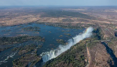
Victoria Falls, on the Zambezi River between Zambia and Zimbabwe, is about 1,708 meters wide and up to 108 meters deep. UNESCO calls it the largest curtain of falling water in the world, and its spray can be seen from tens of kilometers away.
-
 Watch
Natural wonder
Sahara
The Sahara fills almost all of northern Africa. Britannica calls it the largest hot desert in the world: about 4,800 kilometers from east to west and about 8.6 million square kilometers in all. Only about a quarter of it is sand dunes; the rest is gravel plains, rocky plateaus and mountains.
-
 Watch
Natural wonder
Mount Kilimanjaro
Mount Kilimanjaro, in northeastern Tanzania, is what UNESCO calls the highest mountain in Africa: its top is 5,895 meters high. It is a huge volcanic mountain standing alone above the plains, and as you climb it you pass through farms, forest, moorland and high alpine desert to its icy top.
For parents & teachers
What children will learn
- Locate Lake Turkana in the Great Rift Valley of northwestern Kenya.
- Explain how a lake with no outlet loses water by evaporation.
- Describe why the lake's islands matter for crocodiles, hippos and birds.
- Explain what fossils at Koobi Fora tell scientists about early humans.
Recommended ages: 3 to 17 · About 15 minutes
Talk about it
- Why might a lake with no outlet become salty over time?
- Why might migrating birds stop at a lake in the desert?
- What can petrified trees tell us about how a place's climate has changed?
Try at home or in class
- Stir salt into a shallow dish of water, leave it in a sunny window for a few days and look at what is left behind.
- On a map of Africa, find the Great Rift Valley, Lake Turkana and the Omo River flowing into it from the north.
Key vocabulary: rift valley, evaporation, outlet, fossil, petrified
Where these facts come from
- Wikidata , Wikimedia Foundation (CC0 1.0)
- Lake Turkana National Parks (World Heritage List) , UNESCO World Heritage Centre
- Lake Turkana (AFR-20) , International Lake Environment Committee, World Lake Database
- Heat Illness , US National Weather Service
- File:LakeTurkanaSouthIsland.jpg , Wikimedia Commons
- Natural Earth vector data , Natural Earth (NACIS) (Public domain)
- Wikimedia Commons , Wikimedia Foundation (Per file (public domain, CC0, CC BY or CC BY-SA); see each media record)
Checked, not yet human-reviewed. Last updated November 1, 2026. Spotted a mistake? Tell us.