
Natural wonder South America
Lençóis Maranhenses National Park
Lençóis Maranhenses is a park in Brazil full of white sand dunes. After the rains, blue and green lagoons fill the spaces between them.
Lençóis Maranhenses National Park, on the coast of Maranhão in northeastern Brazil, looks like a desert of white dunes. But so much rain falls that lagoons form between the dunes each rainy season, then dry up again.
Lençóis Maranhenses National Park (World Heritage 2024) holds about 90,000 ha of barchan dunes, considered the largest dune field in South America (UNESCO), with temporary lagoons fed only by rain (about 125 cm a year, NASA) and held up by a partly impermeable layer beneath the sand.
Photo: Julius Dadalti, CC BY-SA 4.0, via Wikimedia Commons
Discover Lençóis Maranhenses
Lençóis Maranhenses is a national park in Brazil. It is covered with white sand dunes.
In this photo, green and blue lagoons wind between the dunes.
UNESCO says Lençóis Maranhenses National Park, on the east coast of Maranhão in northeastern Brazil, looks like a desert. But it has a rainy season that brings large amounts of water, and lagoons form between the dunes. NASA explains that lençóis is the Portuguese word for bedsheets: from far away, the white dunes look like a rumpled sheet.
This photo by Julius Dadalti, taken on 20 June 2018, looks out over the park: rows of white dunes with green and blue water between them, and puffy clouds far away.
UNESCO: 156,562 ha on the east coast of Maranhão, about 90,000 ha of it an extensive dune field with temporary and permanent lagoons, behind an 80 km coastline; inscribed 2024 under criteria vii and viii. NASA (2026) gives the dune field as about 900 km2 and calls it the largest coastal dune field in South America.
The photo (Julius Dadalti, CC BY-SA 4.0, 20 June 2018, Commons Picture of the Year finalist and quality image) shows winding chains of white dunes, green and blue lagoons between them, more dunes to the horizon and puffy white clouds.
- Area (UNESCO)
- 156,562 ha
- Dune field (NASA)
- about 900 km²
- World Heritage Site
- since 2024
Sand from rivers, shaped by wind
Rivers carry sand to the coast. Strong winds blow it into dunes.
The dunes slowly move across the land.
NASA explains that rivers, including the Mearim and the Parnaíba, bring huge amounts of quartz sand to this very flat coast. Over the past few hundred thousand years, rising and falling seas helped pile it up.
Strong trade winds then blow the sand inland. UNESCO says small curved dunes called barchans form near the beach and grow up to 30 meters tall as they move inland, lined up in long, winding chains. They move 4 to 25 meters a year.
UNESCO: the dune field formed through the Quaternary from sediment of marine transgressions and regressions worked by wind, in the Barreirinhas Basin. Sand from the beach is eroded by mostly unidirectional wind into small barchans 50 cm to 1 m high near the shore, reaching up to 30 m as they migrate inland over older dunes, forming winding chains up to 75 km long and moving over 20 km inland at 4 to 25 m a year.
NASA: rivers including the Mearim and Parnaíba supply quartz sand; dry-season trade winds, often at least 50 km/h, push the dunes west; Landsat shows parts of the field extending about 0.5 km westward between 1986 and 2026.
Lagoons that come and go
When it rains a lot, water fills the low spaces between the dunes.
In the dry season, most of the lagoons dry up.
NASA says the park gets about 125 centimeters of rain a year. A layer of rock and clay under the sand stops much of the water from draining away, so lagoons fill the low ground between the dunes. They are fed only by rain, with no rivers flowing in or out.
As the rains ease between August and November, the water table falls, and by December most lagoons dry up. Because the dunes move, the lagoons come back in new places and shapes the next year.
NASA: about 125 cm of rain a year; a partly impermeable layer of bedrock and clay keeps lagoons from draining in the wet season; water levels typically peak around June; as rains subside (August to November) the water table falls and most lagoons dry by December. Shallow lagoons look turquoise; deeper ones darker blue, as deep water absorbs more red, yellow and green light; sediment, algae and dissolved organic matter add green and brown tones.
UNESCO: the lagoons, with no inlet or outlet, are fed exclusively by rainwater and controlled by the water table; with dunes migrating 4 to 25 m a year, they re-emerge in new places, their beds coated with brown or green algae and cyanobacteria.
Life between the dunes
Fish, birds, manatees and otters live in and around the park.
One fish hides in the damp mud when the lagoons dry up.
NASA says the park is home to more than 850 recorded species. Among them are endangered animals such as the West Indian manatee, the neotropical otter, the scarlet ibis and the oncilla, a small wild cat.
The trahira, a hunting fish with big, sharp teeth, lives in the lagoons. In the dry season it burrows under the sand to damp mud and rests until the rains return. The park lies where three Brazilian biomes meet: the Amazon, the Cerrado and the Caatinga.
NASA: more than 850 documented species, including four endangered species (neotropical otter, West Indian manatee, scarlet ibis, oncilla); the trahira (Hoplias malabaricus) burrows to damp mud in the dry season and becomes dormant, emerging after the rains to hunt insects and fish.
UNESCO: a transition zone between the Cerrado, Caatinga and Amazon biomes; restinga pioneer formations (more than 40,000 ha), mangroves and alluvial communities, with marine and freshwater environments, sustain species diversity; the moving dunes create new habitats for pioneer flora and fauna.
Exploring safely
The white sand and water reflect the sun. Wear a hat and sunscreen.
Only swim with a grown-up watching.
The dunes have no shade, and sunlight bounces off sand and water. The CDC says UV rays reflect off water and sand, so wear sunscreen, sunglasses and a wide-brimmed hat.
The CDC also says adults should watch children closely around any water, and children should wear life jackets for activities in and around natural water.
CDC sun safety: UV rays reflect off surfaces such as water and sand; use broad-spectrum sunscreen, UV-blocking sunglasses and a wide-brimmed hat, and seek shade where possible.
CDC drowning prevention: close adult supervision of children around water, and life jackets for children in and around natural water.
Amazing facts
-
The park's name means 'bedsheets', because the dunes look like a sheet.
Lençóis is the Portuguese word for bedsheets: from far away, the dunes look like a rumpled white sheet.
NASA: the name stems from the Portuguese lençóis, 'bedsheets', apt when the sweeping dune field is seen from afar.
-
One fish naps in the mud until the rain comes back.
The trahira burrows into damp mud under the sand in the dry season and waits for the rains.
NASA: the trahira (Hoplias malabaricus) burrows to damp mud in the dry season, becomes dormant, and emerges after the rains to hunt insects and fish.
-
The lagoons are filled only by rain.
No rivers flow into or out of the lagoons: they are filled only by rainwater.
UNESCO: with no inlet or outlet, the lagoons are fed exclusively by rainwater; their level follows the water table.
Words to know
- dune
- a hill of sand piled up by the wind
- barchan
- a curved, crescent-shaped dune
- lagoon
- a shallow body of water
- water table
- the level below which the ground is full of water
- biome
- a large area with its own kind of climate, plants and animals
Discovery challenge
-
What fills the spaces between the dunes after rain?
What forms between the dunes in the rainy season?
What temporary features form between the barchans when the water table rises?
- Lagoons
- Glaciers
- Volcanoes
Show the answer
Lagoons
Lagoons of rainwater.
Freshwater lagoons.
Temporary inter-dunal lagoons, fed only by rain (UNESCO).
-
In which country is Lençóis Maranhenses?
Lençóis Maranhenses is on the coast of Maranhão in which country?
In which country is this 2024 World Heritage dune field?
- Brazil
- Egypt
- China
Show the answer
Brazil
Brazil.
Brazil.
Brazil (UNESCO).
-
What stops the rain from draining away?
What under the sand keeps the lagoons from draining?
According to NASA, what keeps the lagoons from draining in the wet season?
- A layer of rock and clay
- A layer of ice
- Plastic sheets
Show the answer
A layer of rock and clay
A layer of rock and clay.
A layer of rock and clay that water can't easily pass through.
A partly impermeable layer of bedrock and clay (NASA).
-
What moves the dunes?
What pushes the dunes inland?
Which force builds the barchans and drives them 4 to 25 m a year?
- Wind
- Earthquakes
- Tides alone
Show the answer
Wind
The wind.
Strong trade winds.
Wind: persistent easterly trade winds (NASA), mostly unidirectional (UNESCO).
-
What does the word lençóis mean?
The Portuguese word lençóis means what?
To what does NASA say the park's name refers?
- Bedsheets
- Mountains
- Rivers
Show the answer
Bedsheets
Bedsheets.
Bedsheets.
Bedsheets: the dune field seen from afar looks like a rumpled sheet (NASA).
Nearby places
-
 Watch
City
Fortaleza
Fortaleza is the capital of the state of Ceará, on the Atlantic coast of northeastern Brazil. It began as a small fort in the 1600s and grew into a port and one of the most visited beach resorts on Brazil's north coast. Brazil's statistics office estimated 2,578,483 people in mid-2025.
-
 Watch
City
Recife
Recife is a city on the Atlantic coast of northeastern Brazil, where the Capibaribe and Beberibe rivers meet the sea. It grew up around a harbor sheltered by reefs. Its Carnival music and dance, frevo, is on UNESCO's list of the world's living heritage. Brazil's statistics office estimated 1,588,376 people in mid-2025.
-
 Watch
City
Salvador
Salvador is the capital of the state of Bahia in Brazil. The Portuguese founded it in 1549 by Todos os Santos Bay, and it was Brazil's first capital until 1763. The 2022 census counted 2,417,678 people in its urban area.
-
 Watch
Natural wonder
Atlantic Ocean
The Atlantic Ocean is the second-largest ocean basin on Earth. A long underwater mountain range, the Mid-Atlantic Ridge, runs down the middle, where the ocean floor is slowly spreading apart. The warm Gulf Stream current carries water north, and the Sargasso Sea in the middle has no shore at all.
-
 Watch
City
Brasília
Brasília is the capital of Brazil, built from scratch on a high plateau in the middle of the country. It opened on April 21, 1960, with a plan by Lúcio Costa and buildings by Oscar Niemeyer. Brazil's statistics office estimated 2,996,899 people in 2025.
-
 Watch
City
Paramaribo
Paramaribo is the capital, biggest city and main port of Suriname, on the Suriname River about 15 kilometers from the Atlantic coast. At the 2012 census 240,924 people lived there. Its old center, full of wooden buildings, has been a UNESCO World Heritage Site since 2002.
-
 Watch
Landmark
Amazon Theater
The Amazon Theater (Teatro Amazonas) stands in Manaus, Brazil. It opened on 31 December 1896, during the rubber boom. Its dome is covered with 36,000 pieces brought from France, and since 2026 it has been part of a World Heritage Site.
-
 Watch
Natural wonder
Amazon rainforest
The Amazon rainforest covers about 6 million square kilometers around the Amazon River and its branches in northern South America, and about 60 percent of it is in Brazil. Britannica calls it the world's richest and most varied home for living things, with millions of kinds of insects, plants and animals.
Explore next
-
 Watch
Natural wonder
Namib
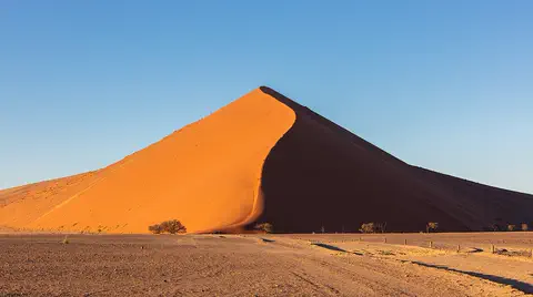
The Namib is a cool desert that runs for about 1,900 kilometers along Africa's Atlantic coast, from Angola through Namibia into South Africa. It gets almost no rain, but cold ocean water makes thick fog that drifts inland. UNESCO says its Namib Sand Sea is the only coastal desert in the world with huge dune fields influenced by fog.
-
 Watch
Animal
Scarlet ibis
The scarlet ibis is a bright red wading bird of South America, red all over except for black wingtips. It probes mud and shallow water with its long, curved bill for crabs, crayfish and insects, and its color comes from pigments in its food.
-
 Watch
 Country
Brazil
Brazil covers about half of South America and is the fifth-largest country in the world. It holds most of the Amazon River basin and much of the world's largest rainforest, and about 214 million people lived there in 2026, most of them near the Atlantic coast.
- Watch Geography What makes a desert? A desert is any place that gets very little rain or snow, usually less than about 250 millimeters a year. Deserts can be hot, like the Sahara, or freezing cold, like Antarctica, the driest continent. They form where winds, mountains or cold ocean currents keep rain away.
- Watch Geography Coasts and beaches Coasts are where land meets the sea, and they are always changing. Waves wear away rocky cliffs into caves, arches and stacks. Rivers and waves carry sand along the shore to build beaches. Beach sand can come from rocks worn down over millions of years, from volcanoes, from tiny shells, and even from fish!
-
 Watch
Natural wonder
Iguaçu Falls
Iguaçu Falls, on the Iguaçu River where Brazil and Argentina meet, is a system of many waterfalls and rapids almost three kilometers wide, with drops of up to about 80 meters. Clouds of spray keep the rainforest around it green and wet.
-
Watch
Natural wonder
Amazon rainforest
The Amazon rainforest covers about 6 million square kilometers around the Amazon River and its branches in northern South America, and about 60 percent of it is in Brazil. Britannica calls it the world's richest and most varied home for living things, with millions of kinds of insects, plants and animals.
-
 Watch
Natural wonder
Galápagos Islands
The Galápagos Islands are a group of volcanic islands in the Pacific Ocean, about 1,000 kilometers off the coast of Ecuador. Many of their animals live nowhere else on Earth, and they helped inspire Charles Darwin's theory of evolution by natural selection.
For parents & teachers
What children will learn
- Locate Lençóis Maranhenses National Park in northeastern Brazil.
- Explain how wind builds and moves sand dunes.
- Explain why lagoons can form in a place that looks like a desert.
- Describe how animals cope when lagoons dry up each year.
Recommended ages: 3 to 17 · About 15 minutes
Talk about it
- Why might a place with lots of rain still look like a desert?
- How might moving dunes change where the lagoons appear each year?
- How does a fish that rests in mud survive the dry season?
Try at home or in class
- Put a layer of clay in a clear container, add sand on top and pour water in: watch the water collect in the low spots.
- Blow gently across a tray of dry sand with a straw to see how wind shapes and moves little dunes.
Key vocabulary: dune, barchan, lagoon, water table, biome
Where these facts come from
- Wikidata , Wikimedia Foundation (CC0 1.0)
- Lençóis Maranhenses National Park (World Heritage List) , UNESCO World Heritage Centre
- The Paradox of Lençóis Maranhenses National Park , NASA Earth Observatory
- Sun Safety Facts , US Centers for Disease Control and Prevention
- Preventing Drowning , US Centers for Disease Control and Prevention
- File:Lençóis Maranhenses 2018.jpg , Wikimedia Commons
- UNESCO World Heritage List , UNESCO World Heritage Centre (Linked as a reference; site facts come from Wikidata)
- Wikimedia Commons , Wikimedia Foundation (Per file (public domain, CC0, CC BY or CC BY-SA); see each media record)
Checked, not yet human-reviewed. Last updated November 1, 2026. Spotted a mistake? Tell us.