
 Country
Africa
Morocco
Morocco is a country in North Africa. It has tall, snowy mountains, two seas and old cities with busy markets.
Morocco is a country in the northwest corner of Africa, with coasts on both the Atlantic Ocean and the Mediterranean Sea. The Atlas Mountains cross its center, and its 2024 census counted about 36.8 million people, in cities such as Casablanca, Rabat, Fez and Marrakesh and in mountain villages.
Morocco, in western North Africa, is the only African country with coasts on both the Atlantic and the Mediterranean. The Rif and Atlas ranges, raised from Tethys Sea sediments, divide Atlantic Morocco from the east and the Sahara. Its 2024 census counted 36,828,330 people, and its cities record the Amazigh, Roman, Arab and Andalusian strands of a long history.
Photo: Petar Milošević, CC BY-SA 4.0, via Wikimedia Commons
Discover Morocco
Morocco is a country in North Africa.
It has the ocean on one side and a sea on another. Big mountains cross the middle. Some tops are white with snow. The capital city is Rabat.
Morocco is in the northwest corner of Africa. It has two coasts: one on the Atlantic Ocean and one on the Mediterranean Sea. Spain is just across the Strait of Gibraltar.
Most of Morocco is high land. The Rif Mountains rise in the north and the Atlas Mountains cross the center, and beyond them lies the edge of the Sahara. Morocco's 2024 census counted about 36.8 million people. Casablanca is the largest city, and Rabat, on the Atlantic coast, is the capital.
Morocco lies in western North Africa; Britannica calls it the only African country with coastal exposure to both the Atlantic Ocean and the Mediterranean Sea. Most of the country stands high, averaging about 800 m above sea level. The Rif and Atlas ranges, formed by the folding and uplift of sediments laid down in the Tethys Sea between about 65 and 2.6 million years ago, separate Atlantic Morocco from the east and the Sahara.
The High Commission for Planning (HCP) set the legal population at 36,828,330 on September 1, 2024, including 148,152 foreign residents; 62.8 percent lived in towns and cities. The census covers the parts of Western Sahara that Morocco administers, within its Laâyoune-Sakia El Hamra and Dakhla-Oued Ed-Dahab regions. Casablanca is the largest city and major Atlantic port, Rabat is the capital, and Morocco is the only monarchy in North Africa.
Cities and famous places
Casablanca is the biggest city. Rabat is the capital.
Fez is a very old city with a walled old town. Marrakesh has red walls and big gates. In the south, there are old towns built of earth.
Casablanca is Morocco's largest city and a major port. Under French rule it grew from a small coastal village into a huge city, and Rabat became the capital. Fez, founded in the 800s, has a medina, an old walled town, full of madrasas (schools), palaces, fountains and mosques. Marrakesh was founded around 1070 and has walls, monumental gates and the great square of Jemaa el-Fna.
In the south, people built fortified villages called ksour, with earthen houses crowded inside high walls. Aït-Ben-Haddou is a famous example.
Casablanca, Morocco's largest city and major Atlantic port, was transformed under the protectorate from a small coastal village into a bustling metropolis, and Rabat became the capital and center of administration (Britannica). The French built villes nouvelles beside the medinas instead of rebuilding them. UNESCO lists Rabat (2012) for its 1912-1930s new town and its 12th-century Almohad ramparts and the Hassan Mosque, begun in 1184.
Fez, founded in the 9th century, reached its height under the Marinids in the 13th and 14th centuries, when it replaced Marrakesh as capital; its medina's madrasas, fondouks, palaces and fountains date from then (World Heritage, 1981). Marrakesh, founded in 1070-72 by the Almoravids, kept its walls, gates, gardens and the Koutoubiya Mosque, and Jemaa el-Fna, which UNESCO calls a veritable open-air theater (1985). Aït-Ben-Haddou (1987), in Ouarzazate province, is a ksar, earthen buildings within high walls reinforced by corner towers.

Mountains, rivers and desert
Morocco has tall mountains.
The Atlas Mountains get snow in winter. Mount Toubkal is the tallest one. Rivers run down from the mountains to the ocean. East and south of the mountains, the land is dry desert.
The Atlas Mountains are really three chains: the High Atlas, the Middle Atlas and the Anti-Atlas. The High Atlas is 740 kilometers long, and its peak, Mount Toubkal, is Morocco's highest point at 4,165 meters. Snow is common above about 2,000 meters and can last on the highest peaks until late spring or early summer.
The mountains catch rain and snow from Atlantic storms, and Morocco has the biggest network of streams in North Africa. The Sebou carries the most water. East of the mountains, in their rain shadow, the land turns to desert, and the Sahara begins in the south.
The Rif, geologically part of the cordilleras reaching south from Iberia, rises to 2,456 m at Mount Tidirhine. The Atlas comprises three chains: the High Atlas, 740 km long, reaching 4,165 m at Mount Toubkal (Britannica); the Middle Atlas, cresting at 3,340 m; and the Anti-Atlas, running southwest to the Atlantic. Eastern Morocco holds the Moulouya basin and the High Plateaus at 1,200-1,300 m, and south and southeast of the Atlas lies the northwestern edge of the Sahara.
Windward slopes capture Atlantic storms, giving Morocco the most extensive stream network in North Africa. The Sebou, about 450 km, has the largest volume and, with its tributaries, almost half the country's surface water; the Drâa, about 1,100 km, is the longest, though all but its upper course is usually dry. Rain falls from October to April, from about 800 mm on the Gharb plain to under 200 mm in the Sous valley; the central Rif gets more than 2,030 mm. The cold Canary Current and offshore high pressure reduce rainfall, and in late spring or summer the sharqī, a hot, dusty Saharan wind, can push temperatures to 41 °C.

Animals and forests
Barbary macaques are monkeys. They live in the forests of the mountains.
Storks build their nests on city walls. Little fennec foxes live in the Atlas region too.
With protection from the government, the Barbary macaque, a monkey, now does well in the forests of the Middle Atlas. Those mountain forests have oak trees on the lower slopes and fir and cedar higher up. Gazelles are still seen sometimes in the south, and mouflons, a kind of wild sheep, and fennec foxes live in the Atlas region.
The richest wildlife in Morocco today is its birds. Storks build their nests on city ramparts and mosque rooftops, and flamingos, pelicans and cattle egrets visit too. In the southwest grows the argan tree, found only there.
Large game has been progressively eliminated since Roman times, when lions and elephants were still abundant; both are long gone. Gazelles are still seen occasionally in the south, and mouflons and fennecs in the Atlas region, while the Barbary macaque, under government protection, flourishes in the forests of the Middle Atlas. Britannica calls the bird life the country's richest fauna: migratory storks nest on ramparts and mosque roofs, alongside flamingos, pelicans and cattle egrets.
Outside the deserts the vegetation resembles Iberia's: cork, evergreen and deciduous oak on lower slopes, fir and cedar higher up, especially in the Middle Atlas, and thuja, juniper and pine in drier mountains. The cork oak Mamora Forest lies east of Rabat. In the highlands south of Essaouira grow open forests of argan, unique to southwestern Morocco; UNESCO inscribed the practices and know-how of the argan tree in the Arganeraie Biosphere Reserve in 2014. Centuries of cutting, grazing and burning have left dense scrub, or maquis, on many lower slopes.
People, languages and food
Morocco's 2024 census counted about 36.8 million people.
Most people speak Moroccan Arabic, called Darija. Many also speak an Amazigh language. Couscous is made from tiny grains rolled by hand and steamed.
Morocco's people are mostly Arabs and Imazighen, also called Berbers, or a mix of both. Arabic and Tamazight are both official languages. In the 2024 census, about nine in ten people said they use Moroccan Arabic, called Darija, and about one in four use an Amazigh language, such as Tachelhit, Tamazight or Tarifit. French is an important second language. Most Moroccans are Muslim.
Three-fourths of the people live on the coastal plains and plateaus. In the Rif and Atlas mountains, many villages perch on hillsides, with fields on terraces. Couscous, made from semolina rolled by hand and steamed, is a tradition Morocco shares with Algeria, Mauritania and Tunisia.
Britannica describes the population as mainly Arabs and Imazighen or a mix of the two, with descendants of refugees from Reconquista Spain and of sub-Saharan Africans brought by trade and slavery; Jews were a sizable minority until the mid-20th century, when many left the country. The 2024 census found that 91.9 percent of people use Moroccan Darija and 24.8 percent an Amazigh language: Tachelhit 14.2 percent, Tamazight 7.4 and Tarifit 3.2. Tamazight became an official language beside Arabic in 2011. Islam is the state religion, and most Moroccans are Sunni Muslims of the Mālikī rite.
The coastal plains and plateaus hold three-fourths of the population and almost all commercial farming, mainly rain-fed wheat and barley. The highlands, home to about a fifth of the people, are centers of Amazigh culture, with tightly clustered villages of stone, adobe or tamped earth; some herders move their flocks between summer and winter pastures. South of the Atlas, nearly all settlement is in oases, where dates are the main crop. UNESCO inscribed couscous traditions, shared with Algeria, Mauritania and Tunisia, in 2020.

A long history
Morocco has a long history.
The Imazighen have lived here for a very long time. Long ago, Romans built a town called Volubilis. Later, people built the cities of Fez and Marrakesh. Morocco has a king.
Morocco is the traditional homeland of the Imazighen. Carthage controlled the region early on, and later it became the westernmost province of the Roman Empire. Volubilis, founded in the 200s BCE, became an important Roman town.
Arab rule began in the late 600s, and most people became Muslim. Fez was founded in the 800s. In the 1000s the Almoravids, the first Amazigh dynasty of North Africa, built an empire from southern Spain to parts of Africa south of the Sahara, and founded Marrakesh. The royal family that rules today has ruled since the 1600s. Morocco was a French protectorate from 1912 and became independent again in 1956.
The traditional domain of the Imazighen, the region was controlled early by Carthage and later became the westernmost province of the Roman Empire; Volubilis, a Mauretanian capital founded in the 3rd century BCE, became an important Roman outpost and later, briefly, the capital of Idris I, founder of the Idrisid dynasty. After the Arab conquest of the late 7th century CE most people accepted Islam. Fez was founded in the 9th century; in the 11th the Almoravids, the first native Amazigh dynasty of North Africa, built an empire from Andalusian Spain to parts of sub-Saharan Africa and founded Marrakesh in 1070-72. Under the Almohads, Rabat's Hassan Mosque was begun in 1184, and under the Marinids Fez became the capital. European attempts at permanent footholds from the late 15th century were largely repulsed, and the ʿAlawite dynasty has ruled since the 17th century.
Morocco was made a French protectorate in 1912 and regained independence in 1956. A constitution approved by referendum in July 2011 expanded the powers of the prime minister and parliament while keeping the king as the final authority. To the south, the political status of Western Sahara remains unresolved: Morocco claimed the territory after independence and controls most of it, while the Polisario Front's Sahrawi Arab Democratic Republic also claims it, and a referendum promised with the UN-brokered 1991 ceasefire has not been held.

Morocco on the map
Find Morocco on the globe.
It is in the top left corner of Africa. The big Atlantic Ocean is on one side. The Mediterranean Sea is at the top. Spain is very close.
Morocco is in the northwest corner of Africa. The Atlantic Ocean lies to the west and the Mediterranean Sea to the north, and Spain is just across the Strait of Gibraltar. Algeria lies to the east and southeast.
Two small Spanish cities, Ceuta and Melilla, sit on Morocco's northern coast. Moving south from the coast, you cross plains, then the Atlas Mountains, then reach the edge of the Sahara.
Britannica describes Morocco as bordered by Algeria to the east and southeast, Western Sahara to the south, the Atlantic to the west and the Mediterranean to the north, with two Spanish enclaves, Ceuta and Melilla, on its northern coast. The Taza Gap in the northeast links Atlantic Morocco with the east between the Rif and the Atlas. Western Sahara's status is disputed; the globe here follows Natural Earth's de facto lines, which draw most of it inside Morocco.
Britannica notes that Morocco's area, not counting Western Sahara, is slightly larger than the US state of California. The coastline is regular, with few natural harbors; before modern ports were built, offshore sandbars and rocky reefs made navigation difficult.
- Coasts
- Atlantic Ocean and Mediterranean Sea
- Highest point
- Mount Toubkal, 4,165 m, in the High Atlas
- High Atlas
- about 740 km long
- People (2024 census)
- 36,828,330 (includes the parts of Western Sahara that Morocco administers)
Amazing facts
-
Morocco has the sea on two sides: an ocean and a sea.
Morocco is the only country in Africa with coasts on both the Atlantic Ocean and the Mediterranean Sea.
Britannica notes that Morocco is the only African country with coastal exposure to both the Atlantic Ocean and the Mediterranean Sea.
-
Argan trees grow wild only in the southwest of Morocco.
The argan tree is found only in southwestern Morocco, and oil made from its fruit is used for cooking.
Argan is an endemic tree of the Arganeraie Biosphere Reserve in southwestern Morocco; UNESCO inscribed the practices and know-how of extracting its oil, mainly by rural women, in 2014.
-
Morocco's longest river is dry most of the way.
The Drâa is Morocco's longest river, about 1,100 kilometers long, but all except its upper part is usually dry.
The Drâa, rising in the High Atlas where the Dadès and the Imini meet, runs about 1,100 km; all but its headstreams and upper course are usually dry.
-
Long ago, lions and elephants lived in Morocco.
In Roman times, lions and elephants were still common in Morocco. Both disappeared long ago.
Britannica records that lions and elephants were still abundant in Roman times; large game has been progressively eliminated since, and both are long gone.
-
A plant called the Barbary fig came to Morocco from far across the ocean.
The Barbary fig, which now covers large areas of Morocco's dry plains with other plants, was brought from the Americas by way of Spain in the 1500s.
The Barbary fig, which with the dwarf palm, jujube and esparto grass covers vast areas of the arid interior plains, was introduced from the Americas by way of Spain in the 16th century.
Words to know
- medina
- the old walled part of a North African city
- ksar
- a fortified village of earthen buildings inside high walls (plural ksour)
- Imazighen
- the Amazigh (Berber) peoples of North Africa; one person is an Amazigh
- rain shadow
- a dry area on the side of a mountain range away from the rain-bringing winds
- terrace
- a flat step cut into a hillside so crops can be grown
- protectorate
- a country controlled and defended by a more powerful country
- World Heritage Site
- a place UNESCO lists as important to all people, to be protected
Discovery challenge
-
What is the capital city of Morocco?
Which city is the capital of Morocco?
Which Atlantic city became Morocco's capital in 1912, when the political capital moved from Fez?
- Rabat
- Casablanca
- Marrakesh
Show the answer
Rabat
Rabat is the capital of Morocco.
Rabat is the capital. Casablanca is the largest city, and Marrakesh is an old city near the Atlas Mountains.
UNESCO notes that the political capital was transferred from Fez to Rabat in 1912; Casablanca is the largest city.
-
What is the tallest mountain in Morocco?
Which mountain is Morocco's highest point?
Which High Atlas peak, 4,165 m by Britannica's figure, is Morocco's highest point?
- Mount Toubkal
- Mount Kilimanjaro
- Mont Blanc
Show the answer
Mount Toubkal
Mount Toubkal is the tallest. It is in the Atlas Mountains.
Mount Toubkal, 4,165 meters high, in the High Atlas, is Morocco's highest point.
Toubkal crowns the High Atlas, a range 740 km long; Kilimanjaro is in Tanzania and Mont Blanc in the Alps.
-
Which two waters are next to Morocco?
Morocco has coasts on which two bodies of water?
Morocco is the only African country with coasts on which two bodies of water?
- The Atlantic Ocean and the Mediterranean Sea
- The Red Sea and the Indian Ocean
- The Pacific Ocean and the Arctic Ocean
Show the answer
The Atlantic Ocean and the Mediterranean Sea
The big Atlantic Ocean and the Mediterranean Sea.
Morocco has an Atlantic coast to the west and a Mediterranean coast to the north.
Britannica: Morocco is the only African country with coastal exposure to both the Atlantic Ocean and the Mediterranean Sea.
-
Which monkey lives in Morocco's mountain forests?
Which monkey now does well in the forests of the Middle Atlas?
Which primate flourishes under government protection in the forests of the Middle Atlas?
- Barbary macaque
- Orangutan
- Japanese macaque
Show the answer
Barbary macaque
The Barbary macaque lives in the mountain forests.
With government protection, the Barbary macaque does well in the Middle Atlas forests of oak, fir and cedar.
Britannica: with government protection, the Barbary macaque now flourishes in the Middle Atlas forests.
-
What are the houses of Aït-Ben-Haddou made of?
A ksar such as Aït-Ben-Haddou is a group of buildings made of what?
UNESCO describes the ksar, a traditional pre-Saharan habitat, as buildings of which material inside high walls?
- Earth
- Glass and steel
- Blocks of ice
Show the answer
Earth
They are made of earth, packed close together.
A ksar is a group of earthen buildings inside high walls with towers at the corners.
UNESCO: a ksar is a group of earthen buildings surrounded by high walls reinforced by corner towers, a traditional pre-Saharan habitat.
Places to discover in Morocco

Animals of Morocco
-
 Watch
Animal
White stork
The white stork is a tall white bird with black flight feathers, a red bill and long orange legs. It nests on rooftops, chimneys and trees across Europe, North Africa and western Asia, and many storks soar south to spend the winter in Africa or South Asia.
-
 Watch
3D
Animal
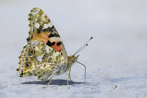
Painted lady
The painted lady is one of the most widespread butterflies in the world. Its orange and black wings carry it on huge journeys: each year, families of painted ladies fly between Africa and northern Europe, one generation after another.
Explore next
-
Watch
Animal
White stork
The white stork is a tall white bird with black flight feathers, a red bill and long orange legs. It nests on rooftops, chimneys and trees across Europe, North Africa and western Asia, and many storks soar south to spend the winter in Africa or South Asia.
-
Watch
3D
Animal
Painted lady
The painted lady is one of the most widespread butterflies in the world. Its orange and black wings carry it on huge journeys: each year, families of painted ladies fly between Africa and northern Europe, one generation after another.
-
 Watch
 Country
Democratic Republic of the Congo
The Democratic Republic of the Congo, or DR Congo, is the second-largest country in Africa. The mighty Congo River curves through its rainforests, volcanoes rise in the east, and its capital, Kinshasa, is a center of music, fashion and popular culture.
-
 Watch
 Country
Ethiopia
Ethiopia is a country on the Horn of Africa with no coast. Much of it is high, rugged land cut by the Great Rift Valley, it is one of the world's oldest countries, and more than 110 million people live there.
-
 Watch
 Country
Kenya
Kenya is a country in East Africa, crossed by the equator. It has the snow-capped Mount Kenya, the deep Great Rift Valley, Lake Victoria and a long Indian Ocean coast, and about 54 million people live there, many of them speaking Swahili.
-
 Watch
 Country
Tanzania
Tanzania is a country in East Africa, just south of the Equator, on the Indian Ocean. It has Mount Kilimanjaro, Africa's highest mountain, deep lakes in the East African Rift, and the Serengeti, where huge herds of wildebeest travel each year.
-
 Watch
 Country
Zimbabwe
Zimbabwe is a landlocked country in southern Africa, high on a wide plateau between the Zambezi and Limpopo rivers. It shares Victoria Falls with Zambia, and its name is a Shona word meaning "stone houses", the name of the great stone city of Great Zimbabwe.
-
 Watch
 Country
Egypt
Egypt is in the northeastern corner of Africa, and its Sinai Peninsula reaches into Asia. Almost all of it is desert, so most of its more than 100 million people live along the green banks of the Nile River, where one of the world's earliest civilizations grew.
For parents & teachers
What children will learn
- Locate Morocco and name its two coasts, its mountain ranges and its neighbor across the Strait of Gibraltar.
- Explain how the Atlas Mountains catch rain and snow and make a rain shadow to the east.
- Describe some of Morocco's languages, villages and cities without treating them as one single culture.
- Outline Morocco's history from Volubilis to independence in 1956.
Recommended ages: 3 to 17 · About 15 minutes
Talk about it
- Why do you think mountain villages in the Rif and Atlas build fields on terraces?
- Many people in Morocco use more than one language. Which languages do people use where you live?
- How might building houses of earth help people live near the edge of a desert?
Try at home or in class
- Spray water at one side of a pile of books covered with a towel and see which side stays dry, like a rain shadow.
- Make a simple map of Morocco and mark the Atlantic, the Mediterranean, the Atlas Mountains and four cities from this page.
Key vocabulary: medina, ksar, Imazighen, rain shadow, terrace, protectorate, World Heritage Site
Where these facts come from
- Wikidata , Wikimedia Foundation (CC0 1.0)
- Natural Earth vector data , Natural Earth (NACIS) (Public domain)
- UNESCO World Heritage List , UNESCO World Heritage Centre (Linked as a reference; site facts come from Wikidata)
- Recensement Général de la Population et de l'Habitat 2024: caractéristiques démographiques et socio-économiques de la population, note sur les principaux résultats , Haut-Commissariat au Plan (HCP), Morocco
- Population légale du Royaume du Maroc répartie par régions, provinces et préfectures et communes selon les résultats du RGPH 2024 , Haut-Commissariat au Plan (HCP), Morocco
- Morocco , Encyclopaedia Britannica
- Morocco: Relief , Encyclopaedia Britannica
- Morocco: Climate (climate, plants, animals, people) , Encyclopaedia Britannica
- Morocco: Settlement patterns , Encyclopaedia Britannica
- Morocco: Independent Morocco , Encyclopaedia Britannica
- Morocco: The reign of Muhammad VI , Encyclopaedia Britannica
- Western Sahara , Encyclopaedia Britannica
- Archaeological Site of Volubilis , UNESCO World Heritage Centre
- Ksar of Ait-Ben-Haddou , UNESCO World Heritage Centre
- Medina of Fez , UNESCO World Heritage Centre
- Medina of Marrakesh , UNESCO World Heritage Centre
- Rabat, Modern Capital and Historic City: a Shared Heritage , UNESCO World Heritage Centre
- Knowledge, know-how and practices pertaining to the production and consumption of couscous , UNESCO Intangible Cultural Heritage
- Argan, practices and know-how concerning the argan tree , UNESCO Intangible Cultural Heritage
- PlayOwl region table, version 1 , PlayOwl (PlayOwl original data)
- flag-icons 7.5.0 , Panayiotis Lipiridis and contributors (MIT)
- Wikimedia Commons , Wikimedia Foundation (Per file (public domain, CC0, CC BY or CC BY-SA); see each media record)
Checked, not yet human-reviewed. Last updated October 24, 2026. Spotted a mistake? Tell us.
Picture credits
- Photo: Petar Milošević, CC BY-SA 4.0, via Wikimedia Commons · source · license
- Photo: Petar Milošević, CC BY-SA 4.0, via Wikimedia Commons · source · license
- Photo: kallerna, CC BY-SA 4.0, via Wikimedia Commons · source · license
- Photo: yeowatzup, CC BY 2.0, via Wikimedia Commons · source · license
- Photo: Chrisi1964, CC BY-SA 4.0, via Wikimedia Commons · source · license
- Photo: Pline, CC BY-SA 3.0, via Wikimedia Commons · source · license
- Photo: Иерей Максим Массалитин from Rabat, Maroc, CC BY-SA 2.0, via Wikimedia Commons · source · license