
 Country
South America
Paraguay
Paraguay is a country in the middle of South America. A big river cuts it in two, and many people speak two languages, Spanish and Guaraní.
Paraguay is a landlocked country in the heart of South America. The Paraguay River divides it into a hilly east, where most people live, and the hot, flat Chaco in the west. Guaraní and Spanish are both official languages, and about 7 million people lived there in 2025.
Paraguay, a landlocked republic in south-central South America, is split by the Paraguay River into the Eastern Region, an extension of the Brazilian Plateau, and the Chaco Boreal, part of the Gran Chaco. It is unusual in Latin America because an Indigenous language, Guaraní, is spoken more widely than Spanish, and its Itaipú Dam with Brazil makes it one of the world's largest exporters of hydropower. Its population was 7.0 million in 2025.
Photo: Embajada de EEUU en Paraguay, CC BY 2.0, via Wikimedia Commons
Discover Paraguay
Paraguay is a country in South America.
It has no sea. A big river runs through the middle. The capital city is called Asunción.
Paraguay is a landlocked country in the middle of South America. The Paraguay River flows from north to south through it, dividing the country into two very different parts: the Eastern Region and the Chaco in the west, which covers about two-thirds of the land.
Rivers trace most of Paraguay's borders and give it a route to the Atlantic Ocean. Its name is said to come from a Guaraní word meaning "river that gives birth to the sea." The capital, Asunción, is on the Paraguay River. About 7 million people lived in Paraguay in 2025.
Paraguay is a landlocked country of south-central South America. The Paraguay River, running north to south, divides it into the Región Oriental, about 160,000 km² and an extension of the Brazilian Plateau, and the Región Occidental or Chaco Boreal, more than 246,000 km² and about two-thirds of the country, part of the flat, largely featureless Gran Chaco. Four-fifths of the perimeter follows the Paraguay, Apa, Paraná and Pilcomayo rivers.
Britannica notes that the country's name is said to derive from a Guaraní word meaning "river that gives birth to the sea," and that rivers give access to the Atlantic and power the hydroelectric plants that make Paraguay one of the world's largest exporters of hydropower. It is also a major soybean producer. The World Bank put the population at 7,013,078 in 2025; about three-fifths of people live in towns and cities.
Cities and famous places
Asunción is the biggest city.
It is beside the Paraguay River. A giant dam on another river makes lots of electricity. Old mission buildings stand in the southeast.
Asunción, the capital and largest city, stands on the east bank of the Paraguay River. It takes its name from a stockade finished there on the Feast of the Assumption, August 15, 1537, and it is home to the national library, the national archive, music schools and a symphony orchestra.
In the east, Ciudad del Este has grown quickly since the 1970s. Just north of it, on the Paraná River, Paraguay and Brazil built the Itaipú Dam, one of the largest dams in the world. In the southeast, two old Jesuit missions, Trinidad and Jesús, are a World Heritage Site.
Asunción, named for a stockade completed on the Feast of the Assumption (15 August) 1537, lies on the east bank of the Paraguay opposite the mouth of the Pilcomayo; its metropolitan area includes San Lorenzo, Luque and Fernando de la Mora. Ciudad del Este, Hernandarias and Puerto Presidente Franco in the far east have grown rapidly since the 1970s, and Encarnación and Concepción are other important centers.
The Itaipú Dam, built with Brazil on the Paraná about 16 km north of the Friendship Bridge at Ciudad del Este, is one of the largest dams in the world; its main gravity dam, completed in 1982, is 196 m high and 1,233 m long. The Yacyretá project with Argentina was established by a 1973 treaty. UNESCO lists the Jesuit Missions of La Santísima Trinidad de Paraná and Jesús de Tavarangue, reminders of the missions of the 17th and 18th centuries and their social and economic initiatives.
Rivers, plateau and the Chaco
The east of Paraguay has hills and lots of rain.
The west is flat, hot and dry. It is called the Chaco. Summers are very hot.
East of the Paraguay River the land rises gently toward hills and low mountains near Brazil, and it gets plenty of rain: about 1,400 to 1,650 millimeters a year. West of the river, the Chaco is flat and gets only about 760 millimeters, and few people live there.
Summers, from October to March, are hot, often 24 to 38 °C, and winters are mild, though cold southern winds can bring frost to the east. The whole country can suffer both floods and droughts. Paraguay has only two big lakes, Ypoá and Ypacaraí.
The Eastern Region rises from about 50 m in the southwest to hills of about 760 m in the east; the Amambay and Mbaracayú mountains form the watershed between the Paraguay and Paraná, and the Paraná Plateau north of Encarnación has the most fertile basaltic soils. The Chaco Boreal's soils are alluvial mud, clay and sand carried from the Bolivian highlands, and its slow rivers, such as the Pilcomayo, often drain into swamps or vanish in dry periods.
The east is mostly subtropical, south of the Tropic of Capricorn, and the Chaco mostly tropical. Summer temperatures range from 24 to 38 °C; winter ones from 16 to 24 °C, with extremes near −1 and 40 °C and frequent frost in the east. Rainfall falls from 1,650 mm in the southeast to 1,400 mm along the Paraguay and about 760 mm across the Chaco, heaviest from October to April; periodic floods and droughts cause severe crop losses.
Animals and plants of Paraguay
Jaguars live in Paraguay's forests.
Anteaters and armadillos live there too. So do toucans and parrots. Piranhas swim in the rivers.
Paraguay's wildlife includes jaguars, ocelots, tapirs, anteaters, armadillos, monkeys, otters and marsh deer. In the Chaco lives the Chacoan peccary, a wild pig that scientists thought had died out until living ones were found in the early 1970s. The birdlife is spectacular, with toucans, parakeets, rheas, ibises, herons and eagles, and piranhas swim in the rivers.
The yerba maté tree grows throughout the country; its leaves are dried to make maté, a tea Paraguayans drink all year round. More than 500 kinds of hardwood trees have been found in Paraguay's forests.
Britannica lists marsh deer, monkeys, armadillos, anteaters, otters, wild boars, tapirs, jaguars, ocelots, bats and the coypu. A small Chaco reserve protects the Chacoan peccary, thought long extinct until living animals were found in the early 1970s. Caimans (especially the yacaré), parrots and macaws are threatened by illegal trade, and skins of armadillos, snakes and iguanas are exported. Birds include parakeets, rheas, ibises, herons, toucans, eagles and falcons; rivers hold many fish, including the piranha.
More than 500 hardwood species have been identified, including red quebracho, a source of tannin, and the bottle-trunked samuú; much of the Chaco is cactus and thorny scrub. Stands of Ilex paraguariensis grow throughout the country, and its dried leaves make maté. Purple passion fruit is native to Paraguay, southern Brazil and northern Argentina.

People, languages and food
About 7 million people live in Paraguay.
Most people speak Guaraní. Many speak Spanish too. Friends share a bitter tea called tereré.
Most Paraguayans have both European and Guaraní ancestors, and they are proud of their Guaraní roots. Guaraní is spoken by nearly nine out of ten people, more than Spanish, which is unusual in Latin America, and at least half the people speak both. Since 1992 both have been official languages.
Corn is used in many dishes, such as sopa paraguaya, a pie made of corn, eggs and milk, and chipa, a bread flavored with cheese and egg. A favorite pastime is sharing tereré, a bitter tea, from a gourd or a carved cow horn. Football is the most popular sport.
Britannica describes one of South America's most homogeneous populations, mostly mestizo and proud of Guaraní descent; Indigenous peoples, about 2 percent, include the Mbyá, Aché and Pai-Tavyterá in the east and the Nivaklé, Ayoreo and others in the Chaco. Immigrants include some 300,000 Brazilians who arrived in the 1970s, about 30,000 German-speaking Mennonites (half in Chaco colonies), and Japanese and Korean communities. About nine-tenths of people are Roman Catholic.
Under the 1992 constitution Spanish and Guaraní are official; Guaraní is spoken by nearly nine-tenths of people but has been a language of school instruction only since 1996, while government and business use Spanish. Cuisine reflects Guaraní cooking: chipa, sopa paraguaya, beef and river fish; yerba maté is drunk year-round and tereré is shared from a guampa. José Asunción Flores invented the guaranía musical style, and the national football team, La Albirroja, won the Copa América in 1953 and 1979.
A long history
The Guaraní people lived here long ago.
Later, Spain ruled the land. In 1811, Paraguay became its own country. Today, the people vote for their leaders.
The Guaraní lived between the Paraguay and Paraná rivers long before Europeans came, farming corn, cassava and sweet potatoes. European explorers arrived in the 1520s, and Asunción was founded in 1537. For more than 150 years, Jesuit missions organized life for about 150,000 Indigenous people in 30 settlements.
Paraguay became independent from Spain in 1811. Later it fought two big wars, the War of the Triple Alliance against Argentina, Brazil and Uruguay and the Chaco War against Bolivia. Alfredo Stroessner ruled from 1954 to 1989, and since 1989 Paraguay has moved toward democracy.
The Guaraní, a Tupian-speaking people, occupied the land between the Paraguay and Paraná rivers long before Europeans; Alejo García (1524) and Sebastian Cabot (1526) were the first explorers to reach it, and Asunción was founded in 1537. From the early 17th century, Jesuit missions in the Paraná and Uruguay basins governed 150,000 Indigenous people in 30 reducciones for more than 150 years. Paraguayan militia repelled an Argentine army in 1811, and an October 1811 alliance amounted to de facto recognition of independence; José Gaspar Rodríguez de Francia then ruled as dictator until 1840.
Under Francisco Solano López, Paraguay fought the War of the Triple Alliance (1864/65–70) against Argentina, Brazil and Uruguay, which devastated the country, and later the Chaco War (1932–35) against Bolivia over the Chaco boundary. After a civil war in 1947, Alfredo Stroessner ruled from 1954 to 1989. Democratization since 1989 has been uneven, and in 2008 the Colorado Party lost power for the first time since 1947 before returning in 2013.
Paraguay on the map
Find Paraguay on the globe.
It is in the middle of South America. It has no sea. Three countries are all around it.
Paraguay is landlocked, with three neighbors: Bolivia to the northwest and north, Brazil to the northeast and east, and Argentina to the southeast, south and west.
Rivers make most of its borders. The Paraná River forms the eastern and southern borders, and it joins the Paraguay River at the country's southwestern corner. From there, the rivers lead all the way to the Atlantic Ocean.
Britannica gives Paraguay's neighbors as Bolivia to the northwest and north, Brazil to the northeast and east, and Argentina to the southeast, south and west. Four-fifths of the perimeter follows the Paraguay, Apa, Paraná and Pilcomayo rivers; the Paraná forms the eastern and southern borders and joins the Paraguay at the southwestern corner, and the Pilcomayo forms the southern edge of the Chaco Boreal.
The Tropic of Capricorn crosses the country, with most of the Eastern Region south of it and most of the Chaco to the north. Rivers provide Paraguay's access to the Atlantic Ocean.
- Chaco Boreal
- about two-thirds of the country
- Borders along rivers
- four-fifths of the perimeter
- Itaipú main dam
- 196 m high, 1,233 m long (1982)
- People (2025)
- 7,013,078
Amazing facts
-
In Paraguay, more people speak Guaraní than Spanish.
Guaraní, an Indigenous language, is spoken by nearly nine out of ten Paraguayans, more than Spanish, which is unusual in Latin America.
Guaraní is spoken by nearly nine-tenths of the population and has been official since the 1992 constitution, yet it has been a language of school instruction only since 1996.
-
Paraguay's name may mean a river that makes the sea.
The name Paraguay is said to come from a Guaraní word meaning "river that gives birth to the sea."
Britannica notes that the name is said to derive from the Guaraní for "river that gives birth to the sea," fitting a country whose rivers trace four-fifths of its borders.
-
A wild pig in Paraguay was thought to be gone, but it was found again.
Scientists thought the Chacoan peccary had died out long ago, until living ones were discovered in the Chaco in the early 1970s.
The Chacoan peccary, thought by scientists to be long extinct, was found alive in the early 1970s; a small Chaco reserve now protects it.
-
Some dancers in Paraguay balance bottles on their heads.
In the bottle dance, a kind of galopa, dancers balance bottles on their heads.
Typical dance music includes polkas and the galopa, a variant of which is the bottle dance; José Asunción Flores invented the guaranía style.
-
A giant dam on Paraguay's border makes lots of electricity.
The Itaipú Dam, built by Paraguay and Brazil on the Paraná River, is one of the largest dams in the world.
Itaipú's main gravity dam, completed in 1982, is 196 m high and 1,233 m long, and the plant has one of the world's highest planned generating capacities.
Words to know
- landlocked
- having no coastline; surrounded by land and other countries
- bilingual
- able to speak two languages
- hydroelectric power
- electricity made by flowing water turning machines in a dam
- Chaco
- a large, flat, hot region of plains and scrub in central South America
- mestizo
- a person with both Indigenous and European ancestors
- mission
- a settlement set up long ago by religious groups, with homes, farms and workshops
Discovery challenge
-
Which language do most people in Paraguay speak?
Which Indigenous language is spoken by nearly nine out of ten Paraguayans?
Which Indigenous language, official since 1992, is spoken more widely in Paraguay than Spanish?
- Guaraní
- Quechua
- Portuguese
Show the answer
Guaraní
Most people in Paraguay speak Guaraní.
Nearly nine out of ten Paraguayans speak Guaraní, and many speak Spanish too.
Guaraní is spoken by nearly nine-tenths of the population, which is unique in Latin America.
-
What does Paraguay NOT have?
Which of these does Paraguay not have?
Which feature does landlocked Paraguay lack, though rivers give it access to the Atlantic?
- Rivers
- A seacoast
- Forests
Show the answer
A seacoast
Paraguay has no sea.
Paraguay is landlocked: it has rivers and forests but no coast.
Paraguay is landlocked; its rivers lead to the Atlantic.
-
What is the big, dry, flat part of Paraguay called?
What is the region west of the Paraguay River called?
Which region, about two-thirds of Paraguay, is part of a larger flat tropical plain shared with Bolivia and Argentina?
- The Chaco
- The Andes
- The Amazon
Show the answer
The Chaco
It is called the Chaco.
The Chaco covers about two-thirds of Paraguay, west of the river.
The Chaco Boreal forms part of the Gran Chaco, which extends into Bolivia and Argentina.
-
Which giant dam did Paraguay build with Brazil?
Which dam on the Paraná River is one of the largest in the world?
Which Paraná River dam, built with Brazil, made Paraguay a major hydropower exporter?
- Hoover Dam
- Itaipú Dam
- Aswan Dam
Show the answer
Itaipú Dam
Paraguay and Brazil built the Itaipú Dam.
The Itaipú Dam on the Paraná is one of the largest dams in the world.
Itaipú's main dam, completed in 1982, is 196 m high and 1,233 m long.
-
What is the capital city of Paraguay?
Which city on the Paraguay River is the capital?
Which city, named for a stockade finished on the Feast of the Assumption in 1537, is Paraguay's capital?
- Asunción
- Buenos Aires
- La Paz
Show the answer
Asunción
Asunción is the capital.
Asunción, on the Paraguay River, is the capital and largest city.
Asunción was named for a stockade completed there on 15 August 1537.
Places to discover in Paraguay
Animals of Paraguay
-
Watch
3D
Animal
Jaguar
The jaguar is the largest cat in North and South America. It lives near rivers and swamps, swims well, and has such a powerful bite that it can crack a turtle's shell. Most jaguars live in the Amazon rainforest.
-
 Watch
Animal
Giant anteater
The giant anteater is the biggest of the four kinds of anteater. It has no teeth at all, but its sticky tongue, about 60 centimeters long, flicks in and out up to 150 times a minute to slurp up ants and termites. Babies ride on their mothers' backs.
-
 Watch
Animal
Maned wolf
The maned wolf lives in the grasslands and open woodlands of central South America. It looks like a big red fox on long black legs, but it is neither a fox nor a true wolf. It eats small animals and lots of fruit, and its long legs help it see over tall grass.
Explore next
-
 Watch
Natural wonder
Pantanal
The Pantanal is one of the world's largest freshwater wetlands, mostly in Brazil and reaching into Bolivia and Paraguay. Each rainy season its rivers overflow and flood the lowlands, making shallow lakes and marshes; in the dry season the water slowly drains away. This rhythm feeds an amazing number of animals, from jaguars and giant otters to about 600 kinds of birds.
-
Watch
3D
Animal
Jaguar
The jaguar is the largest cat in North and South America. It lives near rivers and swamps, swims well, and has such a powerful bite that it can crack a turtle's shell. Most jaguars live in the Amazon rainforest.
-
Watch
Animal
Giant anteater
The giant anteater is the biggest of the four kinds of anteater. It has no teeth at all, but its sticky tongue, about 60 centimeters long, flicks in and out up to 150 times a minute to slurp up ants and termites. Babies ride on their mothers' backs.
-
Watch
Animal
Maned wolf
The maned wolf lives in the grasslands and open woodlands of central South America. It looks like a big red fox on long black legs, but it is neither a fox nor a true wolf. It eats small animals and lots of fruit, and its long legs help it see over tall grass.
-
 Watch
 Country
Brazil
Brazil covers about half of South America and is the fifth-largest country in the world. It holds most of the Amazon River basin and much of the world's largest rainforest, and about 214 million people lived there in 2026, most of them near the Atlantic coast.
-
 Watch
 Country
Chile
Chile stretches about 4,300 kilometers along the west coast of South America, between the Andes and the Pacific Ocean, but it averages only about 180 kilometers wide. Its north holds one of the driest deserts on Earth, and its south is cold, wet and full of fjords and ice.
-
 Watch
 Country
Argentina
Argentina covers most of the southern part of South America. The Andes mountains run down its western side, grassy plains called the Pampas spread across the middle, and windy Patagonia stretches to the far south. INDEC, the national statistics office, estimates that about 46.5 million people lived there in 2026, many of them in and around Buenos Aires.
-
 Watch
 Country
Colombia
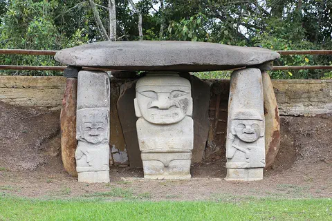
Colombia is in the northwest of South America, with coasts on both the Caribbean Sea and the Pacific Ocean. Three ranges of the Andes run through it, and most people live in the cool mountains, where the capital, Bogotá, sits on a high plateau. About 53.4 million people lived there in 2026, according to DANE, the national statistics office.
For parents & teachers
What children will learn
- Locate Paraguay, its three neighbors and its main rivers.
- Compare the Eastern Region and the Chaco in land, rainfall and population.
- Explain how dams on rivers produce electricity, using Itaipú as an example.
- Describe how Guaraní and Spanish are both part of everyday life.
Recommended ages: 3 to 17 · About 15 minutes
Talk about it
- What would it be like to use two languages every day, one at home and one at school?
- Why might most people live in the wetter part of a country?
- How can a country with no sea still send goods to the ocean?
Try at home or in class
- Pour water over a toy water wheel or a paper pinwheel to see how flowing water can turn a machine.
- Draw a red-and-white striped jersey like those of La Albirroja, Paraguay's football team, whose colors come from the national flag.
Key vocabulary: landlocked, bilingual, hydroelectric power, Chaco, mestizo, mission
Where these facts come from
- Wikidata , Wikimedia Foundation (CC0 1.0)
- Natural Earth vector data , Natural Earth (NACIS) (Public domain)
- UNESCO World Heritage List , UNESCO World Heritage Centre (Linked as a reference; site facts come from Wikidata)
- Paraguay (introduction, quick facts) , Encyclopaedia Britannica
- Paraguay: Land (relief, drainage, soils, climate) , Encyclopaedia Britannica
- Paraguay: Plant and animal life (people, languages, religion, settlement, demography) , Encyclopaedia Britannica
- Paraguay: Resources and power (Itaipú, Yacyretá) , Encyclopaedia Britannica
- Paraguay: Daily life and social customs (arts, sports, early history) , Encyclopaedia Britannica
- Paraguay: Colonial period (independence, the Francia regime) , Encyclopaedia Britannica
- Paraguay: War of the Triple Alliance (the Chaco War) , Encyclopaedia Britannica
- Asunción , Encyclopaedia Britannica
- Jesuit Missions of La Santísima Trinidad de Paraná and Jesús de Tavarangue , UNESCO World Heritage Centre
- Population, total: Paraguay , World Bank
- PlayOwl region table, version 1 , PlayOwl (PlayOwl original data)
- flag-icons 7.5.0 , Panayiotis Lipiridis and contributors (MIT)
- Wikimedia Commons , Wikimedia Foundation (Per file (public domain, CC0, CC BY or CC BY-SA); see each media record)
Checked, not yet human-reviewed. Last updated October 27, 2026. Spotted a mistake? Tell us.
Picture credits
- Photo: Embajada de EEUU en Paraguay, CC BY 2.0, via Wikimedia Commons · source · license
- Photo: Thiagomarcelcampi, CC BY-SA 4.0, via Wikimedia Commons · source · license
- Photo: © Giles Laurent, gileslaurent.com, License CC BY-SA, CC BY-SA 4.0, via Wikimedia Commons · source · license
- Photo: © Giles Laurent, gileslaurent.com, License CC BY-SA, CC BY-SA 4.0, via Wikimedia Commons · source · license