
 Country
Africa
Benin
Benin is a long, narrow country in West Africa. It has sandy beaches and lagoons, old royal palaces, and elephants in the north.
Benin is a narrow country in West Africa that stretches from the Atlantic coast up to the Niger River. Lagoons line its short coast, savanna covers the north, and the palaces of the old kingdom of Dahomey still stand at Abomey. About 15 million people live there.
Benin, called Dahomey until 1975, is a wedge of West Africa about 675 km long, running from a 121 km Atlantic coastline to the Niger River. Its official capital is Porto-Novo, but Cotonou is its largest city and port; it had about 14.8 million people in 2025 (World Bank), some two-fifths of them under 15.
Photo: Joachim Huber, CC BY-SA 2.0, via Wikimedia Commons
Discover Benin
Benin is a country in West Africa.
It is long and thin. Its short coast has sandy beaches. In the far north is the big Niger River. The capital is called Porto-Novo.
Benin is shaped like a long, narrow wedge. It stretches about 675 kilometers north from the Gulf of Guinea, where it has a short coastline, to the Niger River on its northern border.
Porto-Novo is the official capital, where the lawmakers meet, but Cotonou is the biggest city and the main port, and the president lives there. Benin was ruled by France until 1960. About 15 million people lived there in 2025, and more than two-thirds of them live in the south.
Benin is a narrow wedge of territory extending about 675 km north from the Gulf of Guinea, where it has a 121 km (75-mile) coastline, to the Niger River, which forms part of the border with Niger. Porto-Novo, the official capital, is the seat of the legislature, while the president and most ministers reside in Cotonou, the largest city, chief port and de facto administrative capital.
The present name, adopted in 1975, comes from the Bight of Benin rather than the old kingdom of Benin, which lies in Nigeria; the colony had been called Dahomey after the kingdom it absorbed. The World Bank put the population at 14,814,460 in 2025. The southern quarter of the country holds more than two-thirds of the people, and nearly half the population is urban.

Cities and royal palaces
Cotonou is the biggest city.
It has a busy port by the sea. Porto-Novo is the capital. At Abomey, kings built palaces with clay walls and colorful pictures.
Cotonou is Benin's biggest city and its main port, full of shops, markets and cafés. Porto-Novo, the capital, has the National Library and a museum about Benin's many peoples.
Inland, at Abomey, twelve kings of the Kingdom of Dahomey ruled one after another from 1625 to 1900. They built ten palaces inside walls of hard-packed earth, decorated with colorful pictures sculpted into the walls. The Royal Palaces of Abomey became a World Heritage Site in 1985, and part of them is now a history museum.
Cotonou is the focus of the country's commercial and political life; Porto-Novo, seat of the legislature, has the National Library and an ethnographic museum, and Parakou is the main northern market town, dating from colonial times. Ouidah, the old coastal trading center, has a history museum, and the former Portuguese fort there was used in the slave trade.
UNESCO inscribed the Royal Palaces of Abomey in 1985. From 1625 to 1900, twelve kings ruled the Kingdom of Dahomey (Abomey), which grew from the mid-17th century under its founder Wegbaja's precept that the kingdom should always be made greater. The 47-hectare site holds ten palaces, built beside or on top of one another as each king succeeded, enclosed by cob walls and organized around outer, inner and private courtyards; polychrome bas-reliefs are a key feature. A historical museum and artisans' village now occupy part of the site.
Lagoons, plateaus and the Atakora
Benin's coast has lagoons, calm water behind the beach.
Coconut palms grow on the sand. In the north are rocky hills. A hot, dry wind blows in winter.
Benin has five natural regions. The coast is low and sandy, with lagoons of calm water behind it and coconut palms growing on the sand. Behind it lies a fertile clay plateau with a big marsh, then four low plateaus around towns such as Abomey.
In the northwest rise the Atakora Mountains, and in the northeast, plains slope down to the Niger River. The south has two rainy seasons and two dry seasons. The north has one long rainy season from May to September, and from December to March the dusty harmattan wind blows from the northeast.
Britannica describes five natural regions: a low sandy coast, essentially a long sandbar backed by lagoons that reach the sea only at Grand-Popo and Cotonou; the fertile barre (clay) country with the Lama Marsh between Abomey and Allada; four plateaus around Abomey, Kétou, Aplahoué and Zagnanado; the Atakora Mountains in the northwest, a quartzite continuation of the Togo Mountains and the divide between the Volta and Niger basins; and the Niger plains in the northeast. The Ouémé rises in the Atakora and flows about 450 km south, splitting near its mouth between Porto-Novo Lagoon and Nokoué Lake.
The south has an equatorial climate with two rainy and two dry seasons; rainfall rises eastward from about 800 mm at Grand-Popo to about 1,270 mm at Cotonou and Porto-Novo, with temperatures of 22–34 °C and high humidity. The north has a single rainy season (May to September, heaviest in August), with about 1,346 mm in the Atakora and central Benin and about 965 mm farther north; the harmattan blows from December to March, and March highs can reach 43 °C.

Animals of Benin
Elephants live in Benin's big northern parks.
Lions, leopards and buffalo live there too. Monkeys chatter in the trees. Crocodiles rest by the rivers.
Most of the rainforest that once covered southern Benin has been cleared for farms and palm trees. The wildest places are in the far north, in W National Park and Pendjari National Park. There, elephants, leopards, lions, antelope, monkeys, wild pigs, crocodiles and buffalo live, along with pythons and many birds such as guinea fowl.
These parks are part of the W-Arly-Pendjari Complex, shared with Niger and Burkina Faso. UNESCO says it has the largest group of elephants in West Africa and the only healthy group of lions in the region.
The original rainforest of the south has largely been cleared except near rivers, replaced by oil palms, rônier palms and food crops; north of Abomey forest mixes with savanna, giving way to savanna farther north. W National Park, about 5,020 km² and extending into Burkina Faso and Niger, and Pendjari National Park, about 2,750 km², hold elephants, leopards, lions, antelope, monkeys, wild pigs, crocodiles and buffalo, many snakes including pythons and puff adders, and birds such as guinea fowl.
Both belong to the W-Arly-Pendjari Complex (UNESCO), 1,714,831 ha across three countries. UNESCO credits it with about 85 percent of West Africa's savanna elephants, the only viable lion population in the area, probably the only cheetah population in West Africa, and the rare semi-deciduous Bondjagou forest inside Pendjari. It also notes threats from poaching, illegal grazing and spreading farmland.

People, languages and arts
About 15 million people live in Benin.
People speak many languages, like Fon and Yoruba. French is used in schools. Many families grow corn, cassava and yams.
Many different peoples live in Benin. The Fon are the largest group, about two in every five people. The Yoruba live mainly in the southeast, and the Bariba and Somba live in the north. Each group has its own language, and French is the official language and the language of schools.
Around the towns, farmers grow corn, cassava and yams, and oil palms are grown to sell. Benin's artists make carved wooden masks, bronze figures and pottery, and colorful appliquéd cloths that tell the history of the kings of Dahomey.
The Fon make up about two-fifths of the population; the Yoruba, related to Nigeria's Yoruba, about one-eighth; and the Bariba of the northeast, whose towns such as Nikki were once kingdoms, about one-tenth. Other groups include the Adja peoples, the Goun, the Somba (Ditamari) of the northwest and the Fulani. French is official and the language of instruction; Fon, Gen (Mina), Bariba, Yoruba and Dendi are the most widely spoken African languages. Almost half the population is Christian, about one-fourth Muslim and about one-fourth follows traditional beliefs, including Vodun.
Some two-fifths of people are under 15, and Benin's population growth rate is among the highest in the world. Corn, cassava and yams are grown intensively around the towns, and oil palms are the main cash crop of the barre and plateaus. Britannica lists carved wooden masks used in ceremonies, bronze statuettes, appliquéd tapestries recounting the history of Dahomey's kings and the Yoruba guelede masks of the Porto-Novo region; the Somba region in the northwest is known for its thatched, turreted houses.
Kingdoms, colony and republic
Long ago, many kingdoms ruled the land that is now Benin.
Kings lived in palaces at Abomey. Later, France ruled. In 1960, Benin became its own country.
Before France came, the land was made of many separate kingdoms. In the south, Allada was strongest in the 1500s and 1600s, then the Fon kingdom of Dahomey, ruled from Abomey. In the north, the Bariba had kingdoms such as Nikki.
Portuguese sailors reached the coast in 1472. For about two centuries, European traders bought enslaved people here, and Europeans called it the Slave Coast. In the 1890s France took over and named the colony Dahomey. It became independent on August 1, 1960, and in 1975 it was renamed Benin.
Benin as a political unit was created by French conquest at the end of the 19th century. The south was home to Ewe-speaking peoples; Allada was the leading state in the 16th and 17th centuries and Dahomey, the Fon state ruled from Abomey, in the 18th and 19th; Dahomey took Allada in 1724 and Ouidah in 1727, while Porto-Novo stayed independent. In the north the Bariba kingdom of Nikki belonged to a wider confederacy. The Portuguese explored the coast in 1472 and began trading in 1553; slaves were the main export until the mid-19th century, when the area was known to Europeans as the Slave Coast, and the trade depopulated areas and militarized society. From the 1840s palm oil replaced it.
France conquered Dahomey in 1892–94, made it part of French West Africa from 1899 and fixed the present borders in 1909. Independence came on August 1, 1960. Six military coups followed between 1963 and 1972; Mathieu Kérékou, who took power in 1972, renamed the country the People's Republic of Benin in 1975. A new constitution in 1990 opened a democratic transition, and the first multiparty elections were held in 1991.
Benin on the map
Find Benin on the globe.
It is in West Africa, by the ocean. It is long and thin, like a slice of cake. Four countries are its neighbors.
Benin's short coast faces the Gulf of Guinea in the Atlantic Ocean. Togo is to the west, Nigeria to the east, Burkina Faso to the northwest and Niger to the north, where the Niger River forms part of the border.
The Mono River marks part of the border with Togo near the coast, and in the east a lagoon at Porto-Novo leads toward the port of Lagos in Nigeria.
Benin is bounded by Togo to the west, Burkina Faso to the northwest, Niger to the north along part of the Niger River, and Nigeria to the east; its 121 km coast lies on the Gulf of Guinea. Near the coast the Mono River forms the border with Togo, and the Grand-Popo Lagoon extends into Togo.
In the east the Porto-Novo Lagoon provides a natural waterway toward Lagos, though the border discourages its use. The present frontiers were fixed in 1909, after the Anglo-French convention of 1898 settled the line with British Nigeria and Franco-German conventions of 1885 and 1899 settled the line with German Togo.
- Length, coast to Niger River
- about 675 km
- Coastline
- about 121 km (75 miles)
- Neighbors
- Togo, Burkina Faso, Niger and Nigeria
- People (2025)
- 14,814,460
Amazing facts
-
Benin is named after a big bay in the ocean.
Benin is named after the Bight of Benin, a wide bay of the Atlantic, not after the old kingdom of Benin, which was in Nigeria.
The name comes from the Bight of Benin; the colony was at first called Benin, renamed Dahomey in 1894, and the country became the People's Republic of Benin in 1975.
-
Twelve kings built palaces at Abomey.
From 1625 to 1900, twelve kings ruled Dahomey, and they built ten palaces next to and on top of each other at Abomey.
UNESCO's Abomey site covers 47 ha with ten palaces, each built around outer, inner and private courtyards and decorated with polychrome bas-reliefs.
-
Benin's lagoons only meet the sea in two places.
Benin's coastal lagoons connect to the ocean only at Grand-Popo and at Cotonou.
Benin's coast is essentially a long sandbar; its lagoons have outlets to the sea only at Grand-Popo and Cotonou, and some are interconnected.
-
Some cloths in Benin tell the stories of old kings.
Artists in Benin make colorful appliquéd cloths, with shapes sewn on, that tell the history of the kings of Dahomey.
Britannica lists appliquéd tapestries recounting the history of the kings of precolonial Dahomey among Benin's artistic traditions, with bronze statuettes, pottery and the guelede masks of the Porto-Novo region.
Words to know
- lagoon
- a stretch of calm salt water separated from the sea by a sandbar
- kingdom
- a land ruled by a king or queen
- bas-relief
- a picture carved or molded so it stands out slightly from a flat wall
- harmattan
- a dry, dusty wind that blows from the Sahara across West Africa
- bight
- a wide, gently curving bay along a coast
- World Heritage Site
- a place UNESCO lists as important to all people, to be protected
Discovery challenge
-
What is the official capital of Benin?
Which city is the official capital of Benin?
Which city is Benin's constitutional capital and the seat of its legislature?
- Cotonou
- Porto-Novo
- Abomey
Show the answer
Porto-Novo
Porto-Novo is the capital of Benin.
Porto-Novo is the official capital, though Cotonou is the biggest city.
Porto-Novo is the official capital and seat of the legislature; the president and most ministers reside in Cotonou.
-
What was Benin called before?
What was Benin's name before 1975?
Under which name did the country become independent in 1960?
- Dahomey
- Ceylon
- Upper Volta
Show the answer
Dahomey
Benin used to be called Dahomey.
It was called Dahomey, after the old kingdom, until it was renamed Benin in 1975.
Dahomey became independent on August 1, 1960, and was renamed the People's Republic of Benin in 1975.
-
Who lived in the palaces at Abomey?
Who built the palaces at Abomey?
The Abomey palaces were built by the rulers of which kingdom between 1625 and 1900?
- Kings of Dahomey
- Roman emperors
- Chinese emperors
Show the answer
Kings of Dahomey
Kings of Dahomey lived in the palaces.
Twelve kings of Dahomey built palaces at Abomey from 1625 to 1900.
The Kingdom of Dahomey's twelve kings built ten palaces inside cob walls at Abomey.
-
Which big river runs along Benin's northern border?
Which river forms part of Benin's northern border?
Which river, with its tributaries the Mékrou, Alibori and Sota, drains northeastern Benin?
- The Nile
- The Niger
- The Amazon
Show the answer
The Niger
The Niger River is in the north of Benin.
The Niger River forms part of the border with the country of Niger.
The Niger and its tributaries the Mékrou, Alibori and Sota drain the northeast of Benin.
-
Where do elephants live in Benin?
In which part of Benin are its big wildlife parks?
Where are W and Pendjari National Parks, part of a protected area shared with Niger and Burkina Faso?
- In the far north
- On the beach
- In Cotonou
Show the answer
In the far north
Elephants live in big parks in the north.
W and Pendjari National Parks are in the far north of Benin.
Both lie in the north, within the W-Arly-Pendjari Complex, which holds most of West Africa's savanna elephants.
Animals of Benin
Explore next
-
 Watch
3D
Animal
Leopard
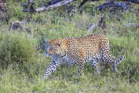
The leopard is a strong, spotted big cat and the best climber of them all. It can carry its food high up into a tree, away from lions and hyenas. Leopards live in more kinds of places than any other big cat, from deserts to rainforests, across Africa and Asia.
-
 Watch
 Country
Nigeria
Nigeria is a large country in West Africa, named after the Niger River. It has rainforests in the south and dry grasslands in the north, and it is Africa's most populous country, with about 238 million people in 2025 who speak hundreds of languages.
-
 Watch
 Country
Burkina Faso
Burkina Faso is a landlocked country in West Africa, on a wide plateau of savanna that is grassy in the north and dotted with forest in the south. About 24 million people live there. Its name, chosen in 1984, means Land of Incorruptible People, and its capital is Ouagadougou.
-
 Watch
 Country
Togo
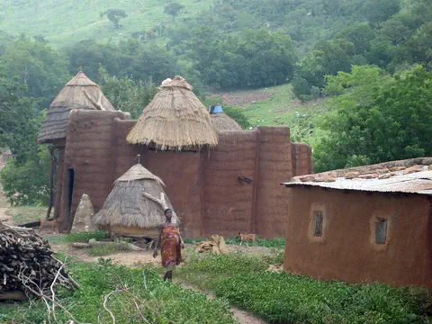
Togo is a small, narrow country in West Africa. It has only 51 kilometers of coast on the Gulf of Guinea but stretches about 515 kilometers inland, from beaches and lagoons to the Togo Mountains and northern savanna. About 8.6 million people lived there in 2025, and Lomé is the capital and main port.
-
 Watch
 Country
Democratic Republic of the Congo
The Democratic Republic of the Congo, or DR Congo, is the second-largest country in Africa. The mighty Congo River curves through its rainforests, volcanoes rise in the east, and its capital, Kinshasa, is a center of music, fashion and popular culture.
-
 Watch
 Country
Ethiopia
Ethiopia is a country on the Horn of Africa with no coast. Much of it is high, rugged land cut by the Great Rift Valley, it is one of the world's oldest countries, and more than 110 million people live there.
-
 Watch
 Country
Kenya
Kenya is a country in East Africa, crossed by the equator. It has the snow-capped Mount Kenya, the deep Great Rift Valley, Lake Victoria and a long Indian Ocean coast, and about 54 million people live there, many of them speaking Swahili.
-
 Watch
 Country
Tanzania
Tanzania is a country in East Africa, just south of the Equator, on the Indian Ocean. It has Mount Kilimanjaro, Africa's highest mountain, deep lakes in the East African Rift, and the Serengeti, where huge herds of wildebeest travel each year.
For parents & teachers
What children will learn
- Locate Benin, its four neighbors, the Gulf of Guinea and the Niger River.
- Describe Benin's five natural regions and how the seasons differ between south and north.
- Describe the peoples, languages and arts of Benin without treating them as one culture.
- Outline Benin's history from the kingdoms of Allada and Dahomey to independence in 1960 and the name Benin in 1975.
Recommended ages: 3 to 17 · About 15 minutes
Talk about it
- Why might a country have its official capital in one city and its president in another?
- Why do you think each king of Dahomey built a new palace instead of using the old one?
- How can old cloths, carvings and buildings help us learn about history?
Try at home or in class
- Make an appliqué picture by gluing cut-out shapes of colored paper or felt onto a background to tell a story from your family's history.
- Build a sand bar in a tray of sand and water and watch a calm 'lagoon' form behind it, like Benin's coast.
Key vocabulary: lagoon, kingdom, bas-relief, harmattan, bight, World Heritage Site
Where these facts come from
- Wikidata , Wikimedia Foundation (CC0 1.0)
- Natural Earth vector data , Natural Earth (NACIS) (Public domain)
- UNESCO World Heritage List , UNESCO World Heritage Centre (Linked as a reference; site facts come from Wikidata)
- Benin (introduction, land, relief, drainage, climate) , Encyclopaedia Britannica
- Benin: Plant and animal life (settlement, people, languages, religion, demographic trends) , Encyclopaedia Britannica
- Benin: Cultural life , Encyclopaedia Britannica
- Benin: History , Encyclopaedia Britannica
- Benin: Decolonization, independence, and military coups , Encyclopaedia Britannica
- Royal Palaces of Abomey , UNESCO World Heritage Centre
- W-Arly-Pendjari Complex , UNESCO World Heritage Centre
- Population, total: Benin , World Bank
- PlayOwl region table, version 1 , PlayOwl (PlayOwl original data)
- flag-icons 7.5.0 , Panayiotis Lipiridis and contributors (MIT)
- Wikimedia Commons , Wikimedia Foundation (Per file (public domain, CC0, CC BY or CC BY-SA); see each media record)
Checked, not yet human-reviewed. Last updated October 27, 2026. Spotted a mistake? Tell us.
Picture credits
- Photo: Joachim Huber, CC BY-SA 2.0, via Wikimedia Commons · source · license
- Photo: Adoscam, CC BY-SA 4.0, via Wikimedia Commons · source · license
- Photo: Ksperentos, CC BY-SA 4.0, via Wikimedia Commons · source · license
- Photo: Giles Laurent, CC BY-SA 4.0, via Wikimedia Commons · source · license
- Photo: Charles J. Sharp, CC BY-SA 4.0, via Wikimedia Commons · source · license
- Photo: Paul M Rae, CC BY 2.5, via Wikimedia Commons · source · license