
 Country
Europe
Hungary
Hungary is a country in the middle of Europe with no sea. It has wide, flat plains, a big lake and the Danube River.
Hungary is a landlocked country in central Europe, in a wide lowland called the Carpathian Basin. Wide plains cover much of it, the Danube River flows through its capital, Budapest, and about 9.5 million people lived there in 2026.
Hungary is a landlocked state of about 93,000 square kilometers in the Carpathian Basin, dominated by the Great and Little Alföld plains and lying wholly within the Danube's drainage basin. Most of its people speak Hungarian, a language of the Ugric branch of the Uralic family, and the Hungarian Central Statistical Office counted 9,488,428 residents on January 1, 2026.
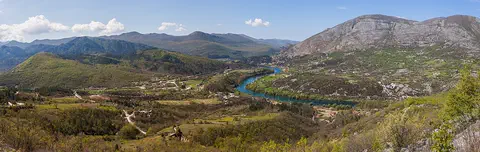
Photo: Thomas Depenbusch (Depi) from Cologne, Germany, CC BY 2.0, via Wikimedia Commons
Discover Hungary
Hungary is a country in the middle of Europe.
It has no seaside. Much of the land is flat and wide. A big river called the Danube flows through it. The capital city is called Budapest.
Hungary is a country in central Europe with no coast. It sits in a wide lowland called the Carpathian Basin. In Hungarian, the country's name is Magyarország.
Most of Hungary is flat or gently hilly. The Great Hungarian Plain covers much of the center and southeast, and the Danube River flows through the country. The capital, Budapest, stands on both banks of the Danube. About 9.5 million people lived in Hungary at the start of 2026.
Hungary lies between about 45° and 49° N and 16° and 23° E, within the Carpathian Basin. It covers 93,025 km² according to the Hungarian Central Statistical Office (KSH). Great lowland expanses form its core: the Little Alföld in the northwest and the Great Alföld, which covers most of central and southeastern Hungary, separated by a low mountain backbone running about 400 km from southwest to northeast.
Britannica describes the country as wholly Budapest-centered: the capital, on both banks of the Danube just downstream of the Danube Bend, dwarfs every other city and holds most scientific, scholarly and artistic institutions. KSH counted 9,488,428 residents on January 1, 2026, about 51,000 fewer than a year earlier. Britannica notes that the population peaked in the late 1970s and early 1980s and that deaths have outnumbered births since then.
Cities and famous places
Budapest is the biggest city in Hungary.
The Danube River flows right through the middle. Bridges join the two sides. On one side there is an old castle on a hill. Far away on the plains, people still keep old kinds of cattle and horses.
Budapest was once three towns, Buda, Óbuda and Pest, on the two banks of the Danube. They joined together as one city in 1873. UNESCO lists the Danube riverbanks and the Buda Castle Quarter as a World Heritage Site, with remains of the Roman town of Aquincum and the Gothic castle of Buda. About 1.68 million people lived in Budapest in 2026.
In the east, the Hortobágy is a huge area of grassy plains and wetlands where people have grazed farm animals for more than 2,000 years. In the north, the village of Hollókő shows how country people lived before modern farming. The Aggtelek hills have hundreds of caves.
UNESCO inscribed Budapest's Banks of the Danube and Buda Castle Quarter in 1987, citing the remains of the Roman city of Aquincum and the Gothic castle of Buda; Clark's suspension bridge, finished in 1849, symbolized the link between Buda and Pest, which with Óbuda formally united only in 1873. KSH counted 1,675,777 residents in Budapest on January 1, 2026; the major provincial centers are Debrecen, Miskolc, Szeged, Pécs and Győr.
The Hortobágy Puszta (1999) is a vast cultural landscape of plains and wetlands where grazing has continued for more than two millennia and the original Hungarian cattle, horse and sheep breeds are preserved. Hollókő (1987), developed mainly in the 17th and 18th centuries, is a deliberately preserved village. The Caves of Aggtelek Karst and Slovak Karst (1995), 712 identified caves shared with Slovakia, show a rare combination of tropical and glacial climatic effects that lets scientists study tens of millions of years of geological history. Tokaj's wine region (2002) and Lake Fertő (2001) are also World Heritage Sites.
Plains, rivers and a great lake
Hungary has big rivers.
The Danube is the longest. The Tisza is another big river. Lake Balaton is a very big lake. Many people go there on holiday. The tallest mountain is called Kékes.
All of Hungary's rivers belong to the Danube's family. The Danube and two of its branches come from the Alps, while the Tisza comes from the Carpathian Mountains to the east. The Danube floods twice a year, in early spring and early summer. To protect against floods, people have built about 4,000 kilometers of long banks called levees.
Lake Balaton, 598 square kilometers, is the largest freshwater lake in central Europe and a favorite place for holidays. The highest peak, Kékes, in the Mátra Mountains, is only 1,014 meters tall. Summers are warm and winters cold: in July the average is about 18 to 23 °C, and in January about −4 to 0 °C.
Hungary lies wholly within the Danube basin. The Danube, Rába and Dráva are of Alpine origin; the Tisza and its tributaries rise in the Carpathians and drain much of the east, meandering across a floodplain marked by oxbow lakes. The Danube floods in early spring and early summer, when discharge can be ten times its autumn and winter levels, and at Szolnok the Tisza has peaked at 50 times its average; about 4,000 km of levees protect against floods. The lowlands lie mostly between 80 and 200 m, with the lowest point, 78 m, near Szeged on the Tisza; the volcanic Mátra Mountains reach 1,014 m at Kékes.
The climate is moderately dry continental: a mean annual temperature of about 10 °C, recorded extremes of 43 °C and −34 °C, and 500–600 mm of precipitation in the lowlands, up to two-thirds of it in the growing season. Lake Balaton (598 km²) is central Europe's largest freshwater lake. Human activity has largely replaced the natural vegetation; about half the land is cultivated, and beech and oak woodland grow in the uplands, with no natural conifer forest.
Animals of Hungary
Deer and wild pigs live in the forests.
Hares and pheasants live on the flat plains. Fish swim in the rivers and lakes. Old kinds of farm cattle, horses and sheep live on the Hortobágy plain.
In Hungary's higher forests, deer and wild pigs are common. On the lowland plains live hares, partridges, pheasants and many small rodents. Many kinds of marsh birds were once common; today they survive only in nature reserves.
The rivers and lakes hold freshwater fish such as pike, bream and pike perch. On the Hortobágy plain, the original Hungarian breeds of cattle, horses and sheep are kept as part of the country's heritage.
Britannica notes that deer and wild pigs are abundant in the forests at higher elevations, while rodents, hares, partridge and pheasant inhabit the lowlands. The once-numerous marsh waterfowl survive only in nature reserves, and the freshwater fish include pike, bream and pike perch. It also records significant water and air pollution in some industrial regions.
Domestic breeds are part of the protected landscape too: in the Hortobágy, the original Hungarian breeds of cattle, horse and sheep have been preserved as national heritage, and UNESCO describes grazing there as a traditional land use for more than two thousand years. UNESCO calls the 712 caves of the Aggtelek and Slovak Karst a typical temperate-zone karst system. About half the land is regularly cultivated and about one-sixth is used for nonagricultural purposes; the rest is meadow, rough pasture, forest and woodland.
People, languages and food
About 9.5 million people live in Hungary.
Most people speak Hungarian. Paprika is a spice made from peppers. It is used in many meals. Goulash is a famous Hungarian dish.
About 9.5 million people lived in Hungary at the start of 2026, and about seven in ten live in towns and cities. Most people speak Hungarian, which belongs to a language family called Uralic. Its closest relatives are two languages spoken far to the east, beyond the Ural Mountains, and it is more distantly related to Finnish and Estonian.
Hungarian food is rich and often spiced with paprika, made from the pods of peppers. Goulash, bean soup with smoked meat, and halászlé, a spicy fish soup, are well-known dishes. On national holidays, many people enjoy folk dancing, choral singing and displays of traditional folk arts.
KSH counted 9,488,428 residents on January 1, 2026. More than four-fifths of the population is ethnically Hungarian and speaks Hungarian (Magyar), a member of the Ugric branch of the Uralic languages, most closely related to Khanty and Mansi east of the Urals and more distantly to Finnish and Estonian. The largest minority is the Roma; others include Germans, Slovaks, Croats, Romanians and Serbs. Hungary has no official religion; more than a third of people are Roman Catholic and about a tenth Calvinist. About seven-tenths of the population is urban, and many ethnic Hungarians live in neighboring countries.
Britannica calls cuisine Hungary's most traditional cultural element: goulash (gulyás), bean soup with smoked meat and beef stew are national dishes, and paprika, made from Capsicum annuum pods and not native to Hungary, is the most distinctive ingredient, with halászlé and lecsó among the spicy dishes. National holidays include March 15 (the Revolution of 1848), August 20 (St. Stephen's Day) and October 23, marked with folk dancing, choral singing and folk arts; the Matyó of the northern plain are noted for embroidery and multicolored dress.

A thousand years of history
Long ago, people called Magyars crossed the mountains.
They made a new home on the wide plains. More than 1,000 years ago, a king named Stephen was crowned. Later, three towns joined to make Budapest.
Long ago, parts of Hungary belonged to the Roman Empire. In the late 800s the Magyars, a people who had herded animals on the steppes far to the east, crossed the Carpathian Mountains and settled in the basin. Their king Stephen was crowned, by tradition on Christmas Day in the year 1000, and Hungary stayed an independent state until 1526.
After 1526, Hungary became part of larger empires, and from 1867 it was a partner in Austria-Hungary. In 1873 Buda, Óbuda and Pest joined to form Budapest. In 1989 Hungary became a democracy with free elections, and in 2004 it joined the European Union.
Parts of Hungary formed the Roman provinces of Pannonia and Dacia; early Christian tombs from Pannonia's last Roman period at Pécs are a World Heritage Site. Britannica relates that the Magyars, a Finno-Ugric people who had become herders on the steppes, crossed the Carpathians under Árpád, probably in the spring of 895, and settled the middle Danube basin. Stephen I received a crown from Pope Sylvester II and, according to tradition, was crowned on Christmas Day 1000; in his day the kingdom was divided into 40 to 50 counties, and Hungary remained independent from 896 to 1526.
It then became part of the Habsburg and Ottoman empires, regaining near-independence as a partner in Austria-Hungary (1867–1918). After World War I Hungary lost 71 percent of its territory under the Treaty of Trianon (1920), and after World War II it was under Soviet domination (1945–90); the Revolution of 1956 is commemorated each October 23. In October 1989 a revision of the constitution introduced a multiparty parliamentary democracy; the unicameral National Assembly elects the president, who may serve two five-year terms. Hungary joined NATO in 1999 and the EU in 2004.
Hungary on the map
Find Hungary on the globe.
It is in the middle of Europe, far from the sea. Seven countries are its neighbors. The big Danube River flows through it.
Hungary is in central Europe and has seven neighbors: Slovakia to the north, Ukraine to the northeast, Romania to the east, Serbia and Croatia to the south, Slovenia to the southwest and Austria to the west. It has no coast.
The Danube flows along the northern edge of the Little Hungarian Plain, then through the Visegrád Gorge and the Danube Bend to Budapest. Lake Balaton lies in the west, and the Great Hungarian Plain spreads across the center and southeast.
Hungary lies between about 45° and 49° N and 16° and 23° E, in the middle of the Carpathian Basin. Britannica lists its borders: Slovakia to the north, Ukraine to the northeast, Romania to the east, Serbia (the Vojvodina region) and Croatia to the south, Slovenia to the southwest and Austria to the west.
The Danube bounds the Little Alföld to the north and cuts through the Visegrád Gorge, which separates the hills of Transdanubia from the Northern Mountains. East of the Tisza lies Transtisza, and between the two rivers the Kiskunság. Lake Fertő (Neusiedler See) lies on the Austrian border. The KSH gives the country's area as 93,025 km² (2026). The map follows Natural Earth's land borders.
- Latitude
- about 45° to 49° north
- Longitude
- about 16° to 23° east
- Lowest point
- 78 m, near Szeged on the Tisza
- Highest point
- Kékes, 1,014 m
Amazing facts
-
Budapest was once three towns.
Budapest was three separate towns, Buda, Óbuda and Pest, until they joined together in 1873.
UNESCO notes that Budapest keeps the separate structural characters of Pest, Buda and Óbuda, which united in 1872–73.
-
Lake Balaton is a very big lake.
Lake Balaton covers 598 square kilometers and is the largest freshwater lake in central Europe.
Britannica gives Lake Balaton's area as 598 km² and calls it the largest freshwater lake in central Europe; most other Hungarian lakes are small.
-
Paprika did not first come from Hungary.
Paprika, Hungary's favorite spice, is not native to Hungary. It was brought from far away, but now it is on most Hungarian tables.
Paprika, made from Capsicum annuum pods, is not native to Hungary; Britannica gives Spain, India by way of the Turks, or the Americas as possible origins.
-
There are hundreds of caves in the hills of Aggtelek.
Together, the Aggtelek Karst in Hungary and the Slovak Karst across the border have 712 known caves.
UNESCO counts 712 caves in the Aggtelek and Slovak Karst, a temperate-zone karst system that records both tropical and glacial climatic effects.
-
Hungarian is a faraway cousin of Finnish and Estonian.
Hungarian's closest relatives, Khanty and Mansi, are spoken far away, east of the Ural Mountains.
Hungarian belongs to the Ugric branch of the Uralic family; its nearest relatives are the Ob-Ugric languages Khanty and Mansi, and more distantly Finnish and Estonian.
Words to know
- landlocked
- surrounded by land, with no coast on the sea
- basin
- a wide, low area of land with higher ground all around it
- plain
- a large area of flat land
- levee
- a long bank of earth built beside a river to stop it flooding
- puszta
- the Hungarian word for the wide, grassy plains of the Great Hungarian Plain
- karst
- a landscape of limestone rock worn into caves and holes by water
- World Heritage Site
- a place UNESCO lists as important to all people, to be protected
Discovery challenge
-
What is the capital city of Hungary?
Which city is the capital of Hungary?
Which capital was formed when Buda, Óbuda and Pest united in 1873?
- Budapest
- Debrecen
- Prague
Show the answer
Budapest
Budapest is the capital. The Danube flows through it.
Budapest is the capital. Debrecen is the largest city of the Great Plain, and Prague is the capital of Czechia.
Budapest united Buda, Óbuda and Pest in 1873; Debrecen is the largest city of the Great Alföld; Prague is in Czechia.
-
What is the big lake in Hungary called?
Which lake in Hungary is the largest freshwater lake in central Europe?
Which 598 km² lake in Transdanubia is central Europe's largest freshwater lake?
- Lake Victoria
- Lake Balaton
- Lake Geneva
Show the answer
Lake Balaton
It is Lake Balaton. Many people go there on holiday.
Lake Balaton covers 598 square kilometers. Lake Victoria is in Africa and Lake Geneva is between Switzerland and France.
Lake Balaton (598 km²) is a leading resort area of Transdanubia; Lake Victoria is in Africa and Lake Geneva lies between Switzerland and France.
-
Which spice is used in many Hungarian meals?
Which spice, made from pepper pods, flavors many Hungarian dishes?
Which spice, ground from Capsicum annuum pods, does Britannica call the most distinctive element of Hungarian cuisine?
- Cinnamon
- Vanilla
- Paprika
Show the answer
Paprika
It is paprika. It is made from peppers.
Paprika is made from pepper pods. It is on most Hungarian dining tables.
Paprika, from Capsicum annuum, is not native to Hungary but is a fixture of its cooking and an important export.
-
Which big river flows through Budapest?
Which river flows through Budapest, between Buda and Pest?
Which river, whose basin includes all of Hungary, floods twice a year and divides Buda from Pest?
- The Danube
- The Nile
- The Amazon
Show the answer
The Danube
The Danube flows through Budapest.
The Danube flows between Buda and Pest. The Nile is in Africa and the Amazon is in South America.
All of Hungary lies in the Danube basin; the river floods in early spring and early summer and runs through the capital.
-
What is the tallest mountain in Hungary?
Which peak in the Mátra Mountains is Hungary's highest?
Which volcanic peak, 1,014 m, in the Mátra Mountains is Hungary's highest point?
- Mont Blanc
- Kékes
- Mount Fuji
Show the answer
Kékes
Kékes is the tallest mountain in Hungary.
Kékes is 1,014 meters tall, in the Mátra Mountains. Mont Blanc and Mount Fuji are in other countries.
Kékes (1,014 m) crowns the volcanic Mátra in the Northern Mountains; the lowest point, 78 m, is near Szeged.
Places to discover in Hungary
-
Watch
City
Budapest
Budapest, the capital of Hungary, was made in 1873 by joining three towns on the Danube River: hilly Buda and old Óbuda on one bank and flat Pest on the other. About 1.7 million people live there (2026), with hot springs under the ground and the first underground railway built on the European mainland.
-
 Watch
Natural wonder
Danube
The Danube is Europe's second-longest river, after the Volga. It begins as two small streams in Germany's Black Forest and flows about 2,850 kilometers east to the Black Sea, passing through 10 countries and four capital cities. For more than 2,000 years it has been a border, a highway for boats and a home for wildlife, and it ends in a giant delta of reeds, lakes and birds.
Animals of Hungary
-
 Watch
3D
Animal
Wild boar
Wild boars are bristly wild pigs that live in forests and fields across Europe, Asia and North Africa. They sniff out food with their powerful snouts, live in family groups called sounders, and are the wild ancestors of farm pigs.
-
 Watch
3D
Animal
Common carp
The common carp is a large, sturdy fish with big scales and little whisker-like barbels by its mouth. It comes from rivers and lakes of Europe and Central Asia, but people have carried it to every continent except Antarctica, where it can muddy the water and harm water plants. Koi are a colorful kind of carp.
Explore next
-
Watch
City
Budapest
Budapest, the capital of Hungary, was made in 1873 by joining three towns on the Danube River: hilly Buda and old Óbuda on one bank and flat Pest on the other. About 1.7 million people live there (2026), with hot springs under the ground and the first underground railway built on the European mainland.
-
Watch
Natural wonder
Danube
The Danube is Europe's second-longest river, after the Volga. It begins as two small streams in Germany's Black Forest and flows about 2,850 kilometers east to the Black Sea, passing through 10 countries and four capital cities. For more than 2,000 years it has been a border, a highway for boats and a home for wildlife, and it ends in a giant delta of reeds, lakes and birds.
-
Watch
3D
Animal
Wild boar
Wild boars are bristly wild pigs that live in forests and fields across Europe, Asia and North Africa. They sniff out food with their powerful snouts, live in family groups called sounders, and are the wild ancestors of farm pigs.
- Watch Geography Caves and karst landscapes Most caves are made by slightly acidic water slowly dissolving rock such as limestone. Over hundreds of thousands of years, cracks grow into tunnels and rooms. The land above, with its sinkholes, disappearing streams and springs, is called karst. Inside, dripping water builds stalactites and stalagmites.
-
Watch
3D
Animal
Common carp
The common carp is a large, sturdy fish with big scales and little whisker-like barbels by its mouth. It comes from rivers and lakes of Europe and Central Asia, but people have carried it to every continent except Antarctica, where it can muddy the water and harm water plants. Koi are a colorful kind of carp.
-
 Watch
 Country
Belarus
Belarus is a landlocked country in eastern Europe. Ice sheets of the last ice age shaped its low hills and wide plains, it has more than 10,000 lakes and one of Europe's largest wetlands, and about 9.1 million people lived there in 2025.
-
 Watch
 Country
Bosnia and Herzegovina
Bosnia and Herzegovina is a mountainous country in southeastern Europe. It has forests, limestone hills and many rivers, and famous old stone bridges cross some of them. Its capital is Sarajevo. It touches the Adriatic Sea along only about 20 kilometers of coast.
-
 Watch
 Country
Bulgaria
Bulgaria is a country on the eastern side of the Balkan Peninsula, with the Danube River to the north and the Black Sea to the east. Mountains cross it from west to east, and about 6.4 million people lived there at the end of 2025.
For parents & teachers
What children will learn
- Locate Hungary in the Carpathian Basin and name its seven neighbors.
- Describe Hungary's plains, rivers and Lake Balaton, and why levees are built along the Danube and Tisza.
- Describe some of Hungary's languages, foods, farm traditions and wildlife without treating them as one single culture.
- Outline Hungary's history from the Magyar settlement and King Stephen to Budapest (1873) and democracy (1989).
Recommended ages: 3 to 17 · About 15 minutes
Talk about it
- Why do you think towns on big plains build long levees along their rivers?
- Budapest was once three towns. Are there places near you that grew together into one?
- Why might people keep old breeds of farm animals, like the cattle of the Hortobágy?
Try at home or in class
- In a baking tray of sand, dig a winding river channel, build a low sand bank along one side, and pour water slowly to see how the bank protects the land behind it.
- Taste or smell sweet paprika with a grown-up, then find on a map the places Britannica says it may have come from: Spain, India and the Americas.
Key vocabulary: landlocked, basin, plain, levee, puszta, karst, World Heritage Site
Where these facts come from
- Wikidata , Wikimedia Foundation (CC0 1.0)
- Natural Earth vector data , Natural Earth (NACIS) (Public domain)
- UNESCO World Heritage List , UNESCO World Heritage Centre (Linked as a reference; site facts come from Wikidata)
- Hungary (introduction and Land) , Encyclopaedia Britannica
- Hungary: Drainage and soils (climate, plant and animal life, ethnic groups, languages, religion) , Encyclopaedia Britannica
- Hungary: Settlement patterns (demographic trends) , Encyclopaedia Britannica
- Hungary: Daily life and social customs , Encyclopaedia Britannica
- Hungary: Government and society , Encyclopaedia Britannica
- Hungary: History , Encyclopaedia Britannica
- Hungary: The Christian kingdom , Encyclopaedia Britannica
- Hungary: Postcommunist Hungary , Encyclopaedia Britannica
- 22.1.2.4. Population by type of settlement, 1st January , Hungarian Central Statistical Office (KSH)
- 8.1.2.1. Area, settlements density, population density, 1 January 2026 , Hungarian Central Statistical Office (KSH)
- Budapest, including the Banks of the Danube, the Buda Castle Quarter and Andrássy Avenue , UNESCO World Heritage Centre
- Hortobágy National Park - the Puszta , UNESCO World Heritage Centre
- Caves of Aggtelek Karst and Slovak Karst , UNESCO World Heritage Centre
- Old Village of Hollókő and its Surroundings , UNESCO World Heritage Centre
- PlayOwl region table, version 1 , PlayOwl (PlayOwl original data)
- flag-icons 7.5.0 , Panayiotis Lipiridis and contributors (MIT)
- Wikimedia Commons , Wikimedia Foundation (Per file (public domain, CC0, CC BY or CC BY-SA); see each media record)
Checked, not yet human-reviewed. Last updated October 24, 2026. Spotted a mistake? Tell us.