
 Country
Australia and Oceania
Pitcairn Islands
The Pitcairn Islands are four small islands far out in the Pacific Ocean. Only one has people. About 50 people live there.
The Pitcairn Islands are a British overseas territory in the South Pacific: Pitcairn, Henderson, Ducie and Oeno. Only Pitcairn Island has people, around fifty of them, most descended from the sailors of HMS Bounty and their Tahitian companions. Its waters form one of the largest marine reserves on Earth.
Pitcairn, Henderson, Ducie and Oeno, a British overseas territory in the south-central Pacific, have about 47 km² of land. Pitcairn Island, a small volcanic outcrop 2,170 km east-southeast of Tahiti, is the only inhabited island, with a population the government puts at around fifty. Henderson Island is a UNESCO World Heritage site, and a marine reserve of 834,000 km² was created in 2015.
Photo: Makemake, CC BY-SA 3.0, via Wikimedia Commons
Discover the Pitcairn Islands
The Pitcairn Islands are far away in the Pacific Ocean.
There are four islands. People live on just one, called Pitcairn Island.
The Pitcairn Islands lie in the South Pacific Ocean, about 2,170 kilometers east-southeast of Tahiti. There are four islands: Pitcairn, Henderson, Ducie and Oeno. Only Pitcairn Island has people living on it.
The islands are a British overseas territory. Their governor is the British High Commissioner to New Zealand, and the islands' office is in Auckland, New Zealand, more than 5,000 kilometers away. On the island, an Island Council led by a mayor runs everyday matters. English and Pitkern are the official languages.
The territory's official name lists all four islands: Pitcairn, Henderson, Ducie and Oeno. The government describes Pitcairn as a small volcanic outcrop at about 25.04° S, 130.06° W, roughly 2,170 km east-southeast of Tahiti and just over 6,600 km from Panama; the administrative headquarters is in Auckland, 5,310 km away.
UNESCO explains that the Wellington-based British High Commissioner to New Zealand holds the office of Governor, much day-to-day administration is handled by a Commissioner in Auckland, and the Island Council (a mayor, officials, four elected members and two appointed advisers) runs local affairs. A 2010 constitution set out residents' rights and freedoms. English and Pitkern, a mix of Tahitian and 18th-century English, are official.
Adamstown, Bounty Bay and the Hill of Difficulty
Adamstown is the only village. Its houses sit on a green hill above the sea.
A steep road climbs up from the bay.
Adamstown, the capital and only settlement, sits on the north coast above Bounty Bay, one of the few places where longboats can land. A steep road called the Hill of Difficulty climbs from the bay up to the village. The photo shows houses scattered among green trees on the slopes, with a ship out at sea.
Pitcairn Island is only about 3.2 kilometers long and 1.6 kilometers wide. Visitors arrive on the islands' supply ship, which carries passengers, or on yachts sailing between Easter Island and Tahiti, and some come ashore from visiting cruise ships.
Adamstown, the chief and only settlement, lies on the north coast above Bounty Bay, which Britannica calls one of the few places where longboats can land; the government notes that the village is reached by a road aptly named the Hill of Difficulty. Pitcairn Island is about 3.2 km by 1.6 km.
Visit Pitcairn, the government's tourism department, describes stays of 4, 11 or 18 days aboard the passenger and supply vessel MV Silver Supporter, yachts calling on the passage from Easter Island to Tahiti, and visiting cruise ships.
A volcanic island and three coral islands
Pitcairn Island is green and steep, with high cliffs.
The other three islands are low and made of coral. No one lives on them.
Pitcairn Island is the rugged half of an old volcanic crater, with steep cliffs all around the coast. Its highest point is Pawala Valley Ridge, 347 meters high. The climate is subtropical, with enough rain, and the soil is fertile.
Henderson Island, about 200 kilometers to the northeast, is a raised coral atoll with limestone cliffs and white beaches. It is the biggest island of the group, yet no one lives there. Oeno lies to the northwest and Ducie far to the east.
Britannica describes Pitcairn Island as a rugged half-crater rising to some 340 m and girded by precipitous coastal cliffs (Wikidata gives Pawala Valley Ridge, the high point, as 347 m), with a subtropical climate, adequate rainfall and fertile soil.
Henderson Island, 200 km northeast of Pitcairn, is an elevated coral atoll of some 3,700 ha, the group's largest island, unsuitable for farming and with little fresh water. UNESCO calls it one of the last near-pristine limestone islands of significant size in the world, with white sandy beaches, limestone cliffs and almost undisturbed vegetation. Polynesians lived on Henderson between the 12th and 15th centuries, but it has been uninhabited since. Oeno and Ducie are low atolls northwest and far east of Pitcairn.
Seabirds, a flightless crake and humpback whales
Lots of seabirds nest on Henderson Island.
A small bird there cannot fly. Big whales swim past Pitcairn too.
Henderson Island has four kinds of land bird found nowhere else on Earth, including the Henderson crake, a bird that cannot fly. It is the only known nesting place of the endangered Henderson petrel, a seabird. Rats brought by people centuries ago harm these birds.
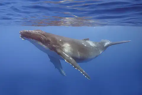
The seas around the islands are a marine reserve where fishing is not allowed except small traditional uses. Humpback whales visit at certain times of year. The whale calf in this photo was taken in French Polynesia.
UNESCO notes that all four of Henderson's land birds are endemic, including the very distinct flightless Henderson crake, that the island is the only known breeding site of the endangered Henderson petrel, and that it holds ten endemic plant taxa. Invasive species are the greatest threat: Polynesian rats introduced centuries ago deplete native birds, and plastic debris washes up on the beaches.
The Pitcairn Islands Marine Reserve, created by the British government on 18 March 2015, covers 834,000 km² as a no-take reserve that allows traditional small-scale uses. Henderson and Ducie have been recognized as important areas for sharks, including grey reef sharks. Humpback whales frequent Pitcairn's waters in season; the calf pictured was photographed off Moorea, French Polynesia.
A very small community
Only about 50 people live on Pitcairn Island.
They grow food, catch fish and make crafts. Islanders keep bees and sell their honey.
Pitcairn has one of the smallest populations of any territory in the world: the government says around fifty people. Most are descended from the Bounty sailors and the Tahitians who came with them.
Britannica describes islanders living on fish, garden produce and crops such as sweet potatoes, taro, bananas and oranges, and keeping bees. Islanders sell honey, stamps, coins and handmade crafts such as carvings and woven baskets. The island got internet access in 2002. In 2023 a marine science base opened on the island.
The government puts the population at around fifty; its tourism department lists 40 (2021). Britannica records 66 in 2008, a decline it links to islanders emigrating to New Zealand. The people are descended from the Bounty mutineers and their Tahitian companions; some descendants have lived on Norfolk Island since 1856.
Britannica describes a diet of fish, garden produce and crops (sweet potatoes, sugarcane, taro, oranges, bananas, coffee), some beekeeping, cash from honey, stamps, coins and tourism, and budgetary aid from Britain; residents gained internet access in 2002. The government promotes over 200 handmade crafts, from carvings to woven baskets. A Marine Science Base for research on climate change and endangered species opened in September 2023.
Polynesians, the Bounty and a marine reserve
Long ago, Polynesian people lived here. Then they left.
Later, sailors from a ship called the Bounty came with friends from Tahiti. Their families still live here.
Stone tools and rock carvings show that people, probably Polynesians, lived on Pitcairn before Europeans came. In 1767 a British ship found the island and named it after the sailor who first saw it.
In 1789 the crew of the British ship HMS Bounty took the ship from its captain. In 1790 the sailors and their Tahitian companions reached Pitcairn, which no one lived on then, came ashore and burned the ship. In 1856 some islanders moved to Norfolk Island. In 2015 Britain created a huge marine reserve around the islands.
Stone tools, burial sites and petroglyphs show earlier inhabitants, probably Polynesian. HMS Swallow found the island in 1767, and Captain Philip Carteret named it for the sailor who first sighted it. In 1789, on a breadfruit voyage from Tahiti, the Bounty's crew, led by first mate Fletcher Christian, mutinied and set Captain William Bligh and loyal sailors adrift; in 1790 the mutineers and Tahitian companions reached uninhabited Pitcairn and burned the ship.
American whalers came upon the community in 1808. Islanders resettled on Tahiti in 1831, but many returned; in 1856 some moved to Norfolk Island because of overpopulation. Pitcairn came under the British high commissioner for the western Pacific in 1898, the governor of Fiji in 1952 and the British High Commissioner in New Zealand in 1970. A constitution followed in 2010, and the marine reserve in 2015.
The Pitcairn Islands on the map
Find the big Pacific Ocean on the globe.
Look far to the south and east of Tahiti. The tiny dots there are the Pitcairn Islands.
The Pitcairn Islands lie about 25 degrees south of the equator in the South Pacific. Tahiti is about 2,170 kilometers to the west-northwest, and Panama is more than 6,600 kilometers away.
The islands are too small for the globe to draw, so PlayOwl marks them with dots: Adamstown and Pawala Valley Ridge on Pitcairn, and the islands of Oeno, Henderson and Ducie.
Pitcairn Island lies at about 25.07° S, 130.10° W. Henderson is 200 km to its northeast, Oeno lies to the northwest and Ducie far to the east; the territory has no land borders.
At the globe's scale the islands have no outlines, so the map uses markers: Adamstown, Bounty Bay, Pawala Valley Ridge (347 m), Oeno, Henderson and Ducie.
- Pitcairn Island
- about 3.2 × 1.6 km
- People
- around 50
- Marine reserve
- 834,000 km²
- Tahiti
- about 2,170 km west-northwest
Amazing facts
-
The road up from the sea is called the Hill of Difficulty.
The steep road from Bounty Bay up to Adamstown is called the Hill of Difficulty.
The government says Adamstown is reached from Bounty Bay by the aptly named Hill of Difficulty.
-
A bird on Henderson Island cannot fly.
The Henderson crake is a bird that cannot fly, and it lives only on Henderson Island.
All four of Henderson's land birds are endemic, including the flightless Henderson crake.
-
The ocean park around Pitcairn is enormous.
The Pitcairn Islands Marine Reserve covers 834,000 square kilometers of ocean.
The Pitcairn Islands Marine Reserve, created on 18 March 2015, protects 834,000 km² of ocean as a no-take reserve.
-
The island got the internet in 2002.
Pitcairn had little contact with the rest of the world until its people got internet access in 2002.
Britannica notes the island had limited contact with the outside world until residents obtained internet access in 2002.
Words to know
- atoll
- a ring-shaped coral island or chain of islands around a lagoon
- marine reserve
- an area of sea where wildlife is protected and fishing is limited or banned
- endemic
- found naturally in only one place in the world
- longboat
- a long open boat rowed or motored between a ship and the shore
- mutiny
- when a ship's crew takes control away from its captain
- overseas territory
- a place far from a country's main land that belongs to that country and governs itself in many ways
Discovery challenge
-
How many of the four islands have people living on them?
How many of the four Pitcairn Islands are inhabited?
Of Pitcairn, Henderson, Ducie and Oeno, how many islands are inhabited?
- One
- Two
- All four
Show the answer
One
Just one, Pitcairn Island.
Only one: Pitcairn Island.
One: Pitcairn Island, with around fifty people.
-
Which ship's sailors came to live on Pitcairn?
The people of Pitcairn are mostly descended from the sailors of which British ship?
Which British ship's mutineers settled uninhabited Pitcairn in 1790?
- Titanic
- HMS Bounty
- Mayflower
Show the answer
HMS Bounty
HMS Bounty!
HMS Bounty. The sailors came with Tahitian companions.
HMS Bounty; the mutineers burned the ship after landing.
-
What is special about the Henderson crake?
What can the Henderson crake NOT do?
The Henderson crake is notable as which kind of bird?
- It cannot fly
- It cannot swim
- It cannot sing
Show the answer
It cannot fly
It cannot fly.
It cannot fly. It lives only on Henderson Island.
A flightless bird, one of Henderson's four endemic land birds.
-
What is the steep road up to the village called?
What is the steep road from Bounty Bay to Adamstown called?
By what name is the road from Bounty Bay up to Adamstown known?
- The Easy Road
- The Hill of Difficulty
- The Long Bridge
Show the answer
The Hill of Difficulty
The Hill of Difficulty!
The Hill of Difficulty.
The Hill of Difficulty, which climbs from Bounty Bay to Adamstown.
Places to discover in Pitcairn Islands
Animals of Pitcairn Islands
Explore next
-
 Watch
 Country
French Polynesia
French Polynesia is a group of about 130 islands in five island chains, spread across the South Pacific. It is an overseas collectivity of France with its own government. Tahiti and its neighbors are tall volcanic islands ringed by coral reefs, while the Tuamotus are low coral atolls. The 2022 census counted 278,786 people.
-
 Watch
 Country
New Zealand
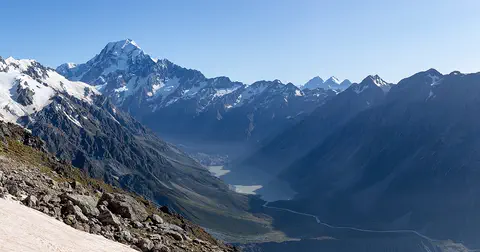
New Zealand, also called Aotearoa, is an island country in the South Pacific. Its two main islands have snowy mountains, glaciers, volcanoes and deep fiords, and about 5.36 million people lived there in 2026.
-
 Watch
 Country
Norfolk Island
Norfolk Island is an Australian territory in the southwestern Pacific, about 1,676 kilometers northeast of Sydney. It is famous for its tall Norfolk Island pines, its old convict buildings at Kingston and its rare birds. Some islanders are descended from the HMS Bounty families who moved here from Pitcairn in 1856.
-
 Watch
 Country
United Kingdom
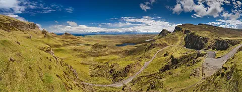
The United Kingdom, or UK, lies on islands off the northwest coast of Europe. It is made up of four parts, England, Scotland, Wales and Northern Ireland, and about 69.5 million people live there. Its capital is London.
-
 Watch
Natural wonder
Easter Island
Easter Island, called Rapa Nui by its first people, is a small volcanic island in the Pacific Ocean, about 3,540 kilometers west of Chile. Polynesian settlers who arrived long ago carved more than 600 giant stone statues, called moai, from the rock of a volcano and set many of them on stone platforms. Today the island's national park is a World Heritage Site cared for by the Rapa Nui people.
-
Watch
3D
Animal
Humpback whale
The humpback whale is a baleen whale famous for leaping out of the water, slapping its giant flippers and singing long, complex songs. It lives in every ocean and makes one of the longest journeys of any mammal, between cold feeding waters and warm waters where calves are born. Once hunted almost to extinction, it is now recovering.
- Watch Geography Islands An island is a piece of land surrounded by water that is smaller than a continent. Islands form in different ways: some broke away from continents, some were built by volcanoes on the sea floor, and some were made by corals or by waves piling up sand. Because they are cut off by water, islands often have unusual plants and animals.
-
 Watch
 Country
Australia
Australia is a country and the smallest continent, surrounded by ocean in the Southern Hemisphere. Much of its middle is dry and flat, most people live near the coast, and its animals include kangaroos, koalas and the platypus, a mammal that lays eggs.
For parents & teachers
What children will learn
- Locate the Pitcairn Islands in the south-central Pacific.
- Describe everyday life in a very small, remote community.
- Describe why Henderson Island is a World Heritage site.
- Explain what a marine reserve protects.
Recommended ages: 3 to 17 · About 15 minutes
Talk about it
- Only around fifty people live on Pitcairn. What jobs would everyone need to share in such a small community?
- Rats brought by people harm Henderson Island's birds. How can visitors avoid bringing new animals to an island?
- Why might people choose to protect a huge area of ocean where almost no one lives?
Try at home or in class
- Plan a supply-ship order: list what a family on a remote island would need to order for three months.
- Measure 3.2 kilometers on a map of your area to see how long Pitcairn Island is.
Key vocabulary: atoll, marine reserve, endemic, longboat, mutiny, overseas territory
Where these facts come from
- Wikidata , Wikimedia Foundation (CC0 1.0)
- Natural Earth vector data , Natural Earth (NACIS) (Public domain)
- Pitcairn Island , Encyclopaedia Britannica
- The Official Website of the Government of the Pitcairn Islands , Government of the Pitcairn Islands
- Visit Pitcairn (Pitcairn Islands Tourism) , Government of the Pitcairn Islands, Tourism Department
- Pitcairn Islands Marine Reserve , Government of the Pitcairn Islands, Tourism Department
- Henderson Island , UNESCO World Heritage Centre
- Pitcairn: islands and settlement (census 1982 to 2008, estimates 2014 and 2020) , City Population (Thomas Brinkhoff)
- PlayOwl region table, version 1 , PlayOwl (PlayOwl original data)
- flag-icons 7.5.0 , Panayiotis Lipiridis and contributors (MIT)
- Wikimedia Commons , Wikimedia Foundation (Per file (public domain, CC0, CC BY or CC BY-SA); see each media record)
Checked, not yet human-reviewed. Last updated November 1, 2026. Spotted a mistake? Tell us.