
Natural wonder Australia and Oceania
Caroline Islands
The Caroline Islands are hundreds of small islands in the Pacific Ocean. Some are made of coral, and some are volcanic islands.
The Caroline Islands are a widely scattered group of islands in the western Pacific Ocean, shared by the Federated States of Micronesia in the east and Palau in the west. They include low coral atolls, volcanic high islands and islands of raised limestone.
The Caroline Islands form a widely scattered archipelago in the western Pacific: the Federated States of Micronesia (607 islands and atolls across about 2,900 km) to the east and the Republic of Palau to the west. Their geology ranges from coral atolls to volcanic high islands, uplifted limestone and, at Yap, raised continental crust (Smithsonian).
Photo: Mr. Ben Mieremet, Senior Advisor OSD, NOAA, public domain, via Wikimedia Commons
Discover the Caroline Islands
The Caroline Islands are spread across the Pacific Ocean. Two countries share them: Micronesia and Palau.
In this photo, a green island sits on a ring of coral reef in blue water.
The Caroline Islands are a widely scattered group of islands in the western Pacific Ocean. The Federated States of Micronesia covers most of them in the east, with 607 islands and atolls stretching about 2,900 kilometers, and Palau lies in the west.
This photo, taken from the air in July 1992 for the US National Oceanic and Atmospheric Administration (NOAA), shows part of Ulithi Atoll: the islet of Falalop in front and a second islet behind, on a reef with a deep pass between the ocean and the lagoon.
The Smithsonian's Flora of Micronesia overview by Dave Lorence describes the Carolines as a widely scattered archipelago, with the Federated States of Micronesia (FSM) to the east, 607 islands and atolls extending 2,900 km across most of the archipelago, and the Republic of Palau in the west.
The hero photo, by Ben Mieremet of NOAA (public domain), shows part of Ulithi Atoll in July 1992: in front the islet of Falalop, and a second islet on the ribbon or barrier reef, separated by a deep pass between the ocean and the lagoon.
- Shared by
- Federated States of Micronesia (east) and Palau (west)
- Federated States of Micronesia
- 607 islands and atolls across about 2,900 km
- Highest island in the FSM
- Pohnpei, 772 m
Volcanoes, coral and raised rock
Some of the islands are volcanic islands with coral reefs around them.
Others are low rings of coral that barely rise above the sea.
The islands of this part of the Pacific range from tiny coral atolls barely rising above the sea to volcanic high islands and raised limestone islands. Pohnpei and Kosrae are volcanic high islands with coral reefs along their shores.
Yap is different: the Smithsonian says its four islands are made of continental crust, lifted up from the Philippine Sea Plate and joined within one coral reef.
The Smithsonian describes Micronesia's geology as complex, with six distinct geological subregions. In the Carolines, Pohnpei (344 km², 772 m) and Kosrae (110 km², 634 m) are volcanic high islands with fringing coral reefs; Yap's four islands are continental crust, formed entirely from an uplift of the Philippine Sea Plate and joined within a common reef; and Chuuk Lagoon holds mountainous volcanic islands inside a barrier reef ringed with coral islets.
Palau mixes volcanic islands (Babeldaob, 331 km², 242 m), coral reefs and atolls, low platform islands and uplifted limestone islands.
Palau's Rock Islands
In Palau, hundreds of rocky islands look like mushrooms.
They sit in bright blue-green water.
Palau's Rock Islands are a UNESCO World Heritage site. UNESCO says the site has 445 uninhabited limestone islands of volcanic origin, many shaped like mushrooms, in turquoise lagoons surrounded by coral reefs.
It also has more marine lakes than anywhere else: pools of seawater cut off from the ocean by land.
UNESCO's Rock Islands Southern Lagoon covers 100,200 ha with 445 uninhabited limestone islands of volcanic origin, many with mushroom-like shapes, in turquoise lagoons surrounded by coral reefs. The Smithsonian counts over 300 Rock Islands in central and southern Palau, many steep-sloped and mushroom-shaped.
UNESCO adds that the site holds the highest concentration of marine lakes anywhere, isolated bodies of seawater separated from the ocean by land barriers, whose high endemism continues to yield new species.
Corals, sharks and island plants
Many kinds of coral, fish and sharks live around the islands.
Some plants grow here and nowhere else.
UNESCO says the Rock Islands' reefs have over 385 kinds of coral, and the waters are home to dugongs and at least thirteen kinds of sharks.
On land, the Smithsonian notes that about 364 kinds of plants are found only in Micronesia, most of them in the Caroline Islands and many only in Palau.
UNESCO describes a complex reef system with over 385 coral species and a large diversity of plants, birds and marine life, including dugong and at least thirteen shark species.
The Smithsonian places Micronesia within the Polynesia-Micronesia biodiversity hotspot and cites an estimate of 364 vascular plant species endemic to Micronesia, most occurring in the Caroline Islands, with a large percentage restricted to Palau.
Visiting safely
The islands are surrounded by the ocean.
Near water, always stay close to your grown-up and wear a life jacket on a boat.
The Caroline Islands are surrounded by the Pacific Ocean. The US Centers for Disease Control and Prevention (CDC) says life jackets lower the risk of drowning while boating, and that children should wear them for all activities in and around natural water.
Grown-ups should watch children closely whenever they are near water.
The CDC advises that life jackets reduce the risk of drowning while boating for people of all ages and swimming abilities, that children should use them for all activities in and around natural water, and that adults should supervise children closely even when lifeguards are present.
Amazing facts
-
Some islands in Palau are shaped like mushrooms!
Many of Palau's Rock Islands are limestone islands shaped like mushrooms, sitting in turquoise lagoons.
UNESCO describes many of the 445 Rock Islands as having unique mushroom-like shapes in turquoise lagoons surrounded by coral reefs.
-
The islands of Yap are made of the same kind of rock as big continents.
Yap's four islands are made of continental crust that was pushed up from the Philippine Sea Plate.
The Smithsonian notes that Yap's four islands are continental crust, formed entirely from an uplift of the Philippine Sea Plate and joined within one coral reef.
-
Palau has lakes of seawater cut off from the sea.
Palau's Rock Islands have more marine lakes, pools of seawater walled off from the ocean by land, than anywhere else.
UNESCO: the Rock Islands Southern Lagoon holds the highest concentration of marine lakes anywhere, and their endemic populations continue to yield new species.
Words to know
- archipelago
- a group or chain of islands
- atoll
- a ring-shaped coral reef or chain of coral islands around a lagoon
- lagoon
- a shallow body of water separated from the open sea by a reef or islands
- high island
- an island made of volcanic rock that rises well above the sea, unlike a low coral island
- marine lake
- a pool of seawater cut off from the ocean by land
Discovery challenge
-
Which two countries share the Caroline Islands?
Which two countries share the Caroline Islands?
Which two countries share the Caroline archipelago, east and west?
- Micronesia and Palau
- Japan and China
- Fiji and Samoa
Show the answer
Micronesia and Palau
Micronesia and Palau.
The Federated States of Micronesia and Palau.
The Federated States of Micronesia (east) and the Republic of Palau (west).
-
What are some of the islands made from?
What kind of islands are Pohnpei and Kosrae?
How does the Smithsonian classify Pohnpei and Kosrae?
- Volcanic high islands
- Ice islands
- Sand dunes
Show the answer
Volcanic high islands
Some are old volcanoes.
Volcanic high islands with coral reefs.
Volcanic high islands with fringing coral reefs.
-
What shape are many of Palau's Rock Islands?
What shape does UNESCO say many of Palau's Rock Islands have?
Which shape distinguishes many of the 445 limestone Rock Islands, according to UNESCO?
- Mushroom shapes
- Perfect squares
- Star shapes
Show the answer
Mushroom shapes
Like mushrooms.
Mushroom-like shapes.
Mushroom-like limestone islands in turquoise lagoons.
-
What is a marine lake filled with?
What water fills Palau's marine lakes?
How does UNESCO describe the water of the Rock Islands' marine lakes?
- Seawater cut off by land
- Melted snow
- Hot spring water
Show the answer
Seawater cut off by land
Seawater that land has cut off from the sea.
Seawater, cut off from the ocean by land.
Land barriers isolate these bodies of seawater from the ocean.
-
What should children wear on a boat?
What does the CDC say children should wear for all activities in and around natural water?
According to the CDC, what reduces the risk of drowning while boating for people of all ages?
- A life jacket
- A foam toy
- A sun hat
Show the answer
A life jacket
A life jacket.
A life jacket, for all activities in and around natural water.
A life jacket, for people of all ages and swimming abilities.
Nearby places
- Watch Natural wonder Mariana Trench The Mariana Trench is a long, curving valley in the floor of the western Pacific Ocean, near the island of Guam. Its deepest spot, the Challenger Deep, is the deepest place known in the whole ocean, close to 11,000 meters down. If Mount Everest stood on the bottom, its peak would still be about 2 kilometers under water.
-
 Watch
City
Palikir
Palikir is the capital of the Federated States of Micronesia, on the mountainous island of Pohnpei in the Pacific Ocean. It is a small place: Larousse gives an estimate of 6,696 people for 2011, and the 2023 census counted 4,903 in the municipality of Sokehs, which includes Palikir.
-
 Watch
Landmark
Kuk Swamp
Kuk Swamp is a wetland in the highlands of Papua New Guinea, about 1,500 meters above sea level. Digging there has shown that people have farmed it almost without a break for 7,000 years, and possibly for 10,000 years. It became a UNESCO World Heritage Site in 2008.
-
 Watch
Natural wonder
Lorentz National Park
Lorentz National Park, on the island of New Guinea in Indonesia, covers about 2.35 million hectares. UNESCO calls it the largest protected area in Southeast Asia and the only one in the world that runs unbroken from snow-capped peaks to a tropical sea.
-
 Watch
City
Port Moresby
Port Moresby is the capital of Papua New Guinea, on the south coast of the island of New Guinea. Traders and missionaries came to the area, home of the Motu people, from 1874. The city has grown very fast: the 2024 census counted 756,754 people in its National Capital District.
-
 Watch
City
Honiara
Honiara is the capital of the Solomon Islands, in the southwest Pacific Ocean. It lies on the north coast of Guadalcanal, the country's largest island, where the Matanikau River meets the sea. The 2019 census counted 130,176 people in the city.
-
 Watch
Natural wonder
Mount Apo
Mount Apo, on the island of Mindanao, is the highest mountain in the Philippines. It is a volcano with hundreds of sulfur vents on its upper slopes, and its forests are a stronghold of the critically endangered Philippine eagle.
-
 Watch
City
Cagayan de Oro
Cagayan de Oro is a city in the north of Mindanao, one of the two biggest islands of the Philippines. The encyclopedia Larousse calls it a farm market and a center of gold mining. The Philippines' 2024 census counted 741,617 people in the city.
Explore next
-
 Watch
Natural wonder
Great Barrier Reef
The Great Barrier Reef stretches about 2,300 kilometers along the coast of Queensland, Australia. It is made of about 2,500 separate reefs and more than 900 islands, built by tiny coral animals, and it is home to more than 1,500 kinds of fish.
-
 Watch
Natural wonder
Pacific Ocean
The Pacific Ocean is the largest and deepest ocean basin on Earth, covering more than 30 percent of the planet's surface. It holds more than half of Earth's free water. Its deepest point, Challenger Deep in the Mariana Trench, is nearly 11 kilometers down, and earthquakes and volcanoes ring its edges.
- Watch Natural wonder Mariana Trench The Mariana Trench is a long, curving valley in the floor of the western Pacific Ocean, near the island of Guam. Its deepest spot, the Challenger Deep, is the deepest place known in the whole ocean, close to 11,000 meters down. If Mount Everest stood on the bottom, its peak would still be about 2 kilometers under water.
-
 Watch
 Country
Palau
Palau is a country of about 340 coral and volcanic islands in the western Pacific, in Micronesia. A huge barrier reef surrounds most of them, and the Rock Islands, hundreds of green limestone islands in a turquoise lagoon, are a UNESCO World Heritage site. Palau became independent in 1994. Its 2025 census counted 16,491 people.
-
 Watch
 Country
Micronesia
The Federated States of Micronesia is a country in the western Pacific made of four states: Yap, Chuuk, Pohnpei and Kosrae. Its islands range from high islands to low coral atolls, spread across about 2,800 kilometers of ocean. Off Pohnpei lie the stone ruins of Nan Madol, a World Heritage site. The 2023 census counted 75,817 people.
-
 Watch
Natural wonder
Uluru
Uluru is a huge sandstone rock in the desert of central Australia, rising 348 meters above the plain, with a base 9.4 kilometers around. The Anangu are its Traditional Owners, and the national park around it is run by Anangu and Parks Australia together.
-
 Watch
Natural wonder
Aoraki / Mount Cook
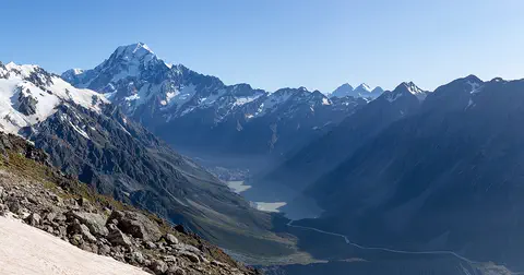
Aoraki / Mount Cook is New Zealand's highest mountain, in the Southern Alps of the South Island. Its name joins its Māori name, Aoraki, with its English name, Mount Cook. The mountain is being pushed up where two of Earth's plates meet, and glaciers carve the valleys around it. In 2013 surveyors measured it at 3,724 meters.
-
 Watch
Natural wonder
Kakadu National Park
Kakadu, in Australia's Northern Territory, is the country's largest national park. It stretches from a high sandstone cliff called the escarpment down to floodplains, mangroves and the sea. Aboriginal people have lived here for tens of thousands of years, and their rock paintings, some up to 20,000 years old, record their way of life.
For parents & teachers
What children will learn
- Locate the Caroline Islands in the western Pacific, shared by Micronesia and Palau.
- Tell apart coral atolls, volcanic high islands and raised limestone islands.
- Describe Palau's Rock Islands and marine lakes.
- Know how to stay safe near water and on boats.
Recommended ages: 3 to 17 · About 15 minutes
Talk about it
- Why might islands made of different rocks look so different from the air?
- How could a lake of seawater end up cut off from the ocean?
- Why might islands far apart in the ocean have plants found nowhere else?
Try at home or in class
- On a map of the Pacific, find Palau, Yap, Chuuk, Pohnpei and Kosrae and measure how far apart they are.
- Draw an island from above, then draw a ring of reef around it with a gap for a pass, like Ulithi in the photo.
Key vocabulary: archipelago, atoll, lagoon, high island, marine lake
Where these facts come from
- Wikidata , Wikimedia Foundation (CC0 1.0)
- Flora of Micronesia: Geographic Overview , Smithsonian National Museum of Natural History, Department of Botany
- Rock Islands Southern Lagoon , UNESCO World Heritage Centre
- Preventing Drowning , US Centers for Disease Control and Prevention
- File:Mvey0290.jpg , Wikimedia Commons
- Natural Earth vector data , Natural Earth (NACIS) (Public domain)
- Wikimedia Commons , Wikimedia Foundation (Per file (public domain, CC0, CC BY or CC BY-SA); see each media record)
Checked, not yet human-reviewed. Last updated November 1, 2026. Spotted a mistake? Tell us.
Picture credits
- Photo: Mr. Ben Mieremet, Senior Advisor OSD, NOAA, public domain, via Wikimedia Commons · source