
Natural wonder North America
Niagara Falls
Niagara Falls is a group of big waterfalls between Canada and the United States. A huge amount of water rushes over them every minute. The spray makes a misty cloud.
Niagara Falls is a set of three waterfalls on the Niagara River, which flows from Lake Erie to Lake Ontario across the border between Canada and the United States. About 500 waterfalls in the world are taller, but Niagara is famous for its height together with the enormous amount of water that pours over it.
Niagara Falls straddles the Canada–United States border on the Niagara River, the 58 km channel linking Lake Erie and Lake Ontario. Born when the last ice sheets melted about 12,500 years ago, the falls have cut back about seven miles to form the Niagara Gorge, through a hard cap of dolostone and limestone above softer shales and sandstones.
Photo: Mariomaster1589 at English Wikipedia, CC BY-SA 3.0, via Wikimedia Commons
Discover Niagara Falls
Niagara Falls is made of three waterfalls.
They are on a river between Canada and the United States. Lots and lots of water rushes over the edge. It falls down with a loud roar and makes clouds of mist.
Niagara Falls is on the Niagara River, which carries water from Lake Erie to Lake Ontario, two of North America's Great Lakes. The river is the border between Canada and the United States, and the falls straddle that border.
The three are the Horseshoe Falls, the American Falls and the small Bridal Veil Falls. The biggest, the Horseshoe Falls, is curved like a horseshoe; it drops about 57 meters and is about 670 meters wide. The American Falls is about 260 meters wide. Niagara is not especially tall: about 500 waterfalls around the world are taller. What makes it amazing is how much water goes over: more than 168,000 cubic meters every minute at busy daytime hours.
The Niagara River runs 58 km (36 miles) north from Lake Erie to Lake Ontario, and the elevation difference between the lakes is about 99 m, half of it at the falls. The Niagara Parks Commission gives the Canadian Horseshoe Falls an average drop of 57 m (188 ft) and a crest about 670 m (2,200 ft) wide, above a plunge pool 35 m deep. The American Falls drops 21 to 34 m to the talus slope of fallen rock at its base, or 57 m to the river, and its crest is about 260 m (850 ft) wide.
Niagara Parks notes that about 500 waterfalls in the world are taller; it is the combination of height and volume that impresses. Under the 1950 Niagara Treaty between Canada and the United States, the flow over the falls must be at least 2,832 m³ per second in daylight hours of the tourist season and 1,416 m³ per second at other times; the rest may be diverted to make hydroelectric power.
- Horseshoe Falls: drop
- about 57 m (188 ft) on average
- Horseshoe Falls: crest width
- about 670 m (2,200 ft)
- American Falls: crest width
- about 260 m (850 ft)
- Niagara River
- 58 km, from Lake Erie to Lake Ontario
Made by the Ice Age
Long ago, thick ice covered this land.
When the ice melted, the water filled big lakes. A river flowed from one lake to another. Where it fell over a cliff, Niagara Falls began.
About 18,000 years ago, during the last Ice Age, sheets of ice two to three kilometers thick covered this part of North America. As the ice moved, it dug out the basins of the Great Lakes. When it melted, it filled them with water.
About 12,500 years ago the land around Niagara was free of ice, and meltwater began to flow from Lake Erie to Lake Ontario. Where it poured over a steep slope called the escarpment, at Queenston and Lewiston, the first Niagara Falls began. Since then the falls have worn their way back about 11 kilometers (seven miles) upstream, leaving the deep Niagara Gorge behind them.
Niagara Parks describes the river and the whole Great Lakes Basin as a legacy of the last Ice Age: 18,000 years ago southern Ontario lay under ice two to three kilometers thick, which gouged out the lake basins and then filled them with meltwater. The Niagara Peninsula became ice-free about 12,500 years ago, and of five original spillways from Lake Erie to Lake Ontario, one survived: the first falls, at the escarpment at Queenston-Lewiston.
About 10,500 years ago, ice re-advances and isostatic rebound rerouted the meltwater through northern Ontario; for some 5,000 years Lake Erie was half its present size, the river carried about 10 percent of its present flow, and the reduced falls stalled near the Niagara Glen. Full flow returned about 5,500 years ago. Since its birth the falls have receded about seven miles, carving the 11 km Niagara Gorge through rock layers laid down as sediments in tropical, saltwater seas some 400 to 440 million years ago.
A waterfall on the move
The falls are slowly moving backward up the river.
Water, spray and ice wear away the rock. Sometimes big pieces of rock break off and fall. Today the falls move much more slowly than before.
At the top of the falls is a layer of hard rock, dolostone and limestone. Under it are softer rocks called shales and sandstones. Frost from the spray, the spray itself and fallen boulders grinding against the soft shale all wear the rock away, and from time to time big pieces of rock fall. Bit by bit, the edge of the falls moves back.
Niagara Parks estimates that for at least the last 560 years the falls moved back about 1 to 1.5 meters a year. Today much of the river's water is taken away to make electricity and the flow is controlled, so the falls wear back far more slowly: about 30 centimeters (1 foot) a year by Niagara Parks' estimate, or 8 to 15 centimeters (3 to 6 inches) by New York State Parks'.
Erosion at Niagara acts on a resistant cap of Lockport Group dolostones and limestones over less resistant shales and sandstones such as the Rochester Shale, as New York State Parks describes the escarpment. Niagara Parks lists frost action from the spray, the dissolving action of the spray and abrasion of the softer shales by fallen limestone boulders, plus cavitation at the base, where collapsing bubbles send shock waves into the rock. It adds that the crest retreats relatively rapidly when it develops a notch, until a new stable position is reached.
Niagara Parks estimates recession over at least the last 560 years at 1 to 1.5 m a year; with flow control and hydroelectric diversion it puts the current rate at about 1 foot a year, possibly falling to 1 foot per 10 years, while noting that the current rate is unclear. New York State Parks gives 3 to 6 feet a year in the past and 3 to 6 inches a year now. Niagara Parks reports that scientists speculate the American Falls, which carried less than 7 percent of the flow even before diversion, could dry up in perhaps 2,000 years, while the Horseshoe Falls may notch back about four more miles over 15,000 years until it reaches soft Salina shale.
Birds of the river
In fall and winter, many gulls come to the Niagara River.
They catch small fish to eat. They rest on the river away from storms. Sometimes the air over the gorge is white with gulls!
The Niagara River is an important stop for birds. In fall and winter, as many as 100,000 gulls stop over on the river. It gives them plenty of small fish to eat, a resting place on their long journeys from the Arctic to the Atlantic coast, and shelter from winter storms on the Great Lakes.
Because it matters so much to birds, the river corridor has been named an Important Bird Area. Bonaparte's gulls, ring-billed gulls and herring gulls gather here in big numbers, along with many kinds of ducks and other waterbirds.
New York State Parks notes that as many as 100,000 gulls stop over on the Niagara River during fall and winter, drawn by small fish, shelter from Great Lakes storms and a resting place on migrations from the Arctic to the Atlantic coast. The corridor has been designated an Important Bird Area by the Audubon Society.
Audubon's description, quoted by the park service, highlights the river as a migratory stopover and wintering site for Bonaparte's gulls, with one-day counts of 10,000 to 50,000 birds, 2 to 10 percent of the world population, and one-day counts of 10,000 to 20,000 ring-billed gulls and 10,000 to 50,000 herring gulls, along with a remarkable diversity and abundance of waterfowl. The water itself is ancient too: Niagara Parks calls it fossil water, mostly left from the ice sheets, with less than 1 percent renewed each year.

Visiting safely
The river near the falls is very fast and very deep.
Never go into the water. Stay on the marked paths. Take only pictures, and leave rocks and plants where they are.
Niagara Parks reminds visitors that the river is beautiful but fast, deep and very dangerous, and swimming is not allowed. Even calm-looking spots near the shore can have a strong undertow, an invisible current under the surface. The Whirlpool Rapids in the gorge move at more than 40 kilometers per hour.
Stay on marked trails, which keep a safe distance from the water; hiking on closed or unmarked trails is dangerous. Wear sturdy shoes, carry water, and remember that every step down into the gorge is a step you must climb back up. Leave no trace: take only pictures, leave only footsteps, and leave rocks and plants where you found them.
Niagara Parks' trail etiquette asks visitors to stay on sanctioned, marked trails, which are a safe distance from the water, and warns that hiking on closed or unmarked trails can result in serious injury; in 2021 it said the Niagara Parks Police were patrolling the Glen and the Whirlpool Trail to enforce park regulations. Swimming is not permitted: the Whirlpool Rapids are rated Class 6, move at over 40 km/h, and even calm-looking shorelines have a strong undertow.
The Glen trails are rated moderate and the Whirlpool Trail difficult. Visitors are asked to wear supportive footwear, drink about one liter of water for every two hours of hiking, know their limits and avoid the jagged, uneven shoreline. Leave-no-trace rules ask people not to touch cultural and historic structures or artifacts and to leave rocks, plants and other natural objects as they found them.
Amazing facts
-
About 500 waterfalls are taller than Niagara Falls.
Niagara is not the tallest waterfall: about 500 others are taller. Its power comes from the huge amount of water.
Niagara Parks notes that about 500 waterfalls are taller; Niagara impresses through the combination of height and volume.
-
The Niagara River flows north.
The Niagara River flows north, from Lake Erie down to Lake Ontario.
Although the Great Lakes Basin slopes from west to east toward the Atlantic, the Niagara River itself flows north from Lake Erie to Lake Ontario.
-
The river looks green because of tiny bits of rock.
The Niagara River's green color comes from dissolved salts and rock flour, very finely ground rock.
An estimated 60 tons of dissolved minerals go over Niagara Falls every minute; dissolved salts and rock flour give the river its green color.
-
Niagara Falls State Park is very old.
Niagara Falls State Park, on the American side, was created in 1885 and is the oldest state park in the United States.
Created in 1885, Niagara Falls State Park is, according to New York State Parks, the oldest state park in the United States.
Words to know
- escarpment
- a long, steep slope or cliff where high land drops to lower land
- gorge
- a deep, narrow valley with steep rocky sides
- ice sheet
- a huge, thick layer of ice covering a large area of land
- shale
- a soft rock made from pressed mud or clay
- undertow
- a strong current under the surface of the water, pulling away from the shore
- hydroelectric power
- electricity made by moving water turning machines
Discovery challenge
-
Which two countries share Niagara Falls?
Niagara Falls is on the border between which two countries?
The Niagara River forms part of the border between which two countries?
- Canada and the United States
- Mexico and the United States
- Brazil and Argentina
Show the answer
Canada and the United States
Canada and the United States share Niagara Falls.
The Niagara River is the border between Canada and the United States, and the falls straddle it.
The river runs 58 km from Lake Erie to Lake Ontario along the Canada–United States border.
-
What made the big lakes and Niagara Falls long ago?
What dug out the Great Lakes and led to Niagara Falls?
Which event created the Great Lakes Basin and, about 12,500 years ago, the first Niagara Falls?
- A volcano
- Ice sheets that melted after the Ice Age
- An earthquake
Show the answer
Ice sheets that melted after the Ice Age
Thick ice dug the lakes. When it melted, the water flowed and the falls began.
Ice sheets two to three kilometers thick dug the lake basins, and their meltwater filled them.
The last glaciation gouged the basins; the peninsula was ice-free about 12,500 years ago, when the falls formed at the escarpment.
-
Which way are the falls slowly moving?
Over time, which way have Niagara Falls moved?
In which direction has Niagara Falls receded, carving the Niagara Gorge?
- Back up the river, toward Lake Erie
- Down the river, toward Lake Ontario
- They never move
Show the answer
Back up the river, toward Lake Erie
They move back up the river, very slowly.
The falls have moved about 11 kilometers back upstream since they began.
They have receded about seven miles upstream from the Queenston-Lewiston escarpment, toward Lake Erie.
-
Why do the falls move more slowly now?
Why do the falls wear back more slowly today?
According to Niagara Parks, what has greatly reduced Niagara's rate of recession?
- Because the rock turned to ice
- Because some water is taken away to make electricity
- Because the river got deeper
Show the answer
Because some water is taken away to make electricity
People take some water away to make electricity.
Much of the river's water is diverted to make electricity and the flow is controlled.
Flow control and diversion for hydroelectric generation have greatly reduced the erosion rate.
-
Is it safe to swim in the Niagara River?
What do Niagara Parks' rules say about swimming in the river?
Does Niagara Parks permit swimming in the Niagara River, and why?
- Yes, it is calm and warm
- Only near the falls
- No, it is fast, deep and dangerous
Show the answer
No, it is fast, deep and dangerous
No! The river is very fast and deep. Stay out of the water.
Swimming is not permitted: the river is fast and deep, with strong undertows even in calm-looking spots.
The Class 6 Whirlpool Rapids exceed 40 km/h and the shore has invisible undertows, so swimming is prohibited.
Nearby places
-
 Watch
Landmark
CN Tower
The CN Tower in Toronto is 553 meters tall. It was built between 1973 and 1975 so that radio and TV signals could reach over the city's new tall buildings. For more than 30 years it was the tallest freestanding structure in the world, and today more than two million people visit it every year.
-
 Watch
City
Ottawa
Ottawa is the capital of Canada. It stands where three rivers meet, beside the Ottawa River, which divides the provinces of Ontario and Quebec. It began as a lumber town called Bytown, became the capital in 1857, and had 1,017,449 people at the 2021 census.
-
 Watch
Landmark
Statue of Liberty
The Statue of Liberty stands on Liberty Island in New York Harbor. France gave her to the United States as a sign of friendship. The sculptor Auguste Bartholdi shaped her copper skin, Gustave Eiffel designed the iron frame inside, and she was dedicated in 1886.
-
 Watch
Landmark
Metropolitan Museum of Art
The Metropolitan Museum of Art, or the Met, stands on Fifth Avenue at the edge of Central Park in New York City. Founded in 1870, it is the largest art museum in the city, with art from ancient Egypt to today. Its grand front, with three arches and pairs of columns, was finished in 1902.
-
 Watch
Landmark
Empire State Building
The Empire State Building rises 1,454 feet (443 meters) over Fifth Avenue in New York City. Its steel frame went up at about four and a half floors a week, and the whole building was finished in one year and 45 days, opening on May 1, 1931.
-
 Watch
City
New York City
New York City sits where the Hudson River meets a great harbor on the Atlantic coast. It has been the largest city in the United States since 1790. About 8.8 million people lived in its five boroughs in 2020, among skyscrapers, bridges and parks.
-
 Watch
Landmark
White House
The White House in Washington, D.C. is the home and office of the President of the United States. Building began in 1792, and President John Adams moved in on November 1, 1800. Its sandstone walls are painted white, and today it has 132 rooms.
-
 Watch
City
Washington, D.C.
Washington, D.C., is the capital of the United States, on the Potomac River. It was planned from scratch in the 1790s, with wide avenues, the U.S. Capitol, the White House and a long green park called the National Mall. About 690,000 people lived there in 2020.
Experiments to try
Explore next
-
 Watch
 Country
Canada
Canada is the second-largest country in the world, stretching across the north of North America from the Atlantic to the Pacific and up into the Arctic. It has the Rocky Mountains, thousands of islands and about 42 million people, who speak English, French and many other languages.
-
 Watch
 Country
United States
The United States is a large country in North America made of 50 states, from icy Alaska to the warm islands of Hawaii. It has the Grand Canyon, the Mississippi River and Yellowstone, and about 342 million people live there.
-
 Watch
Natural wonder
Victoria Falls
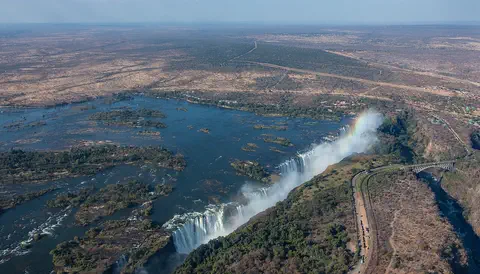
Victoria Falls, on the Zambezi River between Zambia and Zimbabwe, is about 1,708 meters wide and up to 108 meters deep. UNESCO calls it the largest curtain of falling water in the world, and its spray can be seen from tens of kilometers away.
- Watch What If? Lab What if an ice age came back? About 20,000 years ago, ice sheets more than 3,000 meters thick covered much of North America, and the sea was about 125 meters lower than today. Ice ages come and go over tens of thousands of years as Earth's orbit and tilt slowly change. Imagine an ice age returning, and follow what might change.
-
Watch
Landmark
CN Tower
The CN Tower in Toronto is 553 meters tall. It was built between 1973 and 1975 so that radio and TV signals could reach over the city's new tall buildings. For more than 30 years it was the tallest freestanding structure in the world, and today more than two million people visit it every year.
-
 Watch
Natural wonder
Angel Falls
Angel Falls is a waterfall in Canaima National Park in Venezuela. It pours off the cliff of Auyán-tepui, a giant table-shaped mountain, and falls about 979 meters. UNESCO calls it the world's highest waterfall.
-
 Watch
Natural wonder
Grand Canyon
The Grand Canyon is a huge, steep-sided canyon in Arizona carved by the Colorado River. It is about 447 kilometers long and, on average, 1.6 kilometers deep, and its walls show layers of rock almost two billion years old.
-
 Watch
Natural wonder
Yellowstone National Park
Yellowstone National Park sits on top of a giant volcano in the western United States. Heat from melted rock deep underground powers more than 10,000 hot springs, geysers, mudpots and steam vents, and the park is home to bison, wolves and two kinds of bears.
For parents & teachers
What children will learn
- Locate Niagara Falls between Lake Erie and Lake Ontario on the Canada–US border.
- Explain how the last Ice Age created the Great Lakes and the falls.
- Describe how erosion and rock falls make a waterfall retreat, and why it is slower today.
- Name Niagara Parks' safety rules for trails and the river.
Recommended ages: 3 to 17 · About 15 minutes
Talk about it
- Why do you think a waterfall with a hard top and soft bottom moves backward over time?
- People take water from the river to make electricity. What are the good and bad sides of that?
- Why might so many birds choose a river for their winter stop?
Try at home or in class
- Build a small step from a hard biscuit on top of soft sponge cake; drip water on the edge and watch the soft layer go first.
- Press a block of ice into a tray of damp sand and let it melt; look at the water-filled hollow it leaves behind, like a tiny lake basin.
Key vocabulary: escarpment, gorge, ice sheet, shale, undertow, hydroelectric power
Where these facts come from
- Wikidata , Wikimedia Foundation (CC0 1.0)
- Natural Earth vector data , Natural Earth (NACIS) (Public domain)
- Niagara Falls Geology Facts & Figures , Niagara Parks Commission
- Trail Etiquette & Safety , Niagara Parks Commission
- Niagara Parks Reminds Trail Users of the Importance of Safety , Niagara Parks Commission
- Niagara Rocks! , New York State Parks and Historic Sites
- American, Horseshoe and Bridal Veil Falls: A Primer , Destination Niagara USA
- Gorge-ous Gulls of the Niagara in Winter , New York State Parks and Historic Sites
- Wikimedia Commons , Wikimedia Foundation (Per file (public domain, CC0, CC BY or CC BY-SA); see each media record)
Checked, not yet human-reviewed. Last updated October 24, 2026. Spotted a mistake? Tell us.