
City Europe
Venice
Venice is a city in Italy built on little islands. Instead of streets for cars, it has canals full of boats. People walk over hundreds of bridges.
Venice, in northern Italy, is spread over 118 small islands in a shallow lagoon off the Adriatic Sea. There are no cars in the old city: people walk or travel by boat along its canals, past palaces and over about 400 bridges. High tides sometimes flood its squares, so giant gates now protect the lagoon.
Venice grew on 118 islets in the Venetian Lagoon into a maritime republic that was, for centuries, Europe's great link with Asia, until it fell in 1797. A UNESCO World Heritage Site since 1987, it now faces subsidence, rising seas and the acqua alta; since 2020 the MOSE barriers' 78 gates have closed the lagoon inlets against high tides.
Photo: European Space Agency, CC BY-SA 3.0 igo, via Wikimedia Commons
Discover Venice
Venice is a city in Italy.
It is built on lots of little islands in shallow water. The streets are canals, filled with boats. People walk everywhere, over hundreds of little bridges.
Venice is a city in northern Italy, at the top of the Adriatic Sea. Its old center is spread over 118 small islands in a shallow, crescent-shaped lagoon, joined together by canals and about 400 bridges. Cars cannot drive there, so people walk or ride boats.
The whole city area, called the comune, also includes towns on the mainland, such as Mestre. About 249,000 people lived in the comune in 2025, but by the early 2000s fewer than one in four of them lived in the old island city.
Venice, capital of the Veneto region, lies on an archipelago in the Laguna Veneta, a crescent-shaped lagoon about 51 km long at the northwestern end of the Adriatic. UNESCO describes the historic city as spread over 118 small islands; Britannica counts more than 200 original canals and about 400 bridges.
The administrative comune reaches around the lagoon's 145 km perimeter, taking in the mainland districts of Mestre and Marghera and the Marco Polo airport. Italy's statistics office, ISTAT, counted 249,490 residents in the comune in 2025. The historic center's share has fallen steadily: about three-fourths at the start of the 20th century, more than half at mid-century, and less than one-fourth by the early 21st century.
- Country
- Italy (capital of the Veneto region)
- People in the whole comune (2025)
- about 249,000
- Islands in the historic city
- 118
- Bridges
- about 400
Famous places
Venice has a giant square called St. Mark's Square.
At one end is a church with round domes and shiny gold pictures. A tall brick bell tower stands nearby. The biggest canal curves through the city like a long letter S.
St. Mark's Square is a huge paved square lined with arches. At one end stands St. Mark's Basilica, finished in 1071, with five arched doorways, five domes and shining mosaics above its arches. Next to it rises the Campanile, a 99-meter brick bell tower.
The Grand Canal, Venice's main waterway, curves through the city in a giant backward S for more than 3 kilometers. Palaces built by rich merchant families line its banks. Only four bridges cross it; the most famous is the Rialto Bridge, from about 1590.
The Piazza San Marco, a vast paved and arcaded square, opens before the five portals of St. Mark's Basilica. The first church on the site was begun in 829; the present basilica, distinctly Byzantine in design and topped by five domes, was completed in 1071, and over the centuries sculpture, mosaics and treasures were added. The 99 m Campanile collapsed in 1902 and was rebuilt around a reinforced-concrete core by 1912.
The Grand Canal describes a backward S more than two miles (3 km) long, from the railway station to the basin before the Doges' Palace, 30 to 70 m wide and lined with merchants' palaces and warehouses. Four bridges span it: the Rialto Bridge by Antonio da Ponte (about 1590), the Accademia (1930s), the marble Scalzi Bridge (1932) and Santiago Calatrava's Constitution Bridge (2008). The Teatro La Fenice is an opera house.
- St. Mark's Basilica
- present church completed 1071
- Campanile (bell tower)
- 99 m; rebuilt 1902–1912
- Rialto Bridge
- about 1590
- Grand Canal
- more than 3 km long, 30–70 m wide

A republic on the water
Long ago, fishers and salt workers lived on the lagoon islands.
Then more people came to stay safe. They joined the islands with bridges and canals. Venice grew rich by sending ships to trade with faraway lands.
At first, the islands of the lagoon were home to fishers and salt workers. From the year 568, raids on the mainland drove many more people onto the islands, where the water kept them safe. The islanders chose a leader called the doge.
Venice became a sea power. Its ships carried goods between Europe and Asia, and its great shipyard, the Arsenal, built the ships. For about a thousand years Venice ruled itself as a republic. That ended in 1797, when Napoleon's armies came and the last doge was removed from power. In 1866 Venice became part of Italy.
Settlement in the lagoon predates Roman times, but the present city took shape in the early 7th century, as mainlanders fleeing the Lombard incursions that began in 568 joined fishing and salt-working communities on the higher mudflats. Rivo Alto, later Rialto, became the center, linking the islands with bridges and canals under an elected doge; by 840–841 the doge was negotiating treaties in his own name.
Venice grew into the greatest seaport of late medieval Europe and its commercial link with Asia; the Fourth Crusade, which sacked Constantinople in 1204 with the doge Enrico Dandolo among its leaders, brought it a share of Byzantine territory. From the early 15th century it also ruled a large mainland empire. The republic ended when the last doge, Ludovico Manin, was deposed on May 12, 1797; Venice passed to Austria, and in 1866 it was ceded to Italy. In 1846 a railway causeway nearly 3 km long, on 222 arches, joined it to the mainland.

Boats and bridges
In Venice, people walk or ride boats.
Water buses carry people along the canals. Long black boats called gondolas glide by. Even the garbage and the ambulance travel by boat!
Venice is a walking city. Cars are banned except in two big parking areas, so people go everywhere on foot, along canal banks and over about 400 bridges.
On the water, public water buses called vaporetti work like city buses, and water taxis zip about. Special boats carry fruit and vegetables, garbage, luggage, police and even ambulances. Only several hundred gondolas, long black boats rowed by a gondolier, are left, and a few still ferry people across the Grand Canal. A railway causeway, built in 1846, links the islands to the mainland.
Britannica calls Venice a walking city: apart from the large parking areas at Piazzale Roma and on the Lido, automobiles are banned, and any point can be reached on foot along canal banks, paved streets, squares and some 400 bridges, many of them 19th-century wrought-iron replacements for arched marble ones.
The waterways carry everything else: vaporetti run by the municipal transport company, private motor-launch taxis, and barges for fruit and vegetables, garbage and tourists' baggage, alongside ambulance and police launches. Only several hundred keelless gondolas remain, a few serving as Grand Canal ferries. The 1846 railway causeway, nearly 3 km long on 222 arches, ended the city's isolation from the mainland, and the Constitution Bridge (2008) now links the station to Piazzale Roma.
- Cars
- banned, except at Piazzale Roma and on the Lido
- Public transport
- vaporetti (water buses)
- Railway causeway to the mainland
- 1846, nearly 3 km on 222 arches
Weather, tides and floods
Sometimes the sea rises very high in Venice.
The water spills into the squares! People walk on raised wooden walkways. Now giant gates under the sea can rise up to keep high tides out.
Venice has warm summers and cool, misty winters. At the World Meteorological Organization's Venice station, July days averaged about 28 °C and January days about 7 °C between 1971 and 2000.
Venice also has a special problem: acqua alta, or "high water". When high tides come together with winds from the south and east, the lagoon rises and floods low squares. St. Mark's Square, the lowest ground in the city, starts to flood at a tide of about 80 centimeters. To protect the city, engineers built MOSE: 78 hollow steel gates lying on the seabed at the lagoon's three entrances. Since October 2020, they rise when a tide above 110 centimeters is forecast.
WMO normals for the Venice station (1971–2000) give average daily highs and lows of about 7 °C and 0 °C in January and 28 °C and 18 °C in July, with monthly rainfall summing to about 750 mm. Britannica notes summer haze and winter mists.
The lagoon's tides flush the canals twice a day, but deepened shipping channels, overpumping of mainland groundwater, a rising Adriatic and the sinking of the Po basin have lowered the land relative to the sea. When high tides combine with south and east winds, acqua alta floods the city; the 1966 flood prompted national and international efforts. The MOSE system's 78 hollow steel gates lie flat across the three inlets; when a tide above 110 cm is forecast, air is pumped in and they swing up. Construction began in 2003, and on the first real closure, October 3, 2020, the lagoon was held at 70 cm while the sea outside reached 130 cm. The system was declared fully operational at the end of 2023.
- January, average daily high and low (WMO Venice station, 1971–2000)
- about 7 °C and 0 °C
- July, average daily high and low (same station and period)
- about 28 °C and 18 °C
- MOSE flood barrier
- 78 gates; first raised October 2020
- Piazza San Marco starts to flood at
- a tide of about 80 cm
Living in Venice
Each neighborhood in Venice has a little square, called a campo, with a church.
On the island of Murano, people make beautiful glass. Many people in Venice work welcoming visitors from all over the world.
In Venice, each neighborhood grew around a small square called a campo, with its well and its church, and many are still distinct communities. Houses are usually three or four stories tall, with red brick or ochre-painted walls.
Since 1291, much of Venice's glassmaking has happened on the nearby island of Murano. Today most people in the city work in tourism, because millions of visitors come every year. That brings money, but also crowds and high prices, and a shrinking share of the city's people live in the old island city.
The historic city keeps its old parish structure: Britannica describes neighborhoods centered on a campo, the site of the community well, and its church, still distinct communities in many ways. The Ghetto, in the northwest, where Venice's Jews were confined from 1516 to 1797, gave the world the word ghetto. Ordinary houses rise three or four stories; palaces front the larger canals.
Tourism has been at the heart of the economy since the end of the 18th century, and most of the city's workers are employed in it and related industries. Britannica notes that millions of visitors a year strain the infrastructure and push up prices, and that a shrinking share of the comune's people live in the historic center. Glassmaking furnaces moved to Murano in 1291 as a fire precaution, and Murano remains the center of Venetian glass. Venice and its Lagoon has been a UNESCO World Heritage Site since 1987.
- Main work
- tourism and related industries
- Glassmaking island
- Murano, since 1291
- UNESCO World Heritage Site
- Venice and its Lagoon, 1987

Venice on the map
Find Venice on the globe.
It is in Italy, in Europe. Look at the top of the long sea on Italy's east side. Venice sits in a shallow lagoon there.
Venice is in northeastern Italy, at the top of the Adriatic Sea. It sits in the Venetian Lagoon, a shallow bay about 51 kilometers long that is cut off from the sea by a line of long, thin sandbanks.
Three gaps in the sandbanks let the tides and ships in and out. The most famous sandbank is the Lido, a seaside resort. A long causeway carries the railway from the mainland to the city.
Venice lies at about 45.4° N and 12.3° E, at the northwestern end of the Adriatic. The crescent-shaped lagoon, about 51 km long, runs from the reclaimed marshes of Jesolo to the drained lands beyond Chioggia. It formed through the interaction of Adriatic tidal currents with Alpine rivers such as the Piave, Sile, Bacchiglione and Brenta.
A line of sandbanks (lidi) protects the lagoon; its three gaps (porti), at Lido, Malamocco and Chioggia, admit tides of about 1 m and the city's shipping. The Lido has been a seaside resort since the 19th century. On the mainland, Mestre and Marghera form the comune's largest districts.
- Latitude
- about 45.4° north
- Longitude
- about 12.3° east
- Length of the lagoon
- about 51 km
- Inlets to the sea
- 3
Amazing facts
-
One old neighborhood in Venice has houses seven stories tall.
The word ghetto was first used for a small island neighborhood in Venice, where Jewish people were made to live from 1516 to 1797.
The word ghetto was first used in Venice, for the islet where the city's Jews were confined from 1516 to 1797; its houses rise to seven stories.
-
Venice's tall bell tower fell down and was built again.
The 99-meter Campanile, the bell tower in St. Mark's Square, collapsed in 1902. It was rebuilt and finished by 1912.
The Campanile of San Marco collapsed in 1902; the city council rebuilt it at once around a core of reinforced concrete, finishing by 1912.
-
In Venice, even ambulances are boats.
Venice's canals carry ambulance boats, police boats, garbage barges and boats full of fruit and vegetables.
Besides vaporetti and water taxis, Venice's canals carry fruit and vegetable barges, garbage barges, ambulance and police launches and baggage boats.
-
Glassmakers moved to the island of Murano long ago.
In 1291 many glassmaking furnaces were moved to the island of Murano, to keep fires away from the city.
In 1291 many glass furnaces were relocated to Murano as a precaution against fire; Murano remains the center of Venetian glassmaking.
-
Venice's flood gates lie flat on the seabed until they are needed.
The 78 MOSE gates lie flat on the seabed. When a high tide is coming, air is pumped in, and they swing up to close the lagoon.
On MOSE's first real closure, October 3, 2020, the lagoon was held at 70 cm while the sea outside reached 130 cm.
Words to know
- lagoon
- a shallow body of water separated from the sea by sandbanks or reefs
- canal
- a waterway made by people for boats
- gondola
- a long, flat-bottomed Venetian boat rowed by one person standing at the back
- vaporetto
- a Venetian water bus (plural: vaporetti)
- acqua alta
- Italian for "high water": a tide high enough to flood parts of Venice
- subsidence
- the slow sinking of land
- republic
- a state ruled by leaders who are chosen, not by a king or queen
Discovery challenge
-
How do people get around in Venice's old city?
Cars are banned in old Venice. How do people get around?
With automobiles banned from the historic city, how do Venetians travel?
- By boat and on foot
- By subway
- By car
Show the answer
By boat and on foot
By boat and on foot! The streets are canals.
People walk over about 400 bridges or ride water buses, water taxis and gondolas.
On foot over some 400 bridges, or by vaporetto, water taxi and other boats; cars stop at Piazzale Roma and the Lido.
-
How many little islands make up old Venice?
About how many small islands does UNESCO say the historic city of Venice is spread over?
According to UNESCO, over how many small islands is the historic city of Venice spread?
- 8
- 118
- 1,118
Show the answer
118
118! That is a lot of islands.
118 small islands, joined by canals and bridges.
UNESCO gives 118 small islands; Britannica counts more than 200 original canals joining them.
-
What is acqua alta?
What is acqua alta in Venice?
What does the Venetian term acqua alta describe?
- A high tide that floods the city
- A famous ice cream
- A kind of boat
Show the answer
A high tide that floods the city
High water! The sea spills into the squares.
Acqua alta means "high water": high tides and winds push the lagoon into the city.
Flooding when high tides combine with south and east winds, made worse by subsidence and a rising Adriatic.
-
How many MOSE gates protect Venice?
How many gates does the MOSE flood barrier have?
How many hollow steel gates make up the MOSE barriers across the lagoon's three inlets?
- 3
- 78
- 500
Show the answer
78
78 gates! They rise up from the seabed.
78 gates, lying on the seabed at the three entrances to the lagoon.
78 gates in four barriers across the Lido, Malamocco and Chioggia inlets, raised for tides forecast above 110 cm.
-
Which month is warmer in Venice?
In which month is Venice warmer, on average?
In which month do days at the WMO Venice station average about 28 °C?
- January
- July
Show the answer
July
July! Summer is warm.
July days average about 28 °C, and January days about 7 °C.
WMO normals (1971–2000) give about 28 °C for July days and about 7 °C for January days.
Nearby places
-
 Watch
Landmark
Leaning Tower of Pisa
The Leaning Tower is the bell tower of Pisa's cathedral, in Italy. Building began in 1173, and the tower started to lean while workers were still on its second floor, because soft ground lay under shallow foundations. It is 58.36 meters tall, has seven bells and 273 steps, and engineers made it safe between 1990 and 2001.
-
 Watch
Landmark
Milan Cathedral
Milan Cathedral, called the Duomo, is a giant Gothic cathedral made of pink-and-white marble. Building began in 1386, and the last details of its front were finished only in 1965. It has more statues than any other building in the world, over 3,000 of them.
-
 Watch
Landmark
Neuschwanstein Castle
Neuschwanstein Castle stands on a rocky ridge in Bavaria, Germany. King Ludwig II had it built from 1869 as a private retreat in the style of a medieval knights' castle, but with the newest technology inside. It opened to visitors in 1886, and in 2025 about 1.1 million people came.
-
 Watch
City
Munich
Munich is the capital of Bavaria, a state in southern Germany, and the country's third-biggest city. It began in 1158 as a market by a bridge over the Isar River, and its name means "Home of the Monks." Today it is famous for its palaces, art museums, the huge Deutsches Museum and its autumn Oktoberfest.
-
 Watch
Natural wonder
Rhine
The Rhine begins as two small streams high in the Swiss Alps and flows about 1,230 kilometers north and west to the North Sea, through Switzerland, Germany, France and the Netherlands. It tumbles over the Rhine Falls and winds through a gorge lined with castles. After a chemical spill in 1986, the countries along it worked together to clean it, and salmon came back.
-
 Watch
Natural wonder
Alps
The Alps are Europe's great mountain range, an arc about 1,200 kilometers long that runs from the Mediterranean coast near Nice, in France, to Vienna, in Austria. Their highest peak is Mont Blanc, which Britannica gives as 4,807 meters. The Alps rose when the plate carrying Africa pushed north into Europe, and Ice Age glaciers carved their sharp peaks and deep valleys.
-
 Watch
Natural wonder
Matterhorn
The Matterhorn is a 4,478-meter mountain in the Alps, on the border between Switzerland and Italy. Its rock was pushed up when Africa moved toward Europe, and glaciers later carved its steep sides into a pyramid shape. Climbers first reached its top on 14 July 1865.
-
 Watch
Landmark
St. Peter's Basilica
St. Peter's Basilica, in Vatican City, is the church of the popes and a place of worship for Catholics. Building began in 1506 and took more than a century. Bramante, Michelangelo, Maderno and Bernini all helped design it, and 800 workers raised its great dome in just 22 months.
Explore next
-
 Watch
 Country
Italy
Italy is a country in southern Europe on a long peninsula that reaches into the Mediterranean Sea, often described as shaped like a boot. The Alps rise in the north, the Apennine mountains run down its length, and about 58.9 million people (2026) live there. Its capital is Rome.
-
Watch
Life around the world
Water buses of Venice, Italy
Venice is spread over 118 small islands in a lagoon in northern Italy. Cars cannot drive into the old city, so people walk over its 400 or so bridges or take a vaporetto, a public water bus. The canals also carry water taxis, gondolas, and boats for fruit, garbage, ambulances and police.
-
 Watch
City
Amsterdam
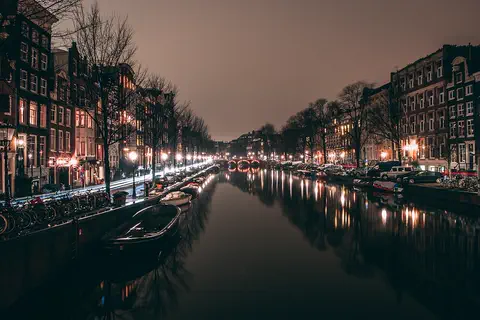
Amsterdam is the capital of the Netherlands. It began as a fishing village beside a dam on the Amstel River, which gave the city its name. Today about 942,000 people live among its rings of canals, hundreds of bridges, houseboats and bicycles.
- Watch Geography Tides Tides are the slow rise and fall of the sea along coasts. The Moon's gravity, helped a little by the Sun, pulls Earth's oceans into two bulges. As Earth turns through them, most coasts get two high tides and two low tides every 24 hours and 50 minutes.
- Watch Geography Sea level The sea's surface moves up and down with waves and tides, so sea level means its average height. It is the zero we use to measure land: Mount Everest is about 8,849 meters above sea level. Satellites show that the global average sea level has risen about 10 centimeters since 1993, mostly because ice on land is melting and warming seawater takes up more room.
-
 Watch
Journey
The Silk Road
The Silk Road was not one road but a web of trade routes, about 6,400 kilometers long, linking China with Central Asia and the Mediterranean. For more than 1,500 years, caravans carried silk, tea, spices and glass, and travelers shared ideas, beliefs and inventions.
-
 Watch
City
Athens
Athens is the capital of Greece and one of the oldest cities in the world. Above it rises the Acropolis, a rocky hill crowned by the marble Parthenon, built about 2,500 years ago. Ancient Athens was home to early democracy, great thinkers and theater.
-
 Watch
City
Barcelona
Barcelona, the capital of Catalonia in northeastern Spain, lies on the Mediterranean between mountains and the sea. It is famous for the buildings of the architect Antoni Gaudí, including the Sagrada Família, a giant church begun in 1882. About 1.7 million people live in the city (2025).
For parents & teachers
What children will learn
- Locate Venice in its lagoon at the top of the Adriatic Sea.
- Explain how people built a city on islands and how they move around without cars.
- Describe what causes acqua alta and how the MOSE gates work.
- Connect Venice's history as a sea-trading republic with its buildings.
Recommended ages: 3 to 17 · About 15 minutes
Talk about it
- What would your day be like if every trip was by boat or on foot?
- Venice is sinking slowly while the sea rises. What are some ways a city can protect itself from the sea?
- Millions of visitors come to Venice. What is good about that, and what problems can it cause for the people who live there?
Try at home or in class
- Float a toy boat in a tray of water, then build a gate from a strip of card hinged with tape at the bottom of the tray's opening. Pour in water from outside to show how lifting the gate keeps the tide out.
- Draw a map of an island city with canals instead of streets, and add bridges so you can walk from one end to the other.
Key vocabulary: lagoon, canal, gondola, vaporetto, acqua alta, subsidence, republic
Where these facts come from
- Wikidata , Wikimedia Foundation (CC0 1.0)
- Natural Earth vector data , Natural Earth (NACIS) (Public domain)
- UNESCO World Heritage List , UNESCO World Heritage Centre (Linked as a reference; site facts come from Wikidata)
- Venice , Encyclopaedia Britannica
- Venice: Lagoon and tides , Encyclopaedia Britannica
- Venice: Canal boats and bridges , Encyclopaedia Britannica
- Venice: The Piazza San Marco , Encyclopaedia Britannica
- Venice: Economy , Encyclopaedia Britannica
- Venice: History , Encyclopaedia Britannica
- Venice: The commune , Encyclopaedia Britannica
- Venice: Zenith of power , Encyclopaedia Britannica
- Venice: In unified Italy , Encyclopaedia Britannica
- San Marco Basilica , Encyclopaedia Britannica
- Venice and its Lagoon (World Heritage List, 394) , UNESCO World Heritage Centre
- MOSE Venice: how the flood barrier works , Visit Venice
- Venice: climatological information , World Meteorological Organization, World Weather Information Service
- Wikimedia Commons , Wikimedia Foundation (Per file (public domain, CC0, CC BY or CC BY-SA); see each media record)
Checked, not yet human-reviewed. Last updated October 27, 2026. Spotted a mistake? Tell us.
Picture credits
- Photo: European Space Agency, CC BY-SA 3.0 igo, via Wikimedia Commons · source · license
- Photo: Nino Barbieri, CC BY-SA 2.5, via Wikimedia Commons · source · license
- Photo: Martin Falbisoner, CC BY-SA 4.0, via Wikimedia Commons · source · license
- Photo: Didier Descouens, CC BY-SA 4.0, via Wikimedia Commons · source · license