
 Country
Europe
Belgium
Belgium is a small country in Europe by the North Sea. People there speak Dutch, French or German, and it is famous for chocolate and comic strips.
Belgium is a small, busy country in northwestern Europe, low and flat near the North Sea and hilly in the forested Ardennes. About 11.9 million people live there, speaking mainly Dutch in the north and French in the south, and its capital, Brussels, hosts the European Union.
Belgium, independent since 1830, straddles the border between Europe's Romance and Germanic languages. A federal constitutional monarchy built from the regions of Flanders, Wallonia and Brussels-Capital, it had 11,867,634 inhabitants on 1 January 2026 and is one of Europe's most densely populated and urbanized countries.
Photo: Kemeter, CC BY-SA 4.0, via Wikimedia Commons
Discover Belgium
Belgium is a small country in Europe.
It has a short coast on the North Sea. In the south there are hills and forests. People speak Dutch, French or German. The capital city is Brussels.
Belgium is one of the smallest countries in Europe, but lots of people live there, so it is one of the most crowded. Most of it is low, flat land that rises gently toward the hills and forests of the Ardennes in the southeast.
About 11.9 million people live in Belgium. In the north, most people speak Dutch (Flemish); in the south, most speak French; and a small community in the east speaks German. The capital, Brussels, is home to the headquarters of the European Union and NATO.
Belgium is one of Europe's smallest and most densely populated countries, with an area of about 30,700 square kilometers (Wikidata, from Statbel, 30,688; Britannica 30,843). Statbel, the Belgian statistical office, counted 11,867,634 inhabitants on 1 January 2026, one-fifth of them aged 65 or older; Britannica puts the urban share at 98.2 percent (2024).
Since independence in 1830 Belgium has been a representative democracy under a hereditary constitutional monarch. It began as a unitary state, but reforms in the 1980s and 1990s made it a federal state sharing power among the regions of Flanders, Wallonia and the Brussels-Capital Region. It is a member of Benelux, the European Union and NATO, all of which have headquarters in or near Brussels.

Cities and famous places
Brussels is the capital of Belgium.
It has a beautiful old square called the Grand-Place. The Atomium looks like giant shiny balls. Bruges is an old city with canals and boats.
Brussels has a famous main square, the Grand-Place, lined with grand buildings mostly from the late 1600s. Also in Brussels stands the Atomium, built for a world exhibition in 1958. It is a giant model of a tiny piece of iron, made of nine shiny metal balls joined by tubes, and it is 102 meters tall.
Bruges, in the northwest, is a medieval city crossed by canals, once one of Europe's great trading and cultural centers. Antwerp is the biggest single city, although the whole Brussels-Capital Region, home to about one in ten Belgians, has more people. Many Belgian towns have a belfry, a tall tower that showed the power and wealth of the town.
UNESCO describes Brussels' Grand-Place (1998) as a remarkably homogeneous group of public and private buildings, mainly from the late 17th century. The Atomium, designed by engineer André Waterkeyn and architects André and Jean Polak for the 1958 World Exhibition, models an iron crystal magnified 165 billion times: nine aluminum-coated steel spheres 18 m across on a structure 102 m tall.
The historic center of Bruges (2000) is an outstanding example of a medieval settlement whose Gothic buildings remain part of its identity; as one of Europe's commercial and cultural capitals it is closely associated with the Flemish Primitive painters. Antwerp (536,079 people in 2023, Wikidata) is the largest municipality, while the Brussels-Capital Region holds about one-tenth of the population. UNESCO's Belfries of Belgium and France include 32 Belgian belfries inscribed in 1999, built between the 11th and 17th centuries as symbols of civic liberties and of the power of town aldermen.

Lowlands, hills and weather
Most of Belgium is flat and green.
In the south are the Ardennes hills with big forests. It often rains. Winters are cool and summers are mild.
From the North Sea coast, Belgium's land rises slowly toward the southeast. The north is a flat plain with fields, towns and planted forests. In the southeast, the Ardennes is a hilly plateau cut by deep river valleys and covered with forests. Its highest point, Botrange, is only 694 meters high.
Belgium's weather comes mostly from the Atlantic Ocean, so it changes often and brings plenty of rain. Winters are damp and cool, and summers are mild. The Ardennes is the coldest and rainiest part, with snow on 30 to 35 days a year.
Belgium rises from a broad coastal plain toward the Ardennes, part of the Hercynian mountain belt formed about 300 to 400 million years ago and now a plateau deeply cut by the Meuse and its tributaries; its highest point is Botrange (694 m). Britannica divides the country into the Ardennes and its foothills, Belgian Lorraine in the south, and the Anglo-Belgian Basin of the north with the Central Plateaus, the plain of Flanders and the Kempenland.
The climate is temperate and maritime, with frequent fronts from the west bringing 750 to 1,000 mm of rain a year and an annual mean of about 10 °C; Brussels averages a January minimum just below 0 °C and a July maximum of about 22 °C. In the Ardennes, frost occurs on about 120 days and snow on 30 to 35; on the coast there are fewer than 50 frost days. Except in the Ardennes, the natural forest is broad-leaved, dominated by oak, but little remains of the forest that covered the land 2,000 years ago.
Animals of Belgium
Wild boars live in the Ardennes forests.
Deer and wildcats live there too. Birds such as snipes and lapwings live in the lowlands.
Human activity has greatly reduced Belgium's wild animals. Most of the remaining wild animals live in the Ardennes, where wild boars, wildcats, deer and pheasants are among the more common.
In the lowlands live birds such as sandpipers, woodcocks, snipes and lapwings. The Hautes Fagnes, at the edge of the Ardennes, has many peat bogs and is part of a nature reserve.
Britannica describes Belgium's animal population as Eurasian and greatly reduced by human activity. Most remaining wild animals are found in the Ardennes, where wild boars, wildcats, deer and pheasants are among the more common; lowland birds include sandpipers, woodcocks, snipes and lapwings.
The Ardennes, heavily logged for centuries, keeps little old-growth forest; conifers dominate the higher ground and mixed beech and oak the foothills. The Hautes Fagnes, on its northeastern edge, has many peat bogs and, forested with spruce, is part of a nature reserve. In the Kempenland, large areas are planted with silver birch and Corsican pine.
People, languages and food
About 12 million people live in Belgium.
In the north, many people speak Dutch. In the south, many speak French. Belgium is famous for chocolate and waffles. Tintin comics come from Belgium.
Belgium sits on the line between two big families of European languages. More than half the people are Flemings, who speak Dutch and live mostly in the north, and about one-third are Walloons, who speak French and live mostly in the south. Brussels is officially bilingual, and a small German-speaking community lives in the east.
Belgium is known for mussels with french fries, waffles and world-famous chocolate. Comic strips are a respected art form there: Tintin, created by Hergé, first appeared in 1929, and Brussels has a large comic-strip museum.
Belgium straddles the boundary between the Romance and Germanic language families. Flemings, speaking Dutch (Flemish), make up more than half the population in the five northern and northeastern provinces; Walloons, speaking French, about one-third in the five southern provinces; the officially bilingual but mostly French-speaking Brussels-Capital Region has about one-tenth; and a small German-speaking population lives in the east.
Britannica notes a strong tradition of fine cuisine, including moules frites and waffles, and calls Belgian chocolate a cultural institution and a main food export. Beer is the national beverage, with several hundred breweries. Festivals mark regional history and the seasons, from the carnival of Binche to the procession of giants at Ath, and the comic strip, from Hergé's Tintin (1929) onward, is regarded as part of the modern cultural heritage.

A long history
Belgium has many old towns with tall towers.
Long ago, towns here made lots of cloth. Belgium became its own country in 1830. Today a king is the head of the country.
From the 1100s, cloth-making grew in the towns of what is now Belgium, and towns built tall belfries that came to show their power and wealth. From 1363 to 1477 the dukes of Burgundy ruled the region, a time of splendid art and a strong economy.
Later the land was ruled in turn by Spain, Austria, France and the Netherlands. In 1830 Belgium broke away from the Netherlands and became an independent kingdom. In the 1900s the country was a battleground in both world wars. Since the 1980s Belgium has become a federal state with three regions.
Textile industries developed in the Belgian territories from the 12th century and, under the Burgundian dukes (1363–1477), became the economic mainstay of northwestern Europe; Britannica calls the period one of political prestige and economic and artistic splendor. The belfries built between the 11th and 17th centuries are, for UNESCO, tokens of the winning of civil liberties. After the Burgundian era the southern Low Countries passed to the Habsburgs of Austria and Spain.
Belgium's union with the Netherlands ended with the revolution of 1830, and the country became an independent constitutional monarchy. Britannica notes that its landscape was a major European battleground for centuries, including at Waterloo in 1815 and in both world wars. After World War II Brussels was rebuilt, and the Atomium was raised for the 1958 World Exhibition. Reforms in the 1980s and 1990s turned Belgium into a federal state of three regions.
Belgium on the map
Find Belgium on the globe.
It is a small country by the North Sea. France is to the south. The Netherlands is to the north. Germany and Luxembourg are to the east.
Belgium has four neighbors: the Netherlands to the north, Germany to the east, Luxembourg to the southeast and France to the south. Its coast on the North Sea is only about 60 kilometers long.
The valley of the Sambre and Meuse rivers cuts across the country from southwest to northeast. North of it lie plateaus and the flat lowlands of Flanders; south of it rise hills and then the Ardennes.
Belgium has 1,385 km of land boundaries, with the Netherlands to the north, Germany to the east, Luxembourg to the southeast and France to the south, and about 60 km of North Sea shoreline. The Sambre-Meuse valley crosses the country from south-southwest to northeast, separating the foothills and the Ardennes from the Central Plateaus and the plains to the north.
Politically, the five northern provinces form Flanders and the five southern provinces Wallonia, with the Brussels-Capital Region just north of the line between Walloon Brabant and Flemish Brabant. Brussels lies roughly in the middle of the country.
- Land borders
- 1,385 km
- North Sea coast
- about 60 km
- Highest point
- Botrange, 694 m
- Regions
- Flanders, Wallonia and Brussels-Capital
Amazing facts
-
The Atomium looks like a giant toy made of balls.
The Atomium is a model of a crystal of iron, made 165 billion times bigger.
The Atomium models an iron crystal magnified 165 billion times; its nine spheres are each 18 m across.
-
Tintin comics come from Belgium.
Tintin, created by the artist Hergé, first appeared in a comic strip in 1929.
In Belgium the comic strip is considered a serious art form; Hergé's Tintin first appeared in 1929, and Brussels has a large comic-strip museum.
-
Belgium's beach is very short.
Belgium's whole North Sea coast is only about 60 kilometers long.
Belgium has 1,385 km of land boundaries but only about 60 km of North Sea shoreline.
-
Old towns built tall towers to show they were strong.
Belgian towns built tall belfries between the 1000s and 1600s to show the power of their town leaders.
UNESCO lists 32 Belgian belfries, built between the 11th and 17th centuries, as tokens of the winning of civil liberties.
Words to know
- bilingual
- using two languages
- belfry
- a tall tower, often with bells, that stood for a town's power and freedom
- federal state
- a country in which power is shared between the national government and regions
- plateau
- a large area of high, mostly flat land
- crystal
- a solid in which tiny particles are arranged in a regular, repeating pattern
- canal
- a waterway dug by people for boats
Discovery challenge
-
What is the capital city of Belgium?
Which city is Belgium's capital and home to the headquarters of the European Union?
Which officially bilingual city is Belgium's capital and hosts EU and NATO headquarters?
- Antwerp
- Brussels
- Bruges
Show the answer
Brussels
Brussels is the capital of Belgium.
Brussels is the capital; the EU and NATO have headquarters there.
Brussels-Capital is officially bilingual; Antwerp is the largest municipality.
-
Which language do many people in northern Belgium speak?
Which language do most people in Flanders, in the north, speak?
The Flemings, more than half of Belgium's population, speak which language?
- Dutch
- Spanish
- Polish
Show the answer
Dutch
Many people in the north speak Dutch.
Flanders is mostly Dutch-speaking; Wallonia in the south is mostly French-speaking.
Flemings speak Dutch (Flemish); Walloons, about one-third, speak French.
-
The Atomium is a giant model of a tiny bit of which metal?
The Atomium is a giant model of a crystal of which metal?
The Atomium represents a crystal of which element, magnified 165 billion times?
- Iron
- Gold
- Copper
Show the answer
Iron
It is a model of iron, made of big balls joined by tubes.
It is a model of a crystal of iron, made 165 billion times bigger.
It models an iron crystal magnified 165 billion times, built for the 1958 World Exhibition.
-
Where do most of Belgium's wild animals live?
In which forested, hilly region do most of Belgium's wild animals live?
Which region, part of the Hercynian belt, holds most of Belgium's remaining wildlife?
- The Ardennes
- The Sahara
- The Alps
Show the answer
The Ardennes
They live in the Ardennes forests.
Wild boars, wildcats and deer live mostly in the Ardennes.
The Ardennes, a plateau cut by the Meuse, holds most of Belgium's remaining wild animals.
-
In which year did Belgium become its own country?
In which year did Belgium become independent from the Netherlands?
In which year did a revolution end Belgium's union with the Netherlands?
- 1830
- 1066
- 1990
Show the answer
1830
Belgium became its own country in 1830.
Belgium became independent in 1830.
The revolution of 1830 ended the union with the Netherlands; Belgium became a constitutional monarchy.
Places to discover in Belgium
Explore next
-
Watch
City
Brussels
Brussels is the capital of Belgium. It began as a market where a road crossed the small Senne River, and its old name means "settlement in the marshes." Its Grand-Place, ringed by 17th-century guildhalls, is a UNESCO World Heritage Site, and the city is home to many offices of the European Union.
-
 Watch
 Country
Luxembourg
Luxembourg is one of the smallest countries in the world, tucked between Belgium, France and Germany. It has forested hills in the north, farms and vineyards in the south, a capital built on a steep rocky outcrop, and about 691,000 people (2026) who use Luxembourgish, French and German.
-
 Watch
 Country
Belarus
Belarus is a landlocked country in eastern Europe. Ice sheets of the last ice age shaped its low hills and wide plains, it has more than 10,000 lakes and one of Europe's largest wetlands, and about 9.1 million people lived there in 2025.
-
 Watch
 Country
Bosnia and Herzegovina
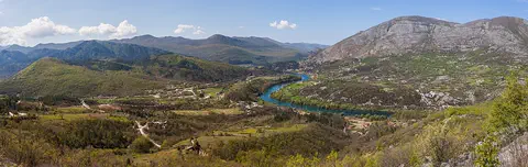
Bosnia and Herzegovina is a mountainous country in southeastern Europe. It has forests, limestone hills and many rivers, and famous old stone bridges cross some of them. Its capital is Sarajevo. It touches the Adriatic Sea along only about 20 kilometers of coast.
-
 Watch
 Country
Bulgaria
Bulgaria is a country on the eastern side of the Balkan Peninsula, with the Danube River to the north and the Black Sea to the east. Mountains cross it from west to east, and about 6.4 million people lived there at the end of 2025.
-
 Watch
 Country
Croatia
Croatia is a crescent-shaped country in southeastern Europe. Its long coast on the Adriatic Sea is fringed by more than 1,100 islands, limestone mountains rise behind it, fertile plains lie in the north, and about 3.87 million people lived there in mid-2025.
-
 Watch
 Country
Czechia
Czechia, also called the Czech Republic, is a landlocked country in central Europe. Mountains ring the old land of Bohemia, the Vltava River flows through the capital, Prague, and about 10.9 million people lived there in 2026.
-
 Watch
 Country
Hungary
Hungary is a landlocked country in central Europe, in a wide lowland called the Carpathian Basin. Wide plains cover much of it, the Danube River flows through its capital, Budapest, and about 9.5 million people lived there in 2026.
For parents & teachers
What children will learn
- Locate Belgium and name its neighbors and its sea.
- Explain how Belgium's regions and languages are arranged north to south.
- Describe Belgium's landscapes from the coastal plain to the Ardennes.
- Outline Belgium's history from medieval cloth towns to independence in 1830 and a federal state.
Recommended ages: 3 to 17 · About 15 minutes
Talk about it
- What might be fun or tricky about living in a country with three official languages?
- Why do you think towns long ago built tall belfries?
- Comic strips are a respected art form in Belgium. What makes a good comic story?
Try at home or in class
- Build an Atomium with balls of modeling clay and drinking straws: put eight balls at the corners of a cube and one in the middle, and connect them.
- Draw a short comic strip in three panels about a trip to a city of canals.
Key vocabulary: bilingual, belfry, federal state, plateau, crystal, canal
Where these facts come from
- Wikidata , Wikimedia Foundation (CC0 1.0)
- Natural Earth vector data , Natural Earth (NACIS) (Public domain)
- UNESCO World Heritage List , UNESCO World Heritage Centre (Linked as a reference; site facts come from Wikidata)
- Belgium , Encyclopaedia Britannica
- Belgium: Climate, plant and animal life , Encyclopaedia Britannica
- Belgium: Cultural life , Encyclopaedia Britannica
- Belgium: History , Encyclopaedia Britannica
- Atomium , Encyclopaedia Britannica
- Structure of the population (1 January 2026) , Statbel, the Belgian statistical office
- La Grand-Place, Brussels , UNESCO World Heritage Centre
- Historic Centre of Brugge , UNESCO World Heritage Centre
- Belfries of Belgium and France , UNESCO World Heritage Centre
- PlayOwl region table, version 1 , PlayOwl (PlayOwl original data)
- flag-icons 7.5.0 , Panayiotis Lipiridis and contributors (MIT)
- Wikimedia Commons , Wikimedia Foundation (Per file (public domain, CC0, CC BY or CC BY-SA); see each media record)
Checked, not yet human-reviewed. Last updated October 24, 2026. Spotted a mistake? Tell us.