 Country
Europe
Moldova
Moldova is a small country in Europe with no sea. It has green hills, two long rivers and very dark, rich soil.
Moldova is a small landlocked country in eastern Europe, squeezed between Romania and Ukraine. Most of it lies between two rivers, the Prut and the Dniester, and its rich black soil grows grapes, sunflowers, grain and fruit. About 2.4 million people were counted there in 2024.
Moldova is a landlocked republic in the northeastern corner of the Balkan region, lying mostly between the Prut and Dniester rivers. It is a hilly plain, averaging 147 m above sea level, with chernozem covering three-fourths of the land. Its 2024 census counted 2,409,200 usual residents in the area where it could be held; the left bank of the Dniester, the municipality of Bender and a few nearby villages were not counted. East of the Dniester lies Transdniestria, a separatist region that proclaimed independence in 1990; a brief civil war followed, and a cease-fire was declared in 1992.
Discover Moldova
Moldova is a country in Europe.
It has no sea coast. Two big rivers run along its sides. There are rolling hills, green forests and many farms. The capital city is called Chișinău.
Moldova is a small country in eastern Europe with no coastline. Ukraine wraps around it on the north, east and south, and Romania lies to the west. Most of the country sits between two winding rivers: the Prut in the west and the Dniester in the east.
The land is a hilly plain, cut by river valleys and gullies, with steep forested slopes in the central hills. Its soil is very fertile, and fields, orchards and vineyards cover much of the country. The capital, Chișinău, is in the south-central part.
Moldova is a landlocked country in the northeastern corner of the Balkan region, bounded by Ukraine to the north, east and south and by Romania to the west. The bulk of it lies between the meandering Prut and Dniester rivers, east of the great arc of the Carpathian Mountains. It is underlain mostly by deep sedimentary rocks on the southwestern edge of the East European Plain; harder crystalline rocks come to the surface only in the north.
Its surface is a hilly plain averaging 147 m above sea level, cut by a dense network of valleys, ravines and gullies. Chernozem, a rich black soil, covers three-fourths of the country. The capital, Chișinău, lies in the south-central part. Formerly known as Bessarabia, the territory declared independence as the Republic of Moldova in August 1991 and joined the United Nations in 1992.
Chișinău and other places
Chișinău is the capital of Moldova.
It sits beside a river. Many people work and study there. One old survey marker in Moldova helped people measure the size of the Earth.
Chișinău, the capital, sits along the Bâcu River. It was first written about in 1466, and today it is the country's main center for business, government and culture, with an academy of sciences and a university founded in 1945.
Moldova also shares a World Heritage Site with nine other countries: the Struve Geodetic Arc. Between 1816 and 1855, surveyors measured a chain of triangles stretching from the Arctic coast of Norway to the Black Sea, and one of the marked survey points is in Moldova.
Chișinău lies on the Bâcu (Byk) River. Its first written mention dates to 1466, under the Moldavian prince Ștefan III; it passed to Russia with the rest of Bessarabia in 1812 and became known by its Russian name, Kishinyov, and the Romanian form of the name came back into official use in 1991. Britannica describes it as Moldova's major industrial and cultural center, with an academy of sciences, a university (1945) and research institutes; it was heavily damaged in World War II and rebuilt afterward, and its newer parts lie on terraces along the river.
The Struve Geodetic Arc, inscribed by UNESCO in 2005, is a chain of survey triangulations about 2,820 km long, from Hammerfest in Norway to the Black Sea, carried out between 1816 and 1855 under the astronomer Friedrich Georg Wilhelm Struve. It gave the first accurate measurement of a long segment of a meridian, helping to fix the size and shape of the Earth. Of the 34 original station points in the listed site, one is in Moldova.

Hills, rivers and black soil
Moldova has soft, rolling hills.
The soil in the fields is black and very rich. Many plants grow well in it. Big rivers flow all the way to the Black Sea. Summers are warm, and winters have only a little snow.
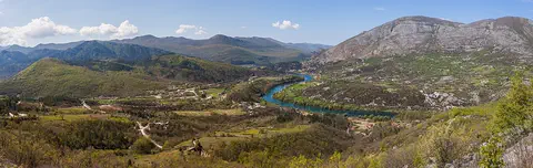
Moldova has no tall mountains. In the middle of the country are the forested Codri Hills, and the highest point, Bălănești Hill, is only about 429 meters high. The north has a flat plain called the Bălți steppe, and the south has the wide Bugeac Plain.
The soil is the real treasure: rich black earth called chernozem covers about three-quarters of the land. All of Moldova's rivers drain south to the Black Sea. The Dniester is the biggest, swollen each spring by snowmelt from the Carpathian Mountains. Summers are warm, winters are fairly mild, and the south can have long dry spells.
Moldova's relief is gentle. The central Codri Hills average 350 to 400 m, rising to Bălănești Hill at 429 m (Britannica), and are cut by deep valleys, ravines and landslide-scoured hollows; steep forested slopes cover much of this upland. The north is the level Bălți steppe (150 to 200 m) with uplands about twice as high, including the eroded Medobory-Toltry limestone ridges along the Prut, and the south is the gullied Bugeac Plain.
All rivers drain south to the Black Sea, but only about a tenth are longer than 10 km. The fast-flowing Dniester is navigable almost throughout the country; the Prut joins the Danube at Moldova's southern tip. Groundwater, which includes more than 2,000 natural springs, is widely used for the water supply. Chernozem covers three-fourths of the land, though Soviet-era overuse of fertilizers and pesticides contaminated soil and groundwater. The climate is warm and moderately continental: annual means of about 8 °C in the north and 10 °C in the south, July means of about 19 and 23 °C, and roughly 500 mm of precipitation a year, which can double in some years and fall far short in others.
Forests and wildlife
Moldova has oak forests.
Wild boars and wolves live there. Herons and wild geese rest in the marshes by the rivers. Many kinds of fish swim in the rivers.
Forests cover the north and center of Moldova, especially in the Codri Hills. The most common trees are hornbeam and oak, along with linden, maple, wild pear and wild cherry. The south was once a grassy steppe, but most of it is now farmland.
Wild boars, wolves, badgers, wildcats, roe deer, hares and foxes live in Moldova. The marshy lower parts of the rivers shelter wild geese, ducks and herons, and white-tailed sea eagles live in the riverside forests. Moldova's fish include carp, perch, bream and pike.
Northern and central Moldova is a forest zone and a steppe belt crosses the south. Britannica counts more than 1,500 plant species. Forests cover about 3,000 km², chiefly in the Codri Hills; hornbeam and oak are the most common trees, with beech at the sources of the Ichel and Bâcu rivers. In the early 19th century about a third of the country was forested, but a growing population cleared much of it, bringing soil erosion, flooding and loss of wildlife; large reforestation projects have run since the early 1990s.
Mammals include wild boar, wolves, badgers, wildcats, ermines, martens and polecats, with roe deer, hares, foxes and muskrats of commercial importance; fallow deer and spotted deer were introduced and are now common. The marshy lower reaches of the rivers are sanctuaries for wild geese, migratory ducks and herons, and white-tailed sea eagles live in the floodplain forests. Lush meadows and reed beds line the floodplains of the Dniester and the Prut.
People, languages and traditions
About 2.4 million people were counted in Moldova in 2024.
Most people speak Romanian. Many people also speak Russian. Farms grow lots of grapes, fruit and vegetables. On March 1, people give red and white threads to welcome spring.
About 2.4 million people were counted in Moldova in 2024, and more of them live in the countryside than in towns. Most people speak Romanian, which is also called Moldovan, and many people use Russian as a second language. Ukrainians, Russians, Gagauz, Bulgarians and Roma are among Moldova's smaller communities. The Gagauz have their own Turkic language.
Grapes are the most important of the crops grown for processing in factories, and farmers also grow sunflowers, wheat, corn and fruit. On March 1, many people make and wear a red and white thread called mărțișor to celebrate the start of spring. Weavers in Moldova and Romania also make wall carpets with detailed patterns, a craft UNESCO lists as shared heritage.
The 2024 census counted 2,409,200 usual residents: 1,290,200 in rural areas and 1,119,000 in towns (National Bureau of Statistics); a preliminary estimate for 1 January 2026 was 2,365,600. About three-fourths of the people are ethnic Moldovans, with smaller Ukrainian, Russian, Gagauz, Roma and Bulgarian communities. The Gagauz have lived on the Bugeac Plain since the late 18th century and speak a Turkic language, official in the autonomous area of Gagauzia. The state language is Romanian: the 1994 constitution called it Moldovan, and in 2013 the Constitutional Court ruled in favor of Romanian; the script changed from Cyrillic to Latin in 1989, and bilingualism with Russian is common. Most people are Eastern Orthodox Christians, with smaller Muslim and Jewish communities.
Grapes are the most important industrial crop. UNESCO lists two traditions Moldova shares with neighbors: wall-carpet weaving with Romania (2016), now valued mainly as art, and the spring practices of March 1 (2017), when a red and white thread is made, given and worn.
A crossroads of history
Many different peoples have lived in Moldova over time.
Long ago it was part of a land called Moldavia. Chișinău was first written about more than 500 years ago. In 1991, Moldova became its own country.
Moldova lies on one of the main land routes into Europe, so many different peoples have ruled it. In the 1400s the land between the Prut and the Dniester became part of a principality called Moldavia, and Chișinău was first mentioned in writing in 1466.
In 1812 the region, then called Bessarabia, became part of the Russian Empire. In 1918 it joined Romania, and in 1940 it became the Moldavian Soviet Socialist Republic, part of the Soviet Union. In 1989 the Moldovan language switched from Cyrillic letters to the Latin alphabet, and on August 27, 1991, Moldova declared independence.
Bessarabia, the land between the Dniester and the Prut, was part of Scythia in the 1st millennium BCE and later came marginally under Roman control as part of Dacia. Lying on a principal land route into Europe, it had many masters; part of it was ruled by Kievan Rus in the 10th to 12th centuries. The whole province became part of the principality of Moldavia in the 15th century, and its south was later organized into districts of the Ottoman Empire. The Treaty of Bucharest (1812) ceded Bessarabia, about half of historic Moldavia, to Russia.
After the Russian Revolution, a council called the Sfatul Țării voted for union with Romania in 1918. In 1940 a Soviet ultimatum forced Romania to cede the region, which became the Moldavian Soviet Socialist Republic, reintegrated into the Soviet Union in 1944. Sovereignty was declared in June 1990 and independence on 27 August 1991. Transdniestria, east of the Dniester, proclaimed its own independence from Moldova in 1990, resulting in a brief civil war; a cease-fire was declared in 1992, and Britannica notes that Russian troops are still present in the security zone. The 1994 constitution gave autonomy to Gagauzia and Transdniestria.
Moldova on the map
Find Moldova on the globe.
It is in Europe, close to the Black Sea. But it does not touch the sea. Romania is on one side. Ukraine is all around the other sides.
Moldova is in eastern Europe, east of the Carpathian Mountains and just north of the Black Sea, though it has no coast of its own. It has only two neighbors: Romania to the west and Ukraine to the north, east and south.
The Prut River flows through the west of the country and joins the Danube at Moldova's southern tip. The Dniester River runs through the east of the country on its way to the Black Sea. Chișinău, the capital, is close to the middle.
Moldova lies in eastern Europe, east of the Carpathian arc, bounded by Romania to the west and Ukraine on all other sides; it has no coastline. The Prut, a tributary of the Danube, runs along the west and joins the Danube at the country's extreme southern tip; the Dniester crosses the east, and the small southern rivers such as the Ialpug and Cogâlnic drain into the Danube estuary in neighboring Ukraine.
On the east bank of the Dniester lies Transdniestria (also called Transnistria or Pridnestrovie), a separatist region that proclaimed independence from Moldova in 1990; a cease-fire was declared in 1992, and Britannica notes that Russian troops are still present in the security zone. The National Bureau of Statistics could not hold the 2024 census in localities it describes as not under the de facto control of the constitutional authorities: those on the left bank of the Dniester (Nistru), the municipality of Bender and a few nearby villages. In the south is the autonomous area of Gagauzia.
- Coastline
- none (landlocked)
- Average height of the land
- 147 m
- Highest point (Britannica)
- Bălănești Hill, 429 m
- Land covered by chernozem
- about three-fourths
- Usual residents, 2024 census (area where it was held: not the left bank of the Dniester or Bender)
- 2,409,200
Amazing facts
-
Most of Moldova's soil is black and very rich.
Rich black soil called chernozem covers about three-quarters of Moldova.
Chernozem covers three-fourths of Moldova; Britannica notes that heavy use of fertilizers and pesticides in the Soviet period contaminated soil and groundwater.
-
Moldova has hills, but no tall mountains.
Moldova's highest point, Bălănești Hill, is only about 429 meters high.
Britannica gives Bălănești Hill, in the west, as the highest point at 429 m; the land averages just 147 m above sea level.
-
One old marker for measuring the Earth is in Moldova.
One of the survey points of the Struve Geodetic Arc, used to measure the size and shape of the Earth in the 1800s, is in Moldova.
The Struve Geodetic Arc's 34 listed station points lie in ten countries, from Norway to the Black Sea; one is in Moldova. The survey ran from 1816 to 1855.
-
Moldova has more than 2,000 springs of water.
Moldova has more than 2,000 natural springs, and underground water is widely used for its water supply.
Groundwater, which includes more than 2,000 natural springs, is used extensively for Moldova's water supply.
-
On March 1, people wear red and white threads.
On March 1, many people in Moldova make, give and wear a red and white thread to celebrate the beginning of spring.
UNESCO inscribed the cultural practices of March 1, shared by Bulgaria, North Macedonia, Moldova and Romania, in 2017; the thread is untied when the first blossoming tree, swallow or stork is seen.
Words to know
- landlocked
- having no coast on a sea or ocean
- chernozem
- a very rich, dark soil, sometimes called black earth
- steppe
- a wide, flat, grassy land with few trees
- tributary
- a river that flows into a bigger river
- principality
- a land ruled by a prince
- census
- an official count of all the people living in a country
Discovery challenge
-
What is the capital city of Moldova?
Which city is the capital of Moldova?
Which city, first mentioned in writing in 1466, is Moldova's capital?
- Chișinău
- Bucharest
- Kyiv
Show the answer
Chișinău
Chișinău is the capital of Moldova.
Chișinău, in the south-central part of the country, is the capital.
Chișinău, on the Bâcu River, was first recorded in 1466 under the Moldavian prince Ștefan III and is the capital and main city.
-
What color is most of the soil in Moldova?
What color is chernozem, the rich soil that covers most of Moldova?
Chernozem covers three-fourths of Moldova. What color is this soil?
- Red
- Black
- White
Show the answer
Black
The soil is black and very rich.
Chernozem is rich black soil, and it covers about three-quarters of Moldova.
Britannica describes chernozem as rich black soil; it covers three-fourths of the country.
-
Does Moldova have a sea coast?
Moldova is landlocked. What does that mean?
Which describes Moldova's position?
- It has a long sea coast
- It is an island
- It has no sea coast
Show the answer
It has no sea coast
Moldova has no sea coast. It is all land.
Landlocked means no coast. Moldova is close to the Black Sea but does not touch it.
Moldova is landlocked, bounded by Romania to the west and Ukraine to the north, east and south.
-
Which fruit grows in big vineyards in Moldova?
Which is Moldova's most important crop grown for processing in factories?
Which is Moldova's most important industrial crop?
- Bananas
- Grapes
- Pineapples
Show the answer
Grapes
Lots of grapes grow in Moldova's vineyards.
Grapes are Moldova's most important industrial crop, with the biggest vineyards in the south and center.
Britannica names grapes as the most important industrial crop; the largest vineyards are in the southern and central regions.
-
Most of Moldova is between two what?
Most of Moldova lies between two of what?
The Prut and the Dniester, which frame most of Moldova, are two what?
- Rivers
- Mountains
- Deserts
Show the answer
Rivers
Two big rivers run along Moldova's sides.
Most of Moldova lies between the Prut River in the west and the Dniester River in the east.
The Prut, a tributary of the Danube, and the Dniester both drain south to the Black Sea.
Places to discover in Moldova
Animals of Moldova
-
 Watch
3D
Animal
Wild boar
Wild boars are bristly wild pigs that live in forests and fields across Europe, Asia and North Africa. They sniff out food with their powerful snouts, live in family groups called sounders, and are the wild ancestors of farm pigs.
-
 Watch
3D
Animal
Gray wolf
The gray wolf is the largest member of the dog family and the wild ancestor of pet dogs. Wolves live in family packs that hunt big animals like elk and moose together, and their howls can carry about 10 kilometers. After being wiped out in many places, wolves are coming back in parts of North America and Europe.
Explore next
-
 Watch
Natural wonder
Danube
The Danube is Europe's second-longest river, after the Volga. It begins as two small streams in Germany's Black Forest and flows about 2,850 kilometers east to the Black Sea, passing through 10 countries and four capital cities. For more than 2,000 years it has been a border, a highway for boats and a home for wildlife, and it ends in a giant delta of reeds, lakes and birds.
-
Watch
3D
Animal
Wild boar
Wild boars are bristly wild pigs that live in forests and fields across Europe, Asia and North Africa. They sniff out food with their powerful snouts, live in family groups called sounders, and are the wild ancestors of farm pigs.
-
Watch
3D
Animal
Gray wolf
The gray wolf is the largest member of the dog family and the wild ancestor of pet dogs. Wolves live in family packs that hunt big animals like elk and moose together, and their howls can carry about 10 kilometers. After being wiped out in many places, wolves are coming back in parts of North America and Europe.
-
 Watch
 Country
Belarus
Belarus is a landlocked country in eastern Europe. Ice sheets of the last ice age shaped its low hills and wide plains, it has more than 10,000 lakes and one of Europe's largest wetlands, and about 9.1 million people lived there in 2025.
-
 Watch
 Country
Bosnia and Herzegovina
Bosnia and Herzegovina is a mountainous country in southeastern Europe. It has forests, limestone hills and many rivers, and famous old stone bridges cross some of them. Its capital is Sarajevo. It touches the Adriatic Sea along only about 20 kilometers of coast.
-
 Watch
 Country
Bulgaria
Bulgaria is a country on the eastern side of the Balkan Peninsula, with the Danube River to the north and the Black Sea to the east. Mountains cross it from west to east, and about 6.4 million people lived there at the end of 2025.
-
 Watch
 Country
Croatia
Croatia is a crescent-shaped country in southeastern Europe. Its long coast on the Adriatic Sea is fringed by more than 1,100 islands, limestone mountains rise behind it, fertile plains lie in the north, and about 3.87 million people lived there in mid-2025.
-
 Watch
 Country
Czechia
Czechia, also called the Czech Republic, is a landlocked country in central Europe. Mountains ring the old land of Bohemia, the Vltava River flows through the capital, Prague, and about 10.9 million people lived there in 2026.
For parents & teachers
What children will learn
- Locate Moldova between Romania and Ukraine and explain what landlocked means.
- Describe chernozem and why it matters for Moldova's farms.
- Name some of the languages and traditions of people in Moldova without treating them as one culture.
- Outline Moldova's history from the principality of Moldavia to independence in 1991.
Recommended ages: 3 to 17 · About 15 minutes
Talk about it
- How might living without a sea coast change how a country trades with others?
- Why might people care so much about the soil in their fields?
- What traditions does your family have for welcoming a new season?
Try at home or in class
- Collect soil from two places near home in clear jars, add water, shake, and compare how dark the layers are when they settle.
- Twist a red and a white piece of yarn together to make a spring thread, and talk about the signs of spring you notice.
Key vocabulary: landlocked, chernozem, steppe, tributary, principality, census
Where these facts come from
- Wikidata , Wikimedia Foundation (CC0 1.0)
- Natural Earth vector data , Natural Earth (NACIS) (Public domain)
- UNESCO World Heritage List , UNESCO World Heritage Centre (Linked as a reference; site facts come from Wikidata)
- Moldova , Encyclopaedia Britannica
- Moldova: Land , Encyclopaedia Britannica
- Moldova: People , Encyclopaedia Britannica
- Moldova: Economy , Encyclopaedia Britannica
- Moldova: History , Encyclopaedia Britannica
- Moldova: Independent Moldova , Encyclopaedia Britannica
- Chișinău , Encyclopaedia Britannica
- Final Results of the Population and Housing Census 2024 , National Bureau of Statistics of the Republic of Moldova
- Number of population (usual resident population as of January 1, 2026, preliminary data) , National Bureau of Statistics of the Republic of Moldova
- Final results of the 2024 Population and Housing Census: geographical distribution of the population , National Bureau of Statistics of the Republic of Moldova
- Struve Geodetic Arc , UNESCO World Heritage Centre
- Traditional wall-carpet craftsmanship in Romania and the Republic of Moldova , UNESCO Intangible Cultural Heritage
- Cultural practices associated to the 1st of March , UNESCO Intangible Cultural Heritage
- PlayOwl region table, version 1 , PlayOwl (PlayOwl original data)
- flag-icons 7.5.0 , Panayiotis Lipiridis and contributors (MIT)
Checked, not yet human-reviewed. Last updated October 24, 2026. Spotted a mistake? Tell us.