
 Country
North America
Turks and Caicos Islands
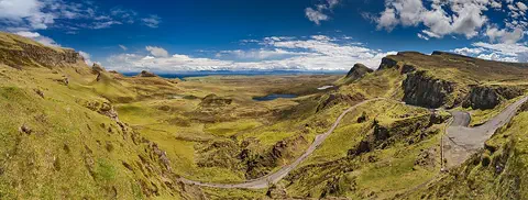
The Turks and Caicos Islands are low coral islands north of the island of Hispaniola. Coral reefs surround them. Long beaches line the shores.
The Turks and Caicos Islands are a British overseas territory at the southeastern end of the Bahamas chain, north of Hispaniola. They are low coral islands with long beaches and reefs, and they are the driest islands in the chain. The government's statistics office gives a 2025 population of 52,299.
The Turks and Caicos Islands, a British overseas territory, are two groups of low coral islands on the southeastern edge of the Bahamas, separated by the 2,100 m deep Turks Island Passage. Cockburn Town on Grand Turk is the seat of government, while Providenciales has grown markedly with tourism. The Turks and Caicos Islands Statistics Authority gives a 2025 population of 52,299.
Photo: Balou46, CC BY-SA 4.0, via Wikimedia Commons
Discover the Turks and Caicos Islands
The Turks and Caicos Islands are many small islands.
They are low, with sandy beaches and bright blue sea all around. The main town is Cockburn Town.
The Turks and Caicos Islands lie in the West Indies at the southeastern end of the Bahamas chain, north of the island of Hispaniola. There are two groups: the Turks Islands and the Caicos Islands, with eight large cays and many smaller ones. Only a few of the islands have people living on them.
The islands are a British overseas territory. A governor represents the British monarch and heads the cabinet, which also includes a premier and other ministers from the House of Assembly. English is the official language, and people pay with the US dollar.
Britannica describes the territory as two groups of islands on the southeastern periphery of the Bahamas, of which they form a physical part, north of Hispaniola: eight large cays and numerous smaller cays, islets, reefs, banks and rocks. Only six of the larger cays and two smaller ones are inhabited.
Under the Turks and Caicos Islands Constitution Order 2011, which took effect on 15 October 2012, a governor represents the British monarch and is responsible for external affairs, internal security, defense, international financial services and appointing public officers. A premier appointed by the governor sits in the cabinet, and the House of Assembly has 21 members, 15 of them directly elected. English is official, and the US dollar is the currency.
Grand Turk, Providenciales and South Caicos
Cockburn Town is on Grand Turk. Little houses look out over the sea.
Most visitors fly in to the big airport on an island called Providenciales.
Cockburn Town, on Grand Turk, is the seat of government. The photo shows its waterfront: a sea wall, wooden piers stretching into turquoise water and colorful houses with red and green roofs.
More than four out of five people live on just three islands: Grand Turk, South Caicos and Providenciales, which most people call Provo. Provo's population has grown a lot since the 1980s as tourism expanded there. Cockburn Harbour, on South Caicos, is the second-largest town.
Cockburn Town on Grand Turk is the seat of government and main commercial center; Cockburn Harbour on South Caicos is the second largest town. Britannica says more than four-fifths of the population lives on South Caicos, Providenciales and Grand Turk, and that Providenciales has grown markedly since the 1980s with tourism, drawing migrants from around the Caribbean, especially Haiti.
The main international airport is on Providenciales, with others on Grand Turk, North Caicos and South Caicos; Grand Turk and Cockburn Harbour are major ports. The photo shows Cockburn Town's seafront, with a sea wall, piers and houses with red and green roofs.
Coral islands, sinkholes and the Wall
The islands are low and made of coral.
It is sunny and dry. Very little rain falls, and fresh water is precious.
The islands are low and were formed by coral reefs. The highest point, Blue Hills on Providenciales, is only about 50 meters high. The rock has many caves and small sinkholes called banana holes, which hold pockets of rich soil.
Between the Turks and the Caicos groups runs the Turks Island Passage, a trench in the sea about 2,100 meters deep, nicknamed the Wall. These are the driest islands in the Bahamas chain: Grand Turk gets only about 736 millimeters of rain a year, and drinking water is scarce. Summer temperatures average 29 to 32 °C.
Britannica describes low-lying islands formed by coral reefs, with many karst features: banana holes (small sinkholes with rich soil), caves, caverns and sea cliffs. Arable land is scarce, and aragonite lies on the shallow banks off West Caicos. The highest elevation is Blue Hills on Providenciales, 50 m in Britannica (49 m in Wikidata).
The Turks group is separated from the Caicos group to its northwest by the Turks Island Passage, or 'the Wall', 35 km long and 2,100 m deep. The climate is tropical savanna, moderated by easterly trade winds: winters average 24 to 27 °C and summers 29 to 32 °C. These are the driest islands of the Bahamas chain, with about 736 mm of rain a year at Grand Turk. Hurricanes can strike from June to November. Vegetation includes scrub, coppice, savanna, marsh, mangroves, cacti and Caribbean pines.
Flamingos, iguanas, conchs and lobsters
Pink flamingos and iguanas live on the islands.
In the sea there are conchs, lobsters and lots of fish.
On land, most of the animals are insects, such as butterflies, along with iguanas and other lizards, and birds, especially flamingos. Many migrating birds pass over the islands on their long journeys.
The reefs and waters around the islands are full of spiny lobsters, conchs, snappers and groupers. Fishing for lobster and conch is a traditional way of earning a living. The spiny lobster in the photo was taken off Cozumel, in Mexico.
Britannica describes land animals as mostly insects (especially butterflies and mosquitoes), iguanas and other lizards, and birds, notably flamingos; the islands lie on several migratory bird routes. The surrounding waters and coral reefs abound in spiny lobsters, conchs, snappers, groupers and other food fishes.
Boatbuilding and fishing for spiny lobster, conch, jack and snapper are traditional livelihoods, and lobster and conch are exported. The Caribbean spiny lobster pictured was photographed off Cozumel, Mexico, in December 2025.

Salt, sailing and scuba diving
People here speak English.
Many visitors come to swim, sail and dive near the reefs. People catch fish, lobster and conch.
More than nine out of ten people in the Turks and Caicos Islands have African ancestors. English is the official language. Island music mixes Haitian and African influences.
Tourism and offshore financial services grew quickly from the mid-1980s, and the islands now rely heavily on them. Visitors come for the beaches and the scuba diving on the coral reefs. Seafood is the main source of protein, and most food is imported. The Turks and Caicos National Museum is on Grand Turk.
Britannica describes a population more than nine-tenths of African heritage, mostly Christian, with English official; thousands of islanders emigrated to the Bahamas and the United States in the 1960s and '70s, and many returned as prosperity grew. GDP grew by an average of 8% a year from the mid-1980s to the early 21st century, driven by tourism and offshore financial services, on which the economy now relies heavily.
The Statistics Authority, created in 2023 from the Statistics Department, reports a 2025 population of 52,299 and unemployment of 4%. Sailing, game fishing and especially scuba diving are popular, traditional music carries Haitian and African influences, and the Turks and Caicos National Museum on Grand Turk keeps collections and archives on island history.
Lucayans, salt rakers and a British territory
Long ago, the Lucayan people lived on these islands.
Later, settlers came to make salt from seawater. Today the islands are a British overseas territory.
Christopher Columbus's diary suggests he reached the islands in 1492, when many were home to the Lucayan Taíno people. In 1678 settlers from Bermuda arrived and made salt by letting seawater dry in the sun. After the American Revolution, settlers came to the Caicos Islands and set up cotton farms worked by enslaved Africans. Slavery was abolished between 1833 and 1843.
The islands were later run from the Bahamas and then from Jamaica. They became a British crown colony in 1962 and have had a governor on Grand Turk since 1973. A new constitution took effect in 2012.
Columbus's partly reconstructed diary suggests he reached the islands in 1492, when the Arawakan-speaking Lucayan Taíno lived on many of them; within a generation of European contact they had died out from introduced diseases and enslavement. Some historians think the islands were uninhabited when Juan Ponce de León arrived in 1512. Bermudian settlers founded a solar salt industry in 1678; after the American Revolution, Loyalists set up cotton plantations worked by enslaved Africans.
The Bahamas annexed the islands in 1799, a separate charter followed in 1848, and slavery was abolished between 1833 and 1843. From 1874 to 1959 the colony was under the governor at Kingston, Jamaica; it became a crown colony in 1962 and received its own British governor at Grand Turk after Bahamian independence in 1973. Plans for independence stalled after the 1980 election, and the territory remained British. Its current constitution took effect on 15 October 2012.
The Turks and Caicos Islands on the map
Find the Caribbean Sea on the globe.
Look north of the big island of Hispaniola. The small islands there are the Turks and Caicos Islands.
The Turks and Caicos Islands lie about 21 to 22 degrees north of the equator, at the southeastern end of the Bahamas chain and north of Hispaniola. The Caicos group lies to the northwest of the Turks group.
The islands are too small for the globe to draw, so PlayOwl marks them with dots: Cockburn Town on Grand Turk, Salt Cay, South Caicos, Middle Caicos and Providenciales.
Cockburn Town lies at about 21.46° N, 71.14° W. The Caicos group lies northwest of the Turks group across the Turks Island Passage; Providenciales, near 21.8° N, 72.3° W, is at the western end. The territory has no land borders.
At the globe's scale the islands have no outlines, so the map uses markers: Cockburn Town, Salt Cay, Cockburn Harbour on South Caicos, Middle Caicos and Providenciales with Blue Hills.
- Highest point
- Blue Hills, about 50 m
- People (2025)
- 52,299
- Turks Island Passage
- 2,100 m deep
- Rain at Grand Turk
- about 736 mm a year
Amazing facts
-
The Turks Islands may be named after a cactus.
The name Turks is said to come from the Turk's head cactus, whose red top looks like a fez hat.
The name Turks is said to derive from the Turk's head cactus (Melocactus intortus), whose scarlet top resembles a fez.
-
Caicos may mean string of islands.
The name Caicos may come from caya hico, which means string of islands in the language of the Lucayan people.
Caicos may derive from the Lucayan phrase caya hico, 'string of islands'.
-
The rocks have holes called banana holes.
Banana holes are small sinkholes in the islands' rock that hold pockets of rich soil.
The islands' karst includes banana holes: small sinkholes containing rich soil in otherwise thin, unfarmable ground.
-
Long ago, people made salt from seawater here.
Settlers from Bermuda arrived in 1678 and made salt by letting seawater dry in the sun.
Bermudian settlers established a solar-evaporated salt industry on the islands in 1678.
Words to know
- cay
- a small, low island of sand or coral
- sinkhole
- a hole in the ground where rock underneath has dissolved away
- trench
- a long, deep valley in the sea floor
- conch
- a large sea snail with a thick spiral shell
- overseas territory
- a place far from a country's main land that belongs to that country and governs itself in many ways
- evaporate
- to turn from a liquid into a gas, leaving anything dissolved, like salt, behind
Discovery challenge
-
What is the deep sea between the islands called?
What nickname is given to the Turks Island Passage?
The 2,100 m deep Turks Island Passage is better known by which name?
- The Wall
- The Bridge
- The Pond
Show the answer
The Wall
The Wall!
The Wall. It is 2,100 meters deep.
'The Wall', a 35 km long marine trench between the two island groups.
-
Long ago, settlers made what from seawater?
What did settlers from Bermuda make on the islands from 1678?
Which industry did Bermudian settlers found on the islands in 1678?
- Sugar
- Salt
- Glass
Show the answer
Salt
Salt!
Salt, by letting seawater dry in the sun.
Solar-evaporated salt.
-
Are the Turks and Caicos Islands wet or dry?
Compared with the rest of the Bahamas chain, how much rain do the Turks and Caicos get?
Where do the Turks and Caicos rank for rainfall in the Bahamas chain?
- They are the wettest
- They are the driest
- They get snow every year
Show the answer
They are the driest
They are dry. Very little rain falls.
They are the driest islands in the chain.
The driest: about 736 mm a year at Grand Turk.
-
Which island has the main town, Cockburn Town?
On which island is Cockburn Town, the seat of government?
Cockburn Town, the seat of government, is on which island?
- Providenciales
- Grand Turk
- Middle Caicos
Show the answer
Grand Turk
Grand Turk.
Grand Turk, in the Turks group.
Grand Turk; Providenciales has the main international airport.
Animals of Turks and Caicos Islands
Explore next
-
 Watch
 Country
The Bahamas
The Bahamas is a chain of nearly 700 islands and cays in the Atlantic Ocean, southeast of Florida and north of Cuba. People live on only about 30 of them. The islands are low and flat, made of limestone from old coral and sea creatures. The 2022 census counted about 398,000 people.
-
 Watch
 Country
Haiti
Haiti covers the western third of the island of Hispaniola in the Caribbean. Its name comes from an old word meaning mountainous land. In 1804, after enslaved people freed themselves, Haiti became independent, and its people created their own language, art and music. About 11.9 million people lived there in 2024.
-
 Watch
 Country
Bermuda
Bermuda is a small group of islands in the North Atlantic Ocean. It is a British Overseas Territory that runs most of its own affairs, and its parliament first met in 1620. The islands sit on top of an old volcano, and the last finished census, in 2016, counted 63,779 people.
-
 Watch
 Country
United Kingdom
The United Kingdom, or UK, lies on islands off the northwest coast of Europe. It is made up of four parts, England, Scotland, Wales and Northern Ireland, and about 69.5 million people live there. Its capital is London.
-
 Watch
Animal
American flamingo
The American flamingo is a tall, bright pink wading bird of the Caribbean. It gets its color from pigments in the tiny water animals and algae it eats, and it feeds by filtering water through its bent bill with its head upside down. Flamingos live and nest in huge, noisy groups.
- Watch Geography Islands An island is a piece of land surrounded by water that is smaller than a continent. Islands form in different ways: some broke away from continents, some were built by volcanoes on the sea floor, and some were made by corals or by waves piling up sand. Because they are cut off by water, islands often have unusual plants and animals.
-
 Watch
 Country
United States
The United States is a large country in North America made of 50 states, from icy Alaska to the warm islands of Hawaii. It has the Grand Canyon, the Mississippi River and Yellowstone, and about 342 million people live there.
-
 Watch
 Country
Mexico
Mexico is a large country in southern North America, between the Pacific Ocean and the Gulf of Mexico. It has smoking volcanoes, ancient cities built by the Maya and other peoples, and about 132 million people, many of them in and around Mexico City.
For parents & teachers
What children will learn
- Locate the Turks and Caicos Islands at the southeastern end of the Bahamas chain.
- Describe how coral islands, sinkholes and deep sea trenches form different landscapes.
- Explain how sea salt can be made from seawater and the sun.
- Describe the islands' traditional work and their modern economy of tourism and finance.
Recommended ages: 3 to 17 · About 15 minutes
Talk about it
- The islands get very little rain. How might people make sure there is enough water to drink?
- Why might so many people move to the island where the hotels are?
- Lobster and conch are caught to eat and to sell. How could people make sure there are still plenty in the future?
Try at home or in class
- Make salt like the old salt rakers: stir salt into warm water, pour it into a shallow dish and leave it in a sunny window for a few days.
- Draw a cross-section showing a low coral island on a shallow bank next to a very deep trench.
Key vocabulary: cay, sinkhole, trench, conch, overseas territory, evaporate
Where these facts come from
- Wikidata , Wikimedia Foundation (CC0 1.0)
- Natural Earth vector data , Natural Earth (NACIS) (Public domain)
- Turks and Caicos Islands (land, people, economy, government and society, history) , Encyclopaedia Britannica
- Turks and Caicos Islands Statistics Authority: 2025 indicators (population, unemployment) , Turks and Caicos Islands Statistics Authority
- PlayOwl region table, version 1 , PlayOwl (PlayOwl original data)
- flag-icons 7.5.0 , Panayiotis Lipiridis and contributors (MIT)
- Wikimedia Commons , Wikimedia Foundation (Per file (public domain, CC0, CC BY or CC BY-SA); see each media record)
Checked, not yet human-reviewed. Last updated November 1, 2026. Spotted a mistake? Tell us.