
 Country
North America
Haiti
Haiti is a country on a mountainous island in the Caribbean Sea. Long ago, its people won their freedom. Today Haitians make colorful art and music.
Haiti covers the western third of the island of Hispaniola in the Caribbean. Its name comes from an old word meaning mountainous land. In 1804, after enslaved people freed themselves, Haiti became independent, and its people created their own language, art and music. About 11.9 million people lived there in 2024.
Haiti occupies the western third of Hispaniola. Formerly France's richest colony, Saint-Domingue, it became independent in 1804 after a revolution by enslaved people, the second country in the Americas, after the United States, to free itself from colonial rule. Its culture blends African and French roots; today it faces deep poverty, natural disasters and violence. Haiti's statistics institute (IHSI) estimated about 11.9 million people in 2024.
Photo: Rémi Kaupp, CC BY-SA 3.0, via Wikimedia Commons
Discover Haiti
Haiti is a country in the Caribbean Sea.
It shares a big island with another country. It has lots of mountains. The capital city is called Port-au-Prince.
Haiti is a country on the island of Hispaniola, in the Caribbean Sea. It takes up the western third of the island, and the Dominican Republic covers the rest. Haiti's name comes from Ayti, an old Indigenous word meaning mountainous land, and about two-thirds of the country is high ground.
Port-au-Prince, the capital, sits by the sea. About 11.9 million people lived in Haiti in 2024. Almost all Haitians are descended from Africans who were brought to the island and enslaved, and who later freed themselves.
Haiti includes the western third of Hispaniola and islands such as Gonâve, Tortue (Tortuga), Grande Caye and Vache. Its name derives from the Indigenous Arawak place-name Ayti, Mountainous Land; about two-thirds of the land lies above 490 m. Britannica notes that the population is almost entirely descended from enslaved Africans and that Haiti, independent from France in 1804, was the second country in the Americas, after the United States, to free itself from colonial rule.
The Haitian Institute of Statistics and Informatics (IHSI) put the population at 11,867,032 in 2024, a figure taken from long-term projections, since the last census was held in 2003. Over the centuries, economic, political and social difficulties and natural disasters have left Haiti with chronic poverty. Britannica (2026) lists a Transitional Presidential Council as head of state and Alix Didier Fils-Aimé as prime minister.
Cities and famous places
Port-au-Prince is the capital city.
Cap-Haïtien is a city by a bay in the north. Nearby, a king built a big palace. A huge stone fort stands on a mountain top.
Port-au-Prince, the capital, was founded in 1749 and is the center of Haiti's culture, with the National Library and art centers. In the north, Cap-Haïtien was once the capital of the French colony.
In the hills south of Cap-Haïtien, Henry Christophe, who ruled northern Haiti after independence, built a grand palace called Sans Souci and a huge fortress, the Citadelle Laferrière, on a mountain peak. Together with the buildings at Ramiers, they are a World Heritage Site and, UNESCO says, symbols of liberty, the first monuments built by enslaved people who had won their freedom.
Port-au-Prince, founded in 1749 and colonial capital from 1770, is the center of cultural and intellectual life, with the National Library (1940), the Centre d'Art (1944) and universities; its metropolitan area includes Pétionville, Carrefour and Delmas, and Victorian wooden gingerbread houses survive in older districts. Cap-Haïtien, formerly Cap-Français, was the colony's original capital.
The National History Park – Citadel, Sans Souci, Ramiers was inscribed by UNESCO in 1982. Henry Christophe, who declared himself King Henry I in 1811, built the Sans Souci palace and the Citadelle Laferrière atop a peak of the Massif du Nord overlooking Cap-Haïtien. UNESCO calls these early 19th-century monuments universal symbols of liberty, the first built by Black people who had freed themselves from slavery. In the gulf, Gonâve Island covers about 750 km², and Tortue Island, off the north coast, was a 17th-century base of privateers and pirates.
Mountains, plains and the sea
Haiti has many mountains.
It is warm all year. Some months bring lots of rain. Big storms called hurricanes sometimes come in summer and fall.
Four long mountain ranges cross the island of Hispaniola from west to east, and Haiti has parts of all of them. Its highest peak, Mount Selle, is 2,674 meters tall. Between the mountains are plains, the best land for farming, and the Artibonite, the longest river on the island, flows to the sea.
Haiti is warm all year, from about 25 °C in January to about 30 °C in July and August, but it is cool high in the mountains. Hurricanes and earthquakes sometimes strike. Over many years most of the forests were cut down, and the soil washed away from the bare hills.
Haiti's coast forms a long southern peninsula and a shorter northern one around the Gulf of Gonâve. Four ranges run west to east: the Massif du Nord (about 1,200 m on average), the Matheux and Trou d'Eau mountains, and the Massif de la Selle, which reaches 2,674 m at Mount Selle, the highest point, continuing west as the Massif de la Hotte (Macaya Peak, 2,345 m). The Artibonite, about 280 km long and the island's longest river, crosses the Central Plateau to the Gulf of Gonâve. A fault line runs along the southern peninsula just south of Port-au-Prince, and earthquakes have struck repeatedly, including in 2010 and 2021.
Temperatures average about 25 °C in January–February and 30 °C in July–August; Kenscoff, at 1,430 m, averages about 16 °C. Haiti lies on the leeward side of the island, where humid trade winds have less influence than in the Dominican Republic; some areas get less than 700 mm of rain a year, and all parts can be hit by hurricanes. Clearing since the 17th century has reduced the forests to a tiny share of the land, and as much as one-third of the land may have eroded beyond recovery. Patches of old forest survive in the Massif de la Selle and on Macaya Peak, with giant tree ferns and orchids.

Animals of Haiti
Pink flamingos wade in the water on one island.
Manatees swim along the coast. Sea turtles swim near coral reefs. Many birds live in Haiti too.
Because so much forest has been cut, many wild animals in Haiti have lost their homes. Some flamingos still live on Gonâve Island, and American crocodiles, gentle West Indian manatees and green sea turtles live in Haiti's lakes, rivers and seas.
The seas around Haiti are known for their coral reefs. In the mountains, the last patches of old forest, with giant tree ferns and orchids, give shelter to plants and animals. Few national parks have been set up, so protecting nature is a big challenge.
Britannica explains that as natural vegetation retreated, wildlife lost habitat and shelter: some species have disappeared, flamingos survive on Gonâve Island, where they are often hunted, and little has been done to conserve Haiti's flora and fauna, with few parks; coral formations have suffered especially. The seas around Haiti are renowned for coral reefs, and mangrove swamps have shrunk as their trees were cut for firewood and charcoal.
The IUCN Red List maps the American flamingo, American crocodile, West Indian manatee and green sea turtle as living in Haiti or its waters today. Old-growth forest survives in the Massif de la Selle, with tall pines, and on the slopes of Macaya Peak in the Massif de la Hotte, an evergreen forest of giant tree ferns and orchids.

People, art, music and food
About 11.9 million people live in Haiti.
Most people speak Haitian Creole. Haitian painters are famous around the world. Rice and beans are everyday foods.
About 11.9 million people lived in Haiti in 2024. Haitian Creole and French are the official languages; Creole is what people speak every day, and French is used at school and on formal occasions. Most people are Christian, and many also practice Vodou, a religion with roots in West Africa.
Haitian art is famous around the world. In 1944 self-taught painters opened an art center in Port-au-Prince, and their works have been shown by major galleries in the United States and Europe. Everyday foods include beans, rice, sweet potatoes, plantains, corn and cassava, and street stalls sell fritay, fried pork, fish or plantain.
Haitian culture grew out of centuries of slavery and colonialism and the victory of newly self-freed people; Britannica describes a distinctive culture with innovative art, music, dance and literature, shaped by African, French and wider Caribbean influences. Haitian Creole and French are official; Creole is used in daily life, while French, the second language of perhaps one-tenth of people, dominates formal settings and schools. More than half of people are Roman Catholic and about one-fourth Protestant; most Catholics also practice Vodou, which was officially recognized in 2003.
The Centre d'Art (1944) launched self-taught artists such as Hector Hyppolite and Georges Liautaud, whose works have been shown in major galleries. Writers include Jean Price-Mars, Jacques Roumain and, in English, Edwidge Danticat. Staples are beans, rice, sweet potatoes, plantains, corn, cassava and taro, seasoned with thyme, anise and cloves. About two-fifths of people live in rural areas, mostly as small farmers.

Freedom, independence and today
Long ago, the Taino people lived on this island.
Later, people were brought from Africa and forced to work. They won their freedom. In 1804, Haiti became its own country.
Taino people farmed cassava and fished on the island they called Quisqueya. Christopher Columbus arrived in 1492, and in the years that followed the Spanish forced the Taino to work, and diseases from Europe caused most of them to die. Later, France took the western part of the island and called it Saint-Domingue. Huge numbers of Africans were brought there as enslaved people to work on sugar farms.
In 1791 enslaved people rose up for their freedom. Slavery was ended in 1793–94, and leaders such as Toussaint Louverture, a formerly enslaved man, came to the fore. On January 1, 1804, the country became independent and took the name Haiti.
Hispaniola was first inhabited about 5000 BCE; the Taino, an Arawak people, called it Quisqueya. After Columbus arrived in 1492, Spanish forced labor and European diseases destroyed the Indigenous population. France obtained the western third in 1697 and, as Saint-Domingue, made it France's most prosperous colony, built on sugar grown by about half a million enslaved Africans by 1789. The Haitian Revolution (1791–1804) began with a mass uprising of enslaved people; slavery was abolished in 1793–94, Toussaint Louverture rose to lead the colony, and Jean-Jacques Dessalines and Henry Christophe defeated Napoleon's army, which had threatened to restore slavery. Independence was declared on January 1, 1804.
The young country faced isolation and poverty. The United States occupied Haiti from 1915 to 1934. Today Haiti faces great hardship: the 2010 earthquake devastated Port-au-Prince, President Jovenel Moïse was assassinated in 2021, and armed gangs came to control most of the capital, forcing many families to flee their homes. Britannica notes that the shared experiences and hardships of generations have shaped Haiti's distinctive culture.
Haiti on the map
Find Haiti on the globe.
Look in the Caribbean Sea, south of the United States. Haiti is on the left side of a big island.
Haiti is in the Caribbean, southeast of the United States. It shares the island of Hispaniola with the Dominican Republic, which lies to the east. The Atlantic Ocean is to the north and the Caribbean Sea to the south and west.
Cuba is just 80 kilometers away across a strait called the Windward Passage, and Jamaica lies to the west. Haiti's two long peninsulas wrap around the Gulf of Gonâve like a pair of open jaws.
Haiti is bordered to the east by the Dominican Republic, to the south and west by the Caribbean and to the north by the Atlantic. Cuba lies about 80 km west of the northern peninsula across the Windward Passage, Jamaica about 190 km west of the southern peninsula across the Jamaica Channel, and Great Inagua in The Bahamas about 110 km to the north.
Haiti also claims Navassa Island, an uninhabited islet administered by the United States about 55 km to the west. The Artibonite rises in the Dominican Republic and follows part of the border before crossing Haiti to the Gulf of Gonâve; Lake Saumâtre lies on the Dominican border east of Port-au-Prince.
- Highest point
- Mount Selle, 2,674 m
- High land
- about two-thirds above 490 m
- Artibonite River
- about 280 km
- People (2024 official estimate)
- 11,867,032
Amazing facts
-
Haiti's name means mountainous land.
The name Haiti comes from Ayti, an Indigenous word meaning mountainous land, and about two-thirds of the country is high ground.
Haiti's name derives from the Arawak place-name Ayti (Mountainous Land); about two-thirds of the land lies above 490 m.
-
Haiti's palace and fort are symbols of freedom.
UNESCO calls Sans Souci and the Citadelle symbols of liberty, because they were the first monuments built by people who had freed themselves from slavery.
UNESCO describes the Palace of Sans Souci, the Ramiers buildings and the Citadel as universal symbols of liberty, the first monuments built by Black people who had gained their freedom.
-
Haitian painters became famous around the world.
In 1944 self-taught artists opened the Centre d'Art in Port-au-Prince, and their paintings have been shown in big galleries in the United States and Europe.
Haitian visual art drew international attention after self-taught artists founded the Centre d'Art (1944); works by Hector Hyppolite and Georges Liautaud have been exhibited by major galleries.
-
Cuba is very close to Haiti.
Cuba is only about 80 kilometers from Haiti, across a strait called the Windward Passage.
Cuba lies some 80 km west of Haiti's northern peninsula across the Windward Passage, which links the Atlantic and the Caribbean.
Words to know
- independence
- when a country rules itself instead of being ruled by another country
- colony
- a land ruled by another country far away
- creole
- a language that grew from a mix of languages and became people's everyday speech
- peninsula
- a piece of land almost surrounded by water
- fortress
- a large, strong building made to protect a place
- World Heritage Site
- a place UNESCO lists as important to all people, to be protected
Discovery challenge
-
What is the capital city of Haiti?
Which city is the capital of Haiti?
Which city, founded in 1749 and colonial capital from 1770, is Haiti's capital?
- Cap-Haïtien
- Santo Domingo
- Port-au-Prince
Show the answer
Port-au-Prince
Port-au-Prince is the capital of Haiti.
Port-au-Prince is the capital. Cap-Haïtien is a city in the north, and Santo Domingo is in the Dominican Republic.
Port-au-Prince, founded in 1749, replaced Cap-Français (Cap-Haïtien) as the colonial capital in 1770.
-
Haiti shares its island with which country?
Which country shares the island of Hispaniola with Haiti?
Which country covers the eastern two-thirds of Hispaniola?
- The Dominican Republic
- Jamaica
- Mexico
Show the answer
The Dominican Republic
Haiti shares its island with the Dominican Republic.
The Dominican Republic covers the rest of Hispaniola, east of Haiti.
Haiti holds the western third of Hispaniola; the Dominican Republic covers the rest.
-
In which year did Haiti become its own country?
In which year did Haiti become independent?
On January 1 of which year was Haiti declared independent?
- 1704
- 1804
- 1904
Show the answer
1804
Haiti became its own country in 1804.
Haiti became independent on January 1, 1804, after enslaved people freed themselves.
Independence was declared on January 1, 1804, ending the revolution of 1791–1804.
-
What does the name Haiti mean?
The name Haiti comes from Ayti, a word meaning what?
Haiti's name comes from the Arawak place-name Ayti. What does it mean?
- Mountainous land
- Green river
- Sunny beach
Show the answer
Mountainous land
Haiti means mountainous land.
Ayti means mountainous land, and Haiti has lots of mountains.
Ayti, Mountainous Land, fits a country where about two-thirds of the land lies above 490 m.
-
Which languages do people speak in Haiti?
What are Haiti's two official languages?
Which two languages are official in Haiti, one used daily and one in formal settings?
- Spanish and English
- Haitian Creole and French
- Portuguese and Dutch
Show the answer
Haitian Creole and French
People speak Haitian Creole and French.
Haitian Creole is spoken every day; French is used at school and on formal occasions.
Creole is used in daily life; French, a second language for perhaps one-tenth of people, dominates formal settings and schools.
Animals of Haiti
-
Watch
Animal
American flamingo
The American flamingo is a tall, bright pink wading bird of the Caribbean. It gets its color from pigments in the tiny water animals and algae it eats, and it feeds by filtering water through its bent bill with its head upside down. Flamingos live and nest in huge, noisy groups.
-
 Watch
Animal
Christmas tree worm
The Christmas tree worm is a small sea worm that lives in a tube inside living coral on Caribbean reefs. Only its two colorful, spiral crowns show. They catch tiny floating food and help it breathe, and the worm pulls them in with a flash if anything comes too close.
Explore next
-
 Watch
 Country
Cuba
Cuba is the largest island in the Caribbean, a long, narrow country with about 1,600 smaller islands and cays around it. It has mountains, green valleys, coral reefs and the old city of Havana, its capital. About 9.4 million people lived there at the end of 2025, and Spanish is the main language.
-
Watch
Animal
American flamingo
The American flamingo is a tall, bright pink wading bird of the Caribbean. It gets its color from pigments in the tiny water animals and algae it eats, and it feeds by filtering water through its bent bill with its head upside down. Flamingos live and nest in huge, noisy groups.
-
Watch
Animal
Christmas tree worm
The Christmas tree worm is a small sea worm that lives in a tube inside living coral on Caribbean reefs. Only its two colorful, spiral crowns show. They catch tiny floating food and help it breathe, and the worm pulls them in with a flash if anything comes too close.
-
 Watch
 Country
United States
The United States is a large country in North America made of 50 states, from icy Alaska to the warm islands of Hawaii. It has the Grand Canyon, the Mississippi River and Yellowstone, and about 342 million people live there.
-
 Watch
 Country
Mexico
Mexico is a large country in southern North America, between the Pacific Ocean and the Gulf of Mexico. It has smoking volcanoes, ancient cities built by the Maya and other peoples, and about 132 million people, many of them in and around Mexico City.
-
 Watch
 Country
Canada
Canada is the second-largest country in the world, stretching across the north of North America from the Atlantic to the Pacific and up into the Arctic. It has the Rocky Mountains, thousands of islands and about 42 million people, who speak English, French and many other languages.
-
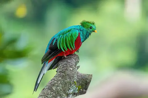 Watch
 Country
Costa Rica
Costa Rica is a small country in Central America between the Caribbean Sea and the Pacific Ocean. Volcanoes and mountains run down its middle, its forests are full of wildlife, and many national parks protect them. Since 1949 it has had no army. About 5.2 million people lived there in 2025.
-
 Watch
 Country
Honduras
Honduras is a mountainous country in Central America, with the Caribbean Sea to the north and a short Pacific coast to the south. Its forests are home to jaguars and macaws, the Maya city of Copán stands in the west, and about 10.2 million people live there (official 2026 estimate).
For parents & teachers
What children will learn
- Locate Haiti on Hispaniola and name its neighbors across the water.
- Explain how mountains, deforestation and storms affect the land and the people who farm it.
- Describe how Haiti became independent in 1804, and why UNESCO calls its monuments symbols of liberty.
- Appreciate Haitian Creole, art, music and food; older students also learn plainly and kindly about present-day hardship.
Recommended ages: 3 to 17 · About 15 minutes
Talk about it
- Why might people who freed themselves from slavery build a huge fortress and a palace?
- What do bright colors and bold shapes in Haitian paintings make you feel?
- How do trees on hillsides help keep soil in place?
Try at home or in class
- Paint a picture of a market, a street or a landscape in bright, bold colors, inspired by Haitian painters.
- Pour water over two slopes of soil, one bare and one covered with leaves, and compare how much soil washes away.
Key vocabulary: independence, colony, creole, peninsula, fortress, World Heritage Site
Where these facts come from
- Wikidata , Wikimedia Foundation (CC0 1.0)
- Natural Earth vector data , Natural Earth (NACIS) (Public domain)
- UNESCO World Heritage List , UNESCO World Heritage Centre (Linked as a reference; site facts come from Wikidata)
- The IUCN Red List of Threatened Species , International Union for Conservation of Nature (IUCN terms of use (no redistribution of Red List data or range maps))
- Haiti (introduction, quick facts, land, relief, drainage, geology, soils) , Encyclopaedia Britannica
- Haiti: Climate (plant and animal life, people, languages, religion, settlement) , Encyclopaedia Britannica
- Haiti: Housing (education, cultural life, food, arts) , Encyclopaedia Britannica
- Haiti: Early period , Encyclopaedia Britannica
- Haiti: The Haitian Revolution , Encyclopaedia Britannica
- Haiti: Haiti in the 21st century , Encyclopaedia Britannica
- National History Park – Citadel, Sans Souci, Ramiers , UNESCO World Heritage Centre
- Estimations désagrégées de la population haïtienne en 2024 (total 11,867,032) , Institut Haïtien de Statistique et d'Informatique (IHSI)
- PlayOwl region table, version 1 , PlayOwl (PlayOwl original data)
- flag-icons 7.5.0 , Panayiotis Lipiridis and contributors (MIT)
- Wikimedia Commons , Wikimedia Foundation (Per file (public domain, CC0, CC BY or CC BY-SA); see each media record)
Checked, not yet human-reviewed. Last updated October 27, 2026. Spotted a mistake? Tell us.
Picture credits
- Photo: Rémi Kaupp, CC BY-SA 3.0, via Wikimedia Commons · source · license
- Photo: Michelle Walz Eriksson, CC BY 2.0, via Wikimedia Commons · source · license
- Photo: Adrian Pingstone, public domain, via Wikimedia Commons · source
- Photo: Rémi Kaupp, CC BY-SA 3.0, via Wikimedia Commons · source · license
- Photo: U.S. Navy photo by Mass Communication Specialist 2nd Class Meranda Keller, public domain, via Wikimedia Commons · source
- Photo: Galen Rathbun, public domain, via Wikimedia Commons · source