
Landmark Asia
Naqsh-e Jahan Square
Naqsh-e Jahan Square is a giant city square in Isfahan, Iran. Tiled buildings stand on every side. Its name means 'Image of the World'.
Naqsh-e Jahan Square in Isfahan, Iran, was built by Shah Abbas I of the Safavid dynasty in the early 1600s. It is 560 meters long and 160 meters wide, with shops in two-story arcades and a grand building on each side. UNESCO listed it as a World Heritage Site in 1979.
Naqsh-e Jahan ('Image of the World'), inscribed by UNESCO in 1979 as Meidan Emam, Esfahan, is the royal square laid out by the Safavid shah Abbas I in the early 17th century at the heart of his capital. Measuring 560 by 160 m, almost 9 ha, it is framed by two-story arcades and anchored by the Royal Mosque, the Ali Qapu pavilion, the Qeyssariyeh portico and a court mosque.
Photo: Arad Mojtahedi, CC BY-SA 3.0, via Wikimedia Commons
Discover Naqsh-e Jahan Square
Naqsh-e Jahan Square is in Isfahan, a city in Iran.
It is a very big open square. Tall buildings with shiny tiles stand all around it.
Naqsh-e Jahan Square lies in the center of Isfahan, a city on the main travel routes across central Iran. Its name means 'Image of the World'. It has also been called Meidan-e Shah, the Royal Square, and UNESCO lists it as Meidan Emam.
UNESCO calls it one of the largest city squares in the world. It is 560 meters long, about five and a half times the length of a 100-meter race, and 160 meters wide. That is unusual in Iran, where cities were usually built close together with few big open spaces.
The square lies in the center of Esfahan, on the main north–south and east–west routes across central Iran. Known as Naqsh-e Jahan ('Image of the World') and formerly as Meidan-e Shah, it is inscribed as Meidan Emam, Esfahan. UNESCO calls it one of the largest city squares in the world and an outstanding example of Iranian and Islamic architecture.
At 560 by 160 m, covering almost 9 ha, it is atypical of Iranian towns, which UNESCO describes as usually tightly laid out without sizeable open spaces except the courtyards of caravanserais. It was registered on Iran's national list of monuments as item no. 102 on 5 January 1932, and inscribed on the World Heritage List in 1979 under criteria (i), (v) and (vi).
- Where
- center of Isfahan (Esfahan), Iran
- Built
- early 17th century
- Size
- 560 m long, 160 m wide, almost 9 ha
- World Heritage
- inscribed 1979
The heart of a royal capital
Long ago, a king named Shah Abbas made Isfahan his capital city.
He built this square in the middle of the city. People came here to shop, listen to music and play games.
Shah Abbas I, of the Safavid dynasty, ruled from 1587 to 1628. He chose Isfahan as his capital and remodeled the city, and in the early 1600s he built this great square.
The square was the heart of the capital. People strolled across it, held celebrations and played polo, a game on horseback. Hundreds of shops filled the arcades, and musicians gave public concerts from a balcony above the bazaar gate.
ICOMOS's 1979 evaluation records that Shah Abbas, who reigned from 1587 to 1628, chose Esfahan as his capital, then remodeled and embellished it, marking its center with a vast royal square. UNESCO dates the square to the early 17th century and stresses that it was built over a short time span according to one coherent plan.
It was the center of the Safavid capital's economic, social and political life. Its sandy open ground was used for promenades, celebrations and polo; the arcades held hundreds of shops; musicians played public concerts from a balcony above the Qeyssariyeh portico; and the shah occasionally received ambassadors in a throne room behind the Ali Qapu terrace. UNESCO calls it the preeminent monument of Persian social and cultural life under the Safavid dynasty (1501–1722; 1729–1736).
One plan, four great buildings
Long rows of arches go all around the square.
On each side stands one big building. Two of them have big round domes.
The square was built to one plan. Long two-story arcades, rows of arches with shops, run around all four sides. In the middle of each side stands a grand building.
On the south side is the Royal Mosque, with a tall entrance framed by two minarets. On the west side is the Ali Qapu pavilion, the entrance to the palace area and royal gardens. On the north side, the Qeyssariyeh portico leads into the bazaar. On the east side stands a mosque built for the royal court.
UNESCO describes a homogeneous urban ensemble anchored on each side by one monument: the Royal Mosque (Masjed-e Shah) to the south, the Ali Qapu pavilion to the west, the Qeyssariyeh portico to the north and, to the east, a mosque built as a private mosque for the royal court and now counted among the masterpieces of Safavid architecture.
The Royal Mosque meets the square through a deep entrance portal with angled corners, topped by a half-dome lined with enamelled tile mosaic and framed by two minarets. A gateway hall leads from it at an angle into the courtyard, so the mosque can face toward Mecca, as is traditional, while the square runs north–south. The Qeyssariyeh portico opens into the 2-km-long Esfahan Bazaar.
Tiles, paintings and a high terrace
The buildings are covered with colorful tiles and paintings of flowers and trees.
One building has a high porch with thin wooden posts holding up its roof.
Every building around the square, even the shop arcades, is decorated with shiny glazed tiles and paintings, mostly of flowers, trees and vases.
The Ali Qapu pavilion has a high entrance 48 meters tall. On top is a covered terrace, called a talar, whose roof rests on 18 thin wooden columns. Its rooms are covered with paintings and largely open to the outside.
All the architectural elements, arcades included, are covered with enamelled ceramic tiles and paintings in which floral ornament dominates (flowering trees, vases, bouquets), alongside figurative scenes in the style of Riza-i Abbasi, head of Esfahan's school of painting under Shah Abbas.
Ali Qapu's high portal (48 m) is flanked by several stories of rooms and topped by a terrace (talar) shaded by a roof resting on 18 thin wooden columns; its apartments are completely decorated with paintings and largely open to the outside. UNESCO calls the Royal Mosque the most celebrated example of the colorful architecture that peaked in Iran under the Safavids.
- Ali Qapu portal
- 48 m high
- Ali Qapu terrace roof
- on 18 thin wooden columns
- Bazaar behind the north portico
- about 2 km long
Looking across the square
In the photo, you see the long square full of trees and grass.
Far away is a blue dome. Mountains stand behind it.
The photo looks down the length of the square. On the left is the pale dome of the east mosque, far ahead is the Royal Mosque's entrance between two minarets with its blue dome, and on the right is the Ali Qapu pavilion with its columned terrace. Arcades line the sides, lawns, trees and a fountain fill the middle, and a road with cars runs across the front.
The square was once covered with sand. Today it is paved with stone, a pond sits in its center, and lawns were added in the 1990s.
The photograph looks south along the square: the east mosque's pale dome at the left edge, the Royal Mosque's portal and minarets with its blue dome at the far end, the Ali Qapu pavilion and its columned talar on the right, two-story arcades on both sides, and lawns, trees, a central fountain and a road with traffic in the foreground, with mountains on the horizon.
UNESCO notes that the once-sandy surface is now paved with stone, a pond was placed at the center, lawns were installed in the 1990s, and two entrances were added to the square's ranges. It lists threats from pressure for multi-story commercial and parking buildings in the buffer zone, road widening, growing numbers of tourists and fire, and has said the property needs a management plan.
Amazing facts
-
The square's name means 'Image of the World'.
Naqsh-e Jahan means 'Image of the World'.
The name Naqsh-e Jahan (also written Naghsh-e Jahan) means 'Image of the World'; the square was formerly called Meidan-e Shah.
-
Long ago, people played polo on horses in this square!
The square's sandy ground was once used for playing polo, a game played on horseback.
Under the Safavids the sandy esplanade was used for polo as well as promenades and celebrations.
-
Musicians played music for everyone from a balcony.
Above the gate to the bazaar was a balcony where musicians gave public concerts.
A balcony above the Qeyssariyeh portico accommodated musicians giving public concerts.
-
The roof of one porch sits on 18 thin wooden posts.
The Ali Qapu terrace's roof rests on 18 thin wooden columns.
Ali Qapu's talar is shaded by a roof resting on 18 thin wooden columns, above a portal 48 m high.
Words to know
- square
- a large open space in a town, with buildings around it
- arcade
- a row of arches, often with shops behind them
- dynasty
- a family of rulers who rule one after another
- minaret
- a tall, thin tower that is part of a mosque
- mosque
- a building where Muslims gather to pray
- bazaar
- a market with many shops along covered streets
- glazed tile
- a baked clay tile with a shiny, colored coating
Discovery challenge
-
What does the name Naqsh-e Jahan mean?
What does the name Naqsh-e Jahan mean?
How does UNESCO translate the name Naqsh-e Jahan?
- Image of the World
- Big Blue Gate
- Garden of Shops
Show the answer
Image of the World
Image of the World!
It means 'Image of the World'.
'Image of the World'.
-
Who built the square?
Which ruler built Naqsh-e Jahan Square?
Which Safavid ruler laid out the square in the early 17th century?
- Shah Abbas I
- A Roman emperor
- A Chinese emperor
Show the answer
Shah Abbas I
Shah Abbas!
Shah Abbas I of the Safavid dynasty.
Shah Abbas I, who reigned from 1587 to 1628.
-
Which game did people play on horses in the square?
Which game was played on the square's sandy ground long ago?
Besides promenades and celebrations, which sport does UNESCO say was played on the esplanade?
- Polo
- Ice hockey
- Baseball
Show the answer
Polo
Polo, on horses!
Polo, a game played on horseback.
Polo.
-
How long is the square?
How long is Naqsh-e Jahan Square?
What is the length of the square, according to UNESCO?
- 560 meters
- 56 meters
- 5,600 meters
Show the answer
560 meters
560 meters!
560 meters long and 160 meters wide.
560 m, by 160 m wide, almost 9 ha.
-
What stands on each side of the square?
What stands in the middle of each side of the square?
How does UNESCO describe the square's layout?
- A grand building
- A tall statue
- A big lake
Show the answer
A grand building
A big, grand building!
A grand building: the Royal Mosque, the Ali Qapu pavilion, the Qeyssariyeh portico and a court mosque.
Arcades all round, anchored on each side by one monumental building.
Nearby places
-
 Watch
City
Isfahan
Isfahan is one of Iran's main cities, in the center of the country. Its great public square, built in the early 1600s, is a UNESCO World Heritage site, with rows of shops in arcades on every side. Iran's 2016 census counted 1,961,260 people in the city.
-
 Watch
Landmark
Persepolis
Persepolis was a royal city of the Persian kings. King Darius I began it around 518 BCE on a huge terrace at the foot of a mountain in southwestern Iran. Its palaces had very tall, slender columns and walls carved with long parades of people bringing gifts. It is a UNESCO World Heritage Site.
-
 Watch
Landmark
Susa
Susa, in southwest Iran, is one of the most ancient places where towns first grew. People built there from more than 6,000 years ago until about 800 years ago, one town on top of another. It was the capital of the Elamites and later of the Persian king Darius I, whose great palace still lies in ruins there.
-
 Watch
City
Tehran
Tehran, the capital of Iran, spreads up the slopes of the Alborz Mountains, with snowy peaks to the north and desert to the south. Once a small village, and later a market town known for its pomegranates, it became the capital in 1786. Today it is a huge, modern city with an old roofed bazaar, a palace that is a World Heritage Site and the 435-meter Milad Tower.
-
 Watch
City
Karaj
Karaj is a big city in Iran, 36 kilometers west of Tehran, on the southern slopes of the Alborz Mountains. It is the main city of Alborz Province. The 2016 census counted 1,592,492 people in Karaj, and Store norske leksikon calls it the fourth largest city in the country.
-
 Watch
Landmark
Behistun Inscription
The Behistun Inscription is a huge carving on a limestone cliff in western Iran, made for the Persian king Darius I around 520 BC. It tells the same story in three languages, all written in cuneiform, and when scholars read it in the 1800s, it unlocked cuneiform writing much as the Rosetta Stone unlocked Egyptian hieroglyphs.
-
 Watch
City
Kuwait City
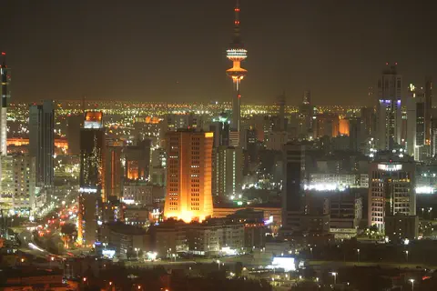
Kuwait City is the capital of Kuwait. It began as a town on the coast early in the 1700s and grew rich from caravans and pearl fishing. Today tall towers rise over the city, and summer days average highs near 47 °C.
-
 Watch
Landmark
Ur
Ur was a great city of Sumer, in the south of what is now Iraq, founded more than 5,000 years ago. Twice it was the capital of an empire. Archaeologists found royal tombs full of gold treasures, streets of brick houses and a huge stepped temple tower called a ziggurat. When the Euphrates River moved away, the fields dried up and the city was abandoned.
Explore next
-
Watch
 Country
Iran
Iran is a country in southwestern Asia. A high, dry plateau fills its middle, with mountain ranges all around it, and about 92 million people (2025) live there. Long ago it was called Persia, and its capital today is Tehran.
-
Watch
Landmark
Persepolis
Persepolis was a royal city of the Persian kings. King Darius I began it around 518 BCE on a huge terrace at the foot of a mountain in southwestern Iran. Its palaces had very tall, slender columns and walls carved with long parades of people bringing gifts. It is a UNESCO World Heritage Site.
-
Watch
City
Tehran
Tehran, the capital of Iran, spreads up the slopes of the Alborz Mountains, with snowy peaks to the north and desert to the south. Once a small village, and later a market town known for its pomegranates, it became the capital in 1786. Today it is a huge, modern city with an old roofed bazaar, a palace that is a World Heritage Site and the 435-meter Milad Tower.
-
 Watch
Landmark
Sultan Ahmed Mosque
The Sultan Ahmed Mosque in Istanbul was built between 1609 and about 1616 for the Ottoman ruler Sultan Ahmed I. Its central dome is ringed by half-domes and smaller domes, and six slender minarets rise around it. Many people call it the Blue Mosque because of the blue and green tiles and painted decoration inside. It is still a working mosque, where Muslims come to pray.
-
 Watch
Landmark
Süleymaniye Mosque
The Süleymaniye Mosque in Istanbul, Türkiye, was designed by the architect Sinan and built between 1550 and 1557 for the Ottoman sultan Süleyman. With the mosque, Sinan built a whole complex of schools, a hospital, an inn for travelers, a kitchen and a bath. It is part of the Historic Areas of Istanbul, a UNESCO World Heritage Site since 1985.
-
 Watch
Landmark
Abraj Al Bait
Abraj Al Bait is a group of seven hotel towers in Mecca, Saudi Arabia, beside the city's Great Mosque. In the middle rises the Makkah Royal Clock Tower, 601 meters tall to the tip of its spire, with a huge clock near the top. It was finished in 2012.
-
 Watch
Landmark
Agra Fort
Agra Fort is a huge red sandstone fortress beside the Yamuna River in Agra, India. The Mughal emperor Akbar began it in 1565. Its walls, about 2.5 kilometers around, protect palaces, halls and mosques added by later emperors. It was both an army base and a royal home.
-
 Watch
Landmark
Akashi Kaikyō Bridge
The Akashi Kaikyō Bridge is a suspension bridge almost 4 kilometers long that crosses the Akashi Strait between Kobe and Awaji Island in Japan. Its middle span is 1,991 meters. When it opened in 1998, it was the longest suspension bridge in the world.
For parents & teachers
What children will learn
- Locate Isfahan in Iran and describe Naqsh-e Jahan Square and the four buildings around it.
- Explain how the square was built to one plan in the early 17th century as the center of the Safavid capital.
- Describe how glazed tiles and paintings decorate the buildings, and what UNESCO says threatens the site today.
Recommended ages: 4 to 17 · About 15 minutes
Talk about it
- The square was used for shopping, music, games and celebrations. What open spaces in your town are used in many ways?
- Why might a ruler build a whole square to one plan instead of letting it grow bit by bit?
- UNESCO worries about tall new buildings and growing crowds of visitors. How can a city keep an old square special?
Try at home or in class
- Design a square on graph paper: draw arcades around the edge and a special building in the middle of each side.
- Make a paper 'tile' pattern of flowers and vases with colored pencils, repeating it like a tiled wall.
Key vocabulary: square, arcade, dynasty, minaret, mosque, bazaar, glazed tile
Where these facts come from
- Wikidata , Wikimedia Foundation (CC0 1.0)
- Meidan Emam, Esfahan (World Heritage List) , UNESCO World Heritage Centre
- Advisory Body Evaluation: Meidan-e Shah, Esfahan (No 115, May 1979) , ICOMOS, via UNESCO World Heritage Centre
- UNESCO World Heritage List , UNESCO World Heritage Centre (Linked as a reference; site facts come from Wikidata)
- Wikimedia Commons , Wikimedia Foundation (Per file (public domain, CC0, CC BY or CC BY-SA); see each media record)
Checked, not yet human-reviewed. Last updated November 1, 2026. Spotted a mistake? Tell us.