
City Asia
Vientiane
Vientiane is the capital city of Laos. It lies beside a great river, the Mekong.
Vientiane is the capital of Laos, on the left bank of the Mekong River. Lao Statistics Bureau figures give Vientiane Capital, the prefecture around the city, an estimated 844,020 people in mid-2015.
Vientiane, capital of Laos, stands on the left bank of the middle Mekong. Universalis says the French protectorate rebuilt it from 1893, and that its urban area tripled in the 1990s. Since 1994 a bridge has crossed the Mekong here, and since 2021 a railway station has served the city.
Photo: Christophe95, CC BY-SA 4.0, via Wikimedia Commons
Discover Vientiane
Vientiane is the capital of Laos, a country in Southeast Asia. It is beside the Mekong, a very long river.
There are many green trees between the houses.
Vientiane is the capital of Laos. Universalis places it on the left bank of the middle Mekong, in the heart of the Indochinese peninsula. The city is part of a prefecture called Vientiane Capital, which also takes in suburban and country districts.
Official figures listed by City Population give Vientiane Capital 698,318 people at the 2005 census and an estimated 844,020 in mid-2015, with a projection of 948,447 for 2020.
Universalis (Christian Taillard) gives the city itself 620,000 people at the 2015 census and calls it the smallest capital of the peninsula, unlike its neighbors' capitals, which lie in river deltas. The prefecture, Vientiane Capital, adds suburban and rural districts.
The Lao Statistics Bureau's figures on City Population: 528,109 (1995 census), 698,318 (2005 census), 844,020 (estimate, 1 July 2015) and 948,447 (projection, 1 July 2020). Laos held its fifth population and housing census in 2025; the national results were announced on 20 October 2026.
- Country
- Laos (capital)
- People in Vientiane Capital (estimate, 1 July 2015)
- 844,020
- People in Vientiane Capital (projection for 2020)
- 948,447
- River
- Mekong (left bank)
The view from the Patuxai
This photo was taken from high up on a monument called the Patuxai. Look at the long, straight road that runs far away!
Palm trees and green trees grow all around.
The photographer took this picture from the Patuxai, a monument in Vientiane. Below it lies a green garden with palm trees and round, trimmed bushes. From there a wide avenue runs straight into the distance, lined with leafy trees, red-roofed buildings and office blocks, under a cloudy sky.
About 1.8 kilometers east-northeast of the Patuxai stands Pha That Luang, which Wikidata lists as a Buddhist stupa dating from 1566.
The Commons file, dated 24 August 2018, is described as a view of Lane Xang Avenue from the Patuxai. It shows the monument's garden of lawns, palms and clipped shrubs, a traffic circle, and the avenue running straight to the southwest between trees, red-roofed buildings and a few office blocks, with radio masts and a construction crane on the skyline.
Wikidata dates the Patuxai monument to 1968 and Pha That Luang, a Buddhist stupa 1.77 km east-northeast of it, to 1566.
- Patuxai
- monument in Laos, 1968
- Pha That Luang
- Buddhist stupa, 1566
- Photo
- Lane Xang Avenue viewed from the Patuxai, 24 August 2018
A city rebuilt by the river
Long ago, the city had to be built again. From 1893, people rebuilt it beside the river.
Today it is much bigger.
Universalis says Vientiane was destroyed twice by the Siamese, in 1778 and 1828, before the French protectorate began rebuilding the city from 1893. It grew in the colonial years and under the royal government, and in 1975 the Lao People's Democratic Republic was founded.
The colonial town kept its buildings laid out in bands parallel to the Mekong. Later, roads replaced the river as the main way of getting around.
Universalis (Christian Taillard) describes how new roads fanned out from the old center: first upstream along the bank, then onto the alluvial terraces to the northeast and north, and finally downstream after the Mekong crossing, first by ferry and from 1994 by bridge. Rice fields and ponds survived between these roads close to the old center, keeping a natural setting that Universalis says has vanished from many other capitals of the peninsula.
Roads, drainage and sewers were rebuilt with international funding in the 1990s; the urban perimeter tripled in that decade and reached 21,000 hectares in 2005.
- Rebuilding began
- 1893, under the French protectorate
- Lao People's Democratic Republic
- 1975
- Urban perimeter (2005)
- 21,000 hectares
Across the Mekong and by train
A long bridge crosses the Mekong River at Vientiane. There is a railway station and an airport too.
People first crossed the Mekong here by ferry. Universalis says a bridge has crossed it since 1994: Wikidata lists the First Thai–Lao Friendship Bridge over the Mekong as opened on 4 April 1994.
Vientiane Railway Station, in Xaythany District, opened on 3 December 2021. Wattay International Airport lies about 6 kilometers west-northwest of the Patuxai.
Measured from the Patuxai (Wikidata points), the First Thai–Lao Friendship Bridge is 14.5 km to the southeast, Vientiane Railway Station 11.4 km to the northeast and Wattay International Airport 6.2 km to the west-northwest.
Wikidata gives the bridge a length of 1,170 m and an opening date of 4 April 1994. Universalis notes that the colonial city slowly swapped river traffic for a network of roads, which spread outward from the old center.
- First Thai–Lao Friendship Bridge
- opened 4 April 1994
- Vientiane Railway Station
- opened 3 December 2021
- Wattay International Airport
- about 6.2 km west-northwest of the Patuxai
A dry season and a wet season
Vientiane is warm all year. From May to September it rains a lot. From November to February it hardly rains at all.
The World Meteorological Organization's table for Vientiane (1951–2000) gives April days an average high of about 34 °C, the hottest of the year. Even in December, the month with the lowest average high, days average about 28 °C.
About 1,661 millimeters of rain fall in an average year, and most of it from May to September. August is the wettest month, with about 335 millimeters, while December averages less than 3.
The WMO table for Vientiane (1951–2000) gives average highs from 28.1 °C in December to 34.3 °C in April and average lows from 16.4 °C in January to 24.9 °C in June.
The monthly rainfall averages add up to 1,660.5 mm. May to September bring 1,429.8 mm, about 86% of the year; August is wettest (334.6 mm) and December driest (2.5 mm). November to February together bring only 34.1 mm.
- April, average high (WMO, 1951–2000)
- 34.3 °C
- January, average low (same table)
- 16.4 °C
- Rainfall in a year (sum of the monthly averages)
- about 1,661 mm
City work and village fields
Many people in Vientiane work in offices, shops and factories. Around the edge of the city, farmers still grow food.
Universalis says economic reforms, including opening up to foreign investment, revived Vientiane's economy at the end of the 20th century. In 2005 income per person in the city was more than double the average for Laos.
Industry, building and a growing service sector lead the economy, and farming and food businesses carry on in the countryside around the city.
Universalis notes that Vientiane, the first to benefit from the reforms, still held a large share of the country's production and income in the 2020s. It describes the city also growing around public buildings such as markets, campuses and hospitals, which became anchors for new neighborhoods.
Outward growth took two forms, it says: patchy spread from old rural villages, and continuous building along main roads. People leaving the center as land prices rose came first, then newcomers from other provinces.
- Income per person (2005)
- more than double the national average
- Main activities
- industry, building and services
- Around the city
- farming and food industries
Vientiane on the map
Find Laos on the globe, in Southeast Asia. Now find the Mekong River. Vientiane is on its bank!
Vientiane lies at about 18° north, on the left bank of the Mekong in the heart of the Indochinese peninsula.
Measured from the Patuxai, Pha That Luang is about 1.8 kilometers to the east-northeast, the airport about 6 kilometers to the west-northwest, the railway station about 11 kilometers to the northeast and the Friendship Bridge about 14.5 kilometers to the southeast.
Vientiane lies at about 17.97° N and 102.60° E. Measured from the Patuxai (Wikidata points): Pha That Luang 1.77 km east-northeast, Wattay International Airport 6.17 km west-northwest, Vientiane Railway Station 11.37 km northeast and the First Thai–Lao Friendship Bridge 14.50 km southeast.
Universalis says that within the 21,000-hectare urban perimeter of 2005, three-quarters of the villages could be called urban, yet they covered only 40% of its area.
- Latitude
- about 18.0° north
- Longitude
- about 102.6° east
- Patuxai to Pha That Luang
- about 1.8 km east-northeast
Amazing facts
-
In Vientiane, rice fields and ponds were kept close to the middle of the city.
Universalis says rice fields and ponds survived close to Vientiane's old center, between the roads that spread out from it.
Universalis (Christian Taillard) says the gaps between Vientiane's radial roads kept rice fields and ponds near the old center, a natural setting that has vanished from many capitals of the Indochinese peninsula.
-
In December, Vientiane gets almost no rain.
In the WMO's Vientiane table, December averages only 2.5 millimeters of rain, while August averages about 335.
WMO Vientiane (1951–2000): August 334.6 mm, December 2.5 mm; August brings about 134 times as much.
-
People once crossed the Mekong here on a ferry. Now there is a bridge.
Universalis says the Mekong was crossed by ferry until a bridge opened in 1994.
Wikidata lists the First Thai–Lao Friendship Bridge over the Mekong as 1,170 m long and opened on 4 April 1994; Universalis says the ferry came first.
-
Vientiane's city limits grew to three times their size in the 1990s.
Universalis says Vientiane's urban perimeter tripled during the 1990s, reaching 21,000 hectares in 2005.
Universalis links the tripling of the urban perimeter in the 1990s to new roads, drainage and sewers built with international funding.
Words to know
- capital
- the city where a country's government meets
- prefecture
- an area run as one unit of local government, like a province
- protectorate
- a land controlled and protected by a stronger country
- stupa
- a Buddhist building shaped like a dome or a pointed tower
- monument
- a building or statue made to remember a person or an event
- rainy season
- the months of the year when most of the rain falls
Discovery challenge
-
Which big river is Vientiane beside?
Vientiane stands on the left bank of which river?
Universalis places Vientiane on the left bank of which river, in the heart of the Indochinese peninsula?
- The Nile
- The Mekong
- The Amazon
Show the answer
The Mekong
The Mekong!
The Mekong.
The middle Mekong.
-
Vientiane is the capital of which country?
Vientiane is the capital of which country?
Vientiane is the capital of which Southeast Asian country?
- Thailand
- Laos
- Vietnam
Show the answer
Laos
Laos!
Laos.
Laos.
-
When does most rain fall in Vientiane?
In which months does Vientiane get most of its rain?
In the WMO's Vientiane table, which months bring about 86% of the year's rainfall?
- November to February
- May to September
- It never rains
Show the answer
May to September
From May to September!
From May to September; the months from November to February are very dry.
May to September: 1,429.8 of 1,660.5 mm.
-
How did people cross the Mekong before the bridge?
Before the bridge of 1994, how did people cross the Mekong at Vientiane?
According to Universalis, how was the Mekong crossed at Vientiane before 1994?
- By ferry
- By cable car
- Through a tunnel
Show the answer
By ferry
By boat, on a ferry!
By ferry.
By ferry, then by bridge from 1994.
-
Where was the photo of Vientiane taken from?
From which monument was the photo of Vientiane taken?
The Commons photo of 24 August 2018 shows Lane Xang Avenue viewed from which monument?
- The Patuxai
- Pha That Luang
- The Friendship Bridge
Show the answer
The Patuxai
From the Patuxai!
From the Patuxai.
The Patuxai, which Wikidata dates to 1968.
Nearby places
-
 Watch
City
Luang Prabang
Luang Prabang is a town in northern Laos, built on a peninsula where the Nam Khan River meets the Mekong. From the 14th to the 16th century it was the capital of the kingdom of Lane Xang, the 'Kingdom of a Million Elephants'. UNESCO lists the town as a World Heritage Site for the way it mixes traditional Lao buildings with buildings from colonial times.
-
 Watch
Natural wonder
Phong Nha–Ke Bang National Park
Phong Nha–Ke Bang National Park, in central Vietnam near the border with Laos, protects one of the world's great limestone landscapes. UNESCO says its rocks began forming about 400 million years ago, and more than 220 kilometers of caves and underground rivers have been mapped. One of them, Son Doong, holds the world's largest known cave passage.
-
 Watch
City
Chiang Mai
Chiang Mai is the main city of northern Thailand, on the Ping River. The encyclopedia Larousse says it was founded in 1296 as the capital of the Thai kingdom of Lan Na. Thailand's registration counted 127,240 people in the city at the end of 2019.
-
 Watch
Natural wonder
Son Doong Cave
Son Doong is a cave in the mountains of central Vietnam, inside Phong Nha–Ke Bang National Park. A river carved it, and its main passage is so wide and tall that a whole city block of skyscrapers could fit inside. Explorers first went in only in 2009. UNESCO says it holds the world's largest documented cave passage.
-
 Watch
Landmark
Ayutthaya Historical Park
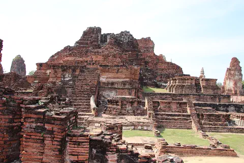
Ayutthaya, in Thailand, was founded in 1350 and became the second capital of the Siamese kingdom. From the 14th to the 18th centuries it grew into a center of trade and diplomacy. Today its brick ruins, tall towers and the remains of large monasteries are kept in a historical park, a UNESCO World Heritage Site since 1991.
-
 Watch
Landmark
Imperial Citadel of Thang Long
The Imperial Citadel of Thang Long is in the heart of Hanoi, the capital of Vietnam. It was built in the 11th century by the Ly dynasty, on the remains of a 7th-century fortress. For almost 13 centuries it was a center of power. Its gates, old palace foundations and an archaeological site are a UNESCO World Heritage Site.
-
Watch
City
Hanoi
Hanoi is the capital of Vietnam, in Southeast Asia. It grew beside the Red River, where a city called Thang Long was founded in 1010. Its old citadel is a UNESCO World Heritage Site, and its old quarter is known for its 36 streets. The 2019 census counted about 8 million people in the city and its surrounding districts.
-
 Watch
City
Bangkok
Bangkok, the capital of Thailand, lies on the delta of the Chao Phraya River, about 40 kilometers from the sea. It became the capital in 1782, when the new royal palace and temples were built. Once called the 'Venice of the East' for its canals, it is now a huge, busy city with skyscrapers and an elevated railway.
Explore next
-
 Watch
 Country
Laos
Laos is a landlocked country in mainland Southeast Asia, covered mostly by forested mountains. The Mekong River runs along its western side, and most people live in villages and grow rice. Its capital, Vientiane, stands on the Mekong.
-
Watch
City
Bangkok
Bangkok, the capital of Thailand, lies on the delta of the Chao Phraya River, about 40 kilometers from the sea. It became the capital in 1782, when the new royal palace and temples were built. Once called the 'Venice of the East' for its canals, it is now a huge, busy city with skyscrapers and an elevated railway.
-
Watch
City
Hanoi
Hanoi is the capital of Vietnam, in Southeast Asia. It grew beside the Red River, where a city called Thang Long was founded in 1010. Its old citadel is a UNESCO World Heritage Site, and its old quarter is known for its 36 streets. The 2019 census counted about 8 million people in the city and its surrounding districts.
-
 Watch
City
Kuala Lumpur
Kuala Lumpur is the capital and largest city of Malaysia, in Southeast Asia. It began in 1857 as a settlement of Chinese tin miners where two rivers meet, and its name means "muddy estuary" in Malay. Today about 2.08 million people live there (2026 estimate), among skyscrapers, mosques and old shop-houses.
-
Watch
City
Luang Prabang
Luang Prabang is a town in northern Laos, built on a peninsula where the Nam Khan River meets the Mekong. From the 14th to the 16th century it was the capital of the kingdom of Lane Xang, the 'Kingdom of a Million Elephants'. UNESCO lists the town as a World Heritage Site for the way it mixes traditional Lao buildings with buildings from colonial times.
-
 Watch
City
Abu Dhabi
Abu Dhabi is the capital of the United Arab Emirates. It began in the 1700s as a small settlement around fresh water on an island, guarded by a coral-stone watchtower. Before oil, it relied on fishing and pearl diving; since the 1960s, money from oil has turned it into a city of towers. An official estimate gave the city about 1.75 million people in 2023.
-
 Watch
City
Almaty
Almaty is the main city of Kazakhstan, in the southeast of the country at the foot of the Ala-Tau mountains. It was founded in 1854 where a Kazakh village called Almaty, 'village of apple trees', stood. It was the capital until 1998, and about 2,387,900 people lived there on 1 September 2026.
-
 Watch
City
Amman
Amman is the capital of Jordan, built on steep hills around a valley high on a plateau. Long ago it was a Roman city called Philadelphia, and its Roman theater, carved into a hillside, still holds about 6,000 people. Today the city spreads across the hills, with houses faced in pale stone. About 4.6 million people lived in Amman Governorate at the end of 2021.
For parents & teachers
What children will learn
- Locate Vientiane on the Mekong River in Laos, in Southeast Asia.
- Describe a climate with a dry season and a rainy season.
- Explain how roads, bridges and railways change how a city grows.
- Notice how a capital can keep fields and ponds close to its center.
Recommended ages: 3 to 17 · About 15 minutes
Talk about it
- Vientiane once used its river as its main road. What changes when people start to travel by road, bridge and train instead?
- Rice fields and ponds survived near the center of Vientiane. Why might green and wet places be good for a city?
- About 86% of Vientiane's rain falls in five months. How might people plan their year around a rainy season?
Try at home or in class
- Rain chart: plot Vientiane's monthly rainfall and color the rainy season.
- City map: draw the Mekong and mark the Patuxai, Pha That Luang, the airport, the railway station and the bridge.
- Then and now: compare the population figures for 1995, 2005 and 2015 on a bar chart.
Key vocabulary: capital, prefecture, protectorate, stupa, monument, rainy season
Where these facts come from
- Wikidata , Wikimedia Foundation (CC0 1.0)
- Natural Earth vector data , Natural Earth (NACIS) (Public domain)
- Laos: Administrative Division (census results, official estimates and projections) , City Population (Thomas Brinkhoff)
- Vientiane , Encyclopaedia Universalis (Christian Taillard)
- Lao PDR announces the results of the 5th Population and Housing Census 2025 , Lao Statistics Bureau
- World Weather Information Service: Vientiane climatological information , World Meteorological Organization
- File:View from the Patuxai (southwest).jpg (Christophe95, 24 August 2018) , Wikimedia Commons
- Wikimedia Commons , Wikimedia Foundation (Per file (public domain, CC0, CC BY or CC BY-SA); see each media record)
Checked, not yet human-reviewed. Last updated November 1, 2026. Spotted a mistake? Tell us.