
Natural wonder Asia
Phong Nha–Ke Bang National Park
Phong Nha–Ke Bang is a park in Vietnam full of green hills and giant caves. Rivers flow right through the mountains. One cave is so big a forest grows inside it.
Phong Nha–Ke Bang National Park, in central Vietnam near the border with Laos, protects one of the world's great limestone landscapes. UNESCO says its rocks began forming about 400 million years ago, and more than 220 kilometers of caves and underground rivers have been mapped. One of them, Son Doong, holds the world's largest known cave passage.
Phong Nha–Ke Bang protects a humid tropical karst in the Annamite Mountains, evolving since the Palaeozoic about 400 million years ago; UNESCO calls it the oldest large-scale karst area in Asia. Listed in 2003 and joined in 2025 with Laos's Hin Nam No National Park as a 217,447-hectare transboundary property, it holds over 220 km of documented caves, including Son Doong, the world's largest documented cave passage by diameter and continuity, and over 2,700 plant and 800 vertebrate species.
Photo: Genghiskhanviet, public domain, via Wikimedia Commons
Discover Phong Nha–Ke Bang
Phong Nha–Ke Bang is a big park in Vietnam.
It has steep green hills made of a rock called limestone. Rivers run into the hills and through dark caves. Some caves are giant. Monkeys and lots of other animals live in the forests.
Phong Nha–Ke Bang National Park lies in central Vietnam, close to the border with Laos, in the Annamite Mountains. It protects a karst landscape: steep limestone hills, cliffs, deep sinkholes and rivers that disappear underground into caves. UNESCO calls it one of the most outstanding and intact limestone karst landscapes in the world.
UNESCO made the park a World Heritage Site in 2003. In 2025 the site grew to include Hin Nam No National Park, just across the border in Laos, so the two countries now protect it together. More than 220 kilometers of caves and underground rivers have been explored and mapped, and some of them are among the largest on Earth.
UNESCO describes Phong Nha–Ke Bang as lying at the junction of the Annamite Range and the Central Indochina Limestone Belt. Since the 2025 transboundary extension, the World Heritage property joins Phong Nha–Ke Bang National Park in Viet Nam with Hin Nam No National Park in the Lao People's Democratic Republic: 217,447 ha in all, surrounded by a 295,889 ha buffer zone that covers the karst's watersheds.
The park was first established in 1986 and enhanced in 2001; UNESCO inscribed it in 2003. Its landscape combines dramatic cliffs, deep sinkholes and a vast network of underground rivers, with more than 220 km of documented caves and subterranean waterways. UNESCO calls it among the largest intact humid tropical karst systems on Earth and notes that, on the surface, the diversity of its polygonal karst features had been recorded nowhere else at the time of the extension.
- Country
- Vietnam (World Heritage Site shared with Laos since 2025)
- World Heritage Site
- since 2003
- Caves and underground rivers mapped
- more than 220 km
- Age of the karst
- about 400 million years
- Transboundary property (with Hin Nam No)
- 217,447 ha
How water carved the caves
The hills are made of limestone, a rock that water can slowly wear away.
For millions of years, rivers ran into the rock. They carved long tunnels and huge caves. In some places the cave roof fell in, and sunlight now shines inside.
This landscape is very old. UNESCO says the karst began forming about 400 million years ago, which makes it the oldest large karst area in Asia. The limestone is mixed with layers of shale, sandstone and granite, which helps give the land its jumble of shapes.
Geomorphologist Darryl Granger told National Geographic that the whole region was squeezed upward when the Indian subcontinent crashed into the Eurasian continent 40 to 50 million years ago. Much later, about 2 to 5 million years ago, river water flowing across the limestone burrowed down along a crack, a fault, and scoured out the giant tunnel of Son Doong cave. Where the rock was weak, the ceiling collapsed, opening huge skylights.
UNESCO dates the karst's evolution from the Palaeozoic, about 400 million years ago, and attributes its distinctive topography to the complex interbedding of limestone with shales, sandstone and granite. Underground, an extraordinary diversity of caves (dry, terraced, dendritic and intersecting) preserves evidence of past processes: abandoned river passages, changes in river routes, and the deposition and later re-solution of giant speleothems.
In National Geographic's 2011 account of the Son Doong expeditions, Purdue University geomorphologist Darryl Granger explains that the region was uplifted when India collided with Eurasia 40 to 50 million years ago, and that Son Doong formed 2 to 5 million years ago as river water flowing across the limestone burrowed down along a fault, scouring a giant tunnel; where the limestone was weak the ceiling collapsed into sinkholes, creating the cave's skylights. UNESCO records that Son Doong contains the world's largest documented cave passage by diameter and continuity, while Xe Bang Fai, in Hin Nam No, has the largest active river cave passage and the largest single gour pool.
Son Doong: a forest inside a cave
Son Doong is one of the biggest caves in the world.
A huge hole in the roof lets in the sunlight. Trees and ferns grow inside the cave! Clouds can even float near the ceiling.
Son Doong means mountain river cave. A local man, Ho Khanh, found its entrance as a boy but forgot where it was, then found it again; in 2009 British cavers led by Howard and Deb Limbert became the first team to explore inside. National Geographic reported that the cave is more than 4 kilometers long, with a passage up to about 90 meters wide and, in places, more than 180 meters high.
Where the roof has fallen in, sunlight pours down, and a jungle of trees, ferns and vines grows on the cave floor. A botanist found mostly the same plants as in the forest above. Inside, explorers also met woodlice, fish and millipedes that are all white, which is common for animals that live in the dark.
National Geographic (January 2011) describes the first expedition into Hang Son Doong in spring 2009 by British cavers led by Howard and Deb Limbert, helped by Ho Khanh, who had found the entrance as a boy and relocated it only the year before. The 2009 team explored about 4 km before a 60 m calcite wall, the 'Great Wall of Vietnam', stopped them; the 2010 team climbed it. Laser surveys showed a passage more than 4 km long, as wide as about 90 m and in places over 180 m high; from the bottom of one section to the ceiling the cavers measured about 200 m.
Collapsed dolines admit light: beneath the first, a calcite tower over 60 m tall carries ferns and palms, and the skylights are large enough for trees, lianas and wispy clouds. Biologist Anette Becher found white woodlice, fish and millipedes, typical of dark-adapted animals, and botanist Dai Inh Vu found mostly the same plant mix as the forest above. UNESCO notes that some invertebrates and fish in the property are restricted to single cave systems.

Forests full of rare life
The park is covered in thick green forest.
Thousands of kinds of plants grow here. Many kinds of monkeys and apes swing through the trees. Some animals live in only one cave in the whole world.
The limestone hills are covered with forests, from dry forest on high karst to thick, moist forest lower down. UNESCO counts more than 2,700 kinds of plants and 800 kinds of animals with backbones in Phong Nha–Ke Bang alone, and says the real numbers are probably higher.
The park and its partner in Laos are home to 10 or 11 kinds of primates. They include the largest remaining group of southern white-cheeked gibbons and the black langur, a monkey found only in this region. Rare orchids and begonias grow here, and some small animals and fish live in just one cave system and nowhere else.
UNESCO places the property within globally significant ecoregions, including the Northern Annamites Rainforests and the Annamite Range Moist Forests, and attributes its high endemism to the complexity of the limestone landscape, which created many ecological niches and allowed speciation at the landscape level. Endemic species occur above ground (several orchids and begonias) and below ground (invertebrates and fish confined to single cave systems).
At the time of inscription, Phong Nha–Ke Bang recorded over 2,700 vascular plant and 800 vertebrate species, including 237 globally threatened species and 400 species endemic to central Laos and/or Viet Nam; Hin Nam No adds over 1,500 vascular plants and 536 vertebrates, including the giant huntsman spider, the largest spider by leg span. The property holds 10 or 11 primate species, four endemic to the Annamites, including the largest remaining population of southern white-cheeked gibbon and the endemic black langur. UNESCO lists illegal hunting, overharvesting, invasive species, infrastructure, land-use change and tourism pressure among the threats.
Visiting safely
Visit the caves with a guide and a grown-up.
Some caves are reached by boat. Wear a life jacket on the river. When heavy rains come, caves can flood and close.
Phong Nha Cave is visited by boat. Showcaves.com, a guide to the world's show caves, explains that boats carry visitors from the tourist center along the Son River and into the cave, following the underground river for about 1.2 kilometers. Visits can be limited in the wet season, from about mid-September to mid-November, after heavy rains.
National Geographic notes that in the monsoon, underground rivers swell and flood cave passages, making them impassable. So only visit caves on official tours with guides, stay on the paths, and never go into a cave on your own. On boats, the US Centers for Disease Control and Prevention (CDC) says life jackets lower the risk of drowning for people of all ages.
According to Showcaves.com (2026), visitors to Phong Nha Cave are taken by boat from the visitor center about 4.5 km along the Son River to the entrance; inside, the boat follows the underground river for up to 1.2 km through a series of chambers, and at about 800 m visitors leave the boat for a short walk through a dry passage called Shallow Cave. Restrictions may apply in the wet season between mid-September and mid-November after heavy rain. National Geographic's account of the region's caves notes that monsoon floods make passages impassable, and that the cavers relied on help from local residents to find the caves.
UNESCO warns that tourism pressure and development, particularly in the eastern part of the property, must stay within the ecological carrying capacity of the karst. Visitors help by keeping to official routes and guides, leaving formations, plants and cave animals untouched, and taking their litter home. On boats, the CDC states that life jackets reduce drowning risk for people of all ages and swimming abilities, and that children should wear them in and around natural water.
Amazing facts
-
Clouds can form inside Son Doong cave.
Son Doong is so big that wispy clouds can float near its ceiling, and a forest grows on its floor beneath holes in the roof.
National Geographic described wispy clouds near the ceiling and a jungle beneath the collapsed dolines, with a calcite tower more than 60 m tall covered in ferns and palms.
-
Cave pearls as big as baseballs were found in Son Doong.
Explorers found cave pearls, round stones made of calcite, as big as baseballs in Son Doong. Most cave pearls are no bigger than a marble.
Cave pearls form as dripping water jostles a grain in a rock cup until a round calcite pearl grows; the Son Doong pearls were baseball-sized, larger than the cavers had ever seen.
-
The world's biggest spider by leg span lives in the park's partner across the border.
The giant huntsman spider, the largest spider in the world by leg span, lives in Hin Nam No National Park in Laos, which shares the World Heritage Site with Phong Nha–Ke Bang.
UNESCO records the giant huntsman spider, the largest spider by leg span and endemic to Laos's Khammouane Province, in Hin Nam No.
-
Boats sail right into Phong Nha Cave.
At Phong Nha Cave, visitors ride boats along an underground river for about 1.2 kilometers inside the mountain.
Showcaves.com describes a boat route that follows Phong Nha Cave's underground river for 1.2 km, after a 4.5 km approach along the Son River.
Words to know
- limestone
- a rock that water can slowly dissolve, often full of caves
- karst
- a landscape of limestone with caves, sinkholes and underground rivers
- sinkhole
- a hole in the ground where the rock underneath has collapsed or dissolved
- stalactite
- a rock icicle that hangs down from a cave ceiling
- stalagmite
- a rock pillar that grows up from a cave floor
- endemic
- found in only one place in the world
- transboundary
- crossing the border between two countries
Discovery challenge
-
What kind of rock are the park's hills made of?
What kind of rock forms the karst landscape of Phong Nha–Ke Bang?
Which rock dominates the park's karst, interbedded with shales, sandstone and granite?
- Limestone
- Ice
- Salt
Show the answer
Limestone
Limestone! Water can slowly carve it into caves.
Limestone; water flowing through it carved more than 220 kilometers of caves and underground rivers.
Limestone, interbedded with shales, sandstone and granite, which UNESCO credits for the varied topography.
-
Which giant cave is in this park?
Which cave in the park has the world's largest known cave passage?
Which cave does UNESCO credit with the world's largest documented cave passage by diameter and continuity?
- Son Doong
- Mammoth Cave
- Carlsbad Cavern
Show the answer
Son Doong
Son Doong! A forest grows inside it.
Son Doong; first explored in 2009, it is more than 4 kilometers long.
Son Doong; UNESCO credits it with the world's largest documented cave passage by diameter and continuity.
-
How do visitors get into Phong Nha Cave?
How do visitors travel through Phong Nha Cave?
According to Showcaves.com, how is Phong Nha Cave toured?
- By boat on an underground river
- By cable car
- By train
Show the answer
By boat on an underground river
By boat! A river flows right into the cave.
Boats carry visitors along the river and about 1.2 kilometers into the cave.
By boat, 4.5 km along the Son River and then 1.2 km along the underground river, with a short walk through a dry passage.
-
Which country shares this special place with Vietnam?
Since 2025, the World Heritage Site has included a national park in which neighboring country?
With which country's Hin Nam No National Park was the property joined in 2025?
- Laos
- Japan
- India
Show the answer
Laos
Laos, right next door.
Laos; Hin Nam No National Park lies just across the border.
Lao People's Democratic Republic; the transboundary property covers 217,447 ha.
-
Why do some caves close when it rains a lot?
Why can cave visits be limited in the wet season?
What makes cave passages in the region impassable during the monsoon?
- Underground rivers rise and flood the caves
- Snow blocks the entrances
- The caves get too hot
Show the answer
Underground rivers rise and flood the caves
The rivers get big and fill the caves with water.
Heavy rain swells the underground rivers, flooding passages.
Monsoon rains swell the underground rivers and flood the passages, National Geographic reports.
Nearby places
-
Watch
Natural wonder
Son Doong Cave
Son Doong is a cave in the mountains of central Vietnam, inside Phong Nha–Ke Bang National Park. A river carved it, and its main passage is so wide and tall that a whole city block of skyscrapers could fit inside. Explorers first went in only in 2009. UNESCO says it holds the world's largest documented cave passage.
-
 Watch
Natural wonder
Ha Long Bay
Ha Long Bay is a bay in northeast Vietnam where more than a thousand limestone islands rise straight out of the sea. Over millions of years, water dissolved the limestone into towers and caves, and then the sea flooded in around them. Together with the nearby Cat Ba Archipelago it is a World Heritage site.
-
 Watch
Landmark
Angkor
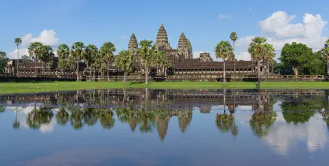
Angkor, in northwestern Cambodia, was the capital of the Khmer Empire from the 9th to the 15th century. Its kings built city after city here, with scores of temples, such as Angkor Wat and the Bayon, and giant reservoirs and canals to water the rice fields. Today it covers about 400 square kilometers, and more than 100,000 people live in villages inside it.
-
Watch
Landmark
Angkor Wat
Angkor Wat, near the town of Siem Reap in Cambodia, was built in the 12th century by the Khmer king Suryavarman II. Britannica (2026) calls it the world's largest religious structure. It was built as a Hindu temple and later became a Buddhist place of worship.
-
 Watch
City
Bangkok
Bangkok, the capital of Thailand, lies on the delta of the Chao Phraya River, about 40 kilometers from the sea. It became the capital in 1782, when the new royal palace and temples were built. Once called the 'Venice of the East' for its canals, it is now a huge, busy city with skyscrapers and an elevated railway.
-
 Watch
City
Ho Chi Minh City
Ho Chi Minh City, once called Saigon, is Vietnam's largest city and the economic heart of the country. It lies on the Saigon River, north of the Mekong Delta. Since merging with two neighboring provinces in 2025, it has more than 14 million people, and in 2024 it opened its first metro line.
-
 Watch
City
Hong Kong
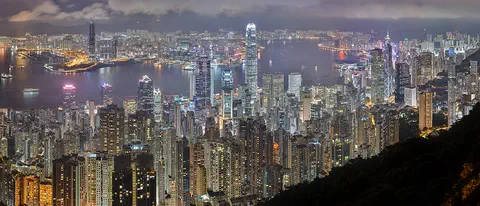
Hong Kong, on the south coast of China, grew around one of the world's great natural harbors. It was a British colony for 156 years and has been a special administrative region of China since 1997. About 7.5 million people lived there in mid-2026.
-
 Watch
Landmark
Three Gorges Dam
The Three Gorges Dam crosses the Yangtze River in central China. It is 2,335 meters long and 185 meters high, and it can make more electricity than any other hydroelectric dam in the world. It also lets big ships travel far up the river, but building it meant that more than a million people had to move.
Experiments to try
Explore next
-
Watch
 Country
Vietnam
Vietnam stretches about 1,650 kilometers along the coast of Southeast Asia, with mountains in the west and two great river deltas, the Red River in the north and the Mekong in the south. About 102.3 million people lived there in 2025. Its capital is Hanoi, and its largest city is Ho Chi Minh City.
-
Watch
Natural wonder
Son Doong Cave
Son Doong is a cave in the mountains of central Vietnam, inside Phong Nha–Ke Bang National Park. A river carved it, and its main passage is so wide and tall that a whole city block of skyscrapers could fit inside. Explorers first went in only in 2009. UNESCO says it holds the world's largest documented cave passage.
-
Watch
Natural wonder
Ha Long Bay
Ha Long Bay is a bay in northeast Vietnam where more than a thousand limestone islands rise straight out of the sea. Over millions of years, water dissolved the limestone into towers and caves, and then the sea flooded in around them. Together with the nearby Cat Ba Archipelago it is a World Heritage site.
- Watch Geography Caves and karst landscapes Most caves are made by slightly acidic water slowly dissolving rock such as limestone. Over hundreds of thousands of years, cracks grow into tunnels and rooms. The land above, with its sinkholes, disappearing streams and springs, is called karst. Inside, dripping water builds stalactites and stalagmites.
- Watch Try it What If? Lab What if a plant lived in a dark cave? A green leaf makes sugar from light, water and air, but it also uses up a little sugar all the time just to stay alive. Carry our model leaf from bright sunshine into a dim cave and watch what happens when the sugar it makes drops below the sugar it uses.
-
 Watch
Natural wonder
Mount Everest
Mount Everest, in the Himalayas on the border of Nepal and China, is what Britannica calls the highest mountain in the world. In 2020 China and Nepal announced its height as 8,848.86 meters. It grew as two giant plates of Earth's crust pushed together, and it is still rising a tiny bit each year.
-
 Watch
Natural wonder
Mount Fuji
Mount Fuji, 3,776 meters high, is the highest mountain in Japan and an active volcano that last erupted in 1707. Its almost perfect cone was built by three volcanoes, one on top of another, and it has inspired artists for hundreds of years.
-
 Watch
Natural wonder
Dead Sea
The Dead Sea is a salt lake in the Middle East, with Jordan on its eastern shore and the Palestinian West Bank along part of its western shore. Its surface lies far below sea level, about 435 meters down in 2019, and its water is nearly ten times saltier than the ocean, so swimmers bob on top without trying.
For parents & teachers
What children will learn
- Locate Phong Nha–Ke Bang in central Vietnam and explain that its World Heritage listing is shared with Laos.
- Explain how water carves caves in limestone and how skylights form when cave roofs collapse.
- Describe Son Doong and why it is famous.
- Name some of the park's rare wildlife and the threats it faces.
Recommended ages: 3 to 17 · About 15 minutes
Talk about it
- Why do you think a cave as big as Son Doong stayed unknown to explorers until 2009?
- How might two countries work together to protect a landscape that crosses their border?
- Why might animals that live in total darkness be white?
Try at home or in class
- Stack sugar cubes into a small 'hill', then slowly drip water onto one spot with a dropper and watch a tunnel form, like water carving limestone.
- Hang a wool string between two jars of strong baking soda solution with a dish underneath; over a week, watch drips build tiny stalactites and stalagmites.
Key vocabulary: limestone, karst, sinkhole, stalactite, stalagmite, endemic, transboundary
Where these facts come from
- Wikidata , Wikimedia Foundation (CC0 1.0)
- UNESCO World Heritage List , UNESCO World Heritage Centre (Linked as a reference; site facts come from Wikidata)
- Phong Nha-Ke Bang National Park and Hin Nam No National Park , UNESCO World Heritage Centre
- Vietnam Cave (Hang Son Doong), National Geographic Magazine, January 2011 , National Geographic
- Động Phong Nha (Phong Nha Cave) , Showcaves.com
- Preventing Drowning , US Centers for Disease Control and Prevention
- Wikimedia Commons , Wikimedia Foundation (Per file (public domain, CC0, CC BY or CC BY-SA); see each media record)
Checked, not yet human-reviewed. Last updated October 27, 2026. Spotted a mistake? Tell us.