
City Asia
Bangkok
Bangkok is the capital city of Thailand. A big river winds through it. It has golden palaces, beautiful temples and boats on the canals.
Bangkok, the capital of Thailand, lies on the delta of the Chao Phraya River, about 40 kilometers from the sea. It became the capital in 1782, when the new royal palace and temples were built. Once called the 'Venice of the East' for its canals, it is now a huge, busy city with skyscrapers and an elevated railway.
Bangkok, capital and chief port of Thailand, was founded as the royal capital of Siam in 1782 on the east bank of the Chao Phraya, 40 km above the Gulf of Thailand. Built around the Grand Palace and walled temples, its canal city was transformed by roads, railways and explosive post-1945 growth into Krung Thep Maha Nakhon (Bangkok Metropolis), which produces about a third of the country's output; 5,676,648 residents were registered in 2018.
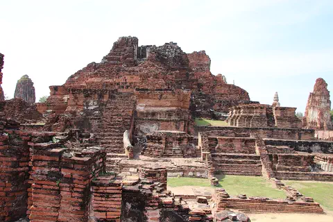
Photo: 西安兵马俑, CC BY-SA 4.0, via Wikimedia Commons
Discover Bangkok
Bangkok is the capital city of Thailand.
Thailand is a warm country in Southeast Asia. A big river called the Chao Phraya flows through Bangkok. There are tall towers, busy roads and lots of temples.
Bangkok is the capital and biggest city of Thailand, in Southeast Asia. It sits on the flat delta of the Chao Phraya River, about 40 kilometers from the Gulf of Thailand. Thai people call their capital Krung Thep.
Bangkok became the capital in 1782. Today it is a crowded, lively city where temples, factories, shops and homes stand side by side along the roads and canals. It is the center of Thailand's business, culture and transportation, and about 5.7 million people were registered as living there in 2018.
Bangkok lies on the delta of the Chao Phraya, about 40 km from the Gulf of Thailand. Once two municipalities, Krung Thep on the east bank and Thon Buri on the west, it was united in 1971 and merged in 1972 with two neighboring provinces to form Krung Thep Maha Nakhon (Bangkok Metropolis), 1,565 km² in area. Thailand's registry counted 5,676,648 residents in 2018; Britannica gives 8,305,218 for 2010.
Britannica calls it Thailand's capital, chief port and only cosmopolitan city. The name Bangkok, used mostly by foreigners, may come from bang (village) and makok (wild plum); Thai people call it Krung Thep, the first part of a long official name. About a third of national output is produced in the city, nearly half of all firms are in the metropolitan area, and it houses the headquarters of the UN Economic and Social Commission for Asia and the Pacific.
- Country
- Thailand (capital)
- Registered residents (2018)
- 5,676,648
- Area of Bangkok Metropolis
- 1,565 km²
- Capital since
- 1782
Famous places
Bangkok has a giant palace with golden roofs.
It is called the Grand Palace. The city also has more than 300 temples called wats. Some have tall, pointed towers covered in patterns. One sits right beside the river.
The walled Grand Palace was built when Bangkok became the capital in 1782, and kings added to it for more than 100 years. Inside its walls is Wat Phra Kaeo, the royal temple of the Emerald Buddha, completed in time for the city's 100th birthday in 1882.
Bangkok has more than 300 Buddhist temples and monasteries, called wats. Many are surrounded by walls and are among the best examples of Thai architecture. Wat Pho, beside the palace, is one of the oldest and largest and was long a center of learning. Across the river stands Wat Arun, known for its tall spire.
Rama I modeled his capital on the former capital, Ayutthaya, and by the end of his reign the walled Grand Palace complex and Wat Pho were complete. Rama II and Rama III added more wats, which served as schools, libraries, hospitals and recreation areas as well as religious centers; Wat Arun, noted for its tall spire, was completed in this period. Under Rama V the triple-spired Chakkri Building in the Grand Palace was finished by 1880, and the royal temple Wat Phra Kaeo, which houses the Emerald Buddha, was completed for the city's centenary in 1882.
Britannica counts more than 300 wats, classic examples of Thai architecture, most enclosed by walls; many lease part of their grounds for homes or shops. Wat Pho, one of the oldest and largest, has often been considered the city's first university. The National Museum holds prehistoric and Bronze Age art and royal objects, and Jim Thompson's Thai House, several traditional mansions, has the country's largest collection of 17th-century Thai religious paintings.
- Grand Palace
- walled complex begun under Rama I (1782)
- Temples (wats)
- more than 300
- Wat Pho
- one of the oldest and largest temples
- Wat Arun
- known for its tall spire
A royal city on the river
In 1782, a new king moved his court across the river.
He built a palace, temples and a strong city wall. People traveled by boat along canals. Later, kings built roads, railways and a big park.
In 1782 a general named Chao Phraya Chakkri became king as Rama I and moved the capital of Siam, as Thailand was then called, to the east bank of the Chao Phraya. The river's wide bend protected the new city like a moat. He modeled it on the old capital, Ayutthaya, 64 kilometers to the north, and built a city wall 7 kilometers long with 63 gates.
For many years the river and canals were the city's roads. King Chulalongkorn, Rama V (1868–1910), built roads and bridges, electric trams began in 1892, and the first railway opened in 1900. After World War II, Bangkok grew faster than ever.
When Rama I, founder of the Chakkri dynasty, took the throne in 1782, he moved the court from the west to the east bank, apparently for strategy: the river's westward bend formed a moat on three sides, and a vast swamp, the 'Sea of Mud', lay to the east. His wall, 7 km long, 3 m thick and 4 m high, had 63 gates and 15 forts and enclosed about 4 km². Chinese merchants on the site moved south to Sam Peng.
Rama IV (1851–68) cut new roads such as Charoen Krung (New Road) and a second moat. Rama V, King Chulalongkorn (1868–1910), an early automobile enthusiast, began a road- and bridge-building program, pulled down most of the wall, built the Dusit Palace and Ratchadamnoen Nok Road, and saw electric trams (1892) and the first railway, to Ayutthaya (1900). Rama VI founded Chulalongkorn University in 1916 and opened Lumphini Park. Krung Thep and Thon Buri became municipalities in 1937 and were united in 1971. Since World War II rapid growth has strained transport, housing, water supply and drainage; an economic boom in the 1980s was blunted by the Asian financial crisis of the late 1990s.
Getting around Bangkok
Long ago, people in Bangkok went everywhere by boat.
Canals were the streets! Now there are cars, buses and three-wheeled taxis. A train runs high above the roads. Boats still float on the river.
Bangkok's first roads were water: its maze of canals earned it the name "Venice of the East." When cars arrived, many canals were filled in to make roads. But the canals had also drained the wet land, so flooding became more common, and traffic jams grew.
Today buses, cars and three-wheeled taxis crowd the streets, and since 1999 the Skytrain, an elevated railway, has run above them. Railways and roads lead north to Chiang Mai and Laos and south to Malaysia, and ships use the busy port at Khlong Toei.
Britannica describes a transport system originally based on water, which earned the name 'Venice of the East'. As cars, buses (color-coded by region) and three-wheeled taxis multiplied, most smaller canals and some large ones were filled in; since the waterways had drained the waterlogged delta, low-lying areas flooded more often, and traffic still became gridlocked. A bus authority was set up in the 1970s, and the Skytrain elevated railway opened in 1999.
Roads run north to Laos and Chiang Mai, east to Cambodia and south to Malaysia, and railways reach the borders of Laos, Malaysia and Cambodia. The port at Khlong Toei, linked to the sea by a 27 km channel dug through the sandbar at the river mouth, handles nearly all of Thailand's imports and exports, and Bangkok's international airport is one of Southeast Asia's busiest.
- Skytrain (elevated railway)
- opened 1999
- First electric tram
- 1892
- Port
- Khlong Toei, handles nearly all Thailand's imports and exports
Weather and seasons
Bangkok is hot all year round.
From May to September, heavy rain pours down in the afternoons. From December to February it is drier and a little cooler. April is the hottest month.
Bangkok is hot all year. In April, the hottest month, highs average about 35 °C and even the nights stay around 26 °C. In December, the coolest month, highs are still about 31 °C, with lows near 21 °C.
About 1,500 millimeters of rain fall in a year, and four-fifths of it comes in the rainy season, from mid-May through September, in short, heavy downpours in the late afternoon. The dry season lasts from December to February. The air is humid, especially in the rainy season.
Britannica describes a climate hot throughout the year, ranging from a mean of 25 °C in the 'cold' season in December to 30 °C at the height of the hot season in April. About 1,500 mm of rain falls annually, four-fifths in brief torrential late-afternoon downpours during the rainy season (mid-May through September); the dry season runs from December to February, and mean monthly relative humidity varies from 60 percent to more than 80 percent.
World Meteorological Organization normals for 1961–1990 give mean daily maxima and minima of 34.9 °C and 26.1 °C in April and 31.3 °C and 20.8 °C in December, with September the wettest month at about 344 mm. Groundwater pumping has caused parts of the city to subside, adding to flood risk on the low delta.
- April, average daily high and low
- about 35 °C and 26 °C
- December, average daily high and low
- about 31 °C and 21 °C
- Rain in a year
- about 1,500 mm, four-fifths in the rainy season
Living in Bangkok
Bangkok has floating markets.
People sell fruit and food from boats on the canals. In the parks, people fly kites in contests at fairs and festivals. Many people come from all over Thailand to live and work here.
In Bangkok's Floating Market, food and goods are sold every day from boats on the canals. Long ago, many such markets and boat sellers served the whole city. In the parks there are fairs, festivals and kite contests, and the National Theatre presents dance, drama and music.
Bangkok is a young city: about two-fifths of its people are under 20, and more than a quarter came from other parts of Thailand. Most people are Thai, and the Chinese community, centered on Sam Peng, is the largest minority. Bangkok has most of Thailand's hospitals and several universities, and many primary schools stand on monastery grounds.
Britannica describes a young population, about two-fifths under 20, with more than a quarter of residents migrants from across Thailand. Most are ethnic Thais; the Chinese, the largest minority, are concentrated in Sam Peng's shop-house commercial district, while Indian, Western and Japanese communities cluster in other areas. The financial district straddles Silom Road.
The wat remains the most important cultural feature: more than 300, most walled, serving as focal points of religious, cultural and even commercial life, and many government primary schools stand on monastery grounds. All of Thailand's daily newspapers are published in Bangkok, in Thai, English and Chinese. Parks host fairs, festivals and kite-flying contests; the 80-hectare King Rama IX Royal Park opened in 1987, and the Floating Market near Wat Sai still sells food and goods from boats.
- Chulalongkorn University
- founded 1916
- Lumphini Park
- the city's first public park
- King Rama IX Royal Park
- 80 hectares, opened 1987
Bangkok on the map
Find Bangkok on the globe.
It is in Thailand, in Southeast Asia. Look for a river flowing into a warm sea. Bangkok sits on the river, near the sea.
Bangkok is in central Thailand, in Southeast Asia. It sits on the flat delta of the Chao Phraya River, about 40 kilometers before the river reaches the Gulf of Thailand.
The old royal city is on the east bank, inside a big bend of the river, and Thon Buri is on the west bank. About 64 kilometers to the north is Ayutthaya, the old capital whose ruins you can still visit.
Bangkok lies at about 13.8° N and 100.5° E on the Chao Phraya delta, 40 km above the Gulf of Thailand. The royal city sits on the east bank, inside the river's wide westward bend; Thon Buri lies on the west bank, and the former capital, Ayutthaya, is 64 km upstream.
The city has spread far beyond its administrative boundaries into surrounding farmland, with the inner city institutional and commercial and the outer city more residential and industrial. Industry clusters at Sam Rong, south of the port, and the river's sandbar mouth is crossed by a 27 km dredged channel.
- Latitude
- about 13.8° north
- Longitude
- about 100.5° east
- Distance to the Gulf of Thailand
- about 40 km
- Ayutthaya, the old capital
- 64 km to the north
Amazing facts
-
The name Bangkok may mean "village of wild plums."
One explanation says the name Bangkok comes from bang, a village, and makok, a wild plum.
One interpretation derives 'Bangkok', the name foreigners use, from bang (village or district) and makok (wild plum), predating the capital.
-
A king of Thailand loved cars very early on.
King Chulalongkorn was an early car enthusiast, so he built roads and bridges to get ready for the motor age.
King Chulalongkorn, an early automobile enthusiast, foresaw the motor vehicle's effect on the city and began a road- and bridge-building program, pulling down most of the old wall.
-
Bangkok's old city wall had 63 gates.
Rama I's city wall was 7 kilometers long and had 63 gates and 15 forts.
Rama I's wall, perhaps the most imposing structure of the new city, was 7 km long, 3 m thick and 4 m high, with 63 gates and 15 forts enclosing about 4 km².
-
A temple in Bangkok was called the city's first university.
Wat Pho, one of Bangkok's oldest temples, was long a center of learning and is often called the city's first university.
Wat Pho, one of the oldest and largest temples in Bangkok and a traditional center of learning, has often been considered the city's first university.
-
To the east of old Bangkok was a swamp called the Sea of Mud.
When Bangkok was founded, a huge swamp called the "Sea of Mud" to the east helped protect the city.
Rama I's site was guarded by the river's bend on three sides and, to the east, by a vast swampy delta called the Sea of Mud, traversable only with extreme difficulty.
Words to know
- capital
- the city where a country's government meets
- delta
- flat land at a river's mouth, built from mud the river carries
- canal
- a waterway dug by people for boats or drainage
- wat
- a Buddhist temple and monastery in Thailand
- rainy season
- the months of the year when most of the rain falls
- subsidence
- when the ground slowly sinks
- elevated railway
- a railway built on supports above the street
Discovery challenge
-
Which river flows through Bangkok?
Bangkok lies on the delta of which river?
Rama I's capital sits in the westward bend of which river?
- The Chao Phraya
- The Nile
- The Amazon
Show the answer
The Chao Phraya
The Chao Phraya! It flows to the sea.
The Chao Phraya, about 40 kilometers from the Gulf of Thailand.
The Chao Phraya; its bend formed a moat on three sides.
-
What did people in old Bangkok use as streets?
Why was Bangkok called the "Venice of the East"?
What original transport network earned Bangkok the name 'Venice of the East'?
- Canals
- Ski slopes
- Railways
Show the answer
Canals
Canals! People traveled by boat.
Because of its maze of canals, which people used like streets.
Its canals, linked to the river; many were later filled in for roads.
-
When did Bangkok become the capital?
In which year did Bangkok become the capital of Siam?
In which year did Rama I, founder of the Chakkri dynasty, move his court to Bangkok?
- 1782
- 1999
- 1492
Show the answer
1782
1782! That is more than 240 years ago.
1782, when Rama I became king.
1782; the city celebrated its centenary in 1882.
-
What are Bangkok's temples called?
What is the Thai word for a Buddhist temple and monastery?
Bangkok has more than 300 walled Buddhist temples and monasteries known as what?
- Wats
- Castles
- Pyramids
Show the answer
Wats
Wats! Bangkok has more than 300.
Wats. Many are surrounded by walls.
Wats, focal points of religious, cultural and even commercial life.
-
What runs high above Bangkok's streets?
What opened in Bangkok in 1999 to help with traffic?
Which elevated rail system opened in 1999 to relieve Bangkok's congestion?
- The Skytrain
- A cable car to the moon
- A canal
Show the answer
The Skytrain
The Skytrain! It runs on tracks above the roads.
The Skytrain, an elevated railway.
The Skytrain, after a bus authority was created in the 1970s.
Nearby places
-
 Watch
Landmark
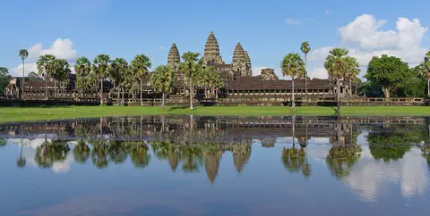
Angkor
Angkor, in northwestern Cambodia, was the capital of the Khmer Empire from the 9th to the 15th century. Its kings built city after city here, with scores of temples, such as Angkor Wat and the Bayon, and giant reservoirs and canals to water the rice fields. Today it covers about 400 square kilometers, and more than 100,000 people live in villages inside it.
-
Watch
Landmark
Angkor Wat
Angkor Wat, near the town of Siem Reap in Cambodia, was built in the 12th century by the Khmer king Suryavarman II. Britannica (2026) calls it the world's largest religious structure. It was built as a Hindu temple and later became a Buddhist place of worship.
-
 Watch
Natural wonder
Phong Nha–Ke Bang National Park
Phong Nha–Ke Bang National Park, in central Vietnam near the border with Laos, protects one of the world's great limestone landscapes. UNESCO says its rocks began forming about 400 million years ago, and more than 220 kilometers of caves and underground rivers have been mapped. One of them, Son Doong, holds the world's largest known cave passage.
-
 Watch
Natural wonder
Son Doong Cave
Son Doong is a cave in the mountains of central Vietnam, inside Phong Nha–Ke Bang National Park. A river carved it, and its main passage is so wide and tall that a whole city block of skyscrapers could fit inside. Explorers first went in only in 2009. UNESCO says it holds the world's largest documented cave passage.
-
 Watch
City
Ho Chi Minh City
Ho Chi Minh City, once called Saigon, is Vietnam's largest city and the economic heart of the country. It lies on the Saigon River, north of the Mekong Delta. Since merging with two neighboring provinces in 2025, it has more than 14 million people, and in 2024 it opened its first metro line.
-
 Watch
Natural wonder
Ha Long Bay
Ha Long Bay is a bay in northeast Vietnam where more than a thousand limestone islands rise straight out of the sea. Over millions of years, water dissolved the limestone into towers and caves, and then the sea flooded in around them. Together with the nearby Cat Ba Archipelago it is a World Heritage site.
-
 Watch
Landmark
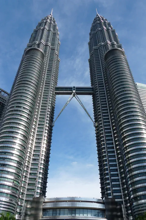
Petronas Towers
The Petronas Twin Towers in Kuala Lumpur, Malaysia, are two matching skyscrapers 452 meters tall, finished in 1998. Seen from above, each floor is shaped like an eight-pointed star, a pattern from Islamic art. A two-story skybridge joins them 170 meters above the ground, and from 1996 to 2003 they were counted as the tallest buildings in the world.
-
 Watch
Natural wonder
Sundarbans
The Sundarbans is a vast mangrove forest where the Ganges and Brahmaputra rivers meet the Bay of Bengal. It is shared by Bangladesh and India. Twice a day the tides flood its muddy islands, and its trees are made to live in salty water. It is one of the last homes of the Bengal tiger, and both countries protect it as a World Heritage Site.
Explore next
-
Watch
 Country
Thailand
Thailand is a tropical country in the middle of mainland Southeast Asia, with forested mountains in the north, rice fields on its central plains and a long, narrow peninsula in the south. Its capital is Bangkok, and about 65.8 million people were on its civil register at the end of 2025.
-
Watch
Landmark
Angkor Wat
Angkor Wat, near the town of Siem Reap in Cambodia, was built in the 12th century by the Khmer king Suryavarman II. Britannica (2026) calls it the world's largest religious structure. It was built as a Hindu temple and later became a Buddhist place of worship.
-
 Watch
City
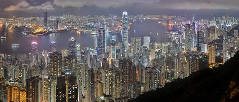
Hong Kong
Hong Kong, on the south coast of China, grew around one of the world's great natural harbors. It was a British colony for 156 years and has been a special administrative region of China since 1997. About 7.5 million people lived there in mid-2026.
-
 Watch
City
Tokyo
Tokyo is the capital of Japan, at the head of Tokyo Bay. It began as the small town of Edo and was renamed Tokyo, the Eastern Capital, in 1868. About 14.3 million people lived in the Tokyo Metropolis in 2022, and Greater Tokyo is Japan's largest city region.
-
Watch
City
Ho Chi Minh City
Ho Chi Minh City, once called Saigon, is Vietnam's largest city and the economic heart of the country. It lies on the Saigon River, north of the Mekong Delta. Since merging with two neighboring provinces in 2025, it has more than 14 million people, and in 2024 it opened its first metro line.
-
 Watch
City
Jakarta
Jakarta, Indonesia's largest city and its capital, lies on the northwest coast of the island of Java, where the Ciliwung River meets the Java Sea. About 11 million people live there (2025). Indonesia is building a new capital called Nusantara, but under the law Jakarta stays the capital until the president signs a decree moving it.
-
 Watch
City
Ankara
Ankara is the capital of Türkiye, in the interior of Anatolia, about 200 kilometers from the Black Sea. People have lived here since the Stone Age, and Romans, Byzantines, Seljuks and Ottomans all left buildings behind. It became the capital in 1923, and today it is a city of government, universities and museums.
-
 Watch
City
Baghdad
Baghdad, the capital of Iraq, stands on the Tigris River in the land once called Mesopotamia. It was founded in 762 as a round city, and for about 500 years it was one of the greatest cities in the world and a great center of learning, where scholars studied math, medicine and the stars. Today it is Iraq's largest city.
For parents & teachers
What children will learn
- Locate Bangkok on the Chao Phraya delta in Thailand.
- Explain why Bangkok was called the 'Venice of the East' and how filling canals affected flooding.
- Describe how Bangkok became the capital in 1782.
- Describe a tropical climate with wet and dry seasons.
Recommended ages: 3 to 17 · About 15 minutes
Talk about it
- Bangkok filled in canals to make roads, and then flooding got worse. Why do you think that happened?
- Would you rather travel to school by boat, bus or elevated train? Why?
- Bangkok is hot all year with a rainy season. How would that change what you wear and play?
Try at home or in class
- Make a model delta: tilt a tray of damp sand, pour water at the top and watch channels form. Then block some channels and see where the water goes.
- Design a floating market stall on a cardboard boat. What would you sell?
Key vocabulary: capital, delta, canal, wat, rainy season, subsidence, elevated railway
Where these facts come from
- Wikidata , Wikimedia Foundation (CC0 1.0)
- Natural Earth vector data , Natural Earth (NACIS) (Public domain)
- Bangkok , Encyclopaedia Britannica
- Bangkok: History , Encyclopaedia Britannica
- Bangkok: People, economy and cultural life , Encyclopaedia Britannica
- Bangkok: climatological information , World Meteorological Organization, World Weather Information Service
- Wikimedia Commons , Wikimedia Foundation (Per file (public domain, CC0, CC BY or CC BY-SA); see each media record)
Checked, not yet human-reviewed. Last updated October 27, 2026. Spotted a mistake? Tell us.