
Landmark Europe
Mehmed Paša Sokolović Bridge
This long stone bridge crosses a green river in Bosnia and Herzegovina. It has eleven arches and was built more than 400 years ago!
The Mehmed Paša Sokolović Bridge crosses the Drina River at Višegrad, in eastern Bosnia and Herzegovina. The architect Sinan built it between 1571 and 1577. It is about 180 meters long, with eleven stone arches, and it has been a UNESCO World Heritage Site since 2007.
The Mehmed Paša Sokolović Bridge at Višegrad was built from 1571 to 1577 by the Ottoman court architect Mimar Koca Sinan, on the orders of the Grand Vizier Mehmed Paša Sokolović. UNESCO calls the 179.5-meter bridge, with its eleven masonry arches and a four-arched access ramp, a masterpiece of Sinan and a witness to the high point of classical Ottoman architecture and civil engineering.
Photo: Julian Nyča, CC BY-SA 3.0, via Wikimedia Commons
Discover the bridge at Višegrad
This bridge is in a town called Višegrad, in Bosnia and Herzegovina.
It crosses a wide river called the Drina. It is made of stone and has eleven arches.
The bridge crosses the Drina River at the town of Višegrad, in the east of Bosnia and Herzegovina. The Drina is a mountain river that flows north toward the Sava and Danube rivers.
The bridge is 179.5 meters long and has eleven stone arches. At one end, a ramp with four small arches runs along the riverbank. UNESCO added the bridge to its World Heritage List in 2007.
The Drina, ICOMOS explains, is a powerful mountain river that passes through many gorges near Višegrad, carrying water from the Balkan mountains toward the Sava and the Danube. The bridge stands just after a sharp bend, where a plain on the right bank allowed the town of Višegrad to grow.
UNESCO describes eleven masonry arches with spans of 11 to 15 meters, and an access ramp at right angles with four arches on the left bank. The 179.5-meter bridge was inscribed on the World Heritage List in 2007, under criteria (ii) and (iv).
- Where
- Višegrad, on the Drina River, Bosnia and Herzegovina
- Built
- 1571–1577
- Architect
- Mimar Koca Sinan
- Length
- 179.5 m
Built by a great architect
Long ago, an important leader named Mehmed Paša Sokolović asked for a bridge here.
A great builder named Sinan made it. It took about six years!
The bridge was ordered by Mehmed Paša Sokolović, a grand vizier: the chief minister of the Ottoman Empire. ICOMOS says he built it mainly as a tribute to the region he came from.
He chose Sinan, the empire's great court architect, to design it. The bridge was built from 1571 to 1577. It became an important point on the road from the Danube plains to Sarajevo and the Adriatic coast.
Mehmed Paša Sokolović (1505–1579), ICOMOS notes, held power at the top of the Ottoman Empire under three sultans; commissioning the bridge was primarily a tribute to his native region. Its design was entrusted to Koca Mimar Sinan, head of the empire's team of architects, who had already built mosques, bridges and other works for him.
The bridge was constructed from 1571 to 1577, with large human and financial resources. It was a highlight of the route linking the plains of the Danube to Sarajevo and the Adriatic coast, especially the free port of Ragusa (Dubrovnik). UNESCO compares Sinan's work with that of his contemporaries of the Italian Renaissance.
Stone arches over a mountain river
The bridge stands on thick stone legs called piers.
One end of the bridge turns a corner. A stone ramp runs along the riverbank, because a rocky hill is in the way!
The piers that hold up the arches are about 3.9 meters thick. The middle of the bridge is the highest part, 15.4 meters above the usual water level.
On the left bank, a rocky hill rises right next to the river. So the builders added a ramp, 120 meters long, that runs along the bank at a right angle to the bridge. The bridge was built of stone from quarries nearby.
ICOMOS gives the roadway a total width of 7.20 meters, including the parapets, and puts the highest, central part 15.40 meters above the average water level. The eleven slightly pointed (ogival) arches range from 10.70 meters to about 15 meters, on piers some 3.90 meters thick.
The piers stand on wooden foundation rafts strengthened with wooden piles and stone blocks. The masonry is dressed travertine from local quarries, laid with binders enriched with clay. Because a rocky hill rises straight from the left bank, a 120-meter ramp on four small arches carries the road along the river and up onto the bridge.
Pointed piers and a wider middle
Look at the piers. Their fronts come to a point.
In the middle of the bridge, there is a wider spot with a stone seat.
On one side of the bridge, each pier ends in a pointed, triangle-shaped front topped by a stone pyramid. On the other side, the piers are rounded and topped by cones.
In the middle, the walkway gets wider. On one side there is a wall with carved writing about the bridge and the people who made it. On the other side there is a stone seat.
ICOMOS lists the features typical of the classical Ottoman period: hollow ribs on the arches; triangular pier-heads topped by pyramids; rounded downstream cutwaters topped by tapered cones; a roadway that projects slightly on a cantilever; and spandrels decorated with hollowed panels forming niches.
At the central pier the passage widens. One side has a wall with engraved inscriptions celebrating the bridge and its creators; the other has a stone divan, or bench. ICOMOS compares the bridge with the Santa Trinita Bridge in Florence, built at exactly the same time, though with a different arch shape.
- Arches
- 11
- Arch spans
- 11 to 15 m
- Access ramp
- 120 m, on four arches
A bridge that has been mended many times
In this photo, the bridge and its arches are reflected in the green water!
The bridge is very old. People have fixed it many times.
This photo was taken in 2007. The pale stone arches are reflected in the calm green water, with houses on the hillside behind.
Floods have damaged the bridge, and it has been repaired many times. A big flood in 1896 covered it completely. The bridge was badly damaged in both World Wars, and was rebuilt in stone in the early 1950s. In 1986 a modern bridge was built about 1 kilometer downstream, and in 2003 cars were stopped from using the old one.
The photograph (2007, by Julian Nyča) looks along the bridge from the riverbank, with its arches and pointed piers reflected in the water and hillside houses beyond.
UNESCO notes that the Drina is prone to flooding: the parapets were destroyed in an exceptional flood in 1896, and the bridge was severely damaged during both World Wars and, after temporary repairs, reconstructed in stone in the early 1950s. In 2007, ICOMOS warned that a hydroelectric power station downstream had raised the water by about 2 meters, and that currents from the power plants upstream and downstream were wearing away the bases of the piers.
Amazing facts
-
One end of this bridge turns a corner, because a rocky hill is in the way!
Because a rocky hill rises beside the river, the road reaches the bridge on a 120-meter ramp that runs along the bank.
The left bank's rocky hill forced a 120-meter access ramp, laid at right angles to the bridge on four small arches.
-
In 1896, a great flood covered the whole bridge with water!
In 1896, an exceptional flood covered the bridge completely and washed away its parapets, but the bridge did not fall.
The exceptional flood of 1896 submerged the bridge entirely and washed away its parapets; the bridge itself was not destroyed.
-
A writer named Ivo Andrić wrote a whole book about this bridge!
The writer Ivo Andrić, winner of the Nobel Prize in Literature, wrote a novel about the bridge, The Bridge over the Drina.
Ivo Andrić, winner of the 1961 Nobel Prize in Literature, made the bridge the subject of his novel Na Drini ćuprija (1945), known in English as The Bridge over the Drina.
Words to know
- arch
- a curved shape, often of stone, that spans an opening and holds up the weight above it
- pier
- a thick post or pillar that holds up the arches of a bridge
- parapet
- a low wall along the edge of a bridge
- grand vizier
- the chief minister of the Ottoman Empire
- ramp
- a sloping road or path that leads up to a higher level
- dam
- a barrier built across a river to hold back water
Discovery challenge
-
How many arches does the bridge have?
How many stone arches carry the bridge across the Drina?
How many masonry arches does UNESCO count in the bridge itself?
- 11
- 3
- 25
Show the answer
11
Eleven arches!
Eleven.
Eleven, with spans of 11 to 15 meters (plus four small arches under the ramp).
-
Who designed this bridge?
Which great architect designed the bridge?
Which Ottoman court architect designed the bridge at Višegrad?
- Sinan
- Michelangelo
- Gustave Eiffel
Show the answer
Sinan
Sinan!
Sinan, the Ottoman court architect.
Mimar Koca Sinan.
-
Which river does the bridge cross?
Which river does the bridge cross at Višegrad?
The bridge crosses which mountain river, flowing toward the Sava and the Danube?
- The Drina
- The Nile
- The Thames
Show the answer
The Drina
The Drina!
The Drina.
The Drina.
-
Why does one end of the bridge turn a corner?
Why does a ramp run along the riverbank at one end of the bridge?
Why is the access ramp on the left bank laid at right angles to the bridge?
- A rocky hill is beside the river
- To make the bridge look longer
- A lake is in the way
Show the answer
A rocky hill is beside the river
A rocky hill is in the way!
A rocky hill rises right next to the river.
The left bank is a rocky hill just beside the river, so the road runs along the bank on a ramp.
-
When was the bridge built?
In which years was the bridge built?
According to ICOMOS, in which years was the bridge constructed?
- 1571 to 1577
- 1871 to 1877
- 1971 to 1977
Show the answer
1571 to 1577
From 1571 to 1577!
From 1571 to 1577.
1571 to 1577.
Nearby places
-
 Watch
City
Sarajevo
Sarajevo is the capital of Bosnia and Herzegovina, built in a valley ringed by mountains, along the Miljacka River. It grew from an Ottoman town founded in the 1400s around a market, the Baščaršija. An official estimate gives 270,608 people in the City of Sarajevo in mid-2026, and in 1984 the city hosted the Winter Olympics.
-
 Watch
Landmark
Stari Most
Stari Most, the Old Bridge, crosses the Neretva River in Mostar, Bosnia and Herzegovina, with a single stone arch. It was built in the 16th century, when the town was an Ottoman frontier town, and the town is even named after it. The bridge was rebuilt in 2004, and since 2005 its old town has been a World Heritage Site.
-
 Watch
City
Podgorica
Podgorica is the capital of Montenegro, on a plain where the valleys of the Morača and Zeta rivers meet. From 1946 to 1992 it was called Titograd. Montenegro's 2023 census counted 179,505 people in the Capital City of Podgorica, the country's most populated municipality.
-
 Watch
City
Belgrade
Belgrade, the capital of Serbia, stands where the Sava River flows into the Danube. Its name, Beograd, means "white city", probably because of the white limestone walls of its old fortress above the rivers. At the 2022 census, about 1.2 million people lived in the city itself and about 1.7 million in the wider City of Belgrade.
-
 Watch
City
Dubrovnik
Dubrovnik is a walled town on the Dalmatian coast of Croatia, beside the Adriatic Sea. UNESCO calls it the 'Pearl of the Adriatic' and says it became an important sea power from the 13th century. Its Old City is a World Heritage site. Croatia's 2021 census counted 26,922 people in the town.
-
 Watch
City
Split
Split is a port on Croatia's Adriatic coast. Larousse says the city was born inside the huge walls of a palace that the Roman emperor Diocletian built around the year 300. Its historic center has been a World Heritage Site since 1979, and Croatia's 2021 census counted 149,830 people in Split.
-
 Watch
City
Skopje
Skopje is the capital and biggest city of North Macedonia, in the Balkans of southeastern Europe. It stands on the Vardar River, where an old stone bridge links the main square with the Old Bazaar. About 526,000 people lived in the City of Skopje at the end of 2024.
-
 Watch
Landmark
Amphitheater of Durrës
The Amphitheater of Durrës is a Roman amphitheater in the center of the coastal city of Durrës, in Albania. It could hold 15,000 to 20,000 spectators. It lay hidden under the city until 1966, when it was found by chance.
Explore next
-
 Watch
 Country
Bosnia and Herzegovina
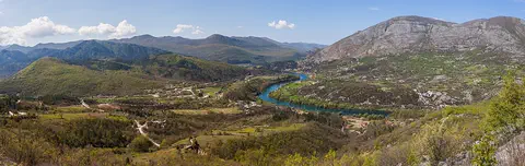
Bosnia and Herzegovina is a mountainous country in southeastern Europe. It has forests, limestone hills and many rivers, and famous old stone bridges cross some of them. Its capital is Sarajevo. It touches the Adriatic Sea along only about 20 kilometers of coast.
-
Watch
Landmark
Stari Most
Stari Most, the Old Bridge, crosses the Neretva River in Mostar, Bosnia and Herzegovina, with a single stone arch. It was built in the 16th century, when the town was an Ottoman frontier town, and the town is even named after it. The bridge was rebuilt in 2004, and since 2005 its old town has been a World Heritage Site.
-
 Watch
Landmark
Selimiye Mosque
The Selimiye Mosque in Edirne, Türkiye, was built from 1569 to 1575 for the Ottoman sultan Selim II. Its architect, Sinan, called it his masterpiece. A single great dome rests on eight supports, and four minarets about 71 meters tall stand around it. It became a UNESCO World Heritage Site in 2011.
-
Watch
City
Sarajevo
Sarajevo is the capital of Bosnia and Herzegovina, built in a valley ringed by mountains, along the Miljacka River. It grew from an Ottoman town founded in the 1400s around a market, the Baščaršija. An official estimate gives 270,608 people in the City of Sarajevo in mid-2026, and in 1984 the city hosted the Winter Olympics.
-
 Watch
Landmark
Aachen Cathedral
Aachen Cathedral in western Germany grew around the Palatine Chapel, the chapel of Emperor Charlemagne's palace, built around the year 800 with eight sides and a dome. A tall Gothic choir with very tall windows, called the Glass House, was added from 1355 to 1414. German kings were crowned here until 1531, and in 1978 it became a World Heritage Site.
-
 Watch
Landmark
Acropolis of Athens
The Acropolis is a steep, flat-topped rock in the middle of Athens. Walls have ringed its top for more than 3,300 years. In the 400s BCE, the Athenians built a grand gateway and three temples there, including the Parthenon. Restorers are still repairing them today.
-
 Watch
Landmark
Afsluitdijk
The Afsluitdijk is a dike 32 kilometers long in the Netherlands. It runs between the provinces of North Holland and Friesland and closes off the IJsselmeer lake from the Wadden Sea. Its last gap was closed on 28 May 1932, and for more than 90 years it has helped protect a large part of the country from floods.
-
 Watch
Landmark
Alhambra
The Alhambra is a palace and fortress above the city of Granada, in Spain. The Nasrid rulers built most of it between 1238 and 1358. It is famous for its courtyards, fountains, carved plaster and tiles, and the gardens of the Generalife next door.
For parents & teachers
What children will learn
- Explain how stone arches carry the weight of a bridge down into its piers.
- Describe why the builders added a ramp at a right angle on one riverbank.
- Explain how floods and dams can affect an old bridge's foundations.
Recommended ages: 4 to 17 · About 15 minutes
Talk about it
- The bridge has been repaired many times. Is a repaired bridge still the same old bridge?
- Why might a bridge on an important road help a town grow?
- Dams make electricity but change a river. How could people protect an old bridge near a dam?
Try at home or in class
- Build an arch from sugar cubes or wooden blocks over a curved cardboard support, then take the support away and see if it stands.
- Find the Drina River on a map of Europe and follow it north to the Sava and the Danube.
Key vocabulary: arch, pier, parapet, grand vizier, ramp, dam
Where these facts come from
- Wikidata , Wikimedia Foundation (CC0 1.0)
- Mehmed Paša Sokolović Bridge in Višegrad , UNESCO World Heritage Centre
- Advisory Body Evaluation (ICOMOS): Visegrad Bridge, No. 1260 , ICOMOS / UNESCO World Heritage Centre
- File:Visegrad Drina Bridge 1.jpg , Wikimedia Commons
- UNESCO World Heritage List , UNESCO World Heritage Centre (Linked as a reference; site facts come from Wikidata)
- Wikimedia Commons , Wikimedia Foundation (Per file (public domain, CC0, CC BY or CC BY-SA); see each media record)
Checked, not yet human-reviewed. Last updated November 1, 2026. Spotted a mistake? Tell us.