
Natural wonder Asia
Anatolia
Anatolia is a big, high land in Türkiye with mountains and lakes. In one place, rock slowly wore away into tall, pointy towers.
Anatolia is a large peninsula in Western Asia, with a high, dry central plateau and mountains such as the Taurus. Erosion has carved the volcanic rock of Cappadocia into tall rock pillars called fairy chimneys, and its lakes range from fresh mountain lakes to the salty Lake Tuz.
Anatolia's central plateau holds the volcanic landscape of Cappadocia, sculpted by erosion into ridges, valleys and hoodoos ('fairy chimneys') between extinct volcanoes such as Erciyes Dağ (3,916 m) and Hasan Dağ (3,253 m), UNESCO says. The plateau also holds the tectonically active Turkish Lakes Region, and groundwater from the Northern Taurus Mountains feeds the saline Lake Tuz.
Photo: I, Duesentrieb, CC BY-SA 3.0, via Wikimedia Commons
Discover Anatolia
Anatolia is a big land in Türkiye. It has high, dry plains, tall mountains and many lakes.
In this photo, a blue lake winds between green hills, and gray mountains rise behind it.
Anatolia is a large peninsula in Western Asia, in Türkiye. Its middle is a high, dry plateau, and it has mountain ranges such as the Taurus Mountains.
The photo, taken in November 2006, looks over the Karacaören reservoir, a lake made by a dam in the Taurus Mountains of the Antalya region. Pine trees and rocks are in front, a wooded island sits in the water, and hazy mountain ridges rise behind.
Anatolia is a peninsula of Western Asia whose interior is the Central Anatolia plateau, the setting UNESCO gives for the volcanic landscape of Cappadocia and NASA gives for the saline Lake Tuz. NASA places the Turkish Lakes Region in a highly active tectonic area on the plateau.
The hero photo, by the Commons user Duesentrieb (17 November 2006), shows the Karacaören reservoir in the Taurus Mountains, Antalya region: a dam lake with a wooded island and pale bare shores, framed by pines and rocks, with hazy ridges behind.
- Extinct volcano at one end of Cappadocia's ranges
- Erciyes Dağ, 3,916 m
- World Heritage Site
- Göreme National Park and the Rock Sites of Cappadocia (1985)
- Salt lake
- Lake Tuz, about 150 km south-southeast of Ankara
- Bird species at Lakes Beyşehir and Eğirdir
- at least 181
Fairy chimneys of Cappadocia
Cappadocia is a land made by old volcanoes.
Over a very long time, its rock slowly wore away. Tall, pointy towers called fairy chimneys were left standing.
Cappadocia lies on the central Anatolia plateau in a volcanic landscape. Erosion, the slow wearing away of rock, has carved it into a series of ridges, valleys and pointed pillars known as fairy chimneys, or hoodoos.
The area is bordered on the south and east by rows of extinct volcanoes, from Erciyes Dağ, 3,916 meters high, to Hasan Dağ, 3,253 meters. UNESCO calls the landscape spectacular, and erosion will keep making new fairy chimneys and rock pillars.
UNESCO describes Göreme National Park and the Rock Sites of Cappadocia (inscribed 1985) as a volcanic landscape on the central Anatolia plateau, sculpted by erosion into a succession of mountain ridges, valleys and pinnacles known as fairy chimneys or hoodoos. It is bounded on the south and east by ranges of extinct volcanoes, with Erciyes Dağ (3,916 m) at one end and Hasan Dağ (3,253 m) at the other.
Under criterion (vii), the Göreme Valley offers a globally renowned and accessible display of hoodoo landforms and other erosional features. The erosional processes that formed the conical rock structures will continue to create new fairy chimneys and pillars; some cones and pillars have also been damaged by earthquakes, which UNESCO treats as a naturally occurring phenomenon.
Lakes of the plateau
Anatolia has lakes of fresh water. It also has a very salty lake.
In summer, the salty lake shrinks. It leaves a shiny white layer of salt.
Lake Beyşehir and Lake Eğirdir, two of the largest freshwater lakes in Türkiye, lie in the Turkish Lakes Region. Lakes in this region are filled by rain, limestone springs, streams and water running off the nearby Sultan Mountains. At least 181 kinds of birds nest and breed on their shores and islands.
Lake Tuz ('tuz' means salt in Turkish) is a saline lake on the central plateau with no outlet. Groundwater from the northern Taurus Mountains bubbles up into it through springs. In summer its water shrinks back and leaves a thick, bright white layer of salt.
NASA's Earth Observatory places Lakes Beyşehir and Eğirdir, among Türkiye's largest freshwater lakes, in the tectonically active Turkish Lakes Region. The region's shallow lakes are replenished by precipitation, limestone springs and streams, and runoff from the Sultan Mountains; levels change seasonally with use for drinking water and irrigation, and at least 181 bird species nest and breed on the shores and islands.
Lake Tuz, about 150 km south-southeast of Ankara, has no outlet: it is fed by groundwater from the Northern Taurus Mountains that rises through springs, plus two major streams and spring rain. When its water recedes in summer, a thick salt layer is exposed; ESA notes that satellites have used this bright white surface to calibrate their sensors for the color white.
Flamingos and a shrinking salt lake
Flamingos used to come to Lake Tuz to feed and build nests.
Now the lake often has very little water. Scientists are studying why.
Lake Tuz was once the second-largest lake in Türkiye, and flamingos flocked there to feed and nest. Scientists who studied satellite images taken every August from 1985 to 2016 found two periods. Before 2000, the lake usually kept some water all summer. After 2000, it held much less, and in 2008 and 2016 it dried up completely.
The flamingos depended on permanent water in the lake's south-west and west, where the water is less salty and the bacteria they eat gather.
Aydin and colleagues (2020) mapped water, salt and marsh at Lake Tuz from Landsat images taken each August from 1985 to 2016. From 1985 to 2000, water covered more than 20 percent of the lakebed in all years except 1992 and 1994; between 2001 and 2016 it covered less than 20 percent every August except 2015, and the lake dried up completely in 2008 and 2016.
The researchers link the decline to more frequent and intense droughts together with heavy use of the groundwater and surface water that feed the lake: some streams were rerouted for irrigation or dammed. Permanent water in the less saline south-west and west had been vital for breeding and feeding flamingos, whose bacterial food concentrated there.
Visiting with care
The fairy chimneys are beautiful but fragile.
Visitors look and take photos, and never scratch or climb on the rocks.
UNESCO warns that Cappadocia's natural landforms can be harmed by too many visitors: overuse by tourists and some vandalism have been reported there. Erosion will keep shaping new fairy chimneys, but slowly, so careless use can still damage them.
Visitors can help by staying on paths, never scratching or carving the rock, and leaving the landscape as they found it. That is PlayOwl's advice, built on UNESCO's warning.
UNESCO's statement of the property's state notes overuse by tourists, some vandalism and incompatible structures, and warns that although erosion will keep creating new fairy chimneys and pillars, the slow rate of that process means the property's natural values can still be threatened by unsustainable use.
PlayOwl's advice, built on that warning: stay on marked paths, never mark or climb the volcanic rock, and leave the landforms untouched. In the Turkish Lakes Region, NASA notes that the shores and islands are nesting and breeding grounds for at least 181 bird species, so keeping a distance from birds there matters too.
Amazing facts
-
Lake Tuz's white salt is so bright that satellites used it to check their colors!
Satellites have used the bright white salt of Lake Tuz to calibrate their sensors for the color white.
The dry-season salt surface of Lake Tuz has been used by Earth-observing satellites to calibrate their sensors for white, like a camera's white balance (ESA).
-
'Tuz' is the Turkish word for salt.
Lake Tuz gets its name from the Turkish word 'tuz', which means salt.
Tuz is Turkish for 'salt' (NASA Earth Observatory).
-
Erosion is still making new fairy chimneys today!
The erosion that shaped Cappadocia's fairy chimneys will keep making new ones, very slowly.
UNESCO: the erosional processes that formed the conical rock structures will continue to create new fairy chimneys and rock pillars.
Words to know
- peninsula
- a piece of land with water on three sides
- plateau
- a large area of high, mostly flat land
- erosion
- the slow wearing away of rock and soil by water, wind and ice
- hoodoo
- a tall, thin pillar of rock left standing by erosion; in Cappadocia, called a fairy chimney
- saline lake
- a lake with very salty water
- groundwater
- water stored underground in soil and rock
Discovery challenge
-
What are the tall, pointy rock towers of Cappadocia called?
What are Cappadocia's rock pillars carved by erosion called?
What name is given to the erosional pinnacles of the Göreme Valley?
- Fairy chimneys
- Stalactites
- Sand dunes
Show the answer
Fairy chimneys
Fairy chimneys.
Fairy chimneys, also called hoodoos.
Fairy chimneys, or hoodoos.
-
What does 'tuz' mean in Turkish?
What does the name of Lake Tuz mean?
What is Lake Tuz named for?
- Salt
- Snow
- Fish
Show the answer
Salt
Salt.
Salt: it is a saline lake.
Salt; it is a saline lake with no outlet.
-
Which pink birds used to feed at Lake Tuz?
Which birds flocked to Lake Tuz to feed and nest?
Which birds depended on permanent water in Lake Tuz's less saline south-west?
- Flamingos
- Penguins
- Ostriches
Show the answer
Flamingos
Flamingos.
Flamingos.
Flamingos, whose bacterial food concentrated there.
-
Where does Lake Tuz get its water from underground?
Where does the groundwater that feeds Lake Tuz come from?
Which mountains are the origin of the groundwater feeding Lake Tuz's springs?
- The northern Taurus Mountains
- The Alps
- The ocean floor
Show the answer
The northern Taurus Mountains
From the Taurus Mountains.
From the northern Taurus Mountains, bubbling up through springs.
The Northern Taurus Mountains.
-
How can visitors help protect the fairy chimneys?
How can visitors help protect Cappadocia's landforms?
UNESCO reports overuse by tourists and some vandalism in Cappadocia. What can visitors do to protect the landforms?
- Look but never scratch or climb the rock
- Carve their names in the rock
- Take rocks home
Show the answer
Look but never scratch or climb the rock
Look and take photos, but leave the rocks alone.
Stay on paths and never mark or climb the rock.
Look, never scratch or climb the rock: UNESCO warns that unsustainable use, including overuse by tourists and some vandalism, threatens the landforms (the advice is PlayOwl's).
Nearby places
-
 Watch
City
Ankara
Ankara is the capital of Türkiye, in the interior of Anatolia, about 200 kilometers from the Black Sea. People have lived here since the Stone Age, and Romans, Byzantines, Seljuks and Ottomans all left buildings behind. It became the capital in 1923, and today it is a city of government, universities and museums.
-
 Watch
Natural wonder
Tigris
The Tigris River rises at Lake Hazar in the Taurus Mountains and flows about 1,900 kilometers south-east through Iraq, where it borders the fertile Mesopotamian Plain. In its upper course, it cuts through mountains pushed up where plates of Earth's crust collide.
-
 Watch
Landmark
Krak des Chevaliers
Krak des Chevaliers is a castle on a high ridge in western Syria. A group of knights, the Hospitallers, rebuilt it between 1142 and 1271, and later the Mamluks added to it. Its two rings of walls and round towers make it, UNESCO says, one of the best-preserved castles of the Crusader period.
-
 Watch
Natural wonder
Black Sea
The Black Sea is a large, almost enclosed sea between Europe and Asia. Its water is in layers that hardly mix: the top 150 meters is less salty and has oxygen, while the deep water below has almost no oxygen, so plants and animals cannot live there.
-
 Watch
Natural wonder
Pamukkale
Pamukkale, in southwestern Türkiye, is a hillside of bright white terraces and pools built by warm spring water. The water is full of a dissolved mineral called calcium carbonate, and as it flows over the slope it leaves the mineral behind as a rock called travertine. Its name means "cotton castle". On top stand the ruins of Hierapolis, an ancient spa town.
-
 Watch
Landmark
Byblos
Byblos, on the Mediterranean coast of Lebanon, is one of the oldest towns in the world where people have lived without a break. Its ruins stack up like layers of a cake: fishermen's huts, Phoenician temples and walls, a Roman theater and a Crusader castle. The Phoenician alphabet developed here.
-
 Watch
Landmark
Topkapı Palace
Topkapı Palace sits on a point of land where the Bosphorus Strait meets the sea in Istanbul. Sultan Mehmed II built it between 1460 and 1478, and for nearly 400 years it was the home of the Ottoman sultans and the center of their government. In 1924 it became a museum.
-
 Watch
Landmark
Hagia Sophia
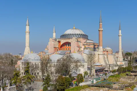
Hagia Sophia in Istanbul was built in under six years, from 532 to 537, for the emperor Justinian. Its enormous dome seems to float on a ring of 40 windows. Over almost 1,500 years it has been a church, a mosque and a museum, and since 2020 it has been a mosque.
Explore next
-
 Watch
 Country
Türkiye (Turkey)
Türkiye, also called Turkey, lies partly in Asia and partly in Europe. A narrow waterway called the Bosporus runs through its biggest city, Istanbul, and its land is mostly mountains and high plains. About 86 million people live there.
-
Watch
Natural wonder
Pamukkale
Pamukkale, in southwestern Türkiye, is a hillside of bright white terraces and pools built by warm spring water. The water is full of a dissolved mineral called calcium carbonate, and as it flows over the slope it leaves the mineral behind as a rock called travertine. Its name means "cotton castle". On top stand the ruins of Hierapolis, an ancient spa town.
- Watch Geography Weathering and erosion Weathering is rocks breaking apart where they are: ice in cracks, rain, wind-blown sand and growing roots all do it. Erosion is the next step, when gravity, rain, rivers, waves, wind and glaciers carry the broken pieces away. Over thousands to millions of years, they carve valleys, cliffs and canyons.
-
Watch
City
Ankara
Ankara is the capital of Türkiye, in the interior of Anatolia, about 200 kilometers from the Black Sea. People have lived here since the Stone Age, and Romans, Byzantines, Seljuks and Ottomans all left buildings behind. It became the capital in 1923, and today it is a city of government, universities and museums.
-
Watch
Natural wonder
Tigris
The Tigris River rises at Lake Hazar in the Taurus Mountains and flows about 1,900 kilometers south-east through Iraq, where it borders the fertile Mesopotamian Plain. In its upper course, it cuts through mountains pushed up where plates of Earth's crust collide.
-
 Watch
Natural wonder
Mount Everest
Mount Everest, in the Himalayas on the border of Nepal and China, is what Britannica calls the highest mountain in the world. In 2020 China and Nepal announced its height as 8,848.86 meters. It grew as two giant plates of Earth's crust pushed together, and it is still rising a tiny bit each year.
-
 Watch
Natural wonder
Mount Fuji
Mount Fuji, 3,776 meters high, is the highest mountain in Japan and an active volcano that last erupted in 1707. Its almost perfect cone was built by three volcanoes, one on top of another, and it has inspired artists for hundreds of years.
-
 Watch
Natural wonder
Ha Long Bay
Ha Long Bay is a bay in northeast Vietnam where more than a thousand limestone islands rise straight out of the sea. Over millions of years, water dissolved the limestone into towers and caves, and then the sea flooded in around them. Together with the nearby Cat Ba Archipelago it is a World Heritage site.
For parents & teachers
What children will learn
- Locate Anatolia and describe its central plateau and mountains.
- Explain how erosion carved Cappadocia's fairy chimneys.
- Describe how Lake Tuz is fed and why it has been shrinking.
- Explain why visitors should leave fragile landforms untouched.
Recommended ages: 3 to 17 · About 15 minutes
Talk about it
- Why might volcanic rock wear away into pillars instead of a flat plain?
- How can using groundwater far away affect a lake?
- Why might satellites need a bright white place on Earth to check their cameras?
Try at home or in class
- With a grown-up, pile damp sand into a mound, put a few small stones on top, and sprinkle water over it with a watering can: the stones protect pillars of sand beneath them, a little like rock towers.
- Stir salt into a shallow dish of warm water until no more dissolves, leave it in a sunny spot for a few days and watch a white salt crust appear.
Key vocabulary: peninsula, plateau, erosion, hoodoo, saline lake, groundwater
Where these facts come from
- Wikidata , Wikimedia Foundation (CC0 1.0)
- Göreme National Park and the Rock Sites of Cappadocia , UNESCO World Heritage Centre
- Disappearing Lake Tuz (Image of the Day, 16 December 2021) , NASA Earth Observatory
- Beysehir and Egirdir (astronaut photograph, 2019) , NASA Earth Observatory
- Anatolia's central plateau, Turkey (2013) , European Space Agency
- File:Reservoir-in-Taurus-Mountains.jpg , Wikimedia Commons
- Natural Earth vector data , Natural Earth (NACIS) (Public domain)
- Wikimedia Commons , Wikimedia Foundation (Per file (public domain, CC0, CC BY or CC BY-SA); see each media record)
Checked, not yet human-reviewed. Last updated November 1, 2026. Spotted a mistake? Tell us.