
Natural wonder Asia
Ha Long Bay
Ha Long Bay is a calm, blue-green sea in Vietnam. Hundreds and hundreds of rocky islands stand up out of the water. Green plants cover their steep sides.
Ha Long Bay is a bay in northeast Vietnam where more than a thousand limestone islands rise straight out of the sea. Over millions of years, water dissolved the limestone into towers and caves, and then the sea flooded in around them. Together with the nearby Cat Ba Archipelago it is a World Heritage site.
Ha Long Bay - Cat Ba Archipelago, in Vietnam's Quang Ninh province and Hai Phong city, covers 65,650 ha and 1,133 islands and islets. UNESCO calls it the most extensive example of marine-invaded tower karst in the world: fengcong peak clusters and fenglin towers, shaped by dissolution in a humid tropical climate and then drowned by the sea, with notch caves cut at the waterline.
Photo: Thierry Borie colour adjusted by Lycaon, public domain, via Wikimedia Commons
Discover Ha Long Bay
Ha Long Bay is in Vietnam, by the sea.
Rocky islands poke up out of the water everywhere. Some are tall and pointy. Some look like big lumps. Trees and plants grow on their steep sides. Boats sail slowly between them.
Ha Long Bay lies on the coast of northeast Vietnam. The whole bay covers about 1,500 square kilometers, and it is crowded with islands made of limestone, a rock that water can slowly dissolve. Some islands are tall, thin towers with cliffs that drop straight into the sea. Others are clusters of cone-shaped peaks.
In 1994 UNESCO listed Ha Long Bay as a World Heritage site. In 2023 the site grew to include the Cat Ba Archipelago next door, and today it covers 65,650 hectares with 1,133 islands and islets. Many of the islands are covered in plants, and some hide caves and lakes inside them.
The World Heritage property Ha Long Bay - Cat Ba Archipelago lies in northeast Viet Nam, within Quang Ninh province and Hai Phong city. UNESCO gives it an area of 65,650 ha with a 34,140 ha buffer zone, and 1,133 islands and islets. It was first inscribed in 1994, its boundaries were modified in 2000, and in 2023 a significant boundary modification added the Cat Ba Archipelago, already a UNESCO Biosphere Reserve since 2004.
UNESCO describes the property as the most extensive and best-known example of marine-invaded tower karst globally, and one of the world's most important areas of fengcong (clusters of conical peaks) and fenglin (isolated towers) karst. It is listed under criteria (vii), for exceptional natural beauty, and (viii), for its record of Earth's history. Nationally, Ha Long Bay became a National Scenic Site in 1962 and a Special National Monument in 2009; Cat Ba became a National Park in 1986.
- World Heritage site area
- 65,650 ha (since 2023)
- Islands and islets
- 1,133 in the World Heritage site
- World Heritage
- Inscribed 1994; boundaries changed in 2000 and 2023
- Where
- Quang Ninh province and Hai Phong city, Vietnam
Limestone towers in the sea
The islands are made of a rock called limestone.
Water can slowly wear limestone away, a tiny bit at a time. Over a very, very long time, water shaped the rock into hills and towers. Then the sea came in and filled the spaces between them.
The islands are made of limestone, and in places the limestone is as much as 1,000 meters thick. Limestone is a rock that water can dissolve. When rain soaks into cracks in limestone, it slowly dissolves the rock, leaving behind holes, caves and steep hills. A landscape shaped this way is called karst.
Ha Long's karst was shaped over about 20 million years in a hot, wet tropical climate, while the land was slowly lifted up. Then the sea flooded in, turning hilltops into islands. The sea level here has risen and fallen many times. Where the waves lapped against the cliffs, they cut grooves called notches into the rock.
The Ha Long Bay Management Board attributes the karst to a combination of thick limestone (as much as 1,000 m), a hot, humid climate, slow tectonic uplift and the full phases of a modern marine cycle. Brooklyn College geologist Guillermo Rocha summarizes the timescale: the limestone has gone through 500 million years of formation in different environments, and the karst itself evolved over about 20 million years under a tropical wet climate. The National Park Service explains the general process: water falling on soluble rock drains into cracks and dissolves the bedrock, creating sinkholes, caves and springs.
The Management Board notes many periods of marine transgression and regression (the sea advancing and retreating). Sea invasions in the late Pleistocene and late Holocene took part directly in the karst process, cutting sea notches and foot caves, and flooding closed, rounded hollows to make saltwater lakes. UNESCO adds that the property displays the full range of karst formation processes, and with Cat Ba it includes every stage of the sea's inundation of tropical karst.
Caves and hidden lakes
Some islands have caves inside them.
Some caves are very old. Others are right at the edge of the water. Some islands even have a little lake of sea water in the middle!
Ha Long Bay has many caves, and UNESCO sorts them into three main kinds. Some are the remains of caves that formed below the water table. Others, called foot caves, formed at the base of the limestone hills. The third kind are notch caves, cut by the sea at the waterline.
Some islands also hold lakes. These lakes fill hollows in the limestone that the sea has drowned, and some of them seem to rise and fall with the tide. To reach the Cong Do sea lake, visitors pass through a cave at low tide or climb over a 10-meter-high cliff.
UNESCO identifies three main cave types in the property: remnants of phreatic caves (formed below the water table), old karstic foot caves, and marine notch caves. Abundant lakes occupying drowned dolines, closed karst hollows, are a distinctive feature of the fengcong karst, and some appear to be tidal. Locally these enclosed marine lakes are called tùng and áng; the Management Board describes how the sea invaded closed, rounded karst depressions to turn them into saltwater lakes.
The Management Board's Cong Do Lagoon page gives a sense of scale: Ang Cong Do covers 0.5 ha and is reached through Cong Do cave at low tide or over a 10 m cliff, and its floor is sand, gravel and aquatic vegetation. The Board also lists scientifically valuable features such as fossils, folds, fault breccias and sea notches, which it calls evidence of ancient sea levels.
Life on the islands and in the sea
Many plants and animals live in Ha Long Bay.
Forests grow on the rocky islands. Coral and fish live in the sea. A very rare animal called the Cat Ba langur lives on Cat Ba island.
The Ha Long Bay Management Board counts nearly 3,000 kinds of plants and animals in the bay area, including 507 land plants, 110 corals, 156 fish, 71 birds and 53 mammals. Seventeen plants grow naturally nowhere else, such as the Ha Long palm. Caves have their own creatures too, like tiger geckos and the Ha Long cave crab.
The Cat Ba Archipelago is home to the Cat Ba langur, a primate that lives only there and is Critically Endangered. In 2000 there were 47 of them. After 23 years of a conservation project, the city of Hai Phong reported 82 langurs in September 2023. UNESCO also lists threatened animals such as the Asian small-clawed otter, the keeled box turtle and the king cobra.
The Management Board describes ten typical ecosystems of the tropical limestone archipelago, from forest on the islands and cave ecosystems to tùng-áng lagoons, mangroves, seagrass and coral reefs. Its species counts are nearly 3,000, including 507 terrestrial plants, 278 phytoplankton, 141 zooplankton, 110 corals, 156 fish, 71 birds and 53 mammals, with 102 threatened species (64 animals, 38 plants) and 17 endemic plants such as Livistona halongensis. Most species of its cave ecosystem are endemic, the Board says; they include Goniurosaurus tiger geckos, the Ha Long cave crab and the Ha Long cave loach.
UNESCO calls the Cat Ba langur a Critically Endangered endemic primate and the archipelago's flagship species, still affected by disturbance from tourism, restricted gene flow and fragmented subpopulations. Hai Phong's city portal reported that the population had grown from 47 individuals in 2000 to 82 in September 2023, about 3 percent a year on average; the project's 2019-2023 phase was sponsored by Germany's Leipzig Zoo. The Board also warns that seagrass beds have almost disappeared from the bay's coasts because of land reclamation.
Visiting safely and caring for the bay
Visitors ride on boats to see the islands.
Grown-ups buy tickets at the proper boat port. Keep the bay clean: never throw rubbish in the water. Never break off pieces of the caves. Leave plants, rocks and coral where they are.
The Ha Long Bay Management Board asks visitors to go to the official passenger port to buy tickets and choose a sightseeing route, rather than hiring boats from people outside the port. At the port, an information center can give advice. Once on the bay, follow the rules of each pier, harbor and attraction.
To protect the bay, never throw rubbish or waste into the water, do not break trees or pick flowers and leaves, never break off stalactites in the caves, and do not buy or sell coral. People who look after the bay work hard to keep it clean: in May 2026 one clean-up team collected more than 1,000 plastic cages from the bay's shores and waters on its first day.
The Management Board's visitor notes ask people to buy tickets for set sightseeing routes and overnight stays at the passenger port, seek advice from its information center, and avoid touts and boats hired outside the port. For the environment it forbids throwing garbage into the bay, damaging trees, picking flowers or leaves, breaking stalactites or carvings in caves, and buying or selling coral. On 10 June 2026, before the summer peak, the head of the Management Board inspected lifesaving and rescue operations at Ti Top Beach and asked staff to keep checking lifesaving equipment, weather warning systems and emergency plans for incidents at sea.
UNESCO notes that the property lies in an area of busy tourism, marine transport, fisheries and daily life on the water. It names rising visitor numbers and tourism development as a continuing management challenge, and asks that tourism stay within the property's ecological carrying capacity. The Board reports pressure from tourism, aquaculture and livelihoods at sea; in a clean-up from 23 to 28 May 2026 its Conservation Centre No. 2 removed foam buoys, rafts and plastic cages, and it told owners to remove unauthorized floating structures.
Amazing facts
-
Some islands have a sea-water lake inside them.
Some of Ha Long's islands hold lakes of sea water in drowned hollows, and some seem to rise and fall with the tide.
UNESCO notes abundant lakes in drowned dolines, a distinctive feature of the fengcong karst, some of which appear to be tidal.
-
Some plants grow only in Ha Long Bay.
Seventeen kinds of plants grow naturally in Ha Long Bay and nowhere else, including the Ha Long palm.
The Management Board records 17 plants endemic to Ha Long Bay, and it lists rare plants such as the Ha Long palm (Livistona halongensis), the Ha Long cycad (Cycas tropophylla) and the Ha Long balsam (Impatiens halongensis) in Vietnam's Red Book.
-
You can go through a cave into a hidden lake.
To reach the Cong Do sea lake, visitors pass through a cave at low tide or climb over a 10-meter-high cliff.
Ang Cong Do, a 0.5 ha sea lake, is reached through Cong Do cave at low tide or over a 10 m cliff, according to the Management Board.
-
More Cat Ba langurs live here now than before.
Cat Ba langurs grew in number from 47 in 2000 to 82 in September 2023.
Hai Phong's city portal reported that the Cat Ba langur population had grown by about 3 percent a year on average, from 47 individuals in 2000 to 82 in September 2023.
Words to know
- limestone
- a kind of rock that water can slowly dissolve
- karst
- a landscape of caves, hollows and steep hills made where water has dissolved rock such as limestone
- islet
- a very small island
- stalactite
- a stony icicle that hangs from a cave roof, made by dripping water
- notch
- a groove cut into the bottom of a cliff by waves at the waterline
- endemic
- found naturally in one place and nowhere else
- lagoon
- a body of salty water partly or fully closed off from the open sea
Discovery challenge
-
Which country is Ha Long Bay in?
In which country is Ha Long Bay?
The World Heritage site Ha Long Bay - Cat Ba Archipelago lies in which country?
- Vietnam
- Japan
- Australia
Show the answer
Vietnam
Ha Long Bay is in Vietnam.
Ha Long Bay is on the coast of northeast Vietnam.
It lies in northeast Viet Nam, within Quang Ninh province and Hai Phong city.
-
What kind of rock are the islands made of?
Which rock are Ha Long Bay's islands made of?
Which soluble rock forms Ha Long Bay's tower karst?
- Granite
- Limestone
- Ice
Show the answer
Limestone
They are made of limestone, a rock that water can slowly wear away.
The islands are limestone, which water can dissolve into towers, hollows and caves.
Thick limestone, up to 1,000 m, dissolved in a humid tropical climate to form the fengcong and fenglin karst.
-
How did the rocky hills turn into islands?
What turned Ha Long's limestone hills into islands?
UNESCO calls Ha Long 'marine-invaded' tower karst. What does 'marine-invaded' describe?
- A volcano pushed them up
- The sea flooded in around them
- Ice carved them
Show the answer
The sea flooded in around them
The sea came in and filled the spaces between the hills.
The sea flooded the limestone land, so the hilltops became islands.
The karst terrain was invaded by the sea, which drowned hollows and cut notches and caves along the shore.
-
Which rare animal lives only on the Cat Ba islands?
Which Critically Endangered animal lives only in the Cat Ba Archipelago?
Which endemic primate does UNESCO call the flagship species of the Cat Ba Archipelago?
- Polar bear
- Kangaroo
- Cat Ba langur
Show the answer
Cat Ba langur
The Cat Ba langur lives only there. There are not many, but now there are more than before.
The Cat Ba langur is found only in the Cat Ba Archipelago; its numbers grew from 47 in 2000 to 82 in 2023.
UNESCO calls the Critically Endangered Cat Ba langur the archipelago's flagship species, still threatened by tourism disturbance and fragmented subpopulations.
-
What should you do with plants, rocks and coral in the bay?
What do the Ha Long Bay Management Board's rules ask visitors to do?
Which of these follows the Management Board's rules for protecting the bay?
- Take a stalactite home
- Throw food scraps in the water
- Leave plants, stalactites and coral where they are
Show the answer
Leave plants, stalactites and coral where they are
Leave them where they are. That is what the bay's rules ask.
Visitors must not pick plants, break stalactites, buy coral or throw rubbish into the bay.
The rules forbid breaking stalactites or carvings in caves, picking plants, buying or selling coral and throwing waste into the bay.
Nearby places
-
 Watch
Natural wonder
Phong Nha–Ke Bang National Park
Phong Nha–Ke Bang National Park, in central Vietnam near the border with Laos, protects one of the world's great limestone landscapes. UNESCO says its rocks began forming about 400 million years ago, and more than 220 kilometers of caves and underground rivers have been mapped. One of them, Son Doong, holds the world's largest known cave passage.
-
 Watch
Natural wonder
Son Doong Cave
Son Doong is a cave in the mountains of central Vietnam, inside Phong Nha–Ke Bang National Park. A river carved it, and its main passage is so wide and tall that a whole city block of skyscrapers could fit inside. Explorers first went in only in 2009. UNESCO says it holds the world's largest documented cave passage.
-
 Watch
City
Hong Kong
Hong Kong, on the south coast of China, grew around one of the world's great natural harbors. It was a British colony for 156 years and has been a special administrative region of China since 1997. About 7.5 million people lived there in mid-2026.
-
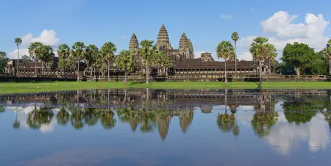 Watch
Landmark
Angkor
Angkor, in northwestern Cambodia, was the capital of the Khmer Empire from the 9th to the 15th century. Its kings built city after city here, with scores of temples, such as Angkor Wat and the Bayon, and giant reservoirs and canals to water the rice fields. Today it covers about 400 square kilometers, and more than 100,000 people live in villages inside it.
-
Watch
Landmark
Angkor Wat
Angkor Wat, near the town of Siem Reap in Cambodia, was built in the 12th century by the Khmer king Suryavarman II. Britannica (2026) calls it the world's largest religious structure. It was built as a Hindu temple and later became a Buddhist place of worship.
-
 Watch
City
Bangkok
Bangkok, the capital of Thailand, lies on the delta of the Chao Phraya River, about 40 kilometers from the sea. It became the capital in 1782, when the new royal palace and temples were built. Once called the 'Venice of the East' for its canals, it is now a huge, busy city with skyscrapers and an elevated railway.
-
 Watch
City
Ho Chi Minh City
Ho Chi Minh City, once called Saigon, is Vietnam's largest city and the economic heart of the country. It lies on the Saigon River, north of the Mekong Delta. Since merging with two neighboring provinces in 2025, it has more than 14 million people, and in 2024 it opened its first metro line.
-
 Watch
Landmark
Three Gorges Dam
The Three Gorges Dam crosses the Yangtze River in central China. It is 2,335 meters long and 185 meters high, and it can make more electricity than any other hydroelectric dam in the world. It also lets big ships travel far up the river, but building it meant that more than a million people had to move.
Experiments to try
Explore next
-
Watch
 Country
Vietnam
Vietnam stretches about 1,650 kilometers along the coast of Southeast Asia, with mountains in the west and two great river deltas, the Red River in the north and the Mekong in the south. About 102.3 million people lived there in 2025. Its capital is Hanoi, and its largest city is Ho Chi Minh City.
-
Watch
Natural wonder
Phong Nha–Ke Bang National Park
Phong Nha–Ke Bang National Park, in central Vietnam near the border with Laos, protects one of the world's great limestone landscapes. UNESCO says its rocks began forming about 400 million years ago, and more than 220 kilometers of caves and underground rivers have been mapped. One of them, Son Doong, holds the world's largest known cave passage.
- Watch Geography Caves and karst landscapes Most caves are made by slightly acidic water slowly dissolving rock such as limestone. Over hundreds of thousands of years, cracks grow into tunnels and rooms. The land above, with its sinkholes, disappearing streams and springs, is called karst. Inside, dripping water builds stalactites and stalagmites.
- Watch Geography Sea level The sea's surface moves up and down with waves and tides, so sea level means its average height. It is the zero we use to measure land: Mount Everest is about 8,849 meters above sea level. Satellites show that the global average sea level has risen about 10 centimeters since 1993, mostly because ice on land is melting and warming seawater takes up more room.
- Watch Geography What is a World Heritage Site? World Heritage Sites are places so important that they belong, in a way, to everyone. Under a 1972 agreement, countries nominate their most outstanding places, experts check them, and a UNESCO committee decides. By 2026 the list held 1,273 sites: cultural places like the Taj Mahal, natural places like the Galápagos, and mixed ones like Machu Picchu.
-
 Watch
Animal
King cobra
The king cobra is the largest venomous snake in the world, growing to more than 5 meters long. It lives in forests and near streams in South and Southeast Asia, eats mainly other snakes, and the mother builds a nest of leaves and guards her eggs.
- Watch What If? Lab What if the ground were made of limestone? Limestone is a rock that rainwater slowly dissolves. Over thousands of years, water seeping through it carves caves, opens sinkholes and bubbles back up as springs. About a fifth of the land in the United States is already this kind of landscape, called karst. Imagine the ground everywhere were limestone, and find out what would happen to the rain.
-
Watch
Natural wonder
Son Doong Cave
Son Doong is a cave in the mountains of central Vietnam, inside Phong Nha–Ke Bang National Park. A river carved it, and its main passage is so wide and tall that a whole city block of skyscrapers could fit inside. Explorers first went in only in 2009. UNESCO says it holds the world's largest documented cave passage.
For parents & teachers
What children will learn
- Locate Ha Long Bay on the coast of northeast Vietnam.
- Explain how water dissolving limestone, followed by the sea flooding in, created a bay full of islands.
- Name some of the bay's living things, including the rare Cat Ba langur.
- Describe the Management Board's rules for protecting the bay.
Recommended ages: 3 to 17 · About 15 minutes
Talk about it
- Why do you think a rock that water can dissolve ends up as tall towers instead of flat land?
- How might many boats and visitors affect a calm bay and its animals?
- Why is it important not to break off stalactites, even small ones?
Try at home or in class
- Stack sugar cubes into a hill on a plate and drip water onto it with a spoon; watch holes and hollows appear where the water soaks in, like karst.
- Build hills from modeling clay in a baking dish, then slowly pour in water; watch the hilltops turn into islands as the 'sea' rises.
Key vocabulary: limestone, karst, islet, stalactite, notch, endemic, lagoon
Where these facts come from
- Wikidata , Wikimedia Foundation (CC0 1.0)
- Natural Earth vector data , Natural Earth (NACIS) (Public domain)
- Ha Long Bay - Cat Ba Archipelago , UNESCO World Heritage Centre
- Geological - Geomorphological values , Ha Long Bay Management Board (Quang Ninh province)
- Biodiversity value , Ha Long Bay Management Board (Quang Ninh province)
- Note when visiting Ha Long Bay , Ha Long Bay Management Board (Quang Ninh province)
- Cong Do Lagoon Ecological Area , Ha Long Bay Management Board (Quang Ninh province)
- Strengthening Environmental Stewardship across the Waters, Tidal Flats and Coastal Islands of Ha Long Bay , Ha Long Bay Management Board (Quang Ninh province)
- Stepping Up Inspections to Ensure Quality Tourist Services on Ha Long Bay During Peak Season , Ha Long Bay Management Board (Quang Ninh province)
- Rocks of Famous Monuments: Halong Bay, Vietnam , Brooklyn College Geology Department (Guillermo Rocha)
- Preservation of Endangered Cat Ba Langurs , Hai Phong City Portal
- Karst Landscapes , U.S. National Park Service
- UNESCO World Heritage List , UNESCO World Heritage Centre (Linked as a reference; site facts come from Wikidata)
- Wikimedia Commons , Wikimedia Foundation (Per file (public domain, CC0, CC BY or CC BY-SA); see each media record)
Checked, not yet human-reviewed. Last updated October 24, 2026. Spotted a mistake? Tell us.
Picture credits
- Photo: Thierry Borie colour adjusted by Lycaon, public domain, via Wikimedia Commons · source