
Natural wonder North America
Mississippi River
The Mississippi is a giant river in the United States. It starts as a tiny stream from a lake. It flows south all the way to the sea. Lots of boats and birds travel along it.
The Mississippi River flows about 3,770 kilometers from Lake Itasca in Minnesota to the Gulf of Mexico, through the middle of the United States. Its basin drains about 40 percent of the continental United States. Long ago Native Americans paddled canoes on it; later came steamboats, and today huge barges carry grain and fuel. Millions of birds follow it when they migrate.
The Mississippi drains about 3.2 million km², parts of 31 states and two Canadian provinces, and discharges about 16,800 m³/s, the most of any North American river. Engineered with 29 locks and dams, a 9-foot channel and vast levees, it is one of the world's busiest waterways, yet its floods still break through, and its nutrients feed a summer dead zone in the Gulf.
Photo: Daniel Schwen, CC BY-SA 4.0, via Wikimedia Commons
Discover the Mississippi
The Mississippi is one of the biggest rivers in the world.
At the start, it is a narrow little stream. As other rivers join it, it grows wider and wider. At the end, it is huge and brown, and it flows into the sea.
The Mississippi River begins at Lake Itasca in Minnesota, where it is only 6 to 9 meters wide, and flows south through the middle of the United States to the Gulf of Mexico. Britannica gives its length as 2,340 miles, about 3,770 kilometers; other agencies give figures from 2,300 to 2,350 miles, because rivers are hard to measure.
Big rivers join it on the way. The Missouri joins near St. Louis, and the Ohio joins at Cairo, Illinois. Below the Ohio, the Mississippi is more than twice as big as before. Its watershed, all the land that drains into it, covers about 40 percent of the continental United States. Its name comes from Algonquian words meaning big water, and it is often called the Father of Waters.
The National Park Service notes that lengths of 2,300 (USGS), 2,320 (EPA) and 2,350 miles (Mississippi National River and Recreation Area) have all been published, because deltas grow and shrink and methods differ; Britannica uses 2,340 miles. Added to the Missouri, the system is about 3,710 miles (5,970 km), fourth among the world's rivers. The NPS gives a discharge into the Gulf of 16,792 m³/s, and Britannica calls the river's flow the largest in North America. Its watershed of about 3.2 million km², the fourth largest in the world, spans parts of 31 states and two Canadian provinces, from the Alleghenies to the Rockies. The NPS now calls the receiving water the Gulf of America.
Britannica divides the river into four reaches: the headwaters to St. Paul; the upper Mississippi past limestone bluffs to the Missouri confluence; the middle Mississippi, about 320 km to the Ohio; and the lower Mississippi below Cairo, where the Ohio, actually the larger river, more than doubles its size. The lower river is a classic meandering alluvial river, leaving oxbow lakes and cutoffs, a shape Mark Twain compared to a long, pliant apple-paring.
- Length (Britannica)
- about 2,340 miles (3,770 km)
- Source
- Lake Itasca, Minnesota
- Mouth
- Gulf of Mexico
- Watershed
- about 3.2 million km², parts of 31 states and 2 Canadian provinces
- Discharge at the mouth
- about 16,800 m³/s
Shaped by ice, mud and floods
Long ago, giant sheets of ice melted in the north.
The meltwater rushed south and carved a big valley. The river carries lots of mud. The mud builds land where the river meets the sea.
During the Ice Age, huge ice sheets covered the land where Minnesota and Wisconsin are now. When they melted, floods of meltwater rushed south, carving channels that the upper Mississippi still follows. Joined by the early Missouri and Ohio rivers, the water widened a giant trough about 1,600 kilometers long, where the lower Mississippi flows today.
The river works like a giant funnel. It picks up mud from a huge area and drops much of it near its mouth. Over millions of years, that mud built the Mississippi delta in Louisiana. Today dams and levees trap much of the mud, so parts of the delta are washing away.
Britannica describes the lower Mississippi's floodplain as land of the river's own making. Western tributaries such as the Missouri, Platte, Arkansas and Red carry heavy silt off the Great Plains, where at least 70 percent of rain falls between April and September; eastern tributaries drain the Appalachians through the Ohio. The upper Mississippi and its tributaries follow sluiceways cut by meltwater from the Wisconsin Glacial Stage ice sheets. With the proto-Missouri and Ohio, the meltwater enlarged a north-south trough some 1,600 km long and 40 to 320 km wide, later buried under 30 to 90 m of outwash.
At the funnel's tip, sediment cones spread over some 77,700 km² of the Gulf floor; the surface delta exceeds 28,500 km². The river once delivered about 220 million tons of sediment a year, mostly silt, but upstream dams and hundreds of miles of levees now trap much of it, so the delta erodes and shrinks. About 25 percent of the river's flow is diverted into the Atchafalaya through the Old River Control Structures, which keep the Mississippi from switching permanently into that channel.
A highway for birds and fish
Lots of animals live in and around the Mississippi.
Many kinds of fish swim in it. Ducks and geese fly along it every spring and fall. The river is like a road in the sky for birds.
The National Park Service counts at least 260 kinds of fish in the Mississippi, a quarter of all the fish species in North America, including big catfish. About 40 percent of the country's migrating ducks, geese and swans use the river's path in spring and fall, and 326 kinds of birds use the basin as a flyway, a highway in the sky.
Britannica says about 8 million ducks, geese and swans spend the winter along the lower part of the flyway, including Canada geese, snow geese and mallards. Mussels live on the river bottom: 38 kinds in the upper river and maybe 60 in the lower river. Alligators are now rare and live only in the most out-of-the-way backwaters.
The National Park Service summarizes the river's biology: at least 260 fish species, 25 percent of North America's; 40 percent of the nation's migratory waterfowl using the corridor; 326 bird species, about 60 percent of North America's birds, using the basin as a flyway; 38 documented mussel species above Cairo and perhaps 60 on the lower river; more than 50 mammal and at least 145 amphibian and reptile species on the upper river.
Britannica describes the Mississippi Flyway as the most heavily traveled of North America's migration routes, reaching from the delta to nesting grounds in northern Canada; an estimated 8 million ducks, geese and swans winter in its lower part, among them Canada and lesser snow geese, mallard, teal, pintail and coots. Wild-rice marshes in Minnesota and coastal wetlands in the delta are key habitats. Commercially fished catfish, walleye and suckers, carp and gar live in the river; alligators are now rare, and the brackish-water shrimp and crab fisheries are in decline. Offshore, the EPA reports, the largest dead zone in the United States forms each summer over the Louisiana-Texas shelf, where freshwater from the Mississippi and Atchafalaya layers over salt water and excess nutrients feed algae whose decay uses up the oxygen; at its largest, in 2017, it covered more than 22,000 km².

Canoes, steamboats and barges
Native Americans paddled canoes on the Mississippi long ago.
Later, big steamboats with paddle wheels carried people and goods. Today long lines of barges, pushed by towboats, carry grain and fuel.
For thousands of years, Native American peoples used the Mississippi as a highway and a source of food, paddling dugout and bark canoes. European explorers arrived in 1541 and 1673, and in 1803 the United States gained the river through the Louisiana Purchase from France. Settlers arriving by steamboat took over Native Americans' lands, the National Park Service explains.
The first steamboat on the river, the New Orleans, arrived in 1811, and soon hundreds of steamboats were carrying goods and passengers. The writer Mark Twain worked as a steamboat pilot, and his name comes from a boatman's call for water 12 feet deep. Jazz grew up in New Orleans, near the river's mouth. Today barges carry about 175 million tons of freight a year on the upper river alone.
Britannica describes the river as highway and larder for the Native peoples along its banks, from the Ojibwa, Ho-Chunk, Fox and Sauk in the north to the Choctaw, Chickasaw, Natchez and others in the lower valley. Hernando de Soto's expedition reached it in May 1541; Louis Jolliet and Jacques Marquette descended it in 1673; La Salle reached the delta in 1682 and claimed the basin for France. After the Louisiana Purchase (1803), Henry Rowe Schoolcraft identified Lake Itasca as the source in 1832. The National Park Service notes that settlers arriving by steamboat dispossessed Native Americans of their lands.
The steamboat New Orleans arrived in 1811; by 1833 more than 1,200 cargo ships were unloaded at New Orleans in a year. The Mississippi River Commission, created in 1879, has overseen a 9-foot channel, 29 locks and dams carrying it up to Minneapolis-St. Paul, and a 45-foot ship channel below Baton Rouge. After the disastrous flood of 1927, which covered about 59,600 km², the federal government committed to a flood-control system of levees, spillways and floodways; the 1993 flood, when the Mississippi and Missouri flooded together for the first time on record, showed that total control is impossible. Britannica also traces jazz, Delta blues and rock and roll to the river's cities, and Mark Twain's pen name to a riverman's call for two fathoms.
Visiting safely
The Mississippi has strong, tricky currents.
Do not swim or wade in it. Always wear a life jacket in a boat. Never walk on the frozen river.
The National Park Service gives clear safety advice for the Mississippi near Minneapolis and St. Paul. Swimming and wading are discouraged because the currents are unpredictable, and in some places the water has too many bacteria, especially when the river is high. Always wear a life jacket in a boat; there, by law, children 10 and younger must wear one.
Avoid boating when the water is high, because fast currents can sweep boats into flooded trees, and floodwater carries big logs. Stay away from dams, even small ones. In winter, never walk on the ice-covered river: moving water freezes slowly, and the ice can change thickness over very short distances. In an emergency, call 911.
The National Park Service's safety guidance for the Mississippi National River and Recreation Area is specific. Swimming and wading are discouraged because of unpredictable currents and, in some stretches, unacceptable levels of bacteria, especially during high water; heavily fished stretches may hide hooks and broken glass, so foot protection is recommended. Always wear a personal flotation device; by law, children 10 and younger must wear one unless below decks on larger boats. Avoid boating in high water, when fast currents can sweep boats into flooded timber and floodwaters carry massive logs; avoid wing and closing dams, since even small drops can create hydraulics that trap people underwater.
Never walk on the ice-covered river: moving water freezes slowly and ice can vary in thickness and strength over very short distances; several people have drowned trying to rescue pets that fell through. Keep back from bluff edges and watch for falling rocks after heavy rain. Downstream, Britannica notes that currents normally of 4 to 6.5 km/h can double at constricted points during floods. Dial 911 for help.
Amazing facts
-
At its start, the Mississippi is very narrow.
At Lake Itasca, the Mississippi is only 20 to 30 feet (about 6 to 9 meters) wide. At Lake Winnibigoshish it is more than 11 miles wide.
The NPS gives a width of 20 to 30 feet at Lake Itasca, more than 11 miles at Lake Winnibigoshish, and about 2 miles in the shipping channel at Lake Pepin.
-
Water takes about three months to float down the whole river.
Water that leaves Lake Itasca takes about three months to reach the Gulf. Near the source it moves about half as fast as you walk.
Surface speed averages about 1.2 mph at the headwaters and about 3 mph at New Orleans; water takes about three months from Lake Itasca to the Gulf.
-
Mark Twain's name came from the river.
The writer Mark Twain, who piloted steamboats, took his pen name from a boatman's call meaning the water is two fathoms, or 12 feet, deep.
Samuel Clemens's pen name came from a riverman's phrase for water two fathoms (12 feet, 3.7 m) deep; he grew up on the river at Hannibal, Missouri.
-
Every second, lots of water flows past New Orleans.
At New Orleans, the water flowing past each second would fill about 166 semi-truck trailers.
The NPS converts the flow at New Orleans, about 600,000 cubic feet per second, into the equivalent of 166 semi-trailers passing Algiers Point each second.
Words to know
- watershed
- all the land whose rain and streams drain into one river
- tributary
- a river or stream that flows into a bigger river
- levee
- a wall or bank built along a river to hold back floods
- meander
- a big loop or bend in a slow river
- flyway
- a route that migrating birds follow every year
- barge
- a long, flat boat for carrying heavy goods, often pushed by a towboat
- dead zone
- an area of water with too little oxygen for most sea life
Discovery challenge
-
Where does the Mississippi start?
At which lake does the Mississippi River begin?
Which lake did Henry Rowe Schoolcraft identify in 1832 as the Mississippi's source?
- Lake Itasca
- Lake Michigan
- Lake Superior
Show the answer
Lake Itasca
Lake Itasca, in Minnesota.
The Mississippi begins at Lake Itasca, in Minnesota, where it is only 20 to 30 feet wide.
Lake Itasca; Schoolcraft named it from the Latin veritas caput, true head.
-
What does the name Mississippi mean?
What do the Algonquian words in the name Mississippi mean?
According to Britannica, what do the Algonquian words misi and sipi mean?
- Big water
- Muddy road
- Fast fish
Show the answer
Big water
Big water! It is a very big river.
Misi means big and sipi means water, which is why it is called the Father of Waters.
Misi, big, and sipi, water; hence the name Father of Waters.
-
Which animals fly along the Mississippi every spring and fall?
Which animals use the Mississippi as a flyway on their migrations?
Which group of animals uses the Mississippi Flyway, with about 8 million wintering in its lower part?
- Ducks, geese and swans
- Whales
- Kangaroos
Show the answer
Ducks, geese and swans
Ducks, geese and swans!
Millions of ducks, geese and swans follow the river on their way north and south.
Waterfowl: an estimated 8 million ducks, geese and swans winter in the lower flyway.
-
What are walls along a river that hold back floods called?
What are the long walls built along the Mississippi to hold back floods called?
Which structures line the lower Mississippi from Cape Girardeau to the Gulf, trapping silt in the channel?
- Levees
- Bridges
- Locks
Show the answer
Levees
Levees. They keep floodwater in the river.
Levees are walls along the river; after the 1927 flood, many more were built.
Main-stem levees; they also trap silt, so the delta loses the sediment that once rebuilt it.
-
Is it safe to swim in the Mississippi?
What does the National Park Service say about swimming and wading in the Mississippi?
Why does the National Park Service discourage swimming and wading in the Mississippi?
- No: the currents are tricky and there can be bacteria
- Yes, anywhere you like
- Yes, if the water looks calm
Show the answer
No: the currents are tricky and there can be bacteria
No. Stay out of the water and wear a life jacket in a boat.
The NPS discourages it because of unpredictable currents and, in some places, too many bacteria.
Unpredictable currents and, in some stretches, unacceptable bacteria levels, especially at high water.
Nearby places
-
 Watch
Landmark
Chichén Itzá
Chichén Itzá is the ruin of a great Maya city on the Yucatán Peninsula in Mexico. Its people built pyramids, a huge ball court and a round building for watching the sky. Its most famous pyramid, El Castillo, has 365 steps, as many as the days in a year.
-
 Watch
Natural wonder
Everglades National Park
Everglades National Park covers 1.5 million acres at the southern tip of Florida. It protects marshes of sawgrass, forests of mangroves and pines, and shallow bays, all fed by fresh water flowing slowly south. It is home to alligators and crocodiles, the rare Florida panther and hundreds of kinds of birds, but invasive Burmese pythons have caused serious harm to its wildlife.
-
 Watch
Landmark
Willis Tower
Willis Tower, first called the Sears Tower, is a skyscraper in Chicago finished in 1973. It is 442 meters tall and was the tallest building in the world for about 25 years. Its clever 'bundled tube' design was made by engineer Fazlur Khan and the firm SOM.
-
 Watch
City
Chicago
Chicago, in the state of Illinois, is the third-biggest city in the United States, with about 2.7 million people (2025). It grew fast beside Lake Michigan, rebuilt itself after the Great Fire of 1871 and became famous for its skyscrapers, railways, museums and music.
-
 Watch
Landmark
Teotihuacan
Teotihuacan, about 50 kilometers northeast of Mexico City, was a huge city almost 2,000 years ago. A long, straight avenue runs through it, lined by giant pyramids, including the Pyramid of the Sun and the Pyramid of the Moon. Around 500 CE, it was one of the largest cities in the world.
-
 Watch
City
Mexico City
Mexico City, the capital of Mexico, sits 2,240 meters high in the Valley of Mexico. It was founded in 1521 on the ruins of Tenochtitlan, the Aztec capital that stood on an island in a lake. About 9.2 million people lived there in 2020, and more than 23 million in the wider metropolitan area.
-
 Watch
Landmark
White House
The White House in Washington, D.C. is the home and office of the President of the United States. Building began in 1792, and President John Adams moved in on November 1, 1800. Its sandstone walls are painted white, and today it has 132 rooms.
-
 Watch
City
Washington, D.C.
Washington, D.C., is the capital of the United States, on the Potomac River. It was planned from scratch in the 1790s, with wide avenues, the U.S. Capitol, the White House and a long green park called the National Mall. About 690,000 people lived there in 2020.
Experiments to try
Explore next
-
Watch
 Country
United States
The United States is a large country in North America made of 50 states, from icy Alaska to the warm islands of Hawaii. It has the Grand Canyon, the Mississippi River and Yellowstone, and about 342 million people live there.
-
 Watch
Natural wonder
Rocky Mountains
The Rocky Mountains, or Rockies, stretch about 4,800 kilometers from northern Canada to New Mexico in the United States. They include more than 100 separate ranges, and their highest peak, Mount Elbert in Colorado, is 4,399 meters tall. Glaciers carved their peaks and valleys, and famous parks such as Banff, Jasper and Yellowstone protect their lakes, hot springs and wildlife.
- Watch Geography River deltas A delta is land a river builds where it slows down and empties into a sea, a lake or another river. The slowing water drops its sand and mud, which pile up into low, flat, watery land. Many deltas are fan-shaped, like the Greek letter delta (Δ), but some look like a bird's foot.
-
 Watch
3D
Animal
Canada goose
The Canada goose is a big, black-necked goose with a white chinstrap, found near lakes, rivers, fields and parks across North America. Many migrate in noisy V-shaped flocks, but more and more stay all year on city lawns. People also brought Canada geese to Britain and other parts of Europe.
-
 Watch
3D
Animal
Mallard
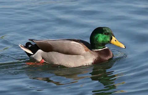
The mallard is perhaps the most familiar duck in the world, found on ponds, lakes, rivers and city parks across North America, Europe and Asia. Males have glossy green heads; females are mottled brown. Almost all farm ducks are descended from mallards.
-
 Watch
3D
Animal
American alligator
The American alligator is a large, armored reptile of the swamps, marshes and lakes of the southeastern United States. Alligator mothers guard their nests and carry their babies to the water, and the holes alligators dig help many other animals survive dry seasons.
- Watch What If? Lab What if a river flooded every year? For thousands of years, the Nile in Egypt flooded every year, spreading fresh mud across its banks. That mud made the land rich for farming, in the middle of a desert. Imagine a river that flooded every year: you could plan for it, farm on it, and build banks called levees to control it. Many of the earliest towns grew up beside rivers like this.
- Watch Geography Rivers from source to mouth A river is fresh water that flows downhill, pulled by gravity. It begins at a source, such as a spring, melting snow or a lake. Smaller streams called tributaries join it along the way, so it grows bigger, until it empties into a lake, a larger river or the ocean at its mouth.
For parents & teachers
What children will learn
- Trace the Mississippi from Lake Itasca to the Gulf and name its biggest tributaries.
- Explain how Ice Age meltwater and river sediment shaped the valley and delta.
- Describe how people have used the river, from Native American canoes to steamboats and barges, including how Native Americans lost their lands.
- Discuss levees, floods and the Gulf dead zone, and how to stay safe near a big river.
Recommended ages: 3 to 17 · About 15 minutes
Talk about it
- Levees protect towns, but they also stop mud from reaching the delta. How would you balance the two?
- Why might fertilizer on a farm in Iowa matter to fish in the Gulf?
- Why do you think birds follow rivers when they migrate?
Try at home or in class
- Make a 'levee' of modeling clay along a sand channel in a tray; pour water and see where the sand goes with and without the levee.
- Measure how long it takes a cork to float 1 meter in a gutter of moving water; talk about how long water takes to travel the whole Mississippi.
Key vocabulary: watershed, tributary, levee, meander, flyway, barge, dead zone
Where these facts come from
- Wikidata , Wikimedia Foundation (CC0 1.0)
- Natural Earth vector data , Natural Earth (NACIS) (Public domain)
- Mississippi River Facts , National Park Service, Mississippi National River and Recreation Area
- Safety , National Park Service, Mississippi National River and Recreation Area
- Mississippi River , Encyclopaedia Britannica
- Mississippi River: Physical features , Encyclopaedia Britannica
- Mississippi River: Plant and animal life (and cultural life) , Encyclopaedia Britannica
- Mississippi River: History and economy , Encyclopaedia Britannica
- Mississippi River: Modern commercial activity (navigation and flood control) , Encyclopaedia Britannica
- Hypoxia 101 , U.S. Environmental Protection Agency, Mississippi River/Gulf Hypoxia Task Force
- Wikimedia Commons , Wikimedia Foundation (Per file (public domain, CC0, CC BY or CC BY-SA); see each media record)
Checked, not yet human-reviewed. Last updated October 27, 2026. Spotted a mistake? Tell us.
Picture credits
- Photo: Daniel Schwen, CC BY-SA 4.0, via Wikimedia Commons · source · license
- Photo: Rhododendrites, CC BY-SA 4.0, via Wikimedia Commons · source · license
- Photo: JackyM59, CC BY-SA 4.0, via Wikimedia Commons · source · license
- Photo: Calibas (edit by Aqwis), CC BY-SA 3.0, via Wikimedia Commons · source · license