
Natural wonder Europe
Rhine Falls
The Rhine Falls is a big, wide waterfall in Switzerland. The River Rhine tumbles over rocks with a loud roar. Boats take people to a rock right in the middle!
The Rhine Falls is a waterfall on the River Rhine in northern Switzerland, beside the town of Neuhausen am Rheinfall near Schaffhausen. The river pours over a rock step about 150 meters wide. In June, the month with the most water, an average of about 560 cubic meters of water rush over it every second, and a rock island stands in the middle of the falls.
The Rhine Falls (Rheinfall) drops over a limestone step about 150 m wide and, by the measure Swiss public broadcaster SRF gives, about 25 m high, with long-term monthly mean flows from about 255 m³/s in February to about 560 m³/s in June (federal gauge, 1959–2025). The official site calls it Europe's largest waterfall. The falls belong to the cantons of Zürich and Schaffhausen, which have monitored the central rock since the early 1980s.
Photo: Christian David, CC BY-SA 4.0, via Wikimedia Commons
Discover the Rhine Falls
The Rhine Falls is in Switzerland.
The River Rhine is wide here. All its water tumbles over a rocky step. It makes white foam and a loud roar. A big rock sticks up in the middle of the falling water.
The Rhine Falls is on the River Rhine in northern Switzerland, between the town of Neuhausen am Rheinfall on one bank and the castle of Schloss Laufen on the other. The water spreads across a width of 150 meters as it pours over the rocks.
The falls belong to two Swiss cantons, Zürich and Schaffhausen. The official Rhine Falls website calls it Europe's largest waterfall. A huge amount of water goes over it: in June, the month with the most water, about 560 cubic meters every second on average.
The Rhine Falls lies on the Rhine at Neuhausen am Rheinfall, near Schaffhausen, with Schloss Laufen on the opposite bank. The official Rhine Falls site, run by the regional tourism office, gives a width of 150 m and calls it Europe's largest waterfall.
Swiss public broadcaster SRF reports a rock step about 25 m high (Wikidata lists 23 m) and an average summer flow of about 600 m³/s; the federal gauge's long-term monthly means (1959–2025) are lower, peaking at about 560 m³/s in June. The falls belong to the cantons of Zürich and Schaffhausen. Two rock pillars rise out of the falls: a large one with a viewing platform, reached by boat, and a smaller one that visitors may not enter.
- Country
- Switzerland (cantons of Zürich and Schaffhausen)
- River
- Rhine
- Width
- 150 m
- Height of the rock step
- about 25 m
- Average flow in June
- about 560 m³ per second (1959–2025)
A step of hard limestone
The water falls over a step of hard rock called limestone.
The rock in the middle is about 15,000 years old. Water rubs against it every day. Very, very slowly, the water wears it away.
The Rhine Falls drops over a step of limestone. The big rock in the middle of the falls formed about 15,000 years ago, SRF reports, and the river has been washing around it ever since.
The rushing water slowly wears the rock down, and weathering breaks it down too. The limestone also has cracks running through it. A geologist told SRF in 2024 that, thousands of years from now, the rock will one day collapse. An official from Schaffhausen added that there was no reason for safety worries at the time.
According to SRF, the rock in the falls formed about 15,000 years ago and has been washed by the river ever since. Slow erosion and weathering weaken the limestone, which is also cut by joints (natural cracks), "in slow motion". Geologist Sandro Truttmann, working for the two cantons, told SRF that in geological time the rock will collapse at some point, in thousands of years.
The cantons have monitored the rock since the early 1980s. In 2024 they began using vibrometry: a seismometer on the viewing platform records the background vibration the waterfall produces, which shows how stiff the rock is and so how stable. Cantonal project leader Jürg Sturzenegger told SRF in July 2024 that there was no reason for concern; the measurements are a precaution.
The rocks in the middle
Two rocks stand in the falling water.
People ride a boat to the big rock. They climb up to a platform and feel the spray! The small rock is just for looking at.
Two rocks stick up out of the Rhine Falls. The big one has a viewing platform on top, and boats carry visitors to it so they can climb up into the middle of the roaring water. The smaller rock next to it is not open to visitors.
People have helped protect both rocks from the force of the water. Near the end of the 1800s, the small rock was given a protective wall. In the winter of 1984 to 1985, workers drained the area around the big rock and covered it with a coat of sprayed concrete.
SRF describes the large rock as reachable by boat and, with its viewing platform, a magnet for tourists; the small rock beside it is not accessible. Both have been reinforced. According to a 1985 report in the journal Wasser, Energie, Luft cited by SRF, the small rock received a protective facing wall at the end of the 19th century.
In 1979 there were fears that the large rock might vibrate at high flow, so it was studied in 1980 and 1981. In November 1983 the cantonal governments decided to coat it with sprayed concrete (shotcrete). The work itself was simple, but the rock had to be drained and a 130 m access walkway built; it was carried out in the winter of 1984/85.
A river that rises and falls
The waterfall is not always the same.
In summer, lots of water thunders down. In late autumn there can be much less. Scientists measure the river all the time.
How much water goes over the falls changes through the year. In June, the month with the most water, the long-term average is about 560 cubic meters a second; in February it is about 255. Switzerland's Federal Office for the Environment measures the Rhine at Neuhausen all the time. On November 1, 2026, its gauge read about 123 cubic meters a second, less than half of the long-term November average of about 288.
The same office sets flood danger levels for the river. The highest level starts when more than 1,150 cubic meters of water flow past every second.
Flow varies strongly through the year. The Federal Office for the Environment (FOEN) gauge Rhein – Neuhausen, Flurlingerbrücke gives long-term monthly means (1959–2025) from about 255 m³/s in February to 559 m³/s in June, and 288 m³/s for November; it read 123 m³/s on November 1, 2026 (24-hour range 119–124 m³/s), and a notice since July 27, 2026 warned that its temperature readings were distorted by the low water level.
FOEN's flood scale for the station runs from level 1 (below 670 m³/s) to level 5 (above 1,150 m³/s). The official Rhine Falls website shows the gauge's live discharge and water temperature, so visitors can see how much water is going over the falls on the day they come.
Visiting safely
You can visit the falls any day of the year.
Paths and platforms let you see the water up close. Stay behind the railings. Rocks near the water are wet and slippery.
The Rhine Falls is open around the clock, every day of the year. From Schloss Laufen a footpath leads past the thundering water to a viewing platform called Fischetz; entry on that side costs a small fee, while the Schlössli Wörth side on the Neuhausen bank is free. A short walk from the train station at Neuhausen Rheinfall brings you to the falls.
The water is fast and powerful, so stay on paths and platforms and behind the railings, and only go out to the big rock on the official boats.
Per the official site, the falls are freely accessible 24 hours a day, 365 days a year; on the Schloss Laufen side an entrance fee (CHF 5.00 per person) covers the Historama and viewing platforms, while access at Schlössli Wörth is free. Neuhausen Rheinfall station is about 8 minutes' walk away.
The cantons monitor the large rock so that tourists can walk on it safely. Visitors should keep to paths and platforms, stay behind railings near the fast, cold water, and reach the rock only by the boat services.
Amazing facts
-
Scientists listen to the rock shake to check that it is safe.
Scientists put a small earthquake sensor on the big rock to measure how the waterfall makes it vibrate. That tells them how stiff and stable the rock is.
Since 2024 the cantons have added vibrometry: a seismometer records the rock's background vibration from the falls to judge its stiffness and stability (SRF).
-
The big rock wears a coat of concrete!
To protect it from the water, the big rock was covered with sprayed concrete in the winter of 1984 to 1985.
The large rock received a shotcrete coating in winter 1984/85, which required draining the rock and building a 130 m access walkway (SRF).
-
Sometimes at night, lights shine on the waterfall.
The official website invites visitors to see the Rhine Falls lit up after dark.
The official site advertises the illuminated falls after dark.
-
You can check how much water is falling right now on the internet.
A Swiss government gauge measures the Rhine at Neuhausen, and the official Rhine Falls website shows its live reading.
The official site displays live discharge and water temperature from the FOEN gauge at Neuhausen.
Words to know
- waterfall
- a place where a river drops over a step of rock
- limestone
- a rock made mostly of calcium carbonate, often from the shells of sea creatures
- erosion
- the slow wearing away of rock or soil by water, wind or ice
- discharge
- the amount of water flowing past a point in a river each second
- canton
- one of the states that make up Switzerland
- shotcrete
- concrete sprayed onto a surface through a hose
Discovery challenge
-
Which river makes the Rhine Falls?
On which river is the Rhine Falls?
Which river flows over the Rhine Falls?
- The Rhine
- The Nile
- The Amazon
Show the answer
The Rhine
The River Rhine.
The Rhine, in northern Switzerland.
The Rhine, at Neuhausen am Rheinfall near Schaffhausen.
-
How do people get to the big rock in the falls?
How do visitors reach the big rock in the middle of the falls?
How is the large rock pillar reached?
- By boat
- By swimming
- By helicopter
Show the answer
By boat
They ride a boat.
By boat; then they climb to a viewing platform.
By boat; it has a viewing platform.
-
When does the most water go over the falls?
In which season does the most water go over the falls?
In which season are the gauge's long-term monthly mean flows highest?
- Summer
- Winter
- It never changes
Show the answer
Summer
In summer.
Summer; in late autumn there can be much less.
Summer: June has the highest monthly mean, 559 m³/s (FOEN, 1959–2025); on November 1, 2026 the gauge read about 123 m³/s.
-
What kind of rock is the big rock?
What rock is the Rhine Falls rock made of?
Which rock forms the step and pillars of the Rhine Falls?
- Limestone
- Ice
- Lava
Show the answer
Limestone
Limestone.
Limestone, with cracks running through it.
Jointed limestone, slowly weakened by erosion and weathering.
Nearby places
-
 Watch
City
Zurich
Zurich is the biggest city in Switzerland, where the Limmat River leaves Lake Zurich. Romans built a fort on a hill here, and old churches with tall towers line the river. More than 450,000 people lived in the city at the end of 2025, more than ever before.
-
 Watch
Natural wonder
Danube
The Danube is Europe's second-longest river, after the Volga. It begins as two small streams in Germany's Black Forest and flows about 2,850 kilometers east to the Black Sea, passing through 10 countries and four capital cities. For more than 2,000 years it has been a border, a highway for boats and a home for wildlife, and it ends in a giant delta of reeds, lakes and birds.
-
 Watch
Natural wonder
Black Forest
The Black Forest is a range of forested mountains in the German state of Baden-Württemberg. Its core is gneiss and granite, covered in places by a sandstone called Buntsandstein, and it rises steeply from the Rhine valley on its west side. Its highest peak, the Feldberg, reaches 1,493 meters, and a national park lets part of its forest grow wild.
-
 Watch
City
Vaduz
Vaduz is the capital of Liechtenstein. It lies on the edge of the Rhine valley, below a steep mountainside, with Vaduz Castle, the home of the country's prince, on a ledge above the town. About 6,100 people lived in Vaduz at the end of 2025, and the town has never had a railway.
-
 Watch
Natural wonder
Rhine
The Rhine begins as two small streams high in the Swiss Alps and flows about 1,230 kilometers north and west to the North Sea, through Switzerland, Germany, France and the Netherlands. It tumbles over the Rhine Falls and winds through a gorge lined with castles. After a chemical spill in 1986, the countries along it worked together to clean it, and salmon came back.
-
 Watch
City
Strasbourg
Strasbourg is a city in the northeast of France, shaped by both French and German influences, UNESCO says. Its cathedral, built of pink sandstone, has a spire 142 meters high. Rivers and canals wind through its old center, which is a UNESCO World Heritage site. The 2023 census counted 293,771 people in the city.
-
 Watch
Landmark
Zytglogge
The Zytglogge is a medieval clock tower in the old town of Bern, Switzerland. Built from 1218 to 1220 as a defensive tower, it became a clock tower after a great fire in 1405. Bern Welcome dates its astronomical clock and moving figures to 1530.
-
 Watch
City
Bern
Bern is the federal city of Switzerland, where the country's government is based. It was founded in the 12th century on a hill surrounded by a loop of the Aare River, and its old town, with covered arcades and old fountains, is a UNESCO World Heritage Site. About 147,000 people lived in the city at the end of 2025.
Explore next
-
 Watch
 Country
Switzerland
Switzerland is a small, landlocked country in central Europe. The Alps cover its south and east, great rivers such as the Rhine and Rhône begin there, and its 9.1 million people share four national languages: German, French, Italian and Romansh.
-
Watch
Natural wonder
Rhine
The Rhine begins as two small streams high in the Swiss Alps and flows about 1,230 kilometers north and west to the North Sea, through Switzerland, Germany, France and the Netherlands. It tumbles over the Rhine Falls and winds through a gorge lined with castles. After a chemical spill in 1986, the countries along it worked together to clean it, and salmon came back.
-
 Watch
Natural wonder
Niagara Falls
Niagara Falls is a set of three waterfalls on the Niagara River, which flows from Lake Erie to Lake Ontario across the border between Canada and the United States. About 500 waterfalls in the world are taller, but Niagara is famous for its height together with the enormous amount of water that pours over it.
-
 Watch
Natural wonder
Victoria Falls
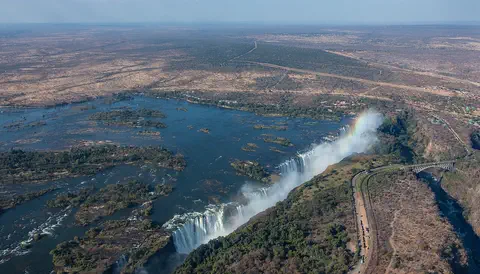
Victoria Falls, on the Zambezi River between Zambia and Zimbabwe, is about 1,708 meters wide and up to 108 meters deep. UNESCO calls it the largest curtain of falling water in the world, and its spray can be seen from tens of kilometers away.
- Watch Geography Weathering and erosion Weathering is rocks breaking apart where they are: ice in cracks, rain, wind-blown sand and growing roots all do it. Erosion is the next step, when gravity, rain, rivers, waves, wind and glaciers carry the broken pieces away. Over thousands to millions of years, they carve valleys, cliffs and canyons.
- Watch Geography Rivers from source to mouth A river is fresh water that flows downhill, pulled by gravity. It begins at a source, such as a spring, melting snow or a lake. Smaller streams called tributaries join it along the way, so it grows bigger, until it empties into a lake, a larger river or the ocean at its mouth.
-
 Watch
Natural wonder
Dettifoss
Dettifoss is a waterfall on the river Jökulsá á Fjöllum in Iceland. It is 44 to 45 meters high and about 100 meters wide, and Vatnajökull National Park calls it the most powerful waterfall in Europe. It pours into Jökulsárgljúfur, a canyon that giant floods from under a glacier are believed to have carved.
-
 Watch
Natural wonder
Matterhorn
The Matterhorn is a 4,478-meter mountain in the Alps, on the border between Switzerland and Italy. Its rock was pushed up when Africa moved toward Europe, and glaciers later carved its steep sides into a pyramid shape. Climbers first reached its top on 14 July 1865.
For parents & teachers
What children will learn
- Locate the Rhine Falls on the Rhine in northern Switzerland.
- Explain how flowing water slowly erodes a rock step.
- Compare a river's flow in different seasons using real measurements.
- Describe how people monitor and protect a natural landmark.
Recommended ages: 3 to 17 · About 15 minutes
Talk about it
- Why might a waterfall carry much more water in summer than in late autumn?
- Should people reinforce natural rocks with concrete to keep them safe for visitors? Why or why not?
- How could listening to a rock's vibrations tell scientists whether it is stable?
Try at home or in class
- Fill a measuring jug and time how long a tap takes to fill one liter. Compare that with about 560,000 liters a second at the Rhine Falls in June.
- Build a step of stacked sugar cubes in a tray and pour a slow stream of water over it. Watch which edges wear away first.
Key vocabulary: waterfall, limestone, erosion, discharge, canton, shotcrete
Where these facts come from
- Wikidata , Wikimedia Foundation (CC0 1.0)
- Beobachtung mit neuer Methode: So wird die Standfestigkeit des Rheinfallfelsens gemessen , SRF (Swiss Radio and Television)
- Rhine Falls , Rheinfall official website (Schaffhauserland Tourismus)
- Opening hours and prices , Rheinfall official website (Schaffhauserland Tourismus)
- Rhein – Neuhausen, Flurlingerbrücke (station 2288) , Federal Office for the Environment FOEN, Hydrological data
- Wikimedia Commons , Wikimedia Foundation (Per file (public domain, CC0, CC BY or CC BY-SA); see each media record)
Checked, not yet human-reviewed. Last updated November 1, 2026. Spotted a mistake? Tell us.