
Natural wonder Africa
Selous Game Reserve
Selous is a huge wild area in Tanzania, in Africa. Elephants, hippos, giraffes and crocodiles live there.
The Selous Game Reserve in Tanzania is one of the largest protected areas in Africa. UNESCO says it holds some of the most important groups of elephants, black rhinos, cheetahs, giraffes, hippos and crocodiles.
The Selous Game Reserve (World Heritage, 1982) is, UNESCO says, among Africa's largest protected areas and one of its largest remaining wilderness areas, dominated by miombo woodland, with sand rivers and Rufiji floodplains, more than 2,100 recorded plants and 350 bird species.
Photo: Richard Mortel from Riyadh, Saudi Arabia, CC BY 2.0, via Wikimedia Commons
Discover the Selous
The Selous is a giant wild place in Tanzania, in East Africa. No one lives there all year.
In this photo, bare trees stand in brown water, with green hills behind.
UNESCO calls the Selous Game Reserve one of the largest protected areas in Africa, and one of the largest wilderness areas left on the continent. No one lives inside it permanently, so people disturb it very little.
This photo by Richard Mortel, taken on 23 June 2016, shows pale, bare trees standing in brown water in the reserve, with a strip of green bushes, forested hills behind and green grass in front.
UNESCO describes the Selous Game Reserve as amongst the largest protected areas in Africa and one of the largest remaining wilderness areas on the continent, relatively undisturbed by human impact, with no permanent habitation inside its boundaries; it lies within a wider Selous Ecosystem of national parks, forest reserves and community wildlife areas.
The photo (Richard Mortel, CC BY 2.0, 23 June 2016) shows leafless pale trees standing in brown water, a band of green vegetation, wooded hills and a grassy foreground.
- Country
- Tanzania
- World Heritage Site
- since 1982
- Bird species
- about 350
Sand rivers and floods
Many rivers here are dry sand most of the year.
When heavy rain comes, they fill with rushing water.
Most of the Selous is miombo woodland. UNESCO says that in heavy rains the soil washes away easily, and this has made a network of 'sand rivers': riverbeds that are usually dry sand but turn into raging torrents in the rainy season.
In the north, the rising water of the Rufiji River floods large areas of wooded grassland for part of each year, which keeps the landscape always changing.
The dominant vegetation is deciduous miombo woodland, a fire-climax vegetation; its soils erode in heavy rains, producing a network of normally dry sand rivers that become raging torrents during the rains, which UNESCO counts among the most distinctive features of the Selous landscape.
Large parts of the wooded grasslands of the northern Selous are seasonally flooded by the rising Rufiji River, creating a very dynamic ecosystem; other habitats include rocky acacia-clad hills, gallery and groundwater forests, swamps and lowland rainforest (UNESCO).
Elephants, wild dogs and hippos
Elephants, hippos, buffaloes and wild dogs live in the Selous.
Crocodiles swim in the rivers, and hundreds of kinds of birds fly here.
UNESCO says the Selous has globally important populations of African elephants, black rhinos and African wild dogs, and one of the world's largest known populations of hippos and buffaloes. Sable antelope, greater kudu, eland and Nyassa wildebeest live there too.
More than 2,100 kinds of plants have been recorded, and about 350 kinds of birds, including the rufous-winged sunbird.
UNESCO: a higher density and diversity of species than any other miombo woodland area; more than 2,100 plants recorded, with more thought to exist in the remote southern forests; globally significant populations of African elephant, black rhinoceros and African wild dog; one of the world's largest known populations of hippopotamus and buffalo; sable antelope, Lichtenstein's hartebeest, greater kudu, eland and Nyassa wildebeest; many Nile crocodiles; 350 bird species including the Udzungwa forest partridge and the rufous-winged sunbird.
Because of this high density and diversity of species, UNESCO calls the reserve a natural habitat of outstanding importance for conserving biological diversity in place.
Part of a bigger wild landscape
The Selous is joined to other wild places around it.
Animals can move between them.
UNESCO says the reserve sits inside a larger area of about 90,000 square kilometers called the Selous Ecosystem, made up of national parks, forest reserves and areas where local communities manage wildlife.
It is also linked to the Niassa reserve in Mozambique, about 42,000 square kilometers, which helps keep the whole wild landscape healthy.
The reserve is embedded within the larger, roughly 90,000 km2 Selous Ecosystem (national parks, forest reserves and community-managed wildlife areas) and is functionally linked with the 42,000 km2 Niassa reserve in Mozambique, both of which UNESCO says enhance its integrity.
UNESCO calls the reserve a valuable laboratory for ongoing ecological and biological processes, including significant predator-prey relationships.
Visiting safely
In the bush, stay in the car or with a guide.
Cover your arms and legs to stop mosquito bites.
PlayOwl's advice: watch elephants, hippos and other wild animals only with a trained guide, and stay in the vehicle unless the guide says it is safe.
Mosquitoes can spread germs that make people sick. The CDC says to use insect repellent and wear loose, long-sleeved shirts and long pants, because mosquitoes bite day and night.
PlayOwl's advice: view large wildlife only with trained guides and at a distance.
CDC mosquito guidance: EPA-registered insect repellents and loose-fitting, long-sleeved shirts and pants; mosquitoes bite day and night and spread germs that cause illness.
Amazing facts
-
Some rivers here are dry sand until the rain comes.
The Selous has 'sand rivers': riverbeds that are usually dry sand but become raging torrents in the rainy season.
UNESCO counts the Selous's normally dry sand rivers, which become raging torrents during the rains, among the most distinctive features of its landscape.
-
Thousands of kinds of plants grow in the Selous.
More than 2,100 kinds of plants have been recorded in the Selous, and scientists think more grow in its remote southern forests.
More than 2,100 plant species are recorded, with more thought to exist in the remote forests of the south (UNESCO).
-
One of the world's biggest groups of hippos lives in the Selous.
UNESCO says the Selous has one of the world's largest known populations of hippos.
The reserve holds one of the world's largest known populations of Hippopotamus amphibius, and of African buffalo (UNESCO).
Words to know
- game reserve
- a large area set aside for wild animals
- miombo woodland
- an African woodland of trees that drop their leaves each year
- sand river
- a riverbed that is dry sand most of the year and fills with water in the rains
- floodplain
- flat land beside a river that floods when the river rises
- wilderness
- a wild area where few or no people live
Discovery challenge
-
In which country is the Selous?
In which country is the Selous Game Reserve?
The Selous Game Reserve is a World Heritage Site in which country?
- Tanzania
- Egypt
- Morocco
Show the answer
Tanzania
Tanzania.
Tanzania, in East Africa.
Tanzania (UNESCO).
-
What are the Selous's 'sand rivers' like most of the year?
What are the Selous's sand rivers like most of the year?
What are the Selous's sand rivers like outside the rainy season?
- Dry sand
- Frozen ice
- Deep lakes
Show the answer
Dry sand
Dry sand, until the rain comes.
Dry sand; they become raging torrents in the rains.
Normally dry; they become raging torrents during the rains (UNESCO).
-
What kind of woodland covers most of the Selous?
Which woodland type covers most of the Selous?
Which deciduous, fire-climax vegetation dominates the reserve?
- Miombo woodland
- Pine forest
- Cactus desert
Show the answer
Miombo woodland
Miombo woodland.
Miombo woodland.
Deciduous miombo woodland (UNESCO).
-
Which big river floods the north of the Selous?
Which river floods wooded grasslands in the northern Selous each year?
Whose rising water seasonally floods the wooded grasslands of the northern Selous?
- The Rufiji River
- The Nile
- The Amazon
Show the answer
The Rufiji River
The Rufiji River.
The Rufiji River.
The Rufiji River (UNESCO).
-
Which animal does the Selous have a lot of?
The Selous has one of the world's largest known populations of which animal?
UNESCO lists one of the world's largest known populations of which large river mammal in the Selous?
- Hippopotamus
- Polar bear
- Kangaroo
Show the answer
Hippopotamus
Hippos!
Hippos.
Hippopotamus amphibius (UNESCO).
Nearby places
-
 Watch
City
Dar es Salaam
Dar es Salaam is the largest city of Tanzania, on the coast of the Indian Ocean in East Africa. It was founded in 1862 beside a harbor that was good for ships. In the 2022 census, 5,383,728 people were counted there.
-
 Watch
City
Zanzibar City
Zanzibar City is the main town of Zanzibar island, off the coast of Tanzania in the Indian Ocean. Its old quarter, Stone Town, is a UNESCO World Heritage Site, a Swahili trading town shaped by Africa, the Arab region, India and Europe. Tanzania's 2022 census counted 709,809 people in the city.
-
 Watch
Natural wonder
Lake Malawi
Lake Malawi is one of the African Great Lakes, in the Great Rift Valley. UNESCO calls it one of the deepest lakes in the world, and it holds many hundreds of kinds of cichlid fish, nearly all found nowhere else.
-
 Watch
City
Moshi
Moshi is a town in Tanzania, south of Mount Kilimanjaro. The encyclopedia Larousse calls it the main town of its region and a commercial center for coffee. Tanzania's 2022 census counted 221,733 people in the city.
-
 Watch
Natural wonder
Mount Kilimanjaro
Mount Kilimanjaro, in northeastern Tanzania, is what UNESCO calls the highest mountain in Africa: its top is 5,895 meters high. It is a huge volcanic mountain standing alone above the plains, and as you climb it you pass through farms, forest, moorland and high alpine desert to its icy top.
-
 Watch
Natural wonder
Ngorongoro Conservation Area
The Ngorongoro Conservation Area in northern Tanzania holds the Ngorongoro Crater, a giant bowl about 16 to 20 kilometers across, left when an ancient volcano collapsed about 2.5 million years ago. Around 25,000 large animals live in and around the crater. The area also protects Olduvai Gorge and Laetoli, where scientists have found important evidence of how humans evolved.
-
 Watch
City
Lilongwe
Lilongwe is the capital of Malawi, in southern Africa. It grew from a market village, and a new capital city was built next to it and opened in 1975. It lies on a high plateau about 1,100 meters above sea level, and Malawi's statistics office projected 1,162,500 people for it in 2023.
-
 Watch
City
Moroni
Moroni is the capital and largest town of the Comoros, a country of islands in the Indian Ocean. It lies on the southwest coast of the island of Grande Comore. In the 2017 census, 74,749 people were counted there.
Explore next
-
 Watch
Natural wonder
Serengeti National Park
Serengeti National Park in northern Tanzania protects 14,763 square kilometers of grassy plains and woodlands. Each year more than a million wildebeest, with zebras and gazelles, travel a great loop across the Serengeti and into Kenya in search of grass and water, followed by lions and other predators.
-
Watch
 Country
Tanzania
Tanzania is a country in East Africa, just south of the Equator, on the Indian Ocean. It has Mount Kilimanjaro, Africa's highest mountain, deep lakes in the East African Rift, and the Serengeti, where huge herds of wildebeest travel each year.
- Watch Geography National parks and protected areas Countries set aside land and sea as national parks and other protected areas, so that wildlife, forests, reefs and wonderful landscapes are looked after. Yellowstone became the first national park in 1872. Today about 18 percent of the world's land is protected, and countries have agreed to aim for 30 percent by 2030.
-
 Watch
Natural wonder
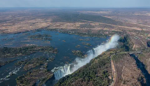
Victoria Falls
Victoria Falls, on the Zambezi River between Zambia and Zimbabwe, is about 1,708 meters wide and up to 108 meters deep. UNESCO calls it the largest curtain of falling water in the world, and its spray can be seen from tens of kilometers away.
-
 Watch
Natural wonder
Sahara
The Sahara fills almost all of northern Africa. Britannica calls it the largest hot desert in the world: about 4,800 kilometers from east to west and about 8.6 million square kilometers in all. Only about a quarter of it is sand dunes; the rest is gravel plains, rocky plateaus and mountains.
-
Watch
Natural wonder
Mount Kilimanjaro
Mount Kilimanjaro, in northeastern Tanzania, is what UNESCO calls the highest mountain in Africa: its top is 5,895 meters high. It is a huge volcanic mountain standing alone above the plains, and as you climb it you pass through farms, forest, moorland and high alpine desert to its icy top.
-
 Watch
Natural wonder
Nile
The Nile flows north through northeastern Africa to the Mediterranean Sea, and its basin is shared by 11 countries. Its length is usually given as about 6,650 kilometers. Two great branches, the White Nile and the Blue Nile, meet at Khartoum in Sudan, and the green strip of farmland along its banks made it the lifeline of ancient Egypt.
-
 Watch
Natural wonder
River Congo
The Congo is Africa's second-longest river, about 4,700 kilometers long. It curves in a giant arc through the rainforests of central Africa and empties into the Atlantic Ocean. Rain falls in its basin all year, so it carries a huge amount of water, and its wild lower rapids are home to about 320 kinds of fish, about 90 of them found nowhere else.
For parents & teachers
What children will learn
- Locate the Selous Game Reserve in Tanzania.
- Explain what sand rivers and floodplains are.
- Describe miombo woodland and the animals of the Selous.
- Explain why connected wild areas help wildlife.
Recommended ages: 3 to 17 · About 15 minutes
Talk about it
- Why might a river be dry for months and then suddenly flood?
- Why might big animals need wild areas that connect to each other?
- How might fire shape a woodland?
Try at home or in class
- Make a sand river in a tray: pour water along a groove in damp sand and watch it carve and carry sand.
- On a map of Africa, find Tanzania, the Rufiji River and Mozambique.
Key vocabulary: game reserve, miombo woodland, sand river, floodplain, wilderness
Where these facts come from
- Wikidata , Wikimedia Foundation (CC0 1.0)
- Selous Game Reserve (World Heritage List) , UNESCO World Heritage Centre
- Preventing Mosquito Bites , US Centers for Disease Control and Prevention
- File:Selous Game Reserve (3) (28986810231).jpg , Wikimedia Commons
- UNESCO World Heritage List , UNESCO World Heritage Centre (Linked as a reference; site facts come from Wikidata)
- Wikimedia Commons , Wikimedia Foundation (Per file (public domain, CC0, CC BY or CC BY-SA); see each media record)
Checked, not yet human-reviewed. Last updated November 1, 2026. Spotted a mistake? Tell us.