
Natural wonder Europe
Volga
The Volga is the longest river in Europe. It flows through Russia. It starts in low hills and ends in a sea called the Caspian Sea.
The Volga is Europe's longest river. It rises in the Valdai Hills northwest of Moscow and flows about 3,530 kilometers to the Caspian Sea, all within Russia. Almost half of Russia's people live in its basin. Big dams now turn much of it into a chain of long lakes, and its huge delta shelters up to 750,000 waterbirds in mild winters.
The Volga, Europe's longest river at about 3,530 km, drains some 1,380,000 km², about two-fifths of European Russia, and Britannica calls it the historic cradle of the Russian state. Soviet-era dams turned it into a chain of reservoirs with hydroelectric stations, but they also cut off spawning routes for Caspian sturgeon. It ends in a vast delta on the Caspian Sea, below sea level.
Photo: Insider, CC BY-SA 3.0, via Wikimedia Commons
Discover the Volga
The Volga is the longest river in Europe.
It starts as a little stream in low hills in Russia. It grows bigger and bigger as other rivers join it. At the end, it flows into a huge lake called the Caspian Sea.
The Volga is the longest river in Europe, about 3,530 kilometers long, and it flows entirely within Russia. It rises in the Valdai Hills northwest of Moscow and winds east and then south to the Caspian Sea. On the way, about 200 tributaries join it; the biggest is the Kama.
The Volga drops very gently. Its source is only 228 meters above sea level, and its mouth is 28 meters below sea level, because the Caspian Sea lies lower than the oceans. Its basin, all the land that drains into it, covers about two-fifths of European Russia, and Britannica says almost half of Russia's people live there. Big cities on its banks include Nizhny Novgorod, Kazan, Samara and Volgograd.
Britannica calls the Volga the continent's longest river, the principal waterway of western Russia and the historic cradle of the Russian state. From the Valdai Hills it flows some 3,530 km to the Caspian Sea, dropping slowly from 228 m above sea level to 28 m below it. About 200 tributaries, mostly on its left bank, feed it, and the whole system comprises some 151,000 rivers and streams. The basin, about 1,380,000 km², stretches from the Valdai Hills and Central Russian Upland to the Ural Mountains.
The course is divided into the upper Volga, to the confluence of the Oka at Nizhny Novgorod; the middle Volga, to the confluence of the Kama below Kazan; and the lower Volga, to the Caspian. Below Kamyshin the river flows for some 400 miles (about 640 km) with no tributaries at all. Above Volgograd its main distributary, the Akhtuba, branches off and runs parallel to the main river, with a floodplain of channels and old loops between them.
- Length
- about 3,530 km
- Source
- Valdai Hills, northwest of Moscow, 228 m above sea level
- Mouth
- Caspian Sea, 28 m below sea level
- Basin area
- about 1,380,000 km²
- Tributaries
- about 200; the largest is the Kama
Snow, forests and steppe
Most of the Volga's water comes from melting snow.
In spring, the snow melts and the river gets very full. The river flows past forests in the north and dry grassland in the south. In winter, it freezes over.
Most of the Volga's water comes from snow. Britannica says melting snow supplies about 60 percent of the river's yearly flow, underground water about 30 percent and rain about 10 percent. Before dams were built, the spring floods could raise the river by more than 10 meters in places.
The Volga flows through four kinds of land. In the north there are thick, marshy forests. Further south come forest steppe, then open grassy steppe, and finally dry, semidesert lowlands near the Caspian Sea. Winters are cold: the river freezes in late November or December and stays ice-free for about 200 days a year, or about 260 days near Astrakhan.
Britannica gives the Volga's sources of water as snow (60 percent of annual discharge), groundwater (30 percent) and rain (10 percent). Its natural regime was marked by high spring floods, the polovodye; before regulation, annual level changes reached 23 to 36 feet (about 7 to 11 m) on the upper river, 39 to 46 feet (12 to 14 m) on the middle river and 10 to 49 feet (3 to 15 m) on the lower river. Average flow grows from about 180 m³/s at Tver to about 8,060 m³/s at the mouth, and more than 90 percent of the runoff is generated above the Kama confluence; below Volgograd about 2 percent is lost to evaporation.
The basin crosses four zones: marshy forest to Nizhny Novgorod and Kazan, forest steppe to Samara and Saratov, steppe to Volgograd, and semidesert lowlands to the Caspian. Rainfall falls from about 635 mm a year in the northwest to about 300 mm in the southeast, and January averages range from about −7 °C to −14 °C upstream; Astrakhan averages −7 °C in January and 25 °C in July. Ice covers the upper and middle river from late November and breaks up in mid-March at Astrakhan and mid-April elsewhere.
Sturgeons, waterbirds and lotus flowers
Big fish called sturgeons swim from the sea up the Volga.
They lay their eggs in the river. Dams now block their way. Huge numbers of water birds spend the winter in the Volga's marshes.
Nearly 70 kinds of fish are native to the Volga. The most famous is the beluga sturgeon, a big fish that lives in the Caspian Sea and swims up rivers like the Volga to lay its eggs. Dams across the river have blocked or cut short its journey, and today, Britannica says, about three-fifths of Caspian sturgeon are bred artificially instead of in their natural spawning grounds.
Where the Volga meets the Caspian Sea, it spreads into a giant delta of channels, lakes and islands. UNESCO calls it the largest inland delta in Europe, and in mild winters its wetlands hold up to 750,000 waterbirds. Lotus flowers, plants of the tropics, grow there too, farther north than anywhere else they grow.
Britannica reports that the dams and reservoirs have blocked or severely curtailed the spawning runs of anadromous fish such as the beluga sturgeon, famous for caviar, and the whitefish (belorybitsa), which live in the Caspian and spawn in the Volga, and have fundamentally altered the habitat of the nearly 70 native fish species. Together with industrial, municipal and agricultural pollution, this has led to the deterioration of the Volga's main fisheries; some three-fifths of Caspian sturgeon are now bred artificially rather than in natural spawning grounds.
The delta begins where the Buzan branches off above Astrakhan and covers more than 7,330 square miles (about 19,000 km²), Russia's largest. UNESCO's Astrakhanskiy Biosphere Reserve, about 90 km from Astrakhan, describes it as the largest inland delta in Europe: a freshwater wetland of channels, creeks, alluvial islands and shallow bays called kultuks, with willow forests and reed and cattail beds. It is a Ramsar site because its wetlands support up to 750,000 waterfowl in mild winters. The lotus (Nelumbo nucifera), a tropical species, reaches its northernmost distribution here and spread from 3.5 ha in the 1930s to several thousand hectares by the 1980s. UNESCO also notes that growing numbers of fishing and hunting boats disturb birds and mammals and deplete fish and game.

A river of dams and canals
People have known about the Volga for a very long time.
Long ago, people wrote about it in old books and maps. Later, people built giant dams that make electricity. Canals connect the Volga to faraway seas.
The Volga has been known for a very long time. The geographer Ptolemy wrote about it in the 2nd century, and Arab geographers described it about 1,000 years ago. In 1700 an Englishman named John Perry made the first measurement of how much water it carries.
In the 1900s, Soviet engineers built a string of huge dams along the Volga and the Kama, turning long stretches into man-made lakes. Each dam has a power station and locks for ships. Canals now link the Volga to the Baltic Sea, the White Sea, Moscow and the Sea of Azov, so boats can travel across much of eastern Europe.
Britannica notes that the Volga was known to Ptolemy in the 2nd century CE, to the Slavs and to Arab geographers of the 10th and 11th centuries, and appears in the 1627 Kniga bolshomu chertyozhu (Book of the Great Chart). John Perry first measured its flow, below Kamyshin, in 1700, and systematic surveys followed from 1782 onward; more than 500 points now monitor its water level.
The reservoir chain began with Ivankovo (1937) and Uglich (1939); Rybinsk (1941, about 1,750 square miles) was the first large one, and Samara, completed in 1957 at some 2,300 square miles, is the largest, backing water about 375 miles up the Kama. Eight hydroelectric stations on the Volga and three on the Kama have some 11 million kilowatts of capacity. The river and more than 70 navigable tributaries carried over half of all Soviet inland freight, about 80 percent of it construction and raw materials. Britannica adds that losses to reservoirs, evaporation and irrigation reduced the flow at the mouth, contributing to an almost steady fall in the Caspian Sea's level after 1930.

Visiting safely
The Volga is wide and deep in many places.
Stay close to a grown-up near the water. Wear a life jacket in a boat. Floating toys do not keep you safe.
The Volga is a working river with ships, locks and wide reservoirs. If you go out on the water, wear a life jacket. The US Centers for Disease Control and Prevention (CDC) explains that big rivers can hide dangerous currents and that a life jacket helps keep boaters of any age safe, swimmers or not. Children near the river need a grown-up close by, watching them, and blow-up toys are not lifesavers.
The seasons matter too. Britannica explains that the Volga freezes from late November or December and the ice breaks up between mid-March and mid-April, so the river changes a lot through the year.
Boating on the Volga's broad reservoirs calls for the CDC's standard precautions. The CDC notes that open natural water can hide dangerous currents or waves, that life jackets reduce the risk of drowning for boaters regardless of age or ability, and that children should wear them around natural water with an adult supervising closely, even if they have learned to swim; air-filled or foam toys are not safety devices.
Britannica's account of the river adds the context: a regulated chain of large reservoirs with navigation locks and heavy freight traffic; ice from late November (upper and middle river) or December (lower river) until mid-March to mid-April; and an ice regime altered by the dams, with longer ice cover at the heads of reservoirs and shorter cover below the dams.
Amazing facts
-
The Volga ends lower than the ocean!
The Volga's mouth is 28 meters below sea level, because the Caspian Sea, where it ends, lies lower than the oceans.
The Volga falls from 228 m above sea level at its source to 28 m (92 feet) below sea level at its Caspian mouth.
-
The Volga has thousands and thousands of little rivers.
Counting every river and stream that feeds it, the Volga's system has about 151,000 waterways.
The Volga system comprises some 151,000 rivers and permanent and intermittent streams, with a total length of about 357,000 miles.
-
For a long stretch, no rivers join the Volga at all.
Below the town of Kamyshin, the Volga flows for about 640 kilometers all the way to the sea without a single tributary joining it.
From Kamyshin to its mouth, some 400 miles, the Volga receives no tributaries.
-
Lotus flowers grow in the Volga's delta.
The lotus, a plant of hot tropical places, grows in the Volga delta, farther north than anywhere else it grows. In the 1930s it covered just 3.5 hectares there.
UNESCO notes that Nelumbo nucifera reaches its northernmost distribution in the Volga delta, spreading from 3.5 ha in the 1930s to several thousand hectares in the biosphere reserve by the 1980s.
Words to know
- basin
- all the land whose rain and streams drain into one river
- reservoir
- a lake made by people, usually behind a dam, to store water
- lock
- a section of a waterway with gates that raises or lowers boats
- steppe
- a wide, dry, grassy plain with few trees
- delta
- a maze of channels, islands and marsh at a river's mouth, built from the mud the river drops
- distributary
- a branch that flows away from a river instead of into it
- spawn
- for fish, to lay eggs
Discovery challenge
-
Where does the Volga end?
Into which body of water does the Volga flow?
Into which body of water, lying below sea level, does the Volga discharge?
- The Caspian Sea
- The Black Sea
- The Baltic Sea
Show the answer
The Caspian Sea
The Caspian Sea. It is a very, very big lake.
The Volga flows into the Caspian Sea through a huge delta.
The Caspian Sea; the Volga's mouth is 28 m below sea level.
-
Where does most of the Volga's water come from?
What supplies most of the Volga's water each year?
Which source supplies about 60 percent of the Volga's annual discharge?
- Melting snow
- Rain
- Glaciers
Show the answer
Melting snow
Melting snow! The river gets very full in spring.
Melting snow gives about 60 percent, underground water 30 percent and rain 10 percent.
Snow (60 percent), then groundwater (30 percent) and rain (10 percent).
-
Which is the biggest river that joins the Volga?
What is the name of the Volga's major tributary?
Which left-bank tributary joins the Volga below Kazan, marking the start of the lower Volga?
- The Kama
- The Danube
- The Rhine
Show the answer
The Kama
The Kama. It joins the Volga in Russia.
The Kama is the Volga's major tributary; it joins in the Samara reservoir below Kazan.
The Kama; Britannica divides the middle and lower Volga at its confluence.
-
What blocks the sturgeon's trip up the Volga?
What has blocked beluga sturgeon from swimming up the Volga to lay eggs?
According to Britannica, what has curtailed the spawning runs of the Volga's anadromous fish?
- Dams and reservoirs
- Waterfalls
- Sea ice
Show the answer
Dams and reservoirs
Big dams block the way.
The dams and reservoirs have blocked or cut short their journey.
The dam and reservoir system; about three-fifths of Caspian sturgeon are now bred artificially.
-
When does the Volga start to freeze?
In which months does the Volga begin to freeze over?
According to Britannica, when does ice form on the upper, middle and lower Volga?
- Late November or December
- June or July
- It never freezes
Show the answer
Late November or December
In late November or December, when winter comes.
The upper and middle Volga begin to freeze at the end of November, the lower river in December.
End of November on the upper and middle river, December on the lower; the ice breaks up from mid-March at Astrakhan to mid-April elsewhere.
Nearby places
-
 Watch
Landmark
Shaki
Shaki, also spelled Sheki, is a historic town in the forested Caucasus Mountains of Azerbaijan. After a flood of mud destroyed the old town in 1772, people rebuilt it higher up the valley, with houses, gardens, water channels and a khan's palace. Its wealth came from silk, and UNESCO made its historic center a World Heritage Site in 2019.
-
 Watch
Natural wonder
Mount Elbrus
Mount Elbrus is the highest peak of the Caucasus Mountains, in southwestern Russia. It is an old volcano with two snow-covered tops, the higher one 5,642 meters tall. Twenty-two glaciers cover its slopes and feed rivers below. Whether it counts as Europe's highest mountain depends on where you draw the line between Europe and Asia.
-
 Watch
City
Tbilisi
Tbilisi, the capital of Georgia, lies along the Mtkvari River between mountain ridges. Its name comes from the Georgian word for "warm", after the hot springs that feed its old bathhouses. At the 2024 census, 1,331,485 people lived in the self-governing city.
-
Watch
City
Baku
Baku, the capital of Azerbaijan, curves around a bay on the Caspian Sea, the world's largest inland body of water. Its old walled town, with the Maiden Tower and a palace of the Shirvan shahs, is a World Heritage Site, and oil has made the city important for more than 150 years.
-
 Watch
Natural wonder
Mount Ararat
Mount Ararat is a huge volcanic mountain in the far east of Türkiye, close to where Türkiye, Iran and Armenia meet. It has two peaks: Great Ararat, about 5,165 meters high and the tallest mountain in Türkiye, and the smaller, cone-shaped Little Ararat. Snow covers the top all year, and a glacier clings to its north side.
-
 Watch
Landmark
Nineveh
Nineveh was the biggest city of the Assyrian Empire, on the east bank of the Tigris River in what is now Mosul, Iraq. About 2,700 years ago, King Sennacherib filled it with streets, canals and a palace of at least 80 rooms, and King Ashurbanipal collected a library of clay tablets. In 612 BCE the city was conquered and burned, and it never recovered.
-
 Watch
City
Tehran
Tehran, the capital of Iran, spreads up the slopes of the Alborz Mountains, with snowy peaks to the north and desert to the south. Once a small village, and later a market town known for its pomegranates, it became the capital in 1786. Today it is a huge, modern city with an old roofed bazaar, a palace that is a World Heritage Site and the 435-meter Milad Tower.
-
 Watch
Landmark
Baikonur Cosmodrome
Baikonur Cosmodrome is a huge rocket launch site on the flat grasslands of Kazakhstan. The Soviet Union began building it in secret in 1955. Sputnik 1, the first satellite, launched from here in 1957, and Yuri Gagarin, the first person in space, in 1961. Today Russia rents it from Kazakhstan, and crews have launched from it to the International Space Station as recently as 2025.
Experiments to try
Explore next
-
 Watch
 Country
Russia
Russia is the largest country in the world. It stretches across eastern Europe and all of northern Asia, through 11 time zones, from the Baltic Sea to the Pacific Ocean. It has frozen tundra, huge forests, Lake Baikal and the big cities of Moscow and Saint Petersburg.
-
Watch
City
Moscow
Moscow, the capital of Russia, grew up on the Moscow River around a fortress called the Kremlin. About 13.3 million people lived there in 2025. Its rings of roads, snowy winters and palace-like subway stations make it like no other city.
-
 Watch
Natural wonder
Danube
The Danube is Europe's second-longest river, after the Volga. It begins as two small streams in Germany's Black Forest and flows about 2,850 kilometers east to the Black Sea, passing through 10 countries and four capital cities. For more than 2,000 years it has been a border, a highway for boats and a home for wildlife, and it ends in a giant delta of reeds, lakes and birds.
-
 Watch
Natural wonder
Ural Mountains
The Ural Mountains run about 2,500 kilometers from north to south through Russia, and they form most of the traditional boundary between Europe and Asia. They are very old mountains that have been worn down over a very long time; their highest peak, Mount Narodnaya, is 1,895 meters tall. The Urals stretch from icy Arctic tundra to dry steppe and are rich in metals and gems.
- Watch Geography River deltas A delta is land a river builds where it slows down and empties into a sea, a lake or another river. The slowing water drops its sand and mud, which pile up into low, flat, watery land. Many deltas are fan-shaped, like the Greek letter delta (Δ), but some look like a bird's foot.
-
 Watch
Animal
Mute swan
The mute swan is among the largest waterfowl, all white with an orange bill topped by a black knob. It is native to Europe and Asia, where it lives on lakes, rivers and park ponds. People took mute swans to North America and other places, where they now live in the wild and can cause problems for native wildlife.
-
 Watch
3D
Animal
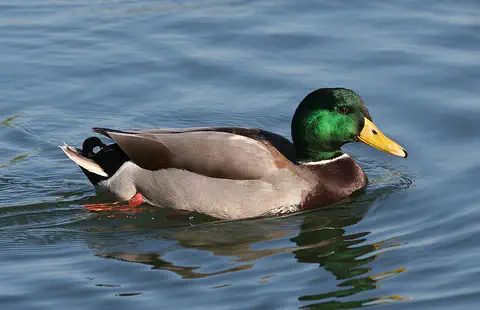
Mallard
The mallard is perhaps the most familiar duck in the world, found on ponds, lakes, rivers and city parks across North America, Europe and Asia. Males have glossy green heads; females are mottled brown. Almost all farm ducks are descended from mallards.
- Watch What If? Lab What if rivers made electricity everywhere? Falling and flowing water can spin a turbine, and a turbine can spin a generator to make electricity. That's hydropower, one of the oldest ways people have used energy. Imagine every river making electricity, then discover how dams work, why fish need a way past them, and how small water wheels can power a single farm.
For parents & teachers
What children will learn
- Trace the Volga from the Valdai Hills to the Caspian Sea and name some cities on its banks.
- Explain where a river's water comes from, using the Volga's snow, groundwater and rain.
- Describe how dams and reservoirs changed the Volga, for people and for fish.
- Explain why a river delta matters for migrating birds.
Recommended ages: 3 to 17 · About 15 minutes
Talk about it
- Dams give electricity and help ships, but block fish. Do you think the trade was worth it? Why?
- Why might the Caspian Sea get lower when people use more of the Volga's water?
- Why do you think almost half of Russia's people live in the Volga's basin?
Try at home or in class
- Fill a tray with damp sand, make a channel, and build a small 'dam' of clay across it; pour water and watch a 'reservoir' form behind it.
- Freeze a cup of water, then let it melt on a plate; talk about how spring snowmelt fills the Volga.
Key vocabulary: basin, reservoir, lock, steppe, delta, distributary, spawn
Where these facts come from
- Wikidata , Wikimedia Foundation (CC0 1.0)
- Natural Earth vector data , Natural Earth (NACIS) (Public domain)
- Volga River , Encyclopaedia Britannica
- Volga River: Climate (dams, navigation, ecology) , Encyclopaedia Britannica
- Volga River: Study and exploration , Encyclopaedia Britannica
- Astrakhanskiy Biosphere Reserve , UNESCO Man and the Biosphere Programme
- Preventing Drowning , US Centers for Disease Control and Prevention
- Wikimedia Commons , Wikimedia Foundation (Per file (public domain, CC0, CC BY or CC BY-SA); see each media record)
Checked, not yet human-reviewed. Last updated October 27, 2026. Spotted a mistake? Tell us.
Picture credits
- Photo: Insider, CC BY-SA 3.0, via Wikimedia Commons · source · license
- Photo: Daniel Döhne, CC BY-SA 3.0, via Wikimedia Commons · source · license
- Photo: Asif Masimov (masimovasif.net), CC BY-SA 4.0, via Wikimedia Commons · source · license
- Photo: Geni, CC BY-SA 4.0, via Wikimedia Commons · source · license
- Photo: Calibas (edit by Aqwis), CC BY-SA 3.0, via Wikimedia Commons · source · license