
City Europe
Berlin
Berlin is the capital city of Germany. Long ago, a wall split it in two. Now the wall is gone, and the city is together again.
Berlin, the capital of Germany, grew from two small trading towns on the Spree River. From 1961 to 1989 the Berlin Wall divided it. Today about 3.7 million people live there (2025), among lakes, forests, museums and the Brandenburg Gate.
Berlin, first recorded in 1244, became the capital of Prussia and, from 1871, of a unified Germany. Divided after 1945 and split by the Wall from 1961 to 1989, it became the all-German capital again in 1990. It is Germany's largest city, with about 3.7 million people in 2025.
Photo: Thomas Wolf, CC BY-SA 3.0, via Wikimedia Commons
Discover Berlin
Berlin is the capital city of Germany.
It is the biggest city in Germany. A river called the Spree flows through it. Berlin has lakes, forests and lots of museums. A big stone gate stands in the middle.
Berlin is the capital of Germany and by far its largest city. It lies in the middle of the North German Plain, on the Spree River, about 180 kilometers south of the Baltic Sea and 89 kilometers west of Poland. About 3.7 million people lived there in 2025.
Berlin is also one of Germany's 16 states. It is big: about 37 kilometers from north to south and 45 kilometers from east to west. About one-third of Greater Berlin is still covered with woods, lakes and beaches, so city life and nature sit side by side.
Berlin lies at the heart of the North German Plain, in the wide glacial valley of the Spree, about 180 km south of the Baltic Sea and 89 km west of Poland. Its site on an east-west trade and geographic axis helped make it the capital of Prussia and then, from 1871, of a unified Germany. It covers 891 km² and had a population of 3,700,577 in 2025.
After World War II the city was divided, East Berlin becoming the capital of East Germany and West Berlin a state of West Germany, enclosed from 1961 by the Wall. The unification treaty restored Berlin as the all-German capital in 1990, and it became one of Germany's 16 states. About one-third of Greater Berlin is still pine and birch woods, lakes and beaches.
- Country
- Germany (capital)
- People in the city (2025)
- about 3.7 million
- Area
- 891 km²
- First recorded
- 1244
Famous places
The Brandenburg Gate is a giant stone gate with tall columns.
Five big museums stand together on an island in the river. A very tall tower with a silver ball looks over the whole city.
The Brandenburg Gate was built from 1788 to 1791, designed by Carl Gotthard Langhans after a famous gateway in ancient Athens. From 1961 to 1989 the Berlin Wall shut it off, so it became a symbol of a divided Germany. It reopened in December 1989.
On Museum Island, in the Spree, five museums were built between 1824 and 1930. The Reichstag building, topped with a new dome, has again been home to Germany's parliament since 1999. And the TV tower at Alexanderplatz, 368 meters tall, goes back to East Germany's plans for a tower to broadcast its television programs.
The Brandenburg Gate (1788–91) follows designs by Carl G. Langhans inspired by the Propylaea, the gateway of the Acropolis in Athens. Between 1961 and 1989 the Wall shut off access to it for both East and West Germans, and it came to symbolize divided Germany; it reopened on December 22, 1989, when West German Chancellor Helmut Kohl walked through to meet East German Prime Minister Hans Modrow.
UNESCO inscribed Museumsinsel (Museum Island) in 1999: its five museums, built from 1824 to 1930, show how ideas of museum design evolved, each designed to suit the art it holds. In the 1990s huge building projects transformed central Berlin; a new dome capped the renovated Reichstag, home of the parliament again from 1999. East Germany planned a television tower in the 1950s for its broadcasts; the tower at Alexanderplatz stands 368 m high.
- Brandenburg Gate
- built 1788–91
- Museum Island
- five museums built 1824–1930; World Heritage Site (1999)
- Reichstag
- home of Germany's parliament again since 1999
- TV tower
- 368 m tall

Divided and united
Long ago, Berlin was two little towns by a river.
They joined and grew into a big city. For 28 years a wall split Berlin in two. People in the east could not cross to the west. In 1989 the wall was opened, and crowds gathered there.
Berlin began as two trading towns, Berlin and Kölln, on opposite sides of the Spree. Kölln is first written about in 1237 and Berlin in 1244, and the two later joined. Berlin became the home of the rulers of Brandenburg, then the capital of Prussia, and in 1871 the capital of a united Germany.
World War II ended in 1945 with much of the city destroyed. Afterward Berlin was divided. In 1961 East Germany built the Berlin Wall around West Berlin. On November 9, 1989, the border was opened, and in 1990 Germany and Berlin were united again. The wall was taken down, except for a few pieces kept as a memorial.
The name Berlin first appears in 1244, seven years after that of its sister town Kölln; the two commanded an east-west trade route across the Spree. From the late 15th century the Hohenzollern electors of Brandenburg made Berlin-Kölln their capital, and in 1701 Frederick I, crowned king in Prussia, made it the royal residence. Bismarck united Germany in 1871 with Berlin as capital, and Greater Berlin was formed in 1920 from 7 districts, 59 rural communities and 27 estates.
In 1933 the Nazis took power and began persecuting their opponents and stripping Jewish Germans of their rights. The war ended in Berlin in 1945, after a Soviet assault in which about 100,000 civilians died. Divided into sectors, the city faced a Soviet land blockade of West Berlin in 1948, broken by an airlift that carried nearly two million tons of food, coal and other supplies; the Soviets abandoned the blockade in May 1949. The Wall went up on the night of August 12–13, 1961; on November 9, 1989, East Germany opened its borders. Berlin became the capital of unified Germany in 1990, the Wall was gone by the summer of 1991 except for preserved segments, and the federal government moved from the Rhine to the Spree.

Getting around Berlin
Berlin has two kinds of city trains.
The S-Bahn often runs high up on bridges. The U-Bahn runs under the ground. There are buses and trams too. While the wall stood, buses carried most people in West Berlin.
Berlin has two big rail networks. The S-Bahn, a railway that runs mostly on raised tracks and partly underground, was begun in 1871. The U-Bahn, the subway, was begun in 1897. Buses and streetcars fill in the gaps.
When the Wall divided the city, the two halves planned their roads and trains separately for almost 30 years. In West Berlin buses became the main way to get around, while streetcars kept running in parts of the east. Today a single new airport, Berlin Brandenburg, has served the city since 2020.
Construction of the Stadtbahn or Schnellbahn (S-Bahn), a largely elevated and partly underground railway, began in 1871, and the Untergrundbahn (U-Bahn) was begun in 1897. After the Wall went up, the bus became the mainstay of transport in the West, though streetcars continued in some eastern districts.
Britannica lists among reunited Berlin's problems a 30-year break in joint planning of the city, its highways and its public transport. Air travel shows how slowly the systems came together: Tegel and Schönefeld stayed open after unification, expansion of Schönefeld began in the late 1990s to create a single commercial airport, and after numerous setbacks and delays Berlin Brandenburg Airport opened in 2020, after which Tegel closed.
- S-Bahn
- construction began 1871
- U-Bahn (subway)
- construction began 1897
- Airport
- Berlin Brandenburg, opened 2020
Weather and landscape
Berlin winters are cold, and summers are warm.
Some of the rain falls as snow. In winter, children can go sledding on a hill made from old rubble!
Berlin sits where the influence of the Atlantic Ocean fades and the climate of the wide inland plain begins. The average temperature is about −1 °C in winter and 18 °C in summer, and about 9 °C over the whole year.
About 568 millimeters of rain and snow fall each year, and one-fifth to one-quarter of it comes as snow. The land is mostly flat and sandy, left by glaciers. After World War II, rubble from bombed buildings was piled into hills; one, Teufelsberg, is now a place for skiing and sledding.
Berlin lies where the influence of the Atlantic fades and the climate of the continental plain begins. Its mean annual temperature is about 9 °C, with mean temperatures from about −1 °C in winter to 18 °C in summer, and average precipitation of 568 mm, of which one-fifth to one-quarter falls as snow.
The city is built mainly on sandy glacial soil amid a belt of forest-rimmed lakes fed by the Dahme to the southeast and the Havel to the west. Its mean elevation is 35 m; the highest point near the center is the Kreuzberg, 66 m above sea level. Several hills were built from World War II bombing rubble, among them Teufelsberg ("Devil's Mountain"), 116 m high and now a winter sports area.
- Average in winter
- about −1 °C
- Average in summer
- about 18 °C
- Rain and snow in a year
- about 568 mm
Living in Berlin
Berlin has many museums.
It has a famous opera house and a grand concert hall. There are lake beaches too. Woods and parks are all around the city.
Berlin has long been a city of music and art. By 1750 its State Opera on the avenue Unter den Linden was counted among the finest opera houses in Europe. Today its museums range from ancient art on Museum Island to the Museum of Transport and Technology and the Jewish Museum Berlin.
Woods, lakes and beaches still cover about a third of Greater Berlin. This photo shows the Konzerthaus, a concert hall on a square called the Gendarmenmarkt, lit up at night.
Berlin's cultural standing grew from the 18th century; by 1750 the Prussian State Opera on Unter den Linden was rated among Europe's finest, and the 19th-century nickname "Athens on the Spree" reflected the contribution of Berliners to architecture, the arts and the sciences. Postwar museums include the Dahlem Museums, the New National Gallery at the Cultural Forum, the Brücke-Museum, the Museum of Transport and Technology and the Jewish Museum Berlin.
Reunification left lasting tasks: Britannica notes high unemployment, especially among former East German government employees, and the work of joining two cities planned apart for 30 years. Britannica writes that the move of the federal government to Berlin and the eastward shift of Europe's center hold strong promise for reviving the city as an economic center and as the political and cultural hub of central Europe. The photo shows the Konzerthaus on the Gendarmenmarkt at night.
Berlin on the map
Find Berlin on the globe.
It is in Germany, in the middle of Europe. The land around it is flat, with lots of lakes. Poland is not far away.
Berlin is in northeastern Germany, in the middle of the flat North German Plain. The Baltic Sea is about 180 kilometers to the north, the Czech border about 190 kilometers to the south, and Poland only about 89 kilometers to the east.
The Spree River runs through the center of the city and joins the Havel River in the west, at Spandau. Lakes and forests ring the city, especially in the southeast and west.
Berlin lies at about 52.5° N and 13.4° E: about 180 km south of the Baltic, 190 km north of the Czech-German border, 177 km east of the former inner-German border and 89 km west of Poland. It measures about 37 km north to south and 45 km east to west.
The Spree crosses the center in a wide glacial valley and meets the Havel at Spandau, where the Ascanians built a fortress in 1160. The belt of lakes around the city is formed from the waters of the Dahme to the southeast and the Havel to the west, and much of it is edged with sandy pine and birch woods.
- Latitude
- about 52.5° north
- Longitude
- about 13.4° east
- Distance to the Baltic Sea
- about 180 km
- Distance to Poland
- about 89 km
Amazing facts
-
Some hills in Berlin are made of old rubble.
After World War II, rubble from bombed buildings was piled into hills. One, Teufelsberg, is 116 meters high and used for skiing and sledding.
Teufelsberg ("Devil's Mountain"), one of several hills built from World War II bombing rubble, rises to 116 m and is now a winter sports area.
-
Airplanes once carried food and coal to Berlin.
In 1948 and 1949, when West Berlin was cut off by land, planes flew in nearly two million tons of food, coal and other supplies.
The Berlin airlift broke the Soviet blockade of West Berlin: Western Allied planes carried nearly two million tons of food, coal and other necessities.
-
About a third of Berlin is woods, lakes and beaches.
About one-third of Greater Berlin is still covered by woods, lakes and beaches.
About one-third of the Greater Berlin area remains sandy pine and mixed birch woods, lakes and beaches, around lakes fed by the Dahme and the Havel.
-
Berlin's Brandenburg Gate was built more than 230 years ago.
The Brandenburg Gate was built from 1788 to 1791, inspired by an ancient gateway in Athens, Greece.
Langhans based the Brandenburg Gate (1788–91) on the Propylaea, the monumental gateway of the Acropolis in Athens.
Words to know
- capital
- the city where a country's government meets
- reunification
- joining together again after being split apart
- airlift
- carrying supplies to a place by airplane when roads and railways are blocked
- glacial valley
- a wide valley shaped by ice and meltwater long ago
- parliament
- the group of elected people who make a country's laws
- rubble
- broken pieces of stone and brick from fallen buildings
Discovery challenge
-
Which river flows through Berlin?
Which river runs through the center of Berlin?
Berlin lies in the wide glacial valley of which river?
- The Spree
- The Thames
- The Tiber
Show the answer
The Spree
The Spree! It flows right through Berlin.
The Spree runs through the center of Berlin and joins the Havel in the west.
The Spree; Berlin and Kölln grew up where a trade route crossed it.
-
What split Berlin in two for many years?
What divided Berlin from 1961 to 1989?
What barrier, put up on the night of August 12–13, 1961, surrounded West Berlin?
- A wall
- A river
- A mountain
Show the answer
A wall
A wall! Now it is gone, except for a few pieces.
The Berlin Wall divided the city from 1961 until the border opened on November 9, 1989.
The Berlin Wall, 45 kilometers through the city and 120 around West Berlin, stood until 1989.
-
In which year did the Berlin Wall open?
In which year was the border through Berlin opened?
In which year did East Germany open its borders, on November 9?
- 1945
- 1961
- 1989
Show the answer
1989
1989! Crowds gathered at the wall.
On November 9, 1989, the border opened, and Germany was united again in 1990.
November 9, 1989; Berlin became the capital of unified Germany in 1990.
-
The Brandenburg Gate looks like an old gate from which city?
The Brandenburg Gate was inspired by an ancient gateway in which city?
Langhans modeled the Brandenburg Gate on the Propylaea of which city's Acropolis?
- Athens
- London
- Rome
Show the answer
Athens
Athens! The gate copies an old gateway there.
Athens. The gate, built from 1788 to 1791, was inspired by an ancient gateway there.
Athens: the Propylaea is the monumental gateway of the Acropolis.
-
What did airplanes bring to West Berlin in 1948 and 1949?
During the airlift of 1948–49, what did planes carry into West Berlin?
What did the Western Allied airlift carry to break the blockade of West Berlin?
- Food and coal
- Snow and ice
- Sand and rocks
Show the answer
Food and coal
Food and coal, so people could eat and stay warm.
Planes carried nearly two million tons of food, coal and other supplies.
Nearly two million tons of food, coal and other necessities.
Nearby places
-
Watch
Landmark
Brandenburg Gate
The Brandenburg Gate is a grand sandstone gateway in the center of Berlin, built from 1788 to 1791 with 12 columns and five passages. On top, a statue called the Quadriga shows a chariot pulled by four horses. From 1961 to 1989 the Berlin Wall shut it off, so the gate became a symbol first of a divided Germany and then of its reunification.
-
 Watch
City
Hamburg
Hamburg, in northern Germany, is the country's second-biggest city and one of Europe's largest ports. It grew from a castle built about 825 into a rich trading city on the Elbe River, with canals, a big lake and brick warehouses. About 1.9 million people lived there in 2025.
-
 Watch
City
Prague
Prague, the capital of the Czech Republic, lies on the Vltava River in the heart of Europe. With Prague Castle on its hill, the 14th-century Charles Bridge and so many church towers that it is called the 'City of a Hundred Spires', its historic center is a UNESCO World Heritage Site. About 1.4 million people lived there in 2025.
-
 Watch
City
Copenhagen
Copenhagen, the capital of Denmark, grew from a small harbor town into a royal city of palaces, canals and towers. Its name means "Merchants' Harbor." It has the Tivoli Gardens, opened in 1843, and the Little Mermaid statue, and about 673,000 people lived there in 2026.
-
 Watch
City
Munich
Munich is the capital of Bavaria, a state in southern Germany, and the country's third-biggest city. It began in 1158 as a market by a bridge over the Isar River, and its name means "Home of the Monks." Today it is famous for its palaces, art museums, the huge Deutsches Museum and its autumn Oktoberfest.
-
 Watch
City
Warsaw
Warsaw is the capital of Poland, on the Vistula River. Much of the city was destroyed in World War II, and afterward its people rebuilt the Old Town so carefully that UNESCO made it a World Heritage Site. About 1.86 million people lived there in 2024.
-
 Watch
City
Vienna
Vienna is the capital of Austria, on the Danube River. For centuries it was the home of emperors, and composers such as Haydn, Mozart and Beethoven lived and worked there. About 2 million people lived in the city at the start of 2026.
-
 Watch
City
Amsterdam
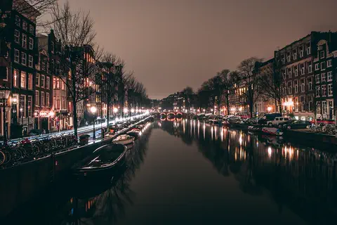
Amsterdam is the capital of the Netherlands. It began as a fishing village beside a dam on the Amstel River, which gave the city its name. Today about 942,000 people live among its rings of canals, hundreds of bridges, houseboats and bicycles.
Explore next
-
 Watch
 Country
Germany
Germany is a country in north-central Europe. The land rises from flat plains by the North Sea and the Baltic Sea to forested hills and, in the far south, the Alps. About 83.5 million people (2025) live there, and its capital is Berlin.
-
Watch
Landmark
Brandenburg Gate
The Brandenburg Gate is a grand sandstone gateway in the center of Berlin, built from 1788 to 1791 with 12 columns and five passages. On top, a statue called the Quadriga shows a chariot pulled by four horses. From 1961 to 1989 the Berlin Wall shut it off, so the gate became a symbol first of a divided Germany and then of its reunification.
-
 Watch
City
Moscow
Moscow, the capital of Russia, grew up on the Moscow River around a fortress called the Kremlin. About 13.3 million people lived there in 2025. Its rings of roads, snowy winters and palace-like subway stations make it like no other city.
-
 Watch
City
Paris
Paris is the capital of France. It grew from an island in the Seine River into a city of about 2.1 million people (2023), with the Eiffel Tower, Notre-Dame, the Louvre and a subway that has run since 1900.
-
Watch
Landmark
Neuschwanstein Castle
Neuschwanstein Castle stands on a rocky ridge in Bavaria, Germany. King Ludwig II had it built from 1869 as a private retreat in the style of a medieval knights' castle, but with the newest technology inside. It opened to visitors in 1886, and in 2025 about 1.1 million people came.
-
Watch
City
Munich
Munich is the capital of Bavaria, a state in southern Germany, and the country's third-biggest city. It began in 1158 as a market by a bridge over the Isar River, and its name means "Home of the Monks." Today it is famous for its palaces, art museums, the huge Deutsches Museum and its autumn Oktoberfest.
-
Watch
City
Hamburg
Hamburg, in northern Germany, is the country's second-biggest city and one of Europe's largest ports. It grew from a castle built about 825 into a rich trading city on the Elbe River, with canals, a big lake and brick warehouses. About 1.9 million people lived there in 2025.
-
Watch
City
Vienna
Vienna is the capital of Austria, on the Danube River. For centuries it was the home of emperors, and composers such as Haydn, Mozart and Beethoven lived and worked there. About 2 million people lived in the city at the start of 2026.
For parents & teachers
What children will learn
- Locate Berlin on the Spree in northeastern Germany.
- Explain in simple terms why Berlin was divided after World War II and when it was reunited.
- Identify the Brandenburg Gate, Museum Island and the TV tower.
- Describe Berlin's mix of city and nature: lakes, forests and rubble hills.
Recommended ages: 3 to 17 · About 15 minutes
Talk about it
- Imagine a wall going up across your town overnight. What would change for your family and friends?
- Why do you think people kept a few pieces of the Berlin Wall instead of removing all of it?
- Berlin turned rubble into hills for sledding. Can you think of other ways a city can reuse what is left over?
Try at home or in class
- Draw a simple map of a town, then draw a line across it. List the places each side can no longer reach, and talk about it.
- Fold a paper gate with six columns like the Brandenburg Gate, using a strip of card across the top.
Key vocabulary: capital, reunification, airlift, glacial valley, parliament, rubble
Where these facts come from
- Wikidata , Wikimedia Foundation (CC0 1.0)
- Natural Earth vector data , Natural Earth (NACIS) (Public domain)
- UNESCO World Heritage List , UNESCO World Heritage Centre (Linked as a reference; site facts come from Wikidata)
- Berlin , Encyclopaedia Britannica
- Berlin: History , Encyclopaedia Britannica
- Berlin: Berlin divided , Encyclopaedia Britannica
- Berlin: The city layout , Encyclopaedia Britannica
- Berlin: The economy , Encyclopaedia Britannica
- Brandenburg Gate , Encyclopaedia Britannica
- Berlin Wall , Encyclopaedia Britannica
- History of the Berlin TV Tower , TV-Turm Alexanderplatz (official site)
- Museumsinsel (Museum Island), Berlin , UNESCO World Heritage Centre
- Wikimedia Commons , Wikimedia Foundation (Per file (public domain, CC0, CC BY or CC BY-SA); see each media record)
Checked, not yet human-reviewed. Last updated October 27, 2026. Spotted a mistake? Tell us.