
City Asia
Riyadh
Riyadh is the capital city of Saudi Arabia. It is in the middle of a desert. Summers there are very, very hot.
Riyadh is the capital and biggest city of Saudi Arabia, in the middle of the Arabian Peninsula. It grew from small villages with gardens into a city of tall towers. An old fort built of mud and hay stands in its center, and a new driverless metro opened in 2024. The 2022 census counted 6,924,566 people in the city.
Riyadh lies at about 600 m on the eastern side of the Najd plateau, between Wadi Hanifa and Wadi al-Batha, on the site of the old town of Hajar. It became the capital of the Second Saudi State in 1824 and of the Kingdom of Saudi Arabia in 1932. The 2022 census counted 6,924,566 people in the city, the largest in the country.
Photo: B.alotaby, CC BY-SA 4.0, via Wikimedia Commons
Discover Riyadh
Riyadh is the capital city of Saudi Arabia. It is the biggest city there.
Riyadh is in the middle of a big desert land called the Arabian Peninsula.
Riyadh is the capital of Saudi Arabia, in the center of the Arabian Peninsula. It stands on a high, flat land called the Najd, about 600 meters above the sea, between two dry valleys: Wadi Hanifa to the west and Wadi al-Batha to the east.
Riyadh is Saudi Arabia's biggest city. The 2022 census counted 6,924,566 people living there, more than in any other city in the country.
Saudipedia places Riyadh on the eastern side of the Najd plateau at about 600 m, on sedimentary rocks of the Arabian Plate, in a triangle bounded by Wadi al-Batha to the east and Wadi Hanifa to the west. A wadi is a valley that is dry most of the year.
The 2022 census counted 6,924,566 people in the city, ahead of Jiddah (3,712,917) and Makkah (2,385,509); the wider Riyadh Region had 8,591,748. Saudipedia notes that the city covers only about 1 percent of the region's land.
- Country
- Saudi Arabia (capital)
- People in the city (2022 census)
- 6,924,566
- Height above sea level
- about 600 m
- Valleys
- Wadi Hanifa to the west, Wadi al-Batha to the east
A mud-brick fort and an arch-topped tower
In the old center stands a fort made of mud and hay. It has round towers at its corners.
Not far away are shiny new towers that light up at night.
Al-Masmak is an old fort in the center of Riyadh. Its thick walls are made of mud mixed with hay, set on stone foundations, and a round watchtower 18 meters tall stands at each corner. Its big door, 3 meters tall, is made of tamarisk and palm wood. Since 1996 it has been a museum.
About 10 kilometers to the north-northwest rises the Kingdom Centre, a skyscraper 302 meters tall with 41 floors, built from 1999 to 2002.
Al-Masmak, in the Al-Thumairi neighborhood, began as a fortress and garrison; Wikidata dates it to 1865. Saudipedia describes walls of mud mixed with hay on stone foundations, plastered outside with clay and inside with gypsum, four cylindrical corner towers 18 m high, an outer wall up to 2 m thick, about 44 rooms on two floors and wooden box-like openings called tarmat. Riyadh Municipality restored it in 1980, and it opened as a museum in 1996.
The Kingdom Centre, completed in 2002, is 302.3 m to its architectural top with 41 floors above ground; the Council on Vertical Urbanism (formerly the Council on Tall Buildings and Urban Habitat) ranks it the fourth-tallest building in Riyadh.
- Al-Masmak
- mud mixed with hay on stone foundations; four corner towers 18 m high
- Al-Masmak museum
- opened 1996
- Kingdom Centre
- 302.3 m, 41 floors, built 1999 to 2002
From the town of Hajar to a capital
Long ago, there were small villages with gardens here. Together they got the name Riyadh.
Later, Riyadh grew into a very big city.
Long ago, a town called Hajar stood here, between two valleys. Later it became a group of small villages, and in the 1600s the villages together were given the name Riyadh. One explanation is that they were gardens where rainwater gathered.
Riyadh became a capital in 1824, and in 1932 it became the capital of the Kingdom of Saudi Arabia. It grew very fast in the 1970s.
Saudipedia records that Riyadh was built on the site of Hajar, between Wadi al-Batha and Wadi Hanifa, the base of the al-Yamama region; when Islam arrived, Hajar exported horses, livestock, grains and dates. The name Hajar lasted until the 13th century; the settlement then became villages such as Muqrin, Mi'kal and Manfouhah, collectively called Riyadh from the 17th century. One account links the name to orchards and gardens where floodwaters gathered.
Riyadh became the capital of the Second Saudi State in 1824 and of the Kingdom of Saudi Arabia on 23 September 1932. Al-Murabba Palace was the first building outside the old walls, and in the 1970s Riyadh was described as the world's largest construction site.
- Old name
- Hajar, used until the 13th century
- Capital of the Second Saudi State
- from 1824
- Capital of the Kingdom of Saudi Arabia
- from 23 September 1932
A driverless metro across the city
Riyadh has a new metro. Its trains drive themselves, with no driver!
The lines have colors, like blue, red and yellow.
The Riyadh Metro is new. Regular trains began running on 1 December 2024, and by January 2025 all six lines had opened. The lines are named by color: Blue, Red, Orange, Yellow, Green and Purple. Together they have 85 stations.
All 190 trains are fully automated, so they run without drivers. The Yellow Line runs along the road to King Khalid International Airport, north of the city.
UrbanRail.Net records an official opening on 27 November 2024 and regular service from 1 December 2024 on the Blue, Yellow and Purple lines, followed by the Red and Green lines on 15 December and the Orange Line on 5 January 2025. It counts 162 km over six lines with 85 stations and notes that official sources give 176 km. The Green Line runs fully underground along King Abdulaziz Road.
The network uses 190 fully automated trains. The Yellow Line follows the road to King Khalid International Airport, which opened in 1983 about 36 km north of Al-Masmak.
- Riyadh Metro
- 6 lines and 85 stations; regular service from 1 December 2024
- Trains
- 190 fully automated trains
- King Khalid International Airport
- opened 1983, north of the city
Scorching summers and very little rain
Summer in Riyadh is very, very hot. From June to September it almost never rains.
Winter days are mild, and winter nights are cool.
Riyadh has a desert climate. The World Meteorological Organization's averages give July and August days of about 44 °C. In January, days average about 20 °C and nights about 7 °C.
A whole year brings only about 111 millimeters of rain. From June to September there is almost none at all, and April is the wettest month.
WMO averages for 1982–2011 give highs of 43.7 °C in both July and August, with lows near 26 °C, and January highs and lows of 20.1 °C and 6.9 °C. Saudipedia explains the wide range: Riyadh is far from any large body of water that could soften its temperatures.
The monthly averages add up to about 111 mm a year, falling on about 46 days. April is the wettest month (26.3 mm on 12.4 days) and March next (21.8 mm); June, July and September average no rain at all, and August only 0.1 rainy days.
- July, average daily high and low (WMO, 1982–2011)
- 43.7 °C and 26.4 °C
- January, average daily high and low (WMO, 1982–2011)
- 20.1 °C and 6.9 °C
- Rain in a year (sum of the monthly averages)
- about 111 mm
Mud-brick palaces at At-Turaif
Near Riyadh is an old town made of mud bricks. It has the walls of many old palaces.
It is a World Heritage Site.
Northwest of Riyadh, at the edge of the ad-Dir'iyah oasis, lies At-Turaif. It was founded in the 1400s and became the first capital of the Saudi dynasty. It has the remains of many palaces built of adobe, sun-dried mud brick.
UNESCO made At-Turaif a World Heritage Site in 2010. It is an example of the Najdi style of building from the center of the Arabian Peninsula, with geometric decoration on its walls.
UNESCO describes the At-Turaif District in ad-Dir'iyah, north-west of Riyadh, as the first capital of the Saudi Dynasty. Founded in the 15th century, it became in the mid-18th century the capital of an independent Arab state, and it includes the remains of many palaces and an urban ensemble on the edge of the ad-Dir'iyah oasis.
It was inscribed in 2010 (28.78 ha) as an outstanding example of the Najdi architectural and decorative style: a building method well adapted to its environment, adobe used in large palace complexes, and a remarkable sense of geometric decoration.
- At-Turaif District in ad-Dir'iyah
- UNESCO World Heritage Site since 2010; founded in the 15th century
- Building style
- Najdi architecture, with palaces built of adobe
- Site size
- 28.78 hectares
Riyadh on the map
Find the Arabian Peninsula on the globe. It is in Asia, next to Africa.
Riyadh is right in the middle of it.
Riyadh is in the middle of the Arabian Peninsula, in Saudi Arabia. Al-Masmak stands in the old center. The Kingdom Centre stands about 10 kilometers to the north-northwest.
At-Turaif lies about 18 kilometers northwest of Al-Masmak, and King Khalid International Airport about 36 kilometers to the north.
Riyadh lies at about 24.6° N and 46.8° E, roughly in the center of the Arabian Peninsula, with Wadi Hanifa along its western side. Measured from Al-Masmak in the old center, Al-Murabba Palace is about 1.8 km north-northwest, the Kingdom Centre about 9.8 km north-northwest, At-Turaif in ad-Dir'iyah about 18 km northwest and King Khalid International Airport about 36 km north.
- Latitude
- about 24.6° north
- Longitude
- about 46.8° east
- At-Turaif
- about 18 km northwest of Al-Masmak
Amazing facts
-
Riyadh's old fort is made of mud mixed with hay!
Al-Masmak's walls are made of mud mixed with hay, and its big wooden door is made of tamarisk and palm wood.
Al-Masmak's mud-and-hay walls are plastered with clay outside and gypsum inside, and wooden box-like openings called tarmat stick out from the outer walls for keeping watch.
-
Riyadh's metro trains drive themselves.
All 190 trains of the Riyadh Metro are fully automated, so no driver sits at the front.
The Riyadh Metro runs 190 fully automated trains, and its Green Line runs entirely underground along King Abdulaziz Road.
-
In summer, it almost never rains in Riyadh.
On average, Riyadh gets no rain at all in June, July and September.
WMO averages give Riyadh 0.0 mm of rain in June, July, August and September, and only 0.1 rainy days in August.
-
Riyadh used to have a different name: Hajar.
Before it was called Riyadh, the town on this spot was called Hajar, a name used until the 1200s.
The name Hajar lasted until the 13th century; Riyadh became the shared name of a cluster of villages in the 17th century.
Words to know
- wadi
- a valley in a dry land that only has water after rain
- plateau
- a large, fairly flat area of high land
- adobe
- bricks made of mud and straw and dried in the sun
- oasis
- a place in a desert where there is water and plants can grow
- automated
- worked by machines and computers instead of people
- fort
- a strong building made to protect people inside it
Discovery challenge
-
Riyadh is the capital of which country?
Which country is Riyadh the capital of?
Riyadh became the capital of which kingdom on 23 September 1932?
- Saudi Arabia
- Egypt
- Morocco
Show the answer
Saudi Arabia
Saudi Arabia!
Saudi Arabia.
The Kingdom of Saudi Arabia.
-
What is the old fort in Riyadh made of?
What are Al-Masmak's walls made of?
What material, on stone foundations, forms Al-Masmak's walls?
- Glass and steel
- Mud mixed with hay
- Ice
Show the answer
Mud mixed with hay
Mud mixed with hay!
Mud mixed with hay, on stone foundations.
Mud mixed with hay, plastered with clay outside and gypsum inside.
-
Who drives the trains on Riyadh's metro?
What is special about the Riyadh Metro's trains?
What do all 190 trains of the Riyadh Metro have in common?
- They are pulled by camels
- They run without drivers
- They fly
Show the answer
They run without drivers
Nobody! They drive themselves.
They are fully automated, with no drivers.
They are fully automated.
-
Is Riyadh very rainy or very dry?
About how much rain does Riyadh get in a year?
About how much rain do the WMO's monthly averages for Riyadh add up to in a year?
- Very dry: about 111 mm
- Very rainy: about 2,000 mm
- Snowy: about 5 meters of snow
Show the answer
Very dry: about 111 mm
Very dry!
Only about 111 millimeters.
About 111 mm, with none from June to September.
-
What are the old palaces at At-Turaif made of?
What building material did UNESCO highlight at At-Turaif?
Which material in large palace complexes did UNESCO cite for At-Turaif's Najdi style?
- Marble
- Wood
- Adobe
Show the answer
Adobe
Mud bricks, called adobe!
Adobe, sun-dried mud brick.
Adobe, with geometric decoration.
Nearby places
-
 Watch
Landmark
Al Zubarah
Al Zubarah is the ruin of a walled town on the coast of Qatar. For about 50 years, in the late 1700s and early 1800s, it was a busy center for pearls and trade. After it was abandoned, desert sand covered and protected its houses, palaces and streets. It became a UNESCO World Heritage Site in 2013.
-
 Watch
City
Doha
Doha is the capital of Qatar, on the east coast of the Qatar peninsula. Its name means 'bay'. Doha was once a village of pearl divers and fishers; after oil was found, it grew into a city of towers, museums and metro lines. The 2020 census counted 1,186,023 people in Doha.
-
 Watch
City
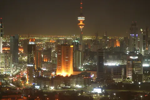
Kuwait City
Kuwait City is the capital of Kuwait. It began as a town on the coast early in the 1700s and grew rich from caravans and pearl fishing. Today tall towers rise over the city, and summer days average highs near 47 °C.
-
 Watch
Landmark
Ur
Ur was a great city of Sumer, in the south of what is now Iraq, founded more than 5,000 years ago. Twice it was the capital of an empire. Archaeologists found royal tombs full of gold treasures, streets of brick houses and a huge stepped temple tower called a ziggurat. When the Euphrates River moved away, the fields dried up and the city was abandoned.
-
 Watch
Landmark
Prophet's Mosque
The Prophet's Mosque in Medina, Saudi Arabia, began as the simple home and courtyard of the Prophet Muhammad, who helped build it after he came to Medina in 622. Rebuilt and enlarged many times, it now has a famous green dome over Muhammad's tomb, ten minarets and room for up to a million worshippers at the busiest times.
-
Watch
City
Medina
Medina is a city in western Saudi Arabia, about 620 meters above sea level, with mountains and lava fields around it. Saudi Arabia's 2022 census counted 1,411,599 people in the city, the country's fourth-largest. It is home to the Prophet's Mosque, a mosque with a green dome and tall minarets.
-
 Watch
City
Abu Dhabi
Abu Dhabi is the capital of the United Arab Emirates. It began in the 1700s as a small settlement around fresh water on an island, guarded by a coral-stone watchtower. Before oil, it relied on fishing and pearl diving; since the 1960s, money from oil has turned it into a city of towers. An official estimate gave the city about 1.75 million people in 2023.
-
 Watch
Landmark
Al-Masjid al-Haram
Al-Masjid al-Haram, the Great Mosque of Mecca in Saudi Arabia, was built around the Kaaba, a cube-shaped building that Muslims face when they pray. It is the most important place of pilgrimage in Islam. In 2026, 1,707,301 pilgrims came to Mecca for the hajj, and the mosque can hold up to about one million worshippers.
Explore next
-
Watch
 Country
Saudi Arabia
Saudi Arabia covers about four-fifths of the Arabian Peninsula. Most of it is dry desert, including the Empty Quarter, the largest sand area in the world. About 35.3 million people lived there in 2024, most of them in cities such as Riyadh, the capital.
-
 Watch
City
Mecca
Mecca is a city in western Saudi Arabia, in a dry valley ringed by mountains, about 70 kilometers from the Red Sea. About 2.4 million people lived there at the 2022 census. Its Great Mosque surrounds the Kaaba, and in 2026 more than 1.7 million pilgrims came to the city for the hajj.
-
 Watch
City
Dubai
Dubai is a city of the United Arab Emirates, on the coast of the Arabian Gulf with desert behind it. It began in 1833 as a small settlement beside a sheltered creek and grew from fishing, pearling and trade into a city of tall towers, including Burj Khalifa, the world's tallest building.
-
 Watch
City
Cairo
Cairo, the capital of Egypt, has stood on the banks of the Nile for more than 1,000 years, where the river spreads out into its delta. Founded in 969, it has a medieval old city full of historic mosques and markets, the Egyptian Museum and, at its edge, the Pyramids of Giza. It is one of the largest cities in Africa.
-
Watch
City
Kuwait City
Kuwait City is the capital of Kuwait. It began as a town on the coast early in the 1700s and grew rich from caravans and pearl fishing. Today tall towers rise over the city, and summer days average highs near 47 °C.
-
Watch
City
Doha
Doha is the capital of Qatar, on the east coast of the Qatar peninsula. Its name means 'bay'. Doha was once a village of pearl divers and fishers; after oil was found, it grew into a city of towers, museums and metro lines. The 2020 census counted 1,186,023 people in Doha.
-
 Watch
City
Jeddah
Jeddah is a port city on the Red Sea coast of Saudi Arabia and the country's second-biggest city: 3,712,917 people lived there at the 2022 census. For centuries, Muslim pilgrims traveling by sea to Mecca, 72 kilometers away, landed at Jeddah's port.
-
 Watch
City
Sanaa
Sanaa is the capital of Yemen, in a mountain valley about 2,200 meters above the sea. UNESCO says people have lived there for more than 2,500 years. Its Old City, with tall tower houses of earth and brick, has been a World Heritage site since 1986.
For parents & teachers
What children will learn
- Locate Riyadh in the center of the Arabian Peninsula, on the Najd plateau.
- Explain how people built with local materials such as mud, hay and palm wood in a hot, dry place.
- Describe how a new metro system can change travel in a large city.
- Read monthly temperature and rainfall averages to describe a desert climate.
Recommended ages: 3 to 17 · About 15 minutes
Talk about it
- Al-Masmak was built of mud and hay. Why might mud walls work well in a hot desert?
- Riyadh's metro trains have no drivers. Would you feel happy riding one? Why?
- Riyadh gets almost no rain in summer. Where do you think a big desert city gets its water?
Try at home or in class
- Mud bricks: mix soil, a little water and dry grass, press it into an ice-cube tray and let it dry in the sun for a few days.
- Rain compare: pour 111 mm of water into a straight-sided glass, then compare it with a year of rain where you live.
- Metro map: draw six colored lines across a city map and mark where they cross to make transfer stations.
Key vocabulary: wadi, plateau, adobe, oasis, automated, fort
Where these facts come from
- Wikidata , Wikimedia Foundation (CC0 1.0)
- Natural Earth vector data , Natural Earth (NACIS) (Public domain)
- Saudi Arabia: Regions and Major Cities (census 2022) , City Population (Thomas Brinkhoff), from the General Authority for Statistics
- Riyadh City , Saudipedia
- When Did Riyadh Become the Capital of Saudi Arabia? , Saudipedia
- Al-Masmak Palace , Saudipedia
- Kingdom Centre , Council on Vertical Urbanism (formerly CTBUH), The Skyscraper Center
- Riyadh Metro , UrbanRail.Net
- At-Turaif District in ad-Dir'iyah , UNESCO World Heritage Centre
- Riyadh: climatological information , World Meteorological Organization, World Weather Information Service
- Wikimedia Commons , Wikimedia Foundation (Per file (public domain, CC0, CC BY or CC BY-SA); see each media record)
Checked, not yet human-reviewed. Last updated November 1, 2026. Spotted a mistake? Tell us.