
Natural wonder Australia and Oceania
Gibson Desert
The Gibson Desert is a big, dry, flat desert in Western Australia. Grasses grow on its red ground.
The Gibson Desert covers about 156,000 square kilometers of Western Australia, Geoscience Australia says. It is a wide, gently rolling plain of gravel and red sand where spinifex grasses and mulga trees grow, and it gets about 200 millimeters of rain a year.
The Gibson Desert (156,000 km2, 2.0% of mainland Australia; Geoscience Australia) is an arid bioregion of lateritic 'buckshot' gravel plains and red dune fields on the sandstones of the Canning (Gunbarrel) Basin, with hummock grassland and mulga and about 200 mm of mainly summer rain (Western Australian biodiversity audit).
Photo: Ghreumaich, CC BY-SA 4.0, via Wikimedia Commons
Discover the Gibson Desert
The Gibson Desert is in Western Australia. It is very dry and very flat.
In this photo, pale grass grows on red ground, and far away, rain falls from a dark cloud.
The Gibson Desert lies in Western Australia. Geoscience Australia lists it as 156,000 square kilometers, about 2 percent of mainland Australia, and fifth in size on its list of the country's deserts.
This photo by Ghreumaich was taken on 24 June 2017 in the Gibson Desert Nature Reserve. Clumps of pale grass grow on red sand right to the flat horizon, and a dark cloud drops rain far away under a blue sky.
Geoscience Australia (Deserts database, 1994, revised 2022): Gibson, Western Australia, 156,000 km2, 2.0% of the mainland; fifth after the Great Victoria, Great Sandy, Tanami and Simpson. Australia's mainland deserts are classed as arid, with rain and summer temperatures that can exceed 35 °C.
The photo (Ghreumaich, CC BY-SA 4.0, 24 June 2017, Gibson Desert Nature Reserve; described as distant rain) shows grass hummocks on red sand, a flat horizon with a few low shrubs, and a rain shaft under a dark cloud.
- Area (Geoscience Australia)
- 156,000 km²
- Share of mainland Australia
- 2.0%
- Rain each year (about)
- 200 mm
Gravel plains and red dunes
Most of the desert is a flat plain covered in small stones.
In another part, there are red sand dunes.
A Western Australian biodiversity audit describes two parts of the Gibson Desert. The Lateritic Plain, which covers most of it, is a flat, gently rolling plain of small gravel called 'buckshot', with a few flat-topped sandstone hills called mesas. The Dune Field has red sand dunes.
Under them lie old, flat layers of sandstone. There are no rivers that flow all year; creeks run only now and then.
Western Australian biodiversity audit (DBCA library): gravelly sandplains and laterised uplands on flat-lying Jurassic and Cretaceous sandstones of the Canning (Gunbarrel) Basin. Two subregions: the Lateritic Plain, a monotonous, gently undulating plain with a few sandstone mesas, and the Dune Field, red dune fields mantling Permian strata of the Gunbarrel Basin. No permanent rivers: the riparian zones follow ephemeral creek lines; Quaternary alluvia along palaeo-drainage features carry coolibah woodland over bunch grasses.
Spinifex, mulga and rare animals
Spinifex grass and mulga trees grow here.
Rare animals are listed for this desert too, like the bilby and the marsupial mole.
Hummock grasses called spinifex cover much of the desert. On the buckshot plains, mulga trees stand over spinifex, and in the valleys mulga scrub grows above the grass.
The audit lists rare animals here, among them the night parrot, the marsupial mole, the bilby, the black-footed rock-wallaby, the malleefowl, the princess parrot, the woma python and the mulgara.
Audit: the Carnegie Botanical District; mulga parkland over Triodia basedowii (a spinifex) on lateritic buckshot plains; shrub steppe in the north and mulga scrub in the south on lateritic uplands; coolibah woodlands on old drainage lines. Rare species include the night parrot, marsupial mole, bilby, black-footed rock-wallaby, malleefowl, princess parrot, woma python and mulgara. More than 40% of the original mammal fauna is regionally extinct; threats named are changed fire regimes and feral animals (camels, rabbits, foxes, cats).
Two Class A nature reserves, the Gibson Desert Nature Reserve and Mangkili Claypan Nature Reserve; more than 1.8 million ha (12%) of the bioregion reserved.
Water in a dry land
Very little rain falls here. Most of the rain falls in summer.
Holes in the rock can hold water.
The Gibson Desert gets about 200 millimeters of rain a year, mostly in summer. No rivers here flow all year.
The audit names Lake Gruszka and the Gibson Desert gnamma holes, natural holes in rock that hold water, as rare features of the region. It says the gnamma holes are no longer regularly looked after by their traditional owners.
Audit: arid climate, mainly summer rainfall, about 200 mm a year. Rare features: Lake Gruszka and the Gibson Desert gnamma holes, two wetlands of national significance; the gnamma holes' greatest threat is siltation, as the site is no longer regularly maintained by traditional owners. Large, intense summer wildfires degrade hummock grasslands and mulga woodland.
Staying safe in the heat
Deserts can be very hot. Wear a wide hat and loose, light clothes.
Drink water, and rest in the shade.
The CDC advises light, loose, light-colored clothing and a wide-brimmed hat in hot places, and drinking during exertion, because waiting until you are thirsty is not enough to prevent mild dehydration.
It also says to avoid hard activity during the hottest part of the day. If someone feels faint in the heat, move to shade or a cool place.
CDC Yellow Book (heat illness): lightweight, loose, light-colored clothing and a wide-brimmed hat; fluid intake during exertion (thirst alone does not prevent mild dehydration, but forcing water on someone not thirsty raises the risk of hyponatremia); avoid strenuous activity in the hottest part of the day; for heat syncope, move to shade or a cool place.
Geoscience Australia: mainland deserts reach temperatures over 35 °C in summer.
Amazing facts
-
The little stones on the plain are called 'buckshot'.
Much of the Gibson Desert is covered in small gravel called 'buckshot'.
The audit describes undulating lateritic 'buckshot' plains supporting hummock grassland, with mulga scrub in the valleys.
-
The Gibson Desert is the fifth biggest desert on Australia's mainland list.
On Geoscience Australia's list of mainland deserts, the Gibson is fifth in size, after the Great Victoria, Great Sandy, Tanami and Simpson.
Geoscience Australia's ten largest mainland deserts total 1,371,000 km2 (18%); the Gibson ranks fifth at 156,000 km2.
-
An animal called the marsupial mole is on this desert's list of rare animals.
The marsupial mole is one of the rare animals listed for the Gibson Desert.
Rare species listed for the bioregion include the marsupial mole, night parrot, bilby and mulgara (audit).
Words to know
- spinifex
- a spiky grass of Australia's dry country that grows in round clumps called hummocks
- mulga
- a small acacia tree or shrub of Australia's dry inland
- laterite
- a hard, iron-rich layer of soil and gravel formed by long weathering
- mesa
- a hill with a flat top and steep sides
- gnamma hole
- a natural hole in rock that collects and holds rainwater
Discovery challenge
-
In which country is the Gibson Desert?
The Gibson Desert is in which country's state of Western Australia?
Which country's Geoscience agency lists the Gibson at 156,000 km2?
- Australia
- Chile
- Mongolia
Show the answer
Australia
Australia.
Australia.
Australia (Geoscience Australia).
-
What are the little stones on the plain called?
What is the small gravel of the Lateritic Plain called?
What name does the audit give the lateritic gravel plains?
- Buckshot
- Marbles
- Pebbles of ice
Show the answer
Buckshot
Buckshot.
Buckshot.
'Buckshot' plains (audit).
-
About how much rain falls here in a year?
About how much rain does the Gibson Desert get each year?
What mean annual rainfall does the audit give for the bioregion?
- About 200 mm
- About 2,000 mm
- About 20,000 mm
Show the answer
About 200 mm
About 200 millimeters.
About 200 mm, mostly in summer.
About 200 mm, mainly summer rain (audit).
-
Which grass covers much of the desert?
Which hummock grass grows under the mulga on the buckshot plains?
Triodia basedowii is a kind of which grass?
- Spinifex
- Bamboo
- Rice
Show the answer
Spinifex
Spinifex.
Hard spinifex.
Spinifex (audit: mulga parkland over Triodia basedowii).
-
What should you wear in the hot desert?
What kind of hat does the CDC suggest in hot places?
Which hat does the CDC say markedly reduces radiant heat exposure?
- A wide-brimmed hat
- A woolly hat
- No hat
Show the answer
A wide-brimmed hat
A wide hat.
A wide-brimmed hat, with light, loose clothes.
A wide-brimmed hat (CDC Yellow Book).
Nearby places
-
 Watch
Natural wonder
Uluru
Uluru is a huge sandstone rock in the desert of central Australia, rising 348 meters above the plain, with a base 9.4 kilometers around. The Anangu are its Traditional Owners, and the national park around it is run by Anangu and Parks Australia together.
-
 Watch
Natural wonder
Purnululu National Park
Purnululu National Park, in the Kimberley region of Western Australia, is home to the Bungle Bungle Range: beehive-shaped sandstone domes striped orange and black, rising high above grassy plains.
-
 Watch
Natural wonder
Simpson Desert
The Simpson Desert covers 176,500 square kilometers where South Australia, Queensland and the Northern Territory meet, Geoscience Australia says. Its parallel sand dunes can stretch for up to 200 kilometers, and South Australia's parks service calls its national park one of the world's best examples of a parallel dune desert.
-
 Watch
Natural wonder
Kakadu National Park
Kakadu, in Australia's Northern Territory, is the country's largest national park. It stretches from a high sandstone cliff called the escarpment down to floodplains, mangroves and the sea. Aboriginal people have lived here for tens of thousands of years, and their rock paintings, some up to 20,000 years old, record their way of life.
-
 Watch
City
Perth
Perth is the capital of Western Australia, on the north bank of the Swan River. It began as the Swan River Colony in 1829, on the land of the Whadjuk Nyoongar people. The Australian Bureau of Statistics estimated 2,452,765 people in Greater Perth in June 2025.
-
 Watch
City
Adelaide
Adelaide is the capital of South Australia. About 1.49 million people lived in Greater Adelaide in mid-2025. Founded in 1837, it was laid out on a plan by Colonel William Light, with a grid of streets ringed by green Park Lands, on the land of the Kaurna people.
-
 Watch
Natural wonder
Komodo National Park
Komodo National Park, in Indonesia, is a group of rugged, dry islands between Sumbawa and Flores. Its three main islands, Komodo, Rinca and Padar, were made by volcanoes. The park contains most of the places where wild Komodo dragons, the largest living lizards, still live, along with rich coral reefs visited by turtles, dolphins and whales.
-
 Watch
Natural wonder
Great Dividing Range
The Great Dividing Range runs through Australia's Eastern Highlands, which stretch along most of the east coast. It divides rivers that flow inland from rivers that flow to the Pacific Ocean or Bass Strait.
Explore next
-
Watch
Natural wonder
Uluru
Uluru is a huge sandstone rock in the desert of central Australia, rising 348 meters above the plain, with a base 9.4 kilometers around. The Anangu are its Traditional Owners, and the national park around it is run by Anangu and Parks Australia together.
-
 Watch
 Country
Australia
Australia is a country and the smallest continent, surrounded by ocean in the Southern Hemisphere. Much of its middle is dry and flat, most people live near the coast, and its animals include kangaroos, koalas and the platypus, a mammal that lays eggs.
- Watch Geography What makes a desert? A desert is any place that gets very little rain or snow, usually less than about 250 millimeters a year. Deserts can be hot, like the Sahara, or freezing cold, like Antarctica, the driest continent. They form where winds, mountains or cold ocean currents keep rain away.
-
Watch
Natural wonder
Simpson Desert
The Simpson Desert covers 176,500 square kilometers where South Australia, Queensland and the Northern Territory meet, Geoscience Australia says. Its parallel sand dunes can stretch for up to 200 kilometers, and South Australia's parks service calls its national park one of the world's best examples of a parallel dune desert.
-
 Watch
Natural wonder
Great Barrier Reef
The Great Barrier Reef stretches about 2,300 kilometers along the coast of Queensland, Australia. It is made of about 2,500 separate reefs and more than 900 islands, built by tiny coral animals, and it is home to more than 1,500 kinds of fish.
-
 Watch
Natural wonder
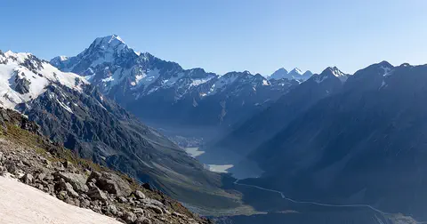
Aoraki / Mount Cook
Aoraki / Mount Cook is New Zealand's highest mountain, in the Southern Alps of the South Island. Its name joins its Māori name, Aoraki, with its English name, Mount Cook. The mountain is being pushed up where two of Earth's plates meet, and glaciers carve the valleys around it. In 2013 surveyors measured it at 3,724 meters.
-
Watch
Natural wonder
Kakadu National Park
Kakadu, in Australia's Northern Territory, is the country's largest national park. It stretches from a high sandstone cliff called the escarpment down to floodplains, mangroves and the sea. Aboriginal people have lived here for tens of thousands of years, and their rock paintings, some up to 20,000 years old, record their way of life.
-
 Watch
Natural wonder
K'gari
K'gari, off the coast of Queensland in Australia, is the largest sand island in the world. Sand dunes rise up to about 250 meters, rainforest grows right on the sand, and about half of the world's perched dune lakes sparkle among the dunes. Once called Fraser Island, it was officially renamed K'gari, the Butchulla people's name for it, in 2023.
For parents & teachers
What children will learn
- Locate the Gibson Desert in Western Australia.
- Describe a lateritic gravel plain and a dune field.
- Name plants and animals adapted to an arid desert.
- Explain how to stay safe in hot weather.
Recommended ages: 3 to 17 · About 15 minutes
Talk about it
- Why would a desert with no permanent rivers still have wetlands that matter?
- How can feral animals and fire change a desert ecosystem?
- Why might rain in this desert fall mostly in summer?
Try at home or in class
- Fill one tray with sand and another with gravel, water both and see which keeps water longer at the surface.
- On a map of Australia, find the Gibson, Great Sandy, Great Victoria, Tanami and Simpson deserts.
Key vocabulary: spinifex, mulga, laterite, mesa, gnamma hole
Where these facts come from
- Wikidata , Wikimedia Foundation (CC0 1.0)
- Deserts (Australia's landforms) , Geoscience Australia
- Gibson Desert (A Biodiversity Audit of Western Australia's Biogeographical Subregions) , Department of Biodiversity, Conservation and Attractions (Western Australia) library
- Heat and Cold Illness in Travelers (CDC Yellow Book) , US Centers for Disease Control and Prevention
- Distant rain, Gibson Desert Nature Reserve (Wikimedia Commons file page) , Wikimedia Commons
- Natural Earth vector data , Natural Earth (NACIS) (Public domain)
- Wikimedia Commons , Wikimedia Foundation (Per file (public domain, CC0, CC BY or CC BY-SA); see each media record)
Checked, not yet human-reviewed. Last updated November 1, 2026. Spotted a mistake? Tell us.