
Natural wonder Australia and Oceania
Purnululu National Park
Purnululu National Park in Australia has round rock domes with orange and black stripes. They look like giant beehives.
Purnululu National Park, in the Kimberley region of Western Australia, is home to the Bungle Bungle Range: beehive-shaped sandstone domes striped orange and black, rising high above grassy plains.
Purnululu National Park (World Heritage 2003; 239,723 ha) protects the Bungle Bungle Range, which UNESCO calls by far the most outstanding example of cone karst in sandstone anywhere, banded black and orange by cyanobacteria and eroded over 20 million years.
Photo: W. Bulach, CC BY-SA 4.0, via Wikimedia Commons
Discover Purnululu
Purnululu National Park is in the far north of Western Australia.
In this photo, tall rock domes with orange and gray stripes rise above grass and bushes.
Purnululu National Park lies in the Kimberley region of Western Australia. UNESCO says it covers almost 240,000 hectares of remote wilderness and includes the Bungle Bungle Range, with beehive-shaped sandstone towers rising 250 meters above the surrounding grasslands. WA Parks recognizes the Gija and Jaru people as the park's Traditional Owners.
This photo by W. Bulach, taken on 21 May 2007, shows striped rock domes with orange and gray bands, a deep crack running up the middle and dry grass and bushes in front.
UNESCO: in the Kimberley region of Western Australia, almost 240,000 ha of remote wilderness (239,723 ha), including the Bungle Bungle Range of beehive-shaped karst sandstone towers rising 250 m above semi-arid savannah grasslands; inscribed 2003 under criteria vii and viii. WA's Department of Biodiversity, Conservation and Attractions gives the range as 45,000 ha and acknowledges the Gija and Jaru people as Traditional Owners.
The photo (W. Bulach, CC BY-SA 4.0, 21 May 2007) shows banded domes, gray and orange, split by a deep vertical crack, above dry grass and shrubs.
- Area (UNESCO; WA Parks)
- 239,723 ha
- Bungle Bungle Range (WA Parks)
- 45,000 ha
- World Heritage Site
- since 2003
How the beehives formed
The domes are made of sandstone. The rock slowly wore away into round shapes.
This took about 20 million years.
UNESCO calls the Bungle Bungles by far the best example in the world of cone karst in sandstone: rounded towers left behind as rock dissolves, weathers and wears away. They have been eroding for about 20 million years.
WA Parks says the striped domes are made of sandstone 350 million years old. UNESCO adds that scientists still do not fully understand how cone karst forms in sandstone.
UNESCO: the Bungle Bungles are by far the most outstanding example of cone karst in sandstones anywhere, formed by interacting geological, biological, erosional and climatic processes over about 20 million years; they clearly demonstrate a process recognized by geomorphologists only recently and still not completely understood, with dissolution, weathering and erosion under a savannah climate in an ancient, stable sedimentary landscape.
WA Parks describes the domes as 350-million-year-old striped sandstone.
Living stripes and palm gorges
The dark stripes on the domes are made by tiny living things.
Palm trees grow in the narrow gorges.
UNESCO explains that the black bands on the domes come from cyanobacteria, tiny one-celled living things that make food from sunlight. They help hold the old sandstone together and protect it.
Narrow, steep-sided gorges between the towers are lined with Livistona fan palms. WA Parks says the northern end of the range has open woodlands and spinifex hummocks, with chasms and cliffs lined with palms, such as Echidna Chasm.
UNESCO: the black and orange banding comes from depositional processes and weathering, with the dark bands formed by cyanobacteria (single-celled photosynthetic organisms) that stabilize and protect the ancient sandstone; sinuous, sheer-sided gorges are lined with Livistona fan palms, and cliffs up to 250 m high are cut by seasonal waterfalls and pools.
WA Parks: the northern end has open woodlands, spinifex hummocks, hidden chasms and cliffs lined with Livistona palms (Echidna Chasm, Mini Palms Gorge); the southern end holds the beehive-shaped domes. Spinifex- and mulga-dominated sand plains lie to its north, south and east within the park (UNESCO).
Dry season and wet season
People can only visit in the dry season. In the wet season the park closes.
The domes change color after rain and as the sun moves.
WA Parks says visitors come in the dry season, from April to November, by four-wheel drive. The park usually closes from November to April because of the wet season.
UNESCO notes that the towers change their look through the day and through the seasons, with striking color changes after rain and as the sun moves across the sky.
WA Parks: visit in the dry season, April to November, subject to weather and road conditions; the park generally closes November to April for the wet season; access is by high-clearance 4WD only on the 53-km Spring Creek Track; it is 47 km (an 80-minute drive) between the northern and southern ends.
UNESCO: the structures undergo remarkable daily and seasonal variation in appearance, including striking color transition following rain and with the position of the sun.
Exploring safely
It gets very hot. Drink lots of water and rest in the shade.
Stay on the marked trails.
WA Parks warns that daytime temperatures can top 40 degrees Celsius, and radiant heat can push it above 50 degrees. It advises a hat, loose long-sleeved clothing, sunscreen and sturdy shoes.
Carry and drink about 1 liter of water per person for every hour of walking, sip often, rest in the shade, walk in the cooler parts of the day and stay on marked trails.
WA Parks: temperatures can exceed 40 degrees C by day, and radiant heat can push them over 50 degrees C; wear a hat, long-sleeved loose clothing, broad-spectrum sunscreen and sturdy shoes; carry and drink 1 liter of water per hour of walking per person in small, regular amounts; rest in shade, walk in cooler hours, stay on marked trails.
There is no phone service driving into or within the park; WA Parks suggests a personal locator beacon or satellite phone and telling someone your travel plans.
Amazing facts
-
The black stripes on the rocks are alive!
The dark bands on the Bungle Bungle domes are made by cyanobacteria, tiny living things that help protect the sandstone.
UNESCO: the black banding comes from cyanobacteria, single-celled photosynthetic organisms that stabilize and protect the ancient sandstone.
-
Scientists are still learning how these rocks got their shape.
UNESCO says scientists only recently recognized how cone karst forms in sandstone, and they still do not fully understand it.
UNESCO: sandstone cone karst is a phenomenon recognized by geomorphologists only recently and still not completely understood.
-
The park is closed in the rainy months.
Purnululu usually closes from November to April, during the wet season.
WA Parks: the park generally closes between November and April because of the wet season; visits are in the dry season, April to November.
Words to know
- sandstone
- rock made of sand grains pressed and stuck together
- cone karst
- a landscape of rounded, cone-shaped towers left as rock wears away
- cyanobacteria
- tiny one-celled living things that make food from sunlight
- gorge
- a narrow valley with steep rock walls
- erosion
- the slow wearing away of rock by water and wind
Discovery challenge
-
What shape are the Bungle Bungle rocks?
UNESCO says the Bungle Bungle towers are shaped like what?
What shape does UNESCO use to describe the karst sandstone towers?
- Beehives
- Cubes
- Arches
Show the answer
Beehives
Like beehives.
Beehives.
Beehive-shaped (UNESCO).
-
What makes the dark stripes on the rocks?
Which tiny living things form the black bands?
Which organisms form the black banding that stabilizes the sandstone?
- Cyanobacteria
- Painted lines
- Ice crystals
Show the answer
Cyanobacteria
Tiny living things called cyanobacteria.
Cyanobacteria.
Cyanobacteria (UNESCO).
-
In which country is Purnululu National Park?
Purnululu is in the Kimberley region of which country?
In which country's state of Western Australia is Purnululu?
- Australia
- Brazil
- Norway
Show the answer
Australia
Australia.
Australia.
Australia (UNESCO).
-
What kind of rock are the domes made of?
The Bungle Bungle domes are made of which rock?
In which rock type is Purnululu's cone karst formed?
- Sandstone
- Ice
- Coral
Show the answer
Sandstone
Sandstone.
Sandstone.
Sandstone (UNESCO; WA Parks).
-
When can people visit the park?
In which season is the park open to visitors?
Which months does WA Parks give for visiting in the dry season?
- The dry season, April to November
- The wet season, November to April
- Only in December
Show the answer
The dry season, April to November
In the dry season.
The dry season, April to November.
April to November, subject to weather and road conditions (WA Parks).
Nearby places
-
 Watch
Natural wonder
Kakadu National Park
Kakadu, in Australia's Northern Territory, is the country's largest national park. It stretches from a high sandstone cliff called the escarpment down to floodplains, mangroves and the sea. Aboriginal people have lived here for tens of thousands of years, and their rock paintings, some up to 20,000 years old, record their way of life.
-
 Watch
Natural wonder
Gibson Desert
The Gibson Desert covers about 156,000 square kilometers of Western Australia, Geoscience Australia says. It is a wide, gently rolling plain of gravel and red sand where spinifex grasses and mulga trees grow, and it gets about 200 millimeters of rain a year.
-
 Watch
Natural wonder
Uluru
Uluru is a huge sandstone rock in the desert of central Australia, rising 348 meters above the plain, with a base 9.4 kilometers around. The Anangu are its Traditional Owners, and the national park around it is run by Anangu and Parks Australia together.
-
 Watch
Natural wonder
Simpson Desert
The Simpson Desert covers 176,500 square kilometers where South Australia, Queensland and the Northern Territory meet, Geoscience Australia says. Its parallel sand dunes can stretch for up to 200 kilometers, and South Australia's parks service calls its national park one of the world's best examples of a parallel dune desert.
-
 Watch
Natural wonder
Komodo National Park
Komodo National Park, in Indonesia, is a group of rugged, dry islands between Sumbawa and Flores. Its three main islands, Komodo, Rinca and Padar, were made by volcanoes. The park contains most of the places where wild Komodo dragons, the largest living lizards, still live, along with rich coral reefs visited by turtles, dolphins and whales.
-
 Watch
Natural wonder
Mount Agung
Mount Agung is a cone-shaped volcano on the eastern end of Bali, in Indonesia, and the island's highest point at about 3,000 meters. It erupted strongly in 1963 and 1964, and again with explosions, ash clouds and lava in its crater from 2017 to 2019. Scientists watch it all the time and set safety zones around it when it is restless.
-
 Watch
City
Denpasar
Denpasar is the main city of the island of Bali, in Indonesia, and a center for shops and visitors. The city's own history says it grew up around a royal palace finished in 1788. The census of 15 September 2020 counted 725,314 people in the city.
-
 Watch
Natural wonder
Lorentz National Park
Lorentz National Park, on the island of New Guinea in Indonesia, covers about 2.35 million hectares. UNESCO calls it the largest protected area in Southeast Asia and the only one in the world that runs unbroken from snow-capped peaks to a tropical sea.
Explore next
-
Watch
Natural wonder
Uluru
Uluru is a huge sandstone rock in the desert of central Australia, rising 348 meters above the plain, with a base 9.4 kilometers around. The Anangu are its Traditional Owners, and the national park around it is run by Anangu and Parks Australia together.
-
 Watch
 Country
Australia
Australia is a country and the smallest continent, surrounded by ocean in the Southern Hemisphere. Much of its middle is dry and flat, most people live near the coast, and its animals include kangaroos, koalas and the platypus, a mammal that lays eggs.
- Watch Geography Weathering and erosion Weathering is rocks breaking apart where they are: ice in cracks, rain, wind-blown sand and growing roots all do it. Erosion is the next step, when gravity, rain, rivers, waves, wind and glaciers carry the broken pieces away. Over thousands to millions of years, they carve valleys, cliffs and canyons.
- Watch Geography What is a World Heritage Site? World Heritage Sites are places so important that they belong, in a way, to everyone. Under a 1972 agreement, countries nominate their most outstanding places, experts check them, and a UNESCO committee decides. By 2026 the list held 1,273 sites: cultural places like the Taj Mahal, natural places like the Galápagos, and mixed ones like Machu Picchu.
-
 Watch
Natural wonder
Great Barrier Reef
The Great Barrier Reef stretches about 2,300 kilometers along the coast of Queensland, Australia. It is made of about 2,500 separate reefs and more than 900 islands, built by tiny coral animals, and it is home to more than 1,500 kinds of fish.
-
 Watch
Natural wonder
Aoraki / Mount Cook
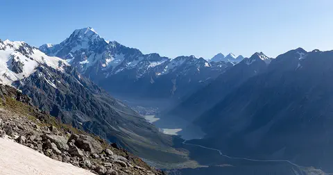
Aoraki / Mount Cook is New Zealand's highest mountain, in the Southern Alps of the South Island. Its name joins its Māori name, Aoraki, with its English name, Mount Cook. The mountain is being pushed up where two of Earth's plates meet, and glaciers carve the valleys around it. In 2013 surveyors measured it at 3,724 meters.
-
Watch
Natural wonder
Kakadu National Park
Kakadu, in Australia's Northern Territory, is the country's largest national park. It stretches from a high sandstone cliff called the escarpment down to floodplains, mangroves and the sea. Aboriginal people have lived here for tens of thousands of years, and their rock paintings, some up to 20,000 years old, record their way of life.
-
 Watch
Natural wonder
K'gari
K'gari, off the coast of Queensland in Australia, is the largest sand island in the world. Sand dunes rise up to about 250 meters, rainforest grows right on the sand, and about half of the world's perched dune lakes sparkle among the dunes. Once called Fraser Island, it was officially renamed K'gari, the Butchulla people's name for it, in 2023.
For parents & teachers
What children will learn
- Locate Purnululu National Park in Western Australia.
- Explain how erosion can shape sandstone into rounded towers.
- Describe how tiny living things can help protect rock.
- Explain how to stay safe in extreme heat.
Recommended ages: 3 to 17 · About 15 minutes
Talk about it
- Why might living things on the surface of a rock help protect it?
- Why might a park close during the wet season?
- Why is it important to drink water often, not just when you feel thirsty, in hot places?
Try at home or in class
- Stack layers of damp sand and a little clay in a cup, turn it out and sprinkle water over it to see how rounded shapes form.
- On a map of Australia, find Western Australia, the Kimberley region and Halls Creek.
Key vocabulary: sandstone, cone karst, cyanobacteria, gorge, erosion
Where these facts come from
- Wikidata , Wikimedia Foundation (CC0 1.0)
- Purnululu National Park (World Heritage List) , UNESCO World Heritage Centre
- Purnululu National Park , Department of Biodiversity, Conservation and Attractions, Western Australia (Explore Parks WA)
- File:8 Purnululu N.P. - Australien.jpg , Wikimedia Commons
- UNESCO World Heritage List , UNESCO World Heritage Centre (Linked as a reference; site facts come from Wikidata)
- Wikimedia Commons , Wikimedia Foundation (Per file (public domain, CC0, CC BY or CC BY-SA); see each media record)
Checked, not yet human-reviewed. Last updated November 1, 2026. Spotted a mistake? Tell us.