
Natural wonder Australia and Oceania
Simpson Desert
The Simpson Desert is a red, sandy desert in Australia. Long lines of sand dunes run across it.
The Simpson Desert covers 176,500 square kilometers where South Australia, Queensland and the Northern Territory meet, Geoscience Australia says. Its parallel sand dunes can stretch for up to 200 kilometers, and South Australia's parks service calls its national park one of the world's best examples of a parallel dune desert.
The Simpson Desert (176,500 km2, 2.3% of mainland Australia; Geoscience Australia) spans the corners of the Northern Territory, Queensland and South Australia. Its parallel dunes can stretch for up to 200 km (NPWS SA); linear dunes form parallel to the resultant of sand-shifting winds, and dating cited by Fitzsimmons (ANU) puts the forming of dunes oblique to today's winds at about 74,000-14,000 years ago and the start of today's wind-aligned dunes at 14,000-10,000 years ago.
Photo: Ian Cochrane, CC BY 2.0, via Wikimedia Commons
Discover the Simpson Desert
The Simpson Desert is in Australia. It has red sand and long sand dunes.
In this photo, dry grass and shrubs grow on a red sand dune. Pale, flat ground stretches far away.
The Simpson Desert lies across the corners of three parts of Australia: South Australia, Queensland and the Northern Territory. Geoscience Australia lists it as 176,500 square kilometers, the fourth largest desert on its list of Australia's mainland deserts.
In this photo by Ian Cochrane, dry grass and gray-green shrubs grow on a low dune of orange-red sand, and a wide, pale, flat stretch of ground reaches to the horizon under a blue sky.
Geoscience Australia (Deserts database, 1994, revised 2022): Simpson, NT/QLD/SA, 176,500 km2, 2.3% of the mainland; fourth after the Great Victoria, Great Sandy and Tanami. National Parks and Wildlife Service South Australia: the Munga-Thirri – Simpson Desert National Park, in the center of the desert and in the driest region of the continent, covers 3.6 million hectares.
The photo (Ian Cochrane via Flickr, CC BY 2.0; no reliable date) shows a low dune of orange-red sand with dry grass and shrubs, and a level pale flat extending to the horizon.
- Area (Geoscience Australia)
- 176,500 km²
- Share of mainland Australia
- 2.3%
- National park in South Australia
- 3.6 million ha
Dunes lined up by the wind
Wind built the long sand dunes here.
The dunes run side by side.
The U.S. Geological Survey explains that linear dunes are long, straight or slightly wavy ridges of sand, often in sets of parallel ridges. Kathryn Fitzsimmons of the Australian National University explains that they form in line with the winds that move sand.
In the Simpson Desert, parallel dunes can stretch for up to 200 kilometers, South Australia's parks service says. Between them lie low valleys called swales, which collect more water than the dune tops.
USGS: linear dunes are straight or slightly sinuous sand ridges, typically much longer than wide, sometimes over 160 km long, usually in parallel sets separated by interdune corridors; many form in bidirectional wind regimes. Fitzsimmons (ANU, SERC): linear dunes form parallel to the resultant vector of sand-shifting winds and cover about one-third of Australia.
For the Simpson Desert she cites Hollands et al. (2006): dunes oblique to today's winds formed between about 74,000 and 14,000 years ago, dunes matching today's winds began between about 14,000 and 10,000 years ago, and the wind whorl has shifted south by about 1-1.5 degrees since the Last Glacial Maximum.
Spinifex, wildflowers and night animals
Spinifex grass grows on the sand. After rain, wildflowers can cover the dunes.
Many of the desert's mammals come out only at night, when it is cooler.
South Australia's parks service says sandhill cane-grass grows on the dune crests and spinifex on the steadier sand, while bigger shrubs such as mulga and gidgee grow in the swales between dunes. Many plants grow, flower and set seed within a couple of months of rain, and the dunes can be covered in wildflowers.
More than 150 kinds of birds live in the desert. To escape the heat, many mammals, such as small dunnarts and the ampurta, come out only at night. Perenties, sand goannas and central bearded dragons live here too.
NPWS SA: sandhill cane-grass on dune crests; lobed spinifex (Triodia) on stable sands, its tussocks often forming donut shapes as the center dies; eremophila, grevillea, mulga and gidgee in the swales; samphire around playa lakes; short plant life cycles after rain (poached-egg daisy, fleshy groundsel).
Over 150 bird species (another NPWS page says 195 recorded), including the eyrean grasswren on dune slopes and the rare Australian bustard; nocturnal dunnarts and ampurta; dingoes; perentie, sand goanna, bearded dragons, woma python; feral rabbits, camels and foxes.
People of the desert
Aboriginal people have lived in and around this desert for a very long time.
They found water at native wells called mikiri.
South Australia's parks service says the Wangkangurru people lived in the desert, gathering in family groups around native wells called mikiri, which gave the only permanent water. In good seasons they spread out across the desert after rain.
They traded widely with groups to the north and south, swapping stone axes, grinding stones and ochre. All Aboriginal sites in the park are protected.
NPWS SA: before the 19th century the Wangkangurru lived in the desert, and the Lower Southern Arrernte on and partly in its western edge; family groups centered on native wells (mikiri), the only permanent water, dispersing in good seasons to use groundwater and post-rain growth. They were hunter-gatherers who traded extensively: ground-edge axes from Queensland quarries, sandstone grinding stones and ochre from the North Flinders Ranges. Stone implements occur in the park but are not common; all Aboriginal sites are protected.
Ready for the heat
The desert parks close in the hottest months. It can get very, very hot.
Wear a wide hat and loose clothes, and rest in the shade.
The Simpson Desert parks in South Australia and Queensland close each year from 1 December to 15 March, because temperatures can go above 50 degrees Celsius, and the best time to visit is from May to October. Visitors must carry extra fuel, water and food.
The CDC suggests light, loose, light-colored clothing and a wide-brimmed hat in hot places, drinking during exercise, and avoiding hard activity in the hottest part of the day.
NPWS SA: the Simpson parks close from 1 December to 15 March for public safety, as temperatures can exceed 50 °C; autumn, winter and spring are the most enjoyable times (another NPWS page: May to October is ideal); reserves of fuel, water, food, spare parts and recovery gear must be carried, and firewood collection is prohibited because dead wood shelters animals.
CDC Yellow Book: lightweight, loose, light-colored clothing; a wide-brimmed hat markedly reduces radiant heat; drink during exertion but do not force water; avoid strenuous activity in the hottest part of the day.
Amazing facts
-
Spinifex grass can grow in a ring, like a donut.
Spinifex clumps can grow into donut shapes as the middle of the plant dies and the edges keep growing.
Lobed spinifex tussocks often form donut-like rings as the center dies while the outer edge keeps growing (NPWS SA).
-
In Australia, lots of the land is covered by long sand dunes.
Linear dunes like the Simpson's cover about one-third of Australia's land.
Linear dunes occupy about one-third of the Australian continental land surface, forming a continental-scale whorl (Fitzsimmons, ANU).
-
After rain, the dunes can turn into a carpet of flowers.
Many desert plants grow, flower and set seed within a couple of months of rain, covering the dunes in wildflowers.
Long-dormant seeds of poached-egg daisies and fleshy groundsel spring up after rain (NPWS SA).
Words to know
- linear dune
- a long, straight or slightly wavy ridge of sand
- swale
- a low strip of ground between two dunes
- spinifex
- a spiky grass of Australia's dry country that grows in clumps
- nocturnal
- active at night
- playa lake
- a shallow lake that fills with water only after rain
Discovery challenge
-
In which country is the Simpson Desert?
The Simpson Desert lies where three parts of which country meet?
Which country's Geoscience agency lists the Simpson at 176,500 km2?
- Australia
- Egypt
- Mexico
Show the answer
Australia
Australia.
Australia: South Australia, Queensland and the Northern Territory.
Australia (Geoscience Australia).
-
What built the long sand dunes?
Linear dunes line up with what, Fitzsimmons explains?
Linear dunes form parallel to the resultant vector of which sand-moving agent?
- The wind
- Rivers
- Earthquakes
Show the answer
The wind
The wind.
The winds that move sand.
Sand-shifting winds (Fitzsimmons, ANU).
-
When do many desert animals here come out?
When do many of the Simpson Desert's mammals come out, to escape the heat?
Dunnarts and ampurta in the Simpson are mostly active at what time?
- At night
- At midday
- Only in winter storms
Show the answer
At night
At night.
At night, when it is cooler.
At night (NPWS SA).
-
What is the low ground between dunes called?
What are the low strips between the dunes called?
Which part of the dunefield collects more water and supports larger shrubs?
- Swales
- Peaks
- Glaciers
Show the answer
Swales
Swales.
Swales, which collect more water than the dune tops.
The swales (NPWS SA).
-
When are the desert parks closed?
When are South Australia's Simpson Desert parks closed each year?
Why do the Simpson parks close from 1 December to 15 March?
- In the hottest months
- In the coldest months
- Never
Show the answer
In the hottest months
In the hottest months.
From 1 December to 15 March, when it can be hotter than 50 °C.
Public safety: temperatures can exceed 50 °C (NPWS SA).
Nearby places
-
 Watch
Natural wonder
Uluru
Uluru is a huge sandstone rock in the desert of central Australia, rising 348 meters above the plain, with a base 9.4 kilometers around. The Anangu are its Traditional Owners, and the national park around it is run by Anangu and Parks Australia together.
-
 Watch
Natural wonder
Gibson Desert
The Gibson Desert covers about 156,000 square kilometers of Western Australia, Geoscience Australia says. It is a wide, gently rolling plain of gravel and red sand where spinifex grasses and mulga trees grow, and it gets about 200 millimeters of rain a year.
-
 Watch
Natural wonder
Great Dividing Range
The Great Dividing Range runs through Australia's Eastern Highlands, which stretch along most of the east coast. It divides rivers that flow inland from rivers that flow to the Pacific Ocean or Bass Strait.
-
 Watch
City
Adelaide
Adelaide is the capital of South Australia. About 1.49 million people lived in Greater Adelaide in mid-2025. Founded in 1837, it was laid out on a plan by Colonel William Light, with a grid of streets ringed by green Park Lands, on the land of the Kaurna people.
-
 Watch
Natural wonder
Purnululu National Park
Purnululu National Park, in the Kimberley region of Western Australia, is home to the Bungle Bungle Range: beehive-shaped sandstone domes striped orange and black, rising high above grassy plains.
-
 Watch
Natural wonder
Great Barrier Reef
The Great Barrier Reef stretches about 2,300 kilometers along the coast of Queensland, Australia. It is made of about 2,500 separate reefs and more than 900 islands, built by tiny coral animals, and it is home to more than 1,500 kinds of fish.
-
 Watch
Landmark
Siding Spring Observatory
Siding Spring Observatory sits on Mount Woorut in New South Wales, Australia, next to Warrumbungle National Park. The Australian National University chose the site in 1962 for its dark, cloudless skies. Today it is home to many telescopes, including the Anglo-Australian Telescope, the largest optical telescope in Australia.
-
 Watch
Natural wonder
Kakadu National Park
Kakadu, in Australia's Northern Territory, is the country's largest national park. It stretches from a high sandstone cliff called the escarpment down to floodplains, mangroves and the sea. Aboriginal people have lived here for tens of thousands of years, and their rock paintings, some up to 20,000 years old, record their way of life.
Explore next
-
 Watch
 Country
Australia
Australia is a country and the smallest continent, surrounded by ocean in the Southern Hemisphere. Much of its middle is dry and flat, most people live near the coast, and its animals include kangaroos, koalas and the platypus, a mammal that lays eggs.
-
Watch
Natural wonder
Gibson Desert
The Gibson Desert covers about 156,000 square kilometers of Western Australia, Geoscience Australia says. It is a wide, gently rolling plain of gravel and red sand where spinifex grasses and mulga trees grow, and it gets about 200 millimeters of rain a year.
-
Watch
Natural wonder
Uluru
Uluru is a huge sandstone rock in the desert of central Australia, rising 348 meters above the plain, with a base 9.4 kilometers around. The Anangu are its Traditional Owners, and the national park around it is run by Anangu and Parks Australia together.
- Watch Geography What makes a desert? A desert is any place that gets very little rain or snow, usually less than about 250 millimeters a year. Deserts can be hot, like the Sahara, or freezing cold, like Antarctica, the driest continent. They form where winds, mountains or cold ocean currents keep rain away.
-
 Watch
Animal
Perentie
The perentie is Australia's largest lizard, a kind of monitor, also known as a goanna. It lives in the dry, rocky deserts of central and western Australia, hiding in deep cracks and burrows among the rocks and hunting across the open desert around them.
-
 Watch
Animal
Central bearded dragon
The central bearded dragon is a lizard of the dry woodlands, scrub and deserts of eastern inland Australia. It eats plants and small animals, basks on fence posts and logs, waves its arm and bobs its head to talk to other dragons, and puffs out a spiky beard to look big. It is also a very popular pet lizard.
-
Watch
Natural wonder
Great Barrier Reef
The Great Barrier Reef stretches about 2,300 kilometers along the coast of Queensland, Australia. It is made of about 2,500 separate reefs and more than 900 islands, built by tiny coral animals, and it is home to more than 1,500 kinds of fish.
-
 Watch
Natural wonder
Aoraki / Mount Cook
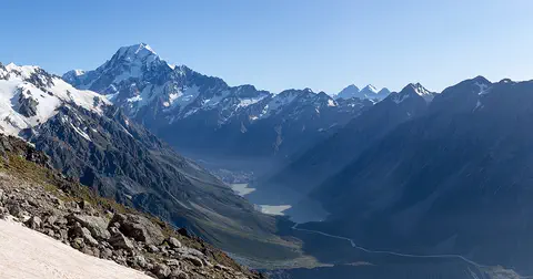
Aoraki / Mount Cook is New Zealand's highest mountain, in the Southern Alps of the South Island. Its name joins its Māori name, Aoraki, with its English name, Mount Cook. The mountain is being pushed up where two of Earth's plates meet, and glaciers carve the valleys around it. In 2013 surveyors measured it at 3,724 meters.
For parents & teachers
What children will learn
- Locate the Simpson Desert in Australia.
- Explain how wind builds linear sand dunes.
- Describe how desert plants and animals cope with heat and rare rain.
- Explain how to prepare for extreme heat.
Recommended ages: 3 to 17 · About 15 minutes
Talk about it
- Why might plants that grow, flower and seed quickly do well in a desert?
- How could wells that always have water shape where people live in a desert?
- Why might the dunes point in different directions from today's winds?
Try at home or in class
- Spread dry sand on a tray and blow across it gently through a straw from one direction, then from two directions, and compare the shapes (with a grown-up; keep sand away from eyes).
- On a map of Australia, find where South Australia, Queensland and the Northern Territory meet.
Key vocabulary: linear dune, swale, spinifex, nocturnal, playa lake
Where these facts come from
- Wikidata , Wikimedia Foundation (CC0 1.0)
- Deserts (Australia's landforms) , Geoscience Australia
- Munga-Thirri – Simpson Desert National Park , National Parks and Wildlife Service South Australia
- Know before you go: Simpson Desert , National Parks and Wildlife Service South Australia
- Regional trends in desert dune morphology and orientation: Examples from the Australian deserts (Kathryn E. Fitzsimmons, Australian National University) , Science Education Resource Center, Carleton College
- Types of Dunes (Deserts: Geology and Resources) , US Geological Survey
- Heat and Cold Illness in Travelers (CDC Yellow Book) , US Centers for Disease Control and Prevention
- Simpson Desert dune (Wikimedia Commons file page) , Wikimedia Commons
- Natural Earth vector data , Natural Earth (NACIS) (Public domain)
- Wikimedia Commons , Wikimedia Foundation (Per file (public domain, CC0, CC BY or CC BY-SA); see each media record)
Checked, not yet human-reviewed. Last updated November 1, 2026. Spotted a mistake? Tell us.