
Natural wonder Australia and Oceania
K'gari
K'gari is a long island in Australia made almost all of sand. It has tall sand hills, clear blue lakes and even rainforest growing on the sand. Its name is said like GAR-ree.
K'gari, off the coast of Queensland in Australia, is the largest sand island in the world. Sand dunes rise up to about 250 meters, rainforest grows right on the sand, and about half of the world's perched dune lakes sparkle among the dunes. Once called Fraser Island, it was officially renamed K'gari, the Butchulla people's name for it, in 2023.
K'gari (formerly Fraser Island), off southeastern Queensland, is the world's largest sand island and a World Heritage Site since 1992. Built by longshore drift, its dunes form one of the longest and most complete age sequences of coastal dune systems known, carrying tall rainforest on sand, about half of the world's perched freshwater dune lakes and podzol soils more than 25 m thick. The island officially took its Butchulla name, K'gari, in 2023.
Photo: Korkut Tas, CC BY-SA 3.0, via Wikimedia Commons
Discover K'gari
K'gari is an island near Australia.
It is made of sand, almost all of it! There are long beaches, tall sand hills, clear lakes and green forests. It used to be called Fraser Island. Now it has its Butchulla name, K'gari.
K'gari lies off the southeastern coast of Queensland, in Australia, across Hervey Bay and the Great Sandy Strait from the mainland. Britannica says it is about 120 kilometers long and 25 kilometers across at its widest point, and both UNESCO and Britannica call it the largest sand island in the world.
The island has more than 250 kilometers of sandy beaches, colorful sand cliffs, huge dunes, freshwater lakes and tall rainforest. For many years it was known as Fraser Island. In 2023 it was officially renamed K'gari, the name used by the Butchulla people, its Traditional Owners. It is said like GAR-ree.
K'gari lies off southeastern Queensland, separated from the mainland and the port of Maryborough by Hervey Bay and the Great Sandy Strait; Britannica gives it as about 120 km long, 25 km wide at most and about 1,600 km² in area, with sand hills rising to nearly 250 m. UNESCO's property, 181,851 ha, takes in all of K'gari, small islands off its west coast such as Stewart and Dream Islands, and a strip 500 m seaward of high water.
Inscribed in 1992 under criteria (vii), (viii) and (ix), and added to Australia's National Heritage List in 2007, the island is mostly national park, with its surrounding waters in the Great Sandy Marine Park. Britannica records that it was officially renamed K'gari in 2023, the name used by the Butchulla people, its traditional owners and custodians.
- Country
- Australia (Queensland)
- Length
- about 120 km
- World Heritage property
- 181,851 ha
- Ocean beaches
- over 250 km
- Named K'gari
- officially in 2023
An island built by moving sand
Waves and wind carry sand along the coast.
Over a very long time, the sand piled up into a giant island. Wind blew it into tall hills called dunes. New dunes are still forming today.
K'gari was built by sand on the move. UNESCO points to longshore drift, in which waves move sand along the coast. Over a very long time, huge amounts of sand piled up here, and wind heaped it into giant dunes.
UNESCO explains that K'gari's dunes are part of the longest and most complete record of dunes of different ages anywhere in the world. Young, moving dunes lie on top of older dunes that formed when the sea was lower, and they are still changing. Some dunes are covered in rainforest as high as 240 meters above the sea.
UNESCO cites K'gari under criterion (viii) for ongoing geological processes, above all longshore drift. Its immense dunes belong to the longest and most complete age sequence of coastal dune systems in the world and are still evolving: active parabolic dunes are superimposed on remnants of older dunes deposited during periods of low sea level, which are stabilized by rainforest at elevations of up to 240 m, an arrangement UNESCO considers unique.
The soils record that sequence too. From the young dunes on the east to the oldest on the west, podzols range from rudimentary profiles under 0.5 m to giant forms more than 25 m thick, far deeper than known anywhere else. On the oldest dunes the soil becomes too deep to nourish tall forest, causing retrogressive succession: forest gives way to lower vegetation. Spectacular blowouts, where wind scoops sand from a dune, and more than 40 km of colored sand cliffs complete the picture.
Lakes perched on sand
K'gari has lakes high up in the sand hills.
Their water is fresh, not salty. Some of the lakes are very, very old. There is lots of fresh water hidden in the sand too.
One of K'gari's biggest surprises is its lakes. Many are perched dune lakes, sitting high up among the dunes. Britannica counts 40 perched dune lakes on K'gari, about half of all the perched dune lakes in the world.
UNESCO says the island also holds the world's largest unconfined aquifer on a sand island, a huge store of fresh water soaked into the sand. The lakes are unusual for their number, their variety and their age, and they show how lakes form and change over time.
UNESCO describes half of the world's perched freshwater dune lakes on K'gari, exceptional in number, diversity and age, and Britannica counts 40 of them. UNESCO links them to the island's hydrology: the dynamic interrelationship between the dune sand mass, the aquifer and the lakes produces a sequence of lake formation in both space and time, and the island holds the world's largest unconfined aquifer on a sand island.
Since listing, patterned fens have been discovered on the property; with those at nearby Cooloola, they are the only known subtropical patterned fens in the world and support an unusual number of rare and threatened species. UNESCO warns that heavy, localized recreational use can degrade lake water quality, one of the property's key management concerns.
Rainforest on sand
Tall trees grow on K'gari, right in the sand!
Low, flowering bushes cover other parts. Many birds live here. Special frogs live in the wet, sandy places. Wild dogs called dingoes live here too.
On K'gari, tall rainforest grows right on sand dunes, with trees up to 50 meters tall. UNESCO says rainforest on coastal dunes at this scale is not known anywhere else in the world. Britannica lists kauri pine, hoop pine, blackbutt and satinay among the island's trees.
Other parts are covered in low, shrubby heath called wallum and wildflowers. Some frogs, including threatened species, have adapted to the acidic water of the wet heaths. Britannica says birds are plentiful but there are few kinds of mammals: bats are the most common, and there are dingoes.
Under criterion (ix) UNESCO highlights biological processes acting on a uniform sand medium: rainforest with trees up to 50 m on coastal dunes, unknown elsewhere at this scale; vegetation that changes markedly over very short distances with salinity, water table, dune age, nutrients, exposure and fire; and low shrubby heaths (wallum) of evolutionary significance, where ancient flowering plants continue to adapt to low fertility, fire, waterlogging and aridity. Heath and closed forest shelter relict and disjunct populations, and several threatened frogs are adapted to the acidic wet heaths and sedgelands.
Britannica notes abundant birdlife but few mammal species, chiefly bats and dingoes, and names kauri and hoop pine, blackbutt and satinay among the timber trees. UNESCO records that logging affected the tall forests but has stopped, and that weeds, plant diseases and feral animals are present in low numbers under active management.

The Butchulla people and K'gari's name
The Butchulla people have lived on K'gari for thousands of years.
K'gari is their name for the island. In 2023, it became the island's official name.
Archaeological evidence shows that the Butchulla people have lived on the island for at least 5,000 years, Britannica says. They are its Traditional Owners and custodians, and K'gari is their name for it.
The British explorer James Cook sighted the island in 1770, and Matthew Flinders landed there in 1802. It was later named Fraser Island after a ship's captain, James Fraser, who died there after a shipwreck in 1836. In 2023 the island was officially renamed K'gari. Over the years, parts of it became a forest reserve and a national park, and in 1992 UNESCO listed the whole island as a World Heritage Site.
Britannica reports archaeological evidence of Butchulla occupation for at least 5,000 years. The island was designated a reserve for Aboriginal people in 1860, but the designation was revoked in 1906, after the Butchulla had been removed from the island. Cook sighted it in 1770, believing it a promontory; Flinders made the first landing in 1802; it was named for Captain James Fraser, who died there in 1836 after surviving a shipwreck. In 2023 it was officially renamed K'gari, the Butchulla name.
Protection grew in stages: a forest reserve from 1908, about a quarter of the island declared national park in 1971, Great Sandy National Park established in 1976, sand mining ended in 1977 when the Commonwealth banned mineral-sand exports, World Heritage inscription in 1992 and the National Heritage List in 2007. UNESCO notes that Indigenous, community and scientific advisory committees advise governments on managing the property.
Visiting safely
Dingoes on K'gari are wild animals.
Stay close to your grown-ups and never walk alone. Never feed a dingo. Keep food packed away.
K'gari's dingoes are wild, and Queensland's rangers say visitors can never relax around them. Rangers advise keeping children and young teens within arm's reach, walking in groups, never walking alone or running on the beach, and carrying a stick, which helps keep dingoes away. Families can also stay in fenced camping areas.
Never feed dingoes: the island gives them plenty of natural food. Keep food locked away. Help protect the lakes too: UNESCO warns that crowds of visitors can harm their water quality. Stay on tracks, and take all your rubbish home.
Queensland's Department of the Environment, Tourism, Science and Innovation (DETSI) reminded visitors in December 2024 that they "can never relax around dingoes on K'gari": keep children and small teens within reach, never walk alone or run on the beach, carry a stick as a deterrent, consider fenced camping areas, and report concerning encounters to rangers. The release stresses that K'gari provides plenty of food for dingoes and that they do not need to be fed.
UNESCO lists visitor numbers, inappropriate fire, invasive plants and animals and climate change as key threats, noting that intensive, localized recreation can degrade lake water quality. Visitors help by following ranger advice, keeping to tracks and leaving lakes, dunes and wildlife undisturbed.
Amazing facts
-
Half of the world's lakes perched in sand dunes are on K'gari.
K'gari has 40 perched dune lakes, about half of all the perched dune lakes in the world.
Britannica counts 40 perched dune lakes on K'gari, about half the world total.
-
K'gari's soil can be deeper than a tall building.
On K'gari's oldest dunes, the soil layers are more than 25 meters thick, deeper than such soils anywhere else in the world.
UNESCO reports giant podzols more than 25 m thick on the oldest dunes, far exceeding known podzol depths elsewhere.
-
The sand cliffs come in many colors.
K'gari has more than 40 kilometers of strikingly colored sand cliffs along its beaches.
UNESCO cites more than 40 km of strikingly colored sand cliffs among the island's scenic features.
-
Say the island's name like this: GAR-ree.
K'gari is pronounced GAR-ree. It is the Butchulla people's name for the island.
Britannica gives the pronunciation GAR-rie for K'gari, the Butchulla name officially adopted in 2023.
Words to know
- sand dune
- a hill of sand piled up by the wind
- longshore drift
- the way waves move sand along a coast
- perched lake
- a lake that sits high up among sand dunes
- aquifer
- a layer of sand or rock that holds water underground
- heath
- open land covered with low, shrubby plants
- Traditional Owners
- the Aboriginal people who, by their laws and customs, own and care for an area of land
Discovery challenge
-
What is K'gari made of?
What makes K'gari different from most islands?
K'gari holds which world title, according to UNESCO and Britannica?
- It is the biggest sand island in the world
- It is made of ice
- It is a volcano
Show the answer
It is the biggest sand island in the world
Sand! It is the biggest sand island.
It is the largest sand island in the world.
The world's largest sand island.
-
Whose name is K'gari?
K'gari is the name used by which people?
Which people are K'gari's traditional owners, whose name the island took in 2023?
- The Butchulla people
- Ship captains
- Visitors from Europe
Show the answer
The Butchulla people
The Butchulla people.
The Butchulla people, who have lived there for at least 5,000 years.
The Butchulla, traditional owners and custodians; the name became official in 2023.
-
What grows on K'gari's sand that is surprising?
Which kind of forest grows on K'gari's sand dunes?
Which vegetation does UNESCO say grows on coastal dunes at a scale unknown elsewhere?
- Tall rainforest
- Cactus forest
- Snowy pine forest
Show the answer
Tall rainforest
Tall rainforest!
Tall rainforest, with trees up to 50 meters high.
Rainforest with trees up to 50 m on coastal dunes.
-
What do waves do to sand along the coast?
Which process brought the sand that built K'gari?
Which ongoing geological process does UNESCO emphasize under criterion (viii)?
- Longshore drift: waves move sand along the coast
- Lava flowing from a volcano
- Glaciers grinding rock
Show the answer
Longshore drift: waves move sand along the coast
Waves push sand along the beach.
Longshore drift, which moves sand along the coast.
Longshore drift, building the dune systems.
-
What should you never do with a dingo?
What do rangers say you should never do on K'gari?
Which behavior do rangers say is unnecessary and unsafe because the island gives dingoes plenty of food?
- Feed a dingo
- Stay with your family
- Walk in a group
Show the answer
Feed a dingo
Never feed a dingo.
Never feed dingoes; stay close together and walk in groups.
Feeding dingoes: K'gari provides plenty of natural food.
Nearby places
-
 Watch
Landmark
Sydney Opera House
The Sydney Opera House stands on a point of land in Sydney Harbour, Australia. Danish architect Jørn Utzon won a competition to design it in 1957, building began in 1959, and it opened on October 20, 1973. Its shell-shaped roofs are covered in more than a million tiles.
-
 Watch
City
Sydney
Sydney is Australia's largest city and the capital of the state of New South Wales. It surrounds Port Jackson, a harbor of countless bays, on the lands of the Gadigal people of the Eora Nation. The British set up a convict colony here in 1788. Today the Harbour Bridge, the Opera House and its beaches are world famous, and about 5.45 million people lived in Greater Sydney in 2023.
-
 Watch
Natural wonder
Great Barrier Reef
The Great Barrier Reef stretches about 2,300 kilometers along the coast of Queensland, Australia. It is made of about 2,500 separate reefs and more than 900 islands, built by tiny coral animals, and it is home to more than 1,500 kinds of fish.
-
 Watch
Natural wonder
Uluru
Uluru is a huge sandstone rock in the desert of central Australia, rising 348 meters above the plain, with a base 9.4 kilometers around. The Anangu are its Traditional Owners, and the national park around it is run by Anangu and Parks Australia together.
-
 Watch
Natural wonder
Kakadu National Park
Kakadu, in Australia's Northern Territory, is the country's largest national park. It stretches from a high sandstone cliff called the escarpment down to floodplains, mangroves and the sea. Aboriginal people have lived here for tens of thousands of years, and their rock paintings, some up to 20,000 years old, record their way of life.
-
 Watch
Natural wonder
Aoraki / Mount Cook
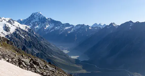
Aoraki / Mount Cook is New Zealand's highest mountain, in the Southern Alps of the South Island. Its name joins its Māori name, Aoraki, with its English name, Mount Cook. The mountain is being pushed up where two of Earth's plates meet, and glaciers carve the valleys around it. In 2013 surveyors measured it at 3,724 meters.
-
 Watch
Natural wonder
Komodo National Park
Komodo National Park, in Indonesia, is a group of rugged, dry islands between Sumbawa and Flores. Its three main islands, Komodo, Rinca and Padar, were made by volcanoes. The park contains most of the places where wild Komodo dragons, the largest living lizards, still live, along with rich coral reefs visited by turtles, dolphins and whales.
- Watch Natural wonder Mariana Trench The Mariana Trench is a long, curving valley in the floor of the western Pacific Ocean, near the island of Guam. Its deepest spot, the Challenger Deep, is the deepest place known in the whole ocean, close to 11,000 meters down. If Mount Everest stood on the bottom, its peak would still be about 2 kilometers under water.
Experiments to try
Explore next
-
 Watch
 Country
Australia
Australia is a country and the smallest continent, surrounded by ocean in the Southern Hemisphere. Much of its middle is dry and flat, most people live near the coast, and its animals include kangaroos, koalas and the platypus, a mammal that lays eggs.
-
 Watch
Animal
Dingo
The dingo is Australia's wild dog and the country's largest meat-eating mammal. People brought its ancestors to Australia about 4,000 years ago. It hunts rabbits, kangaroos and wallabies, howls rather than barks, and scientists still argue about whether it is its own species or a very old kind of dog.
- Watch Geography Coasts and beaches Coasts are where land meets the sea, and they are always changing. Waves wear away rocky cliffs into caves, arches and stacks. Rivers and waves carry sand along the shore to build beaches. Beach sand can come from rocks worn down over millions of years, from volcanoes, from tiny shells, and even from fish!
- Watch Geography Islands An island is a piece of land surrounded by water that is smaller than a continent. Islands form in different ways: some broke away from continents, some were built by volcanoes on the sea floor, and some were made by corals or by waves piling up sand. Because they are cut off by water, islands often have unusual plants and animals.
- Watch Geography Where Earth's water is About 71 percent of Earth's surface is covered by water, and the oceans hold about 96.5 percent of all of it. Only about 2.5 percent of Earth's water is fresh, and most of that is frozen in ice or hidden underground. The lakes and rivers we use every day hold only a tiny part.
-
Watch
Natural wonder
Kakadu National Park
Kakadu, in Australia's Northern Territory, is the country's largest national park. It stretches from a high sandstone cliff called the escarpment down to floodplains, mangroves and the sea. Aboriginal people have lived here for tens of thousands of years, and their rock paintings, some up to 20,000 years old, record their way of life.
-
Watch
Natural wonder
Great Barrier Reef
The Great Barrier Reef stretches about 2,300 kilometers along the coast of Queensland, Australia. It is made of about 2,500 separate reefs and more than 900 islands, built by tiny coral animals, and it is home to more than 1,500 kinds of fish.
- Watch Try it What If? Lab What if an island experienced more erosion? Wave power grows with the square of wave height, so a wave about three times taller carries about 11 times the power. In our model, swapping 1.5-meter waves for 5-meter storm waves makes a sandy island wear away about 11 times faster, though plant roots help hold it together.
For parents & teachers
What children will learn
- Locate K'gari off the coast of Queensland, Australia.
- Explain how longshore drift and wind built a sand island.
- Describe perched dune lakes and rainforest on sand.
- Explain why the island was officially renamed K'gari in 2023.
Recommended ages: 3 to 17 · About 15 minutes
Talk about it
- How can a forest grow on sand?
- Why do you think it matters to use the Butchulla name for the island?
- What rules help people and dingoes share the island safely?
Try at home or in class
- In a tray, pile damp sand at one end and pour water in gently at an angle along one side. Watch how the water moves sand along the edge, like longshore drift.
- Put a plastic lid in a cup of sand, cover it with more sand and pour water on top. Some water stays above the lid: a model of a perched lake.
Key vocabulary: sand dune, longshore drift, perched lake, aquifer, heath, Traditional Owners
Where these facts come from
- Wikidata , Wikimedia Foundation (CC0 1.0)
- UNESCO World Heritage List , UNESCO World Heritage Centre (Linked as a reference; site facts come from Wikidata)
- K’gari , UNESCO World Heritage Centre
- K’gari , Encyclopaedia Britannica
- Always remain vigilant when visiting K’gari over the holiday season (2024) , Queensland Department of the Environment, Tourism, Science and Innovation
- Natural Earth vector data , Natural Earth (NACIS) (Public domain)
- Wikimedia Commons , Wikimedia Foundation (Per file (public domain, CC0, CC BY or CC BY-SA); see each media record)
Checked, not yet human-reviewed. Last updated October 27, 2026. Spotted a mistake? Tell us.