
Natural wonder Asia
Mount Agung
Mount Agung is a tall volcano on the island of Bali, in Indonesia. It is the highest mountain on Bali. Sometimes it puffs out clouds of ash, and scientists watch it closely.
Mount Agung is a cone-shaped volcano on the eastern end of Bali, in Indonesia, and the island's highest point at about 3,000 meters. It erupted strongly in 1963 and 1964, and again with explosions, ash clouds and lava in its crater from 2017 to 2019. Scientists watch it all the time and set safety zones around it when it is restless.
Mount Agung is a stratovolcano of the Sunda arc at the eastern end of Bali, about 3,000 m high (Smithsonian's Global Volcanism Program gives 2,997 m; Britannica 3,014 m) and rising above the southeast rim of the Batur caldera. Its 1963-64 eruption was among the largest of the 20th century, and a further eruptive period from November 2017 to June 2019 produced explosions, ash plumes and summit lava flows.
Photo: Michael W. Ishak, CC BY-SA 4.0, via Wikimedia Commons
Discover Mount Agung
Mount Agung is on Bali, an island in Indonesia.
It is a volcano shaped like a big cone. It is the tallest mountain on Bali. At the top there is a deep hole called a crater.
Mount Agung towers over the eastern end of Bali, an island in Indonesia. Britannica calls it the highest point in Bali. It is about 3,000 meters tall, though sources give slightly different heights: 2,997 meters from the Smithsonian's Global Volcanism Program and 3,014 meters from Britannica.
Agung is a stratovolcano, a tall, steep cone built from many layers of lava and ash. Its slopes reach all the way down to the sea on its north and south sides. At the top, the summit stretches 1.5 kilometers from west to east, with the highest point on the west and a steep-walled crater about 800 meters wide on the east.
The Smithsonian's Global Volcanism Program (GVP) describes Agung as a symmetrical stratovolcano of the Sunda Volcanic Arc that towers over the eastern end of Bali, rising above the southeast rim of the Batur caldera, with northern and southern flanks extending to the coast. The summit area extends 1.5 km east-west, with the high point on the west and a steep-walled crater 800 m wide on the east; a smaller cone, Pawon, lies low on the southeast flank. GVP gives its elevation as 2,997 m and Britannica as 3,014 m.
GVP notes that its name means "Paramount". The temple complex of Pura Besakih stands on the volcano's slopes (Britannica); GVP's reports locate Besakih about 7 km southwest of the summit.
- Country
- Indonesia (Bali)
- Height
- about 3,000 m (2,997 m GVP; 3,014 m Britannica)
- Type
- Stratovolcano
- Summit crater
- about 800 m wide
- Recent eruptions
- 1963-64; 2017-2019
A volcano on the Ring of Fire
Deep under Indonesia, hot melted rock pushes up.
It comes out of volcanoes like Agung. Each time, lava and ash pile up. Layer by layer, the mountain grew tall.
The Global Volcanism Program places Agung in the Sunda Volcanic Arc, a chain of volcanoes in Indonesia. Below volcanoes like these, melted rock called magma rises toward the surface.
Agung is a stratovolcano, which means it was built up by eruptions, layer upon layer. Some eruptions pour out lava. Others blast out ash and rock fragments. Over time, these layers piled up into the steep, cone-shaped mountain we see today, next to the large bowl of another volcano, the Batur caldera.
GVP places Agung in the Sunda Volcanic Arc and classifies it as a composite stratovolcano, an edifice built of alternating lava flows and explosive deposits. Its eruptive style is mixed: the 1963-64 eruption was both explosive and effusive, with voluminous ashfall, pyroclastic flows (fast avalanches of hot gas and rock) and lahars (volcanic mudflows), while the 2017-2019 activity included explosions, ash plumes, summit lava flows and incandescent ejecta.
Agung rises above the southeast rim of the Batur caldera, a large collapse depression of a neighboring volcano. Only a few eruptions have been recorded in historical time, dating back to the early 19th century, according to GVP; Britannica notes that before 1963 it had been dormant for 120 years.
When Agung wakes up
Sometimes Agung wakes up. It puffs huge clouds of ash into the sky.
Scientists watch the volcano all the time. When it gets busy, people move away from it to stay safe.
In 1963, after about 120 quiet years, Agung erupted. The Global Volcanism Program describes it as one of the largest eruptions of the 1900s, with heavy falls of ash and flows of hot rock and mud that caused great damage.
Agung erupted again from November 2017 to June 2019. There were explosions, big clouds of ash and lava inside the summit crater. NASA's satellites tracked the ash plume, which rose about 6 miles (10 kilometers) high in November 2017. Indonesia's volcano scientists closed safety zones around the summit, at the most restless times in 2017 reaching 8 to 12 kilometers out, and told people not to enter them.
The 1963-64 eruption, after some 120 years of dormancy (Britannica), was one of the largest of the 20th century (GVP), with voluminous ashfall, pyroclastic flows and lahars causing extensive damage. A new phase began in November 2017 and lasted until June 2019: GVP reports explosions, significant ash plumes, lava flows at the summit crater and incandescent ejecta. NASA's Earth Observatory imaged the plume on 29 November 2017 rising from two vents in the crater to about 6 miles; NASA's David Considine noted it was not energetic enough to affect global temperatures as Pinatubo did in 1991, since that would require sulfate in the stratosphere above about 10 miles.
Indonesia's volcanological agency, PVMBG, managed the crisis with alert levels and exclusion zones: at Alert Level 4 in late 2017 the zones reached 8 to 12 km from the crater; at Level 3 the zone was 4 km, reduced to 2 km when the level was lowered to 2 in July 2019, and the level was later lowered to 1 (GVP). Small ash plumes were reported in 2022.
Life around the volcano
Many people live on Bali near the volcano.
Villages, farms and forests surround the mountain. When the volcano is quiet, life goes on as usual.
Agung's slopes reach down to the coast on both its northern and southern sides, and many communities lie around the mountain. Volcano reports name nearby places such as Besakih, Rendang and Selat, where ash sometimes fell during the 2019 eruptions.
The photo of the 2017 eruption, taken from the northeast, shows trees, power lines and small buildings at the foot of the volcano. People living near an active volcano depend on the scientists who watch it and warn them when to leave and when it is safe to return.
GVP's weekly reports track ash falling on surrounding communities during the 2017-2019 activity: on 21 April 2019, for example, ashfall was reported in Besakih (7 km southwest), Rendang, Klungkung, Gianyar, Bangli, Tabanan and at the international airport in Denpasar, about 60 km southwest. Monitoring posts at Rendang and Batulompeh observed the volcano throughout.
Monitoring by the seismic network, ground deformation measurements, satellite thermal data and observers lets the authorities raise and lower alert levels and set exclusion zones. NASA's Earth Observatory adds that volcanic steam, lava and ash tend to have local and regional effects, while gas emissions can sometimes have global consequences.
Visiting safely
Agung is an active volcano.
Scientists tell people when it is safe to go near it. Always follow their warnings, and never go into a closed area.
Agung is still an active volcano: the Global Volcanism Program lists small ash plumes in 2022. Indonesia's volcano agency, PVMBG, uses alert levels from 1 to 4. When the alert level is high, it closes a zone around the summit, and no one should enter it.
Before visiting, check the current alert level and local rules. Go onto the volcano only when the authorities allow it, and turn back if warnings change. Ash can also affect air travel, so check flights when the volcano is active.
PVMBG's alert scale runs from 1 to 4; during 2018-2019 Alert Level 3 carried a 4 km exclusion zone around the crater, reduced to 2 km at Level 2 in July 2019 (GVP). Ash from the 2019 explosions reached communities up to about 60 km away, including Denpasar's international airport.
Visitors should consult current PVMBG alert information before approaching the volcano, respect exclusion zones absolutely and follow local regulations on climbing. Because conditions on an active stratovolcano can change quickly, plans should include the possibility of sudden closures.
Amazing facts
-
Agung's name means "Paramount".
The Smithsonian's Global Volcanism Program says the name Agung means "Paramount", which fits the highest mountain on Bali.
GVP glosses the volcano's name as "Paramount".
-
Satellites in space watched Agung's ash cloud.
NASA's Terra satellite photographed Agung's ash plume on 29 November 2017, using special light to tell ash apart from clouds.
MODIS on Terra imaged the plume on 29 November 2017 using shortwave infrared and natural color to separate ash, cloud and forest.
-
Agung's ash cloud came out of two holes at the top.
In NASA's satellite picture, the 2017 plume seemed to rise from two vents in Agung's crater.
NASA noted the plume appeared to issue from two vents; whiter plumes carry more steam, darker ones more ash.
-
Agung slept for about 120 years before 1963.
Before it erupted in 1963, Agung had been quiet for about 120 years.
Britannica records that Agung erupted in 1963 after 120 years of dormancy.
Words to know
- volcano
- an opening in Earth's surface where melted rock, ash and gas come out
- stratovolcano
- a tall, steep volcano built from many layers of lava and ash
- crater
- a bowl-shaped hole at the top of a volcano
- ash plume
- a cloud of tiny rock pieces and gas blown up by a volcano
- caldera
- a huge bowl left when the top of a volcano collapses
- exclusion zone
- an area people must not enter because it is dangerous
Discovery challenge
-
On which island is Mount Agung?
Mount Agung is the highest point of which island?
Agung stands at the eastern end of which Indonesian island?
- Bali
- Iceland
- Hawaii
Show the answer
Bali
Bali, in Indonesia.
Bali, in Indonesia.
Bali, in the Sunda Volcanic Arc.
-
What kind of mountain is Mount Agung?
What kind of volcano is Agung?
How does the Global Volcanism Program classify Agung?
- A stratovolcano, built of layers of lava and ash
- A sand dune
- A glacier
Show the answer
A stratovolcano, built of layers of lava and ash
A volcano made of many layers.
A stratovolcano: a steep cone of lava and ash layers.
A composite stratovolcano of the Sunda arc.
-
When did Agung erupt again, not long ago?
When did Agung's most recent big eruptions happen?
Between which years did Agung's most recent eruptive period with summit lava flows take place?
- 2017 to 2019
- 1066
- It has never erupted
Show the answer
2017 to 2019
From 2017 to 2019.
From November 2017 to June 2019.
November 2017 to June 2019, with explosions, ash plumes and summit lava flows.
-
Who tells people when it is safe near the volcano?
What do Indonesia's volcano scientists do when Agung becomes restless?
Which measures did PVMBG use to manage the 2017-2019 activity?
- Set alert levels and close zones around the summit
- Paint the volcano
- Nothing at all
Show the answer
Set alert levels and close zones around the summit
Volcano scientists give warnings.
They raise the alert level and close zones around the summit.
Alert levels from 1 to 4, with exclusion zones that reached 8 to 12 km at Level 4 in 2017.
-
What came out of Agung in the photo?
What is the tall gray cloud rising from Agung in the 2017 photo?
What does a darker plume indicate, according to NASA?
- Ash and steam
- Snow
- Smoke from a campfire
Show the answer
Ash and steam
Ash and steam from the volcano.
A column of volcanic ash and steam.
More ash; a whiter plume contains more steam.
Nearby places
-
 Watch
Natural wonder
Komodo National Park
Komodo National Park, in Indonesia, is a group of rugged, dry islands between Sumbawa and Flores. Its three main islands, Komodo, Rinca and Padar, were made by volcanoes. The park contains most of the places where wild Komodo dragons, the largest living lizards, still live, along with rich coral reefs visited by turtles, dolphins and whales.
-
 Watch
Landmark
Borobudur
Borobudur is a huge Buddhist monument in central Java, Indonesia, built about 1,200 years ago. It is shaped like a stepped pyramid around a small hill, with carved walls and 72 bell-shaped stupas on its round top terraces. For centuries it lay hidden under volcanic ash and plants, and today it is a UNESCO World Heritage Site.
-
 Watch
City
Jakarta
Jakarta, Indonesia's largest city and its capital, lies on the northwest coast of the island of Java, where the Ciliwung River meets the Java Sea. About 11 million people live there (2025). Indonesia is building a new capital called Nusantara, but under the law Jakarta stays the capital until the president signs a decree moving it.
-
 Watch
Natural wonder
Kakadu National Park
Kakadu, in Australia's Northern Territory, is the country's largest national park. It stretches from a high sandstone cliff called the escarpment down to floodplains, mangroves and the sea. Aboriginal people have lived here for tens of thousands of years, and their rock paintings, some up to 20,000 years old, record their way of life.
-
 Watch
Landmark
Petronas Towers
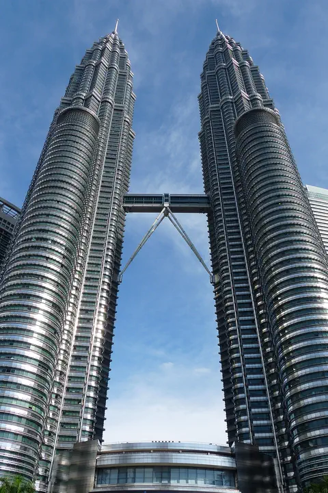
The Petronas Twin Towers in Kuala Lumpur, Malaysia, are two matching skyscrapers 452 meters tall, finished in 1998. Seen from above, each floor is shaped like an eight-pointed star, a pattern from Islamic art. A two-story skybridge joins them 170 meters above the ground, and from 1996 to 2003 they were counted as the tallest buildings in the world.
-
 Watch
City
Ho Chi Minh City
Ho Chi Minh City, once called Saigon, is Vietnam's largest city and the economic heart of the country. It lies on the Saigon River, north of the Mekong Delta. Since merging with two neighboring provinces in 2025, it has more than 14 million people, and in 2024 it opened its first metro line.
-
 Watch
Natural wonder
Uluru
Uluru is a huge sandstone rock in the desert of central Australia, rising 348 meters above the plain, with a base 9.4 kilometers around. The Anangu are its Traditional Owners, and the national park around it is run by Anangu and Parks Australia together.
-
 Watch
Landmark
Angkor Wat
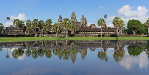
Angkor Wat, near the town of Siem Reap in Cambodia, was built in the 12th century by the Khmer king Suryavarman II. Britannica (2026) calls it the world's largest religious structure. It was built as a Hindu temple and later became a Buddhist place of worship.
Experiments to try
Explore next
-
 Watch
 Country
Indonesia
Indonesia is a country of about 17,500 islands in Southeast Asia, spread across the Equator between the Indian and Pacific oceans. It has more than 100 active volcanoes, rainforests full of wildlife, and about 286 million people (2025).
- Watch Geography Types of volcanoes Volcanoes come in different shapes. Runny lava builds wide, gentle shield volcanoes like Mauna Loa. Sticky lava and ash build tall, steep stratovolcanoes like Mount Fuji. Small cinder cones grow from bits of lava thrown into the air. Whether lava is runny or sticky, and how much gas it holds, decides the shape and how explosive the eruptions are.
- Watch Geography Why the Ring of Fire exists The Ring of Fire is a horseshoe-shaped path about 40,000 kilometers long around the edges of the Pacific Ocean, with more than 450 volcanoes. It exists because around most of the Pacific, ocean plates are sinking under other plates, which makes magma, deep trenches and earthquakes.
- Watch Geography Tectonic plates Earth's hard outer shell is cracked into a dozen or so giant pieces called tectonic plates. They carry the continents and oceans and move a few centimeters a year. Where plates pull apart, push together or slide past each other, we find volcanoes, mountains and earthquakes.
-
 Watch
Natural wonder
Mount Fuji
Mount Fuji, 3,776 meters high, is the highest mountain in Japan and an active volcano that last erupted in 1707. Its almost perfect cone was built by three volcanoes, one on top of another, and it has inspired artists for hundreds of years.
-
Watch
Natural wonder
Komodo National Park
Komodo National Park, in Indonesia, is a group of rugged, dry islands between Sumbawa and Flores. Its three main islands, Komodo, Rinca and Padar, were made by volcanoes. The park contains most of the places where wild Komodo dragons, the largest living lizards, still live, along with rich coral reefs visited by turtles, dolphins and whales.
- Watch What If? Lab What if volcanoes stopped erupting? Volcanoes build new land, like the island of Surtsey near Iceland, and their rock slowly breaks down into some of the richest soil on Earth. Over millions of years, gases from volcanoes even helped give Earth its air and oceans. Imagine every volcano going quiet, and follow what might change.
-
 Watch
Natural wonder
Mount Nyiragongo
Mount Nyiragongo is a steep volcano in the Virunga Mountains of the Democratic Republic of the Congo, near the border with Rwanda and just north of Lake Kivu. It is 3,470 meters high, and its deep summit crater often holds a lake of bubbling lava. Its lava is very runny, and eruptions in 1977, 2002 and 2021 sent lava flowing down its sides toward the city of Goma.
For parents & teachers
What children will learn
- Locate Mount Agung on Bali, Indonesia.
- Explain how a stratovolcano is built from layers.
- Describe the 1963-64 and 2017-2019 eruptions in simple terms.
- Explain why volcano alert levels and exclusion zones matter.
Recommended ages: 3 to 17 · About 15 minutes
Talk about it
- Why do you think people live near active volcanoes?
- How can satellites help scientists keep people safe?
- What would you pack if you had to leave home quickly because of a warning?
Try at home or in class
- Build a layered volcano: stack alternating layers of colored play dough around a cardboard tube to see how a stratovolcano grows layer by layer.
- Make an alert-level chart from 1 (normal) to 4 (highest) and decide what each level should mean for a pretend village near a volcano.
Key vocabulary: volcano, stratovolcano, crater, ash plume, caldera, exclusion zone
Where these facts come from
- Wikidata , Wikimedia Foundation (CC0 1.0)
- Agung , Smithsonian Institution, Global Volcanism Program
- Ash at Agung , NASA Earth Observatory
- Mount Agung , Encyclopaedia Britannica
- Wikimedia Commons , Wikimedia Foundation (Per file (public domain, CC0, CC BY or CC BY-SA); see each media record)
Checked, not yet human-reviewed. Last updated October 27, 2026. Spotted a mistake? Tell us.