
Natural wonder Africa
Mount Nyiragongo
Mount Nyiragongo is a volcano in Africa. Deep inside its crater there is a lake of glowing, melted rock called lava. Scientists watch it carefully.
Mount Nyiragongo is a steep volcano in the Virunga Mountains of the Democratic Republic of the Congo, near the border with Rwanda and just north of Lake Kivu. It is 3,470 meters high, and its deep summit crater often holds a lake of bubbling lava. Its lava is very runny, and eruptions in 1977, 2002 and 2021 sent lava flowing down its sides toward the city of Goma.
Nyiragongo is a 3,470 m stratovolcano of the Albertine Rift in the Virunga Mountains, inside Virunga National Park in the Democratic Republic of the Congo. Its summit crater has repeatedly held an active lava lake, and its unusually fluid, silica-poor lavas drained through the flanks in 1977, 2002 and 2021, reaching toward Goma, about 15 km to the south. The Smithsonian's Global Volcanism Program lists lava-lake activity continuing into 2026.
Photo: Cai Tjeenk Willink (Caitjeenk), CC BY-SA 3.0, via Wikimedia Commons
Discover Mount Nyiragongo
Mount Nyiragongo is a volcano in the middle of Africa.
It is tall and steep. At the top there is a deep hole called a crater. Inside the crater, glowing melted rock bubbles like a hot lake.
Mount Nyiragongo rises in the Virunga Mountains of east-central Africa, in the Democratic Republic of the Congo, close to the border with Rwanda. It stands 3,470 meters high, just north of Lake Kivu and the city of Goma, inside Virunga National Park.
Nyiragongo is famous for its lava lake: a pool of molten rock inside its summit crater. Britannica describes the main crater as about 2 kilometers wide and 250 meters deep. The Smithsonian's Global Volcanism Program, which keeps records of the world's volcanoes, measures the crater at 1.2 kilometers wide and says the lava lake has been active again and again.
The Smithsonian's Global Volcanism Program (GVP) classifies Nyiragongo as a stratovolcano of the Albertine Rift Volcanic Province, 3,470 m high, located immediately north of Lake Kivu within Virunga National Park, a UNESCO World Heritage property. Britannica places it near the Rwandan border, 19 km north of Goma, with a main crater about 2 km wide and 250 m deep holding a liquid lava pool; GVP gives the steep-walled summit crater as 1.2 km wide and Goma as about 15 km to the south. The figures differ by source.
Two older stratovolcanoes, Baruta and Shaheru, are partly overlapped by Nyiragongo to the north and south, and about 100 smaller cones lie along radial fissures and a northeast-southwest zone reaching Lake Kivu. Its steep slopes contrast with the low profile of its neighbor, the shield volcano Nyamuragira.
- Country
- Democratic Republic of the Congo
- Height
- 3,470 m
- Type
- Stratovolcano with a lava lake
- Mountain range
- Virunga Mountains
- Protected area
- Virunga National Park
A volcano in the rift
Deep under this part of Africa, hot melted rock pushes up.
It comes out at volcanoes like Nyiragongo. Eruption after eruption piled up layers of lava, and a tall, steep volcano grew.
Nyiragongo belongs to a group of volcanoes that scientists call the Albertine Rift Volcanic Province, along with neighbors such as Nyamuragira. It is built on top of two older volcanoes, Baruta and Shaheru.
Nyiragongo is a stratovolcano, a steep cone built up by eruption after eruption. Its lava is unusual: GVP describes it as extremely fluid, or runny, and its lava flows have spread long distances down the mountain's sides. About 100 small cones dot its slopes, many of them buried under later lava flows.
GVP assigns Nyiragongo to the Albertine Rift Volcanic Province. It is built over the remains of two older stratovolcanoes, Baruta and Shaheru, and its flanks carry about 100 parasitic cones along radial fissures and a northeast-southwest alignment extending to Lake Kivu. Many cones are buried by voluminous lava flows that extend long distances down the flanks.
The lavas are foiditic, an unusual, silica-poor rock type, and GVP describes the 1977 flows as extremely fluid. The JAXA satellite radar analysis of the 2021 eruption showed ground spreading east-west and displacement of more than a meter, a typical pattern of magma intruding beneath the surface.
A lake of lava
The lava lake glows orange and red.
On top, the lava cools into a dark crust, like a skin. Bright cracks show the hot lava underneath. Clouds of steam and gas rise up.
Nyiragongo's lava lake is one of its most amazing sights. Lava inside the crater cools on top into a dark crust, which breaks into plates separated by glowing cracks. Gas and steam pour out of it.
The lake rises and falls over time. Steps on the crater walls, called benches, mark where the lava lake once stood, and GVP says lava lakes have been observed here since the late 1800s. After the 2021 eruption, the crater slowly refilled with small lava flows, and GVP lists lava-lake activity continuing into 2026.
GVP records that the summit crater held a lava lake active for half a century before it drained through the flanks in 1977, and that benches in the 1.2 km crater mark the levels of former lakes observed since the late 19th century; a later report describes a lava lake active since at least 1971. After the collapse of May 2021, the Virunga Volcanoes Supersite's radar analysis showed the crater slowly refilling, with about 69 m of change between June 2021 and March 2024 from small intra-crater lava flows.
Activity is variable: satellite thermal data show periods of low emission alternating with strong pulses, and the Observatoire Volcanologique de Goma (OVG) reports gas emissions including sulfur dioxide. GVP's eruptive history lists the current lava-lake episode, which began in 2002, as continuing in March 2026.
When the lava escapes
Sometimes the lava lake drains out of cracks in the side of the volcano.
The runny lava flows down the mountain. Scientists watch closely and warn people so they can move to safety.
In 1977, 2002 and 2021, Nyiragongo's lava escaped down its sides in large flank eruptions. In 1977, the lava lake drained through cracks in the flanks, and its extremely runny lava flowed down the mountain. In 2002, lava flows reached the city of Goma and damaged large parts of it.
In May 2021, the volcano erupted again. Japan's space agency, JAXA, used satellites to watch the lava flow about 13 kilometers toward Goma, splitting in two on the way. The lava reached homes on the edge of the city, though Britannica says it stopped short of the city limits.
GVP summarizes the volcano's destructive flank eruptions: in 1977 the long-lived lava lake drained catastrophically through the outer flanks, sending extremely fluid flows downslope; in January 2002 lava flows inundated portions of Goma, which Britannica describes as largely destroyed. In May 2021 a flank eruption sent lava south; JAXA's night-time thermal image on 23 May showed it about 13 km from the volcano, split into two branches, and JAXA reports that it reached residential areas and caused severe damage, while Britannica says it stopped short of Goma's city limits.
Radar interferometry (ALOS-2) recorded more than 1 m of ground displacement associated with magma intrusion. Monitoring by the OVG, satellite agencies and international partners underpins warnings for the communities around the volcano.
Life beside a volcano
Lots of people live near Nyiragongo, in the city of Goma.
Scientists at a volcano observatory watch the mountain every day. Plants grow in some of the old craters.
Nyiragongo stands inside Virunga National Park, a protected area and World Heritage Site. Britannica notes that some of the older craters on the mountain are known for their plant life.
The big city of Goma lies at the volcano's foot, beside Lake Kivu. Scientists at the Goma Volcano Observatory, together with satellite teams around the world, keep watch on the lava lake, the gases and the ground, so they can warn people if the volcano becomes dangerous.
Nyiragongo lies within Virunga National Park, a UNESCO World Heritage property (GVP), and Britannica notes that some of its older craters are known for their plant life. Its neighbors in the Virunga Mountains include the low shield volcano Nyamuragira.
The proximity of Goma, about 15 km to the south (GVP), makes monitoring essential. The Observatoire Volcanologique de Goma reports gas and seismic activity, while satellite data from MODIS (via MIROVA), Sentinel-1 and -2 and Japan's ALOS-2 and GCOM-C track heat, ground deformation and lava flows, as the 2021 response showed.
Visiting safely
Nyiragongo is an active volcano.
Never go near it without permission. Always listen to the scientists and park rangers.
Nyiragongo is an active volcano with a lava lake that can change quickly. It gives off gases such as sulfur dioxide, and its runny lava poured down its sides in large flank eruptions in 1977, 2002 and 2021.
The volcano lies inside Virunga National Park, so any visit must follow the park's rules and its rangers. Always check the latest warnings from the Goma Volcano Observatory and official travel advice for the area before planning a trip.
GVP lists lava-lake activity continuing into 2026, with variable thermal output and sulfur dioxide emissions reported by the OVG; flank eruptions in 1977, 2002 and 2021 show how quickly very fluid lava can travel. Any approach to the crater must be authorized by Virunga National Park and should follow OVG alerts.
Visitors should also consult current official travel advice for eastern DR Congo before planning a visit, since conditions in the region can change. Watching the lava lake through satellite imagery and observatory reports is a safe way to follow this volcano from anywhere.
Amazing facts
-
Steps on the crater walls show where the lava lake used to be.
Ledges called benches on Nyiragongo's crater walls mark the levels where lava lakes once stood.
GVP notes that benches in the summit crater record the levels of former lava lakes observed since the late 19th century.
-
Nyiragongo has about 100 baby volcanoes on its sides.
About 100 small volcanic cones dot Nyiragongo's slopes, some reaching as far as Lake Kivu.
About 100 cones lie along radial fissures and a NE-SW zone extending to Lake Kivu (GVP).
-
Satellites from Japan watched the 2021 lava flow at night.
A Japanese satellite saw the 2021 lava flow at night through gaps in the clouds, because the lava was hotter than everything around it.
JAXA's GCOM-C night-time thermal image of 23 May 2021 traced the flow about 13 km toward Goma through a cloud gap.
-
Plants grow inside some of the volcano's old craters.
Some of the older craters on Nyiragongo are known for their plant life.
Britannica notes that some older craters on the mountain are noted for their plant life.
Words to know
- lava lake
- a pool of melted rock inside a volcano's crater
- stratovolcano
- a tall, steep volcano built from many layers of lava and ash
- crater
- a bowl-shaped hole at the top of a volcano
- rift
- a place where Earth's crust is being pulled apart
- flank
- the side of a mountain or volcano
- observatory
- a place where scientists watch and measure something, such as a volcano
Discovery challenge
-
What is inside Nyiragongo's crater?
What is Nyiragongo most famous for?
Which feature of Nyiragongo's summit crater has GVP observed since the late 19th century?
- A lake of lava
- A glacier
- A forest
Show the answer
A lake of lava
A lake of glowing, melted rock!
Its lava lake inside the summit crater.
Lava lakes, whose former levels are marked by benches.
-
Which big lake is close to Nyiragongo?
Nyiragongo stands just north of which lake?
Toward which lake does Nyiragongo's NE-SW cone zone extend?
- Lake Kivu
- Lake Superior
- Lake Titicaca
Show the answer
Lake Kivu
Lake Kivu!
Lake Kivu, with the city of Goma on its shore.
Lake Kivu (GVP).
-
What is special about Nyiragongo's lava?
How is Nyiragongo's lava different from most lava?
Why can lava from Nyiragongo travel so quickly when the crater drains?
- It is very runny
- It is cold
- It is made of ice
Show the answer
It is very runny
It is very runny, so it flows fast.
It is extremely runny, so it can flow quickly downhill.
Its foiditic, silica-poor magma is exceptionally fluid.
-
Which city is near Nyiragongo?
Which city lies south of Nyiragongo, where lava flowed in 2002 and 2021?
Which city did the 2002 flows partly inundate and the 2021 flow approach?
- Goma
- Cairo
- Nairobi
Show the answer
Goma
Goma, by Lake Kivu.
Goma, about 15 kilometers to the south.
Goma, about 15 km south (GVP).
-
Who watches Nyiragongo every day?
How do scientists keep watch on Nyiragongo?
Which combination monitors Nyiragongo, according to GVP and JAXA reports?
- Scientists at an observatory and satellites
- Nobody at all
- Only tourists
Show the answer
Scientists at an observatory and satellites
Scientists and satellites!
The Goma Volcano Observatory and satellites watch the lava, gases and ground.
The Goma Volcano Observatory plus satellites such as ALOS-2, GCOM-C, Sentinel and MODIS.
Nearby places
-
 Watch
Natural wonder
Virunga National Park
Virunga National Park, in the east of the Democratic Republic of the Congo, was founded in 1925; the park describes itself as Africa's first national park. It stretches from active volcanoes in the south to the snowy Rwenzori Mountains in the north. About one third of the world's mountain gorillas live in its forests, along with elephants, hippos, chimpanzees and hundreds of kinds of birds.
-
 Watch
Natural wonder
Lake Victoria
Lake Victoria is the largest lake in Africa, and Britannica says only Lake Superior, in North America, is a bigger freshwater lake. It is shared by Kenya, Tanzania and Uganda. The lake is wide but shallow, its only outlet is the Nile, and it is home to hundreds of kinds of colorful fish called cichlids.
-
 Watch
Natural wonder
Lake Tanganyika
Lake Tanganyika lies in a deep crack in Africa called a rift valley. Britannica calls it the longest freshwater lake in the world, and only Lake Baikal, in Russia, is deeper. Four countries share it: Tanzania, the Democratic Republic of the Congo, Burundi and Zambia. Its water is home to about 250 kinds of cichlid fish found nowhere else.
-
 Watch
Natural wonder
Serengeti National Park
Serengeti National Park in northern Tanzania protects 14,763 square kilometers of grassy plains and woodlands. Each year more than a million wildebeest, with zebras and gazelles, travel a great loop across the Serengeti and into Kenya in search of grass and water, followed by lions and other predators.
-
 Watch
Natural wonder
Ngorongoro Conservation Area
The Ngorongoro Conservation Area in northern Tanzania holds the Ngorongoro Crater, a giant bowl about 16 to 20 kilometers across, left when an ancient volcano collapsed about 2.5 million years ago. Around 25,000 large animals live in and around the crater. The area also protects Olduvai Gorge and Laetoli, where scientists have found important evidence of how humans evolved.
-
 Watch
Natural wonder
Great Rift Valley
The Great Rift Valley is a huge valley that runs through East Africa, where the continent is slowly being stretched and pulled apart. Long, steep cliffs line its sides, its floor holds lakes full of flamingos, and giant volcanoes such as Kilimanjaro and Mount Kenya rose beside it. Scientists think a new ocean may one day open here.
-
 Watch
City
Nairobi
Nairobi, the capital of Kenya, sits high in the highlands of East Africa. It began in the late 1890s as a railway camp beside a Maasai water hole called Enkare Nairobi, "Cold Water." Today it is one of the biggest cities in tropical Africa, with Nairobi National Park, full of wild animals, at its edge.
-
 Watch
Natural wonder
Mount Kenya
Mount Kenya is the second highest mountain in Africa, 5,199 meters tall, standing just south of the Equator in central Kenya. It is an old volcano that stopped erupting millions of years ago and has been carved by glaciers into sharp rocky peaks. Its slopes climb through farms, forests, bamboo and strange giant plants up to small, shrinking glaciers.
Experiments to try
Explore next
-
Watch
 Country
Democratic Republic of the Congo
The Democratic Republic of the Congo, or DR Congo, is the second-largest country in Africa. The mighty Congo River curves through its rainforests, volcanoes rise in the east, and its capital, Kinshasa, is a center of music, fashion and popular culture.
-
Watch
Natural wonder
Virunga National Park
Virunga National Park, in the east of the Democratic Republic of the Congo, was founded in 1925; the park describes itself as Africa's first national park. It stretches from active volcanoes in the south to the snowy Rwenzori Mountains in the north. About one third of the world's mountain gorillas live in its forests, along with elephants, hippos, chimpanzees and hundreds of kinds of birds.
-
Watch
Natural wonder
Great Rift Valley
The Great Rift Valley is a huge valley that runs through East Africa, where the continent is slowly being stretched and pulled apart. Long, steep cliffs line its sides, its floor holds lakes full of flamingos, and giant volcanoes such as Kilimanjaro and Mount Kenya rose beside it. Scientists think a new ocean may one day open here.
- Watch Geography Types of volcanoes Volcanoes come in different shapes. Runny lava builds wide, gentle shield volcanoes like Mauna Loa. Sticky lava and ash build tall, steep stratovolcanoes like Mount Fuji. Small cinder cones grow from bits of lava thrown into the air. Whether lava is runny or sticky, and how much gas it holds, decides the shape and how explosive the eruptions are.
- Watch Geography Tectonic plates Earth's hard outer shell is cracked into a dozen or so giant pieces called tectonic plates. They carry the continents and oceans and move a few centimeters a year. Where plates pull apart, push together or slide past each other, we find volcanoes, mountains and earthquakes.
-
 Watch
Natural wonder
Mount Agung
Mount Agung is a cone-shaped volcano on the eastern end of Bali, in Indonesia, and the island's highest point at about 3,000 meters. It erupted strongly in 1963 and 1964, and again with explosions, ash clouds and lava in its crater from 2017 to 2019. Scientists watch it all the time and set safety zones around it when it is restless.
- Watch What If? Lab What if volcanoes stopped erupting? Volcanoes build new land, like the island of Surtsey near Iceland, and their rock slowly breaks down into some of the richest soil on Earth. Over millions of years, gases from volcanoes even helped give Earth its air and oceans. Imagine every volcano going quiet, and follow what might change.
-
 Watch
Natural wonder
Victoria Falls
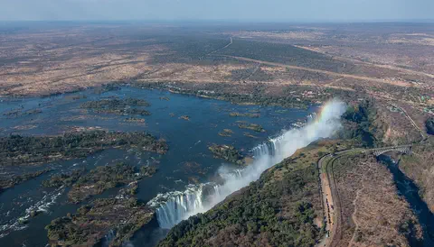
Victoria Falls, on the Zambezi River between Zambia and Zimbabwe, is about 1,708 meters wide and up to 108 meters deep. UNESCO calls it the largest curtain of falling water in the world, and its spray can be seen from tens of kilometers away.
For parents & teachers
What children will learn
- Locate Mount Nyiragongo north of Lake Kivu in the Democratic Republic of the Congo.
- Explain what a lava lake is.
- Describe why very runny lava can be dangerous when it escapes.
- Explain how scientists and satellites monitor volcanoes.
Recommended ages: 3 to 17 · About 15 minutes
Talk about it
- Why might a runny lava travel farther and faster than a thick one?
- How can satellites help people who live near a volcano?
- Why do you think a city grew so close to an active volcano?
Try at home or in class
- Race 'lavas' down a tilted tray: drip honey and water side by side and time them. Runny lava, like water, moves much faster than thick lava, like honey.
- Warm a spoonful of chocolate until it melts, then let it cool on a plate and watch a dark skin form on top, like the crust on a lava lake (with a grown-up).
Key vocabulary: lava lake, stratovolcano, crater, rift, flank, observatory
Where these facts come from
- Wikidata , Wikimedia Foundation (CC0 1.0)
- Nyiragongo , Smithsonian Institution, Global Volcanism Program
- Mount Nyiragongo , Encyclopaedia Britannica
- The eruption of Mount Nyiragongo (2021) , JAXA Earth Observation Research Center
- Wikimedia Commons , Wikimedia Foundation (Per file (public domain, CC0, CC BY or CC BY-SA); see each media record)
Checked, not yet human-reviewed. Last updated October 27, 2026. Spotted a mistake? Tell us.