
City Asia
Ho Chi Minh City
Ho Chi Minh City is the biggest city in Vietnam. It used to be called Saigon. It is warm all year, and lots of people ride motorbikes.
Ho Chi Minh City, once called Saigon, is Vietnam's largest city and the economic heart of the country. It lies on the Saigon River, north of the Mekong Delta. Since merging with two neighboring provinces in 2025, it has more than 14 million people, and in 2024 it opened its first metro line.
Ho Chi Minh City, known as Saigon until 1976, grew from a 17th-century Vietnamese settlement into the capital of French Cochinchina and then of South Vietnam. Renamed by the National Assembly on July 2, 1976, it is Vietnam's largest city; a merger on July 1, 2025 tripled its area to about 6,770 km² and raised its population above 14 million.
Photo: Clay Gilliland, CC BY-SA 2.0, via Wikimedia Commons
Discover Ho Chi Minh City
Ho Chi Minh City is the biggest city in Vietnam.
Its old name is Saigon. A river winds through it. The weather is warm all year, and the streets are full of motorbikes.
Ho Chi Minh City is the largest city in Vietnam and the economic heart of the country's south. It lies on the Saigon River, north of the Mekong River delta and about 80 kilometers from the South China Sea. For a long time it was called Saigon, and many people still use that name.
Before 2025 the city had more than 9.9 million people. On July 1, 2025, it joined with two neighboring provinces, Binh Duong and Ba Ria–Vung Tau. Now more than 14 million people live within its borders, more than in any other place in Vietnam.
Ho Chi Minh City lies on the Saigon River north of the Mekong delta, about 80 km from the South China Sea, with the old commercial center of Cho Lon immediately to the west. Vietnam's tourism board calls it the economic heart of Vietnam and the main hub of the south.
On July 1, 2025, as Vietnam reorganized its provinces into 34 units, the city merged with Binh Duong and Ba Ria–Vung Tau provinces. Its area more than tripled to over 6,770 km² and its population rose from more than 9.9 million to more than 14 million, the largest of any locality in Vietnam, with a density of nearly 2,070 people per km². The merger plan casts the core city as a center for finance, high technology and innovation.
- Country
- Vietnam (largest city)
- People in the city (2025)
- more than 14 million
- Area since July 1, 2025
- about 6,770 km²
- Name since
- July 2, 1976 (before: Saigon)
Famous places
Ho Chi Minh City has a big palace with a garden and a fountain.
There is a busy market called Ben Thanh. There is a big old cathedral. And there is a skyscraper with 81 floors!
On one walk along Dong Khoi Street you can see the Notre Dame Cathedral, the Central Post Office and the old Saigon Opera House. Many buildings in the center date from the time when France ruled the city. Nearby is Ben Thanh Market, one of the city's best-known places to shop.
The Independence Palace stands in a big park with a lawn and a fountain. Today it is a historic site and museum with more than 3,700 objects. Rising high above the river is Landmark 81, a skyscraper with 81 stories, the largest building in Vietnam.
Britannica notes that the city keeps the faded look of a European city, with many Western-style buildings from French colonial rule. Along Dong Khoi Street stand the Notre Dame Cathedral Basilica, the Central Post Office and the Saigon Opera House; the old opera house served for 20 years as the National Assembly building before being converted to a national theater. Ben Thanh Market lies at the center, and in Cho Lon, the historic Chinese neighborhood, Binh Tay Market is a vast wholesale center.
On the site of the Independence Palace, the French began a palace in 1868 as the residence of the Governor of Cochinchina, named Norodom Palace. The Independence Palace is now a special national historical site, recognized in 1976 and among the first ten so classified in 2009, with more than 3,700 artifacts and works of art. The 81-story Vincom Landmark 81 is Vietnam's largest building.
- Independence Palace site
- palace begun 1868; national historical site
- Landmark 81
- 81 stories, Vietnam's largest building
- Ben Thanh Market
- a famous market in the center
From Saigon to Ho Chi Minh City
Long ago, this land was part of Cambodia.
Vietnamese people came here about 400 years ago. Later, people from France ruled the city and built wide streets. Today the city has a new name, Ho Chi Minh City.
For a long time, the land where the city stands was part of the kingdom of Cambodia. Vietnamese settlers arrived in the 1600s, and the city's museum counts Saigon's history from 1698. French traders came in the 1700s.
In 1859 France captured the town, and from 1862 Saigon was the capital of the French colony of Cochinchina. The French built villas, grand public buildings, tree-lined boulevards and railways, and Saigon became the main port for shipping rice from the Mekong Delta. On July 2, 1976, the city was given its present name, Ho Chi Minh City.
The area was long part of the kingdom of Cambodia; the Vietnamese gained entry in the 17th century, and the Ho Chi Minh City Museum counts the city's history from 1698. French traders and missionaries settled in the 18th century. France captured the town in 1859, and Emperor Tu Duc ceded it in 1862. As capital of Cochinchina, Saigon became a major port, the main collecting point for Mekong Delta rice exports, with villas, imposing public buildings, tree-lined boulevards and railways north and south.
Japan occupied Saigon in 1940, though the city itself was largely unaffected by World War II. After 1945 came the First Indochina War, which ended at the 1954 Geneva conference with Vietnam divided into northern and southern zones; Saigon became the capital of South Vietnam (1954–75) and received many refugees from the north. During the Vietnam War it was the headquarters of U.S. military operations. On April 30, 1975, North Vietnamese troops captured the city, and on July 2, 1976, the National Assembly renamed Saigon–Gia Dinh as Ho Chi Minh City, after President Ho Chi Minh.
Getting around Ho Chi Minh City
Lots and lots of people in Ho Chi Minh City ride motorbikes.
Now there is a new train too. It runs above the streets and under the ground. A big airport is close to the middle of the city.
Ho Chi Minh City is known for its busy traffic, and riding on the back of a motorbike is a popular way to see the city. In 2024 the city opened its very first metro line. Line 1 runs 19.7 kilometers from Ben Thanh Market in the center to Suoi Tien in Thu Duc, and it is the first of eight planned lines.
Tan Son Nhat International Airport, Vietnam's busiest airport, is only about 7 kilometers from the center. Taxis, ride-hailing cars and city buses link it with the rest of the city.
Metro Line 1 began commercial operation on December 22, 2024, after 17 years of planning and construction: the city's first metro line (Hanoi's first line had opened in 2021). Its 19.7 km run from Ben Thanh Market to Suoi Tien Theme Park in Thu Duc is the first of eight planned routes, built with Japanese cooperation; at first it ran about 200 trips a day from 5 a.m. to 10 p.m., free for its first month.
Vietnam's tourism board describes the city as vibrating with traffic, and motorbikes fill its streets. Tan Son Nhat International Airport, the country's busiest, lies about 7 km from the center. Since French colonial times the city has been a port and railway hub, with lines running north and south.
- Metro Line 1
- opened December 22, 2024; 19.7 km
- Tan Son Nhat International Airport
- about 7 km from the center
Weather and seasons
Ho Chi Minh City is hot all year long.
It has a dry season and a rainy season. In the rainy season, short showers come in the afternoon.
Ho Chi Minh City is warm to hot all year round. Even in January, highs average about 32 °C and lows about 23 °C. The hottest month is May, with highs of about 35 °C.
Instead of summer and winter, the city has a dry season and a rainy season. From December to April the days are sunny and less humid. From May to November, short afternoon showers are common, and September is the wettest month. In all, about 1,650 millimeters of rain fall in a year.
World Meteorological Organization normals for 1991–2020 show little change through the year: mean daily maxima and minima of 32.0 °C and 23.4 °C in January and 34.9 °C and 26.4 °C in May, the hottest month. The real contrast is in rain: monthly totals add up to about 1,653 mm, with only about 8 mm and one rain day in February but about 273 mm and 18 rain days in September.
Vietnam's tourism board describes the dry season (December to April) as sunny and less humid, and the May-to-November rainy season as one of short afternoon showers.
- January, average daily high and low
- about 32 °C and 23 °C
- May, average daily high and low
- about 35 °C and 26 °C
- Rainfall in a year
- about 1,650 mm
Living in Ho Chi Minh City
People in Ho Chi Minh City love to eat outdoors.
They gather at little metal tables on the sidewalk. They eat sandwiches called bánh mì and savory pancakes. There are big, busy markets too.
Many people in Ho Chi Minh City enjoy eating at small metal tables set up on the sidewalk. Favorite foods include bánh mì sandwiches, bánh xèo, savory pancakes, and cơm tấm, broken rice. In the evening, sidewalk sellers fill the streets.
Cho Lon, the city's old Chinese neighborhood, is a great place to explore on foot, with the huge Binh Tay Market. Old apartment and office buildings in the center have been turned into shopping centers full of small stores.
Vietnam's tourism board highlights the city's roadside eating culture, with dishes such as bánh mì, southern-style savory pancakes (bánh xèo) and broken rice (cơm tấm), and evening sidewalk vendors. Cho Lon, the Chinese neighborhood west of the center, is known for Binh Tay Market, a colossal wholesale center, and in District 1 decades-old apartments and offices have been repurposed as shopping centers.
Britannica notes that after 1975 many businesses closed or were disrupted, and that a state-run handicraft enterprise exports furniture, carpets and lacquer paintings made largely from local materials. The University of Saigon was reorganized as the University of Ho Chi Minh City, and the old Cercle Sportif club of 1912 became a people's museum. Under the 2025 merger plan, the core city focuses on finance, high technology, research and education, Binh Duong on modern industrial manufacturing and Ba Ria–Vung Tau on logistics, seaports and energy.
- Street food to try
- bánh mì, bánh xèo, cơm tấm
Ho Chi Minh City on the map
Find Ho Chi Minh City on the globe.
It is in the south of Vietnam, in Asia. Look for the big Mekong River near the sea. The city is just to the north.
Ho Chi Minh City is in southern Vietnam, in Southeast Asia. It lies on the Saigon River, just north of the delta where the great Mekong River spreads out into many branches before reaching the sea.
The city center is about 80 kilometers from the South China Sea. Since 2025, the city also includes Ba Ria–Vung Tau, with its deep-water seaports.
Ho Chi Minh City lies at about 10.8° N and 106.7° E on the Saigon River, north of the Mekong delta and about 80 km from the South China Sea, with Cho Lon immediately west of the old center.
The 2025 merger joined it to Binh Duong, planned as a center of modern manufacturing with dozens of large industrial zones, and Ba Ria–Vung Tau, planned as a center for logistics, seaports and energy because of its deep-water ports.
- Latitude
- about 10.8° north
- Longitude
- about 106.7° east
- Distance to the South China Sea
- about 80 km
Amazing facts
-
Ho Chi Minh City's first metro train opened in 2024.
Metro Line 1, the city's first metro line, opened on December 22, 2024. Riders traveled free for the first month.
Metro Line 1, opened December 22, 2024 after 17 years of planning and construction, was the city's first metro line; service was free from December 22 to January 20, 2025.
-
In 2025 the city grew three times bigger in one day!
On July 1, 2025, the city joined two neighboring provinces, and its area more than tripled to over 6,770 square kilometers.
After merging with Binh Duong and Ba Ria–Vung Tau on July 1, 2025, the city's area more than tripled, while its population grew by less than one and a half times.
-
Ships once carried rice from here all over the world.
Under French rule, Saigon became the main port for shipping rice grown in the Mekong Delta.
As capital of Cochinchina, Saigon became the principal collecting point for the export of Mekong Delta rice, served by railway lines north and south.
-
A palace in the city is now a museum full of old things.
The Independence Palace keeps more than 3,700 historical objects and works of art.
The Independence Palace collection holds more than 3,700 historical artifacts and works of art from the Norodom Palace period to the present.
Words to know
- delta
- flat land at the mouth of a river, where it splits into many channels before the sea
- metro
- a city railway, often running underground or on raised tracks
- colony
- a land ruled by a faraway country
- merge
- to join together into one
- dry season
- the months of the year when little rain falls
- rainy season
- the months of the year when most of the rain falls
- bánh mì
- a Vietnamese sandwich, a favorite street food
Discovery challenge
-
What was Ho Chi Minh City called before?
What was Ho Chi Minh City's name before 1976?
Before the National Assembly renamed it on July 2, 1976, the city was known as what?
- Saigon
- Hanoi
- Bangkok
Show the answer
Saigon
Saigon! Many people still use that name.
Saigon. It was renamed Ho Chi Minh City in 1976.
Saigon (officially Saigon–Gia Dinh at the time of the renaming).
-
Which great river spreads out near the city?
Ho Chi Minh City lies just north of the delta of which great river?
Ho Chi Minh City lies north of which river's delta, whose rice it once shipped abroad?
- The Mekong
- The Nile
- The Danube
Show the answer
The Mekong
The Mekong! It splits into many branches near the sea.
The Mekong. The city itself sits on the Saigon River.
The Mekong: under French rule Saigon was the main collecting point for Mekong Delta rice exports.
-
What new kind of train opened in the city in 2024?
What opened in Ho Chi Minh City on December 22, 2024, the first of its kind in the city?
What first for the city began commercial operation on December 22, 2024?
- A metro line
- A steam railway
- A cable car to the sea
Show the answer
A metro line
A metro! It carries people across the city.
Metro Line 1, 19.7 kilometers long, the city's first metro line.
Metro Line 1, Ben Thanh to Suoi Tien, the first of eight planned routes.
-
Which months are the dry season in Ho Chi Minh City?
When is the dry season in Ho Chi Minh City?
Which months make up Ho Chi Minh City's dry season?
- December to April
- May to November
Show the answer
December to April
December to April! Then the rain comes.
December to April. From May to November, short afternoon showers are common.
December to April; February averages only about 8 mm of rain, September about 273 mm.
-
What is a bánh mì?
What is bánh mì, a favorite street food in Ho Chi Minh City?
Which of these is bánh mì, one of the city's roadside foods?
- A sandwich
- A soup
- A drink
Show the answer
A sandwich
A sandwich! People eat it at sidewalk tables.
A sandwich, one of the city's favorite street foods.
A sandwich; other local favorites include bánh xèo pancakes and cơm tấm, broken rice.
Nearby places
-
 Watch
Landmark
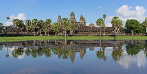
Angkor Wat
Angkor Wat, near the town of Siem Reap in Cambodia, was built in the 12th century by the Khmer king Suryavarman II. Britannica (2026) calls it the world's largest religious structure. It was built as a Hindu temple and later became a Buddhist place of worship.
-
Watch
Landmark
Angkor
Angkor, in northwestern Cambodia, was the capital of the Khmer Empire from the 9th to the 15th century. Its kings built city after city here, with scores of temples, such as Angkor Wat and the Bayon, and giant reservoirs and canals to water the rice fields. Today it covers about 400 square kilometers, and more than 100,000 people live in villages inside it.
-
 Watch
Natural wonder
Son Doong Cave
Son Doong is a cave in the mountains of central Vietnam, inside Phong Nha–Ke Bang National Park. A river carved it, and its main passage is so wide and tall that a whole city block of skyscrapers could fit inside. Explorers first went in only in 2009. UNESCO says it holds the world's largest documented cave passage.
-
 Watch
City
Bangkok
Bangkok, the capital of Thailand, lies on the delta of the Chao Phraya River, about 40 kilometers from the sea. It became the capital in 1782, when the new royal palace and temples were built. Once called the 'Venice of the East' for its canals, it is now a huge, busy city with skyscrapers and an elevated railway.
-
 Watch
Natural wonder
Phong Nha–Ke Bang National Park
Phong Nha–Ke Bang National Park, in central Vietnam near the border with Laos, protects one of the world's great limestone landscapes. UNESCO says its rocks began forming about 400 million years ago, and more than 220 kilometers of caves and underground rivers have been mapped. One of them, Son Doong, holds the world's largest known cave passage.
-
 Watch
Landmark
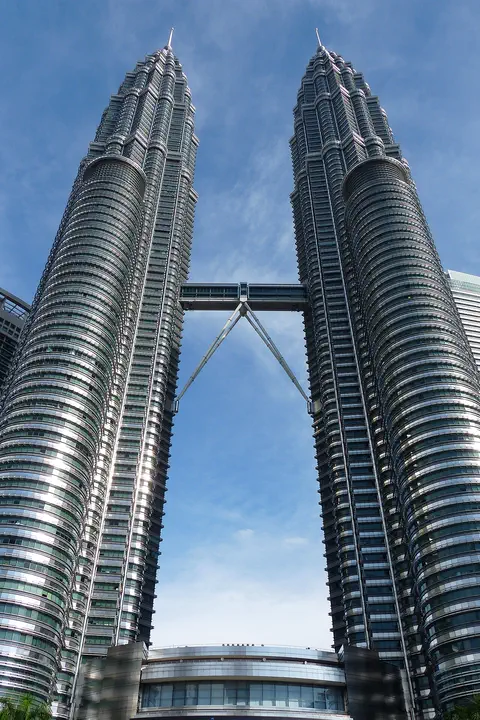
Petronas Towers
The Petronas Twin Towers in Kuala Lumpur, Malaysia, are two matching skyscrapers 452 meters tall, finished in 1998. Seen from above, each floor is shaped like an eight-pointed star, a pattern from Islamic art. A two-story skybridge joins them 170 meters above the ground, and from 1996 to 2003 they were counted as the tallest buildings in the world.
-
 Watch
Natural wonder
Ha Long Bay
Ha Long Bay is a bay in northeast Vietnam where more than a thousand limestone islands rise straight out of the sea. Over millions of years, water dissolved the limestone into towers and caves, and then the sea flooded in around them. Together with the nearby Cat Ba Archipelago it is a World Heritage site.
-
 Watch
City
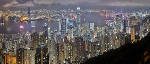
Hong Kong
Hong Kong, on the south coast of China, grew around one of the world's great natural harbors. It was a British colony for 156 years and has been a special administrative region of China since 1997. About 7.5 million people lived there in mid-2026.
Explore next
-
Watch
 Country
Vietnam
Vietnam stretches about 1,650 kilometers along the coast of Southeast Asia, with mountains in the west and two great river deltas, the Red River in the north and the Mekong in the south. About 102.3 million people lived there in 2025. Its capital is Hanoi, and its largest city is Ho Chi Minh City.
-
 Watch
Life around the world
Breakfast noodles in Hanoi
Pho is a soup of rice noodles, meat and a fragrant broth, and in Vietnam it is mostly eaten for breakfast. In Hanoi, near where pho is thought to have begun, cooks focus on a clear broth simmered with bones, meat, ginger, shallots and spices, served at street stalls from early morning.
-
Watch
City
Bangkok
Bangkok, the capital of Thailand, lies on the delta of the Chao Phraya River, about 40 kilometers from the sea. It became the capital in 1782, when the new royal palace and temples were built. Once called the 'Venice of the East' for its canals, it is now a huge, busy city with skyscrapers and an elevated railway.
-
 Watch
City
Jakarta
Jakarta, Indonesia's largest city and its capital, lies on the northwest coast of the island of Java, where the Ciliwung River meets the Java Sea. About 11 million people live there (2025). Indonesia is building a new capital called Nusantara, but under the law Jakarta stays the capital until the president signs a decree moving it.
-
 Watch
City
Ankara
Ankara is the capital of Türkiye, in the interior of Anatolia, about 200 kilometers from the Black Sea. People have lived here since the Stone Age, and Romans, Byzantines, Seljuks and Ottomans all left buildings behind. It became the capital in 1923, and today it is a city of government, universities and museums.
-
 Watch
City
Baghdad
Baghdad, the capital of Iraq, stands on the Tigris River in the land once called Mesopotamia. It was founded in 762 as a round city, and for about 500 years it was one of the greatest cities in the world and a great center of learning, where scholars studied math, medicine and the stars. Today it is Iraq's largest city.
-
 Watch
City
Baku
Baku, the capital of Azerbaijan, curves around a bay on the Caspian Sea, the world's largest inland body of water. Its old walled town, with the Maiden Tower and a palace of the Shirvan shahs, is a World Heritage Site, and oil has made the city important for more than 150 years.
-
 Watch
City
Beijing
Beijing, the capital of China, has been the country's capital for most of the last 600 years. At its heart is the Forbidden City, the emperors' palace. About 21.8 million people lived in the Beijing municipality at the end of 2024.
For parents & teachers
What children will learn
- Locate Ho Chi Minh City on the Saigon River near the Mekong Delta in southern Vietnam.
- Explain that the city was called Saigon and was renamed in 1976.
- Describe a tropical climate with a dry season and a rainy season.
- Discuss how cities change their borders, as Ho Chi Minh City did in 2025.
Recommended ages: 3 to 17 · About 15 minutes
Talk about it
- Ho Chi Minh City opened its first metro in 2024. How might a new train line change the way people live and work?
- In 2025 the city joined with two neighboring provinces. What might change when places join together?
- Instead of summer and winter, the city has a dry season and a rainy season. Which seasons does your town have?
Try at home or in class
- Make a two-column chart of the dry season and the rainy season, then color the months: December to April yellow, May to November blue.
- Draw a river splitting into many branches as it nears the sea, like the Mekong Delta, and mark Ho Chi Minh City just to the north.
Key vocabulary: delta, metro, colony, merge, dry season, rainy season, bánh mì
Where these facts come from
- Wikidata , Wikimedia Foundation (CC0 1.0)
- Natural Earth vector data , Natural Earth (NACIS) (Public domain)
- Ho Chi Minh City , Encyclopaedia Britannica
- Proud of the city named after Uncle , Ho Chi Minh City Museum
- Ho Chi Minh City becomes most populous locality after merger , Dan Tri International (DTiNews)
- HCM City ready for operation of new government apparatus from July 1 , VnEconomy
- Vietnam's first metro line put into commercial operation , VnEconomy
- Ho Chi Minh City , Vietnam National Authority of Tourism (vietnam.travel)
- Independence Palace , Independence Palace (Reunification Hall), official site
- Ho Chi Minh City: climatological information , World Meteorological Organization, World Weather Information Service
- Resolution 202/2025/QH15 on the reorganization of provincial-level administrative units (English text) , National Assembly of Vietnam, via LuatVietnam
- First metro line begins operation (Cat Linh–Ha Dong, Hanoi) , Viet Nam Government Portal, Ha Noi Capital, November 7, 2021
- Wikimedia Commons , Wikimedia Foundation (Per file (public domain, CC0, CC BY or CC BY-SA); see each media record)
Checked, not yet human-reviewed. Last updated October 27, 2026. Spotted a mistake? Tell us.