
Natural wonder Asia
Taal Volcano
Taal Volcano is an island in a lake in the Philippines. There is another lake inside its crater!
Taal Volcano is a volcanic island in Taal Lake, on the island of Luzon in the Philippines. The lake fills a much bigger caldera, and a lake fills the island's own main crater. It is one of the Philippines' most active volcanoes.
Taal is a complex volcano: multiple stratovolcanoes, cones and craters have grown together into the 5-km-wide Volcano Island, which rises from Taal Lake inside the broader Taal caldera (NASA). All recorded eruptions have come from Volcano Island, and UPRI counts 47 cones and craters besides the main crater.
Photo: TheCoffee (Mike Gonzalez), CC BY-SA 3.0, via Wikimedia Commons
Discover Taal Volcano
Taal Volcano is in the Philippines. It is an island in the middle of a lake.
In this photo from high above, you can see a lake inside the volcano's crater.
NASA says Taal Volcano, in the south of Luzon, is not a single cone. Many volcanoes, hills and craters have grown together to make Volcano Island, about 5 kilometers wide. The island rises from Taal Lake, which fills a much broader hollow called the Taal caldera.
This photo by Mike Gonzalez, taken from an airplane on 22 December 2012, shows Volcano Island from above: the Main Crater Lake in the middle, green slopes and fields around it, and Taal Lake all around.
NASA Earth Observatory describes Taal as complex: multiple stratovolcanoes, conical hills and craters have grown together into the 5-km-wide Volcano Island, one of the Philippines' most volcanically active areas, rising from the north-central side of Taal Lake inside the much broader Taal caldera.
The photo (TheCoffee (Mike Gonzalez), CC BY-SA 3.0, 22 December 2012, from an airplane) shows the island from above with the Main Crater Lake at its center and Taal Lake around it.
- Volcano Island width
- about 5 km
- Cones and craters on the island
- 47, besides the main crater
- Island
- Luzon, Philippines
Islands and lakes, one inside another
A lake has an island in it. That island has a lake. That lake has a tiny island!
Volcanoes made all of it.
In the center of Volcano Island, the Main Crater Lake fills the old crater floor, and one rocky piece of that floor still pokes out. So there is an island in a lake, on an island, in a lake. NASA says it is among the world's largest islands of this kind.
Scientists at the University of the Philippines say Taal Lake was once part of Balayan Bay, an arm of the sea, until eruptions cut it off. Its water was salty in the late 1500s and slowly became fresh.
Main Crater Lake fills the old crater floor, from which one rocky remnant still emerges: an island in a lake on an island in a lake on an island, which NASA calls among the world's largest of its kind. After the January 2020 eruption the crater lake dried up for a time and refilled by March 2020 (UPRI).
UPRI: scientific evidence indicates the caldera lake was part of Balayan Bay before eruptions separated it from the sea; its water was notably salty in the late 16th century and, isolated as a catchment, became fresh. UPRI classes Taal Lake as a caldera and Volcano Island as a cone-maar complex on the Luzon-Bataan-Mindoro Arc.
An active volcano
Taal erupts from time to time. Scientists watch it closely.
Sometimes steam and ash shoot high into the sky.
NASA says all recorded eruptions of Taal have come from Volcano Island. In September 1965 a strong two-day eruption hit the island's southwest side, and in January 2020 an eruption sent a plume of steam, gas and ash 10 to 15 kilometers high.
The Philippine volcano agency, PHIVOLCS, uses alert levels to show how active Taal is.
The September 1965 eruption on the southwest side rated VEI 4; Binintiang Malaki, the largest flank cone, formed in 1707 (VEI 2), and smaller 1970s explosions reshaped the 1965 crater (NASA). The 12 January 2020 eruption sent a plume of steam, gas and tephra 10-15 km high (VEI 4), with further activity in 2021, 2022 and 2024 (UPRI).
PHIVOLCS raised the alert level to 2 (on a 0-5 scale) in April 2011 after rising seismicity and lake temperature, and lowered it that July (NASA).
Sea fish that became lake fish
Some fish in Taal Lake once lived in the sea.
The tawilis is a sardine that lives only in this lake.
When Taal Lake was cut off from the sea and slowly turned fresh, many sea creatures adapted. UPRI says some became freshwater kinds found only in the lake.
One is the tawilis, which UPRI calls the only freshwater sardine in the world. Another is the maliputo, a freshwater form of a sea fish called talakitok.
As the lake became fresh, many marine creatures adapted, eventually becoming freshwater variants exclusive to it (UPRI). These endemic forms include the tawilis (Sardinella tawilis), described by UPRI as the only freshwater sardine in the world, and the maliputo (Caranx ignobilis), the freshwater variant of a saltwater fish known locally as talakitok.
The island's slopes, as the photo shows, are green with plants and patches of fields.
Staying safe near a volcano
Volcanoes can be dangerous.
Always listen to the grown-ups in charge and to safety warnings.
Taal is one of the Philippines' most active volcanoes, so its alert level can change. The CDC says to follow the advice of local officials about volcanoes, and to be ready to leave the area or take shelter if they say so.
PlayOwl's advice: on boats, wear a life jacket and stay close to your grown-up. The CDC says children near water need close, constant supervision.
CDC volcano guidance: follow local officials' advice on preparing for an eruption and, if necessary, on evacuating or sheltering; make a plan for both. CDC drowning guidance: drowning happens in seconds and is often silent; children need close and constant supervision near water.
PlayOwl's advice: check PHIVOLCS alert levels before any visit and obey closures.
Amazing facts
-
Taal has an island in a lake, on an island, in a lake!
A rocky island in Taal's Main Crater Lake is, NASA says, among the world's largest islands in a lake on an island in a lake on an island.
A rocky remnant of the old crater floor rises from Main Crater Lake; NASA counts it among the world's largest islands in a lake on an island in a lake on an island.
-
A sardine that lives in fresh water swims in Taal Lake.
The tawilis of Taal Lake is, scientists at the University of the Philippines say, the only freshwater sardine in the world.
Sardinella tawilis, endemic to Taal Lake, is described by UPRI as the world's only freshwater sardine.
-
Taal Lake used to be part of the sea.
Taal Lake was once part of Balayan Bay. Eruptions cut it off, and its salty water slowly became fresh.
The caldera lake was part of Balayan Bay before eruptions separated it from the sea; it was still notably salty in the late 16th century (UPRI).
Words to know
- caldera
- a large hollow made when the ground over a volcano collapses
- crater lake
- a lake that fills a volcano's crater
- flank cone
- a small volcano on the side of a bigger one
- endemic
- found in only one place in the world
- alert level
- a number scale scientists use to tell people how active a volcano is
Discovery challenge
-
Where is Taal Volcano?
Where does Volcano Island rise from?
Volcano Island rises from which lake, which fills the Taal caldera?
- From Taal Lake
- From a desert
- From a glacier
Show the answer
From Taal Lake
From the middle of Taal Lake.
From Taal Lake.
Taal Lake (NASA).
-
What is in the middle of Taal's crater?
What fills the old crater floor in the center of Volcano Island?
What occupies the center of Volcano Island today?
- A lake
- A forest of pine trees
- A glacier
Show the answer
A lake
A lake!
The Main Crater Lake.
Main Crater Lake (NASA).
-
Which little fish lives only in Taal Lake?
Which fish of Taal Lake is called the only freshwater sardine in the world?
Which endemic species does UPRI call the world's only freshwater sardine?
- Tawilis
- Salmon
- Goldfish
Show the answer
Tawilis
The tawilis.
The tawilis.
Sardinella tawilis (UPRI).
-
What was Taal Lake long ago?
What was Taal Lake part of before eruptions cut it off?
Of which body of water was the caldera lake once part, according to UPRI?
- Part of the sea (Balayan Bay)
- A frozen glacier
- A sand desert
Show the answer
Part of the sea (Balayan Bay)
Part of the sea.
Balayan Bay, an arm of the sea.
Balayan Bay (UPRI).
-
In which country is Taal Volcano?
On which island of the Philippines is Taal Volcano?
Taal shapes the southern end of which Philippine island?
- Luzon, Philippines
- Java, Indonesia
- Honshu, Japan
Show the answer
Luzon, Philippines
The Philippines.
Luzon, in the Philippines.
Luzon (NASA).
Nearby places
-
 Watch
City
Quezon City
Quezon City is a city in Metro Manila, in the Philippines, northeast of the city of Manila. The 2024 census counted 3,084,270 people there. It has a large university, a big nature park, busy shopping districts and a very rainy season.
-
 Watch
City
Cagayan de Oro
Cagayan de Oro is a city in the north of Mindanao, one of the two biggest islands of the Philippines. The encyclopedia Larousse calls it a farm market and a center of gold mining. The Philippines' 2024 census counted 741,617 people in the city.
-
 Watch
Natural wonder
Mount Apo
Mount Apo, on the island of Mindanao, is the highest mountain in the Philippines. It is a volcano with hundreds of sulfur vents on its upper slopes, and its forests are a stronghold of the critically endangered Philippine eagle.
-
 Watch
City
Kaohsiung
Kaohsiung is a city on the southwest coast of Taiwan, with the largest international port on the island. The port's history says it began as a small fishing village, and it was opened to trade with other countries in 1863. The census of 1 November 2020 counted 2,734,275 people in Kaohsiung City.
-
 Watch
City
Hong Kong
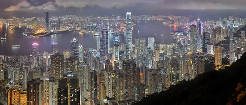
Hong Kong, on the south coast of China, grew around one of the world's great natural harbors. It was a British colony for 156 years and has been a special administrative region of China since 1997. About 7.5 million people lived there in mid-2026.
-
 Watch
City
Macau
Macau is a small city on the south coast of China. It was a busy trading port under Portuguese administration from the mid-1500s until 1999, when it came under Chinese sovereignty. Its historic center, where Chinese and Portuguese buildings mix, is a UNESCO World Heritage Site.
-
 Watch
Landmark
Taipei 101
Taipei 101 is a skyscraper in Taipei, Taiwan, 508 meters tall with its spire and 101 stories high. When it opened, it was the tallest building in the world. Inside hangs a 660-ton steel ball, a tuned mass damper, that helps steady the tower in typhoon winds and earthquakes.
-
 Watch
City
Taipei
Taipei is a big city in the north of Taiwan, in a flat basin with rivers and hills. Its tower, Taipei 101, is 508 meters tall. Trains of the Taipei Metro carry people around the city, and its night markets are famous for snacks. About 2.4 million people were registered in Taipei City in September 2026.
Explore next
-
Watch
Natural wonder
Mount Apo
Mount Apo, on the island of Mindanao, is the highest mountain in the Philippines. It is a volcano with hundreds of sulfur vents on its upper slopes, and its forests are a stronghold of the critically endangered Philippine eagle.
-
 Watch
 Country
Philippines
The Philippines is an island country in Southeast Asia, in the western Pacific Ocean. It has more than 7,000 islands, about 50 volcanoes and rich coral reefs, and about 112.7 million people were counted there in 2024.
- Watch Geography Types of volcanoes Volcanoes come in different shapes. Runny lava builds wide, gentle shield volcanoes like Mauna Loa. Sticky lava and ash build tall, steep stratovolcanoes like Mount Fuji. Small cinder cones grow from bits of lava thrown into the air. Whether lava is runny or sticky, and how much gas it holds, decides the shape and how explosive the eruptions are.
-
 Watch
Natural wonder
Mount Everest
Mount Everest, in the Himalayas on the border of Nepal and China, is what Britannica calls the highest mountain in the world. In 2020 China and Nepal announced its height as 8,848.86 meters. It grew as two giant plates of Earth's crust pushed together, and it is still rising a tiny bit each year.
-
 Watch
Natural wonder
Mount Fuji
Mount Fuji, 3,776 meters high, is the highest mountain in Japan and an active volcano that last erupted in 1707. Its almost perfect cone was built by three volcanoes, one on top of another, and it has inspired artists for hundreds of years.
-
 Watch
Natural wonder
Ha Long Bay
Ha Long Bay is a bay in northeast Vietnam where more than a thousand limestone islands rise straight out of the sea. Over millions of years, water dissolved the limestone into towers and caves, and then the sea flooded in around them. Together with the nearby Cat Ba Archipelago it is a World Heritage site.
-
 Watch
Natural wonder
Dead Sea
The Dead Sea is a salt lake in the Middle East, with Jordan on its eastern shore and the Palestinian West Bank along part of its western shore. Its surface lies far below sea level, about 435 meters down in 2019, and its water is nearly ten times saltier than the ocean, so swimmers bob on top without trying.
-
 Watch
Natural wonder
Lake Baikal
Lake Baikal, in southern Siberia, Russia, fills a deep crack in the Earth's crust where the land is pulling apart. UNESCO calls it the oldest and deepest lake in the world, about 25 million years old, and it holds about a fifth of the world's unfrozen fresh water. Many of its animals, like the Baikal seal, live nowhere else.
For parents & teachers
What children will learn
- Locate Taal Volcano in southern Luzon, Philippines.
- Explain how a caldera lake and a crater lake form.
- Describe how sea fish adapted when Taal Lake became fresh.
- Explain what volcano alert levels are for.
Recommended ages: 3 to 17 · About 15 minutes
Talk about it
- How can a lake that was once part of the sea become fresh water?
- Why might a fish that lives in only one lake need protection?
- Why do scientists keep watching a volcano even when it is quiet?
Try at home or in class
- Draw Taal as nested circles: lake, island, crater lake and the tiny rocky island inside it.
- On a map of the Philippines, find Luzon, Manila and Taal Lake.
Key vocabulary: caldera, crater lake, flank cone, endemic, alert level
Where these facts come from
- Wikidata , Wikimedia Foundation (CC0 1.0)
- Volcano Island of Taal , NASA Earth Observatory
- Taal: Philippine Active Volcano Profile , University of the Philippines Resilience Institute (UPRI)
- Staying Safe During a Volcanic Eruption , US Centers for Disease Control and Prevention
- Preventing Drowning , US Centers for Disease Control and Prevention
- File:Taal Volcano aerial 2013.jpg , Wikimedia Commons
- Wikimedia Commons , Wikimedia Foundation (Per file (public domain, CC0, CC BY or CC BY-SA); see each media record)
Checked, not yet human-reviewed. Last updated November 1, 2026. Spotted a mistake? Tell us.