
City Asia
Taipei
Taipei is a big city in the north of Taiwan. It has a very tall tower called Taipei 101. People love its night markets full of food.
Taipei is a big city in the north of Taiwan, in a flat basin with rivers and hills. Its tower, Taipei 101, is 508 meters tall. Trains of the Taipei Metro carry people around the city, and its night markets are famous for snacks. About 2.4 million people were registered in Taipei City in September 2026.
Taipei lies in the northeastern part of the Taipei Basin, where the Tamsui, Xindian and Keelung rivers meet, and New Taipei City surrounds it on every side. It grew from riverside trading towns such as Mengjia and Dadaocheng and became a walled prefecture city in the 1880s. Taiwan's government meets here. The Department of Civil Affairs counted 2,418,872 registered residents in September 2026.
Photo: Heeheemalu, CC BY-SA 4.0, via Wikimedia Commons
Discover Taipei
Taipei is a big city in the north of Taiwan. Rivers flow through it, and hills rise around it.
Taiwan's government meets in Taipei.
Taipei is in the north of the island of Taiwan. It sits in the Taipei Basin, a low, flat area with rivers winding across it, ridges, and old volcanoes to the north. Another big city, New Taipei City, wraps all the way around it.
Taipei City covers about 272 square kilometers and has 12 districts. In September 2026, 2,418,872 people were registered as living there. Taiwan's government meets in the city.
Taipei City lies in the northeastern part of the Taipei Basin, which the Taipei City Government describes as a basin formed by fault movement and shaped by erosion from the Tamsui River and its tributaries. Its land falls into three types: the basin floor, ridges along thrust faults, and the Datun volcanoes in the north. New Taipei City borders it on all sides.
The city covers 271.7997 km² in 12 administrative districts, a number fixed in a 1990 reorganization of 16 districts. The Department of Civil Affairs recorded 2,418,872 registered residents in September 2026, down from 2,704,974 in January 2016. Taiwan's government meets in Taipei.
- Located in
- Taiwan
- People registered in Taipei City (September 2026)
- 2,418,872
- Area
- 271.8 square kilometers, in 12 districts
- Rivers
- the Tamsui, Xindian and Keelung
A record-breaking tower and an old city gate
Taipei 101 is a very, very tall tower. It looks like big boxes stacked on top of each other.
Taipei also has an old stone city gate called the North Gate.
Taipei 101 stands in the Xinyi District. It is 508 meters tall and has 101 floors above the ground. It was built from 1999 to 2004, and the Council on Tall Buildings lists it as the tallest building in the world from 2004 to 2010. Near the top hangs a large steel ball, a damper that swings to steady the tower in strong winds.
The North Gate is much older. It was built in 1879 as one of five gates in the old city wall, and it is the only gate that still looks the way it did then.
Taipei 101 rises in eight-story sections that flare outward; the Council on Tall Buildings and Urban Habitat says they evoke a Chinese pagoda. Built from 1999 to 2004 to designs by C.Y. Lee & Partners, it is 508 m tall with 101 floors above ground, and it was the world's tallest building from 2004 to 2010. A tuned mass damper, a large spherical steel pendulum in a cavity near the top, offsets swaying from strong winds in a typhoon-prone region.
The North Gate (Cheng'en Gate), built in 1879, was one of five gates in the city wall and the main entrance toward Dadaocheng. During the period of Japanese rule the West Gate was demolished, and the others were later renovated; only the North Gate kept its original appearance and is a national monument.
- Taipei 101
- 508 m tall, 101 floors above ground, built 1999 to 2004
- Tallest building in the world
- 2004 to 2010 (Council on Tall Buildings)
- North Gate
- built in 1879; the only city gate that keeps its original look

From river towns to a walled city
Long ago, the Ketagalan people lived here. They hunted and fished.
Later, farmers came, and little river towns grew into a big city.
The Taipei Basin was home to the Ketagalan people, who hunted and fished there. From 1709, Han Chinese settlers began farming the land on a large scale, and villages grew. Mengjia, a riverside market town now called Wanhua, was the first place with real streets and markets. By the early 1800s it was Taiwan's third-largest port.
In the 1860s, Dadaocheng became a port for selling tea, especially oolong tea, to other countries. Taipei became a prefecture in 1875, and a wall around the city was finished in 1884. The wall was pulled down in 1905 to make room for roads.
The Taipei City Government's history describes the basin as the home of the Ketagalan, a Plains Indigenous group, before a land grant of 1709 began large-scale farming by Han Chinese settlers. Mengjia (today's Wanhua) formed the first street blocks and markets; by the early 19th century it was Taiwan's third port, after Tainan and Lugang. After Danshui Harbor opened in 1860, Dadaocheng became an export port and a center for processing oolong tea.
The Qing court set up Taipei Prefecture in 1875, and a walled city was completed in 1884. Under Japanese rule the walls were demolished in 1905 for roads. Taipei became a directly controlled municipality in July 1967, took in six neighboring townships a year later, and in 1990 its 16 districts were reorganized into 12.
- Taipei Prefecture set up
- 1875
- Walled city completed
- 1884 (walls pulled down in 1905)
- Directly controlled municipality
- since July 1967
A metro that began in 1996
Trains called the metro carry people all over Taipei.
The first metro trains had no driver at all!
The Taipei Metro opened its first line, the Muzha Line, on 28 March 1996. It was 10.5 kilometers long, and its trains ran without drivers. A year later the Tamsui Line opened. By August 2026 the metro had 5 lines and 118 stations on 132.5 kilometers of track.
Taoyuan International Airport is about an hour from Taipei. Around the city, people can ride the metro, city buses, taxis or bikes.
The Taipei Rapid Transit Corporation's chronicle records the opening of the Muzha Line on 28 March 1996 as Taiwan's first driverless medium-capacity rapid transit line (10.5 km), followed on 28 March 1997 by the Tamsui Line, Taiwan's first heavy-capacity line. The route network plan had been approved in 1986.
The corporation's network figures, updated 30 August 2026, list 5 lines (Wenhu, Tamsui-Xinyi, Songshan-Xindian, Zhonghe-Xinlu and Bannan), 118 stations and 132.5 km in operation. The longest, the line from Tamsui (Tamsui-Xinyi), runs 30.7 km with 29 stations. Taoyuan International Airport lies about an hour from the city.
- First metro line
- the Muzha Line, opened 28 March 1996
- Taipei Metro today
- 5 lines, 118 stations, 132.5 km in operation (August 2026)
- Main airport
- Taoyuan International Airport, about an hour away
Hot, wet summers and mild winters
Summer in Taipei is very hot. Winter is mild, not cold.
It rains a lot in Taipei, in every season.
Taipei has a subtropical monsoon climate, with very hot summers and mild winters. The Central Weather Administration's averages give July days of about 35 °C and nights of about 27 °C. In January, days average about 19 °C and nights about 14 °C.
Rain falls in every season, about 2,330 millimeters in a year. June is the wettest month, and typhoons can bring storms in summer and autumn.
Central Weather Administration normals for Taipei (1991–2020) give average highs and lows of 34.8 °C and 26.6 °C in July, the hottest month, and 19.4 °C and 14.2 °C in January. The city government links the seasons to the monsoons: a northeast monsoon in winter, a humid southwest monsoon in summer, and typhoons in summer and autumn.
The yearly average is 2,329.5 mm of rain on 163.3 days. June is the wettest month (345.0 mm), followed by August (337.8 mm) and September (315.2 mm); November is the driest (83.2 mm). Even so, rain falls on at least 12 days in every month of the year.
- January, average daily high and low (CWA, 1991–2020)
- 19.4 °C and 14.2 °C
- July, average daily high and low (CWA, 1991–2020)
- 34.8 °C and 26.6 °C
- Rain in a year (CWA, 1991–2020)
- 2,329.5 mm, on about 163 days
Night markets and steaming volcanoes
In the evening, people go to night markets. They eat snacks like oyster omelets and fried chicken.
Near the city are old volcanoes. Steam puffs out of the ground there!
Taipei is famous for its night markets. Raohe Street Tourist Night Market is the city's oldest designated tourist market, known for oyster vermicelli and pork rib soup. Ningxia Road Night Market sells oyster omelets and taro cakes, and Shilin Night Market is known for crispy fried chicken cutlets.
In the north of the city is Yangmingshan National Park. Its Mount Qixing (Seven Star Mountain), 1,120 meters high, is the highest peak in Taipei City. At Xiaoyoukeng, steam rises from vents in the ground, with sulfur crystals and hot springs nearby.
Taipei's tourism office describes Raohe Street as the city's oldest designated tourist night market (oyster vermicelli, herbal pork rib soup), Ningxia Road for traditional dishes such as oyster omelets, taro cakes and braised pork rice, and Shilin, near Jiantan Station, for fried chicken cutlets and sausages. Its 2011 audio guide called Shilin the largest night market in Taipei, with more than 500 stores and vendors.
In Yangmingshan National Park, Mount Qixing (Seven Star Mountain), 1,120 m, is Taiwan's tallest dormant volcano and the highest peak in Taipei City. At Xiaoyoukeng, at its northwestern foot, fumaroles, sulfur crystals, hot springs and landslide terrain come from post-volcanic activity, and the Taiwan Volcano Observatory-Tatun in the park monitors the Datun volcanoes.
- Oldest designated tourist night market
- Raohe Street Tourist Night Market
- Shilin Night Market (2011)
- the largest night market in Taipei, more than 500 stores and vendors
- Highest peak in Taipei City
- Mount Qixing, 1,120 m, in Yangmingshan National Park
Taipei on the map
Find Taiwan on the globe. It is an island near the east coast of Asia.
Taipei is at the top of the island, in the north.
Taipei is near the northern tip of Taiwan, an island in East Asia. The old parts of the city, with the North Gate and Dadaocheng, are in the west, close to the Tamsui River. Taipei 101 stands about 6 kilometers to the east, in the Xinyi District.
Xiangshan, also called Elephant Mountain, is a hill just east-southeast of Taipei 101, and Mount Qixing in Yangmingshan rises about 14 kilometers north-northeast of the North Gate.
Taipei lies at about 25.0° N and 121.6° E, in the northeast of the Taipei Basin, whose floor slopes down toward the northwest. The Tamsui, Xindian and Keelung rivers wind across the basin, and the Keelung River has the most strongly winding course of the three.
The old core is in the west: the North Gate, Taipei Main Station and, about 2 km north of the gate, Dihua Street in Dadaocheng. Taipei 101 stands about 5.6 km east-southeast of the North Gate, with Xiangshan about 1.4 km to its east-southeast. Shilin Night Market is about 4.6 km north-northeast of the gate, and Mount Qixing about 14 km north-northeast.
- Latitude
- about 25.0° north
- Longitude
- about 121.6° east
- Neighbor on every side
- New Taipei City
Amazing facts
-
A giant steel ball hangs near the top of Taipei 101. It helps keep the tower steady in the wind.
Taipei 101 has a tuned mass damper: a big steel ball that swings near the top of the tower to cancel out swaying in strong winds.
Taipei 101's tuned mass damper, a large spherical steel pendulum, hangs in a multi-story cavity near the top, where it best counters the forces from typhoon winds.
-
The very first metro trains in Taipei had no drivers!
Taipei's first metro line, the Muzha Line of 1996, was Taiwan's first rapid transit line with driverless trains.
The Muzha Line, opened on 28 March 1996, was Taiwan's first driverless medium-capacity rapid transit line; the Tamsui Line of 1997 was its first heavy-capacity line.
-
Long ago, ships from Taipei carried tea to faraway places.
After Danshui Harbor opened in 1860, Dadaocheng became a center for preparing and selling oolong tea.
Tea, above all oolong, became Dadaocheng's main export after the harbor opened, and the district filled with tea shops and foreign trading houses.
-
Near Taipei, warm steam comes out of the ground.
At Xiaoyoukeng in Yangmingshan National Park, steam puffs from vents called fumaroles, and sulfur crystals form there.
Xiaoyoukeng, about 805 m above sea level at the foot of Mount Qixing, is known for fumaroles, sulfur crystals, hot springs and landslide terrain formed by post-volcanic activity.
Words to know
- basin
- a low area of land with higher ground around it
- night market
- a street market that opens in the evening, with food stalls and shops
- damper
- a heavy weight that moves to reduce shaking or swaying in a building
- metro
- a fast train system that carries people around a city
- fumarole
- an opening in the ground near a volcano where steam and gases come out
- typhoon
- a very strong tropical storm in the western Pacific Ocean
Discovery challenge
-
What is the name of Taipei's very tall tower?
Which tower in Taipei is 508 meters tall?
Which Taipei tower, built from 1999 to 2004, was the world's tallest building from 2004 to 2010?
- The Eiffel Tower
- Taipei 101
- Big Ben
Show the answer
Taipei 101
Taipei 101!
Taipei 101, which has 101 floors above the ground.
Taipei 101, 508 m tall, in the Xinyi District.
-
What do people go to in the evening to eat snacks?
What kind of market is Taipei famous for?
Raohe Street, Ningxia Road and Shilin are all famous examples of which kind of Taipei market?
- Night markets
- Fish auctions
- Flower shows
Show the answer
Night markets
Night markets!
Night markets, full of snacks like oyster omelets and fried chicken.
Night markets; Raohe Street is the oldest designated tourist night market.
-
What drink did ships carry from old Taipei?
Which product made Dadaocheng an export port after 1860?
Which export, above all the oolong kind, made Dadaocheng a processing center after Danshui Harbor opened?
- Coffee
- Milk
- Tea
Show the answer
Tea
Tea!
Tea, especially oolong tea.
Tea, especially oolong.
-
What was special about Taipei's first metro trains?
What was special about the Muzha Line, opened in 1996?
What made the 1996 Muzha Line a first in Taiwan?
- They had no drivers
- They floated on water
- They were pulled by horses
Show the answer
They had no drivers
They had no drivers!
Its trains ran without drivers.
It was Taiwan's first driverless medium-capacity rapid transit line.
-
What comes out of the ground near Taipei's old volcanoes?
What rises from the fumaroles at Xiaoyoukeng?
What escapes from the fumaroles of the Datun volcanoes at Xiaoyoukeng?
- Snow
- Steam
- Sand
Show the answer
Steam
Steam!
Steam, with sulfur crystals nearby.
Steam and volcanic gases, from post-volcanic activity.
Nearby places
-
Watch
Landmark
Taipei 101
Taipei 101 is a skyscraper in Taipei, Taiwan, 508 meters tall with its spire and 101 stories high. When it opened, it was the tallest building in the world. Inside hangs a 660-ton steel ball, a tuned mass damper, that helps steady the tower in typhoon winds and earthquakes.
-
 Watch
City
Kaohsiung
Kaohsiung is a city on the southwest coast of Taiwan, with the largest international port on the island. The port's history says it began as a small fishing village, and it was opened to trade with other countries in 1863. The census of 1 November 2020 counted 2,734,275 people in Kaohsiung City.
-
 Watch
Landmark
Grand Canal
The Grand Canal is a huge system of man-made waterways in eastern China, running from Beijing in the north to Zhejiang province in the south. Parts were dug from the 5th century BC, and it was joined into one network in the 7th century AD. UNESCO calls it the longest and oldest canal in the world, and boats still use it today.
-
 Watch
City
Shanghai
Shanghai is China's most populous city, on the coast where the great Yangtze River meets the East China Sea. Once a small fishing village, it grew into one of the world's busiest seaports. About 24.9 million people lived in Shanghai in 2020, and the towers of Pudong rise across the Huangpu River.
-
 Watch
Landmark
Shanghai World Financial Center
The Shanghai World Financial Center is a 101-floor skyscraper in the Pudong district of Shanghai, China, finished in 2008. It is 492 meters tall and holds offices, a hotel and an observatory. Near its top, a huge opening 164 feet wide helps relieve the strong wind pressure on the tower.
-
 Watch
City
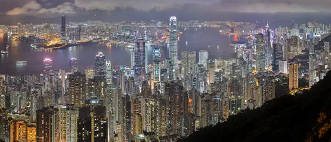
Hong Kong
Hong Kong, on the south coast of China, grew around one of the world's great natural harbors. It was a British colony for 156 years and has been a special administrative region of China since 1997. About 7.5 million people lived there in mid-2026.
-
 Watch
City
Guangzhou
Guangzhou, also known as Canton, is the capital of Guangdong Province in southern China. About 19.08 million people lived there in November 2025. For centuries it was a great port, and today its Canton Tower rises 600 meters.
-
 Watch
City
Macau
Macau is a small city on the south coast of China. It was a busy trading port under Portuguese administration from the mid-1500s until 1999, when it came under Chinese sovereignty. Its historic center, where Chinese and Portuguese buildings mix, is a UNESCO World Heritage Site.
Explore next
-
Watch
 Country
Taiwan
Taiwan is an island in the western Pacific Ocean, about 160 kilometers off the coast of southeastern China. Mountains cover about two-thirds of it, and most of its 23 million people live on the flatter west side. It has its own government, based in Taipei. The People's Republic of China, governed from Beijing, says Taiwan is part of China, and Taiwan's status is disputed.
-
Watch
Landmark
Taipei 101
Taipei 101 is a skyscraper in Taipei, Taiwan, 508 meters tall with its spire and 101 stories high. When it opened, it was the tallest building in the world. Inside hangs a 660-ton steel ball, a tuned mass damper, that helps steady the tower in typhoon winds and earthquakes.
-
Watch
City
Hong Kong
Hong Kong, on the south coast of China, grew around one of the world's great natural harbors. It was a British colony for 156 years and has been a special administrative region of China since 1997. About 7.5 million people lived there in mid-2026.
-
 Watch
City
Seoul
Seoul is the capital of South Korea, on the Han River. It became a capital in 1394, and its old palaces and city gates still stand among skyscrapers. About 9.7 million people lived there in 2020, and its subway is one of the main ways to get around.
-
Watch
City
Kaohsiung
Kaohsiung is a city on the southwest coast of Taiwan, with the largest international port on the island. The port's history says it began as a small fishing village, and it was opened to trade with other countries in 1863. The census of 1 November 2020 counted 2,734,275 people in Kaohsiung City.
-
 Watch
City
Quezon City
Quezon City is a city in Metro Manila, in the Philippines, northeast of the city of Manila. The 2024 census counted 3,084,270 people there. It has a large university, a big nature park, busy shopping districts and a very rainy season.
-
 Watch
City
Abu Dhabi
Abu Dhabi is the capital of the United Arab Emirates. It began in the 1700s as a small settlement around fresh water on an island, guarded by a coral-stone watchtower. Before oil, it relied on fishing and pearl diving; since the 1960s, money from oil has turned it into a city of towers. An official estimate gave the city about 1.75 million people in 2023.
-
 Watch
City
Almaty
Almaty is the main city of Kazakhstan, in the southeast of the country at the foot of the Ala-Tau mountains. It was founded in 1854 where a Kazakh village called Almaty, 'village of apple trees', stood. It was the capital until 1998, and about 2,387,900 people lived there on 1 September 2026.
For parents & teachers
What children will learn
- Locate Taipei near the northern tip of Taiwan, in the Taipei Basin.
- Describe how river ports and trade, such as tea, helped a city grow.
- Explain how a tall building can be made to resist strong winds.
- Read monthly temperature and rainfall averages to describe a wet subtropical climate.
Recommended ages: 3 to 17 · About 15 minutes
Talk about it
- Taipei grew from small towns beside rivers. Why do you think so many cities started next to rivers?
- Taipei's old city wall was pulled down to make room for roads. Was that a good idea? What would you keep?
- Night markets open in the evening. What would you sell or eat at a night market?
Try at home or in class
- Steady tower: build a tall tower from paper cups, hang a small weight from a string inside the top, and gently shake the table to see how it sways.
- River towns: draw a basin with three rivers meeting, then mark where you would build a market town and a port.
- Rain record: measure rain in a straight-sided jar for a week and compare it with Taipei's monthly averages.
Key vocabulary: basin, night market, damper, metro, fumarole, typhoon
Where these facts come from
- Wikidata , Wikimedia Foundation (CC0 1.0)
- Natural Earth vector data , Natural Earth (NACIS) (Public domain)
- The latest monthly population and number of households in each administrative district of Taipei City (CSV, to September 2026) , Department of Civil Affairs, Taipei City Government (Taiwan government open data platform)
- Geographical Overview , Taipei City Government
- History , Taipei City Government
- TAIPEI 101 , Council on Tall Buildings and Urban Habitat, The Skyscraper Center
- North Gate (audio guide) , Taipei Travel, Department of Information and Tourism, Taipei City Government
- Chronicles , Taipei Rapid Transit Corporation
- Network and Systems , Taipei Rapid Transit Corporation
- Savoring the Spirit: A Journey Through Taipei's Flavors , Taipei Travel, Taipei City Government
- Shilin Night Market (audio guide, 2011) , Taipei Travel, Taipei City Government
- About Taipei (SEDI 2020) , Institute of Earth Sciences, Academia Sinica
- Monthly mean maximum temperature, 1991–2020 , Central Weather Administration
- Monthly mean minimum temperature, 1991–2020 , Central Weather Administration
- Monthly mean precipitation, 1991–2020 , Central Weather Administration
- Monthly mean precipitation days, 1991–2020 , Central Weather Administration
- Wikimedia Commons , Wikimedia Foundation (Per file (public domain, CC0, CC BY or CC BY-SA); see each media record)
Checked, not yet human-reviewed. Last updated November 1, 2026. Spotted a mistake? Tell us.