
City Europe
Tirana
Tirana is the capital city of Albania. It has a huge square for walking, brightly painted buildings and a big pyramid you can climb.
Tirana is the capital and largest city of Albania, on a plain about 27 kilometers from the Adriatic Sea. Founded in the early 1600s, it became the capital in 1920. About 389,000 people lived in the city in 2023.
Tirana, Albania's capital since 1920, grew from a 17th-century Ottoman-era settlement at a crossroads of caravan trails into the country's largest city and main industrial center under communist rule. Since 2000 its painted apartment blocks, the pedestrian Skanderbeg Square (finished 2017) and the reused Pyramid (2023) have reshaped its center; the 2023 census counted 389,323 people in the city.
Photo: Albinfo, CC BY-SA 3.0, via Wikimedia Commons
Discover Tirana
Tirana is the capital city of Albania.
Albania is a country in southern Europe, by the sea. Tirana sits on flat land, with tall mountains behind it. It has parks, a lake and lots of bright buildings.
Tirana is the capital and the biggest city of Albania, a small, mountainous country in southern Europe on the Balkan Peninsula. The city lies along the Ishm River at the end of a fertile plain, about 27 kilometers inland from the Adriatic Sea. In the 2023 census, 389,323 people lived in the city.
Tirana is young for a capital: it was founded in the early 1600s and chosen as Albania's capital in 1920. Its heart is Skanderbeg Square, a giant space for people on foot, ringed by museums, a mosque, an opera house and government buildings.
Tirana lies along the Ishm River at the inland end of a fertile plain, 27 km east of the Adriatic coast, on the low western plains, the most densely populated part of the country and its chief farming and industrial region. A congress at Lushnjë chose it as the capital in 1920, and under communist rule after 1946 it grew, with Soviet and Chinese help, into the country's largest city and main industrial center. The 2023 census counted 389,323 people in the city itself (citypopulation.de, from Albania's statistics office INSTAT).
The center is a palimpsest of regimes: an Ottoman-era mosque, an Italian-planned axis of the 1930s, Soviet-built and communist-era monuments, and post-1990s projects. Since 2000, successive mayors have repainted, replanted and pedestrianized it, most visibly in Skanderbeg Square, which won the European Prize for Urban Public Space in 2018.
- Country
- Albania (capital)
- People in the city (2023 census)
- 389,323
- Capital since
- 1920
- Distance from the Adriatic Sea
- about 27 km
Famous places
In the middle of Tirana is a giant square.
No cars drive on it, so people can walk and play. A big statue of a rider on a horse stands there. Nearby is a huge pyramid. Steps go all the way up its sides!
Skanderbeg Square is the heart of Tirana. Since 2017 it has been more than 10 hectares of space for walking, with no cars. The middle is shaped like a very low pyramid, and a fountain lets water trickle down over paving stones brought from all over Albania. Twelve gardens with trees ring the square. An 11-meter statue of Skanderbeg, Albania's national hero, rides there on horseback.
Around the square stand the National History Museum, the country's biggest museum, the Palace of Culture with the opera and ballet theater, and the Et'hem Bey Mosque with its slender clock tower. A short walk south is the Pyramid of Tirana, now covered in steps you can climb.
Skanderbeg Square began as a neo-Renaissance plan of 1939, drawn up under Italian occupation, at the junction of two boulevards. For decades it was mainly traffic and parking. After a first attempt under mayor Edi Rama (2008–11) was reversed, mayor Erion Veliaj revived the project in 2016; finished in 2017 after public consultation, it gave more than 10 ha to pedestrians. Its central esplanade of almost 40,000 m² rises like a four-sided pyramid, 2 m high at the top with a 2.5% slope, and a fountain wets the mosaic of stones from across Albania. Twelve gardens of native plants ring it. The design by 51N4E won the 2018 European Prize for Urban Public Space.
The square gathers Tirana's history: the 11 m equestrian Skanderbeg (Gjergj Kastrioti, 1405–1468), raised in 1968 for the 500th anniversary of his death in place of a monument to Stalin; the Et'hem Bey Mosque, dated 1819 by Britannica; the Soviet-built Palace of Culture (1963), home of the National Theatre of Opera and Ballet; the National History Museum (1981); and the National Library.
- Skanderbeg Square
- more than 10 hectares for people on foot (finished 2017)
- Skanderbeg statue
- 11 m tall, put up in 1968
- National History Museum
- 1981, Albania's biggest museum
- Pyramid of Tirana
- opened 1988; reopened with steps in 2023
From crossroads town to capital
About 400 years ago, a leader built a mosque, a bathhouse and a bakery here.
People came to live near them, and a town grew. Traders passed through with their goods. In 1920, Tirana became the capital of Albania.
Tirana was founded in the early 1600s by an Ottoman general, Süleyman Pasha. The story goes that he built a mosque, a bathhouse and a bakery to encourage people to settle. The town grew into a trading center where roads and caravan trails met.
In 1920, Albanian leaders meeting at Lushnjë chose Tirana as the capital. Italian architects later redesigned its center. During World War II, Italy and then Germany occupied the country (1939–44). In 1946 a communist government took power in Tirana and ruled until the early 1990s; in 1992 an opposition party won the election. Since 2000, the city has been painting, planting and opening up its streets.
Britannica credits the founding, in the early 17th century, to an Ottoman general, Barkinzade Süleyman Pasha, who is said to have built a mosque, a bathhouse and a bakery to attract settlers; the town became a trading center at a junction of roads and caravan trails. In 1920 the Congress of Lushnjë chose it as capital, and under King Zog I (reigned 1928–39) Italian architects replanned the city; the axis of boulevards around Skanderbeg Square dates from a 1939 plan drawn up after Fascist Italy occupied Albania.
After the Italian and German occupations (1939–44), a communist People's Republic was proclaimed in Tirana on January 11, 1946. The city expanded with Soviet and Chinese assistance; power plants were completed in 1951, and it became the main industrial center, with metalworking, textiles and food processing. In 1988 a pyramid-shaped museum dedicated to the dictator Enver Hoxha opened. After the fall of communism elsewhere in eastern Europe in 1989, pressure for change grew in Albania, and in March 1992 the anticommunist opposition won a decisive election. As mayor from 2000, Edi Rama repaired city hall, cleared public spaces and had colorless communist-era apartment blocks painted in bright hues.
Getting around Tirana
Many people in Tirana walk to where they want to go.
The big square in the middle is only for people on foot. Buses carry people around the city. Planes fly in and out of an airport near the city.
After communism ended, private cars became very popular, and for years Skanderbeg Square was used mostly for traffic and parking. When the square was rebuilt, cars were moved out and parked underground, and the space was given to people on foot, buses and trees. Together with nearby streets, it now forms a very large pedestrian area.
An international airport serves the city. In 2021 Albania signed a contract to rebuild the railway between Tirana and the port of Durrës, more than 34 kilometers long, with a new 5-kilometer line planned to Tirana International Airport.
Publicspace.org, which documents the European Prize for Urban Public Space, notes that the end of communism set off a wave of enthusiasm for private cars. The 2016–17 redesign of Skanderbeg Square deliberately took space from traffic, concealing parked vehicles in an underground car park and keeping the square for pedestrians, public transport and planting; the esplanade is now part of what that page calls the biggest pedestrian zone in the Balkans.
For longer journeys, Britannica lists an international airport and rail connections to Durrës and Laç. In 2021 Albania's state railways signed the first contract for the country's first large-scale railway overhaul, supported by a €36.9 million EBRD loan and an EU grant of up to €35.5 million: more than 34 km of track between Tirana and Durrës, Albania's largest port, was to be rehabilitated and a new 5 km line built to Tirana International Airport.
- Skanderbeg Square
- for people on foot, buses and trees; cars parked underground
- Railway to Durrës (rebuilding contract signed 2021)
- more than 34 km
- New rail line to the airport (planned 2021)
- about 5 km
Weather and seasons
Summer in Tirana is warm and dry.
Winter is mild, and that is when most rain falls. Tall mountains stand behind the city. From high up, you can see green parks and a lake.
Albania has the kind of climate found around the Mediterranean Sea: warm, dry summers and mild, wet winters. The west of the country, where Tirana lies on a plain not far from the coast, gets warm air from the sea, which keeps temperatures more moderate than in the mountains of the east.
Rain is plentiful in Albania but uneven, and about 40 percent of it falls in winter. Tirana sits only about 110 meters above sea level, and mountains rise beyond the city.
Britannica describes Albania's climate as Mediterranean, with warm, dry summers and mild, wet winters, but with marked local variation: the western lowlands, under the influence of warm maritime air from the Adriatic and Ionian seas, have more moderate temperatures than the continental, mountainous east. Precipitation is abundant but uneven, from more than 2,500 mm a year in the North Albanian Alps to less than 760 mm along much of the eastern border, and some 40 percent falls in winter.
Tirana itself lies at about 110 m on the plain of the Ishm River, 27 km from the coast, so it sits in the milder, lowland west rather than the colder mountain east.
- Climate
- Mediterranean: warm, dry summers and mild, wet winters
- Height above sea level
- about 110 m
- Rain that falls in winter (Albania)
- about 40% of the year's total
Living in Tirana
People in Tirana like to be outside.
They stroll, chat and meet friends in the big square. Some buildings are painted in stripes and bright colors. Teenagers learn to make cartoons and robots inside the Pyramid.
Many people in Tirana spend time outdoors, walking and meeting others in the streets. Skanderbeg Square is used for all sorts of things, from morning prayers to evening concerts, and sometimes local farmers hold a market there.
After 2000, the mayor had gray apartment blocks painted in bright colors and thousands of trees planted. The old Pyramid has become a place for young people: inside, the TUMO center gives teenagers aged 12 to 18 free after-school classes in software, robotics, animation, music and film. The city also has museums, a national theater, a concert hall and a university founded in 1957.
Publicspace.org observes that Tirana's public space is used intensively, spontaneously and informally; after the redesign, Skanderbeg Square hosts everything from morning prayers to evening concerts and occasional farmers' markets. A Princeton University case study of Edi Rama's years as mayor (2000–2010) records that he repaired city hall, cleared public spaces, painted colorless communist-era apartment blocks in bright hues and planted thousands of trees.
The Pyramid, opened in 1988 as a museum for Enver Hoxha, later served as a radio station, nightclub, conference venue and, during the 1999 Kosovo War, a NATO base. MVRDV's transformation, inaugurated on October 16, 2023, added steps up its sloping sides, a lift and one slide, and colorful boxes for cafés and studios. About half the spaces house TUMO Tirana, a nonprofit offering free after-school education to 12- to 18-year-olds. The city also has museums, a national institute of folklore, a national theater, a concert hall and the University of Tirana (1957).
- TUMO Tirana (in the Pyramid)
- free after-school technology classes for ages 12 to 18
- University of Tirana
- founded 1957
Tirana on the map
Find Tirana on the globe.
It is in Albania, in southern Europe. The sea is a short drive to the west. Mountains rise behind it.
Tirana is in the middle of Albania, which lies on the Balkan Peninsula in southern Europe. Albania's neighbor to the west, Italy, lies about 80 kilometers away across the Adriatic Sea.
The city sits on a plain along the Ishm River, about 27 kilometers from the sea. To the west is Durrës, Albania's biggest port, linked to Tirana by railway. Beyond the city, mountains rise.
Tirana lies at about 41.3° N and 19.8° E, in central Albania, at the inland end of the fertile plain of the Ishm River, 27 km from the Adriatic. Albania's coastal plains stretch nearly 200 km along the sea and reach some 50 km inland; three-quarters of the country is mountains and hills above 200 m.
Durrës, to the west, was founded by Greek settlers as Epidamnus in the 7th century BCE and became the Roman Dyrrhachium, the start of the Via Egnatia across the Balkans; it was declared capital of an independent Albania in 1913, before Tirana was chosen in 1920. Italy, Albania's western neighbor, lies some 80 km across the Adriatic from the Albanian coast.
- Latitude
- about 41.3° north
- Longitude
- about 19.8° east
- River
- Ishm
- Nearest big port
- Durrës, on the Adriatic
Amazing facts
-
The paving stones in Tirana's big square came from all over Albania.
The paving of Skanderbeg Square is a mosaic of stones from all over Albania, and a fountain makes their colors shine.
Skanderbeg Square's mosaic paving uses stone from all over Albania; to supply it, abandoned quarries were reactivated and three tree nurseries opened for the gardens.
-
The middle of Tirana's big square is a very flat pyramid.
The center of Skanderbeg Square is shaped like a very low pyramid, just 2 meters high at the top.
The square's 40,000 m² esplanade is a four-sided pyramid with a 2.5% slope, 2 m high at its tip, where a fountain lets water trickle down its sides.
-
You can slide down part of the Pyramid of Tirana.
One beam of the Pyramid of Tirana still has a sloped section where people can slide to the bottom.
MVRDV kept one sloped beam as a slide, a nod to the youths who used to climb and slide down the derelict Pyramid.
-
Tirana began with a mosque, a bathhouse and a bakery.
Tirana's founder is said to have built a mosque, a bathhouse and a bakery to persuade people to settle there.
Barkinzade Süleyman Pasha is said to have built a mosque, a bathhouse and a bakery in the early 17th century to attract settlement to the site.
-
The Skanderbeg statue took the place of an older statue.
The statue of Skanderbeg went up in 1968, 500 years after his death, replacing a monument to the Soviet leader Stalin.
The 11 m equestrian Skanderbeg was erected in 1968 for the 500th anniversary of his death, on the square's south side, replacing a monument to Stalin.
Words to know
- capital
- the city where a country's government meets
- pedestrian
- a person traveling on foot; a pedestrian area has no cars
- caravan
- a group of traders traveling together with animals or carts
- communism
- a system in which one party runs the government and the state owns farms and factories
- equestrian statue
- a statue of a person riding a horse
- mosaic
- a picture or pattern made of many small pieces of stone, glass or tile
- port
- a town with a harbor where ships load and unload
Discovery challenge
-
Tirana is the capital of which country?
Tirana is the capital and largest city of which country?
Which country chose Tirana as its capital at the Congress of Lushnjë in 1920?
- Albania
- Greece
- Italy
Show the answer
Albania
Albania! Tirana is its biggest city.
Albania. Tirana has been its capital since 1920.
Albania; Durrës had been declared capital in 1913, before the congress chose Tirana.
-
Who can use Tirana's big square?
Since 2017, Skanderbeg Square has been kept mainly for whom?
The 2016–17 redesign of Skanderbeg Square gave its space chiefly to whom?
- People on foot
- Racing cars
- Airplanes
Show the answer
People on foot
People on foot! Cars stay out, so people can walk and play.
People on foot. Cars now park underground, and the square has gardens and a fountain.
Pedestrians, with public transport and planting; parking moved underground, freeing more than 10 ha.
-
What did Tirana paint on its gray buildings?
After 2000, what did Tirana do to many gray apartment blocks?
Which change to communist-era apartment blocks marked Edi Rama's time as mayor?
- Painted them in bright colors
- Covered them in ice
- Moved them to the sea
Show the answer
Painted them in bright colors
Bright colors! Stripes and patterns made the streets cheerful.
They were painted in bright colors, and thousands of trees were planted too.
Painting colorless blocks in bright hues, alongside repairing city hall, clearing public spaces and planting trees.
-
What can you do on the Pyramid of Tirana?
What was added to the sides of the Pyramid of Tirana when it reopened in 2023?
What did MVRDV add to the Pyramid's sloping facades so people could reach the top?
- Steps to climb
- A waterfall
- A railway
Show the answer
Steps to climb
Climb it! Steps go all the way up.
Steps, so people of all ages can climb to the top. There is also a lift and a slide.
Steps up the sloping sides, plus a lift on the west side and one beam kept as a slide.
-
Which sea is close to Tirana?
Tirana lies about 27 kilometers from which sea?
Tirana's port, Durrës, lies on which sea?
- The Adriatic Sea
- The Black Sea
- The Red Sea
Show the answer
The Adriatic Sea
The Adriatic Sea! It is just a short trip to the west.
The Adriatic Sea, about 27 kilometers west of the city.
The Adriatic; Durrës, Albania's largest port, is linked to Tirana by rail.
Nearby places
-
 Watch
Natural wonder
Mount Olympus
Mount Olympus is the highest mountain in Greece, about 2,918 meters tall, rising almost straight up from the shore of the Aegean Sea. It is made of limestone that formed in a warm, shallow sea long ago. Greece's first national park was created here in 1938, and nearly 2,000 kinds of plants grow on its slopes.
-
 Watch
City
Sofia
Sofia, the capital of Bulgaria, lies in a valley near the middle of the Balkans, at the foot of Vitosha Mountain. The Romans called it Serdica, and an old church of St. Sofia later gave the city its name. About 1.2 million people lived there in 2025.
-
 Watch
City
Belgrade
Belgrade, the capital of Serbia, stands where the Sava River flows into the Danube. Its name, Beograd, means "white city", probably because of the white limestone walls of its old fortress above the rivers. At the 2022 census, about 1.2 million people lived in the city itself and about 1.7 million in the wider City of Belgrade.
-
 Watch
Landmark
Olympia
Olympia, in a green valley in southern Greece, was a great religious sanctuary of the ancient Greeks and the home of the ancient Olympic Games. The Games were held there every four years from 776 BCE to 393 CE. Today you can walk among the ruins of its temples, its stadium and its training grounds.
-
 Watch
Landmark
Pompeii
Pompeii was a Roman town near Naples, in Italy. In 79 CE the volcano Vesuvius erupted and buried it under ash and small stones. Digging began in 1748, and today you can walk its streets, shops, baths and houses. In 2025, 4,000,090 people visited.
-
 Watch
Natural wonder
Mount Vesuvius
Mount Vesuvius is an active volcano that rises above the Bay of Naples in southern Italy. In AD 79 it erupted and buried the Roman towns of Pompeii and Herculaneum, which people can visit today. Its last eruption was in 1944. Because more than two million people live around it, scientists watch it closely, and Italy has a plan to keep everyone safe.
-
 Watch
Landmark
Mycenae
Mycenae, in southern Greece, was the richest and most important palace city of Bronze Age Greece, more than 3,000 years ago. Its people built huge stone walls, a palace, a gate topped with two carved lions and great round tombs. Archaeologists have found gold masks, cups and jewelry there, and clay tablets with an early form of Greek writing.
-
 Watch
City
Athens
Athens is the capital of Greece and one of the oldest cities in the world. Above it rises the Acropolis, a rocky hill crowned by the marble Parthenon, built about 2,500 years ago. Ancient Athens was home to early democracy, great thinkers and theater.
Explore next
-
 Watch
 Country
Albania
Albania is a small, mountainous country on the Balkan Peninsula, facing Italy across the Adriatic Sea. About three-fourths of it is mountains and hills, the coastal plains are its most crowded part, and its language has no close relatives.
-
Watch
City
Athens
Athens is the capital of Greece and one of the oldest cities in the world. Above it rises the Acropolis, a rocky hill crowned by the marble Parthenon, built about 2,500 years ago. Ancient Athens was home to early democracy, great thinkers and theater.
-
 Watch
City
Amsterdam
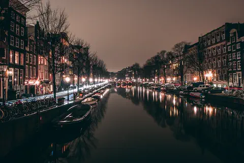
Amsterdam is the capital of the Netherlands. It began as a fishing village beside a dam on the Amstel River, which gave the city its name. Today about 942,000 people live among its rings of canals, hundreds of bridges, houseboats and bicycles.
-
 Watch
City
Barcelona
Barcelona, the capital of Catalonia in northeastern Spain, lies on the Mediterranean between mountains and the sea. It is famous for the buildings of the architect Antoni Gaudí, including the Sagrada Família, a giant church begun in 1882. About 1.7 million people live in the city (2025).
-
Watch
City
Belgrade
Belgrade, the capital of Serbia, stands where the Sava River flows into the Danube. Its name, Beograd, means "white city", probably because of the white limestone walls of its old fortress above the rivers. At the 2022 census, about 1.2 million people lived in the city itself and about 1.7 million in the wider City of Belgrade.
-
 Watch
City
Berlin
Berlin, the capital of Germany, grew from two small trading towns on the Spree River. From 1961 to 1989 the Berlin Wall divided it. Today about 3.7 million people live there (2025), among lakes, forests, museums and the Brandenburg Gate.
-
 Watch
City
Brussels
Brussels is the capital of Belgium. It began as a market where a road crossed the small Senne River, and its old name means "settlement in the marshes." Its Grand-Place, ringed by 17th-century guildhalls, is a UNESCO World Heritage Site, and the city is home to many offices of the European Union.
-
 Watch
City
Bucharest
Bucharest, the capital of Romania, lies on a wide plain beside the Dâmbovița River. First written about in 1459, it became the capital of Walachia in 1659 and of Romania in 1862. Today it is a city of broad boulevards, a huge parliament palace, the Romanian Athenaeum concert hall and an open-air Village Museum.
For parents & teachers
What children will learn
- Locate Tirana in central Albania, near the Adriatic Sea.
- Describe how Tirana grew from a crossroads town into a capital.
- Explain how a city can change its public spaces, such as a square for people on foot.
- Give an example of reusing an old building for a new purpose.
Recommended ages: 3 to 17 · About 15 minutes
Talk about it
- Tirana took cars out of its main square. What would you change about a busy street near you?
- Do bright colors on buildings change how a place feels? Why or why not?
- The Pyramid was kept and given a new use instead of being knocked down. What old building near you could be used in a new way?
Try at home or in class
- Draw a gray apartment block, then redesign it with stripes, squares and bright colors.
- Plan a square for people on foot: draw a fountain, gardens, benches and paths, and decide where buses can stop.
Key vocabulary: capital, pedestrian, caravan, communism, equestrian statue, mosaic, port
Where these facts come from
- Wikidata , Wikimedia Foundation (CC0 1.0)
- Natural Earth vector data , Natural Earth (NACIS) (Public domain)
- Tirana , Encyclopaedia Britannica
- Albania: Climate, plant and animal life , Encyclopaedia Britannica
- Albania: Land , Encyclopaedia Britannica
- Albania: Collapse of communism , Encyclopaedia Britannica
- Durrës , Encyclopaedia Britannica
- Renovation of Skanderbeg Square , European Prize for Urban Public Space (CCCB)
- The people reclaim the monument: MVRDV's Pyramid of Tirana inaugurated , MVRDV
- Tirana (keyword: A New Face for a Tired City: Edi Rama and Tirana, Albania, 2000-2010) , Innovations for Successful Societies, Princeton University
- EBRD and EU support rehabilitation of Albanian railway , European Bank for Reconstruction and Development
- Albania: Cities (Tiranë) , City Population (Thomas Brinkhoff), from INSTAT census 2023
- Wikimedia Commons , Wikimedia Foundation (Per file (public domain, CC0, CC BY or CC BY-SA); see each media record)
Checked, not yet human-reviewed. Last updated October 27, 2026. Spotted a mistake? Tell us.