
 Country
Australia and Oceania
Samoa
Samoa is a country of islands in the Pacific Ocean. The two big islands are Upolu and Savai'i. Most people live in villages by the sea.
Samoa is a Polynesian country in the South Pacific, made of nine volcanic islands ringed by coral reefs and lagoons. Most people live in coastal villages and follow the fa'a Samoa, the Samoan way of life. Samoa became independent from New Zealand in 1962, and in 2011 it jumped across the International Date Line. Its 2021 census counted 205,557 people.
Samoa, called Western Samoa until 1997, shares the Samoan archipelago with American Samoa. Its nine islands west of 171° W were built by volcanic activity that moved from east to west over the past seven million years. Village life is organized around aiga (extended families) and their matai (chiefs), who alone may sit in the Legislative Assembly. Independent since January 1, 1962, Samoa counted 205,557 people in its 2021 census.
Photo: Stephen Glauser, CC BY-SA 2.0, via Wikimedia Commons
Discover Samoa
Samoa is made of islands in the Pacific Ocean.
Coconut palms grow along the coasts. Coral reefs and shallow lagoons ring the islands.
Samoa is a country of nine islands in the central South Pacific Ocean, about 2,900 kilometers northeast of New Zealand. Only four of the islands have people living on them: Upolu, Savai'i, Manono and Apolima.
The capital is Apia, on Upolu. Samoan is the official language, and English is widely spoken too. The 2021 census counted 205,557 people. The photo shows a white-sand beach on Upolu in 2009, with palm trees and a shallow lagoon.
Samoa lies among the westernmost island countries of Polynesia, about 130 km west of American Samoa, 2,900 km northeast of New Zealand and 4,200 km southwest of Hawaii. Its nine islands west of longitude 171° W cover about 2,830 km² (Britannica); four are inhabited (Upolu, Savai'i, Manono, Apolima) and five are not.
The Samoa Bureau of Statistics' 2021 census counted 205,557 people (104,853 male, 100,704 female); a new census was under way in October 2026. Samoan became the official language under a 2014 act, while the constitution requires the legislature to work in both Samoan and English. The currency is the tala. The photo shows a beach on Upolu in 2009.
Apia, Upolu and Savai'i
Apia is the capital city.
It is on the island of Upolu. Most people live in villages near the coast.
Apia, on the north coast of Upolu, is Samoa's only town. It is the main port and the center for trade, and about one in five Samoans lives there. Most other people live in coastal villages, as Samoans have since the islands were first settled.
Visitors come to see Fuipisia Falls, which drops about 55 meters, and Vailima, the last home of the Scottish writer Robert Louis Stevenson. His house is now a museum.
Apia, on Upolu's northern coast, is the only town, the main port and the center for services and trade, with roughly one-fifth of the population; about four-fifths of Samoans are rural. Local government rests with more than 360 villages in 11 districts, five on Upolu and six on Savai'i.
Britannica lists Mulinu'u (site of the parliament and traditional meeting grounds), Fuipisia Falls (about 55 m) and Vailima among the main sights. Vailima, Robert Louis Stevenson's last home and for a time the head of state's residence, houses the Robert Louis Stevenson Museum (1990). The University of the South Pacific has its School of Agriculture at Alafua, near Apia, and the National University of Samoa opened in 1984.
Volcanic islands, rainforest and reefs
Volcanoes made Samoa's islands.
Rainforest grows inland. It is warm all year, and it rains a lot.
Samoa's islands are rocky and were built by volcanoes. Savai'i, the biggest island, rises to 1,858 meters at Mount Silisili, a volcano near its center. Mount Matavanu on Savai'i last erupted from 1905 to 1911.
Rainforests and cloud forests grow inland, and nearly half the land is forest. It is warm all year, about 27 °C on average. The wet season lasts from about November to April, when strong storms can strike.
The islands were formed by volcanic activity that progressed from east to west within the past seven million years. Savai'i (1,707 km²) peaks at Mount Silisili, 1,858 m; Upolu (1,119 km²), 16 km east across the Apolima Strait, reaches 1,100 m at Mount Fito. Short, shallow rivers radiate from the central highlands, and coral reefs and lagoons ring the coasts except where lava cliffs meet the sea. Matavanu erupted intermittently in 1905–11.
Rainfall ranges from more than 2,540 mm on the northern and western coasts to 7,620 mm inland; temperatures stay between 23 and 30 °C. The volcanic soils are fertile but erode easily. Wildfires set to clear farmland in 1998 destroyed nearly one-fourth of Savai'i's forests.
Flying foxes and the manumea
Lots of birds live in Samoa.
The manumea is Samoa's national bird. It is a rare pigeon with a thick, curved beak.
More than 50 kinds of birds are found in Samoa. The only native mammals are bats, including flying foxes, which are endangered.
Samoa's national bird is the tooth-billed pigeon, called the manumea. Its thick, curved bill lets it eat hard fruits. It is critically endangered because of forest loss, hunting and animals people brought to the islands. The Samoa Conservation Society and the government's environment ministry are working to protect its remaining forest.
Britannica counts more than 50 bird species, at least 16 of them indigenous, and notes that the only native mammals are bats: endangered flying foxes and smaller species. Rats, wild cattle and pigs were introduced. Lizards, two boas, centipedes, scorpions and many insects make up much of the smaller fauna.
The tooth-billed pigeon or manumea (Didunculus strigirostris), the national bird, is a close relative of the extinct dodo and is listed as Critically Endangered. It has declined since the 1990s through deforestation, hunting and invasive species; an adult has never been clearly photographed in the wild, and none were reported between 2006 and 2012. The Samoa Conservation Society and the Ministry of Natural Resources and Environment monitor it. O Le Pupu-Pu'e National Park (1978), Samoa's first, covers about 28 km² of south-central Upolu.
Fa'a Samoa: villages, fale and kirikiti
Many Samoan homes are called fale. A fale has a roof but open sides.
People eat taro, breadfruit and fish. Sometimes whole villages play a game called kirikiti.
Samoans work to keep the fa'a Samoa, the Samoan way of life. Each extended family, or aiga, chooses at least one matai (chief) to lead it, and the matai meet in village councils. Most villages have a church, a meetinghouse and a green with fale around it: oval houses with open sides, where rolled palm-leaf mats can be let down against the weather.
Typical foods include taro, yams, breadfruit, fish and shellfish. Rugby is popular, and whole communities sometimes play kirikiti, a game like cricket with teams of any size.
About nine-tenths of people are ethnic Samoans, with Euronesians (mixed European and Polynesian ancestry) most of the rest. Samoan is thought to be among the oldest Polynesian languages and is related to Maori, Tahitian, Hawaiian and Tongan; many words name ocean currents, winds, stars and directions. Most Samoans are Christian; the Congregational Christian Church has a little under one-third of the population.
Many fale have given way to rectangular houses of timber or concrete block. Kava, made from a pepper plant, is drunk at social events, mainly by matai. Arts include music, the sāsā sitting dance, the fa'ataupati slap dance and the traditional waist-to-knee tattoo for young men, a tradition Samoans kept when missionaries ended it on other islands. Novelist Albert Wendt has written about the fa'a Samoa. Independence Day is celebrated on June 1–3.
From canoe voyagers to independence
People came to Samoa in canoes about 3,000 years ago.
Later, New Zealand ruled Samoa. In 1962 Samoa became its own country.
Polynesian voyagers in outrigger canoes reached Samoa around 1000 BCE; pieces of their Lapita pottery have been found in a lagoon on Upolu. Samoans became expert navigators, boatbuilders and fishers.
In 1899 the islands were divided: the United States took the eastern islands and Germany the western ones. New Zealand took over Western Samoa in 1914. A Samoan movement called the Mau pushed for self-rule, and Western Samoa became independent on January 1, 1962. In 1997 it changed its name to Samoa.
Lapita shards in Mulifanua Lagoon on Upolu show settlement about 1000 BCE, and features of the Samoan language suggest the settlers came from Tonga. By about 200 CE Samoa was central to the settlement of eastern Polynesia. Europeans visited from 1722, and the missionary John Williams arrived in 1830. In 1899 the islands were split, the United States annexing the east and Germany the west, without consulting Samoans.
New Zealand occupied Western Samoa in 1914 and governed it under a League of Nations mandate from 1920. The Mau ('Strongly Held View') movement, led by Olaf Frederick Nelson, campaigned against that rule. Independence came on January 1, 1962, the first in the Pacific after World War II (EBSCO). The name became Samoa in 1997. A magnitude 8.3 earthquake in 2009 caused a tsunami that flattened villages; the country later rebuilt with international help.
Samoa on the map
Find New Zealand on the globe.
Move up and to the right across the sea. Two big islands close together are Samoa.
Find New Zealand, then travel about 2,900 kilometers northeast across the Pacific. Samoa's two big islands, Savai'i in the west and Upolu in the east, sit just 16 kilometers apart. American Samoa lies about 130 kilometers farther east.
Samoa has no land borders. Since the end of 2011 it has been on the west side of the International Date Line, sharing a calendar day with New Zealand and Australia.
The country occupies the western part of the Samoan archipelago, west of 171° W; the six islands east of that meridian form American Samoa. New Zealand lies about 2,900 km to the southwest and Hawaii about 4,200 km to the northeast.
On December 29, 2011, Samoa skipped December 30 and moved to the west side of the International Date Line, 119 years after it had moved the other way. The government said the switch would help trade with Australia and New Zealand: local time went from 23 hours behind Auckland to one hour ahead (BBC).
- Distance from American Samoa
- about 130 km
- Distance from New Zealand
- about 2,900 km
- Mount Silisili
- 1,858 m
- People (2021 census)
- 205,557
Amazing facts
-
Samoa once skipped a whole day: December 30, 2011.
In 2011 Samoa went straight from December 29 to December 31 to move across the International Date Line.
Samoa crossed to the west of the date line by skipping December 30, 2011, 119 years after crossing the other way.
-
Samoa's national bird is a rare pigeon called the manumea.
The manumea, Samoa's national bird, is a close relative of the dodo.
The tooth-billed pigeon is closely related to the extinct dodo, and its thick, curved bill lets it feed on hard fruits.
-
In kirikiti, a team can have lots and lots of players.
Kirikiti is like cricket, but teams can be any size, and the host village provides food for everyone.
Kirikiti matches are social as well as sporting events: teams are of unrestricted size, spectators cheer and sing, and the host village provides the food.
-
The only wild mammals that were always in Samoa are bats.
Samoa's only native mammals are bats, including flying foxes.
Flying foxes, which are endangered, and smaller bats are Samoa's only native mammals; rats, wild cattle and pigs were introduced.
Words to know
- fa'a Samoa
- 'the Samoan way of life': the customs and family ties Samoans work to keep
- matai
- a Samoan chief chosen by an extended family to lead and speak for it
- fale
- a traditional Samoan oval house with open sides and a roof held up by wooden pillars
- lagoon
- shallow, calm water between a coast and a coral reef
- International Date Line
- an imaginary line in the Pacific Ocean where the calendar date changes by one day
- mandate
- a territory the League of Nations gave another country to govern
Discovery challenge
-
Which day did Samoa skip in 2011?
To cross the International Date Line in 2011, which date did Samoa skip?
Which calendar date did Samoa omit when it moved west of the International Date Line in 2011?
- January 1
- December 30
- June 1
Show the answer
December 30
December 30. They went from December 29 to December 31!
December 30, so Samoa's days now match New Zealand's and Australia's.
December 30, 2011; local time went from 23 hours behind Auckland to one hour ahead.
-
What are the sides of a fale like?
What is special about the walls of a traditional Samoan fale?
Which feature describes the sides of a traditional Samoan fale?
- Open, with mats to let down
- Made of ice blocks
- Thick stone walls
Show the answer
Open, with mats to let down
The sides are open. Mats roll down when it rains.
They are open, and rolled palm-leaf mats can be let down against the weather.
Open sides under a thatched or tin roof on wooden pillars, with palm-leaf mats that can be lowered.
-
What built Samoa's islands?
Mount Silisili and Mount Matavanu are examples of what?
Samoa's islands were formed over the past seven million years by what kind of activity?
- Glaciers
- Volcanoes
- Sand dunes
Show the answer
Volcanoes
Volcanoes built the islands.
Volcanoes; Matavanu last erupted from 1905 to 1911.
Volcanic activity, which moved from east to west across the islands.
-
Which country ruled Samoa before 1962?
Western Samoa became independent in 1962 from which country?
Which country governed Western Samoa under a League of Nations mandate from 1920 until 1962?
- New Zealand
- France
- Japan
Show the answer
New Zealand
New Zealand ruled Samoa before 1962.
New Zealand, which took over in 1914.
New Zealand, first by occupation in 1914 and then under the 1920 mandate.
Places to discover in Samoa

Explore next
-
 Watch
 Country
Tonga
Tonga is a Polynesian kingdom of about 170 islands in the southwestern Pacific, in three main groups: Tongatapu, Ha'apai and Vava'u. Some islands are volcanoes and others are low coral islands. Captain Cook called them the Friendly Islands. Tonga's 2021 census counted 100,179 people, and the capital is Nuku'alofa.
-
 Watch
 Country
Fiji
Fiji is a country of about 300 islands and 540 islets in the South Pacific, around a sea called the Koro Sea. About 100 of the islands have people living on them. The capital, Suva, is on the largest island, Viti Levu. The 2017 census counted about 885,000 people.
-
 Watch
 Country
American Samoa
American Samoa is a group of islands in the South Pacific, the eastern part of the Samoan islands. It is a territory of the United States, but most people are Samoan and follow the fa'asamoa, the Samoan way of life. Rainforest covers its steep volcanic mountains, coral reefs ring its shores, and the 2020 census counted 49,710 people.
-
 Watch
 Country
New Zealand
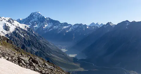
New Zealand, also called Aotearoa, is an island country in the South Pacific. Its two main islands have snowy mountains, glaciers, volcanoes and deep fiords, and about 5.36 million people lived there in 2026.
-
 Watch
Journey
The first voyagers of the Pacific
Over thousands of years, the ancestors of today's Pacific Islanders sailed double-hulled canoes across the Pacific and settled islands from Samoa and Tonga to Hawaiʻi, Rapa Nui and Aotearoa New Zealand. They had no compasses or maps: navigators read the stars, the ocean swells, the clouds and the birds.
-
 Watch
 Country
Cook Islands
The Cook Islands are 15 small islands and atolls spread across about 2 million square kilometers of the South Pacific. They govern themselves in free association with New Zealand, and Cook Islanders are New Zealand citizens. The 2021 census counted 14,987 residents, more than 70% of them on Rarotonga.
-
 Watch
 Country
Tuvalu
Tuvalu is a Polynesian country of nine small coral islands strung across about 676 kilometers of the west-central Pacific. Most of the land is only 4 to 5 meters above the sea. Once called the Ellice Islands, Tuvalu became independent in 1978. Its 2022 census counted 10,643 people.
-
 Watch
 Country
Tokelau
Tokelau is a territory of New Zealand made of three coral atolls in the South Pacific, about 480 kilometers north of Samoa. It has no single capital: each atoll looks after itself. Since 2012, solar panels have made nearly all of its electricity. The 2019 population count found 1,647 usual residents.
For parents & teachers
What children will learn
- Locate Samoa in the South Pacific and name its two main islands, Upolu and Savai'i.
- Explain how volcanoes built the islands and why coral reefs and lagoons ring them.
- Describe the fa'a Samoa: extended families, matai, village councils and fale houses.
- Explain why Samoa skipped a day in 2011 when it moved across the International Date Line.
Recommended ages: 3 to 17 · About 15 minutes
Talk about it
- What would it feel like to go to bed on December 29 and wake up on December 31?
- Why might a house with open sides suit a warm, rainy place?
- How do the families you know make decisions together?
Try at home or in class
- On a globe or map, trace the International Date Line and find the countries on each side of it near Samoa.
- Build a model fale from craft sticks and paper, with a paper 'mat' that can roll down the side.
Key vocabulary: fa'a Samoa, matai, fale, lagoon, International Date Line, mandate
Where these facts come from
- Wikidata , Wikimedia Foundation (CC0 1.0)
- Natural Earth vector data , Natural Earth (NACIS) (Public domain)
- Samoa (introduction, land, climate, plant and animal life) , Encyclopaedia Britannica
- Samoa: People and economy , Encyclopaedia Britannica
- Samoa: Government and society , Encyclopaedia Britannica
- Samoa: Cultural life , Encyclopaedia Britannica
- Samoa: History , Encyclopaedia Britannica
- Samoa Bureau of Statistics (Population and Housing Census 2021: total population) , Samoa Bureau of Statistics
- Samoa and Tokelau skip a day for dateline change , BBC News
- Western Samoa Gains Independence from New Zealand , EBSCO Research Starters
- Funding urgently needed to save Samoa's 'little dodo' from extinction , BirdGuides
- PlayOwl region table, version 1 , PlayOwl (PlayOwl original data)
- flag-icons 7.5.0 , Panayiotis Lipiridis and contributors (MIT)
- Wikimedia Commons , Wikimedia Foundation (Per file (public domain, CC0, CC BY or CC BY-SA); see each media record)
Checked, not yet human-reviewed. Last updated November 1, 2026. Spotted a mistake? Tell us.