
Landmark Africa
Kariba Dam
The Kariba Dam is a curved concrete wall across the Zambezi River in Africa. It holds back a long lake and makes electricity!
The Kariba Dam is a curved concrete dam across the Zambezi River, between Zambia and Zimbabwe. It is 128 meters high. It was built between 1956 and 1960, and its lake, Lake Kariba, is 280 kilometers long. Two power stations use the water to make electricity.
Kariba Dam is a double-curvature concrete arch dam on the Zambezi River, 128 m high with a crest 617 m long, designed by the French engineer Andre Coyne and built between 1956 and 1960. Its reservoir reaches 280 km in length. The Zambezi River Authority, set up by Zambia and Zimbabwe in 1987, monitors the dam; its two power stations can generate 1,080 MW and 1,050 MW.
Photo: Rhys Jones, CC BY 2.0, via Wikimedia Commons
Discover the Kariba Dam
The Kariba Dam is in Africa, on a river called the Zambezi.
It is a tall wall of concrete that holds back the water.
The Kariba Dam stands on the Zambezi River, about halfway along its route from northwestern Zambia to the Indian Ocean. It is looked after by the Zambezi River Authority, which Zambia and Zimbabwe set up together.
The dam wall is 128 meters high. Behind it lies Lake Kariba, which stretches 280 kilometers.
The Kariba Hydro-electric Scheme lies roughly halfway down the Zambezi River, in the Gwembe Valley, a rift valley that averages 70 km across and is bordered by escarpments about 700 m high (Zambezi River Authority).
The Authority was established on 1 October 1987 by parallel legislation in the parliaments of Zambia and Zimbabwe, after the Central African Power Corporation was reconstituted. The Authority has monitored the dam since its reservoir began to fill in 1958.
- River
- Zambezi
- Height
- 128 m
- Crest length
- 617 m
- Built
- 1956–1960
Building the dam
Workers built the dam between 1956 and 1960.
An engineer from France named Andre Coyne designed it.
In 1955 the government of the time asked companies to bid to build the dam wall. In 1956 an Italian group of companies called Impresit won the contract to build the wall and the power station.
The dam was designed by the French engineer Andre Coyne, an expert in arch dams. Digging the foundations, building the wall and starting the first generator took from 1956 to 1960.
An investigation into possible hydroelectric schemes at Kariba began under the Electricity Supply Commission, and funds were made available in 1941. In 1955 the then Federal Government of Rhodesia and Nyasaland (today's Zambia, Zimbabwe and Malawi) called for tenders for the dam wall, and on 16 July 1956 the contract for the wall and power station went to the Italian consortium Impresit.
The French engineer Andre Coyne, a specialist in arch dams who personally designed over 55 dams, designed Kariba. Excavation of the foundations, construction of the wall and power stations and commissioning of the first generator took place between 1956 and 1960; the reservoir began to fill in 1958.
A curved concrete wall
The dam wall is curved, like a bow.
High up in the wall are six gates that let water out of the lake.
Kariba is an arch dam: its concrete wall is curved. The Zambezi River Authority calls it a double-curvature concrete arch.
The wall is 128 meters high and 617 meters long along the top. It is 13 meters thick at the top and 24 meters thick at the base.
The Zambezi River Authority classes Kariba as a double-curvature concrete arch: 128 m high, with a crest 617 m long and 13 m thick and a base 24 m thick.
Six sluice gates, each 9.14 by 8.84 m, sit in the upper part of the wall and form the spillway. At full supply level each can release 1,574 cubic meters of water a second into the plunge pool below, which the Authority gives as 81 m deep. Water for power generation is taken from the lake into the power stations upstream of the wall.
Lake Kariba and its power
Behind the dam is a long lake called Lake Kariba.
Water from the lake turns machines that make electricity.
When it is full, Lake Kariba is 280 kilometers long and up to 32 kilometers wide, about 18 kilometers on average.
Two power stations, one on the north bank and one on the south bank, use water from the lake to make electricity. One can make 1,080 megawatts and the other 1,050 megawatts.
At full supply level the reservoir is 280 km long and up to 32 km wide (18 km on average), and it holds 185 billion cubic meters at its maximum retention level of 487.8 m above sea level. The Authority gives a mean annual evaporation of 1.56 m.
The North Bank power station can generate 1,080 MW and the South Bank station 1,050 MW. The second power station, built in the 1980s, also reduced spilling, because more water was diverted for power generation than before.
- Lake length
- 280 km
- Lake width
- up to 32 km
- North Bank power station
- 1,080 MW
- South Bank power station
- 1,050 MW
Caring for an old dam
In this old photo, the curved dam stands between green hills.
The lake is on one side, and the river is on the other.
This photo was taken in 1994 and scanned from slide film. It shows the curved wall, the spillway gates, the blue lake behind and the river below, with trees in front.
After 60 years, routine checks showed the dam needed repair work. The repair project, which began in 2017, reshapes the plunge pool below the dam and refurbishes the six spillway gates.
The photograph (1994, Rhys Jones, converted from 35 mm slide film) looks across the downstream face of the arch to the spillway gates and Lake Kariba beyond, framed by trees.
Heavy spills of flood water, especially in the dam's early years, eroded the natural riverbed below the dam into a deep plunge pool. The Kariba Dam Rehabilitation Project, a $294 million program that began in 2017, is reshaping the pool and refurbishing the spillway gates. On 7 May 2026 the Authority reported the project about 94% complete.
Amazing facts
-
The man who designed this dam designed more than 55 dams!
Andre Coyne, the French engineer who designed Kariba, personally designed over 55 dams.
The Zambezi River Authority notes that Andre Coyne, a specialist in arch dams, personally designed over 55 dams, Kariba among them.
-
Falling water dug a deep pool in the rock below the dam!
Water pouring through the spillway wore away the riverbed below the dam and made a deep pool, called a plunge pool.
Heavy spills of flood water, especially in the dam's early years, eroded the natural riverbed downstream into a plunge pool, which the Authority gives as 81 m deep.
-
Concrete grows a tiny bit when it gets wet!
Concrete exposed to water expands a little. Over many years, this could make the spillway gates stick, so they are being refurbished.
The Authority explains that concrete exposed to water expands slightly; over a long period this could affect the smooth opening and closing of the spillway gates, so all six are being refurbished, and consultants recommended a movable backup gate on the upstream side.
Words to know
- dam
- a wall built across a river to hold back water
- arch dam
- a dam whose concrete wall curves across a valley
- spillway
- the gates or channel that let extra water out of a dam
- reservoir
- a lake made by people to store water
- hydroelectric
- making electricity from moving water
- megawatt
- a unit for measuring a large amount of electric power
Discovery challenge
-
Which river does the Kariba Dam stand on?
The Kariba Dam holds back which African river?
Which river does the Kariba scheme dam, roughly halfway along its course?
- The Zambezi
- The Amazon
- The Danube
Show the answer
The Zambezi
The Zambezi!
The Zambezi.
The Zambezi.
-
How high is the Kariba Dam?
How high is the Kariba Dam's wall?
What height does the Zambezi River Authority give for the dam?
- 128 meters
- 12 meters
- 1,280 meters
Show the answer
128 meters
128 meters!
128 meters.
128 m.
-
What shape is the dam wall?
What kind of dam is Kariba?
How does the Authority classify the Kariba Dam?
- A curved arch
- A straight earth bank
- A pile of logs
Show the answer
A curved arch
A curved arch!
A curved concrete arch dam.
A double-curvature concrete arch.
-
How many spillway gates does the dam have?
How many sluice gates form the dam's spillway?
How many sluice gates in the upper wall make up the spillway?
- 6
- 2
- 60
Show the answer
6
Six!
Six.
Six, each 9.14 by 8.84 m.
-
The Kariba Dam is between which two countries?
The Zambezi River Authority, which looks after the dam, was set up by which two countries?
The Zambezi River Authority was set up in 1987 by the parliaments of which two countries?
- Zambia and Zimbabwe
- Kenya and Uganda
- Egypt and Sudan
Show the answer
Zambia and Zimbabwe
Zambia and Zimbabwe!
Zambia and Zimbabwe.
Zambia and Zimbabwe.
Nearby places
-
 Watch
City
Lusaka
Lusaka is the capital of Zambia, an African country with no coast. Zambia's 2022 census counted 2,212,301 people in the city, by far the most in the country. Lusaka was planned in the 1930s as a new capital and officially opened in 1935.
-
 Watch
Natural wonder
Victoria Falls
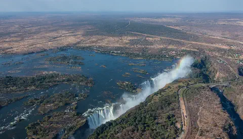
Victoria Falls, on the Zambezi River between Zambia and Zimbabwe, is about 1,708 meters wide and up to 108 meters deep. UNESCO calls it the largest curtain of falling water in the world, and its spray can be seen from tens of kilometers away.
-
 Watch
Landmark
Great Zimbabwe
Great Zimbabwe is the ruin of a great stone city in southern Africa, built by the Shona people between about 1100 and 1450. Its walls of granite blocks were laid without mortar. At its height it was the capital of a large state, with more than 10,000 people, and it traded gold for goods from as far away as China.
-
 Watch
City
Lilongwe
Lilongwe is the capital of Malawi, in southern Africa. It grew from a market village, and a new capital city was built next to it and opened in 1975. It lies on a high plateau about 1,100 meters above sea level, and Malawi's statistics office projected 1,162,500 people for it in 2023.
-
 Watch
Natural wonder
Okavango Delta
The Okavango Delta, in northwestern Botswana, is a huge wetland in the middle of a dry land. The Okavango River flows in from Angola, spreads out into channels, lagoons and grassy plains, and then soaks away into the sands of the Kalahari instead of reaching the sea. Its flood arrives in the dry season, drawing elephants, buffalo, zebras and many other animals.
-
 Watch
Natural wonder
Lake Malawi
Lake Malawi is one of the African Great Lakes, in the Great Rift Valley. UNESCO calls it one of the deepest lakes in the world, and it holds many hundreds of kinds of cichlid fish, nearly all found nowhere else.
-
 Watch
Landmark
Tsodilo
Tsodilo is a small group of rocky hills in the Kalahari Desert of Botswana. With more than 4,500 rock paintings in an area of only 10 square kilometers, it has been called the 'Louvre of the Desert'. People have used these hills for at least 100,000 years.
-
 Watch
City
Gaborone
Gaborone is the capital of Botswana, in southern Africa. It was built as a new capital in the 1960s, almost ready when Botswana became independent in 1966. Planned for 20,000 people, it counted 246,325 in the 2022 census.
Explore next
-
Watch
 Country
Zambia
Zambia is a landlocked country on a high plateau in south-central Africa, named after the Zambezi River. On its southern border the Zambezi thunders over Victoria Falls. About 22 million people live there, and its copper mines have long made it one of Africa's great copper producers.
-
Watch
 Country
Zimbabwe
Zimbabwe is a landlocked country in southern Africa, high on a wide plateau between the Zambezi and Limpopo rivers. It shares Victoria Falls with Zambia, and its name is a Shona word meaning "stone houses", the name of the great stone city of Great Zimbabwe.
-
 Watch
Landmark
Hoover Dam
Hoover Dam is a huge concrete dam across the Colorado River, on the border between Nevada and Arizona in the United States. Built from 1931 to 1936, it holds back Lake Mead, protects farms and towns from floods, stores water for cities and farms, and makes electricity.
-
 Watch
Landmark
Aswan High Dam
The Aswan High Dam crosses the Nile River in southern Egypt. Finished in 1970, it is 111 meters high and 3,830 meters long. It controls the Nile's yearly flood, stores water for farms, makes electricity and created a huge reservoir, Lake Nasser. Ancient temples had to be moved to save them from the rising water.
-
 Watch
Landmark
Abu Simbel
Abu Simbel is two temples cut into the rock by King Ramesses II of Egypt, around 1264 BCE. Four seated statues of the king, each 21 meters tall, guard the Great Temple. In the 1960s, a new dam was about to flood them, so workers cut them into more than a thousand blocks and rebuilt them higher up.
-
 Watch
Landmark
Aït Benhaddou
Aït Benhaddou is a ksar, a village of earthen buildings inside high walls, on the southern slopes of the High Atlas mountains in Morocco. Its oldest buildings probably date from no earlier than the 1600s. It was a stop on an old trade route to Marrakesh, and it became a UNESCO World Heritage Site in 1987.
-
 Watch
Landmark
Amphitheater of El Jem
The Amphitheater of El Jem is a Roman arena in Tunisia, built around the year 238. It stands on flat ground and is made entirely of stone blocks. UNESCO says it could hold about 35,000 spectators, which makes it one of the largest amphitheaters in the world.
-
 Watch
Landmark
Bent Pyramid
The Bent Pyramid stands at Dahshur in Egypt. It was built for King Sneferu, who reigned about 2613 to 2589 BCE. Its builders started the sides at a steep angle of 55 degrees, then changed to 43 degrees because the pyramid was becoming unstable. That change gives it its bent shape.
For parents & teachers
What children will learn
- Explain how a dam can turn moving water into electricity.
- Name the main parts of a dam: wall, spillway, reservoir and power station.
- Explain why old dams need checks and repairs.
Recommended ages: 4 to 17 · About 15 minutes
Talk about it
- Why might two countries share one dam?
- What could happen to a riverbed when lots of water pours over it for years?
- Why do engineers keep checking a dam long after it is built?
Try at home or in class
- Bend a strip of card into an arch and press on it from the curved side, then try a flat strip: which holds better?
- Find the Zambezi River on a map of Africa and follow it to the Indian Ocean.
Key vocabulary: dam, arch dam, spillway, reservoir, hydroelectric, megawatt
Where these facts come from
- Wikidata , Wikimedia Foundation (CC0 1.0)
- Kariba HES , Zambezi River Authority
- Kariba HES Technical Data , Zambezi River Authority
- Zambezi River Authority (home page) , Zambezi River Authority
- Kariba Dam Rehabilitation Project: Overview , Zambezi River Authority
- Plunge Pool Reshaping , Zambezi River Authority
- Spillway Refurbishment , Zambezi River Authority
- Update On the KDRP: Spillway Refurbishment Works (7 May 2026) , Zambezi River Authority
- File:KaribaDam.jpg , Wikimedia Commons
- Wikimedia Commons , Wikimedia Foundation (Per file (public domain, CC0, CC BY or CC BY-SA); see each media record)
Checked, not yet human-reviewed. Last updated November 1, 2026. Spotted a mistake? Tell us.