
Natural wonder Australia and Oceania
Lake Taupō
Lake Taupō is the largest lake in New Zealand. It fills a hollow left by a volcano.
Lake Taupō, in the center of New Zealand's North Island, is the country's largest lake. It fills the caldera of Taupō volcano, which last erupted over 1,800 years ago.
Lake Taupō (about 616 km²) is New Zealand's largest lake and fills the caldera of Taupō volcano, whose eruption over 1,800 years ago GeoNet calls the most violent in the world in the last 5,000 years. About 30 rivers flow in; the Waikato River is its only outlet (ILEC).
Photo: Krzysztof Golik, CC BY-SA 4.0, via Wikimedia Commons
Discover Lake Taupō
Lake Taupō is in New Zealand. It is the largest lake in the country.
In this photo, hills rise across the gray water of the lake.
Lake Taupō lies in the center of New Zealand's North Island, 357 meters above sea level. The International Lake Environment Committee (ILEC) lists it as the largest lake in New Zealand, about 616 square kilometers.
This photo by Krzysztof Golik, taken in November 2017, shows the lake under a cloudy sky, with hills and headlands across the water, low green land and a few islets in front and forest below.
ILEC's World Lake Database places Lake Taupō at the center of the North Island, 357 m above sea level, the largest lake in New Zealand, with a surface area of 616 km². The International Association for Great Lakes Research (IAGLR) gives 610 to 616 km² from two sources.
The photo (Krzysztof Golik, CC BY-SA 4.0, November 2017) shows the lake under clouds, with hills and headlands beyond, low green land with a few islets, and forested slopes in the foreground.
- Surface area
- about 616 km²
- Height above sea level
- 357 m
- Type
- lake in a volcanic caldera
A lake inside a volcano
Lake Taupō sits inside a volcano.
The volcano threw rock far away. Then the ground sank, and water filled it.
GeoNet, New Zealand's hazard monitoring service, says Taupō volcano began to erupt over 300,000 years ago. It has many vents, and most of them are now under the lake.
Taupō is not a mountain. Its eruptions were so explosive that the rock was thrown far from the vents, and the ground then collapsed to form a caldera, a collapsed volcano. Today New Zealand's largest lake fills it.
Taupō volcano first began to erupt over 300,000 years ago and has many vents, most now under the lake (GeoNet). Geological studies show the volcano makes up only the northern half of the lake and a small surrounding area, with numerous eruptions from different sites.
Taupō is not a large mountain because its eruptions were so explosive that material was deposited far from the vent, and the ground then collapsed to form a caldera. IAGLR lists the lake's origin as both tectonic (faulting) and volcanic (caldera).
Pumice from the Taupō eruption
Long ago, Taupō volcano erupted and threw out pumice.
Pumice is a rock made by volcanoes. You can still find it on beaches.
Over 1,800 years ago, the Taupō eruption burst from a line of vents near the eastern side of today's lake. GeoNet calls it the most violent eruption in the world in the last 5,000 years.
It dropped five layers of pumice and ash across the central North Island, then an energetic flow of pumice and ash, called a pyroclastic flow, filled the main river valleys. The pumice can still be seen today, rivers carry it when they flood, and rounded pumice on North Island beaches came from this eruption.
The Taupō eruption, over 1,800 years ago, came from a line of vents near the eastern side of the modern lake; GeoNet calls it the most violent eruption in the world in the last 5,000 years. Its first phases laid down five pumice and ash fall deposits over the central North Island, especially to the east.
It ended with an energetic pyroclastic flow that swept over about 20,000 km² and filled the major river valleys with pumice and ash. Rivers still carry this pumice in flood, and rounded pumice on North Island beaches comes from it.
Clear, deep water
About 30 rivers flow into Lake Taupō.
Only one river, the Waikato, flows out.
ILEC says about 30 rivers flow into Lake Taupō, and the Waikato River is its only outlet. The town of Taupō sits where the Waikato River leaves the lake.
ILEC's records give the lake a maximum depth of 164 meters and a volume of 60 cubic kilometers. Its water is clear, with a maximum transparency of 21 meters: you could see that far down. It has remarkably little nitrogen, which keeps the lake low in nutrients.
About 30 rivers flow into the lake and the Waikato River is its only outlet (ILEC). ILEC lists a maximum depth of 164 m, mean depth of 91 m, volume of 60 km³, shoreline of 153 km and water residence time of 10.6 years; IAGLR gives a maximum depth of 159 to 164 m.
The water is clear and highly transparent, with a maximum transparency of 21 m. Nitrogen and the nitrogen-to-phosphorus ratio are remarkably low, which ILEC says may be mainly due to the catchment's geology and makes the lake oligotrophic.
Fish of the lake
Two kinds of fish, koaro and toitoi, are native to the lake.
Rainbow trout were brought here and live there too.
ILEC names the koaro and the toitoi as fish native to Lake Taupō. The koaro, with a flat head and tough, slimy skin, was an important food fish for the Māori people living around the lake, but it has become very scarce.
Rainbow trout were stocked in the lake by people and are now abundant and mainly important for sport fishing. The common smelt was brought in between 1934 and 1940.
Native fish include the koaro and the toitoi (ILEC). The koaro, flat-headed with tough but slimy skin, was an important fish resource for Māori living around the lake but has become very scarce.
Artificially stocked rainbow trout are now abundant and mainly important for sport fishing; the common smelt was introduced between 1934 and 1940 after the average size of trout declined. Submerged plants include Chara and Nitella.
Visiting safely
Wear a life jacket in and around a lake.
Always swim with a buddy and a grown-up watching.
The US Centers for Disease Control and Prevention (CDC) says children should wear life jackets for all activities in and around natural water such as lakes. A grown-up should watch children closely the whole time they are in or near water.
Lakes can have hidden hazards such as currents, waves, rocks, plants and water you cannot see through, so always swim with a buddy. Swimming lessons help too.
The CDC advises life jackets for children in all activities in and around natural water, close and constant supervision by a designated adult (even when lifeguards are present), and the buddy system.
Lakes, rivers and oceans have hidden hazards such as dangerous currents or waves, rocks or vegetation and limited visibility. Formal swimming lessons can reduce the risk of drowning, but children who have had them still need close supervision.
Amazing facts
-
Rocks called pumice from Taupō's eruption wash up on beaches.
GeoNet says rounded pumice found on North Island beaches came from the Taupō eruption over 1,800 years ago.
Rounded pumice on North Island beaches comes from the Taupō eruption, and major rivers still carry its pumice in flood (GeoNet).
-
Lake Taupō is not on a mountain. It fills a sunken volcano.
Taupō volcano is not a mountain: its eruptions were so explosive that the ground collapsed into a caldera.
Taupō is not a large mountain: explosive eruptions deposited material far from the vents and the ground collapsed into a caldera (GeoNet).
-
The water of Lake Taupō is very clear.
ILEC gives Lake Taupō's water a maximum transparency of 21 meters: you could see that far down.
ILEC records a maximum transparency of 21 m and remarkably low nitrogen, making the lake oligotrophic.
Words to know
- caldera
- a wide hollow formed when the ground collapses after a volcano erupts
- pumice
- a volcanic rock full of holes left by gas bubbles
- vent
- an opening where lava, ash and gas come out of a volcano
- outlet
- a river that carries water out of a lake
- native
- living naturally in a place, not brought there by people
Discovery challenge
-
Which country is Lake Taupō in?
In which country is Lake Taupō the largest lake?
Lake Taupō is the largest lake of which country, according to ILEC and GeoNet?
- New Zealand
- Iceland
- Canada
Show the answer
New Zealand
New Zealand.
New Zealand: it lies in the center of the North Island.
New Zealand (central North Island).
-
What does Lake Taupō fill?
What kind of hollow does Lake Taupō fill?
Which volcanic landform does Lake Taupō occupy?
- A volcano's caldera
- A glacier's valley
- A meteorite crater
Show the answer
A volcano's caldera
A hollow left by a volcano.
The caldera of Taupō volcano.
The caldera of Taupō volcano, formed by ground collapse after explosive eruptions.
-
Which rock from the eruption is found on beaches?
Which rock from the Taupō eruption washes up on North Island beaches?
Which eruption product of the Taupō eruption is found rounded on North Island beaches?
- Pumice
- Marble
- Coal
Show the answer
Pumice
Pumice.
Pumice from the eruption over 1,800 years ago.
Pumice (GeoNet).
-
Which river flows out of Lake Taupō?
Which river is Lake Taupō's only outlet?
Of the lake's inflows and outflows, which river is the only outlet?
- The Waikato River
- The Nile
- The Danube
Show the answer
The Waikato River
The Waikato River.
The Waikato River; about 30 rivers flow in.
The Waikato River (ILEC).
-
What should children wear in and around a lake?
What does the CDC say children should wear in and around natural water?
Which safety gear does the CDC advise for children in all activities around natural water?
- A life jacket
- A winter coat
- Nothing special
Show the answer
A life jacket
A life jacket.
A life jacket, and a grown-up watching closely.
Life jackets, with close and constant adult supervision and the buddy system.
Nearby places
-
 Watch
Natural wonder
Tongariro National Park
Tongariro National Park, in the middle of New Zealand's North Island, is the country's oldest national park. At its heart are three active volcanoes: Ruapehu, Tongariro and Ngāuruhoe. The mountains are important to the Māori people of the area, and UNESCO lists the park as a World Heritage Site for both its nature and its culture.
-
 Watch
Natural wonder
Mount Ruapehu
Mount Ruapehu, at 2,797 meters, is the highest mountain in New Zealand's North Island and an active volcano. A crater lake fills its vent, and DOC says lahars, fast volcanic mudflows, are its main volcanic hazard.
-
 Watch
Landmark
Te Papa
Te Papa, the Museum of New Zealand, opened on Cable Street in Wellington on 14 February 1998. Its name means 'container of treasures'. The building stands on soft land near a major fault line, so it sits on 152 base isolators that let it move gently in an earthquake.
-
 Watch
City
Christchurch
Christchurch is the main city of New Zealand's South Island. Universalis says English settlers founded it in 1850 on the wide Canterbury Plains, a few kilometers from the east coast. Its port, Lyttelton, lies beyond the Port Hills. About 407,800 people lived in the Christchurch urban area in mid-2025.
-
 Watch
Natural wonder
Southern Alps / Kā Tiritiri o te Moana
The Southern Alps / Kā Tiritiri o te Moana stretch hundreds of kilometers along New Zealand's South Island. Two of Earth's plates push together here, along the Alpine Fault, and NASA says the mountains should keep rising over time.
-
 Watch
Natural wonder
South Island
The South Island of New Zealand sits where two of Earth's tectonic plates meet. Their collision built the Southern Alps, which rise to nearly 4,000 meters close to the sea. Glaciers carved its fiords and lakes, and its southwest is a World Heritage area full of rare birds.
-
 Watch
Natural wonder
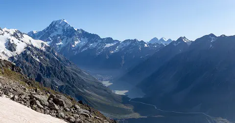
Aoraki / Mount Cook
Aoraki / Mount Cook is New Zealand's highest mountain, in the Southern Alps of the South Island. Its name joins its Māori name, Aoraki, with its English name, Mount Cook. The mountain is being pushed up where two of Earth's plates meet, and glaciers carve the valleys around it. In 2013 surveyors measured it at 3,724 meters.
-
 Watch
Natural wonder
Milford Sound / Piopiotahi
Milford Sound / Piopiotahi is a fiord in Fiordland National Park, in the south-west of New Zealand's South Island. Glaciers carved its steep valley, and the sea filled it. It stretches 16 kilometers to the open sea, and Mitre Peak rises 1,692 meters straight from the water. It is one of the wettest places in New Zealand.
Explore next
-
Watch
Natural wonder
Tongariro National Park
Tongariro National Park, in the middle of New Zealand's North Island, is the country's oldest national park. At its heart are three active volcanoes: Ruapehu, Tongariro and Ngāuruhoe. The mountains are important to the Māori people of the area, and UNESCO lists the park as a World Heritage Site for both its nature and its culture.
-
 Watch
Natural wonder
Laacher See
Laacher See is a lake in western Germany that fills a caldera, a hollow where the ground sank after a volcano erupted about 13,000 years ago. Ash from that eruption spread across Europe. Today bubbles of carbon dioxide still rise from the lake floor, and ducks rest on the water in winter.
-
Watch
 Country
New Zealand
New Zealand, also called Aotearoa, is an island country in the South Pacific. Its two main islands have snowy mountains, glaciers, volcanoes and deep fiords, and about 5.36 million people lived there in 2026.
- Watch Geography Types of volcanoes Volcanoes come in different shapes. Runny lava builds wide, gentle shield volcanoes like Mauna Loa. Sticky lava and ash build tall, steep stratovolcanoes like Mount Fuji. Small cinder cones grow from bits of lava thrown into the air. Whether lava is runny or sticky, and how much gas it holds, decides the shape and how explosive the eruptions are.
-
Watch
Natural wonder
Mount Ruapehu
Mount Ruapehu, at 2,797 meters, is the highest mountain in New Zealand's North Island and an active volcano. A crater lake fills its vent, and DOC says lahars, fast volcanic mudflows, are its main volcanic hazard.
-
 Watch
Natural wonder
Great Barrier Reef
The Great Barrier Reef stretches about 2,300 kilometers along the coast of Queensland, Australia. It is made of about 2,500 separate reefs and more than 900 islands, built by tiny coral animals, and it is home to more than 1,500 kinds of fish.
-
 Watch
Natural wonder
Uluru
Uluru is a huge sandstone rock in the desert of central Australia, rising 348 meters above the plain, with a base 9.4 kilometers around. The Anangu are its Traditional Owners, and the national park around it is run by Anangu and Parks Australia together.
-
Watch
Natural wonder
Aoraki / Mount Cook
Aoraki / Mount Cook is New Zealand's highest mountain, in the Southern Alps of the South Island. Its name joins its Māori name, Aoraki, with its English name, Mount Cook. The mountain is being pushed up where two of Earth's plates meet, and glaciers carve the valleys around it. In 2013 surveyors measured it at 3,724 meters.
For parents & teachers
What children will learn
- Locate Lake Taupō on New Zealand's North Island.
- Explain how a caldera forms and fills with water.
- Describe the Taupō eruption and the pumice it left behind.
- Know how to stay safe in and around lakes.
Recommended ages: 3 to 17 · About 15 minutes
Talk about it
- Why might a very explosive volcano leave a hollow instead of a mountain?
- Why might pumice float and travel down rivers to the sea?
- Why do people bring new fish into a lake, and what might change when they do?
Try at home or in class
- Put a piece of pumice (or a light sponge) and a pebble in a bowl of water and compare which floats.
- On a map of New Zealand, find Lake Taupō and follow the Waikato River from the lake to the sea.
Key vocabulary: caldera, pumice, vent, outlet, native
Where these facts come from
- Wikidata , Wikimedia Foundation (CC0 1.0)
- About Taupo (volcano) , GeoNet (Earth Sciences New Zealand)
- Lake Taupo (World Lake Database) , International Lake Environment Committee Foundation (ILEC)
- Lake Taupo (lake profile) , International Association for Great Lakes Research
- Preventing Drowning , US Centers for Disease Control and Prevention
- File:Lake Taupo 01.jpg , Wikimedia Commons
- Natural Earth vector data , Natural Earth (NACIS) (Public domain)
- Wikimedia Commons , Wikimedia Foundation (Per file (public domain, CC0, CC BY or CC BY-SA); see each media record)
Checked, not yet human-reviewed. Last updated November 1, 2026. Spotted a mistake? Tell us.