
Natural wonder Australia and Oceania
Mount Ruapehu
Mount Ruapehu is a big, snowy volcano in New Zealand. A lake sits in its crater at the top.
Mount Ruapehu, at 2,797 meters, is the highest mountain in New Zealand's North Island and an active volcano. A crater lake fills its vent, and DOC says lahars, fast volcanic mudflows, are its main volcanic hazard.
Mount Ruapehu (2,797 m, GeoNet) is the North Island's highest mountain and has erupted for over 200,000 years. Te Wai ā-moe/Crater Lake fills its vent; DOC calls lahars its main volcanic hazard, and GeoNet keeps it at Volcanic Alert Level 1, minor unrest.
Photo: Geoff McKay, CC BY 2.0, via Wikimedia Commons
Discover Mount Ruapehu
Mount Ruapehu is a volcano in New Zealand. It is the tallest mountain on the North Island.
In this photo, the snowy mountain rises above red-brown and green bushes.
GeoNet, New Zealand's volcano monitoring service, says Mount Ruapehu stands 2,797 meters high and is the highest mountain in the North Island. It has been erupting for more than 200,000 years and is one of the more active volcanoes in New Zealand. The Department of Conservation (DOC) says it lies in Tongariro National Park.
This photo by Geoff McKay, taken on 1 July 2021, shows Ruapehu covered in winter snow under a deep blue sky, rising beyond red-brown and green shrubland.
GeoNet (2020): at 2,797 m Ruapehu is the North Island's highest mountain, a source of eruptions for over 200,000 years and one of New Zealand's more active volcanoes. DOC describes Tongariro National Park as an active volcanic area where eruptions can occur with little or no warning.
The photo (Geoff McKay via Flickr, CC BY 2.0, 1 July 2021 12:47; the photographer notes he used a polarizing and a graduated filter) shows the snow-covered massif under a deep blue sky above red-brown and green shrubland.
- Height (GeoNet)
- 2,797 m
- Volcanic Alert Level (GeoNet, October 2026)
- 1, minor volcanic unrest
- Crater lake
- Te Wai ā-moe/Crater Lake
A lake in the volcano's vent
At the top of Ruapehu there is a lake. It sits right where the volcano erupts.
Scientists check the lake's temperature.
DOC explains that Te Wai ā-moe, Ruapehu's Crater Lake, fills the volcano's vent. Scientists sample its water and gases every month and measure its temperature.
When Ruapehu erupts, water from the lake can be thrown out. It rushes down the valleys like a flash flood, mixing with ash, rocks and snow. This fast volcanic mudflow is called a lahar, and DOC says it is the main volcanic hazard on Ruapehu.
DOC: the Summit Hazard Zone is a 3 km radius around Te Wai ā-moe/Crater Lake, which fills Ruapehu's vent. Lahars, the main volcanic hazard, form when eruptions eject lake water that flows at speed down valleys as a flash flood, mixing with ash, rocks and snow; they can also form when heavy rain remobilizes volcanic debris, and large ones have traveled well beyond the volcano's slopes.
GeoNet: volcanologists sample the crater lake's water and gas, and airborne gas, monthly; recent bulletins track its temperature and gas output.
Eruptions and a watchful eye
Ruapehu erupted in 1995 and 1996. Ash fell on the land around it.
Today, scientists watch the volcano closely.
GeoNet says the most notable of the 1995-1996 eruptions came on 23 September 1995, when the volcano threw rocks and plumes of hot ash and steam into the sky, and lahars surged down into the Whangaehu River. The eruptions emptied the crater lake. A new lake began to fill in 2003, and in March 2007 the dam of volcanic debris holding it failed, sending a lahar down the Whangaehu Valley.
GeoNet watches Ruapehu with web cameras, seismographs, microphones and GPS stations, working with DOC.
GeoNet (2020): the 1995-1996 eruptions peaked on 23 September 1995 with ballistics, plumes of hot ash and steam and lahars into the Whangaehu River; later eruptions spread ash, and the sequence removed the crater lake and modified the rim and outlet. The new lake, filling from 2003 to about nine meters above the outlet behind a debris dam, broke out in March 2007 as a dam-break lahar.
Monitoring (with DOC): three web cameras, 10 seismographs, six microphones that detect explosions and nine continuous GPS stations. In October 2026 GeoNet kept Ruapehu at Volcanic Alert Level 1 (minor unrest), noting fluctuating low-to-moderate tremor.
Tussock, beech forest and blue ducks
Golden and red tussock grass covers big areas of the park.
Blue ducks swim in fast mountain streams.
DOC says large areas of Tongariro National Park are covered in golden and red tussock grasses, and many alpine plants, like mountain daisies and gentians, flower in summer. Much of the forest is mountain beech, which grows above 1,000 meters.
The endangered whio, or blue duck, lives on fast-flowing streams in and around the park, and North Island brown kiwi live in its forests.
DOC (Tongariro National Park flora and fauna): a wide diversity of alpine plants, many flowering in summer (purple parahebe, mountain daisies, buttercups, eyebrights, gentians); golden and red tussocks over large areas, now invaded by introduced heather; mountain beech forest above about 1,000 m with podocarps below; orchids; sundews in tarns formed because volcanic ash is rather impermeable.
Birds include the endangered whio (blue duck) on fast streams, North Island brown kiwi in the forests, pipits, sometimes seen above 1,600 m, and, rarely seen, kākā, kārearea (falcon) and kākāriki.
Exploring safely
If you are in a valley and the volcano erupts, climb to higher ground.
Always follow the park's safety signs.
DOC says eruptions can happen at any time with little or no warning. Before visiting, check the volcano's current status and the advice for your track.
If an eruption happens, DOC says to move away from it and out of valleys, sideways to higher ground such as a ridge, because a lahar can rush down a valley like a flash flood. If you see flying rocks or an ash cloud coming, shelter behind a bank or ridge and cover your head with your pack.
DOC at Risk Management Stage A (Alert Level 1): do not enter within 700 m of the center of Te Wai ā-moe/Crater Lake; do not camp within 1.5 km of it, on the Summit Plateau or in valleys; choose campsites on high ground away from lahar paths.
In an eruption: move away and out of valleys, sideways to a ridge; shelter behind a bank or ridge from flying rocks or an ash cloud and cover your head with your pack; at Whakapapa, sirens warn people to move out of lahar paths.
Amazing facts
-
There is a lake at the top of this volcano.
Te Wai ā-moe, Ruapehu's Crater Lake, fills the volcano's vent.
DOC: Te Wai ā-moe/Crater Lake fills Ruapehu's vent; the Summit Hazard Zone is a 3 km radius around it.
-
Microphones on the mountain listen for explosions.
Six microphones on Ruapehu listen for volcanic explosions.
GeoNet monitors Ruapehu with three web cameras, 10 seismographs, six microphones that detect volcanic explosions and nine continuous GPS stations.
-
Blue ducks live in the fast streams near Ruapehu.
The endangered whio, or blue duck, lives on fast-flowing rivers and streams in and around Tongariro National Park.
DOC: the endangered whio (blue duck) lives on fast-flowing rivers and streams in and around the park.
Words to know
- crater lake
- a lake that fills the crater of a volcano
- vent
- the opening where a volcano erupts
- lahar
- a fast-moving volcanic mudflow, like a flash flood
- seismograph
- an instrument that records ground shaking
- tussock
- a thick clump of tall grass
Discovery challenge
-
In which country is Mount Ruapehu?
Mount Ruapehu is the highest mountain on the North Island of which country?
In which country does GeoNet monitor Ruapehu at Volcanic Alert Level 1?
- New Zealand
- Italy
- Mexico
Show the answer
New Zealand
New Zealand.
New Zealand.
New Zealand (GeoNet).
-
What sits at the top of Ruapehu?
What fills Ruapehu's vent?
What is Te Wai ā-moe?
- A crater lake
- A forest
- A sandy desert
Show the answer
A crater lake
A lake.
A crater lake, Te Wai ā-moe.
Ruapehu's Crater Lake, which fills its vent (DOC).
-
What is a fast volcanic mudflow called?
DOC says the main volcanic hazard on Ruapehu is what?
Which fast-moving flow of water, ash, rock and snow is Ruapehu's main volcanic hazard?
- A lahar
- A glacier
- A geyser
Show the answer
A lahar
A lahar.
Lahars.
The lahar (DOC).
-
If you are in a valley and the volcano erupts, where should you go?
DOC says that in an eruption you should move out of valleys to where?
Where does DOC advise moving if you are in a valley during an eruption?
- Higher ground, like a ridge
- Down into the river
- Into the crater
Show the answer
Higher ground, like a ridge
Up to higher ground.
Sideways to higher ground, such as a ridge top.
Sideways to higher ground (a ridge top), away from lahar paths (DOC).
-
Which rare duck lives in the fast streams here?
Which endangered duck lives on fast-flowing streams in and around the park?
Which endangered bird does DOC name on the park's fast rivers and streams?
- Whio (blue duck)
- Mallard
- Penguin
Show the answer
Whio (blue duck)
The whio, or blue duck.
The whio, or blue duck.
The whio, or blue duck (DOC).
Nearby places
-
 Watch
Natural wonder
Tongariro National Park
Tongariro National Park, in the middle of New Zealand's North Island, is the country's oldest national park. At its heart are three active volcanoes: Ruapehu, Tongariro and Ngāuruhoe. The mountains are important to the Māori people of the area, and UNESCO lists the park as a World Heritage Site for both its nature and its culture.
-
 Watch
Natural wonder
Lake Taupō
Lake Taupō, in the center of New Zealand's North Island, is the country's largest lake. It fills the caldera of Taupō volcano, which last erupted over 1,800 years ago.
-
 Watch
Landmark
Te Papa
Te Papa, the Museum of New Zealand, opened on Cable Street in Wellington on 14 February 1998. Its name means 'container of treasures'. The building stands on soft land near a major fault line, so it sits on 152 base isolators that let it move gently in an earthquake.
-
 Watch
City
Christchurch
Christchurch is the main city of New Zealand's South Island. Universalis says English settlers founded it in 1850 on the wide Canterbury Plains, a few kilometers from the east coast. Its port, Lyttelton, lies beyond the Port Hills. About 407,800 people lived in the Christchurch urban area in mid-2025.
-
 Watch
Natural wonder
Southern Alps / Kā Tiritiri o te Moana
The Southern Alps / Kā Tiritiri o te Moana stretch hundreds of kilometers along New Zealand's South Island. Two of Earth's plates push together here, along the Alpine Fault, and NASA says the mountains should keep rising over time.
-
 Watch
Natural wonder
South Island
The South Island of New Zealand sits where two of Earth's tectonic plates meet. Their collision built the Southern Alps, which rise to nearly 4,000 meters close to the sea. Glaciers carved its fiords and lakes, and its southwest is a World Heritage area full of rare birds.
-
 Watch
Natural wonder
Aoraki / Mount Cook
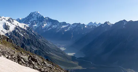
Aoraki / Mount Cook is New Zealand's highest mountain, in the Southern Alps of the South Island. Its name joins its Māori name, Aoraki, with its English name, Mount Cook. The mountain is being pushed up where two of Earth's plates meet, and glaciers carve the valleys around it. In 2013 surveyors measured it at 3,724 meters.
-
 Watch
Natural wonder
Milford Sound / Piopiotahi
Milford Sound / Piopiotahi is a fiord in Fiordland National Park, in the south-west of New Zealand's South Island. Glaciers carved its steep valley, and the sea filled it. It stretches 16 kilometers to the open sea, and Mitre Peak rises 1,692 meters straight from the water. It is one of the wettest places in New Zealand.
Explore next
-
Watch
Natural wonder
Tongariro National Park
Tongariro National Park, in the middle of New Zealand's North Island, is the country's oldest national park. At its heart are three active volcanoes: Ruapehu, Tongariro and Ngāuruhoe. The mountains are important to the Māori people of the area, and UNESCO lists the park as a World Heritage Site for both its nature and its culture.
-
Watch
Natural wonder
Lake Taupō
Lake Taupō, in the center of New Zealand's North Island, is the country's largest lake. It fills the caldera of Taupō volcano, which last erupted over 1,800 years ago.
-
Watch
 Country
New Zealand
New Zealand, also called Aotearoa, is an island country in the South Pacific. Its two main islands have snowy mountains, glaciers, volcanoes and deep fiords, and about 5.36 million people lived there in 2026.
- Watch Geography Types of volcanoes Volcanoes come in different shapes. Runny lava builds wide, gentle shield volcanoes like Mauna Loa. Sticky lava and ash build tall, steep stratovolcanoes like Mount Fuji. Small cinder cones grow from bits of lava thrown into the air. Whether lava is runny or sticky, and how much gas it holds, decides the shape and how explosive the eruptions are.
-
 Watch
Natural wonder
Great Barrier Reef
The Great Barrier Reef stretches about 2,300 kilometers along the coast of Queensland, Australia. It is made of about 2,500 separate reefs and more than 900 islands, built by tiny coral animals, and it is home to more than 1,500 kinds of fish.
-
 Watch
Natural wonder
Uluru
Uluru is a huge sandstone rock in the desert of central Australia, rising 348 meters above the plain, with a base 9.4 kilometers around. The Anangu are its Traditional Owners, and the national park around it is run by Anangu and Parks Australia together.
-
Watch
Natural wonder
Aoraki / Mount Cook
Aoraki / Mount Cook is New Zealand's highest mountain, in the Southern Alps of the South Island. Its name joins its Māori name, Aoraki, with its English name, Mount Cook. The mountain is being pushed up where two of Earth's plates meet, and glaciers carve the valleys around it. In 2013 surveyors measured it at 3,724 meters.
-
 Watch
Natural wonder
Kakadu National Park
Kakadu, in Australia's Northern Territory, is the country's largest national park. It stretches from a high sandstone cliff called the escarpment down to floodplains, mangroves and the sea. Aboriginal people have lived here for tens of thousands of years, and their rock paintings, some up to 20,000 years old, record their way of life.
For parents & teachers
What children will learn
- Locate Mount Ruapehu in New Zealand's North Island.
- Explain what a crater lake and a lahar are.
- Describe how scientists monitor an active volcano.
- Explain what to do in a valley if a volcano erupts.
Recommended ages: 3 to 17 · About 15 minutes
Talk about it
- Why might a crater lake make a volcano more dangerous for people in the valleys below?
- What different tools do scientists use to watch a volcano, and what does each tell them?
- Why might sirens and warning systems help visitors stay safe?
Try at home or in class
- Tilt a tray of sand and pour water down it to see how a fast flow picks up material, like a lahar.
- On a map of New Zealand, find the North Island, Tongariro National Park and Mount Ruapehu.
Key vocabulary: crater lake, vent, lahar, seismograph, tussock
Where these facts come from
- Wikidata , Wikimedia Foundation (CC0 1.0)
- Ruapehu eruptions – 25 years on , GeoNet
- Ruapehu (volcano status and bulletins) , GeoNet
- Volcanic risk in Tongariro National Park , Department of Conservation, New Zealand
- Flora and fauna: Tongariro National Park , Department of Conservation, New Zealand
- File:Mount Ruapehu - Flickr - Geoff J Mckay.jpg , Wikimedia Commons
- Natural Earth vector data , Natural Earth (NACIS) (Public domain)
- Wikimedia Commons , Wikimedia Foundation (Per file (public domain, CC0, CC BY or CC BY-SA); see each media record)
Checked, not yet human-reviewed. Last updated November 1, 2026. Spotted a mistake? Tell us.