
Natural wonder Australia and Oceania
Tongariro National Park
Tongariro National Park is in New Zealand. It has three big volcanoes. Snow sits on top, and forests grow below.
Tongariro National Park, in the middle of New Zealand's North Island, is the country's oldest national park. At its heart are three active volcanoes: Ruapehu, Tongariro and Ngāuruhoe. The mountains are important to the Māori people of the area, and UNESCO lists the park as a World Heritage Site for both its nature and its culture.
Tongariro National Park (79,596 ha) surrounds the active volcanoes Ruapehu (2,797 m, the North Island's highest mountain), Tongariro and Ngāuruhoe. It grew from an 1887 tuku of the three peaks by Ngāti Tūwharetoa and became New Zealand's first national park in 1894. Inscribed on the World Heritage List in 1990, in 1993 it became the first property listed under the revised criteria for cultural landscapes.
Photo: W. Bulach, CC BY-SA 4.0, via Wikimedia Commons
Discover Tongariro National Park
Tongariro National Park is in New Zealand.
It has three volcanoes. The tallest one is called Ruapehu. There is snow and ice near its top. Below the mountains there are forests, streams and grassy slopes.
Tongariro National Park is in the center of New Zealand's North Island. The Department of Conservation calls it the country's oldest national park. Three active volcanoes stand at its heart: Ruapehu, Tongariro and Ngāuruhoe. At 2,797 meters, Ruapehu is the highest mountain in the North Island.
UNESCO lists the park as a World Heritage Site twice over: for its volcanoes and landscapes, and for the importance of its mountains to the Māori people.
The Department of Conservation (DOC) describes Tongariro as New Zealand's oldest national park and a dual World Heritage area, recognized for its Māori cultural associations and its outstanding volcanic features. UNESCO gives the property as 79,596 ha, inscribed in 1990 and modified in 1993, under criteria (vi), (vii) and (viii); in 1993 it became the first property inscribed under the revised criteria for cultural landscapes.
GeoNet, New Zealand's volcano-monitoring service, gives Ruapehu's height as 2,797 m, the highest in the North Island. Tongariro is a complex of several cones built over 275,000 years, and Ngāuruhoe is the youngest and largest of those cones, about 7,000 years old.
- Country
- New Zealand (central North Island)
- National park since
- 1894
- Area
- 79,596 ha (about 796 km²)
- Highest point
- Ruapehu, 2,797 m
- World Heritage Site
- since 1990; cultural landscape since 1993
Volcanoes built layer by layer
Deep under the ground, rock gets so hot that it melts.
It pushes up and pours out as lava and ash. Layer on layer, the lava and ash built these mountains.
Ruapehu is a stratovolcano: a tall cone built up from many layers of lava and ash from eruption after eruption. The International Union of Geological Sciences calls it a subduction-related volcano: subduction is when one of Earth's plates slides beneath another. Ruapehu has erupted large amounts of lava over about the last 200,000 years.
Tongariro is a group of several volcanic cones built over 275,000 years. Ngāuruhoe is a young cone on its southern end, only about 7,000 years old. Many of its recent eruptions sent lava flowing down its sides.
The IUGS lists Ruapehu as a geological heritage site: a subduction-related stratovolcano at the tip of the Taupō Volcanic Zone that has erupted large volumes of basaltic andesite and andesite over about the last 200,000 years. Its massif is about 150 km³, with a ring plain of about the same volume made of tephra and lahar deposits, and its andesites, typically sourced from 5–10 km deep, make it a model for how andesite forms.
GeoNet describes Tongariro as a complex of multiple cones constructed over 275,000 years, with active vents including Te Māri, Emerald Lakes, North Crater and Red Crater. Ngāuruhoe, about 7,000 years old, is the most continuously active volcano in New Zealand; many of its recent eruptions produced lava flows, the last in 1954.
A lake on top of a volcano
At the top of Ruapehu there is a lake inside a crater.
When the volcano erupts, water from the lake can splash out. It mixes with snow and rock and rushes down the mountain.
Near the summit of Ruapehu, the active vent is filled by a lake called Crater Lake, Te Wai-ā-moe. During eruptions, water from the lake is often thrown out onto the ice and snow. It mixes with rock and snow and rushes down the valleys as a lahar, a fast flow of mud and debris.
GeoNet's scientists watch Ruapehu closely and take samples from the crater lake. Ruapehu erupted in 1995 and 1996, and most recently in a short explosion in September 2007.
GeoNet notes that three summit craters have been active in the last 10,000 years, including South Crater, which holds the currently active vent filled by Crater Lake (Te Wai-ā-moe). Water ejected from the lake onto ice and snow during eruptions produces frequent lahars, a hazard on top of the usual volcanic ones. The IUGS adds that the lake has made Ruapehu a focus for studying small eruptions.
The most recent eruption, on 25 September 2007, was explosive and lasted about seven minutes, spreading ash, rocks and water across the summit and sending lahars down two valleys; unlike the 1996 eruptions, it made no high ash plume.
Mountains that matter to Māori
The mountains are very important to the Māori people who live nearby.
Long ago, a Māori chief acted to keep the mountains safe for his people and for everyone in New Zealand. Later the mountains became a park.
The mountains of Tongariro are very important to the Māori people of the area, especially the iwi (tribe) Ngāti Tūwharetoa. In 1887 their chief, Horonuku Te Heuheu Tūkino IV, made a tuku, a customary act, of the three volcanic peaks. He meant it to protect the mountains for his people, other iwi and all New Zealanders, in partnership with the Crown, at that time Queen Victoria.
The national park was set up in 1894. Out of respect, local iwi ask visitors not to climb to the summits of the mountains.
DOC explains that in 1887 the Ariki (chief) Horonuku Te Heuheu Tūkino IV of Ngāti Tūwharetoa enacted a tuku of the three volcanic peaks, about 2,640 ha, to protect and preserve them for Ngāti Tūwharetoa, other iwi and all New Zealanders, intending a partnership with the Crown. In 1894 Tongariro became the first national park in New Zealand and, DOC says, the fourth in the world; the land block was enlarged to 25,000 ha and vested in the Crown alone.
UNESCO says the mountains at the heart of the park have cultural significance for the Māori people. Ngāti Hikairo ki Tongariro is the hapū (sub-tribe) of Ngāti Tūwharetoa that DOC names as guardians of the area, and local iwi respectfully ask visitors not to summit the mountains.
Tussock, beech forest and blue ducks
Golden grass grows on the open slopes. Forests grow lower down.
A blue duck called whio swims in the fast streams. Kiwi birds live in the forests.
Large parts of the park are covered in golden and red tussock grass. Mountain beech forest grows above about 1,000 meters, and below that the forest has more podocarp trees. In summer, alpine flowers bloom: mountain daisies, mountain buttercups, purple parahebe and gentians.
The endangered whio, or blue duck, lives on fast-flowing rivers and streams, and North Island brown kiwi live in the forests. Pipits can often be seen in open areas, sometimes higher than 1,600 meters.
DOC describes tussock grassland, now invaded by introduced heather, over large areas; mountain beech forest above about 1,000 m and more podocarp forest below; kaikawaka (mountain cedar) and mountain cabbage trees; orchids; and sundews in acidic wetlands and tarns that form because the volcanic ash is fairly impermeable to water.
Birds include the endangered whio on fast streams, North Island brown kiwi in the forests (and in a monitored sanctuary in the neighboring Tongariro Forest Conservation Area), forest birds such as tomtit, robin, tūī, bellbird and kererū, and pipits in open country above 1,600 m at times. Kākā, kārearea (New Zealand falcon) and kākāriki are present but seldom seen.
Visiting safely
The volcanoes can wake up without much warning.
Go with a grown-up, follow the signs and stay away from the craters. Snow and ice on the mountain can be slippery too.
Tongariro National Park is an active volcanic area, and DOC warns that eruptions can happen with little or no warning. The closer you are to the active vents, the greater the risk, so DOC discourages walking or climbing into the hazard zones around the summits.
There is no marked track to Ruapehu's summit, and every route crosses avalanche terrain, so DOC suggests the marked Skyline Walk in the Whakapapa ski area instead. Dogs and drones are not allowed. If an eruption starts while you are in a valley, move to higher ground.
DOC: eruptions can occur with little or no warning; monitoring and warning systems reduce risk but cannot guarantee safety; visitors decide what risk is acceptable and should check the current status of each volcano before going. In November 2026, at its normal stage for Ruapehu, DOC advised against entering the area within 700 m of the center of Crater Lake or camping within 1.5 km of it, and recommended campsites on high ground away from lahar paths.
The summit has no marked track and avalanche terrain on every route; summer climbers need alpine skills, ice axe and crampons. The park has no dogs and no drones, the Tongariro Alpine Crossing needs a booking for shuttle and guided services, and the visitor center is in Whakapapa Village.
Amazing facts
-
The tallest volcano here has a lake on top!
Ruapehu's active crater is filled by a lake called Crater Lake, Te Wai-ā-moe. Scientists collect samples of its water.
The active vent in Ruapehu's South Crater is filled by Crater Lake (Te Wai-ā-moe); GeoNet scientists sample its water, and water thrown out in eruptions causes lahars.
-
Tongariro was the first park of its kind in New Zealand.
Tongariro became New Zealand's first national park in 1894. DOC says it was the fourth national park in the world.
Established in 1894, Tongariro was New Zealand's first national park and, according to DOC, the fourth in the world.
-
Little pools in the park have tiny plants called sundews.
Volcanic ash doesn't let water drain through easily, so pools and wetlands form. Tiny sundews with white flowers grow there.
Wetlands and tarns form because the volcanic ash is fairly impermeable; sundews grow in these acidic places, for example beside the Taranaki Falls and Silica Rapids tracks.
-
One volcano here is much younger than the others.
Ngāuruhoe is only about 7,000 years old, the youngest of Tongariro's cones, and it is the most continuously active volcano in New Zealand.
Ngāuruhoe, about 7,000 years old, is the youngest and largest cone of the Tongariro complex; Māori recorded many of its eruptions before European colonization, and the first European description was of an eruption in 1839.
Words to know
- volcano
- an opening in Earth's surface where melted rock, ash and gases come out
- stratovolcano
- a tall, cone-shaped volcano built from many layers of lava and ash
- lahar
- a fast-moving flow of mud, water and rock down a volcano
- crater
- a bowl-shaped hollow at the top of a volcano
- iwi
- a Māori word for a tribe
- tuku
- a Māori customary act; the 1887 tuku of the three peaks was meant to protect them in partnership with the Crown
Discovery challenge
-
What are the big mountains in Tongariro?
What kind of mountains stand at the heart of Tongariro National Park?
What are Ruapehu, Tongariro and Ngāuruhoe?
- Volcanoes
- Sand dunes
- Giant trees
Show the answer
Volcanoes
They are volcanoes!
Three active volcanoes: Ruapehu, Tongariro and Ngāuruhoe.
Active volcanoes: Ruapehu is a stratovolcano, Tongariro a complex of cones, and Ngāuruhoe its youngest cone.
-
What is on top of Ruapehu?
What fills the active crater of Ruapehu?
What fills Ruapehu's active vent, and what hazard does it cause?
- A lake
- A forest
- A town
Show the answer
A lake
A lake inside the crater.
Crater Lake, Te Wai-ā-moe.
Crater Lake; water ejected onto ice and snow during eruptions causes lahars.
-
Who are the mountains very important to?
For which people are the mountains of Tongariro especially important?
Which iwi made the 1887 tuku of the three peaks?
- The Māori people of the area
- Sailors from far away
- No one at all
Show the answer
The Māori people of the area
The Māori people who live nearby.
The Māori people of the area, especially Ngāti Tūwharetoa.
Ngāti Tūwharetoa, through its chief Horonuku Te Heuheu Tūkino IV.
-
Which bird swims in the fast streams?
Which endangered bird lives on the park's fast-flowing streams?
Which endangered duck does DOC describe on fast-flowing rivers in and around the park?
- The whio, or blue duck
- The penguin
- The flamingo
Show the answer
The whio, or blue duck
The blue duck, called whio.
The whio, or blue duck.
The whio (blue duck), endangered.
-
What should you do near the volcanoes?
Why does DOC ask visitors to keep out of hazard zones?
What does DOC say about eruption warnings in the park?
- Eruptions can come with little or no warning
- The zones are full of snakes
- The zones are private gardens
Show the answer
Eruptions can come with little or no warning
Volcanoes can surprise us, so stay away from the craters.
Eruptions can happen with little or no warning, and the risk is highest near the vents.
Eruptions can occur with little or no warning; monitoring reduces risk but cannot guarantee safety.
Nearby places
-
 Watch
Natural wonder
Mount Ruapehu
Mount Ruapehu, at 2,797 meters, is the highest mountain in New Zealand's North Island and an active volcano. A crater lake fills its vent, and DOC says lahars, fast volcanic mudflows, are its main volcanic hazard.
-
 Watch
Natural wonder
Lake Taupō
Lake Taupō, in the center of New Zealand's North Island, is the country's largest lake. It fills the caldera of Taupō volcano, which last erupted over 1,800 years ago.
-
 Watch
Landmark
Te Papa
Te Papa, the Museum of New Zealand, opened on Cable Street in Wellington on 14 February 1998. Its name means 'container of treasures'. The building stands on soft land near a major fault line, so it sits on 152 base isolators that let it move gently in an earthquake.
-
 Watch
City
Christchurch
Christchurch is the main city of New Zealand's South Island. Universalis says English settlers founded it in 1850 on the wide Canterbury Plains, a few kilometers from the east coast. Its port, Lyttelton, lies beyond the Port Hills. About 407,800 people lived in the Christchurch urban area in mid-2025.
-
 Watch
Natural wonder
Southern Alps / Kā Tiritiri o te Moana
The Southern Alps / Kā Tiritiri o te Moana stretch hundreds of kilometers along New Zealand's South Island. Two of Earth's plates push together here, along the Alpine Fault, and NASA says the mountains should keep rising over time.
-
 Watch
Natural wonder
South Island
The South Island of New Zealand sits where two of Earth's tectonic plates meet. Their collision built the Southern Alps, which rise to nearly 4,000 meters close to the sea. Glaciers carved its fiords and lakes, and its southwest is a World Heritage area full of rare birds.
-
 Watch
Natural wonder
Aoraki / Mount Cook
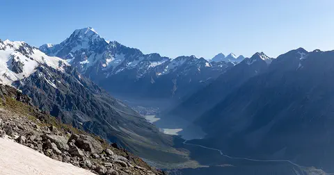
Aoraki / Mount Cook is New Zealand's highest mountain, in the Southern Alps of the South Island. Its name joins its Māori name, Aoraki, with its English name, Mount Cook. The mountain is being pushed up where two of Earth's plates meet, and glaciers carve the valleys around it. In 2013 surveyors measured it at 3,724 meters.
-
 Watch
Natural wonder
Milford Sound / Piopiotahi
Milford Sound / Piopiotahi is a fiord in Fiordland National Park, in the south-west of New Zealand's South Island. Glaciers carved its steep valley, and the sea filled it. It stretches 16 kilometers to the open sea, and Mitre Peak rises 1,692 meters straight from the water. It is one of the wettest places in New Zealand.
Explore next
-
Watch
 Country
New Zealand
New Zealand, also called Aotearoa, is an island country in the South Pacific. Its two main islands have snowy mountains, glaciers, volcanoes and deep fiords, and about 5.36 million people lived there in 2026.
-
Watch
Natural wonder
Mount Ruapehu
Mount Ruapehu, at 2,797 meters, is the highest mountain in New Zealand's North Island and an active volcano. A crater lake fills its vent, and DOC says lahars, fast volcanic mudflows, are its main volcanic hazard.
-
Watch
Natural wonder
Lake Taupō
Lake Taupō, in the center of New Zealand's North Island, is the country's largest lake. It fills the caldera of Taupō volcano, which last erupted over 1,800 years ago.
-
Watch
Natural wonder
Aoraki / Mount Cook
Aoraki / Mount Cook is New Zealand's highest mountain, in the Southern Alps of the South Island. Its name joins its Māori name, Aoraki, with its English name, Mount Cook. The mountain is being pushed up where two of Earth's plates meet, and glaciers carve the valleys around it. In 2013 surveyors measured it at 3,724 meters.
- Watch Geography Types of volcanoes Volcanoes come in different shapes. Runny lava builds wide, gentle shield volcanoes like Mauna Loa. Sticky lava and ash build tall, steep stratovolcanoes like Mount Fuji. Small cinder cones grow from bits of lava thrown into the air. Whether lava is runny or sticky, and how much gas it holds, decides the shape and how explosive the eruptions are.
- Watch Geography What is a World Heritage Site? World Heritage Sites are places so important that they belong, in a way, to everyone. Under a 1972 agreement, countries nominate their most outstanding places, experts check them, and a UNESCO committee decides. By 2026 the list held 1,273 sites: cultural places like the Taj Mahal, natural places like the Galápagos, and mixed ones like Machu Picchu.
-
Watch
Natural wonder
Milford Sound / Piopiotahi
Milford Sound / Piopiotahi is a fiord in Fiordland National Park, in the south-west of New Zealand's South Island. Glaciers carved its steep valley, and the sea filled it. It stretches 16 kilometers to the open sea, and Mitre Peak rises 1,692 meters straight from the water. It is one of the wettest places in New Zealand.
-
 Watch
Natural wonder
Great Barrier Reef
The Great Barrier Reef stretches about 2,300 kilometers along the coast of Queensland, Australia. It is made of about 2,500 separate reefs and more than 900 islands, built by tiny coral animals, and it is home to more than 1,500 kinds of fish.
For parents & teachers
What children will learn
- Locate Tongariro National Park in New Zealand's North Island.
- Explain how a stratovolcano is built and what a lahar is.
- Describe why the mountains matter to Ngāti Tūwharetoa and how the park began.
- Explain how to reduce risk when visiting active volcanoes.
Recommended ages: 3 to 17 · About 15 minutes
Talk about it
- Local iwi ask visitors not to climb to the summits. How can visitors show respect for places that matter to other people?
- Why do you think scientists keep watching a volcano even when it is quiet?
- The 1887 tuku was meant to protect the mountains for everyone. What does it mean to look after a place for future generations?
Try at home or in class
- Build a model volcano from layers of colored play dough, one layer for each pretend eruption. Cut it in half to see the layers inside a stratovolcano.
- Put a small cup of water on top of a pile of sand and snow (or crushed ice), then tip it. Watch how the water carries sand down the slope like a lahar.
Key vocabulary: volcano, stratovolcano, lahar, crater, iwi, tuku
Where these facts come from
- Wikidata , Wikimedia Foundation (CC0 1.0)
- UNESCO World Heritage List , UNESCO World Heritage Centre (Linked as a reference; site facts come from Wikidata)
- Tongariro National Park , UNESCO World Heritage Centre
- Tongariro National Park , Department of Conservation, New Zealand
- History and culture: Tongariro National Park , Department of Conservation, New Zealand
- Flora and fauna: Tongariro National Park , Department of Conservation, New Zealand
- Volcanic risk in Tongariro National Park , Department of Conservation, New Zealand
- About Ruapehu , GeoNet (Earth Sciences New Zealand)
- About Tongariro , GeoNet (Earth Sciences New Zealand)
- About Ngauruhoe , GeoNet (Earth Sciences New Zealand)
- Ruapehu Volcano , International Union of Geological Sciences (IUGS Geoheritage Sites)
- Wikimedia Commons , Wikimedia Foundation (Per file (public domain, CC0, CC BY or CC BY-SA); see each media record)
Checked, not yet human-reviewed. Last updated November 1, 2026. Spotted a mistake? Tell us.