
Natural wonder Asia
Lake Toba
Lake Toba is a giant lake on the island of Sumatra in Indonesia. It fills a hole left by a huge volcanic eruption long ago.
Lake Toba, in North Sumatra, Indonesia, fills a caldera left by one of the most powerful volcanic eruptions in Earth's history. UNESCO calls it the world's largest volcanic crater lake, with Samosir Island at its center.
Lake Toba fills the Toba Caldera in North Sumatra, Indonesia, formed when the ground collapsed after a super-eruption tens of thousands of years ago (about 75,000 years ago according to UNESCO; around 70,000 according to NASA). UNESCO gives the lake 1,100 km², a surface 904 m above sea level and a maximum depth of 505 m.
Photo: Lattecupoftea, CC BY 4.0, via Wikimedia Commons
Discover Lake Toba
Lake Toba is on the island of Sumatra, in Indonesia. An island called Samosir sits in the middle of it.
In this photo, the sun sets over the lake behind tall pine trees.
Lake Toba lies in North Sumatra, Indonesia. UNESCO calls it the world's largest volcanic crater lake: it covers 1,100 square kilometers, its surface is 904 meters above sea level, and it is up to 505 meters deep. Samosir Island sits at its center.
This photo by Lattecupoftea shows a sunset over the lake, seen through pine trees from a rest stop called Penatapan, with a dark headland reaching into the water.
UNESCO's Toba Caldera Global Geopark page describes Lake Toba as the world's largest volcanic crater lake, spanning 1,100 km², with its surface 904 m above sea level and a maximum depth of 505 m. Steep caldera walls form its watersheds, and Samosir Island lies at its center.
The hero photo, by Lattecupoftea (CC BY 4.0), is captioned on Commons as a sunset at Lake Toba taken at a small rest and eating area called Penatapan: pines in silhouette, a headland and the lake in low sunlight.
- Size
- 1,100 km², the world's largest volcanic crater lake (UNESCO)
- Surface height
- 904 m above sea level
- Maximum depth
- 505 m
A lake made by a super-eruption
Long, long ago, a giant volcano blew out a huge amount of ash and rock.
The ground sank, and water filled the hole to make the lake.
Tens of thousands of years ago, Toba erupted in what UNESCO calls one of the most powerful volcanic events in Earth's history, about a thousand times stronger than the 1980 eruption of Mount St. Helens. UNESCO dates it to about 75,000 years ago; NASA says around 70,000 years ago.
NASA explains that after the eruption the ground collapsed, leaving a caldera that filled with water to make Lake Toba. The US Geological Survey (USGS) says the caldera formed when the magma chamber emptied.
NASA's Earth Observatory calls the Toba eruption the largest in the past 2 million years: over what was probably a two-week span, thousands of cubic kilometers of debris spewed out, and pyroclastic flows buried at least 20,000 km² around the caldera. Ash lies in layers up to 6 m thick as far away as India.
UNESCO estimates the eruption was a thousand times stronger than Mount St. Helens in 1980 and says its ash and gases spread across South Asia and cooled the climate. NASA and the USGS describe the same sequence: the magma chamber emptied, the ground collapsed into a caldera, and water filled it.
Samosir, an island pushed up from below
Samosir Island in the lake was pushed up from underneath by hot melted rock.
A newer volcano also grew on the lake's shore.
NASA says Samosir Island is a resurgent dome: a mound of rock pushed up by pressure from magma still in the chamber beneath the volcano. The ash layer on Samosir is more than 600 meters thick.
A newer volcano, Pusukbukit, also formed on the western shore of the lake after the great eruption.
According to NASA, Samosir Island is a resurgent volcanic dome, rock uplifted by pressure from un-erupted magma in the chamber beneath the volcano, and the Toba ash on Samosir is more than 600 m thick. The Pusukbukit volcano on the western shore also formed after the eruption.
UNESCO adds that the surrounding terrain includes undulating hills, mountains and plains, and that the steep caldera walls form the lake's watersheds.
Forests, plants and the Batak Toba people
Green forests grow around the lake today.
The Batak Toba people live here and make a colorful cloth called ulos.
UNESCO says the lake is surrounded by Sumatran forests and provides habitats for many plants and animals. Endemic Toba plants such as andaliman, a spice used in Batak cooking, grow with Toba orchids and pitcher plants in a botanical garden there.
The area is home to the Batak Toba people, known for wooden houses decorated with Gorga carvings in white, red and black, and for ulos, a handwoven cloth.
UNESCO describes Lake Toba as a vital ecological and cultural site surrounded by Sumatran forests. The Eden Park botanical garden features endemic Toba plants such as andaliman, a key spice in Batak cuisine, as well as Toba orchids and pitcher plants.
The geopark is home to the Batak Toba people, whose traditional wooden houses, built on stone foundations without cement, carry Gorga carvings in white, red and black. Their handwoven ulos cloth is dyed with plants such as salaon (Indigofera tinctoria) for blue and sona (Pterocarpus indicus) for red.
Visiting safely
Lake Toba is very deep.
Near water, always stay close to your grown-up and wear a life jacket on a boat.
UNESCO gives Lake Toba a maximum depth of 505 meters. The US Centers for Disease Control and Prevention (CDC) says life jackets lower the risk of drowning while boating, and that children should wear them for all activities in and around natural water.
Grown-ups should watch children closely whenever they are near water.
The CDC advises that life jackets reduce the risk of drowning while boating for people of all ages and swimming abilities, that children should use them for all activities in and around natural water, and that adults should supervise children closely even when lifeguards are present.
UNESCO notes the region is prone to tectonic activity, earthquakes and flooding, and says the traditional Batak house style reflects this.
Amazing facts
-
The island in the middle of Lake Toba was pushed up from below by melted rock!
Samosir Island is a resurgent dome: rock pushed up by pressure from magma still under the volcano.
NASA describes Samosir as a resurgent volcanic dome uplifted by un-erupted magma, with more than 600 m of Toba ash on it.
-
Ash from the Toba eruption landed far away, all the way in India.
Ash from the Toba eruption lies in layers up to 6 meters thick as far away as India.
NASA notes Toba ash layers up to 6 m (about 20 ft) thick as far away as India.
-
The Toba eruption was much, much stronger than a famous eruption in the United States.
UNESCO estimates the Toba eruption was about a thousand times stronger than the 1980 eruption of Mount St. Helens.
UNESCO's estimate: roughly a thousand times stronger than Mount St. Helens in 1980, making it one of the most powerful volcanic events in Earth's history.
Words to know
- caldera
- a large bowl-shaped hollow that forms when the ground collapses after a volcano empties its magma chamber
- magma chamber
- a pool of melted rock deep under a volcano
- resurgent dome
- a mound of rock pushed up inside a caldera by magma below
- geopark
- an area named by UNESCO for its important rocks and landforms, protected together with local people
- endemic
- found naturally in only one place in the world
Discovery challenge
-
What made the hole that Lake Toba fills?
What kind of event formed the caldera that holds Lake Toba?
What event emptied Toba's magma chamber and led to the caldera's collapse?
- A giant volcanic eruption
- A glacier melting
- A river cutting a canyon
Show the answer
A giant volcanic eruption
A giant volcano eruption.
A super-eruption; the ground then collapsed and the hole filled with water.
A super-eruption that emptied the magma chamber, so the ground collapsed into a caldera.
-
What is the island in the middle of Lake Toba called?
Which island sits at the center of Lake Toba?
Which resurgent volcanic dome forms the island at the center of Lake Toba?
- Samosir
- Bali
- Borneo
Show the answer
Samosir
Samosir Island.
Samosir Island.
Samosir, uplifted by pressure from un-erupted magma.
-
How deep is Lake Toba in its deepest place?
What maximum depth does UNESCO give for Lake Toba?
What maximum depth does UNESCO's geopark page give for Lake Toba?
- 505 meters
- 5 meters
- 50 meters
Show the answer
505 meters
505 meters.
505 meters.
505 m, with the surface 904 m above sea level.
-
What colorful cloth do the Batak Toba people make?
What is the name of the handwoven cloth of the Batak Toba people?
Which handwoven Batak cloth is dyed with salaon and sona plants?
- Ulos
- Kilt
- Kimono
Show the answer
Ulos
Ulos.
Ulos, a handwoven cloth.
Ulos: salaon gives blue dye and sona gives red.
-
What should children wear on a boat?
What does the CDC say children should wear for all activities in and around natural water?
According to the CDC, what reduces the risk of drowning while boating for people of all ages?
- A life jacket
- A foam toy
- A sun hat
Show the answer
A life jacket
A life jacket.
A life jacket, for all activities in and around natural water.
A life jacket, for people of all ages and swimming abilities.
Nearby places
-
 Watch
Natural wonder
Mount Sinabung
Mount Sinabung is a 2,460-meter stratovolcano in North Sumatra, Indonesia. It had no eruption for about 1,200 years until 2010, and since 2013 scientists have watched it closely as it builds and loses lava domes.
-
 Watch
City
Kuala Lumpur
Kuala Lumpur is the capital and largest city of Malaysia, in Southeast Asia. It began in 1857 as a settlement of Chinese tin miners where two rivers meet, and its name means "muddy estuary" in Malay. Today about 2.08 million people live there (2026 estimate), among skyscrapers, mosques and old shop-houses.
-
 Watch
Landmark
Petronas Towers
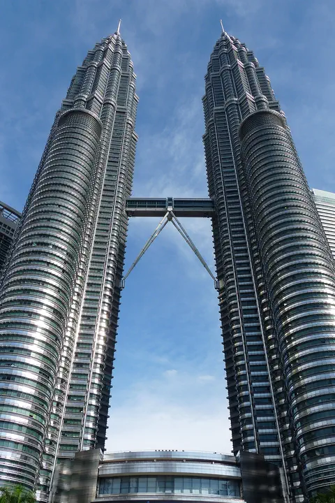
The Petronas Twin Towers in Kuala Lumpur, Malaysia, are two matching skyscrapers 452 meters tall, finished in 1998. Seen from above, each floor is shaped like an eight-pointed star, a pattern from Islamic art. A two-story skybridge joins them 170 meters above the ground, and from 1996 to 2003 they were counted as the tallest buildings in the world.
-
 Watch
Natural wonder
Andaman Sea
The Andaman Sea is part of the eastern Indian Ocean, near Thailand and Myanmar, with the Andaman and Nicobar Islands nearby. Its rugged sea floor helps make large waves deep inside the water, and its islands have coral reefs and seagrass where dolphins and dugongs feed.
-
 Watch
City
Palembang
Palembang is a city on the Musi River, in the south of the island of Sumatra, in Indonesia. The encyclopedia Larousse says it was once the capital of the kingdom of Srivijaya. Indonesia's 2020 census counted 1,668,848 people in the city.
-
 Watch
Natural wonder
Krakatoa
Krakatoa, also called Krakatau, is a volcano between the Indonesian islands of Java and Sumatra. After an enormous eruption in 1883 destroyed the old island, a new volcano, Anak Krakatau, meaning 'child of Krakatau', rose from the sea about fifty years later. It still erupts often.
-
 Watch
City
Bangkok
Bangkok, the capital of Thailand, lies on the delta of the Chao Phraya River, about 40 kilometers from the sea. It became the capital in 1782, when the new royal palace and temples were built. Once called the 'Venice of the East' for its canals, it is now a huge, busy city with skyscrapers and an elevated railway.
-
 Watch
City
Ho Chi Minh City
Ho Chi Minh City, once called Saigon, is Vietnam's largest city and the economic heart of the country. It lies on the Saigon River, north of the Mekong Delta. Since merging with two neighboring provinces in 2025, it has more than 14 million people, and in 2024 it opened its first metro line.
Explore next
-
Watch
Natural wonder
Krakatoa
Krakatoa, also called Krakatau, is a volcano between the Indonesian islands of Java and Sumatra. After an enormous eruption in 1883 destroyed the old island, a new volcano, Anak Krakatau, meaning 'child of Krakatau', rose from the sea about fifty years later. It still erupts often.
-
 Watch
Natural wonder
Java
Java is an island of Indonesia on the Pacific Ring of Fire, and it has many active volcanoes. Its tallest, Mount Semeru, is also its most active. At its western tip, Ujung Kulon National Park protects the island's largest remaining lowland rainforest and the endangered Javan rhinoceros.
-
 Watch
Natural wonder
Mount Agung
Mount Agung is a cone-shaped volcano on the eastern end of Bali, in Indonesia, and the island's highest point at about 3,000 meters. It erupted strongly in 1963 and 1964, and again with explosions, ash clouds and lava in its crater from 2017 to 2019. Scientists watch it all the time and set safety zones around it when it is restless.
-
Watch
 Country
Indonesia
Indonesia is a country of about 17,500 islands in Southeast Asia, spread across the Equator between the Indian and Pacific oceans. It has more than 100 active volcanoes, rainforests full of wildlife, and about 286 million people (2025).
- Watch Geography Types of volcanoes Volcanoes come in different shapes. Runny lava builds wide, gentle shield volcanoes like Mauna Loa. Sticky lava and ash build tall, steep stratovolcanoes like Mount Fuji. Small cinder cones grow from bits of lava thrown into the air. Whether lava is runny or sticky, and how much gas it holds, decides the shape and how explosive the eruptions are.
-
Watch
Natural wonder
Mount Sinabung
Mount Sinabung is a 2,460-meter stratovolcano in North Sumatra, Indonesia. It had no eruption for about 1,200 years until 2010, and since 2013 scientists have watched it closely as it builds and loses lava domes.
-
Watch
City
Palembang
Palembang is a city on the Musi River, in the south of the island of Sumatra, in Indonesia. The encyclopedia Larousse says it was once the capital of the kingdom of Srivijaya. Indonesia's 2020 census counted 1,668,848 people in the city.
-
 Watch
Natural wonder
Laacher See
Laacher See is a lake in western Germany that fills a caldera, a hollow where the ground sank after a volcano erupted about 13,000 years ago. Ash from that eruption spread across Europe. Today bubbles of carbon dioxide still rise from the lake floor, and ducks rest on the water in winter.
For parents & teachers
What children will learn
- Locate Lake Toba on the island of Sumatra, Indonesia.
- Explain how a caldera forms when a magma chamber empties and the ground collapses.
- Describe how Samosir Island was pushed up from below.
- Know how to stay safe near lakes and on boats.
Recommended ages: 3 to 17 · About 15 minutes
Talk about it
- Why might two science organizations give different dates for the same eruption?
- How could scientists tell that ash found in India came from Toba?
- Why might people in an earthquake-prone area build houses without cement on stone foundations?
Try at home or in class
- Bury a small, partly blown-up balloon in a bowl of flour, then slowly let the air out: watch the flour surface sink into a hollow, like a caldera.
- On a map of Indonesia, find Sumatra and Lake Toba, then find Krakatoa between Sumatra and Java.
Key vocabulary: caldera, magma chamber, resurgent dome, geopark, endemic
Where these facts come from
- Wikidata , Wikimedia Foundation (CC0 1.0)
- Toba Caldera UNESCO Global Geopark , UNESCO International Geoscience and Geoparks Programme
- Toba Caldera (Image of the Day, 6 February 2007) , NASA Earth Observatory
- Supersized eruptions are all the rage! , US Geological Survey, Volcano Hazards Program
- Preventing Drowning , US Centers for Disease Control and Prevention
- File:2022,A sunset at Lake Toba,Penatapan View.jpg , Wikimedia Commons
- Natural Earth vector data , Natural Earth (NACIS) (Public domain)
- Wikimedia Commons , Wikimedia Foundation (Per file (public domain, CC0, CC BY or CC BY-SA); see each media record)
Checked, not yet human-reviewed. Last updated November 1, 2026. Spotted a mistake? Tell us.