
Natural wonder Asia
Mount Sinabung
Mount Sinabung is a volcano in Indonesia. It was quiet for a very long time, then woke up in 2010.
Mount Sinabung is a 2,460-meter stratovolcano in North Sumatra, Indonesia. It had no eruption for about 1,200 years until 2010, and since 2013 scientists have watched it closely as it builds and loses lava domes.
Sinabung (2,460 m, PVMBG) in Karo Regency, North Sumatra, had its first eruption in about 1,200 years in August 2010 (USGS); an eruption that began in September 2013 went through phases of lava domes, lava flows and dome collapses. Indonesia's volcano agency raised it to Level III (Siaga) on 31 August 2026.
Photo: Elfandri, CC BY-SA 4.0, via Wikimedia Commons
Discover Mount Sinabung
Mount Sinabung is a volcano on the island of Sumatra in Indonesia.
In this photo, its gray top pokes into white clouds above green hills and trees.
Mount Sinabung rises 2,460 meters in North Sumatra, Indonesia, in the Karo region. Indonesia's Center for Volcanology and Geological Hazard Mitigation (PVMBG) keeps watch on it, with an observation post for the volcano.
This photo by Elfandri was taken on 5 May 2019. It shows the volcano's gray upper slopes partly hidden in cloud, rising above hills covered in green trees under a blue sky.
PVMBG (Geological Agency, Ministry of Energy and Mineral Resources) gives Sinabung's height as 2,460 m above sea level; NASA calls it a stratovolcano. CNN Indonesia places it in Karo Regency, North Sumatra.
The photo (Elfandri, CC BY-SA 4.0, 5 May 2019, a Wiki Loves Earth 2019 entry) shows the cone with cloud around its summit, bare gray upper slopes and forested hills in front.
- Height (PVMBG)
- 2,460 m
- Woke up
- 28 August 2010
- Alert level (31 Aug 2026)
- Level III (Siaga)
A volcano that woke up
For a very, very long time, Sinabung was quiet.
In 2010 it puffed out ash. In 2013 it woke up again and stayed busy for years.
NASA says Sinabung had no confirmed eruptions in the historical record before 2010. The US Geological Survey reports that a small eruption on 28 August 2010 was its first in about 1,200 years. Steam and gas kept rising for almost three years.
A new eruption began on 15 September 2013. Lava piled up at the top into lava domes. When parts of a dome broke off, hot flows of rock and ash rushed down the slopes.
USGS (Gunawan et al., 2019): a small phreatic eruption on 28 August 2010 from two vents in the south crater was the first in about 1,200 years; ash plumes reached altitudes of up to 5 km in early to mid-September; fumarolic emissions continued almost three years. The eruption that began on 15 September 2013 went through phases: phreatomagmatic (to 18 December 2013); a first dome with collapses and pyroclastic density currents; a lava flow (January to September 2014); a second dome (to July 2015); then dome collapses and ash explosions.
NASA (2014): collapses of the unstable summit dome sent pyroclastic flows at least 4.5 km down the slopes.
Watching the volcano
Scientists listen to the volcano with special tools.
They tell people when it is safe and when to stay away.
Two days after the 2010 eruption, a network of seismometers around Sinabung began recording its earthquakes, and a network of GPS stations was added in 2011, the USGS reports. Satellites watch it from space too.
On 31 August 2026, after a new eruption and a string of earthquakes, Indonesia raised Sinabung's alert to Level III, the second highest. People were asked to keep out of a zone around the summit.
USGS: monitoring by a telemetered seismic network began two days after the 2010 eruption, plus remote sensing; a near-field continuous GPS network was added in February 2011. NASA satellite instruments (Landsat 8, EO-1, Terra ASTER) imaged the ash plumes, lava flow and flow deposits in 2014.
CNN Indonesia (citing the national disaster agency BNPB): 85 volcanic earthquakes were recorded before the 31 August 2026 eruption; PVMBG raised the status from Level II (since 17 May 2023) to Level III; before this, Sinabung had last erupted in 2022.
Farms and forests
Farmers grow coffee and chili peppers near the volcano.
Green forests grow nearby too.
NASA's satellite pictures show Sinabung surrounded by farms and forest. Coffee, chili peppers and other crops grow in plantations clustered at the foot of the volcano.
The dark green forests of Gunung Leuser National Park are also visible in NASA's satellite images of the area.
NASA Earth Observatory: Landsat 8 (6 March 2014) shows the volcano surrounded by farms and forest; ash from the 2013-2014 eruption coated the coffee, chili pepper and other plantations clustered at its foot and turned dark green forest tan in satellite images; a 2003 Landsat 7 image shows the villages, fields and the dark green forests of Gunung Leuser National Park.
Staying safe near volcanoes
Near a volcano, always do what the grown-ups in charge say.
Stay out of the danger zone.
When Sinabung's alert was raised in 2026, people and visitors were told not to go into villages that had been moved, within 3 kilometers of the summit, or within 6 kilometers on the south-east side. People living near rivers that start on the volcano were told to watch out for lahars.
The CDC says to follow the advice of local officials, have a plan to leave or shelter, and protect your lungs and eyes from ash.
CNN Indonesia (31 August 2026, BNPB): no activity in relocated villages, within a 3 km radius of the summit, or within 6 km in the south-east sector; residents near rivers rising on Sinabung should stay alert for lahars and follow BPBD directions.
CDC volcano safety: follow local officials' advice; plan to evacuate or shelter; an emergency kit with respiratory protection and goggles; ash can harm the respiratory tract (use an N95 respirator outdoors).
Amazing facts
-
Sinabung was quiet for about 1,200 years before it woke up.
The small eruption of 28 August 2010 was Sinabung's first in about 1,200 years.
USGS: the 28 August 2010 phreatic eruption, from two small vents in the south crater, marked the first eruption in the past ~1,200 years.
-
Satellites in space took pictures of Sinabung.
A NASA satellite image used infrared light to show a hot lava flow creeping down Sinabung's eastern side in 2014.
NASA: a false-color Landsat 8 image (6 March 2014) revealed a hot lava flow on the eastern flank and told apart clouds and a gas and steam plume, both pure white in natural color.
-
Before it erupted in 2026, the volcano had many earthquakes.
Before the eruption of 31 August 2026, instruments recorded 85 volcanic earthquakes.
CNN Indonesia (BNPB): 85 volcanic earthquakes, 1 emission earthquake and 1 harmonic tremor were recorded before the 31 August 2026 eruption.
Words to know
- stratovolcano
- a tall, cone-shaped volcano built from many layers of lava and ash
- lava dome
- a mound of thick, sticky lava that piles up over a volcano's vent
- pyroclastic flow
- a fast, very hot flow of rock, ash and gas down a volcano's slopes
- lahar
- a flow of mud and volcanic debris down a river valley
- seismometer
- an instrument that records shaking of the ground, such as small earthquakes
Discovery challenge
-
In which country is Mount Sinabung?
Mount Sinabung is on the island of Sumatra in which country?
In which country's province of North Sumatra is Sinabung?
- Indonesia
- Japan
- Italy
Show the answer
Indonesia
Indonesia.
Indonesia.
Indonesia (PVMBG; CNN Indonesia).
-
In which year did Sinabung first wake up?
In which year did Sinabung have its first eruption in about 1,200 years?
In which year was Sinabung's phreatic eruption, its first in ~1,200 years?
- 2010
- 1980
- 2020
Show the answer
2010
2010.
2010 (28 August).
28 August 2010 (USGS).
-
What piled up at the top of the volcano?
What did thick lava build at Sinabung's summit after 2013?
Collapses of what summit feature produced Sinabung's pyroclastic flows?
- Lava domes
- Ice caps
- Sand dunes
Show the answer
Lava domes
Lava domes.
Lava domes.
Lava domes (USGS; NASA).
-
How do scientists keep track of the volcano?
Which instruments record Sinabung's earthquakes?
What kind of network began recording Sinabung's earthquakes in 2010?
- Seismometers
- Telescopes
- Thermometers in the sea
Show the answer
Seismometers
With seismometers that record earthquakes.
Seismometers.
A telemetered seismic network, plus GPS from 2011 (USGS).
-
What should you do near a volcano?
What does the CDC say to do near an active volcano?
What is the CDC's first advice for preparing for an eruption?
- Follow the advice of local officials
- Walk up to the crater
- Ignore the warnings
Show the answer
Follow the advice of local officials
Do what the people in charge say.
Follow the advice of local officials.
Follow local officials' advice and plan to evacuate or shelter (CDC).
Nearby places
-
 Watch
Natural wonder
Lake Toba
Lake Toba, in North Sumatra, Indonesia, fills a caldera left by one of the most powerful volcanic eruptions in Earth's history. UNESCO calls it the world's largest volcanic crater lake, with Samosir Island at its center.
-
 Watch
City
Kuala Lumpur
Kuala Lumpur is the capital and largest city of Malaysia, in Southeast Asia. It began in 1857 as a settlement of Chinese tin miners where two rivers meet, and its name means "muddy estuary" in Malay. Today about 2.08 million people live there (2026 estimate), among skyscrapers, mosques and old shop-houses.
-
 Watch
Landmark
Petronas Towers
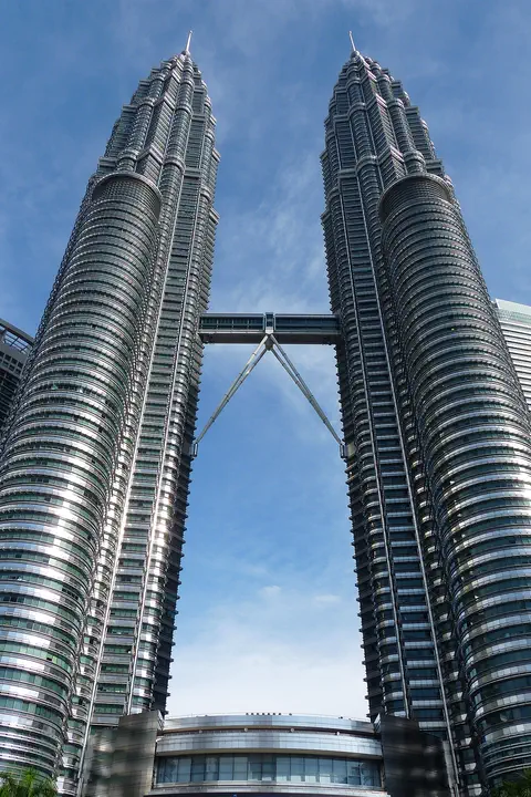
The Petronas Twin Towers in Kuala Lumpur, Malaysia, are two matching skyscrapers 452 meters tall, finished in 1998. Seen from above, each floor is shaped like an eight-pointed star, a pattern from Islamic art. A two-story skybridge joins them 170 meters above the ground, and from 1996 to 2003 they were counted as the tallest buildings in the world.
-
 Watch
Natural wonder
Andaman Sea
The Andaman Sea is part of the eastern Indian Ocean, near Thailand and Myanmar, with the Andaman and Nicobar Islands nearby. Its rugged sea floor helps make large waves deep inside the water, and its islands have coral reefs and seagrass where dolphins and dugongs feed.
-
 Watch
City
Palembang
Palembang is a city on the Musi River, in the south of the island of Sumatra, in Indonesia. The encyclopedia Larousse says it was once the capital of the kingdom of Srivijaya. Indonesia's 2020 census counted 1,668,848 people in the city.
-
 Watch
City
Bangkok
Bangkok, the capital of Thailand, lies on the delta of the Chao Phraya River, about 40 kilometers from the sea. It became the capital in 1782, when the new royal palace and temples were built. Once called the 'Venice of the East' for its canals, it is now a huge, busy city with skyscrapers and an elevated railway.
-
 Watch
City
Ho Chi Minh City
Ho Chi Minh City, once called Saigon, is Vietnam's largest city and the economic heart of the country. It lies on the Saigon River, north of the Mekong Delta. Since merging with two neighboring provinces in 2025, it has more than 14 million people, and in 2024 it opened its first metro line.
-
 Watch
Landmark
Ayutthaya Historical Park
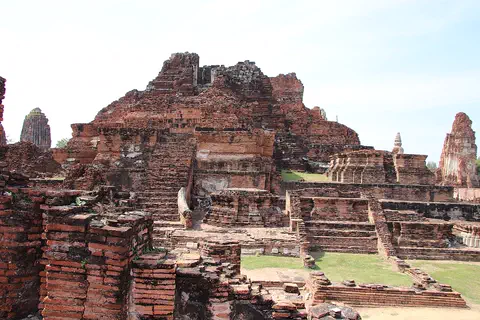
Ayutthaya, in Thailand, was founded in 1350 and became the second capital of the Siamese kingdom. From the 14th to the 18th centuries it grew into a center of trade and diplomacy. Today its brick ruins, tall towers and the remains of large monasteries are kept in a historical park, a UNESCO World Heritage Site since 1991.
Explore next
-
Watch
Natural wonder
Lake Toba
Lake Toba, in North Sumatra, Indonesia, fills a caldera left by one of the most powerful volcanic eruptions in Earth's history. UNESCO calls it the world's largest volcanic crater lake, with Samosir Island at its center.
-
 Watch
Natural wonder
Krakatoa
Krakatoa, also called Krakatau, is a volcano between the Indonesian islands of Java and Sumatra. After an enormous eruption in 1883 destroyed the old island, a new volcano, Anak Krakatau, meaning 'child of Krakatau', rose from the sea about fifty years later. It still erupts often.
-
 Watch
 Country
Indonesia
Indonesia is a country of about 17,500 islands in Southeast Asia, spread across the Equator between the Indian and Pacific oceans. It has more than 100 active volcanoes, rainforests full of wildlife, and about 286 million people (2025).
- Watch Geography Types of volcanoes Volcanoes come in different shapes. Runny lava builds wide, gentle shield volcanoes like Mauna Loa. Sticky lava and ash build tall, steep stratovolcanoes like Mount Fuji. Small cinder cones grow from bits of lava thrown into the air. Whether lava is runny or sticky, and how much gas it holds, decides the shape and how explosive the eruptions are.
-
 Watch
Natural wonder
Mount Everest
Mount Everest, in the Himalayas on the border of Nepal and China, is what Britannica calls the highest mountain in the world. In 2020 China and Nepal announced its height as 8,848.86 meters. It grew as two giant plates of Earth's crust pushed together, and it is still rising a tiny bit each year.
-
 Watch
Natural wonder
Mount Fuji
Mount Fuji, 3,776 meters high, is the highest mountain in Japan and an active volcano that last erupted in 1707. Its almost perfect cone was built by three volcanoes, one on top of another, and it has inspired artists for hundreds of years.
-
 Watch
Natural wonder
Ha Long Bay
Ha Long Bay is a bay in northeast Vietnam where more than a thousand limestone islands rise straight out of the sea. Over millions of years, water dissolved the limestone into towers and caves, and then the sea flooded in around them. Together with the nearby Cat Ba Archipelago it is a World Heritage site.
-
 Watch
Natural wonder
Dead Sea
The Dead Sea is a salt lake in the Middle East, with Jordan on its eastern shore and the Palestinian West Bank along part of its western shore. Its surface lies far below sea level, about 435 meters down in 2019, and its water is nearly ten times saltier than the ocean, so swimmers bob on top without trying.
For parents & teachers
What children will learn
- Locate Mount Sinabung on the island of Sumatra, Indonesia.
- Explain what a lava dome is.
- Describe how scientists monitor a volcano.
- Explain why people follow volcano alert levels and keep-out zones.
Recommended ages: 3 to 17 · About 15 minutes
Talk about it
- How can a volcano be quiet for 1,200 years and still be dangerous?
- Why might farmers live and grow crops near a volcano?
- Why do volcano scientists measure small earthquakes?
Try at home or in class
- Squeeze thick toothpaste slowly out of a tube onto a plate to see how sticky lava can pile up into a dome.
- On a map of Indonesia, find Sumatra and Lake Toba, and then find Sinabung to its north-west.
Key vocabulary: stratovolcano, lava dome, pyroclastic flow, lahar, seismometer
Where these facts come from
- Wikidata , Wikimedia Foundation (CC0 1.0)
- Overview of the eruptions of Sinabung Volcano, 2010 and 2013-present, and details of the 2013 phreatomagmatic phase , U.S. Geological Survey
- PVMBG: Masyarakat Diimbau Beraktivitas di Luar Radius 5 km dari Puncak Gunung Sinabung (press release, 10 August 2020) , Ministry of Energy and Mineral Resources of Indonesia
- Status Gunung Sinabung Naik Jadi Siaga (31 August 2026) , CNN Indonesia
- Eruption of Sinabung Volcano, Indonesia , NASA Earth Observatory
- Changed Landscape Around Sinabung , NASA Earth Observatory
- Angry Indonesian Volcano Imaged by NASA Spacecraft , NASA Photojournal
- Staying Safe During a Volcanic Eruption , US Centers for Disease Control and Prevention
- Mount Sinabung (Wikimedia Commons file page) , Wikimedia Commons
- Wikimedia Commons , Wikimedia Foundation (Per file (public domain, CC0, CC BY or CC BY-SA); see each media record)
Checked, not yet human-reviewed. Last updated November 1, 2026. Spotted a mistake? Tell us.