
Natural wonder Asia
Andaman Sea
The Andaman Sea is part of the Indian Ocean. Giant hidden waves roll deep under its surface. Dolphins and dugongs live there.
The Andaman Sea is part of the eastern Indian Ocean, near Thailand and Myanmar, with the Andaman and Nicobar Islands nearby. Its rugged sea floor helps make large waves deep inside the water, and its islands have coral reefs and seagrass where dolphins and dugongs feed.
The Andaman Sea, a section of the eastern Indian Ocean, is known for large internal waves, generated as tides move layered water over ridges, banks and seamounts in a volcanically and tectonically active basin. Off the Southern Andaman Islands, 16 marine mammal species have been recorded, including a small, Vulnerable dugong population.
Photo: © Vyacheslav Argenberg, CC BY 4.0, via Wikimedia Commons
Discover the Andaman Sea
The Andaman Sea is part of the Indian Ocean. Islands with coral reefs lie in it.
In this photo, the water is a bright blue-green. White clouds float in a blue sky.
NASA describes the Andaman Sea as a section of the eastern Indian Ocean near Thailand and Myanmar. Nearby lie the Andaman and Nicobar Islands, a group of volcanic islands with coral reefs, seagrass beds and mangroves.
This photo was taken in December 2009 in the Andaman Islands. The shallow water is a clear turquoise, a few brown patches show just under the surface, and puffy white clouds drift over a straight horizon.
NASA's Earth Observatory places the Andaman Sea in the eastern Indian Ocean, near Thailand and Myanmar. The Andaman and Nicobar Islands are volcanic island systems with complex bathymetry, fringing coral reefs, seagrass beds and mangroves, according to the Important Marine Mammal Area factsheet for the Southern Andaman Islands.
The hero photo, by Vyacheslav Argenberg (1 December 2009), shows the turquoise shallows of the Andaman Sea in the Andaman Islands under a sky of scattered cumulus.
- Part of
- the eastern Indian Ocean
- Known for
- large internal waves
- Active volcano
- Barren Island, in the Andaman Islands
- Marine mammals off South Andaman
- 16 species recorded
A rugged, restless sea floor
Under the Andaman Sea, the sea floor has tall underwater mountains and deep holes.
One island here is an active volcano.
The floor of the Andaman Sea is very uneven. Around the Andaman and Nicobar Islands, the sea floor rises quickly from about 3,000 meters deep to only 200 meters, then drops again into the Andaman Sea. There are shallow ridges, reefs and underwater banks.
The area is volcanically and tectonically active, so there are mountains on the sea floor. Barren Island, in the Andaman Islands, is an active volcano: in March 2007, a satellite photographed it giving off puffs of steam.
NASA describes a basin of rugged hidden topography: the Indian Ocean floor rises rapidly from about 3,000 m to 200 m around the Andaman and Nicobar Islands and then drops again into the Andaman Sea, with shallow ridges, reefs and submarine banks. Because the region is volcanically and tectonically active, seamounts rise from the floor.
The Advanced Land Imager on Earth Observing-1 photographed the active Barren Island volcano emitting puffs of steam on 6 March 2007. All this topography alters the flow of water sloshing into and out of the basin, which NASA gives as the main reason the sea is known for large internal waves.
Giant waves inside the sea
The sea has layers. Cold, salty water sits at the bottom. Warmer water floats on top.
When tides push the water over underwater hills, big waves roll between the layers.
The ocean is layered: deeper water is usually colder, denser and saltier, and shallower water is warmer, lighter and fresher. When tides and currents push these layers over ridges on the sea floor, waves form inside the sea, between the layers. They are called internal waves.
Internal waves can be hundreds of meters tall and tens to hundreds of kilometers long, yet they move along tens to hundreds of meters below the surface. From space, they show up as long stripes of smooth and rough water.
In the 19th century, oceanographer Matthew Fontaine Maury described 'ripplings' in the Andaman Sea that beat against ships; scientists now call them internal waves, or solitons, studied from ships since the 1960s and now seen on a grand scale by satellites. They form because density and salinity differences make ocean layers behave like separate fluids; tides, currents, gravity and Earth's rotation drive these layers over ridges and canyons.
At the surface they appear as alternating bands of calm water over crests and rough water over troughs, which sunglint reveals in Landsat 8 images from 29 November 2019. NASA notes they can be hundreds of meters tall and tens to hundreds of kilometers long, last many hours, and focus and dissipate energy in the ocean.
Dolphins and dugongs
Many kinds of dolphins and whales swim around the Andaman Islands.
Dugongs graze on seagrass in quiet bays.
Scientists have recorded 16 kinds of marine mammals in the waters of South Andaman: 15 kinds of whales and dolphins, plus the dugong. Indo-Pacific bottlenose dolphins live near the shore, have been seen there with calves and hunt fish such as Indian mackerel around the reefs.
A small group of dugongs grazes on seagrass meadows in sheltered bays and channels. Dugongs are listed as Vulnerable on the IUCN Red List, and across the Andaman and Nicobar Islands the places they use are estimated to have shrunk by about 60% over 20 years.
The Important Marine Mammal Area (IMMA) factsheet for the Southern Andaman Islands lists 16 marine mammal species, 15 cetaceans and the dugong, recorded from vessel, ferry and opportunistic surveys. Only Indo-Pacific bottlenose dolphins (Tursiops aduncus) are nearshore residents, seen with calves and feeding on Indian mackerel around reefs; Omura's whale, recorded twice, marks the species' northern record in the Indian Ocean.
A small, Vulnerable dugong population uses seagrass meadows of Halophila and Halodule; D'Souza and colleagues (2013) estimated that dugong occupancy across the archipelago declined by 60% over 20 years, leaving them mostly in sheltered bays and channels.
Visiting safely
On a reef, never touch or stand on the coral.
Watch dolphins and dugongs from far away, and never feed them.
NOAA, the United States ocean agency, asks people to watch dolphins and other sea animals from a safe, respectful distance, never feed them, and never try to touch them or swim with them. Snorkelers and divers should not touch, kick or stand on corals.
At the beach, NOAA warns about rip currents. If one catches you, don't fight it: swim parallel to the shore, then back to land at an angle.
NOAA Fisheries advises viewing marine mammals from a safe, respectful distance (at least 50 yards, about 46 m, from dolphins by boat), never feeding them, limiting viewing to 30 minutes or less, and not touching, kicking or standing on corals. These are US guidelines, but the reasons behind them apply to any sea, especially where a small dugong population depends on a few seagrass meadows.
NOAA's National Ocean Service notes that rip currents can move at up to eight feet (about 2.4 m) per second; swim parallel to the shore and return at an angle rather than fighting one.
Amazing facts
-
Some waves travel deep under the sea, not on top!
Internal waves move tens to hundreds of meters below the surface and can be hundreds of meters tall.
Internal waves can be hundreds of meters tall and tens to hundreds of kilometers long while traveling below the surface (NASA Earth Observatory).
-
An island in the Andaman Sea is a volcano that puffs steam.
Barren Island, in the Andaman Islands, is an active volcano; a satellite saw it puffing steam in 2007.
EO-1's Advanced Land Imager captured the active Barren Island volcano emitting steam on 6 March 2007.
-
One kind of whale has been seen just twice near the Andaman Islands.
Omura's whale has been recorded twice off the Southern Andaman Islands.
Two Omura's whale records within the Southern Andaman Islands IMMA mark the species' northern record in the Indian Ocean.
Words to know
- internal wave
- a wave that moves between layers of water deep inside the sea
- density
- how heavy something is for its size
- seamount
- a mountain on the sea floor that does not reach the surface
- seagrass
- a flowering plant that grows in shallow seawater
- dugong
- a sea mammal that eats seagrass
- sunglint
- sunlight reflected off the water like a mirror
Discovery challenge
-
Which ocean is the Andaman Sea part of?
The Andaman Sea is a section of which ocean?
Of which ocean is the Andaman Sea a section, according to NASA?
- The Indian Ocean
- The Arctic Ocean
- The Atlantic Ocean
Show the answer
The Indian Ocean
The Indian Ocean.
The eastern Indian Ocean.
The eastern Indian Ocean.
-
Where do internal waves travel?
Where do internal waves move?
Between what do internal waves form?
- Deep inside the sea, between layers of water
- Only on the beach
- In the air above the sea
Show the answer
Deep inside the sea, between layers of water
Deep inside the sea.
Between layers of water, below the surface.
Between ocean layers of different density and salinity.
-
Which island in the Andaman Sea is a volcano?
Which island in the Andaman Islands is an active volcano?
Which active volcano did EO-1 photograph emitting steam in 2007?
- Barren Island
- Iceland
- Hawaii
Show the answer
Barren Island
Barren Island.
-
What do dugongs eat?
What do the Andaman Islands' dugongs graze on?
Which habitat does the remnant dugong population depend on?
- Seagrass
- Fish
- Coral
Show the answer
Seagrass
Seagrass.
Seagrass meadows in sheltered bays.
Seagrass meadows of Halophila and Halodule.
-
What should you never do with a wild dolphin?
What does NOAA say you should never do with wild dolphins?
Which action do NOAA's viewing guidelines call harmful and illegal in US waters?
- Feed it
- Watch it from far away
- Stay quiet
Show the answer
Feed it
Never feed a dolphin.
Never feed it; watch it from a respectful distance.
Feeding wild dolphins.
Nearby places
-
 Watch
City
Bangkok
Bangkok, the capital of Thailand, lies on the delta of the Chao Phraya River, about 40 kilometers from the sea. It became the capital in 1782, when the new royal palace and temples were built. Once called the 'Venice of the East' for its canals, it is now a huge, busy city with skyscrapers and an elevated railway.
-
 Watch
Landmark
Ayutthaya Historical Park
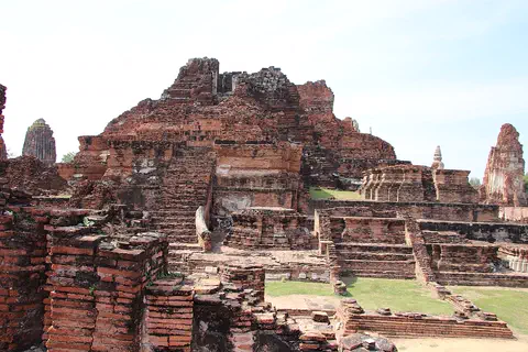
Ayutthaya, in Thailand, was founded in 1350 and became the second capital of the Siamese kingdom. From the 14th to the 18th centuries it grew into a center of trade and diplomacy. Today its brick ruins, tall towers and the remains of large monasteries are kept in a historical park, a UNESCO World Heritage Site since 1991.
-
 Watch
City
Yangon
Yangon, once spelled Rangoon, is the largest city in Myanmar and its main port. It lies in the eastern part of the Irrawaddy delta, where two rivers meet. At the 2024 census, 4,584,622 people lived in the city.
-
 Watch
Landmark
Shwedagon Pagoda
The Shwedagon Pagoda is a huge Buddhist stupa covered in gold, on Singuttara Hill in the center of Yangon, Myanmar. Rebuilt and raised by kings and a queen over many centuries, it now stands 112 meters tall. Covered stairways climb the hill to it from the four directions.
-
 Watch
Natural wonder
Mount Sinabung
Mount Sinabung is a 2,460-meter stratovolcano in North Sumatra, Indonesia. It had no eruption for about 1,200 years until 2010, and since 2013 scientists have watched it closely as it builds and loses lava domes.
-
 Watch
Natural wonder
Lake Toba
Lake Toba, in North Sumatra, Indonesia, fills a caldera left by one of the most powerful volcanic eruptions in Earth's history. UNESCO calls it the world's largest volcanic crater lake, with Samosir Island at its center.
-
 Watch
Landmark
Angkor
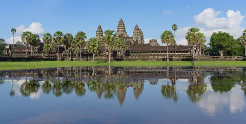
Angkor, in northwestern Cambodia, was the capital of the Khmer Empire from the 9th to the 15th century. Its kings built city after city here, with scores of temples, such as Angkor Wat and the Bayon, and giant reservoirs and canals to water the rice fields. Today it covers about 400 square kilometers, and more than 100,000 people live in villages inside it.
-
Watch
Landmark
Angkor Wat
Angkor Wat, near the town of Siem Reap in Cambodia, was built in the 12th century by the Khmer king Suryavarman II. Britannica (2026) calls it the world's largest religious structure. It was built as a Hindu temple and later became a Buddhist place of worship.
Explore next
-
 Watch
Natural wonder
Indian Ocean
The Indian Ocean is the third-largest ocean basin, after the Pacific and the Atlantic. Off the coast of East Africa, a current called the Somali Current changes direction with the seasons. Its deepest known point lies in the Java Trench, 7,187 meters down.
-
 Watch
Natural wonder
Arabian Sea
The Arabian Sea lies in the north-west of the Indian Ocean, between the Horn of Africa, Pakistan and India. Monsoon winds that switch direction with the seasons stir up nutrients, and green swirls of tiny phytoplankton show up in satellite images.
-
Watch
 Country
Thailand
Thailand is a tropical country in the middle of mainland Southeast Asia, with forested mountains in the north, rice fields on its central plains and a long, narrow peninsula in the south. Its capital is Bangkok, and about 65.8 million people were on its civil register at the end of 2025.
-
 Watch
 Country
India
India is a huge country in South Asia, shaped like a big triangle pointing into the Indian Ocean. The Himalayas rise along its north, heavy monsoon rains arrive every summer, and about 1.46 billion people (2025) live there, speaking hundreds of languages.
- Watch Geography The five oceans There is really only one global ocean, covering about 71 percent of Earth and holding about 97 percent of its water. People divide it into five named oceans: the Pacific, Atlantic, Indian, Southern and Arctic. They are all connected, so water and ocean animals can travel from one to the next.
-
 Watch
Natural wonder
Mount Everest
Mount Everest, in the Himalayas on the border of Nepal and China, is what Britannica calls the highest mountain in the world. In 2020 China and Nepal announced its height as 8,848.86 meters. It grew as two giant plates of Earth's crust pushed together, and it is still rising a tiny bit each year.
-
 Watch
Natural wonder
Mount Fuji
Mount Fuji, 3,776 meters high, is the highest mountain in Japan and an active volcano that last erupted in 1707. Its almost perfect cone was built by three volcanoes, one on top of another, and it has inspired artists for hundreds of years.
-
 Watch
Natural wonder
Ha Long Bay
Ha Long Bay is a bay in northeast Vietnam where more than a thousand limestone islands rise straight out of the sea. Over millions of years, water dissolved the limestone into towers and caves, and then the sea flooded in around them. Together with the nearby Cat Ba Archipelago it is a World Heritage site.
For parents & teachers
What children will learn
- Locate the Andaman Sea in the eastern Indian Ocean.
- Explain how layered water and tides make internal waves.
- Describe how a rugged sea floor shapes ocean currents.
- Name some marine mammals of the Andaman Islands and how to watch them kindly.
Recommended ages: 3 to 17 · About 15 minutes
Talk about it
- How can a wave be hidden under the surface?
- Why might satellites see things that people on boats miss?
- Why might a small group of dugongs need special care?
Try at home or in class
- With a grown-up, fill a clear bottle halfway with salty water, then gently pour colored fresh water on top; tilt it slowly and watch a wave travel along the boundary between the layers.
- Find the Andaman Sea on a map, then find the Andaman and Nicobar Islands and Thailand's coast.
Key vocabulary: internal wave, density, seamount, seagrass, dugong, sunglint
Where these facts come from
- Wikidata , Wikimedia Foundation (CC0 1.0)
- Making Waves in the Andaman Sea , NASA Earth Observatory
- Internal Waves in the Indian Ocean , NASA Earth Observatory
- Southern Andaman Islands (Important Marine Mammal Area factsheet) , IUCN Marine Mammal Protected Areas Task Force
- Marine Life Viewing Guidelines , NOAA Fisheries
- What is a rip current? , NOAA National Ocean Service
- File:Andaman Sea, Andaman Islands.jpg , Wikimedia Commons
- Natural Earth vector data , Natural Earth (NACIS) (Public domain)
- Wikimedia Commons , Wikimedia Foundation (Per file (public domain, CC0, CC BY or CC BY-SA); see each media record)
Checked, not yet human-reviewed. Last updated November 1, 2026. Spotted a mistake? Tell us.